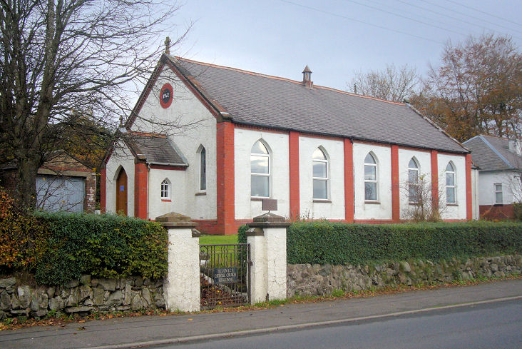
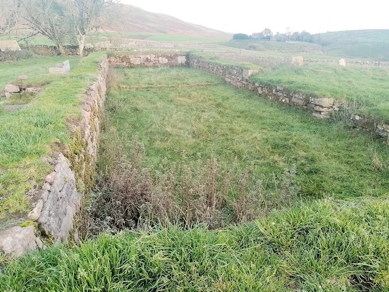
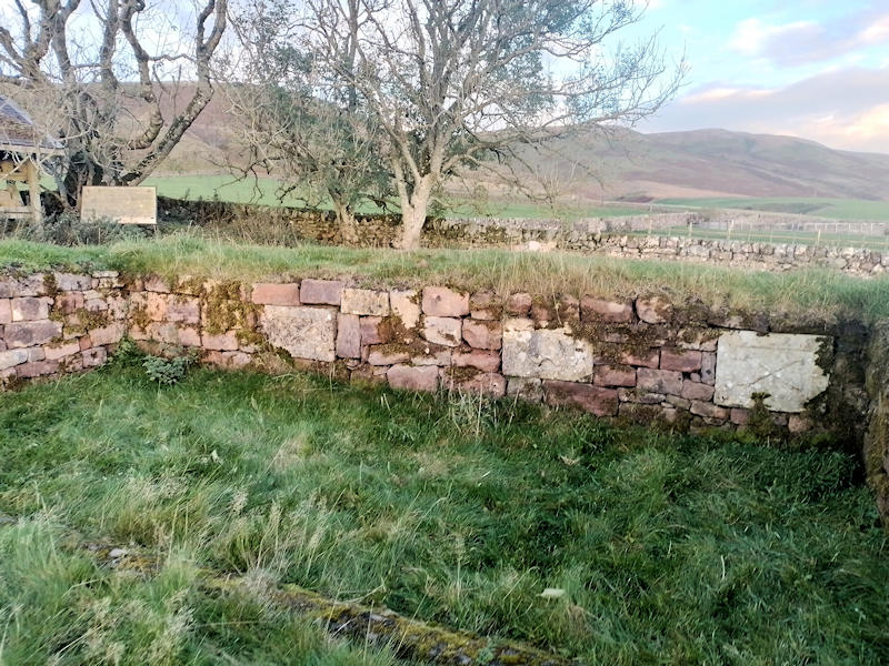
|
|
Dumfries and Galloway
Dumfries and Galloway on Wikipedia.
Annan.
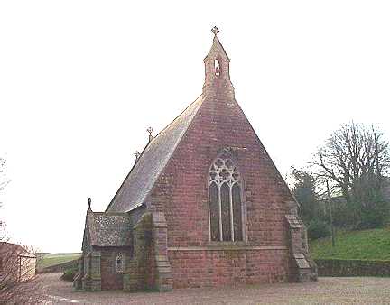
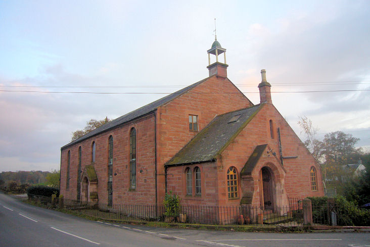
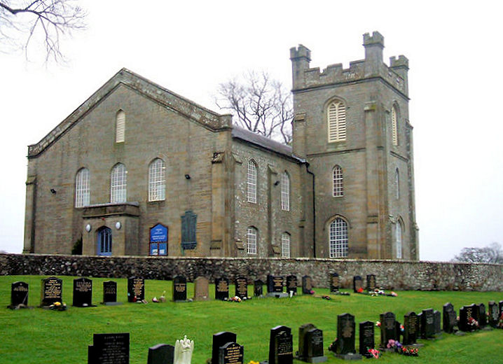
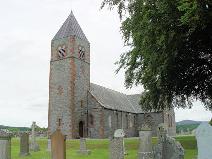
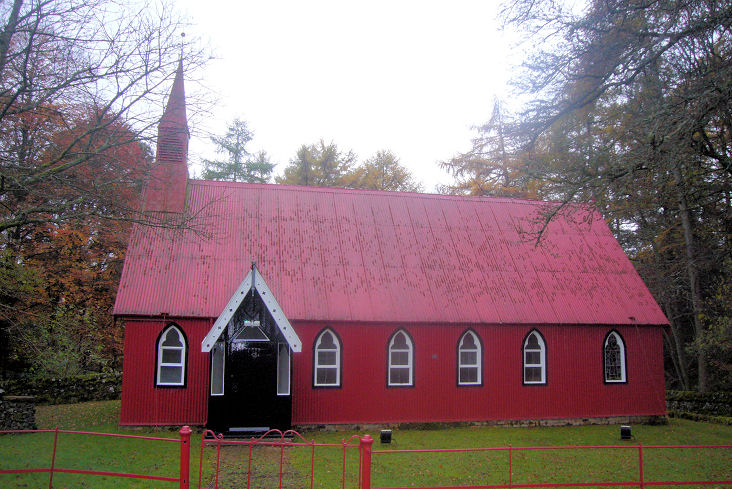
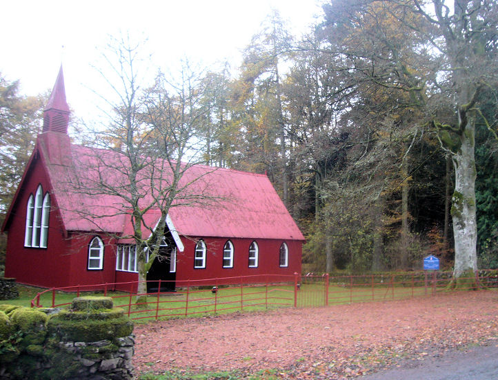
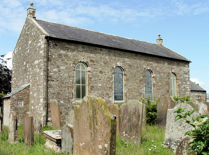
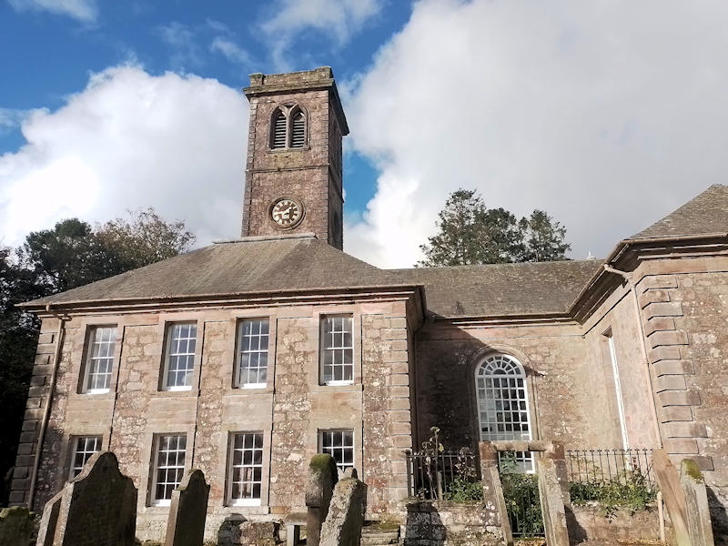
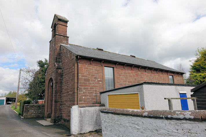
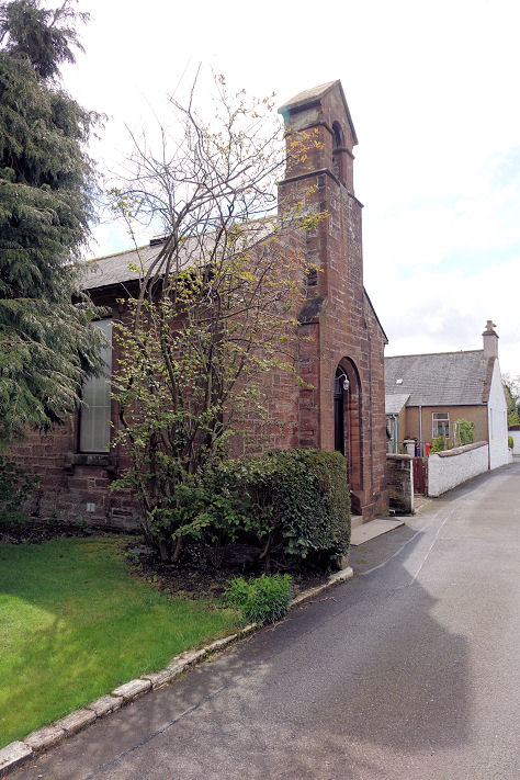
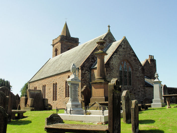
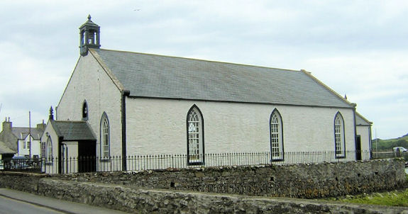
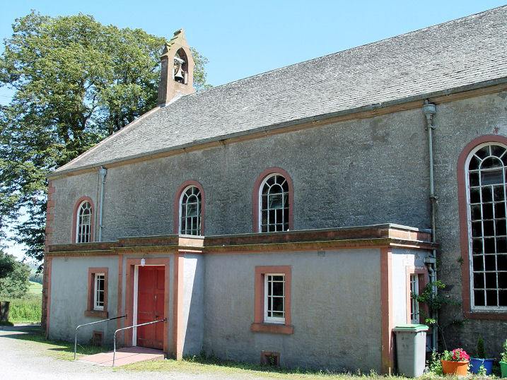
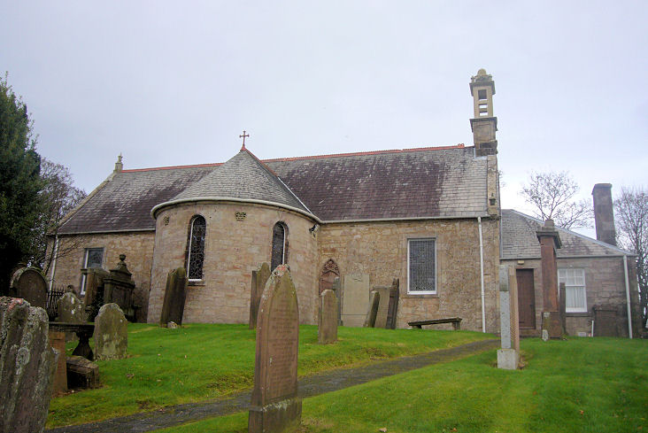
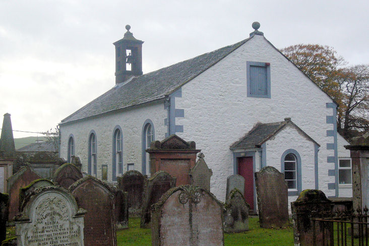
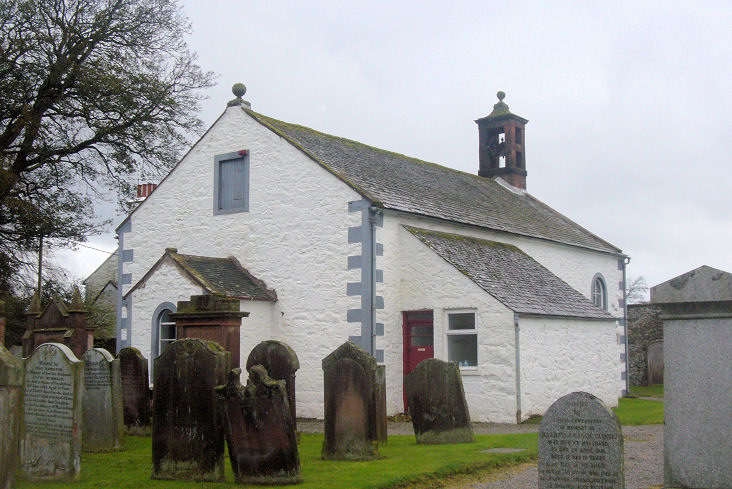
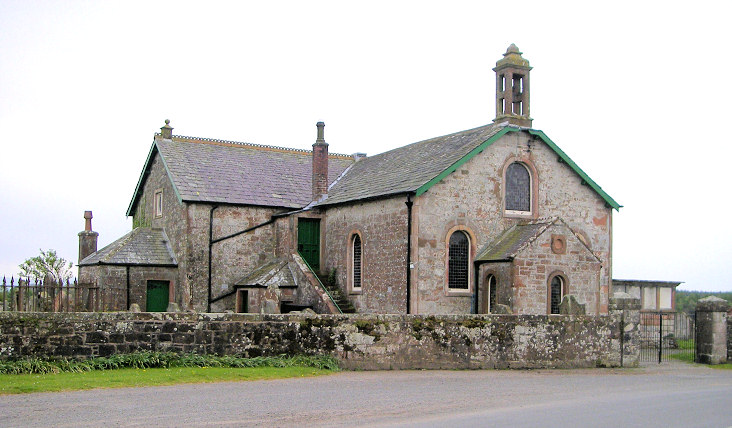
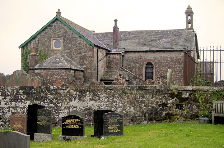
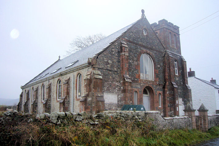
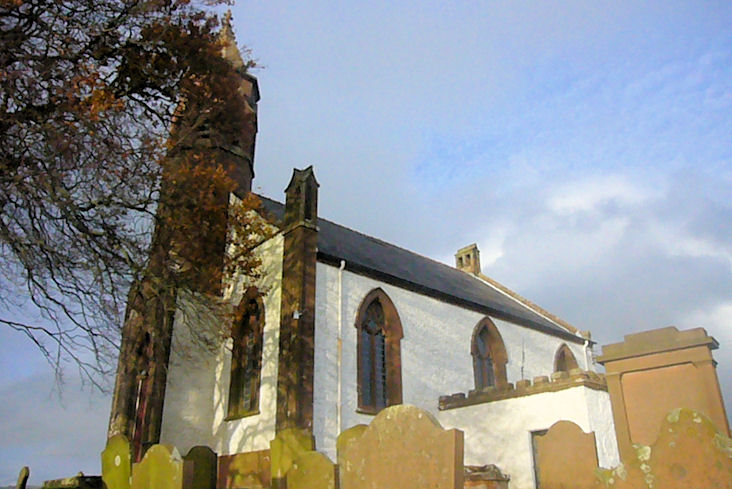
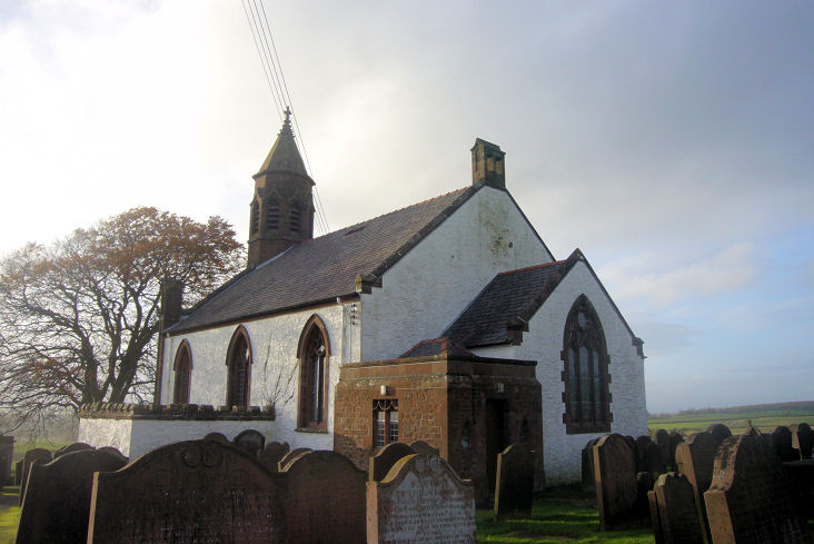
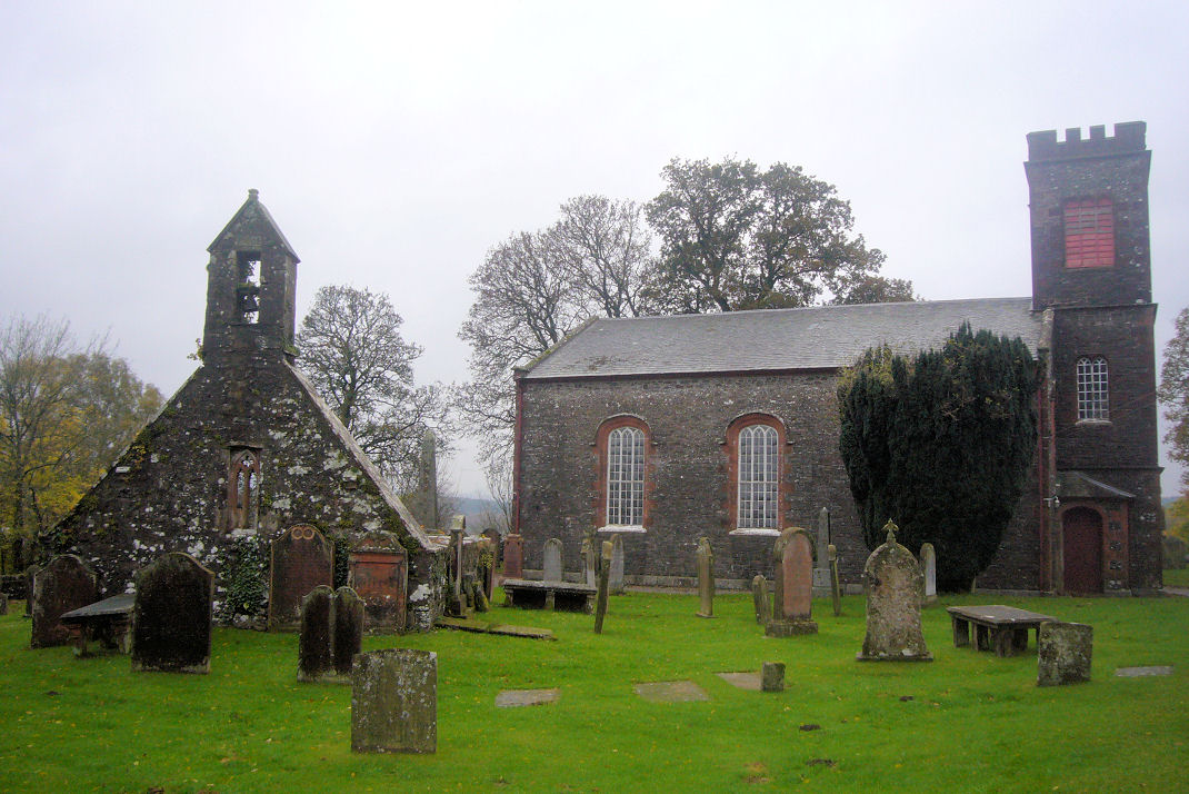
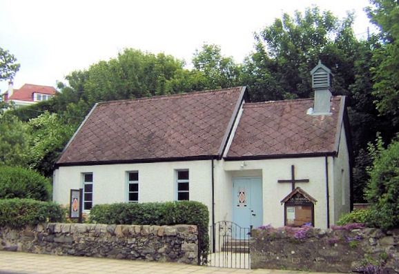
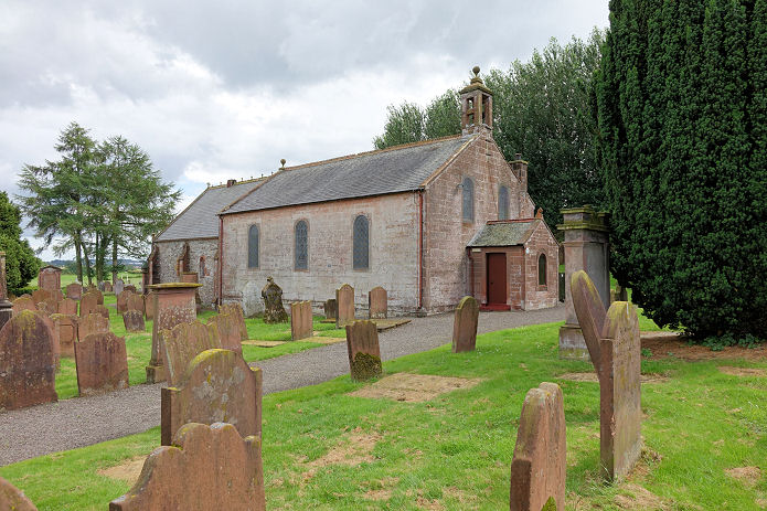
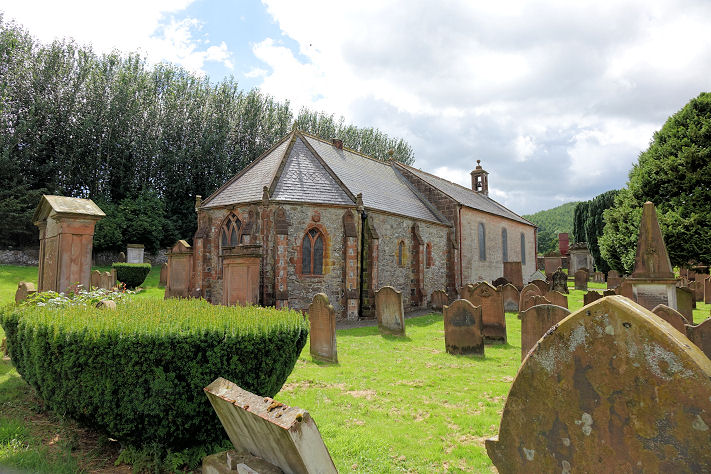
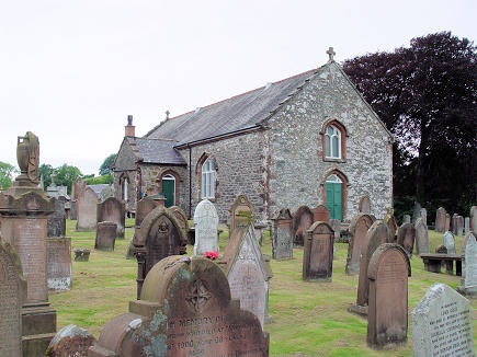
Anwoth, the parish church. Its
category B listing dates it to 1826-7. NX 5822 5596. From an old postcard (franked 1903) in Steve Bulman's
Collection. A 2021
Streetview. Kevin Price advises that it was closed in 2001 and
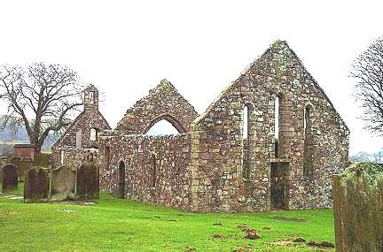
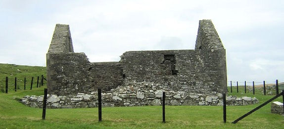
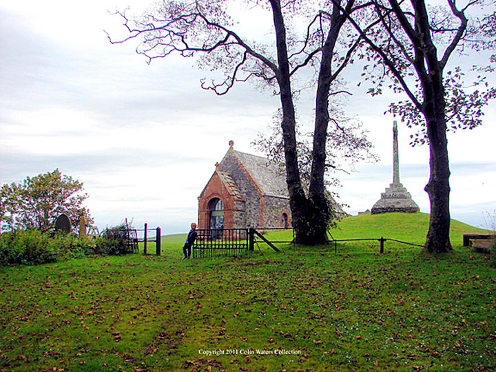
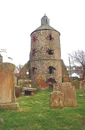
subsequently sold. The remains of
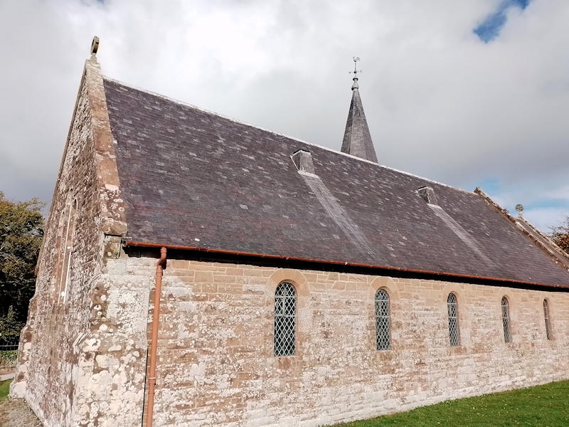
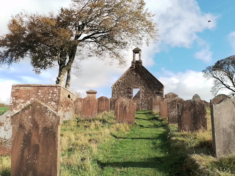
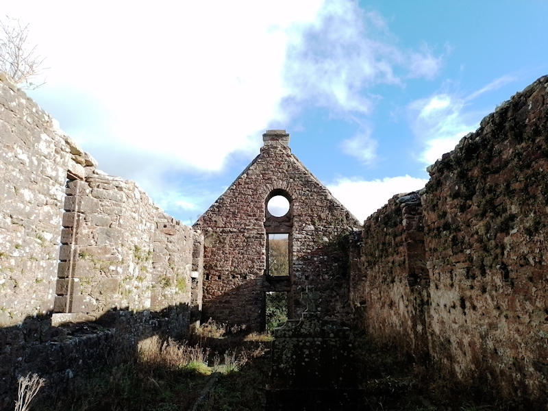
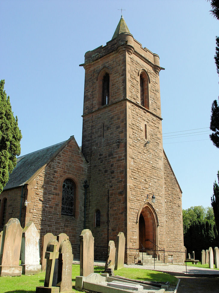
Anwoth Old Kirk stand less than a quarter of a mile to the north, at
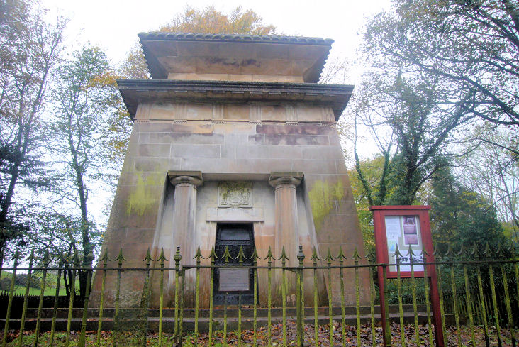
NX 5828 5621. The memorial to
Samuel Rutherford (Wikipedia
entry), one-time minister of Anwoth Church. Both © Alan Marsden
(2024). The churchyard is
category A listed.
Canmore.
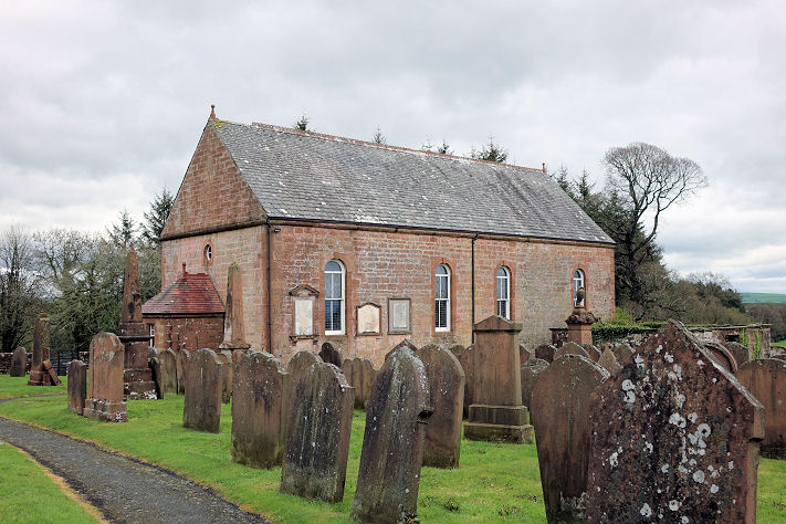
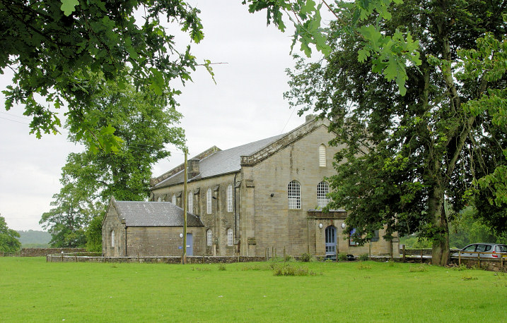
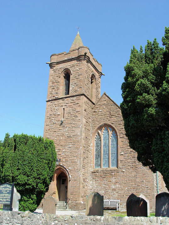
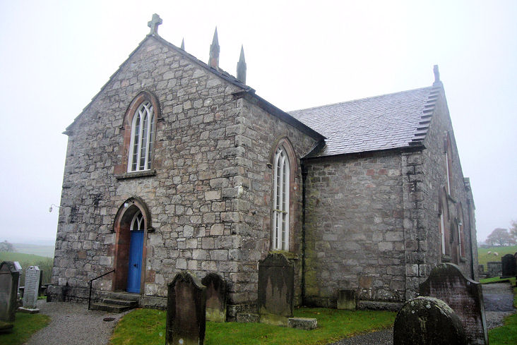
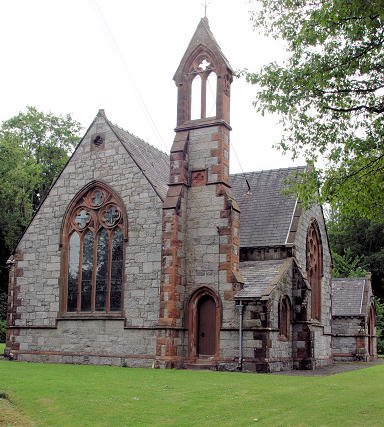
Applegarthtown, Applegarth,
Sibbaldie and Johnstone Church
(CoS). NY 1045 8429. © Peter Amsden (2014).
Link.
Category
B listed.
O.S. maps mark, a little way to the south,
Monastery (Site of). NY 1049 8404. This
source questions its
validity.
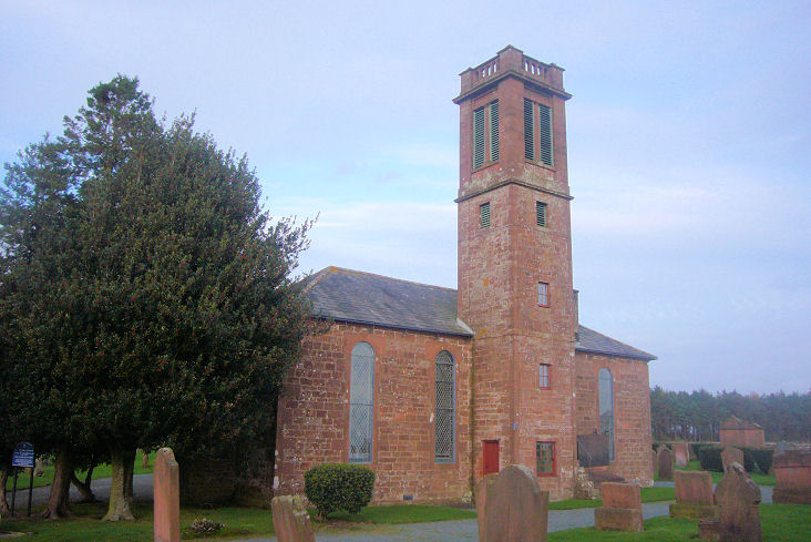
Auchencairn, Church of Scotland.
NX 7992 5128. © Bill
Henderson. Link.
Category
B listed - dates it to circa 1858.
The village also used to have a Free Church
on Main Street. It pre-dates a map of 1854, had closed no later than
1954, and later demolished. Its site was seen by
Streetview in
2021. NX 7967 5129.
Link
outlines its history, where it's dated to 1844. A
Baptist Mission is mentioned
here, but its exact location is unknown.
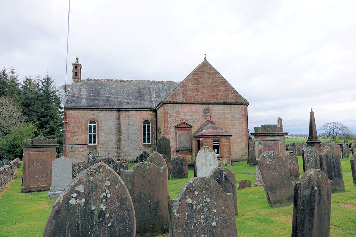
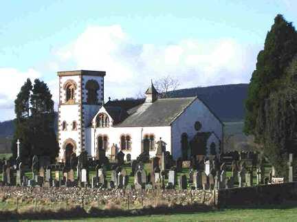
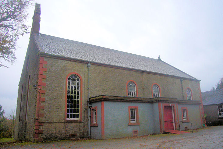
Bankend, Caerlaverock Church of
Scotland. Another view. NY 0250
6920. Both © Steve Bulman (2015).
Link.
Category B listed - dates it to 1781.
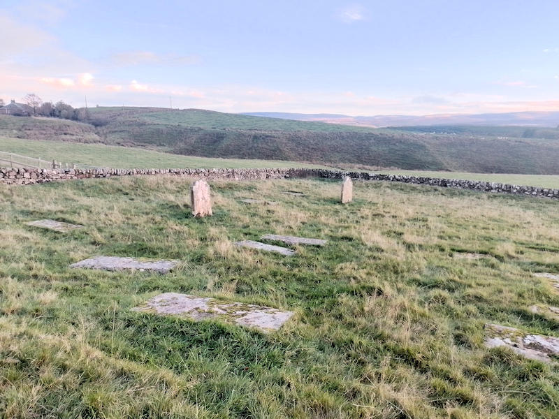
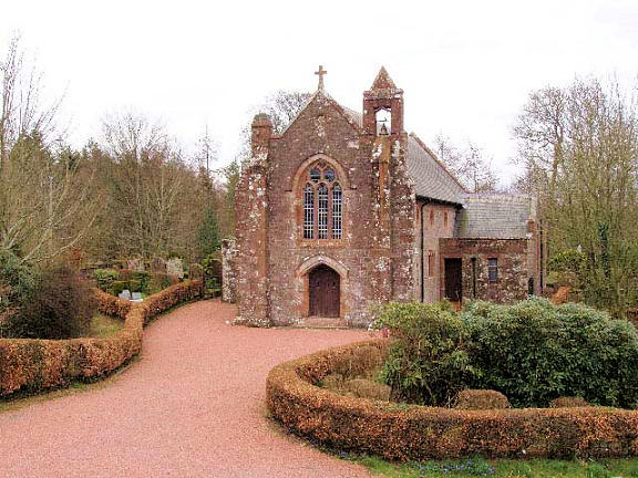
Barhobble (near Airylick), the
surviving lower courses of the church, on an early Christian site. © Alan
Marsden (2024).
Link. Canmore
- supplies a grid ref. of
NX 3104 4941.
Beeswing,
the former Lochend Church of Scotland, undergoing conversion to a private residence.
This source
dates it to 1867-8, NX 8949 6924. © James
Murray (2009). The same source mentions a short-lived predecessor of 1860
"further to the east", which became a school. I think it survives as the house
seen by Streetview in
2021. NX 8986 6969.
Link.
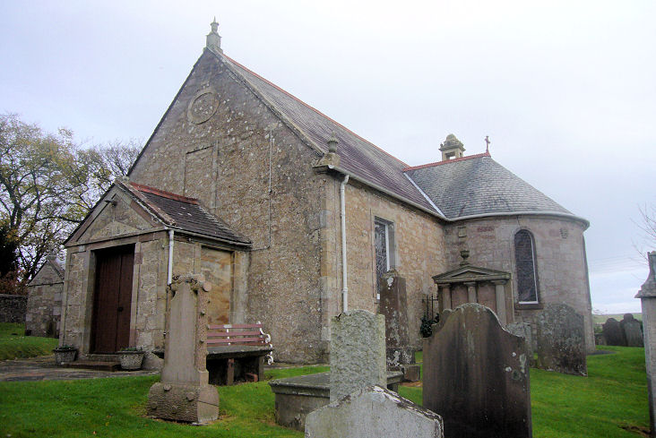
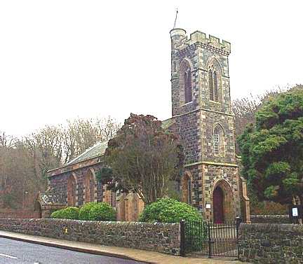
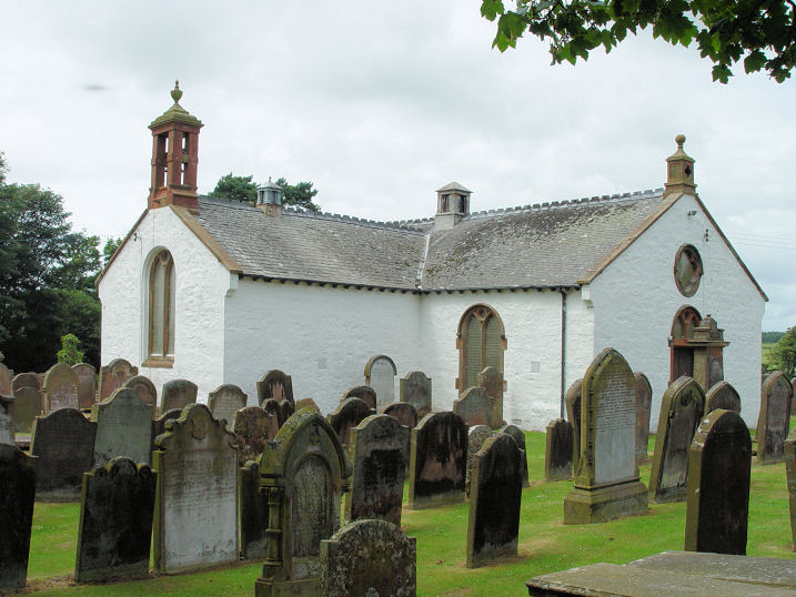
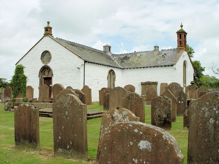
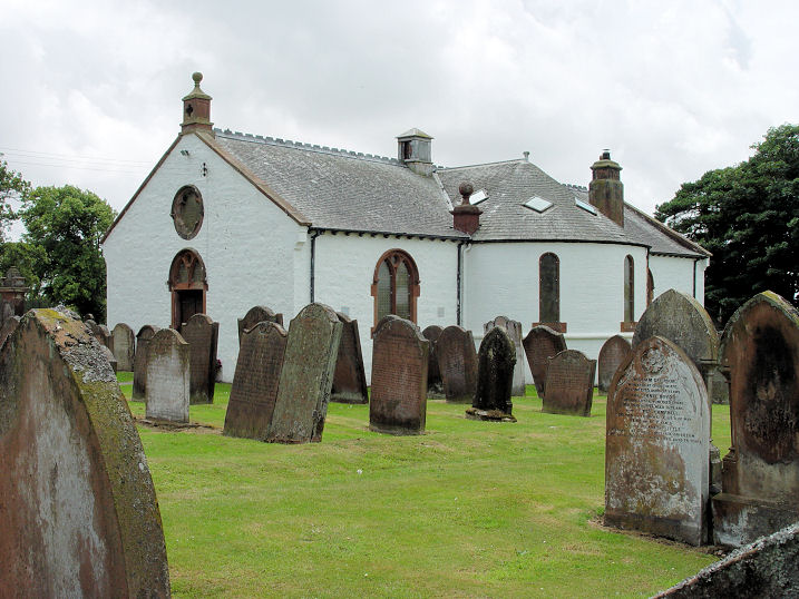
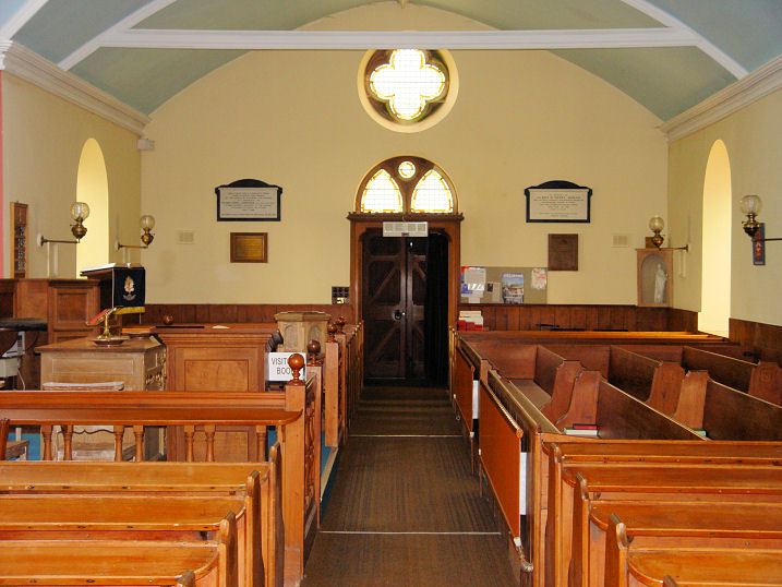
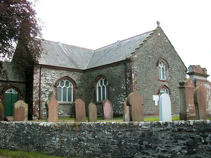
Borgue, the parish church. NX 6289 4830. © Steve Bulman.
It's dated
here to 1814, closing in 2018.
Category B listed. Older O.S. maps show, a little way to the east, a
Free Church, at NX 6298 4831. It pre-dates a map of
1854, and shows as still being active on a map of 1955. It was seen by
Streetview in 2009.
Buittle, Church of
Scotland, built 1819. NX 8080 5989. © Bill Henderson. It was being
offered for sale in 2018.
Category B listed. The remains of the Auld Kirk
stands close by to the south, at NX 8078 5983. Its
Canmore
entry (which has more photos) says it was dedicated to St. Colman. ©
Bill Henderson.
Burnhead, the former Free Church, now in secular use.
NX 8645 9546. © James Murray (2009).
Link.
Category C listed, wherein it's dated to circa 1843. There's also a former
United Presbyterian Church
(2023 Streetview), at NX 8616 9551. It's dated
here to 1839, on the site of a predecessor of 1800.
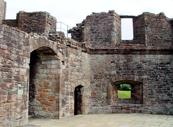
Caerlaverock, the chapel of Caerlaverock Castle is believed to have been on
the first floor. NY 025 655. © Steve Bulman (2010).
Canonbie, United Parish Church (CoS and United Free CoS).
POWiS dates it to 1821-2, on or close to the site of vanished predecessor. NY 3949
7633. © Bill Henderson.
Another view, © Steve Bulman (2012).
Link.
Category B listed. The churchyard itself, and a monument therein are also
category B listed. A former Free Church stands
about ½ a mile to the north-west. Seen by
Streetview in 2021, it
pre-dates a map surveyed in 1857. Its
Category B listing dates it to 1851. NY 3882 7708. A little way to the S.E.
is marked Site of Priory (Augustinian) on
O.S. maps, at NY 4003 7589. Its site hasn't been seen by Streetview.
Link.
Carsphairn, the Parish Church. NX
5626 9317. © James
Murray (2009). Link.
Category C listed - dates it to 1815. The churchyard is also listed
at
B. A map of 1895 shows a
United Presbyterian
Church (2023 Streetview) at NX 5608 9325. It's dated
here to 1892-3, and sold in 1938, by which time it was North Church
of Scotland.
Castle Douglas.
Caulkerbush, Southwick Parish Church.
NX 9274 5738. © Steve Bulman.
Link dates it to 1891.
Category B listed.
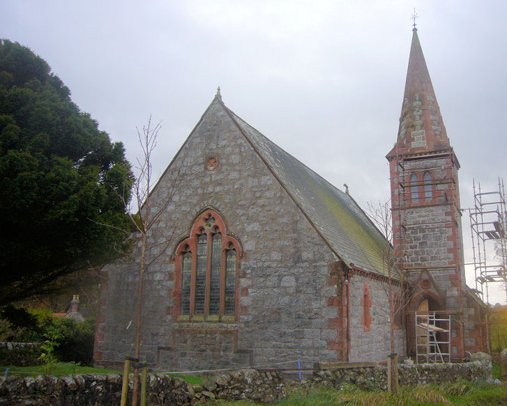
Challoch, All Saints (Episcopal). NX 3852 6749. © Peter Amsden (2014).
Link.
Category A listed, which dates it to 1871-2.
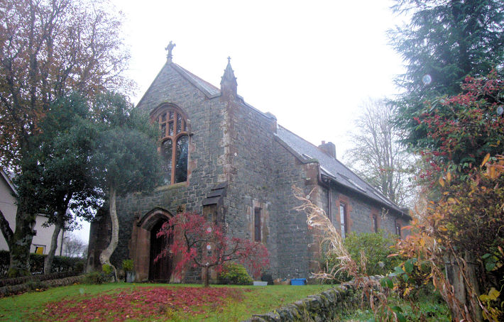
Colvend, the Parish Church. NX 8621 5412.
© Steve Bulman. Link.
Category B listed - dates it to 1911. Older maps show its
predecessor, a few yards further south in the churchyard at NX 8621
5409. I haven't been able to find an old photo of it.
Creetown, Kirkmabreck Parish
Church (CoS). Another view.
NX 4761 5850. Both © James Murray (2009).
Link.
Category B listed - dates it to 1834. Old maps show a
Mission Hall (pre-1895) just a stone's
throw to the N.W. at NX 4757 5852. It now serves as the parish hall, and
was seen by
Streetview in 2021.
Link. Across the river is the Site of
Church, marked on O.S. maps at NX 4768 5867, and presumably
the predecessor of the present parish church. Its site can't be seen on
Streetview. Also shown on O.S. maps is
St. Joseph's R.C.
Chapel (2021 Streetview) on a triangle of land between High Street
and Hill Street. It was built before 1895 and was still in active use at
the time of a map of 1955, but is now an art's centre (link).
NX 4763 5889.
Category B listed - dates it to 1858-9 as a Free Church, became
Catholic in 1876, closing in 1994. There was also a
United Presbyterian Church on the Newton
Stewart road at NX 4751 5913. It pre-dated a map of 1894, and still
shows as active on one of 1953, but has since been demolished. This
source calls it Trinity Church. Its site (by the roadside) was seen
by Streetview in
2023. The building still remaining is the former manse.
Crossmichael, the Parish Church. Another view.
NX 7298 6698. Both © James Murray (2009).
Link.
Category A listed. A memorial vault is also listed as
category A.
Cummertrees, the former Church of
Scotland. NX 1401 6641. © Bill Henderson.
Link.
Category C listed.
Dalbeattie.
Dalswinton, Barony Church. Another view.
NX 9417 8499. Both © James Murray (2009).
Link.
Facebook - dates it to 1881. More photos
here. O.S. maps show, a little way along the road to the N.W.,
Chapel (Site of), at NX 9381 8527. This
source calls it St. Bride. No trace remains. In a 2021 Streetview, if the
map is accurate, the chapel stood not far along the tree-line at left, somewhere
near where the trailer is.
Dalton, Church of
Scotland (2022 Streetview). It's dated
here
to 1895. The same source says it was closed in 2025. NY 1138 7399.
Another view,
© Alan Marsden (2025).
Category B listed. Nearby stands the roofless shell of its
predecessor of 1704.
Another view. NY 1143 7398. Both ©
Alan Marsden (2025).
Post-dating a map of 1861 is the
Free Church (2022
Streetview), built by 1898. NY 1143 7408.
Davington. The former Reformed Presbyterian
Church hasn't been seen by Streetview, and I haven't been able to find a photo
of it. Shown on the oldest available map surveyed no later than 1859, and shown
as still active on one of 1961, it's dated
here to 1835-7,
and "dissolved possibly prior to 1964".
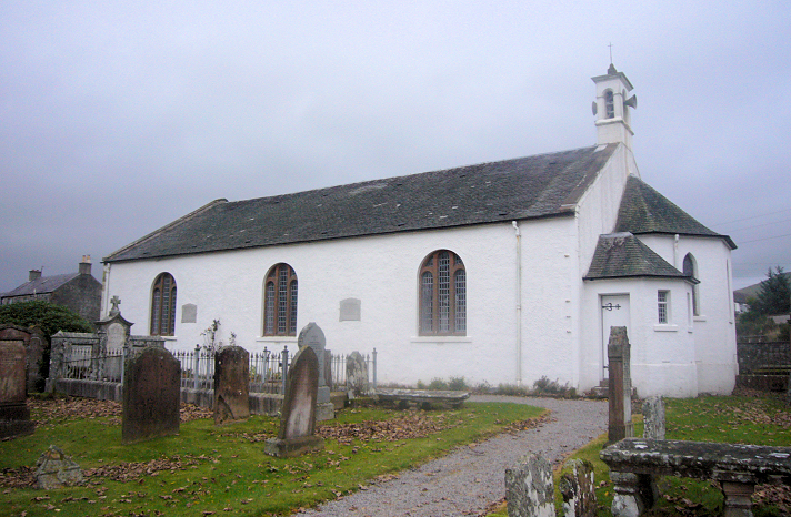
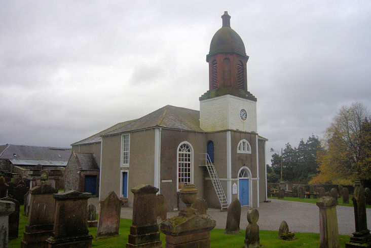
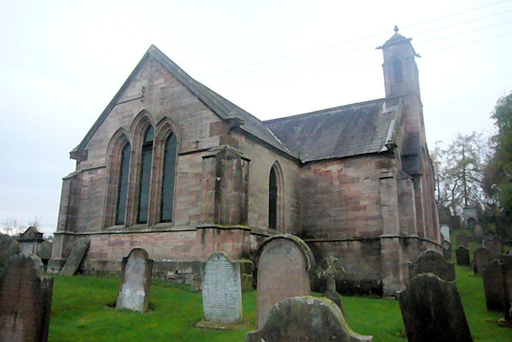
Dornock, the Parish Church.
Another view. NY 2304 6599. Both © Steve
Bulman (2010). It's dated
here to 1792,
where it's described as the former CoS. Its predecessor,
St. Marjory, stood, according to O.S. maps a very
short distance to the south. In a
2021 Streetview the old
church would have stood about half way between church and camera. A building
labelled as Anderson's Hall shows on O.S. maps at NY 2329 6611. It's listed
here as a former Mission Hall, dating it to
1887.
Dumfries.
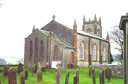
Dundrennan, Rerrick Parish Church.
NX 7490 4774. © Bill
Henderson. It was being
offered
for sale in 2024.
Category B listed - dates it to 1865. It's medieval predecessor, which is
called St. Glaistian (or Glassen)
here, stands about a mile S.E. of the village, at Rerrick. NX 7601 4673.
What little of it remains was seen by
Streetview in 2021.
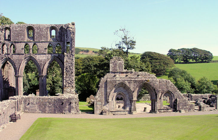
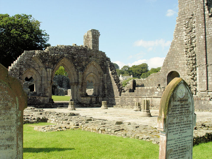
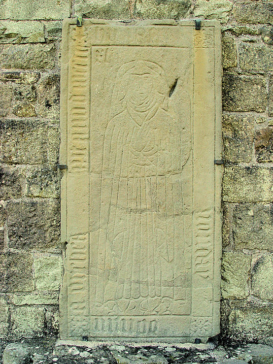
Category B listed. Dundrennan Abbey. Four further views - 1,
2, 3, 4, and a
decorated grave slab. NX 7491 4752. All © Steve Bulman (2010).
Link.
Category A listed.
Dunscore, the Parish Church. NX 8667
8434. © James
Murray (2009). Link.
Category A listed, wherein it's dated to 1823-4. Its medieval predecessor
stood almost 4 miles to the E.S.E., near the hamlet of Gateside, at NX 9266
8324. It was ruinous by 1649 (source).
Its walled graveyard can be seen on a
Streetview from 2021.
Link.
Category B listed.
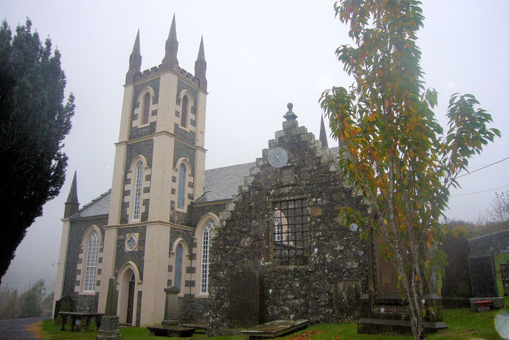
Durisdeer, the Parish Church. NS
8940 0377. © Alan Marsden (2024).
A 2010 Streetview provides
another view.
Link
says
"mostly dating from 1719-20 but built on the foundation of a much older church".
Category A listed.
Eastriggs, Church of
Scotland, aka Baxter Memorial Hall, on Annan Road. It's dated
here to 1930 ca. NY 245 663. © Steve Bulman (2010). A
2009 Streetview
shows that it had been demolished by then, and a house built on the
site. St.
John the Evangelist (Episcopal) on Dunedin Road and Ladysmith Road
is dated
here to 1917. NY 2452 6624. © Steve Bulman
(2010). Facebook.
Older maps show a Mission Hall on Annan
Road at NX 2434 6632. Pre-dating a map surveyed in 1898, it had gone out
of use before the middle of the last century (perhaps after Baxter Hall
opened?). The housing built on its site was seen by
Streetview in
2021.
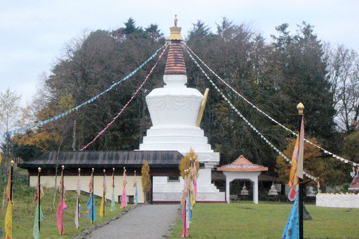
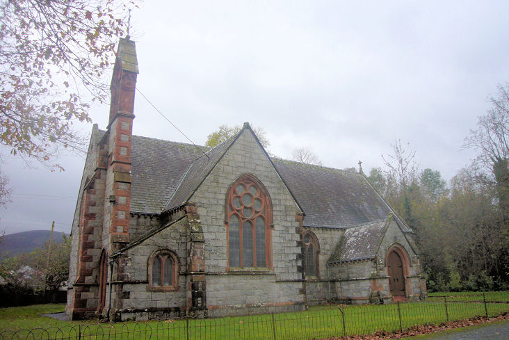
Eskdalemuir, the Parish
Church (CoS). NY 2526 9789. © James Murray (2009). A
2021 Streetview
shows it being offered for sale at that time.
Link dates it to 1826, replacing an earlier church of 1703, perhaps
on the same site, or perhaps across the road in the
graveyard (2021
Streetview). Samye-Ling Tibetan
Monastery and Centre. NT 2457 0003. © James Murray (2009). Link.
Gatehouse of Fleet.
Glencaple, former(?) church on Church
Street. It may be the one referred to
here in the early
1880's as a Free Church. Another view.
NX 9954 6879. Both © Steve Bulman (2015). South of the village at NX 9977
6757 is marked n O.S. maps St. Columba's Chapel (Site of).
It stood somewhere behind the hedge to the left of the road, seen in a
2021 Streetview.
Gretna and Gretna Green.
Haugh of Urr, Urr Parish Church (CoS,
1914, on site of an 1815 and earlier churches). Many of the
monuments in the graveyard pre-date the present church. Two further views - 1,
2. NX 8168 6581. All © Steve Bulman (2011).
Link.
Category B listed.
O.S. maps mark Chapel (Remains of) at NX
8054 6717. This
source calls it Glen of Spottes Private
Chapel, possibly dedicated to St. Constantine. It hasn't been
seen by Streetview, and I haven't found a photo of it. O.S. maps also
mark Site of Chapel further west, at NX
7971 6737. If the map is accurate, the chapel stood to the right of the
field wall in the middle distance.
Link.
Holywood,
Irongray, the
parish church. It's dated
here to 1803, "incorporating parts of the original church". NX 9151 7957. © Kevan Mellor. Another view, © James Murray
(2009).
Category B listed.
Isle of Whithorn, Church of
Scotland, which
dates from 1844. It was built as a Free Church (source). NX 4784 3640.
© Dave Westrap.
Category B listed. The remains of St. Ninian's
Chapel. It's dated
here to circa 1300, and not the first church on the site. NX 4796 3623. © Dave Westrap.
Category B listed.
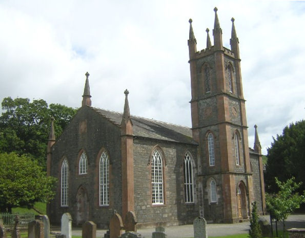
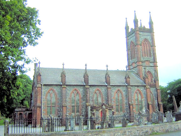
Kells, Church of Scotland.
NX 6321 7835. © James Murray (2009).
Link1.
Link2.
Category B listed, wherein it's dated to 1822.
Kelton,
the Parish Church. In the grounds stands the
Douglas Mausoleum (link).
NX 7592 6025. Both © James Murray
(2009). Another view, © Steve Bulman (2011).
Link.
Category B listed - dates it to 1805-6, using stone from its predecessor.
Nearby are the scant remains of an earlier church, at NX 7606 6019, within the
burial ground (distant
2021 Streetview).
Category
C listed.
Kirk of Mochrum (or Mochrum),
Church of Scotland. It's dated
here
to 1794, on an older site (although this
source says that the medieval church was a little further south at NX 3470
4630). Another view and the
interior (taken through a
window). NX 3473 4639. All © Alan Marsden (2024).
Link.
Category B listed.
Kirkbean,
the former Church of Scotland. It's dated to 1776
here, probably on the site of its medieval predecessor. It also dates its
closure to 1978. NX 9797 5923.
© Steve Bulman. Another view, © James Murray
(2009).
Category B listed.
The churchyard sun-dial is
category C listed.
Kirkconnel, Church of Scotland,
dated 1729. Another view.
NS 7281 1230. Both © James Murray (2009).
Link.
Category B listed.
St. Conal (R.C.) on Main Street.
NS 7362 1214. © James Murray (2009). This
source dates it to 1921, closing in the 2010's. The former
Salvation Army Church on
Main Street, as seen by Streetview in 2023. It bears a date-stone - U.F.
Church 1911, for the United Free Church. It became S.A. in or after 1956,
and sold by them in the 1990's (source).
NS 7340 1215. Kirkconnel
Gospel Hall (2023 Streetview) stands on Needle Street at NS 7303 1210. This
source dates it to pre-1961, the congregation having met in the Public Hall
from 1914. I've been unable to locate this Public Hall, but it may have had a
name change of course. The 1955 1" O.S. map shows a place of worship on the
south side of Main Street, at NS 7364 1210. I suspect that this is a mis-placed
"+" for the United Free Church, which isn't shown. Rather less than
two miles to the N.N.W. are the remains of
Kirkconnel Old Church (St. Connel).
Two more views, of the church and
churchyard. NS 7236 1502. All ©
Alan Marsden (2025).
Kirkcudbright.
Kirkgunzeon, Church of Scotland.
Another view. NX 8661 6678. Both © James Murray
(2009).
Link - which lists it as "former", dates it to "about 1790", probably on the
site of an earlier church. Closure in 2013
here.
Category B listed,
as is the
churchyard.
Kirkland, Glencairn Parish Church. which
dates from 1836-7. NX 8091 9046. © Dave Westrap. This
source says it was closed and sold in 2018.
Category
A listed. The churchyard has its own
category B listing. O.S. maps indicate Church (Remains
of) within the present churchyard, at NX 8094 9044. It was dedicated to
St. Cuthbert. It can't be seen on Streetview because of vegetation, but a photo
of the two ivy-covered end-gables can be seen
here. At Maxwelton to the S.E. of the village is Maxwelton Chapel (Episcopal), built by the Laurie family, of which
Annie Laurie was an ancestor. Interior view. NX 8251 8954. Both
© James Murray (2009).
Link - dates it to 1868-9.
Category B listed.
West of the village, at Crawfordton House, is a Private
Chapel. It's tentatively dated
here to 1863-6 (the same as for the house). Some photos can be seen
here. NX
7964 9042.
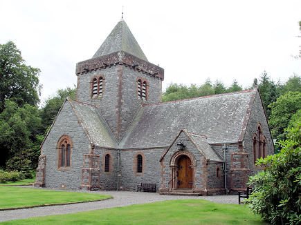
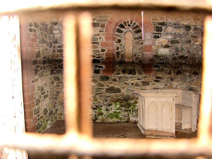
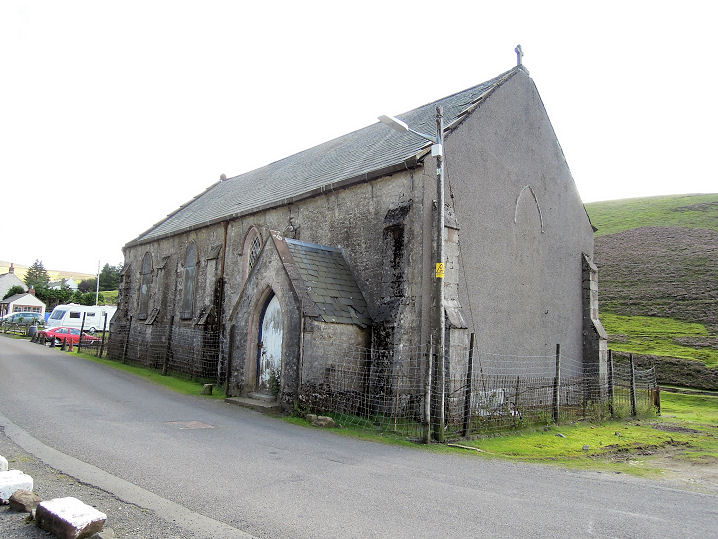
Kirkmadrine, the church, which
although relatively modern (its
category A listing says late 19th century), it's suggested that it stands on the site of a very early
monastery. No longer in use, the church is mostly famous for its collection of
C5-C6 gravestones.
Interior view, taken through a
window. NX 0802 4839. All © Colin Waters Collection (2011).
Kirkpatrick Fleming, the Parish Church (CoS).
It's dated
here to 1726, on the site of a predecessor, and some of which may have been
incorporated, and closed "about 2020". Another view.
NY 2764 7009. Both © Jim Parker
(2012).
Category B listed.
Kirkstile, Ewes Church of
Scotland. NY 3693 9084. © Bill Henderson. It's listed
here as
"former".
Category B listed
- wherein it's dated to 1867. Just metres away is marked on O.S. maps
St. Cuthbert's Church (Site of) at NY 3691 9082. In a
2021 Streetview
the old church would have stood left of and just beyond the present
church.
Kirtlebridge, the former
Church of Scotland. A map of 1862 labels it as Kirtle Church. NY 2377
7261. © Alan Marsden (2025). A 2021 Streetview provides
another view.
Kirkton, Kirkmahoe Parish Church,
dated
here to 1822-3. NX 9745 8153. © James Murray (2009).
Link.
Category B listed. Just a few yards to the S.E. is marked on O.S. maps
St. Quintin's Church (Site of), at NX 9747 8150.
The position indicated by the O.S. is about halfway along the churchyard wall
running away from the camera in a
2021 Streetview. North
of the village at NX 9746 8202 is a former
Free Church (2021
Streetview), dated
here to 1845-1929. In Cemetery Wood south of the village is
The Mount Mausoleum. A photo can be seen
here, where it's described as a chapel/mausoleum, dated to 1847. It also
advises that it's in a poor condition. NX 9746 8095.
Category A listed.
Langholm.
Lochmaben, Church of Scotland. NY
0836 8228. © James
Murray (2009). Link.
Category A listed
- dates it to 1819-20. Its predecessor, the medieval St.
Mary Magdalene, stood further to the north in the middle of a graveyard
which survives. O.S. maps mark its position at NY 0813 8250.
2021 Streetview.
Link.
Category B listed - has more photos. The town also had at one time a
Free Church. Dated
here to 1843, it was closed in 1957 and subsequently demolished. The housing
on its site was seen by
Streetview in 2021. NY 0820 8263. A map of 1861 shows a
United Presbyterian Church at the northern end of
the town on Church Crescent, at NY 0814 8332. This
source says it was built in 1864, replacing an earlier church (originally
Secession Burgher, of 1811) on the same site, and closing in 1928. Since
converted to residential use, it was seen by
Streetview in 2021.
Lockerbie.
Merkland (near Dunscore), former church, now a private residence.
It's described
here as Dunscore East CoS, and dated to 1899 (as a Free Church), on the site
of its Free Church predecessor of 1844. NX 9046 8501. © James Murray (2009).
Middlebie, the Parish Church. It's
dated
here to 1928-9, on the site of earlier churches. NY 2143
7616. © Gill Webb-Tomkinson.
Category B listed.
Minnigaff, the Monigaff Parish Church
(CoS). NX 4102 6660. © Dave Westrap. This
source says it
is "former", and dates it 1834-6. This
source says it was put up for sale in 2024.
Category B listed, wherein it's dated to 1836. The site of the Old Parish
Church is just a little way to the south - the church survives, though roofless,
and doesn't seem to be listed, though a monument is, as
category A. Poorly seen on Streetview, a photo can be seen
here. NX 4102 6656.
Mochrum - see Kirk of Mochrum, above.
Moffat.
Moniaive, St. Ninian (CoS) on
North Street. It's labelled on older O.S. maps as Mission Church. NX 7777
9098. © James Murray (2009). Link1.
Link2.
Glencairn Memorial Institute was built in 1834 as a church, and in 1921 was sold by the United Presbyterian Church
(when it was called the Glencairn and Moniaive United Free Church) to serve as a memorial to the dead of WWI.
NX 7784 9084. © James Murray (2009).
Link. Ruined church,
the former Glencairn Free Church as listed in Pevsner, where it's dated to 1843.
NX 7845 9067. © James Murray (2009).
Mouswald, the Parish Church, probably
on the site of its medieval predecessor (source). Another view.
NY 0651 7267. Both © James Murray (2009).
Category C listed, wherein it's dated to circa 1929. Less than a mile to the
south at the hamlet of Kirkfield is the site of Ruthwell
Free Church, dated
here to 1859 when it was "re-constructed" from the original church of 1843,
and demolished in the 1950's. Later known
as Mount Kedar Church, its
site lies
behind the house seen in
Streetview from 2021. Perhaps the surviving gateposts are from the church. NY
0717 7153.
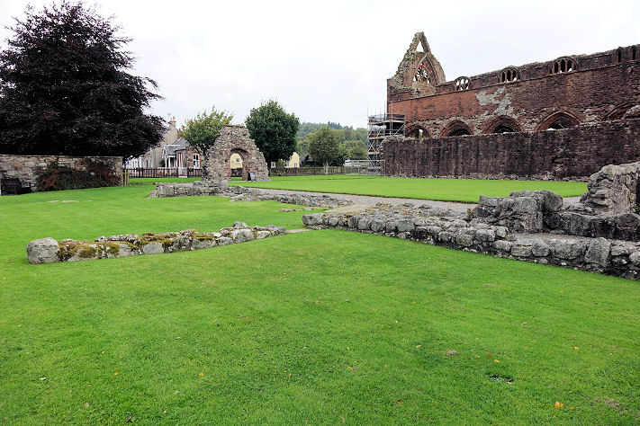
New Abbey,
the Parish Church. NX 9651 6597. © Steve Bulman. Another view,
© James Murray (2009). Link.
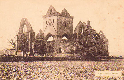
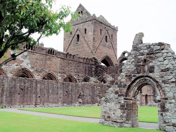
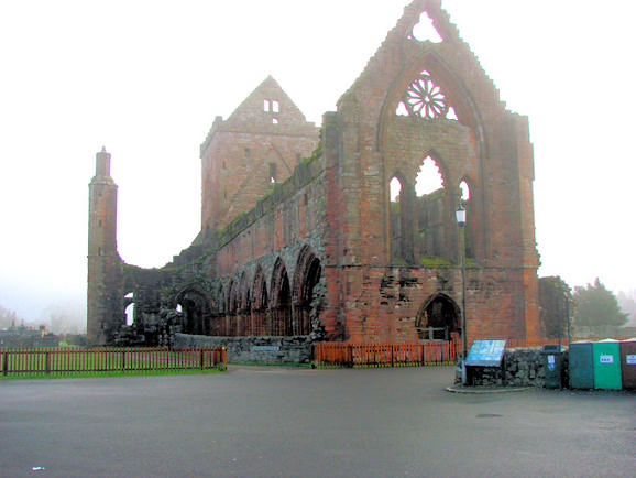
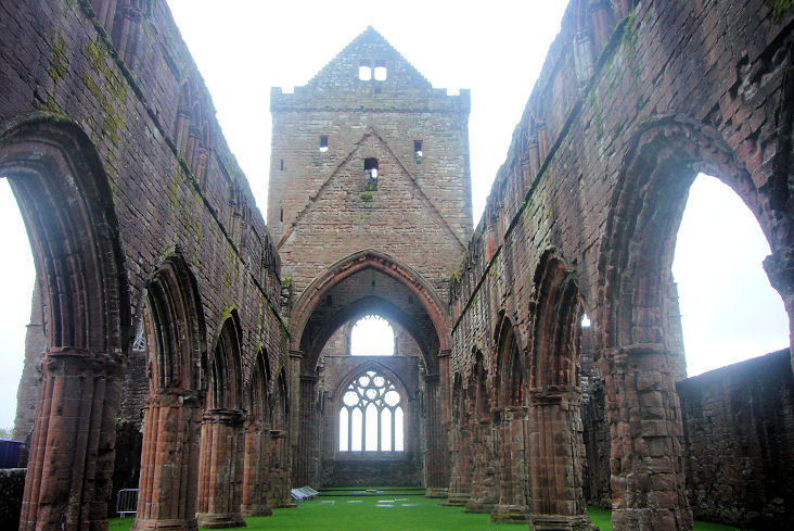
Category B listed. Sweetheart Abbey,
from an old postcard in Steve Bulman's Collection. A
modern view, © Steve Bulman. And another,
© Bill Henderson.
Another view, and an "interior view",
both © James Murray (2009). NX 9650 6627.
Link.
After the reformation, the nave of the abbey was no longer used for services for
the local people, and they initially met for services in what had been the abbey
refectory in the south range (the low
walls in the foreground) of the abbey buildings. This was succeeded in 1731
by a new church built against or near the
south wall of the abbey nave. No
trace remains. Both © Steve Bulman (2016). Also in the village is
St. Mary (R.C.) at NX 9667 6609. Not seen on
Streetview, a photo can be seen on its
PoWiS entry, where it's dated to 1824. Its
category B listing also has a photo. West of the Abbey, beside New Abbey
Bridge, is a former Free
Church (2021 Streetview) at NX 9624 6633. It pre-dates a map of 1895.
Newton Stewart.
Parton, the Parish Church (CoS). Another view.
NX 6968 6991. Both © James Murray (2009).
Link.
Category B listed. To the left in the first photo, and now forming part of a walled burial area, is
the remaining fragment of the old parish church. Its
Category B listing, which calls it St. Inan, dates it to 1592.
Penpont,
Church of Scotland. NX 8487 9447. © Dave Westrap.
Category B listed - dates it to 1867. The old graveyard, which is adjacent,
also has a
B listing. The medieval church was within the graveyard, according to this
source, and the graveyard was seen by
Streetview in 2023. The
6" O.S. map of 1900 shows a Ch. on Marrburn
Road, at NX 8472 9468. Available earlier and later maps don't show it, but
assuming it wasn't an error, it's been demolished, and its
site (Cameronian
Gardens) was seen by Streetview in 2023. A former Free
Church survives to the west of the town, at NX 8405 9440. This
source
advises that it was built as Scaurbridge Reformed Presbyterian Church in or by
1832, and closing as Penpont West CoS in 1942. It also says that it was partly
demolished during conversion to residential use. It was seen by
Streetview in 2023.
Portpatrick,
Church of Scotland on Main Street, which this
source dates to 1840-2. NX 0015 5443. © Bill Henderson.
Facebook.
Category B listed.
St. Andrew's Auld Kirk,
1628-9 (source),
which ceased being used as a church in 1842. NW 9999 5422. © Bill Henderson.
Category A listed. The graveyard is also listed as
category B.
St. Ninian (Episcopal).
It's dated
here to 1937. NX
0010 5430. © Dave Westrap.
Link. The former
Portpatrick Free Church, latterly Trinity CoS on School Brae, as
seen by Streetview in 2021. It's dated
here to 1886-7, on the site of a predecessor of 1843, and closing as
a church in 1930. NX 0008 5423.
Rigg, the former
United Presbyterian Church (later United Free), as seen by Streetview in 2021.
This
source advises that it was built in 1832 as a United Secession Church. It
also says that it was closed in 1929, though O.S. maps continue to mark it as
active at least up to the middle of the last century. NY 2906 6687.
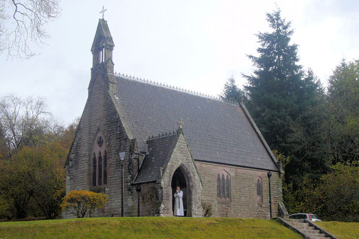
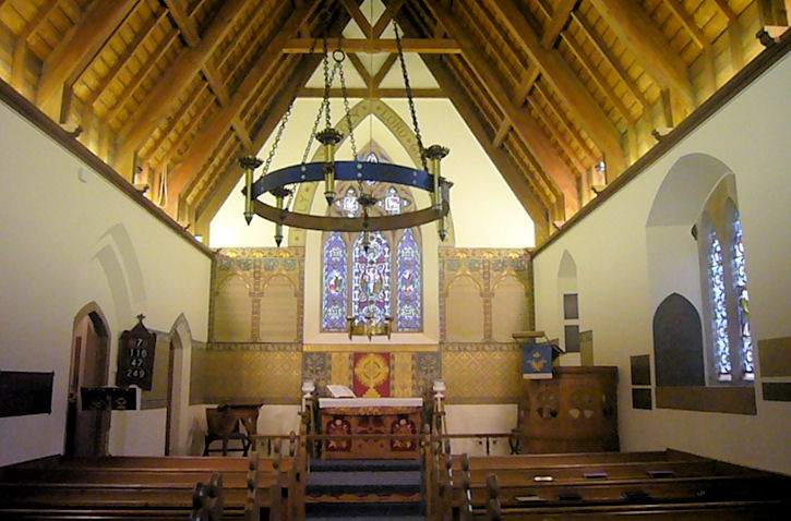
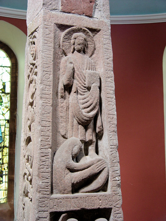
Ruthwell,
the Parish Church, to the north of the village. The famous Ruthwell Cross shows in this
internal photo. NY 1006 6821. Both ©
Gill Webb-Tomkinson. Three further views - 1,
2, 3,
two interior views - 1,
2, the latter also showing the
cross, and a close-up of the cross
itself, all © Steve Bulman (2010).
Link.
Category B listed.
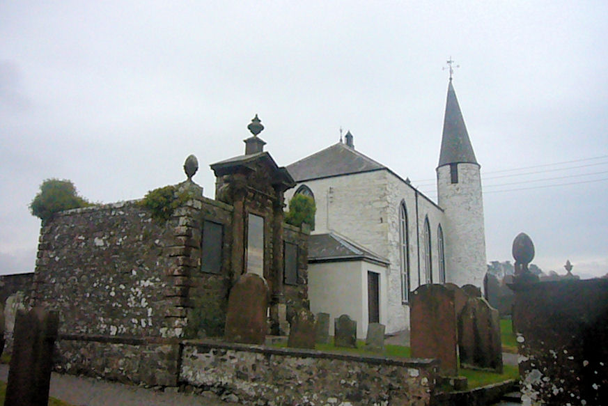
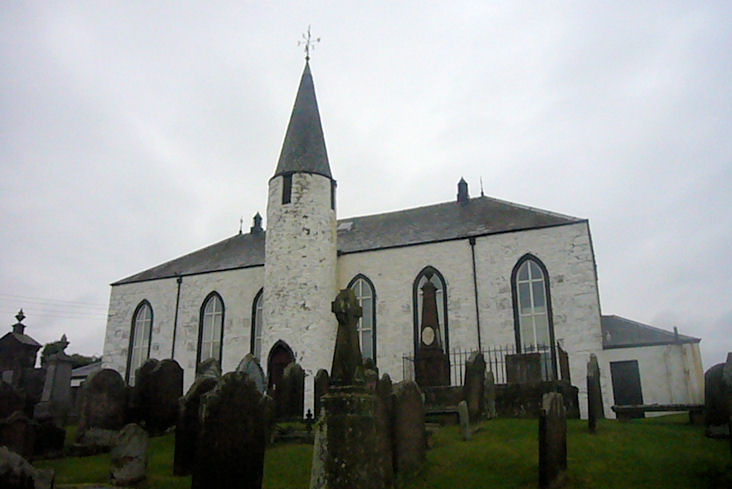
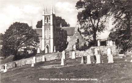
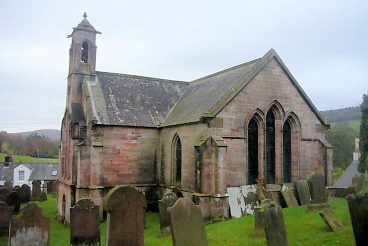
St. John's Town of Dalry,
Dalry Parish Church. It's dated
here to 1831, on the site of an earlier church or churches. NX 6187 8119. From an old postcard in Steve Bulman's Collection. A
modern view, © James Murray (2009).
Category B listed. Also
B listed are the restored remains of the predecessor C16 church in the
churchyard. It hasn't been seen by Streetview, but a photo showing a gable end
can be seen
here. Former church on Main Street, converted to a private dwelling.
This
source dates it to 1897-9 as United Presbyterian, was later United Free, and
at its closure "prior to 1955", St. John's CoS. NX 6223 8125. © James Murray (2009).
It had a predecessor in the town, on Kirkland Street and Wayside, at NX 6238
8124. Dated
here to 1825 as a Secession Church, it was U.P. from 1847. Date of closure
not specified, but presumably on or soon after the successor church was opened.
Demolished at some point, its
site was seen by
Streetview in 2021.
Sanquhar.
Sorbie, the ruins of the Old Kirk
(St. John).
On a map of 1850 it's shown as if it is in active use.
Another view. NX 4388 4679. Both © Alan
Marsden (2024).
Category B listed, wherein it's dated to circa 1750. The village also has a
former Free/United Free
Church (2021 Streetview) off the main road, at NX 4359 4686. It pre-dates a
map of 1850 (it's dated
here to 1844), and seem to have still been in active use into the second half of
the last century. Another
Streetview, from a side street, in 2009.
Springkell, the ruins of Kirkconnel Church. Not seen by
Streetview, the photo link is to Geograph UK. NY 2502 7535.
Link.
Stranraer, the Parish Church on
Leswalt High Road. A map of 1894 labels it as Sheuchan Church. Its
category B listing, which calls it the High Kirk, dates it to 1841.
Another view. NX 0559 6088. Both © John
Balaam (2025).
Link. The former St. Ninian
on Lewis Street, now in use as a funeral parlour. The 1894 map has it as U.P.
Church. Another view. NX
0598 6069. Both © John Balaam (2025). A short walk north along Lewis Street and
Church Street is Holy Ground, Stranraer
Community Church. It pre-dates the 1894 map, where it's labelled
(unhelpfully) just as Church, but its
category B listing, identifies it as Old Parish Church, dating it to
1838-41. NX 0596 6080. © John Balaam (2025).
St. John the Evangelist
(Episcopal) stands on Harbour Street and North Strand Street. NX 0606 6094.
Another view. Both © John Balaam
(2026). Link advises that the
church occupies the first floor, and the building dates from the 1990's. The
church was present on a different site prior to this - this
source locates it at the corner of Bellevilla Road and London Road at NX
0636 6070. There is a photo, and it's dated to 1892 to
"just prior to 1997". Its site now forms part of a large car park -
2025 Streetview.
Terregles,
Parish Church (C, CoS). According to this
source, the church is essentially of 1814, on the foundations of its
medieval predecessor. Another view. NX
9305 7702. Both © Steve Bulman (2014).
Link. Grade B listed.
O.S. maps show, less than half a mile to the N.W., Site of
Ladye Chapel. Its site lies within the wooded area shown in a
Streetview from 2021. NX
9268 7735.
Link.
Thornhill, the Parish Church on
Manse Road, dated
here to 1839-41. Another view. NX
8823 9581. Both © James Murray (2009). As of 2025, Google Streetview is
labelling it as "permanently closed".
Category B listed. This
former church on Townhead
Street was Virginhall Church (confirmed by Janet Gimber), and is now in
commercial use. Older maps label it as United Presbyterian.
Link dates it to 1784, originally as an Antiburgher Church, closing in or
soon after 1963. NX 8771 9531. © James Murray (2009). The
former Evangelical Union Church on
Drumlanrig Street, now a squash club. NX 8800 9534. © James Murray (2009). Dated
here to 1873-4 to 1956. It also says that they had previously met in a
Masonic Hall - the likely candidate for this is the former Freemasons Hall on
Drumlanrig Street, seen by
Streetview in 2021.
Tongland,
the roofless remains of the Parish Church (1813). NX 6980 5392. © Steve Bulman.
Category B listed. Beside it stand the
even more ruinous remains of the Old
Parish Church, incorporating fabric from Tongland Abbey. NX 6977 5392. © Steve Bulman.
Category B listed.
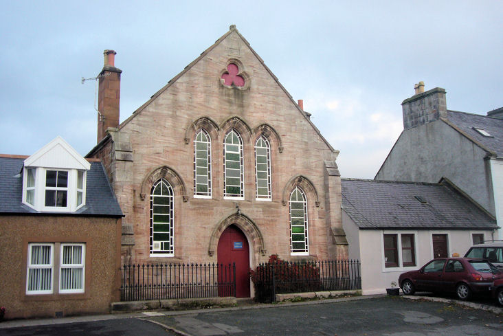
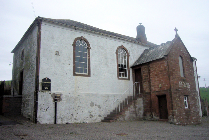
Torthorwald, the Parish Church. NY
0358 7824. © James Murray (2009). Link.
Its
category B listing, which dates it to 1782 includes the churchyard walls and
gate-piers. O.S. maps show Site of (the medieval) Church
in the present churchyard, at NY 0361 7824. In a distant
2021 Streetview of the
churchyard, the old church site is about in the centre. Both churches are
discussed
here.
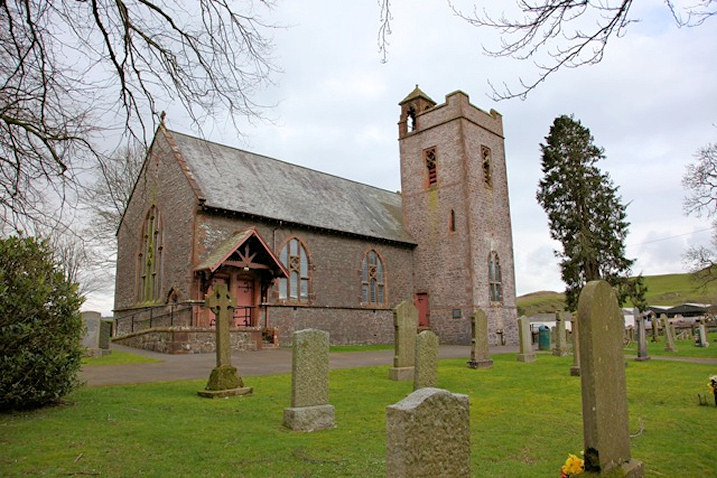
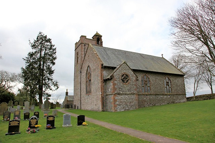
Tundergarth, Church of Scotland (O, 1900). This stands a couple of miles east of Lockerbie at NY 1747 8075.
Another view. Both © Martin Richter (2012).
Facebook.
Link.
Category B listed. It replaced an earlier building which was built in 1770,
the overgrown ruins of which stand in the churchyard, and seen
here (behind the
fencing) in a 2021 Streetview. Both churches are discussed
here.
Twynholm, the Parish Church, which is
dated
here to 1818. NX 6643
5422. © Steve Bulman. Another view, ©
Mark Eccles.
Category B listed. The site of its medieval predecessor (discussed here) is
uncertain. There is an interesting sub-circular feature (typical of early
churchyards) to be seen on Lidar, centred at NX 6659 5402. The same feature
appears on the 6" O.S. map of 1852, tree-ringed, but is less obvious on later
maps.
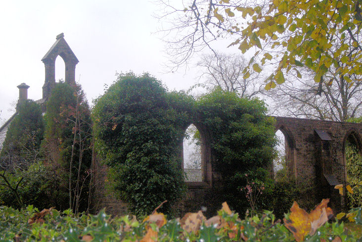
Tynron, the former Parish Church. It's
dated
here to 1835-7, on the site of several earlier churches, and closing
"probably in the early 1990s".
This source says
it was disused by 1998. Another view.
NX 8059 9300. Both © James Murray (2009).
Link.
Category A listed.
Wanlockhead,
the former CoS has been closed for many years. It's dated here to the
mid-1840's, "to replace an earlier church", closing "about 1978".
Another view. This may be the
"Miner's Church" mentioned on
Genuki. NS 8709
1309. Both ©
Adam Schofield (2014).
Link. There's a
site (2023 Streetview)
of a demolished Free Church at the eastern end of the village, at NS 8773 1294.
Later Hasting's Memorial CoS, it's dated
here to 1859-post 1932. Another Free Church
shows on the 1860 6" O.S. map at NS 8731 1269. It will have been the one
described
here as a wooden church of 1851, closing within a few years.
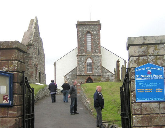
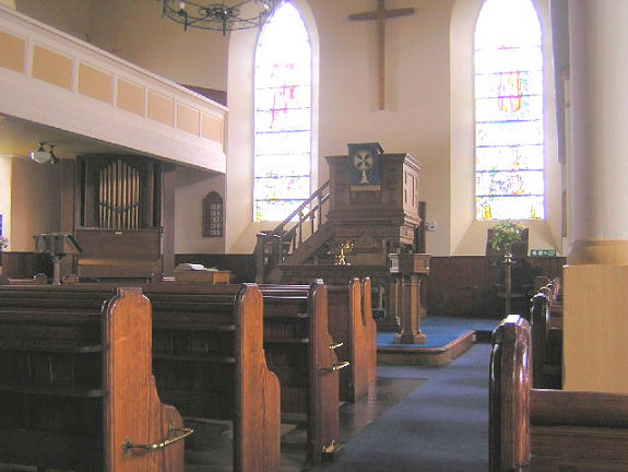
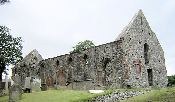
Whithorn, St. Ninian's
Priory (CoS, the parish church). Interior
view. Adjacent to it are the remains of the 12th century
Priory, which was later the parish
church until the present one was built in 1822. NX 4444 4033. All
© Dave Westrap. Link1.
Link2.
A former United Presbyterian
Church now serves (or has served) as a petrol station. It stands on St.
John's Road and Park Lane. A map of 1850 shows
Secession Church on the same site, though aligned at 90° to the later
church. This
source dates the first church to circa 1790, and the U.P. Church to
1891-2. It had closed no later than 1959. NX 4465 4061. © Alan
Marsden (2024). Older O.S. maps also show a Free Church
on King's Road, at NX 4461 4017. This
source dates it to 1844, and calls it St. Ninian's United Free
Church, later becoming a church hall, and subsequently demolished. It's
site remains undeveloped, and was seen by
Streetview in
2021. St. Martin and
St. Ninian (R.C.) on George Street, as seen by Streetview in 2023.
It's dated here to 1959-60.
Link. A map of
1850 shows a Reformed Presbyterian Church
on Drill Hall Lane at NX 4453 4002. Much alterred, it was seen by
Streetview in
2021. This source says it was originally a Seceder's Church,
built by 1832. At about a mile north of the town is marked on O.S. maps,
Chapel (in ruins) at NX 4485 4211. Later
maps show it as Chapel (Site of). It's close to a farm called Chapel
Outon, and is evidently the church mentioned here as a
Pre-Reformation Church. Nothing shows on Lidar. In a
2023 Streetview,
it's site will be to the right of the field wall, just beyond the ridge.
Wigtown.
|
|