The Churches of Britain and Ireland
| Sanquhar,
Dumfries & Galloway
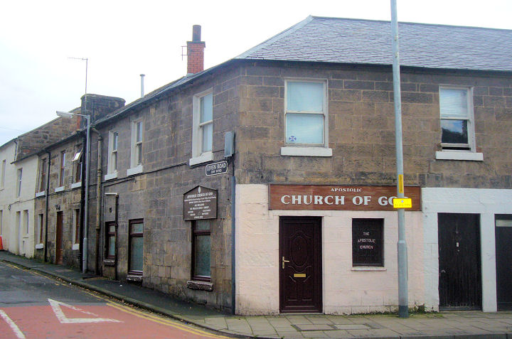
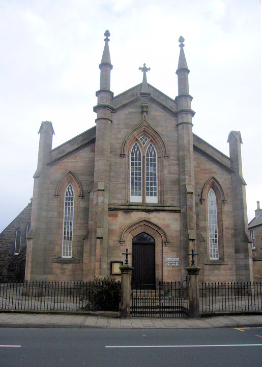
Apostolic Church of God, on High Street and Leven Road, at NS 7842 0972. As a church it post-dates a map of 1956, though the building is evidently older than that. © James Murray (2009). Facebook. This source says it had a predecessor on Harvey Wynd, at NS 7825 0992, built in the mid-1950's. Since demolished, its site was seen by Streetview in 2023. On Station Road is a former (and unrecognizable) Evangelical Union Church (2021 Streetview), now in commercial use. It's dated here to 1865, closing in the 1950's. NS 7806 1011. The former Free Church (2023 Streetview) on St. Mary's Street, at NS 7817 1004. After numerous name changes (source) it was finally closed in the 2010's as a Congregational/Evangelical Union Church. St. Bride (CoS), at the northern edge of the town, as seen by Streetview in 2021. It's dated here to 1822-4 (also a contradictory 1827-8), on a medieval site. NS 7790 1017. Link. Category B listed. St. Ninian's Baptist Church on High Street. Built as a United Secession Church in 1841-2, it had numerous name changes, becoming Baptist in 1984 (source). NS 7844 0969. © James Murray (2009). Category B listed. Its Baptist predecessor (2023 Streetview) still stands on St. Mary's Street. This source dates it to 1849, originally as United Presbyterian. It was Baptist from circa 1970. NS 7816 0999. The predecessor of the United Presbyterian Church on St. Mary's Street (see the St. Ninian's entry, above) stood at the top of the same street, close to the railway line. Originally a Secession Burgher Church (source) dating from 1818, it was demolished in the late 1840's because of subsidence. Not shown on any available O.S. maps, the map on the source already given places it at circa NS 7819 1011, on the right of the road seen in a Streetview from 2023.
|
||
10 February 2025
© Steve Bulman