|
|
Dorset
Dorset on Wikipedia.
Dorset Historic Churches.
Abbotsbury, St. Nicholas.
Another view, an ancient
carved stone figure in the
porch (the listing says it's of an abbot, of circa 1200),
another in the exterior
wall (St. Nicholas?), two of the interior -
1,
2, the
altar and the
font. SY 5777 8521. All © Peter
Morgan (2017). An old postcard view, from Steve
Bulman's Collection.
Link.
Grade I listed.
For other listed features see
here. St. Catherine's Chapel (originally
part of the abbey), and the
interior. SY 5725
8483. Both © Peter Morgan (2017).
Link. The former Congregational Church.
SY 5773 8541. © Dennis Harper (2011). Older maps show that a
Primitive Methodist Chapel once stood to
the north of Back Street, at SY 5764 8543. It pre-dated a map of 1889,
and according to this
source it dated from 1799 as Congregational. After its closure as a
church in 1925 it was eventually used for storage, and was severely
damaged in a fire. Reportedly, the remains survive, but its site hasn't been seen by the Streetview van.
Its replacement in 1925 was the now-demolished
Methodist Church on West Street. Its closure is given
here (where there is a photo) as 1984, with demolition following in
1985. It also describes as having stood where the garage is in this
2021 Streetview.
SY 5745 8530.
Affpuddle, St.
Lawrence. SY 8054 9371. © Bill McKenzie. Another view,
© June Norris.
Link.
Grade I listed. For other listed features see
here.
Alderholt, St. James, some
distance from the village. Another view. As Roger points out, the stepped
gable is very unusual outside of Scotland, and in this case the 12 steps are probably symbolic of the apostles.
SU 1048 1260. © Roger Hopkins.
Link.
Grade II listed, wherein it's dated to 1849, with a later chancel.
Alderholt Chapel
on Hillbury Road, as seen by Streetview in 2023. The leftmost buildings
are a relatively recent addition, as a
Streetview from
2009 shows. SU 1235 1302.
Link. Older O.S. maps show an Independent
Chapel on Station Road at SU 1226 1302. It's presumably this
chapel which can be seen in a Francis Frith photo
here, where it's given as Congregational. The bungalow on its site
was seen by
Streetview in 2023.
Almer, St. Mary. SY 9132 9894. © Mike Rice. Another view, from an old postcard in Reg
Dosell's Collection. Another view, and an interior view, both © Roger
Hopkins. Roger rates this C12 church very highly.
Link.
Grade I listed. A churchyard cross and tomb are also listed
here.
Alton Pancras, St. Pancras. Interior view.
ST 6988 0241. Both © Marion
Hall.
Link.
Grade II* listed. For related listed features see
here.
Ashmore, St. Nicholas, and its
interior. ST 9114 1778. Both © Chris Kippin (2022). Link.
Grade II listed. For other listed features
associated with the church, see
here. The village has a former
Methodist Chapel (originally Wesleyan, of 1855) on High
Street, now in residential use. ST 9120 1776. © Chris Kippin
(2022). Grade
II listed. What appears to be
another former Chapel stands
on Green Lane. It has a date-stone for 1904. A
Streetview from 2011
shows it before the wall was built, and reveals that the arched windows
aren't original. It may have been the Sunday school shown on a
map of 1963. But was it ever a chapel? ST 9139 1769. © Chris
Kippin (2022).
Athelhampton, St. Edward King and
Martyr (Orthodox, formerly St. John, Anglican). SY 7711 9414. © June Norris.
Link.
Grade II listed, wherein it's dated to 1861-2. O.S. maps indicate
the position of its medieval predecessor at SY 7702 9422, within the
grounds of Athelhampton Hall.
Beaminster, St. Mary. ST 4789 0125.
© Steve Bulman (2010). The church
website calls it St.
Mary of the Annunciation.
Grade I listed. For related listed features see
here. The former Congregational Church
on Whitcombe Road, now the town museum. Its
grade II listing dates it to 1749, enlarged in 1825, and the
museum website says it was
"Converted in 1990". ST 4816 0116. © Steve Bulman (2010).
St.
John (R.C.) on Shortmoor. ST 4820 0174. © Steve Bulman (2010). The church
website
history page dates its opening to 1967, and says that prior to this,
services were held in a room in the
Red Lion (2023
Streetview) on North Street and Prout Hill. ST 4807 0130. Immediately west of
St. John is the former Holy
Trinity (2011 Streetview). Its
Wikipedia entry (which has an old photo) dates it to 1849-51, made redundant
in 1978. ST 4815 0173. Older maps show Centenary Chapel
(Wes. Meth.) on Fleet Street at ST 4808 0148. Its
grade II listing dates it to the mid-19th century, and it was still active
into the second half of the 20th. It was seen by
Streetview in 2023.
Belchalwell, St. Aldhelm. ST 7924
0980. © Chris Kippin (2022). Link.
Grade II* listed. A table tomb in the churchyard
is listed as
grade II. Less than a mile to the S.S.E. at Belchalwell Street is a former
Wesleyan Methodist Chapel
(2023 Streetview). Pre-dating a map of 1887 it had gone out of use no later than
1957. ST 9550 0903.
Bere Regis,
St. John the Baptist. SY 8474 9476. © Bill Henderson.
Another view, the
interior, and a charming C15 roof
carving. The story of the Turberville family, commemorated in the Turberville window, is famous as the inspiration
for Hardy's "Tess of the D'Urbervilles". The wealthy Turberville family lived in Bere Regis. All © Roger Hopkins.
Another view, and a
close up of the ceiling, both
© Christopher Skottowe (1978).
Link.
Grade I listed. The war memorial in the churchyard
is listed at
grade II. A
Congregational Chapel stands on Butt Lane at SY 8458 9509. A map of 1887
shows a Mission Hall on the same site - this is possibly unrelated, as the
church website history dates
the church to 1893, when an existing schoolroom was converted. It was seen by
Streetview in 2010. Link. The
source just mentioned also discusses Drax Hall as
an earlier chapel. It still stands on North Street, used as the village hall,
and was seen by Streetview
in 2023. The
village also had a Methodist Chapel, marked on
older maps as Wesleyan. The
National
Archives reference documents pertaining to it for the years 1864-1964. A
house now stands on the site, seen
here by Streetview in 2010.
SY 8468 9482.
Bettiscombe, St. Stephen. SY 3991
9998. © June
Norris. Link.
Grade II listed.
Bishop's Caundle, St. Peter and
St. Paul, or no dedication, according to source consulted. ST 6962 1316. ©
June Norris. Link.
Grade I listed. A table tomb in the churchyard is also listed, as
grade II. Older O.S. maps show a Primitive Methodist
Chapel a little way east of the village at ST 7002 1307, pre-dating the
1887 map. In a 2015
Streetview, the chapel would have stood beside the nearer end of the house
extending to the roadside. Does anything of it survive? It was succeeded in 1908
by a new chapel built a short distance away on the other side of the road. It
survives and was seen by
Streetview in 2009. ST 6997 1308.
Link includes a comment that it was closed (presumably as Methodist) in
1983.
Blackdown, Holy Trinity. ST 3963 0308. ©
Julie Baker. Link says
it was consecrated in 1840.
Blandford Forum.
Blandford St. Mary,
St. Mary. ST 8916 0527. © June
Norris. Link.
Grade II* listed.
A number of churchyard monuments are also listed
here.
Boscombe, Bournemouth - see the
Bournemouth page.
Bothenhampton,
Holy Trinity New Church. SY 4703 9194. From an old postcard in Reg Dosell's Collection.
Link.
Grade II* listed
- dates it to 1887-9.
The Old Church, also dedicated to the Holy Trinity, is now in the care of the Churches
Conservation Trust. Another view, two interior views - 1,
2, and the font.
SY 4753 9176. All © Dennis Harper (2011).
Link.
Grade I listed.
For related listed features see
here.
Bournemouth.
Bradford Abbas,
St. Mary. A detail from the pulpit.
ST 5874 1428. Both © Gene
Hawkins. Link (O).
Grade I listed. Related listed features can be seen
here. A map revised in 1927 shows a Wes. Meth. Church.
on North Street at ST 5893 1453. It shows as still active on a map of 1960. The
house on the site was seen by
Streetview in 2009.
Link says it was demolished in 1971. The tiny hamlet of Clifton Maybank
stands a little way to the S.W. of Bradford Abbas. O.S. maps indicate
Chapel (Site of) at ST 5762 1382. It stood in this
field, seen by
Streetview in 2026. According to this
source,
a chapel was recorded in 1291, but the building demolished in 1824 dated from
1600.
Branksome, Poole - see the
Poole page.
Bridport.
Broadoak, St. Paul on Broadoak Lane.
Built as a chapel-of-ease to Symondsbury in 1865-6, to the designs of
Thomas Talbot Bury.
SY 4389 9629. © Richard Roberts (2016).
Link.
Grade II listed.
Broadwindsor, St. John the Baptist.
ST 4378 0265. ©
June Norris.
Link.
Grade II* listed. Three table tombs also share a
grade II listing. Older O.S. maps show a
Congregational Chapel in the village, on West Street at ST 4360 0254. It
seems to be included on a map of 1888, though it isn't labelled, and it seems to
have gone out of use in the middle of the 20th century. It hasn't survived
- in a 2023 Streetview,
what seems to be its Sunday School shows at the right - the chapel was
immediately to its left, a little further back from the road. It can be seen in
a photo from 1902
here, just below the centre.
Brownsea Island,
St. Mary. SZ 0282 8777. © Dave Westrap. Another view,
interior view, and the unusual
tomb (grade
II listed) of George Cavendish-Bentinck in
the graveyard. A medieval Italian well-head, the 19th century owner of the
island brought it back to adorn his final resting place. All
© Roger Hopkins. Another view,
interior, and finely-executed
tomb, all © Peter Morgan (2017).
Link.
Grade II* listed.
Bryanston, St. Martin, dating from 1898.
Standing in the grounds of Bryanston Public School, it was constructed using
stone from the demolished Bryanstone House (1778).
Interior view. The
roof is constructed from the
ballroom floor of the House. ST 8748 0697. All © Roger Hopkins. Link.
Grade II listed. What is now the
Portman Chapel was the parish
church before St. Martin was built, and was also known as St. Martin's. ST 8746
0706. © Chris Kippin (2022). Link
(a good history, with interior photos).
Grade I listed.
Buckland Newton, Church of the Holy Rood. Interior view.
ST 6876 0527. Both ©
Marion Hall. Link.
Grade I
listed. The war memorial and numerous tombs are also listed
here. East of the village is a former
Primitive Methodist Chapel,
now The Old Chapel Stores, seen by Streetview in 2023. It pre-dates a map
of 1887, and, according to this
source,
was closed in 1942. ST 6937 0508.
Burton,
Christchurch - see the Christchurch page.
Burton Bradstock, St. Mary the Virgin. Two further views - 1,
2, interior view,
altar, and the font.
All © Dennis Harper (2011).
Link.
Grade I listed.
For related listed features see
here. The former
Wesleyan Chapel (1825) now serves as
the library. © Dennis Harper (2011).
Grade II listed.
Castleton, St. Mary Magdalene.
ST 6463 1681. ©
Andrew Ross (2018).
Link.
The adjacent Sherborne Castle used to have a
Chapel, marked on O.S. maps at ST 6490
1685. Its site hasn't been seen by Streetview.
Cattistock, St. Peter and St. Paul.
SY 5914 9953. From an old postcard in Paul E. Barnett's Collection.
Link.
Grade I listed. For related listed features see
here. The village also has a former Primitive
Methodist Chapel, on The Square, at SY 5914 9966. It's dated
here to 1870, remaining in active use to 1971 at least, but has
since been converted to residential use. It was seen by
Streetview in
2023.
Cerne Abbas, St. Mary. ST
6659 0122. © Karel Kuča (2025). The
interior, from an old postcard in Paul E. Barnett's Collection.
Link.
Grade I listed. The war memorial in the churchyard is also listed, at
grade II. There used to be a Wesleyan Methodist
Chapel on Long Street, at ST 6660 0115. According to this
source (where there is a photo) it dates from 1882-1919, and was
later used as a Salvation Army Barracks (source).
It was demolished at some point and public toilets built on the site,
seen by Streetview
in 2023. There is also a former
Congregational/U.R.C. Chapel (2023 Streetview), on Abbey Street.
This
page refers to records for the church for the years 1762-1981. ST
6653 0124. There are also several remains of Cerne
Benedictine Abbey, just N.E. of the village. See its
Wikipedia article
for more details and photos, and
here for listing details. There's nothing above ground of the Abbey
Church, but recent excavations have located it - see
here.
Chalbury,
All Saints. SU 0185 0684. © June Norris.
Link.
Grade I listed. A monument in the churchyard is also listed, as
grade II.
Charlton
Marshall, St. Mary the Virgin. ST 9003 0407. © June Norris.
Link.
Grade I listed. Several churchyard monuments are also listed
here. The village also had a Primitive
Methodist Chapel, on The Close at ST 9012 0385. A bungalow stands
on its site, seen by
Streetview in 2023. It pre-dated a map of 1887, and this
source says it was closed by 1901. It also mentions the congregation
later acquiring a former Congregational Chapel on Gravel Lane - this is
shown on O.S. maps as a Baptist Chapel (General)
on Gravel Lane on a map of 1887 at ST 8993 0431, and on map of
1930 as Meth. Ch. It has survived, and was seen (though not well)
by Streetview in
2023. The source already given has a better photo.
Charminster, St. Mary the Virgin. SY
6792 9270. Another view. Both © Les
Needham. Link.
Grade I listed. The 1888 O.S. map marks a
Wesleyan Methodist Chapel on North Street, at SY 6781 9316.
Aerial views suggest it may have survived, but the building on the site
is blurred out on the only available
Streetview. It
had been closed no later than 1957. I haven't been able to find a photo
of it. There was also a United Free Methodist
Chapel on East Hill at SY 6805 9263. The converted chapel is now
called Wesley Cottage, and was seen by
Streetview in
2021. Some O.S. maps show Chapel (Site of)
at Wolfeton House (south of the village) at SY 6787 9216. The site
hasn't been seen by Streetview.
Charmouth, St. Andrew
on The Street.
Although of medieval origin, it was completely
re-built in 1836 by
Charles Fowler. SY 3643 9359. © Graeme Harvey.
Interior view,
© Richard Roberts (2016).
Link.
Grade II listed. Churchyard wall, gates and tombs are also listed
here. U.R.C. on
The Street. Founded as Congregational in 1689, the
present chapel is of 1815. SY 3663 9364. ©
Richard Roberts (2016).
Grade II listed. Mortuary Chapel
in Charmouth Cemetery, located at SY 3536 9411. It pre-dates the OS map of 1889. ©
Richard Roberts (2016). Google Streetview marks Charmouth
Christian Fellowship as meeting at The Elms on St. Andrew's
Drive. Its
Facebook page says that the fellowship "no longer exists". The
Elms was seen (from The Street) by
Streetview in
2023. SY 3639 9361. A 2001
Ship of
Fools entry is for Lighthouse Christian
Fellowship, meeting in the village hall, which is on Wesley
Close. There is a photo, but
here is a more
recent Streetview, from 2023.
Chettle, St. Mary. ST 9516 1329. ©
Chris Kippin (2019).
Link.
Grade II* listed. Possible former
church? Howard Richter has been examining old maps to
determine something of the history of this building, and can find no evidence of
religious use. ST 9518 1338. © Chris Kippin (2019).
Chideock, St. Giles. SY 4216 9287. © Graeme Harvey.
Two further views - 1, 2, two interior views -
1, 2, and the font, all ©
Dennis Harper (2011). Link.
Grade I listed. Churchyard walls and five tombs are also listed
here. The Church of Our
Lady, Queen of Martyrs, and St. Ignatius (R.C., 1872) on North Road. Built
by Charles Weld in the grounds of Chideock Manor.
Interior view. SY 4203 9345. Both © Richard Roberts
(2016). Link.
Grade II* listed. Also by Charles Weld, the
Catholic Cemetery Memorial Chapel
(1852), aka Weld Memorial Chapel, on North Road. SY 4216 9291. © Richard Roberts (2016).
Grade II* listed.
Child
Okeford, St. Nicholas. ST 8355 1275. © June Norris. An old postcard view (on which it is spelled Childe Okeford) from
Reg Dosell's Collection.
Link.
Grade II* listed.
Chapel House
(2023 Streetview) is a former Wesleyan Methodist
Chapel. A map of 1887 suggests that it had been built by then,
but it isn't labelled. It was still active into the second half of the
last century. ST 8326 1304.
Link. An old photo of it can be seen
here. The same source also mentions a demolished
Plymouth Brethren Chapel, and there are
photos of it. It locates it as having stood "opposite Pine Walk", but
I've been unable to locate this, and it doesn't seem to be shown on any
of the available maps. Can you pinpoint where it stood?
Chiswell - see Portland.
Christchurch.
Colehill, St. Michael and All
Angels. Three more views - 1,
2, 3.
SU 0248 0122. All © Karel Kuča (2011).
Link.
Grade II* listed, wherein it's dated to 1893-5. The
Methodist Church on Lonnen
Road, as seen by Streetview in 2011. SU 0275 0122.
Link.
Compton Abbas, St. Mary the
Virgin. See also East Compton for St. Mary's predecessor. ST 8691 1847. © June
Norris.
Link.
Grade II listed - dates it to 1868. The village also has a
former Wesleyan
Methodist Chapel (2009 Streetview), at ST 8700 1857. The National
Archives
references documents pertaining to the chapel for the years
1864-1967.
Corfe Castle, St. Edward King and Martyr.
SY 9606 8205. © Bill
McKenzie. Another view, © Malcolm
Matthews. A view of the church from the castle, and an interior view,
both © Roger Hopkins. The font, © Graeme Harvey (2011).
Link.
Grade II* listed.
A churchyard monument is also listed, as
grade II. Chapel on the Green (aka
Corfe Castle Evangelical Congregational Church) on East Street. It
stands behind other buildings so that it it barely seen by
Streetview, but
the church website has a photo
from the rear. Older maps (it pre-dates one of 1888) label it as
Congregational. SY 9614 8194. The village also has a former
Wesleyan Methodist Chapel, further south at
SY 9622 8169. It too is not well see by Streetview (here,
in 2014), but a better photo can be found
here. It also pre-dates the 1888 map, and was still active at least
into the 1950's.
Corfe Mullen, St. Hubert. SY 9767
9834. © June
Norris.
Link.
Grade II* listed. A
churchyard cross is also listed, as
grade II.
Cranborne, St. Mary and St. Bartholomew. Another view,
and the interior, a splendid wall-painting,
and the Tregonwell window. SU 0545
1325. All © Roger Hopkins.
Link.
Grade I listed. According to the village
Wikipedia entry,
the church was originally the Abbey Church of
Cranborne Benedictine Abbey or Priory, the site of which is
marked on O.S. maps just a few yards south of the church at SU 0546
1321. Link.
The village also has a former Wesleyan Methodist
Chapel, off Salisbury Street, at SU 0542 1334. Streetview has
only been able to see a sliver of the building (in
2009). There is
a slightly better photo
here, where it's dated to 1847-1967. Just a little way further north
is a former
Primitive Methodist Chapel. Like the other chapel, the P.M. chapel
is difficult to see from the road (2023 Streetview). This
source dates the building to 1828, originally as Rehoboth Wesleyan
until 1848, when the P.M's took it over. It may have been re-named as
Ebenezer - see the source for a discussion on this. SU 0540 1344.
Dean, the
former Primitive Methodist Chapel, as seen by Streetview in 2021.
A P.M. Chapel shows here on a map of 1887, though it was a smaller
building than shown on later maps. It had gone out of use no later than
1957, and is reported
here as being still active in 1940. ST 9772 1592.
Dewlish, All Saints. Another view,
and the interior. SY 7755
9818. All © Chris Kippin (2022).
Link.
Grade II* listed. For listed monuments in the churchyard, see
here. The former Wesleyan
Methodist Chapel on Middle Street. It pre-dates a map of 1887 -
according to this
source it was re-built in 1859, a fire having destroyed its 1843
predecessor. SY
7768 9836. © Chris Kippin (2022).
Dorchester.
Dottery, St. Saviour (CoE, 1882)
on Pymore Lane. Richard advises that this is the last tin tabernacle in regular use in Dorset. SY
4582 9517. © Richard Roberts (2016).
Link.
Durweston, St. Nicholas. ST 8587
0852. © June Norris.
Another view, © Roger Hopkins.
Link.
The former Primitive Methodist
Chapel. It pre-dates a map of 1901, though possibly the same
building (unlabelled) is marked on a map of 1887. ST 8591 0870.
© Chris Kippin (2020).
Link says it may have been closed in the 1960's.
East Compton, the remains of St.
Mary Old Church. Another view.
Dating from the 15th century, the church was abandoned in the mid 19th,
the congregation moving to the then new church of St. Mary at Compton
Abbas. Much of the old building's fabric was re-used in the new church,
leaving the tower, and a 13th century preaching cross in the graveyard.
ST 8756 1880. Both © Roger Hopkins (2010).
Grade I listed.
East Lulworth, St. Mary (R.C.,
1786), N.W. of Lulworth Castle. SY 8525 8227. © Roger Hopkins.
Grade I listed. To the south of the castle is
St. Andrew (2009
Streetview). SY 8537 8208.
Link.
Grade II* listed. About a mile S.S.E. of the castle is a farm
labelled on O.S. maps as Monastery Farm. What if anything remains
of any monastic buildings is unclear - it hasn't been seen by
Streetview, and I haven't been able to find any useful photos. Its story
can be read
here. SY 8613 8101.
East Orchard, the former
St. Thomas of 1859, and its
interior. It's currently undergoing conversion to residential use. A
news story from 2023 says it had been closed since 2018. ST 8334
1793. Both © Chris Kippin (2024).
Grade II listed. Less than half a mile south is a former
Primitive Methodist Chapel, at ST 8313
1750. It was seen by Streetview in 2009 - it has a date-stone, but it's
unreadable. Old maps show it to have been built between 1886 and 1900.
Link.
East Stoke, the former St. Mary, now
residential. SY 8725 8705. © Graeme
Harvey (2011).
Grade II listed - dates it to 1828. It mentions that the font is
from "Old Church". This was also St. Mary, and its scant remains stand
to the S.W. by the river, at SY 8677 8675. It hasn't been seen by
Streetview, but a photo can be seen
here (scroll down).
Grade II listed.
East Stour, Christ Church.
The interior and the
font. ST 7987 2284. All ©
Chris Kippin (2024).
Link.
Grade II listed, wherein it's dated to 1842, and the font is said to
be of the 12th century. The
history page says that it stands near the site of a medieval
predecessor (there is an illustration of it), demolished in 1839. I
haven't been able to establish with certainty exactly where it
stood. Older O.S. maps show Baptist and
Methodist chapels in the village. The
Methodist (originally Wesleyan) is on Back Street at ST 8039 2348. It
survives, and was seen by
Streetview in
2023. The Baptist Chapel stood at ST 8020 2333, also on Back Street. Its
site was seen by
Streetview in 2021 - could the low brick wall be from the chapel?
Easton -
see Portland.
Enmore Green, Shaftesbury - see the
Shaftesbury page.
Eype, St. Peter (1863-5) on Mount
Lane. SY 4512 9178.
© Richard Roberts (2016).
Link.
Farnham, St. Laurence. ST 9579 1505.
© Chris Kippin (2022). Link.
Grade II* listed. Near the northern end of the village is a former
Wesleyan Methodist Chapel
(2009 Streetview). It pre-dated a map of 1887 and shows as still active on
another of 1960. ST 9567 1540.
Fifehead Magdalen, St. Mary Magdalen. The photo is stitched together from several
images, to avoid trees. ST 7828 2160. © Martin Richter (2012).
Link.
Grade II listed. For listed tombs, and the churchyard cross, see
here. A former Baptist
Chapel (2023 Streetview) stands a little way north of the village, at ST
7788 2182. A map of 1886 labels it as Baptist Chapel (General) - it had
gone out of use by the mid-20th century.
Fontmell
Magna, St. Andrew. ST 8654 1699. © June Norris.
Another view, interior view, and the
St. George window. All © Roger Hopkins. An
old postcard view, from
Reg Dosell's Collection. Three more views of
the interior - 1,
2,
3, the carved stone
pulpit, and two fonts, one
Norman, the other
Victorian,
all © Chris
Stafford (2015).
Link.
Grade II* listed. A churchyard monument is separately listed as
grade II. A former
Wesleyan Methodist Chapel
stands on Lurmer Street at ST 8666 1707. It's dated
here
to 1797, and has a later schoolroom attached at the roadside. It's currently in
use as a yoga venue.
© Chris Kippin (2024).
Link.
Grade II listed.
Fordington - see the
Dorchester page.
Fortuneswell - see Portland.
Frampton, St. Mary.
SY 6270 9498. © Graeme Harvey.
Link.
Grade I listed. Two monuments are also listed
here.
O.S. maps show, just south of the village, Frampton Court On Site of
Benedictine Priory. Frampton Court has been
demolished (in 1932, according to
Wikipedia). SY 6261
9465 (for the house).
Link.
Gillingham,
St. Mary the Virgin, much re-built in the 19th and 20th centuries. ST 8064 2659.
© Andrew Ross. Link.
Grade I listed. Three churchyard tombs have their own listings
here.
The
Methodist Church on High Street and Barnaby Mead. Older maps label it as
Wesleyan. As of 2025, Google Streetmap says this is "permanently closed". News
story about its closure
here. ST 8083 2652. © Andrew Ross. The
Baptist Church on
Newbury, as seen by Streetview in 2018. ST 8121 2630.
Link. A
Primitive Methodist Chapel shows on the 25" O.S.
map of 1901, on Queen Street and Chapel Mews, at ST 8066 2686. It's dated 1876
and survived as a place of worship into the latter half of the last century.
This
source, which reports that it had been closed by 1994, also mentions a
predecessor of 1838 on Turners Lane. It doesn't betray any signs of having been
a chapel - 2023 Streetview.
ST 8056 2669. St. Benedict
(R.C.) on Cemetery Road, as seen by Streetview in 2023. ST 8042 2681.
Link. Just inside the adjacent entrance to the cemetery is a
Mortuary Chapel (2011
Streetview) at ST 8039 2684.
Gillingham Community Church on High Street (2023 Streetview). ST 8090 2648.
Link.
Grove - see Portland.
Gussage All Saints, All Saints. ST
9985 1083.
© Chris Kippin (2019).
Link.
Grade I listed.
Gussage St. Andrew, St. Andrew.
Another view and the
interior (including font) taken
through a window. ST 9761 1426. All © Chris
Stafford (2015).
Link.
Grade I listed.
Gussage St. Michael, St.
Michael. ST 9858 1133. © Chris Kippin
(2019).
Link.
Grade I listed. The former St.
Michael Methodist Chapel has a date-stone for 1907, when it was built as
Wesleyan. Its closure is given
here as 1973. There was an earlier smaller chapel on the site, at least as
far back as 1887, when it shows on a map of that vintage. ST 9861 1130.
© Chris Kippin
(2019).
Hammoon, St. Paul. ST 8179 1458. © Chris Kippin (2022). Link.
Grade I listed. For the listed cross base and monument in the
churchyard, see
here.
Hanford, St. Michael and All
Angels, which now serves as a school chapel.
ST 8456 1118. © Chris Kippin (2022). Grade II* listed.
Hartgrove, a former
Methodist Chapel, which pre-dates a map of 1886, as Wesleyan.
It's dated
here to 1881, closing in the mid-1970's, and the further building in
the photo is its predecessor, of 1826. ST 8351 1824. © Chris Kippin
(2024). O.S. maps mark Church (Site of) at ST 8420 1822. I
think it's the predecessor of the St. Thomas at East Orchard
mentioned
here, built in 1859, and the Hartgrove church subsequently
demolished. Its site can't be seen by Streetview, but the road to it can
be seen here in
2011.
Highcliffe,
St. Mark. From an old postcard in Geoff Watt's Collection. I think this
is the Highcliffe in Dorset, though the building has been altered and
extended since the postcard was produced. Compare with the photo
here. Assuming this is the correct identification, here are the
usual other details.
2023 Streetview. SZ 2056 9352.
Link.
Grade II listed, wherein it's dated to 1843-4.
Holy Redeemer Church
on Kilmington Way, as seen by Streetview in 2023. SZ 2071 9365.
Link.
Highcliffe Methodist
Church (2023 Streetview) on Lymington Road. SZ 2135 9358.
Link.
Highcliffe Community Church meets in
Greystones Hall off Waterford Road. The Streetview pin indicates the
blue roofed building seen in a
2023 Streetview.
SZ 2168 9342.
Link.
Walkford U.R.C.
stands on Ringwood Road at SZ 2127 9463, and was seen by Streetview in
2023. Older maps label it as Cranemoor Chapel (Independent). It has
evidently closed, as it was being offered for sale on an
undated webpage. Its
grade II listing calls it Cranemoor U.R.C., and dates it to
the early 19th century.
Hilfield, St. Nicholas. The church has
many superb bench-ends, of which here are three -
1,
2,
3. ST 6351 0510. All
© Christopher Skottowe (1978).
Link.
Grade II* listed. A little way south is Hilfield
Friary, (Society of St. Francis). It's not well seen by
Streetview (site
entrance seen in 2023) - but a photo can be seen on the
Friary website. Old
maps show that the core of the complex was a farm. ST 6308 0445.
Hinton
Martell, St. John the Evangelist. SU 0141 0618. © June Norris. Link.
Grade II listed - dates it to 1870. This
source
says that there was a predecessor which burned down in 1868. The
churchyard war memorial is also listed, as
grade II.
Hinton St. Mary, St. Peter
(O).
The interior, and the
font. ST 7868 1610. All ©
Chris Kippin (2024).
Link.
Grade II* listed. For the three listed table tombs in the
churchyard, see
here. The 1886 O.S. map shows a
Primitive Methodist
Chapel (2023 Streetview) on Marnhull Road at ST 7836 1625. It
shows as still active on a map of 1949, but not on one of 1958.
Link has a comment saying that "an arched chapel window" survives in
the rear wall.
Holnest, Church of the Assumption of the Blessed Virgin Mary
(O). Interior view.
ST 6562 0982. Both © Marion Hall.
Link.
Grade I listed.
Horton, St. Wolfrida - an interior view
from an old postcard in Judy Flynn's Collection, previously in the Unknown
section, and identified by Simon Davies. SU 0301 0745. The exterior is not well
seen by Streetview, but the
church website
has a good one, and there are more on its
grade I listing. A little way to the N.E., at Haythorn, there is or
was a Primitive Methodist Chapel, at SU
0372 0775. It pre-dated a map of 1887 and had gone out of use by 1957.
Whether the building seen by
Streetview in
2023 is the former chapel, or a later build on the same site, is
unclear.
Ibberton,
St. Eustace. ST 7894 0757. © Chris Kippin (2022). Link.
Grade II* listed.
About half a mile to the N.N.W. stands a (former?) Methodist Chapel. Originally
Primitive Methodist, and dated
here to 1869, it was seen by
Streetview in 2011. ST 7856 0834. The former
Wesleyan Methodist Chapel. Its
date-stone, of which there is a photo
here, is for 1884. ST 7889 0772. © Chris Kippin (2022).
Iwerne
Courtney (aka Shroton), St. Mary.
ST 8599 1242. © June Norris.
Link.
Grade I listed - has several photos. Two churchyard monuments are also
listed
here. The village also has a former
Primitive Methodist
Chapel (2023 Streetview), on The Cor at ST 8593 1300. It's dated
here to 1896, closing between 1988 and 2009.
Iwerne Minster,
St. Mary. ST 8684 1446. © June Norris. Another view, from an old postcard in Reg Dosell's Collection.
Link.
Grade I listed. The churchyard wall is also listed, as
grade II. The former
Ebenezer Baptist Chapel on Shute Lane, as seen by Streetview in 2009. The
building is shown but not labelled on a map of 1887. This
link has a photo of its date-stone, dating it to 1810, enlarged 1860. ST
8668 1436. The nearby former
Wesleyan Methodist Chapel
(2023 Streetview) is dated 1879. ST 8664 1433.
Link says it was sold in 1980.
Iwerne Stepleton - see Stepleton, below.
Kingston, St.
James. SY 9556 7955. © Bill McKenzie.
Link.
Grade I listed, wherein it's dated to circa 1880. It replaced an earlier
St. James (2011
Streetview) which still stands, converted to residential use, at the eastern end
of the village. SY 9583 7960.
Grade II listed - dates it to 1833. For related listed features see
here.
Less than half a mile north of the village on Kingston Hill is a former
Wesleyan Methodist Chapel
(2014 Streetview). SY 9587 8010. It's dated
here to 1861-1938.
Knowlton, the ruined church. SU 0239
1028. © Bill McKenzie. Three additional views -
1, 2,
3, all
© Chris Stafford (2015).
Link.
Grade II* listed
- says "abandoned in late C18".
Langton Herring, St. Peter. Another view, two
interior views - 1, 2, the altar
and font. SY 6144 8246. All © Dennis
Harper (2011). Link.
Grade II listed. My appreciation to Martin Reeves, who has advised of a
former Primitive Methodist Chapel on Shop Lane.
Oddly, it's not shown on most of the available O.S. maps - the only one I can
find which does show it is from 1969.
Streetview saw it in
2011. It has a date-stone which this
source (where there is also an old photo) advises is for 1909. SY 6145 8233.
Langton
Long, or Langton Long Blandford, All Saints. This
source
dates it to 1861, replacing a church of circa 1740,
which "appears to have incorporated some part of a mediaeval structure". ST
8982 0592. © June Norris. Another view, © Roger Hopkins.
Link.
Grade II listed.
Langton Matravers,
St. George. SY 9982 7888. © Bill McKenzie.
Link
includes an interior photo.
Grade II listed. A converted
Wesleyan Methodist Chapel
(2019 Streetview) stands a little way west of St. George, at SY 9952 7876. This
source dates it to 1875, replacing an earlier chapel of 1842. A
sale notice also mentions Baptist and Independent Chapels, but I haven't
been able to locate these.
Littlebredy, St. Michael and All Angels. Another view,
interior view, altar and
font. SY 5877 8903. All © Dennis Harper (2011).
Link.
Grade II* listed. The churchyard war memorial is also listed, as
grade II.
Litton Cheney, St. Mary. Interior view, and the
font. SY 5517 9073. All © Dennis Harper
(2011). Link.
Grade I listed. The war memorial and several monuments are also listed
here.
Older O.S. maps show a
Primitive Methodist Chapel (2009 Streetview) on Main Street, at SY 5502
9060. It's dated
here to 1875, closed no later than 1912.
Loders, St. Mary Magdalene. Cris Tyler was trying to identify a church for a friend, which was thought might possibly
in the Leeds area. Phil Draper made the identification. SY 4912 9427.
Link.
Grade I listed.
For related listed features see
here.
Uploders Methodist Church,
as seen by Streetview in 2023. It's labelled on older maps as Wesleyan, and is
dated 1827. SY 5037 9379.
Link.
Long Bredy, St. Peter, in a remote
position north of the village. Another view,
the interior, and the font.
SY 5706 9059. All © Dennis Harper (2011).
Link.
Grade I listed. Several churchyard monuments are also listed - see
here.
In the village proper is a former Primitive Methodist
Chapel. It's dated
here to 1882, and it was seen by
Streetview in 2011. SY
5686 9000.
Long Crichel, St. Mary the Virgin. ST
9776 1028. © Chris Kippin (2019).
Link.
Grade II* listed.
Longburton, St. James the Great. Interior view.
ST 6489 1276. Both © Marion Hall.
Link.
Grade I listed. Two churchyard monuments share a
grade II listing.
Longburton Methodist Church (2023 Streetview) stands to the south of the
village. Older maps label it as Wesleyan. Its
grade II listing dates it to 1878. ST 6502 1211. This
source shows that there was also a Primitive Methodist
presence in or near the village, but where they met is not so far discovered.
Longham, U.R.C. on Ringwood Road
is dated 1841, and is shown on older maps as Congregational. SZ 0664 9856. © Gerard Charmley
(2010). In 2024 the building was bought
by the Maranatha Christian Church -
link.
Lyme Regis.
Lytchett Minster, the church, which has no
dedication. SY 9604 9309. © Bill Henderson. Another view, and an interior view,
both © Roger Hopkins. Link.
Grade II listed. U.R.C. on
Dorchester Road, labelled on older maps as Congregational. SY 9570 9279. © Bill
Henderson.
Grade II listed - dates it to 1824. A
planning application in 2022 requested change of use to residential.
Maiden Newton, St. Mary. SY 5963 9789.
© Steve Bulman (2010).
Link1. Link2.
Grade I listed. Several monuments in the churchyard are also listed
here.
The former
Wesleyan Methodist Church on Dorchester
Road. My appreciation to Janet Gimber for the identification, and for advising
that it seems to have closed in the early 1990's. It pre-dates a map of 1887. SY 5959 9769. © Steve Bulman (2010).
Also pre-dating that map is the former
Congregational Chapel
(2011 Streetview) on Chapel Lane. It had gone out of use by the mid-20th
century. SY 5978 9779.
Manston, St. Nicholas. ST 8165 1505. © Chris Kippin (2022). The
church website has
an interior view.
Grade I listed. A
Mausoleum in the churchyard is listed
as
grade II. © Chris Kippin (2022). For other
listed features in the churchyard, see
here.
A former Wesleyan Methodist Chapel stands on the
B3091, to the west of the village, at ST 8112 1546. It pre-dates a map of 1887,
and its National Archives
entry gives a date of 1965 for its sale.
Margaret Marsh, St. Margaret. ST
8236 1864. © Chris Kippin (2024).
Link.
Grade II* listed. Each of three churchyard table tombs have their own
listing - they can be found
here.
Marnhull, St. Gregory. An older O.S. map
labels it as St. George and St. Gregory. Three more views -
1, 2,
3, and the
interior. ST 7815 1872. All © Chris
Kippin (2024). Link.
Grade I listed. For other related listed features, see
here.
The Methodist Church is on Burton
Street. It was originally Primitive Methodist, dated
here to 1899, successor to an earlier chapel of 1833. The earlier chapel
isn't shown on the same site on a map of 1886, and I can't find it elsewhere. ST
7812 1910. © Chris Kippin (2024). A former
Independent/Congregational Chapel stands on Sackmore Lane at ST 7757
1928. It pre-dates a map of 1886, and was seen by
Streetview in 2023.
Older O.S. maps show that there was a Wesleyan Methodist
Chapel in the village too. It stood on New Street at ST 7779 1859.
Pre-dating a map of 1886, it was seen by
Streetview in 2023.
Our Lady and St. Benedict (R.C.) stands well to the
north of the village, on Old Mill Lane, at ST 7832 2007. It also pre-dates the
1886 map - its
grade II listing says 1832.
Streetview, from 2011.
Link.
Marshwood,
St. Mary. Another view. SY 3827 9962.
Both © Julie Baker.
Link.
Grade II listed. A map of 1888 shows an Independent
Chapel a little way north of St. Mary, at SY 3831 9971. Later maps show
it as Congregational. Its
grade II listing dates it to the mid-18th century, converted to residential
use in 1932. It was seen by
Streetview in 2023.
Martinstown, St. Martin of Tours.
Another view, the
interior, and the
font. The plaque beneath the font
says that it was "Restored to its Ancient Form A.D. 1897". SY 6476 8901.
All © Chris Kippin (2022).
Link.
Grade I listed. For listed monuments in the
churchyard, see
here. A map of 1902 (but not one of 1888) shows a
Wesleyan Methodist Chapel at SY 6442 8895. It was still in active use
into the mid-20th century. It survives, converted, and was seen by
Streetview in 2009
(later Streetviews are hampered by vegetation).
Melbury
Abbas, St. Thomas. ST 8821 2008. © June Norris.
Link.
Grade II* listed - has more photos, including the interior.
Melbury Bubb, St. Mary. The fine
font. ST 5960 0655. Both
© Christopher Skottowe.
Link1.
Link2.
Grade I listed. A cross and several monuments are
listed separately,
here.
Milborne St. Andrew, St. Andrew. SY 8012
9740. © June
Norris. Link1.
Link2.
Grade II* listed. The former
Wesleyan Methodist Chapel. It has a
date-stone for 1861(?). There
was evidently an earlier chapel, as the National Archives
references
documents for the years 1823-1989. SY 8020 9756. Both © Chris Kippin
(2022).
Milton Abbas, St. James. Two interior
views - 1,
2, and the
font. ST 8065 0178. All © Karel
Kuča (2011).
Link.
Grade II* listed. The churchyard wall etc., is also listed, as
grade II. The former
Wesleyan Methodist Chapel on The Street, as seen by Streetview in 2021. It's
dated 1896. ST 8079 0189.
Milton Abbey is
dedicated to SS
Mary, Michael, Sampson and Branwalader, and stands a
short distance to the north-west of the village. ST 7983 0230. © Karel Kuča (2011).
Two more views - 1,
2, and three of the interior -
1,
2,
3, all
© Chris Kippin (2022). Numerous
photos can be found on the abbey website.
East of the Abbey is St. Catherine's Chapel, at ST
8012 0234. Not visible on Streetview, photos and a history are available
here.
Minterne Magna, St. Andrew.
Interior view, and the beautiful
Napier Monument. The church
also holds a tomb of the
Churchill family. ST 6595 0434. All © Roger Hopkins.
Link.
Grade II* listed.
Monkton Wyld, St. Andrew.
Another view. SY 3366 9634. Both
© Chris Kippin (2022). Link.
Grade II* listed, wherein it's dated to 1848.
Moordown, Bournemouth - see the
Bournemouth page.
Morecombelake, St. Gabriel (1841). Another view.
SY 4052 9380. Both © Dennis Harper (2011).
Link.
Grade II listed. This was a replacement for a medieval
church, also St. Gabriel, at
SY 4021 9241, about a mile south of the village. Now ruinous, it can be seen in several photos
here, by
scrolling down the panel to the left of the map. There's another photo on its
grade II* listing. Old maps show a
Congregational Chapel at
SY 4002 9417. It stood beyond the building which can be seen in a 2009
Streetview here.
Moreton, St. Nicholas (O). SY 8054
8928. © June Norris.
A lovely Georgian church, bombed in WWII. Its chief glory now lies in the windows, installed over the last few decades to replace those destroyed by the bomb.
But the replacement windows are of beautifully engraved glass, which give a quality of light in the church which is simply stunning. Three further views -
1, 2, 3,
interior view, and one of the
windows, all © Steve Bulman (2010).
A close-up of one of the engraved
windows, © Christopher Skottowe. Link.
Grade II* listed, where it's called SS Magnus the Martyr and St. Nicholas of
Myra. For related listed features see
here.
One of the features is for the base of a medieval font in the graveyard, perhaps
implying a predecessor church - though my edition of Pevsner makes no mention of
one.
Motcombe, St Mary. ST 8491 2524.
Another view.
Both
© Chris Kippin (2020).
Link.
Grade II* listed. For related listed features see
here.
The Methodist Church,
on The Street. ST 8469 2587.
© Chris Kippin (2020).
Link.
Older maps also show Providence Primitive Methodist Chapel
on The Street, at ST 8499 2545. It's dated
here to 1828, closing by 1980. The same source says that the house
shown in a Streetview
from 2023 is the former chapel. It certainly has the same footprint, but there
are no visible signs of its previous usage.
Mudeford,
Christchurch - see the Christchurch page.
Oborne,
St. Cuthbert. All that remains is the chancel, the nave having been demolished in the 1860's. Now in the care of the Churches Conservation Trust.
Another view, and two interior views - 1,
2. ST 6535 1783. All © Martin Richter (2012).
Link.
Grade II* listed. Its successor, also
St. Cuthbert
(2011 Streetview) , stands about half a mile north, in the village
proper, at ST 6541 1851. Its' dated in its
grade II listing to 1862.
Link.
Okeford Fitzpaine, St.
Andrew. ST 8073 1081.
© Chris Kippin.
Link.
Grade II* listed. There's also a
grade II listed table tomb. The village also has a former
Wesleyan Methodist Chapel (it's dated 1830)
on Lower Street at ST 8039 1109. It was seen by
Streetview in
2023. This
source says it was converted in 1991. The
Primitive's were here too, just east of St. Andrew, on Pound Lane
at ST 8079 1078. Seen by Streetview in 2011 when it appeared to be in
poor condition, it's dated
here to 1859, where it reports that it was later renovated (there
are photos).
Owermoigne, St. Michael.
The interior, altar and
font. SY 7689 8532. All © Dennis Harper (2011).
Link.
Grade II* listed. A monument is also listed as
grade II. A little way north of the village, at Moigne Court, O.S.
maps mark Chapel (Site of), at SY
7707 8573. This
source is hesitant about whether there was a chapel here. Its
supposed site hasn't been seen by Streetview.
Parkstone, Poole - see the
Poole page.
Pentridge, St. Rumbold, and its
interior. SU 0332 1783. Both
© Chris Kippin (2022). Link.
Grade II listed. A group of monuments in the
churchyard is also listed as
grade II.
Piddlehinton, St. Mary the Virgin.
SY 7157 9716. © Graeme Harvey. Another view, and an interior view. Another
favourite church of Roger (and Thomas Hardy!). Both © Roger Hopkins.
Link.
Grade I listed. A table tomb is also listed as
grade II.
Piddletrenthide, All Saints.
ST 7021 0073. © Graeme Harvey.
Link.
Grade I listed. At the southern end of the village is a former
Wesleyan Methodist Chapel (2023
Streetview). It shows on the earliest available on-line map of 1887. By
1902 a new chapel had been built adjacent with the old chapel labelled
as a Sunday School. In a 2023
Streetview, the
old chapel is at left, and the site of the second one to its right. This
source dates the first chapel to 1856, the second to 1894, closing
in 1989. ST 7078 9940.
Pilsdon,
St. Mary. SY 4147 9955. © June Norris.
Link.
Grade I listed.
Pimperne, St. Peter. ST 9037 0941.
© Chris Kippin (2019).
Link.
Grade II* listed. The village also has a former
Wesleyan Methodist Chapel, on Chapel Lane. The building seems to
be present on a map of 1887, but it isn't labelled. It is
labelled on the next map of 1901. This
source says that the chapel, which was thatched, burnt down in the
1920's and was subsequently re-built. Sold in 1972, it was seen by
Streetview in
2009. ST 9044 0894.
Poole.
Portesham, St. Peter. Another view,
the
interior, altar, pulpit, and
font. SY 6026 8584. All © Dennis
Harper (2011).
Link.
Grade I listed. There are many listed churchyard monuments too - see
here. The Methodist
Church on Back Street is dated 1867, built as Primitive Methodist. Another view. The left hand half of the building was built as a schoolroom in 1905.
SY 6016 8590. Both ©
Dennis Harper (2011).
Link1.
Link2.
Portland, comprising of Fortuneswell, Easton, Grove, Weston and Southwell.
Puddletown, St. Mary the Virgin.
Interior view showing the gallery and
organ, and another taken from the gallery. A medieval tomb. Roger
explains that this is Thomas Hardy's Weatherbury Church. The gallery (C17) was used by the church musician's, Hardy's father being one of them.
SY 7587 9436. All © Roger
Hopkins, who rates this church highly. Another
view, the
interior, the
pulpit and tester, the early
font, and the intricate
roof timbers, all © Christopher
Skottowe (1978 [photo 1] and 2013).
Link.
Grade I listed. Numerous monuments in the churchyard have separate listings
- they can be found
here. A former Congregational Chapel stands on
Athelhampton Road, east of the town, at SY 7619 9419. Pre-dating a map of 1902,
it was seen by Streetview in
2016.
Puncknowle, St. Mary. Two further views - 1,
2, the interior, altar and
font. SY 5350 8865. All © Dennis Harper (2011).
Link.
Grade I listed. For related listed features see
here. A little way west of the church is a former
Wesleyan Methodist Chapel, at SY 5333 8866.
A 2021 Streetview
shows the building, with (unreadable) date-stone.
Purewell, Christchurch - see the Christchurch page.
Radipole
- see the Weymouth page.
Shaftesbury.
Shapwick, St. Bartholomew. A lovely
C14 church on a riverbank. Roger relates the following old story - "An
amusing legend told in these parts is about a long ago funeral at Shapwick's
notoriously flood prone church. Mourners were interrupted by a sudden great
storm as they lowered the deceased into the grave. As Shapwick quickly became
flooded they abandoned the proceedings for higher ground. However, returning
later they found the coffin had floated into the River Stour and was never to be
seen again!" ST 9365 0168. © Roger Hopkins.
Link.
Grade I listed. Two table tombs in the churchyard share a
grade II listing. Just a short distance to the east is a former
Primitive Methodist Chapel
(2023 Streetview). It's dated
here to 1892. A predecessor of 1845 is also mentioned, but not located. ST
9378 0171. O.S. maps mark Priory (Site of) on Steward's Lane, at ST 9410 9152.
It the map is accurate, it would have stood in the far corner of the field, just
left of the road, seen in a
Streetview from 2009.
Link.
Sherborne.
Shillingstone, Holy Rood. ST 8248
1147. © Chris Kippin.
Link.
Grade I listed. The former
Methodist Chapel on Blandford Road.
It's dated
here to 1904, as Wesleyan.
Another view. ST 8259 1100.
Both © Chris Kippin. The same source also has a photo of its predecessor of 1854
on Hine Town Lane, which O.S. maps show at ST 8268 1118.
Gospel Hall on The Cross. ST 8248 1132. © Chris Kippin.
Link.
Shipton Gorge, St. Martin. Interior view, and the
font. SY 4980 9146. All © Dennis Harper (2011).
Link.
Grade II* listed. The former
Wesleyan Methodist Chapel
(2023 Streetview) on Chapel Lane, at SY 4965 9160.
Sixpenny Handley, St. Mary. ST 9956 1731. © Chris Kippin (2022). Link.
Grade II* listed. The nearby war memorial is listed as
grade II. The former Ebenezer
Primitive Methodist Chapel on High Street is now in residential use. It has
an unusual date-stone recording
the destruction of its predecessor in a fire in 1892. This
source says it was closed in 1979. ST 9985 1708. Both © Chris Kippin (2022).
Somerford, Christchurch - see the
Christchurch page.
Southbourne, Bournemouth - see the
Bournemouth page.
Southwell - see Portland.
Spetisbury, St. John the Baptist. ST 9094
0292. © June Norris.
Link.
Grade I listed. The war memorial and a monument in the churchyard are also
listed
here. The 1902 O.S. map shows three chapels in the village, all along High
Street, and all now closed or demolished. The most northerly is labelled as
R.C. Chapel, part of St. Monica's Priory. ST
91255 0242. According to this
source
it was successively Augustinian, Bridgettine, Canons Regular, and finally
Ursuline, before being sold in 1926 and subsequently demolished. The site of the
chapel was seen by
Streetview in 2023. A little further south was a
Congregational Chapel. It stood behind the houses seen in a
Streetview from 2023. ST
9136 9231. The most southerly, and only survivor, is the former
Ebenezer Primitive Methodist
Chapel, set back from the road, and just seen (with porch and date-stone) in
a Streetview from 2011.
This
source, which has a better image, dates it to 1842, with closure in 2000. ST
9153 0218. Nothing remains of Spetisbury Benedictine
Priory, shown on O.S. maps at ST 9118 0214. The house supposedly on its
site was seen by Streetview
in 2009.
Link.
Stalbridge, St.
Mary, as seen by Streetview in 2023. ST 7335 1820.
Link.
Grade II* listed. The
Congregational Church on Station
Road. Link
(no longer available), said that the church dates from 1870, and was preceded by an earlier Presbyterian
Meeting House (building registered 1724) and chapel (1725). ST 7358 1785. ©
Martin Richter (2012).
Link.
The former
Methodist Church (1873) on Ring Street.
Streetviews show that the church notice board disappeared between 2011 and 2016. The previous building, Wesleyan, which was built
in 1833, was on Guggleton Street. This was later re-named as Station Road, so Howard Richter speculates that the Congregational Church may be built on the site
of the Wesleyan building (or even be substantially the same building), though has been unable to find any proof of this. © Martin Richter (2012).
Stanpit, Christchurch - see the Christchurch page.
Steeple, St. Michael and All Angels.
SY 9113 8091. © Bill McKenzie.
Link.
Grade I listed. A group of tombs etc., share a
grade II listing.
Stepleton (aka Stepleton Iwerne, or
Iwerne Stepleton), St. Mary - once a parish church but now a private chapel.
ST 8628 1125. © Chris Kippin (2022). Link.
Grade II* listed.
Stinsford, St. Michael.
Two interior views - 1,
2. This is Thomas
Hardy's "Mellstock Church" in "Tess", and "Under the Greenwood Tree".
It was his childhood church, and Roger advises that this
skull had a morbid fascination for
the young Hardy. His heart is buried under this
memorial. SY 7114 9099. All ©
Roger Hopkins.
Link.
Grade I listed. There are numerous listed monuments in the churchyard - the
entries can be seen
here.
Stour Provost, St. Michael
and All Angels. ST 7940 2157. © Chris Kippin (2024).
Link.
Grade I listed. A churchyard table tomb is separately listed, as
grade II.
Stour Row, All Saints. Another view, and the
church bell in the churchyard. ST 8228 2116.
All © Martin Richter (2012).
Link.
Grade II* listed. Former
Chapel on Dover Street. Howard Richter advises that
this seems to have been built between 1865 (when it isn't mentioned in a directory of that year) and 1880 (when Kelly's directory mentions a
Congregational Chapel). On an 1887 map it shows as "Independent". By the time of a 1962 map, it shows as "Chap (Dis)", so disused, and on a map of 1965 it's
"Hall". It appears to continue in use as the village hall today. Another view. ST 8196 2107. Both © Martin Richter (2012).
Stourpaine, Holy Trinity. ST 8603 0937. © June
Norris. Another view, and the
interior, both © Roger
Hopkins. Another view, © Chris Kippin (2019).
Link.
Grade II* listed. The
former Methodist Chapel stands at ST 8608 0951.
Originally Wesleyan, it (or a predecessor) is dated
here to 1833. Another view. Both © Chris Kippin (2019).
Studland, St. Nicholas. SZ 0364 8252.
From an old postcard in Steve Bulman's Collection. Two modern views -
1,
2, and two of the interior -
1,
2. All © Roger Hopkins.
Link.
Grade I listed. Five monuments are also listed
here.
Pre-dating a map of 1901 is a
Wesleyan Methodist Chapel
(2019 Streetview) on Swanage Road at SZ 0343 8244. A comment appended
here says it was closed in 2011.
Sturminster Marshall, St. Mary the
Virgin. ST 9512 0040. © June Norris.
Link.
Grade II* listed. For related listed features see
here. Older O.S. maps show Wesleyan Methodist
and Congregational Chapels in the village. The
Wesleyan is on Market Place at ST 9494 0020, and was seen by
Streetview in 2009. This
source dates it to 1875-2008. The Congregational Chapel stood on King's
Street at ST 9483 0014. It hasn't survived, and the house built on its site was
seen by Streetview in
2023. It pre-dates a map of 1887, and was still in active use into the 1950's at
least.
Sturminster Newton, St. Mary. Interior view.
ST 7880 1395. Both © Roger Hopkins
(2012). Link.
Grade I listed.
For other listed features associated with the church, see
here. The
Methodist Church on
Church Street, seen by Streetview in 2011. It was originally Wesleyan,
pre-dating a map of 1887. ST 7868 1399.
Link. All Saints was the chapel for the adjacent Sturminster Union Workhouse. The chapel is dated
here to 1891 - though
its
grade II listing says mid-19th century.
Another view. ST 7868 1477.
Both © Chris Kippin (2024).
Sturminster Christian Fellowship
on The Row, as seen by Streetview in 2016.
Link.
Mortuary Chapel in the
cemetery at Bridge. ST 7870 1355. © Chris
Kippin (2022). Also at Bridge is a former Primitive
Methodist Chapel, seen
here by Streetview in 2014. According to this
source, it dates from a re-build of 1870, on the site of a chapel of 1846. ST 7840 1351.
Sutton Poyntz, the former Sutton Road Evangelical Church, as seen by Streetview
in 2016. It's mentioned in a planning news story
here where it's dated to pre-1937-2009. Work had commenced by the time of
the next Streetview visit in
2021. SY 7056 8359. There was a medieval Chapel
here. Not shown on O.S. maps, an information board in the village shows it
somewhere north of the water works, at circa SY 7056 8405. If this position is
correct (and some sources says that its location is uncertain), it would have
stood somewhere near the grassy area in the middle distance, seen in a
Streetview from 2009. The
view is somewhat different today, as housing has been built along the road -
Streetview 2021. Large scale
O.S. maps mark Prospect Cottage (On Site of Church), with "Church" in the
font indicating an ancient site, on Plaisters Lane at SY 7053 8374. I don't know
if this is an alternative site for the medieval church mentioned earlier, or for
a different one. Prospect Cottage was seen by
Streetview in 2021. A former
Mission Room stands on Mission
Hall Lane, at SY 7059 8386. It now serves as the
village hall. © Paul E. Barnett (2022).
Streetview provides a view
from the opposite side, from 2016. On Mission Hall Lane stands a former Mission Hall,
at SY 7059 8386 (the single storey red-brick building in the distance).
© Paul E. Barnett (2022).
Sutton Waldron, St. Bartholomew (1847).
ST 8621 1570. © June
Norris. Another view, two of the
interior - 1,
2, the
altar, the
pulpit, and the
font, all © Chris Stafford (2015).
Link.
Grade II* listed. For related listed features see
here.
Swanage.
Swyre, Holy Trinity. SY 5281 8824. © Dennis Harper (2011).
Link.
Grade I listed.
For related listed features see
here.
Sydling St. Nicholas, St. Nicholas. Another view, and a
gargoyle on the tower. SY 6301 9928. All © Steve Bulman (2010).
Link.
Grade I listed. For related listed features see
here. The village has a former Wesleyan Methodist
Chapel on High Street, at SY 6317 9953. It pre-dates a map of 1888, was
closed no later than 1957, and was seen by
Streetview in 2011. At
the northern end of the village is a former
Congregational Chapel
(2023 Streetview), dated 1834. It was still active in 1957. SY 6324 9990.
Symondsbury, St. John the Baptist. Two interior views - 1,
2, the altar and organ,
and the font. SY 4450 9363. All © Dennis Harper (2011).
Link.
Grade I listed. For related listed features see
here.
Tarrant Crawford, St. Mary, now cared for by
the Churches Conservation Trust. Interior views
1
and 2. St. Mary is all that remains
of Tarrant Abbey, which was enormously wealthy. Some 13th/14th century wall
paintings survive, and Roger has used computer restoration to improve this
detail. ST 9229 0347. All © Roger Hopkins.
Another view, © Chris Kippin (2020).
Link.
Grade I listed.
Tarrant Gunville, St. Mary.
The interior, and a
scratch dial. ST 9252 1267. All © Roger Hopkins.
Link.
Grade II* listed.
Tarrant Hinton, St. Mary.
Another view. ST 9363 1116. Both
© Chris Kippin (2019).
Link (many photos).
Grade I listed. A length of churchyard wall is also listed, as
grade II.
Tarrant Keyneston, All Saints.
Another view. ST 9254 0400.
Both
© Chris Kippin (2020). Link.
Grade II* listed. Numerous monuments are also listed
here. At the N.E. end of the village is a former
Primitive Methodist Chapel
(2023 Streetview). It's dated
here to 1896, closing in the 1960's. ST 9327 0461.
Tarrant Monkton, All Saints.
Another view. ST 9440 0882.
Both © Chris Kippin (2019).
Link.
Grade II* listed. A former
Methodist Chapel. The roundel in the
gable-end has the date 1950. ST 9451 0902. © Chris Kippin (2019).
Perhaps the 1950 date is badly preserved, as this
source says it was built in 1936, closing in 1967. It also mentions a wooden
predecessor on High Street (there is a photo). It survives, and stands at ST
9466 0901. Streetviews in
2009 and 2023.
Tarrant Rawston, the former St.
Mary. Interior view.
ST 9391 0667.
Both
© Chris Kippin (2019). This
interesting history (with photos) says that it was "declared redundant in
the early 1970's".
Grade II* listed.
Tarrant Rushton, St. Mary.
Another view. ST 9374 0606. Both
© Chris Kippin (2019).
Link.
Grade II* listed.
Thorncombe, St. Mary. ST 3759 0335.
© Julie Baker. Link.
Grade II listed. For related listed features see
here.
Thorncombe Chapel (Plymouth
Brethren). It's dated
here to
1878-81. ST 3758 0323. © Julie
Baker.
Three Legged Cross, All Saints - an
Iron Mission Church, built 1893. In 1957 it was
clad in stone, but has since been
demolished and replaced. SU 0812 0573. The former Primitive
Methodist Chapel. Dating from 1893, it replaced an earlier building of about
1850, and went out of use in 1984. Extended, it is now a private residence.
A 2021 Streetview shows
the entrance to a house called The Old Chapel. Another
Streetview looking
straight along the drive shows what it presumably the converted chapel.
U.R.C., formerly Congregational
(built 1891). Aerial views show that it hasn't survived, a
house now stands on the
site (2011 Streetview). SU 0895 0522. Old images courtesy of Verwood Historical Society, and kindly forwarded by Jill Coulthard.
The replacement All Saints stands just a few yards south of the site of the old
church, at SU 0812 0572. A
2011 Streetview shows the present church, and the site of the old one, where
the driveway now is. Link.
Todber, St. Andrew. ST 7998 2005. © Chris
Kippin (2024).
Link.
Grade II listed. Less than half a mile to the south is a former
Primitive Methodist Chapel
(2009 Streetview), per-dating a map of 1886. This
source, which calls it Todber Moorside P.M. Chapel, says it was
closed in the 1960's, though an appended comment says 1973. ST 7987 1948.
Toller Fratrum, St. Basil. SY 5787
9740. © Marion Hall. Two views of the 12th century font -
1,
2, both
© Christopher Skottowe (1978).
Link1.
Link2.
Grade II* listed. Adjacent to the church is Little Toller Farm, labelled on
older large scale O.S. maps as being "On Site of Monastery". This may be
mistaken, as all recent sources mention only a manor or house belonging to the
Hospitallers.
Tolpuddle,
St. John. SY 7908 9450. © June Norris. Another view
and the interior.
Tolpuddle is, of course, famous for the Tolpuddle Martyrs, and there is an annual Trade Union
pilgrimage here to pay their respects to the memory of the martyrs, one of whom is buried here. Both © Roger
Hopkins. Two additional interiors - 1,
2, both © Peter Morgan (2017).
Link.
Grade I listed.
For related listed features see
here. The Methodist
Church (Wesleyan, of 1861, restored 1957) also has a memorial commemorating the martyrs - close-ups
here and here. Interior
view. SY 7977 9435. All © Dennis Harper (2011).
Link.
Grade II listed.
Trent, St. Andrew. Another view. ST 5895 1853. Both © Julie Baker.
Link.
Grade I listed. For related listed features see
here.
Turnworth, St. Mary.
Another view. ST 8212 0749. Both
© Chris Kippin.
Link.
Grade II* listed.
Tyneham, St. Mary. Interior view,
and a detail
of the East Window, designed by Martin Travers in 1925. Tyneham is the village commandeered by the MOD during WWII to serve as a training area. See the
Wikipedia entry. SY 8814
8040. All © Roger Hopkins. Link.
Grade II listed. A little less than a mile to the east is a field labelled
on large scale O.S. maps as Chapel Close. I haven't been able to discover
if this is of any particular significance.
Upwey, St. Laurence.
SY 6605 8525. From an old postcard in Steve Bulman's Collection.
2019 Streetview.
Link.
Grade II* listed. The listings for several tombs, headstones, etc., can be
seen
here. The former
Primitive Methodist Chapel on Church Street, as seen by Streetview in 2021.
This
source says that was originally Independent, dating from the late 18th
century. It had gone out of use by the time of a 1958 map. SY 6660 8454. The
former U.R.C. (2023
Streetview) on Dorchester Road and Chapel Lane is labelled as Congregational on
older O.S. maps. It pre-dates a map of 1888 - and is dated
here
to 1881-1992. SY 6701 8441. Also built by 1888 is the former
Wesleyan Methodist Chapel
(2023 Streetview) on Elwell Street. It's likely to be the Wesleyan mentioned
here
as The Ridgeway Wesleyan Methodist Church, with dates 1870-1969. My
appreciation to Martin Reeves who has confirmed that this identification is
correct.
Verwood.
Walditch,
St. Mary. SY 4821 9253. © Martin Reeves (2025).
Link.
Grade II listed, wherein it's dated to an 1863 re-build, on amedieval site.
It also mentions a C13 font.
Wareham.
West Bay, St. John
(O).
SY 4636 9044. © Graeme Harvey. Another view,
the interior,
font, and
organ, all © Dennis Harper (2011).
Link - the
About Us page
dates it to 1936.
Grade II listed. Methodist Church
pre-dates a map of 1889, where it's labelled as Wesleyan. © Graeme
Harvey. Another view, © Dennis Harper (2011).
Since these photos were taken, the church has been closed and is now
West Bay Discovery Centre.
The
history page dates the chapel to 1849-2006.
Grade II listed.
West Lulworth, Holy Trinity. Interior view,
the
altar and the font.
SY 8230 8077. All © Dennis Harper (2011).
Another view, and
the
interior. It looks older, but only dates from 1869-70. The original Norman church was described
in 1763 by John O'Keefe as "very ancient, the smallest I ever saw!" (source,
which includes an illustration). Both © Roger Hopkins (2011).
Link.
Grade II listed, as is the
lych-gate. O.S. maps mark the site of the old church, almost due east at SY
8264 8075. Its graveyard remains, and was seen by
Streetview in 2023 - O.S.
maps mark the site of the church in the corner of the graveyard nearest to the
camera. The listing for the new church includes the following - "Some stonework from
old church re-used in the vestry". The former St. Mary
(R.C.) stands south
of the "new" church, at SY 8234 8058. It was seen by
Streetview in 2023. Just
a few yards further south is the
site (2023 Streetview)
of a Congregational Chapel, at SY 8235 8054. Both
chapels pre-date a map of 1888. This
source dates the
Congregational Chapel (of which there is an old photo), to 1869, closing as
U.R.C. in 1995.
West Orchard, St. Luke. ST 8237 1643. ©
Chris Kippin (2024).
Link.
Grade II listed - says it is of "unknown dedication".
West Stafford, St. Andrew. Interior view of a really lovely church. Hardy
set the marriage of Angel Clare and Tess of "Tess of the D'Urberville's" here.
SY 7255 8963. Both © Roger Hopkins.
Link.
Grade I listed. See
here
for the listed monuments in the churchyard.
West Stour, St. Mary, and its
interior. ST 7846 2291. Both © Chris
Kippin (2024).
Link.
Grade II* listed. Several table-tombs in the churchyard are also listed -
they can be seen
here.
A former Primitive Methodist Chapel stands in the
village, south of the church at ST 7850 2282. It was seen by
Streetview in 2016, and
is dated
here to 1854. Maps indicate that it has been closed for many decades.
Westbourne, Bournemouth - see the
Bournemouth page.
Weymouth.
Whitchurch Canonicorum, the C12 St. Candida &
Holy Cross, off Gassons Lane. SY 3969 9544. © June Norris.
Interior view,
© Richard Roberts (2016). The
pulpit, and a fine
tomb, both
© Elaine Sanders.
Link.
Grade I listed. Five table tombs in the churchyard share a
grade |II listing.
Whitcombe, the Church (dedication unknown). Interior view,
and detail of
a wall painting. In the care of the Churches Conservation Trust, this ancient church was the living of the dialect
poet William Barnes. All © Roger Hopkins.
Link.
Grade I listed. For other listed features see
here.
Wimborne Minster.
Wimborne St. Giles, St. Giles. SU
0320 1196. © Kevin Gordon.
Link.
Grade I listed. O.S. maps mark less than ¾ of a mile to the N.W.,
All Hallows Church (Site of). Turn of the 19th-20th
century maps show it at SU 0239 1259, however, the 1" of 1961 shows it on the
other side of the road at SU 0231 1254, and the 1960 1" map doesn't show it at
all. This
source, a brief history of All Hallows, suggests a reason for the confusion.
The older maps show it within a graveyard (and hence the likely location of the
church), BUT a new graveyard was later made across the road, and the O.S
surveyors mistakenly transferred the label for the vanished church to it.
Nothing useful of the site can be seen on Streetview because of vegetation. A
photo of part of one of the graveyards can be seen
here, though it's not apparent which one.
Winfrith Newburgh, St. Christopher.
Another view,
the
interior, altar and font.
SY 8052 8435. All © Dennis Harper (2011).
Link.
Grade II* listed. Related listed features can be seen
here. The former
Wesleyan Methodist Chapel on High Street/Water Lane. It has a degraded
date-stone, perhaps for 1914. SY 8069 8456.
© Richard Roberts (2016).
Winterborne Anderson,
or Anderson, the redundant St. Michael, as seen by Streetview in 2011. SY 8802
9754.
Grade II listed. The churchyard wall is also listed, as
grade II.
Winterborne Came,
St. Peter (O), as seen (poorly) by Streetview in 2021. It's now cared for by the
Churches Conservation Trust, and there's a much better photo on its
entry on their website. SY 7047 8840.
Grade I listed. A churchyard monument is also listed, as
grade II.
Winterbourne Clenston, St.
Nicholas. ST 8398 0280.
© Chris Kippin.
Link.
Grade II* listed.
Winterborne Houghton, St.
Andrew. The
church website dates it to 1861.
Another view, and the
interior. ST 8203 0440.
All © Chris Kippin (2022).
Grade II listed.
Winterborne Kingston, St. Nicholas. Another view.
SY 8623 9760. Both © Dennis Harper (2011).
Link.
Grade II* listed.
The former Methodist Church (1872)
on Church Street is labelled on older maps as Wesleyan. The earliest Streetview,
of 2009, shows it to have been for sale at that time. © Dennis Harper (2011).
The village also had a Congregational Chapel, set back from North Street and
East Street, at SY 8615 9771. There's a building with the same footprint on the
site today, and it looks as if at least some of the chapel survives, seen in a
Streetview from 2023 -
to the left and behind the village hall.
Winterborne Monkton, St.
Simon and St. Jude. Another
view. SY 6757 8774. Both © Chris Kippin (2022).
Link.
Grade II* listed. Herringston House stands less than a mile to the E.N.E. It
used to have a Chapel, demolished, according to
this
source, in the 19th century. It shows on O.S. maps at SY 6890 8811. Not well
seen by Streetview, the photo on Wikipedia
here shows the
north front of the house; the chapel would have stood somewhere near the large
evergreen tree on the right. Another ¾ of a mile E.N.E. are the remains of
St. German, the one time church of the lost village
of Winterborne Farringdon. Seen only very distantly by Streetview in 2009, a
better photo and a brief description can be seen
here.
SY 6971 8822.
Grade II listed.
Winterborne Steepleton, St.
Michael. Two more views - 1,
2, two of the interior -
1,
2, the
pulpit and the
font. SY 6291 8981. All
© Chris Kippin (2022).
Link.
Grade I listed. Several monuments in the
churchyard are listed separately - they can be seen
here.
Winterborne Stickland, St.
Mary. ST 8346 0463.
© Chris Kippin.
Link.
Grade I listed. The former
Primitive Methodist Chapel on North Street. It's dated
here to 1877, and an appended comment says it closed in 1994. ST 8355 0464.
© Chris Kippin. The village also had a Wesleyan Methodist Chapel, a
little further north off North Street, at ST 8354 0474. I think it can (just) be
seen on Streetview, but there are good photos
here, where it's dated to 1863. A comment says that there exists papers
relating to the sale of the chapel from 1946.
Winterborne Tomson, St. Andrew,
now cared for by the Churches Conservation trust. As early as a 1901 O.S. map
it's labelled as Disused. Two interior views, showing the box pews -
1,
2. SY 8848 9742. All ©
Christopher Skottowe.
Link1.
Link2.
Grade I listed.
Winterborne Whitechurch,
St. Mary.
Another view. ST 8360
0012. Both © Chris Kippin (2022).
Link.
Grade I listed. For other related listed features,
see
here. The village also had a Wesleyan Methodist Chapel,
on Blandford Hill, at ST 8397 0025. It pre-dates a map of 1887, and this source
(which has photos)
says it was closed in 1971 and demolished two years
later. There's a house on the site today, seen by
Streetview in 2021.
Winterbourne Abbas, St. Mary.
SY 6187 9048. ©
Graeme Harvey.
Link.
Grade I listed. The war memorial is also listed, as
grade II. Just a short walk from the church is a former
Baptist Chapel (2023
Streetview), at SY 6179 9051. Its date-stone, to the right of the door, says
"The Old Chapel c. 1872". It had gone out of use by the time of a map of 1960.
Witchampton, St. Mary, St. Cuthberga &
All Saints. ST 9885 0645. © June Norris.
Link.
Grade II* listed. The lych-gate and several monuments are also listed
here.
The former (Wesleyan) Methodist Chapel is due west
of the church, on an apparently un-named street, at ST 9864 0645. Its 2023
Streetview shows a "Sale
agreed" sign. The date-stone says 1890. An earlier chapel stood on the
same site, as it shows on a map of 1887,
and is likely the chapel mentioned
here as dating from 1811.
Woodlands, Church of the Ascension.
SU 0508 0902. ©
June Norris. Link.
Grade II listed. Methodist Church
(interior view). Image courtesy of Verwood Historical Society, and kindly forwarded by Jill Coulthard.
It was originally Wesleyan, and its exterior was seen by
Streetview in 2011. It's
dated
here to 1879. SU 0582 0898.
Wool, Church of the
Holy Rood, as seen by Streetview in 2023. SY 8475 8646.
Link.
Grade II* listed. For the listed table tombs see
here. The
Methodist Church (2014
Streetview) is on Station Road. It post-dates a map of 1902, and pre-dates one
of 1927, where it's labelled as Wesleyan. SY 8459 8683.
Link.
St. Joseph (R.C.). SY 8414 8677. © Graeme Harvey (2011).
Perhaps surprisingly, it's
grade II listed, wherein it's dated 1969-71.
Kingdom Hall of Jehovah's
Witnesses on High Street and High Street Close, as seen by Streetview in
2023. SY 8462 8662. A little way east of the village are the remains of
Bindon Cistercian Abbey. SY 8539 8678.
Link.
Grade I listed. Other buildings etc., nearby are also listed
here.
Within the grounds is marked on older O.S. maps, St.
Mary's R.C. Chapel, which formed part of a house. It can be seen only
poorly on a Streetview
from 2010, but a good photo can be seen
here
(scroll down). SY 8536 8678.
Woolland, the church (no dedication). Its
grade II listing dates it to circa 1857, by G.G. Scott. ST 7761 0698. © Chris Kippin (2022). Link.
Two table tombs in the churchyard are listed separately - they can be found
here.
About ½ a mile to the east of the village at Chitcombe was a
Baptist Chapel. It shows on a map of 1887 as
Baptist Chapel (General), and seems to have been demolished by the mid-20th
century. It's site hasn't been seen by Streetview, and I haven't been able to
find any photos of it. It's mentioned
here where
it says "at Chitcomb there was an Anabaptist meeting house from 1723". ST 7831
0697. The same source says that there was a Methodist Chapel, but I haven't been
able to locate it.
Wootton Fitzpaine, St. Paul
(according to the
church
website) or dedication unknown (on its
grade II* listing). Interior
view. SY 3713 9564. Both
© Richard Roberts (2016).
Worth Matravers, the 12th century St. Aldhelm's
Chapel stands on the clifftop well south of the village.
SY 9607 7556. From an old postcard in Steve Bulman's Collection.
A modern view, and its
interior. Both © Roger
Hopkins.
Link.
Grade I listed. St. Nicholas of
Myra, the parish
church. SY 9729 7745. © Malcolm Matthews. A
modern view, and the
interior, both © Roger
Hopkins.
Link.
Grade I listed. For related listed features see
here. The village also has a former
Wesleyan Methodist Chapel
(2016 Streetview), at SY 9749 7760, pre-dating a map of 1888. It was still in
active use (presumably as Methodist) at the time of a map of 1960.
Link.
Yetminster, St. Andrew.
ST 5944 1064. From an old postcard in Reg Dosell's
Collection. A 2009 Streetview provides a
modern view.
Link.
Grade I listed. Numerous churchyard monuments are also listed
here. The
Methodist Church (2023 Streetview) on Chapel Lane is shown on older
maps as Wesleyan. It pre-dates a map of 1887. ST 5962 1088.
Link. |
|
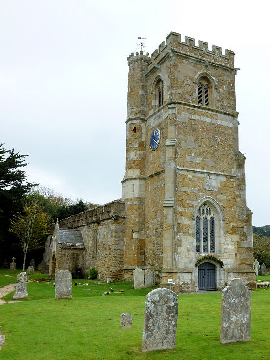
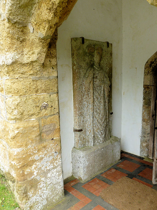
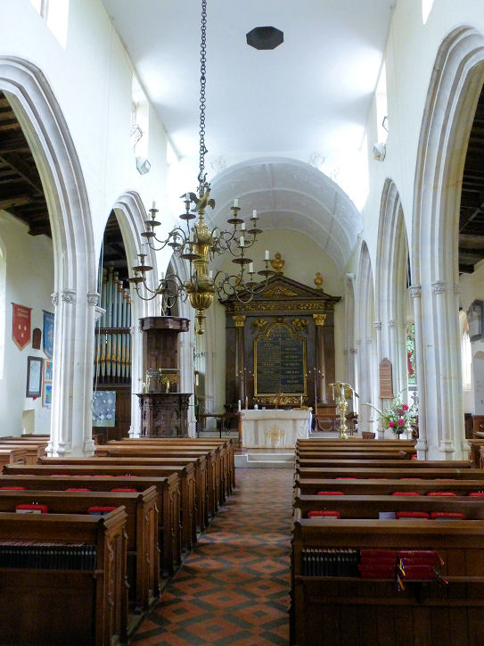
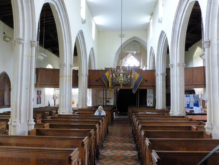
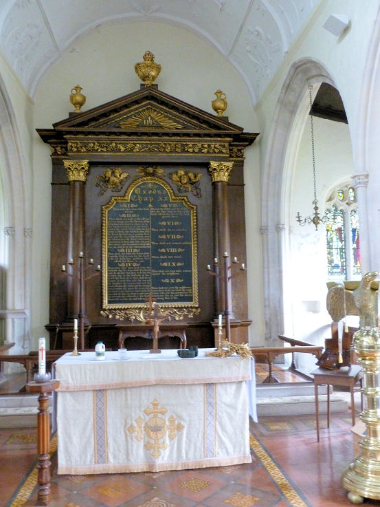
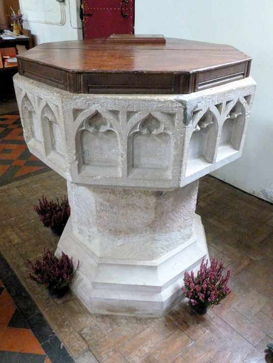
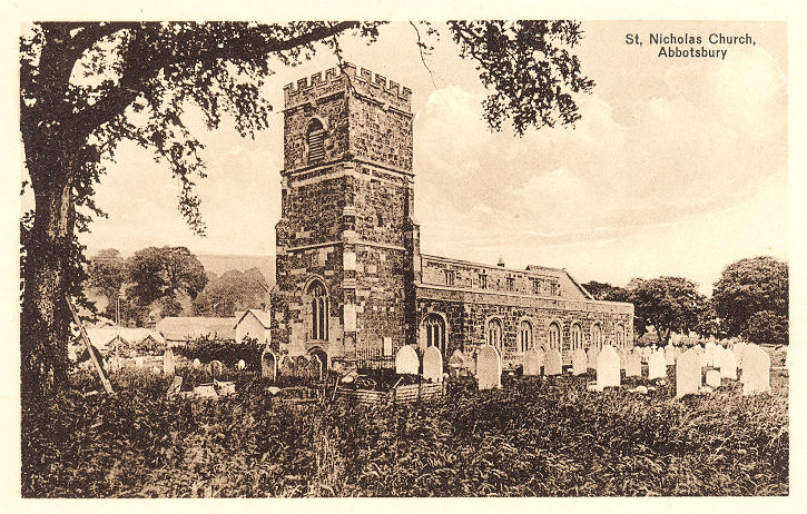
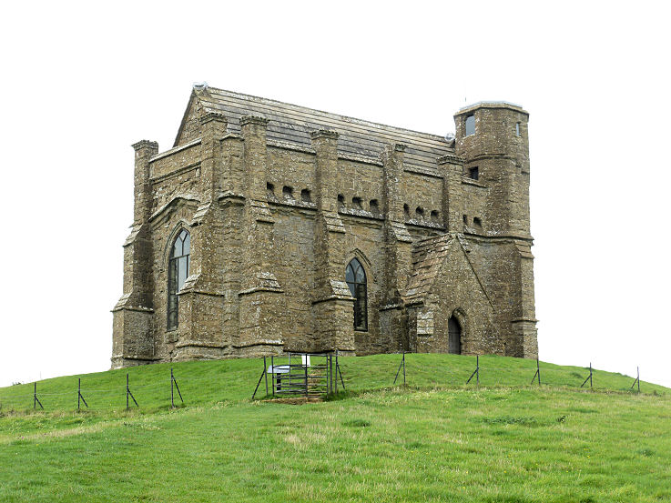
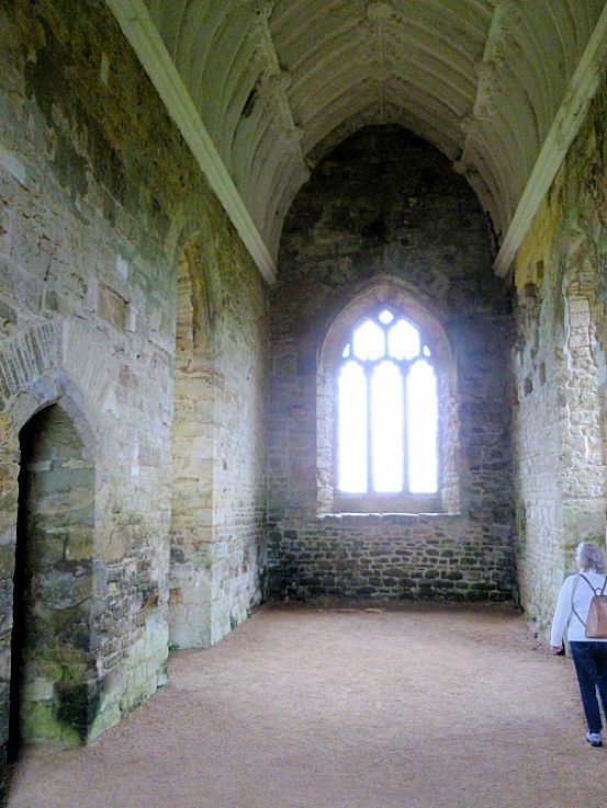
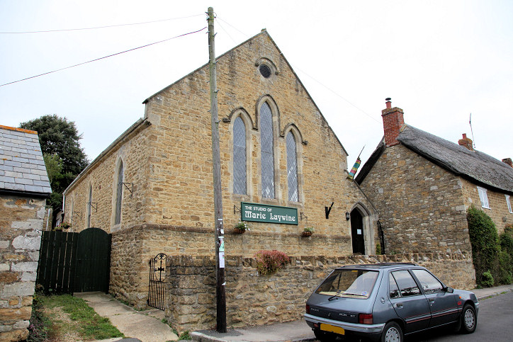
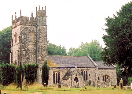
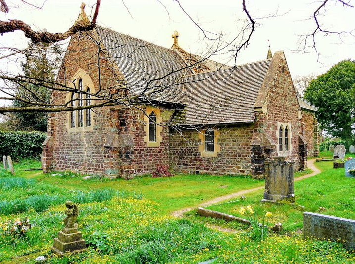
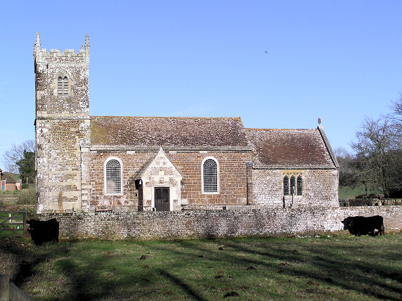
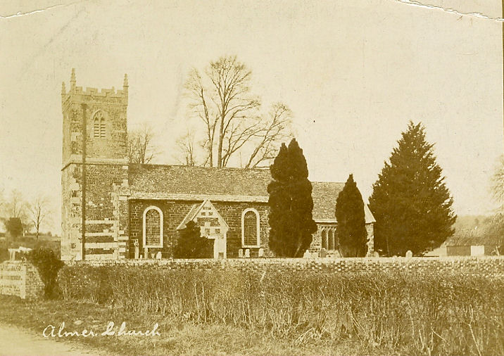
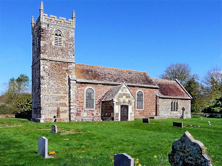
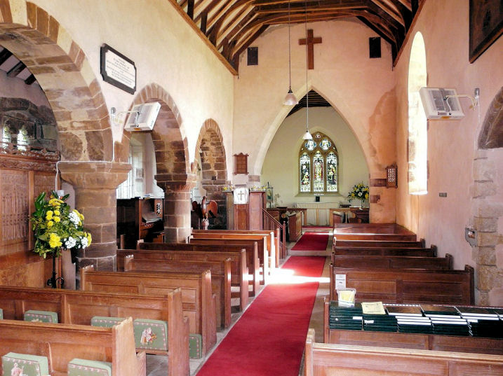
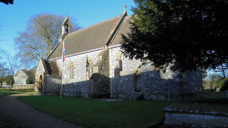
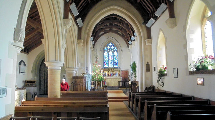
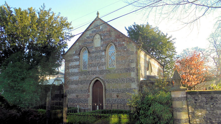
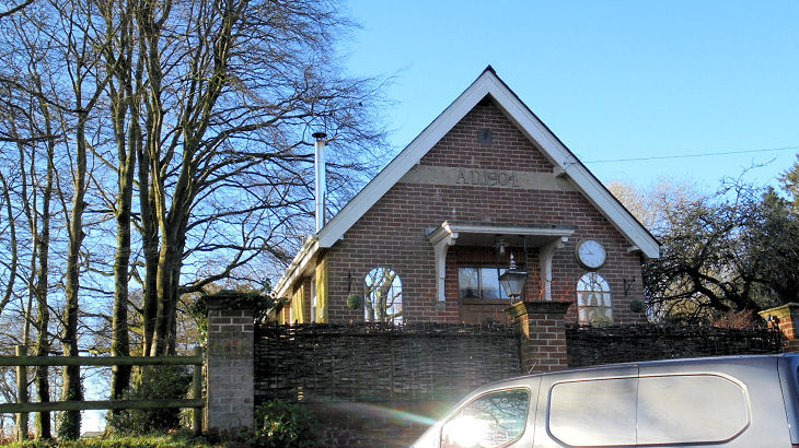
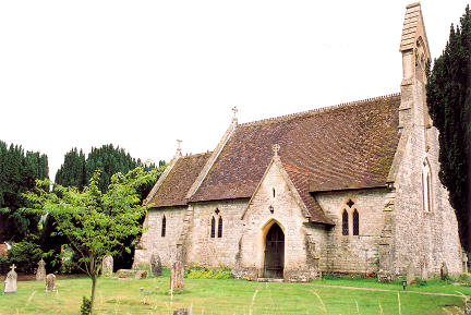
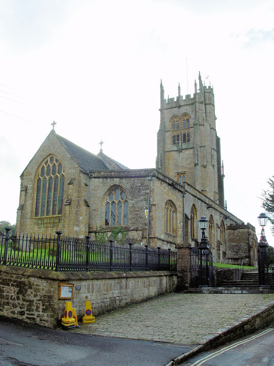
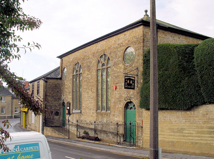
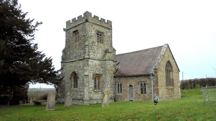
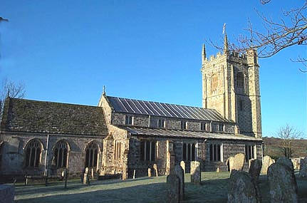
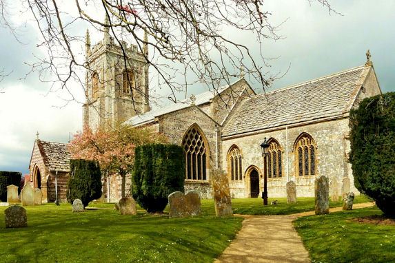
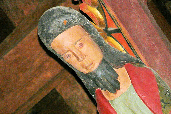
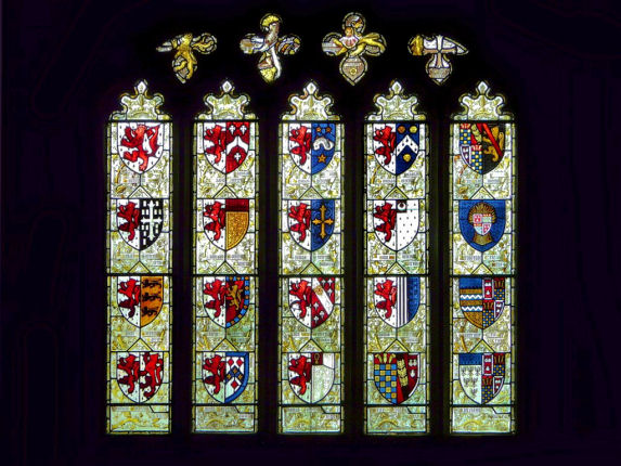
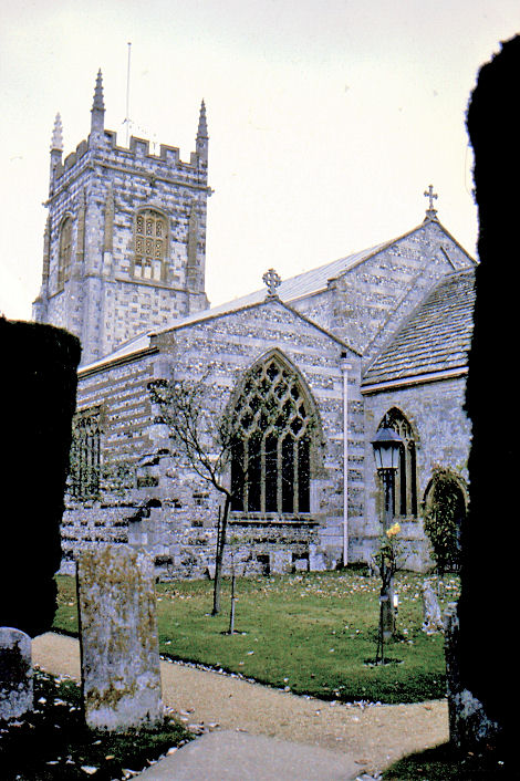
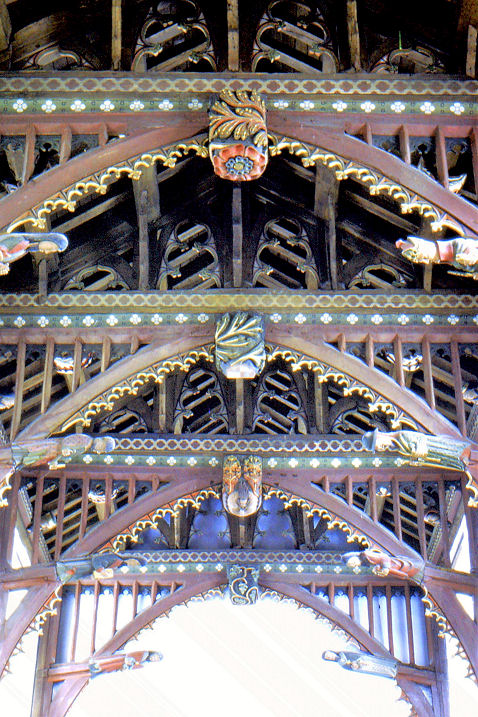
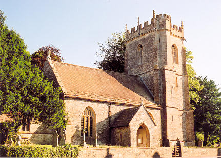
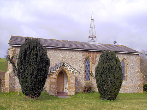
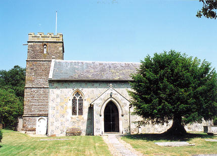
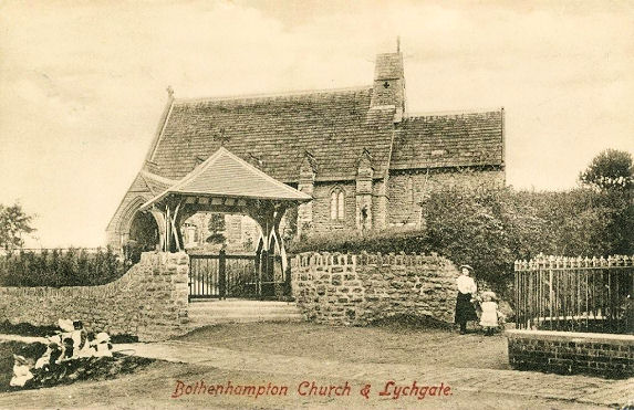
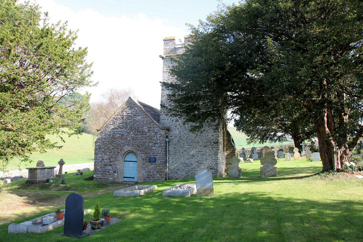
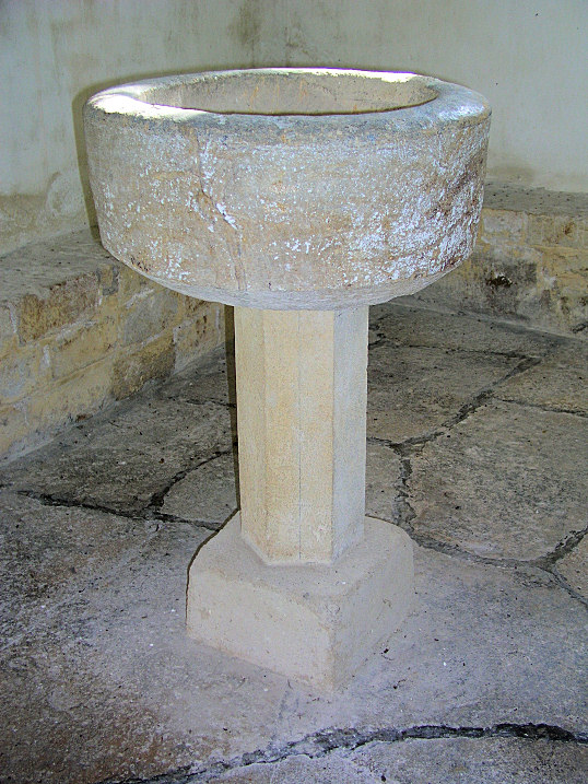
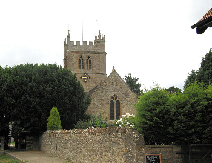
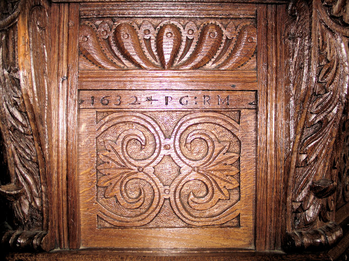
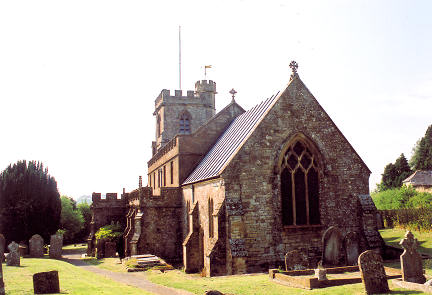
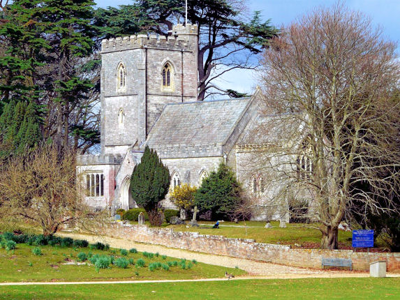
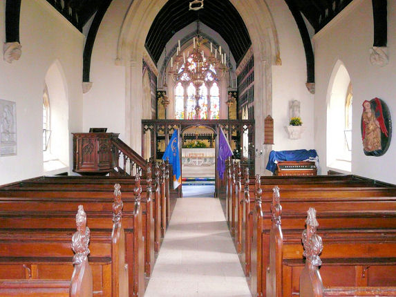
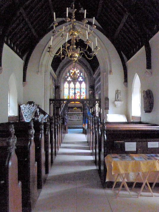
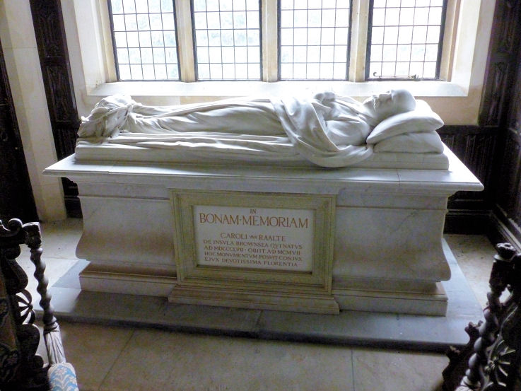
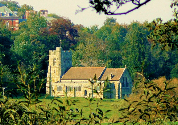
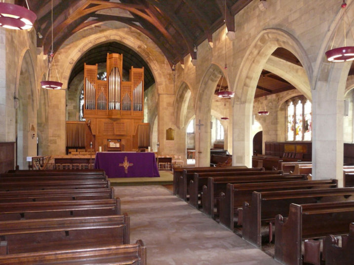
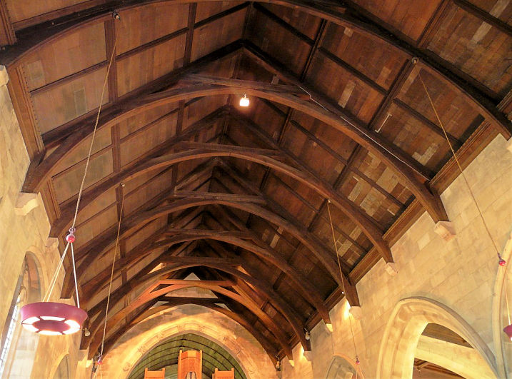
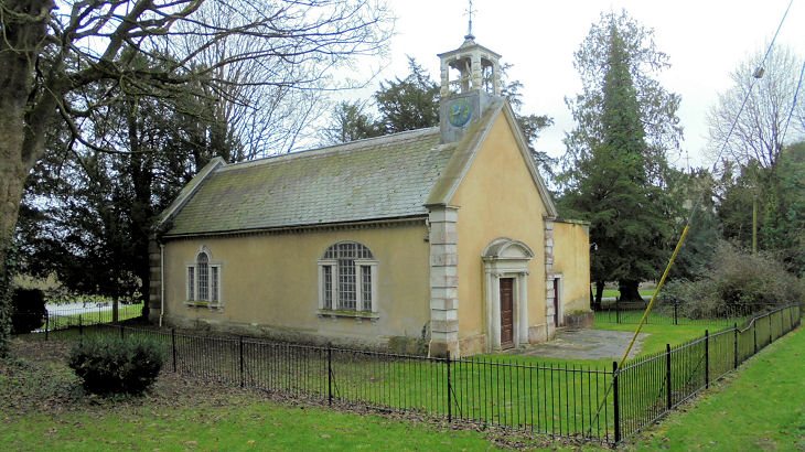
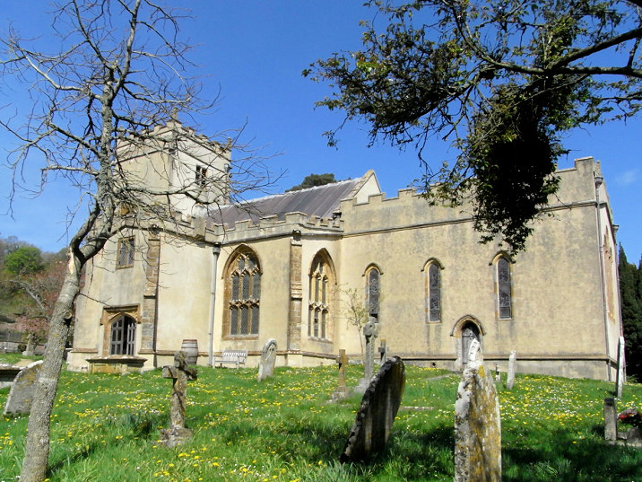
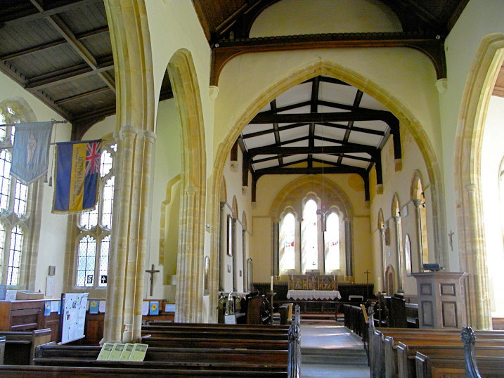
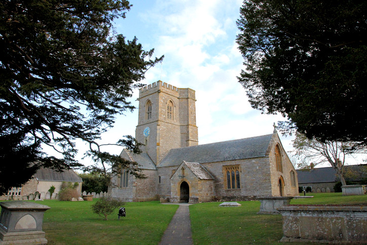
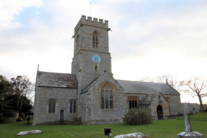
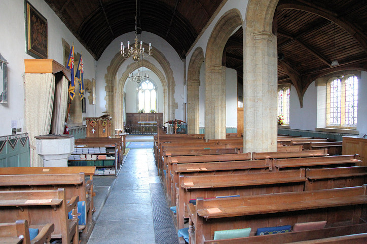
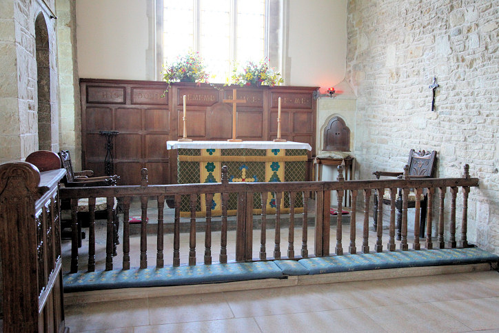
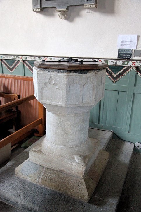
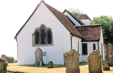
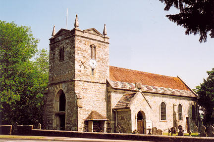
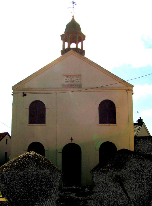
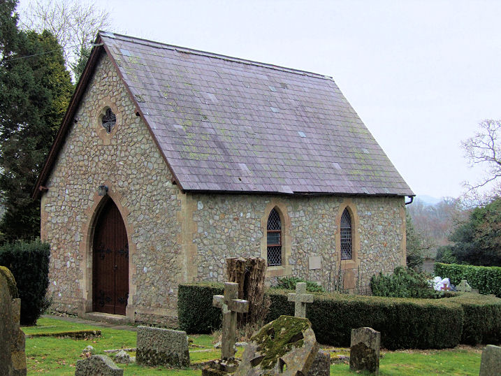
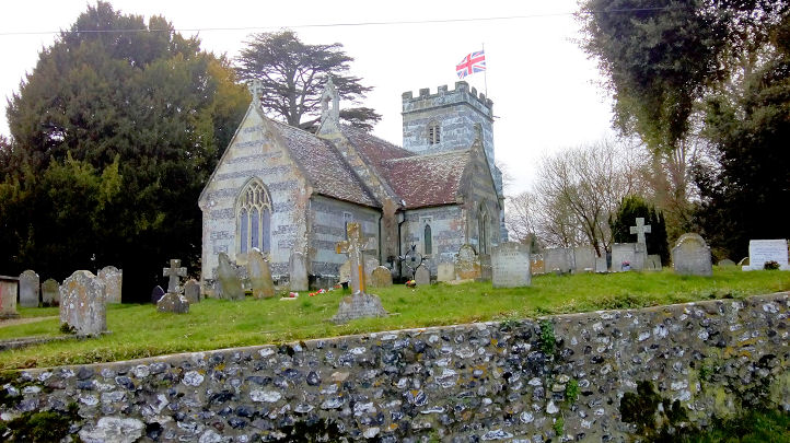
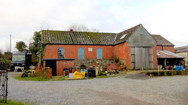
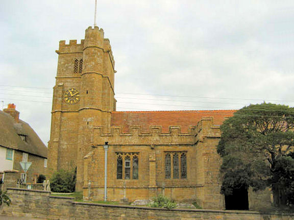
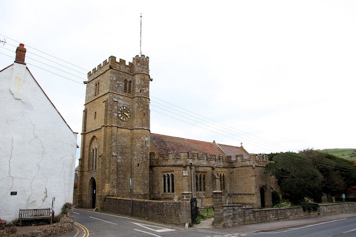
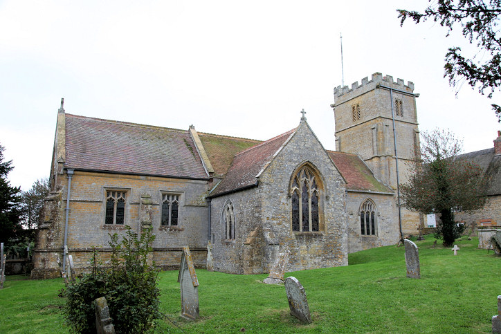
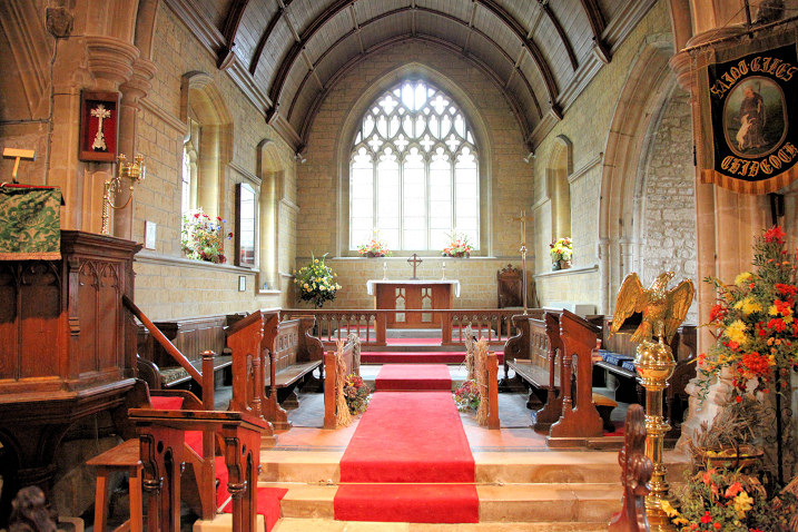
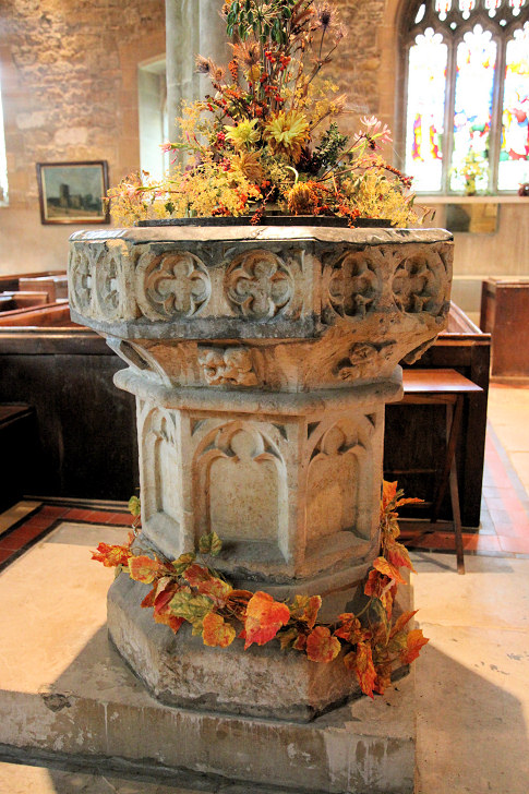
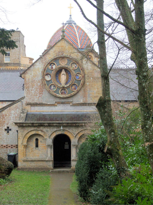
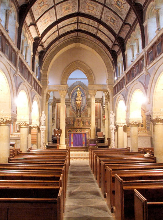
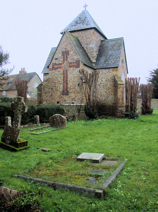
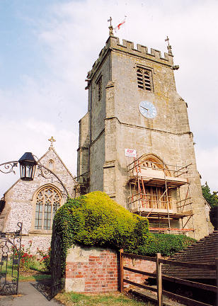
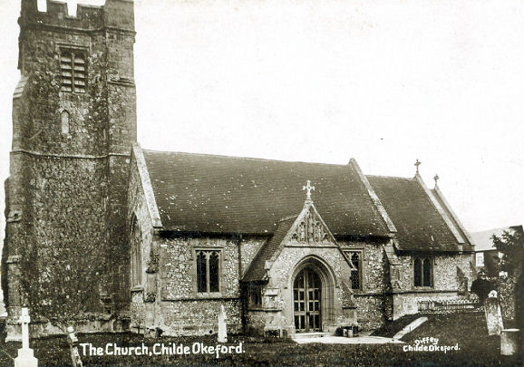
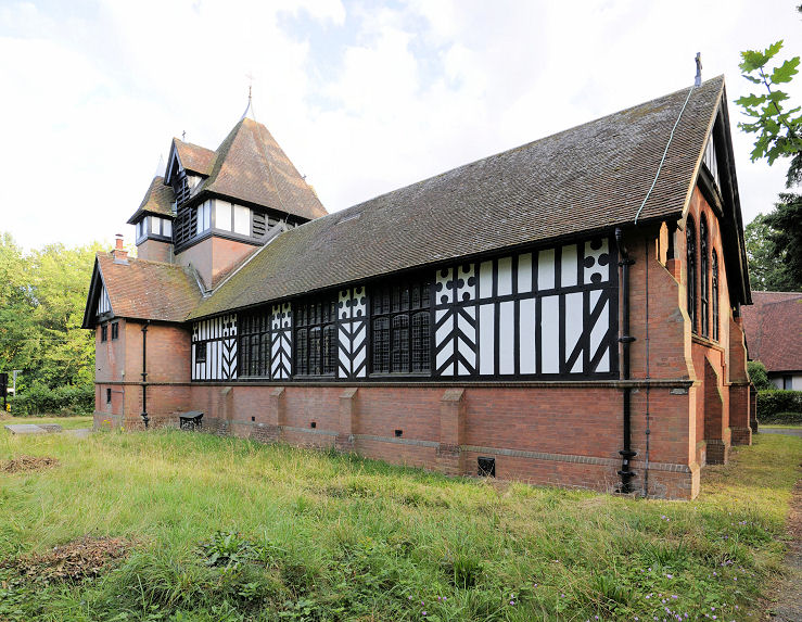
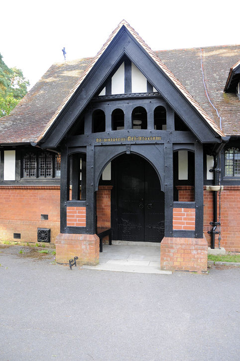
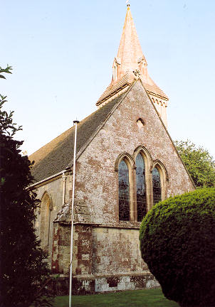
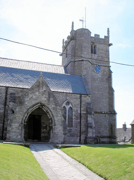
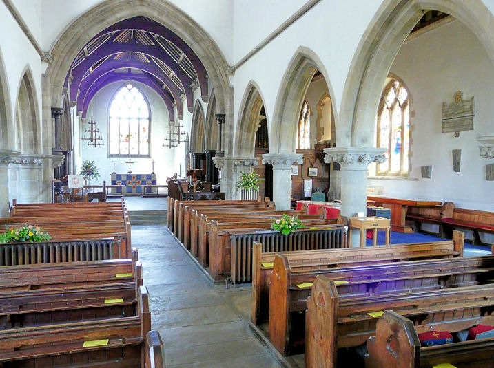
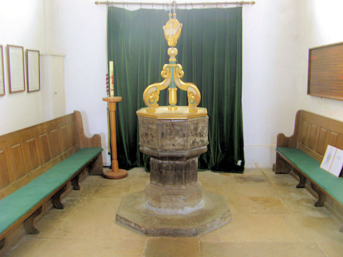
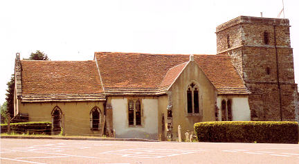
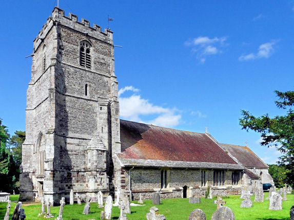
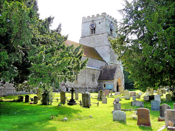
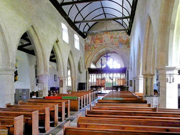
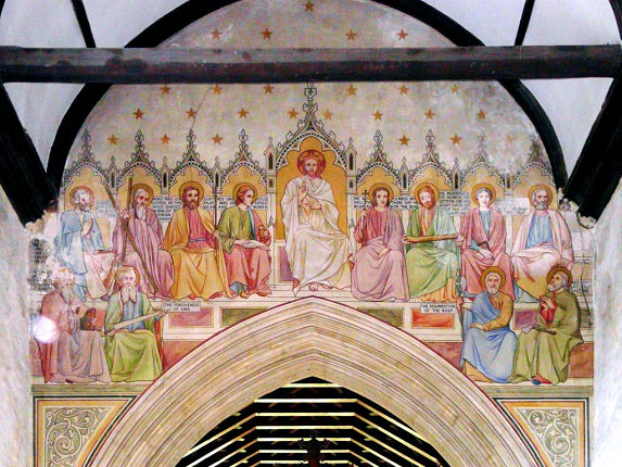
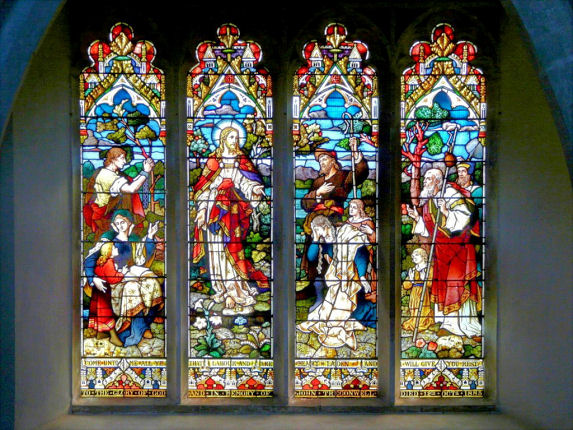
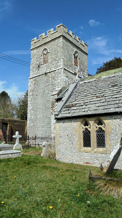
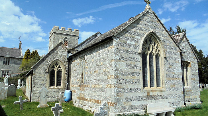
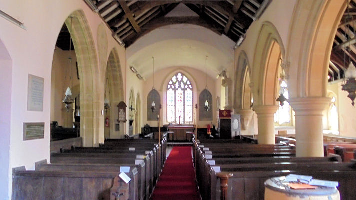
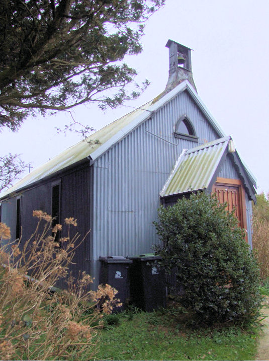
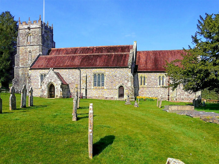
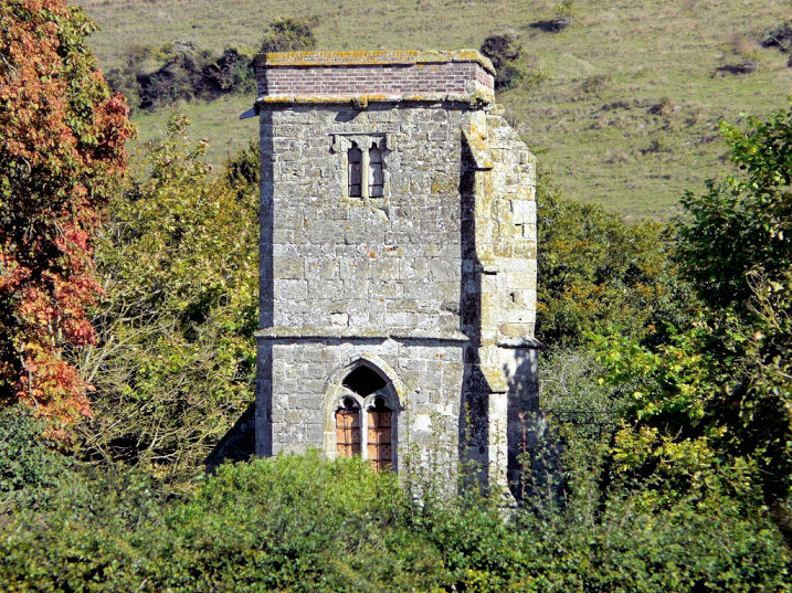
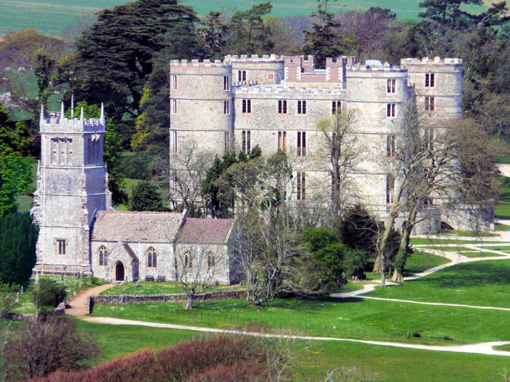
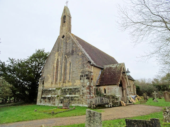
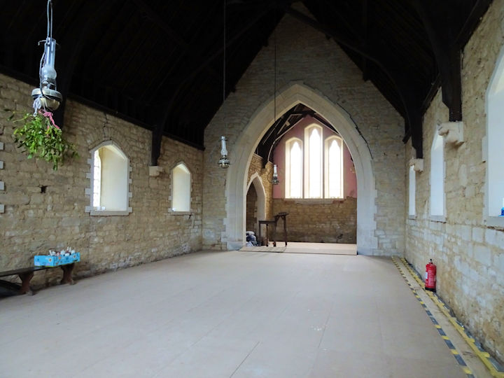
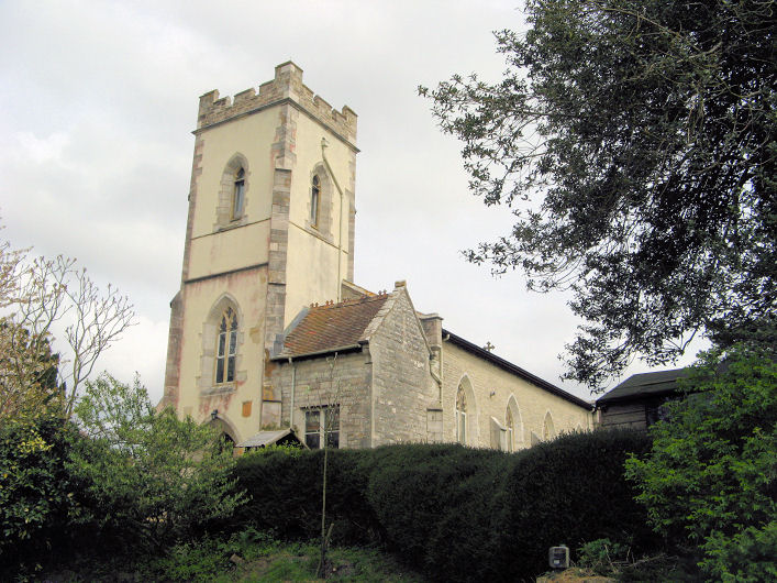
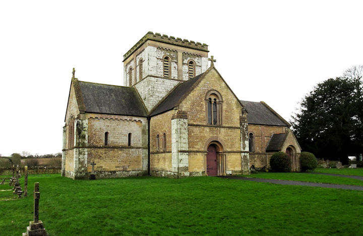
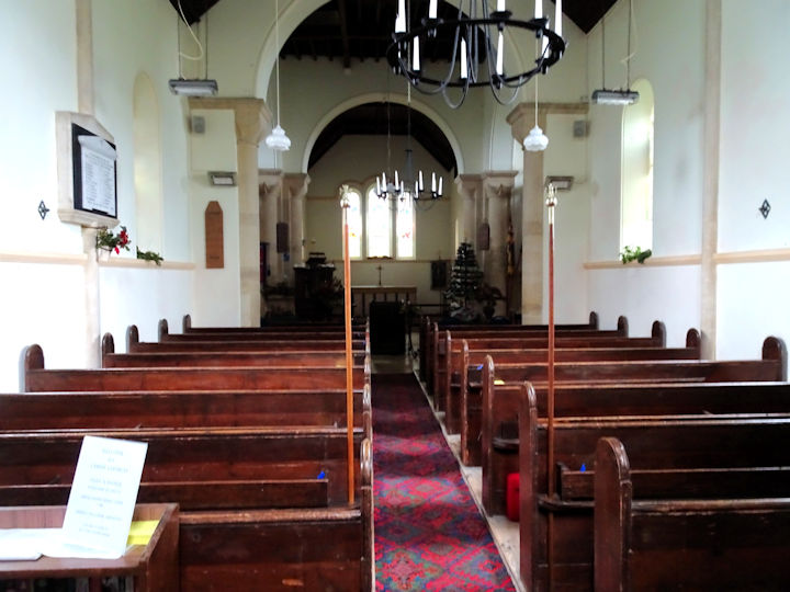
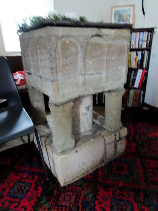
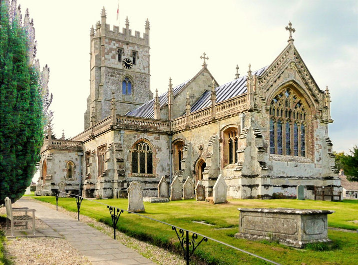
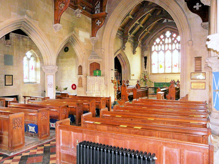
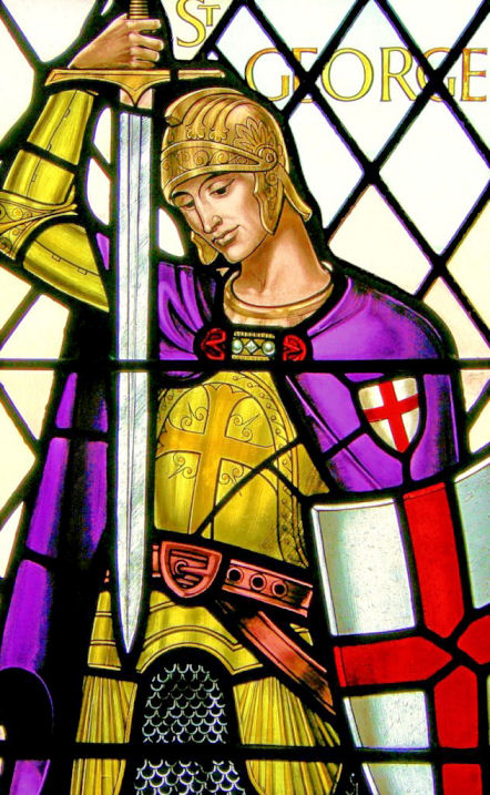
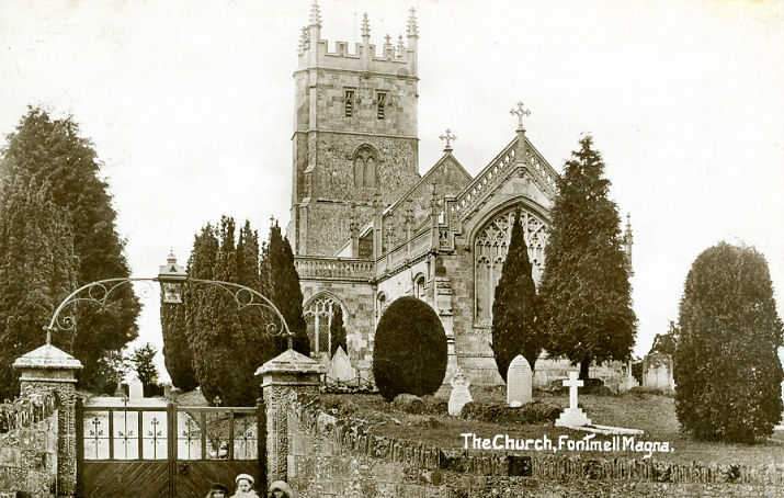
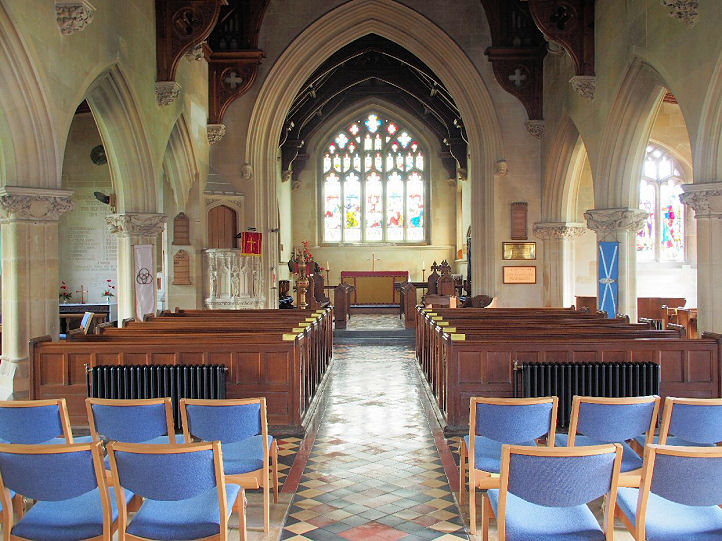
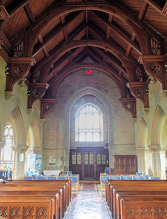
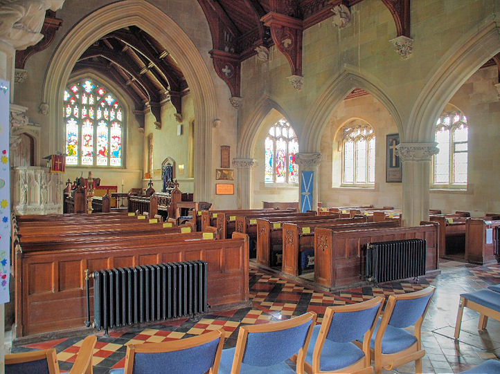
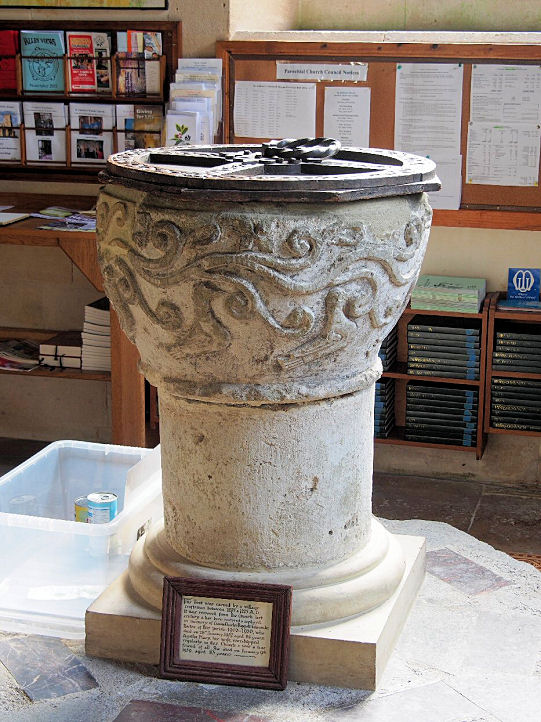
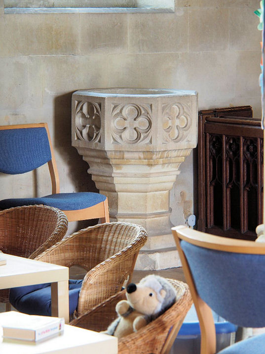
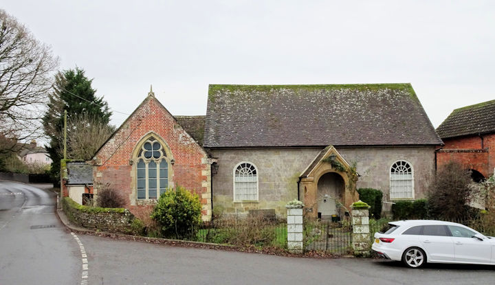
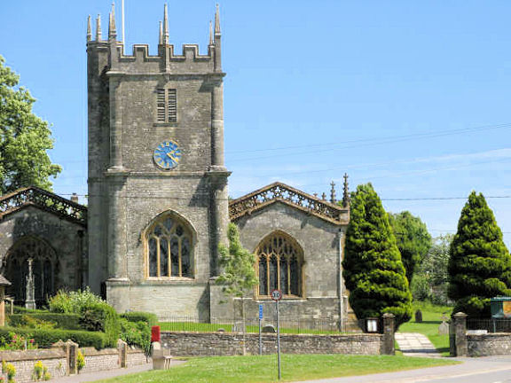
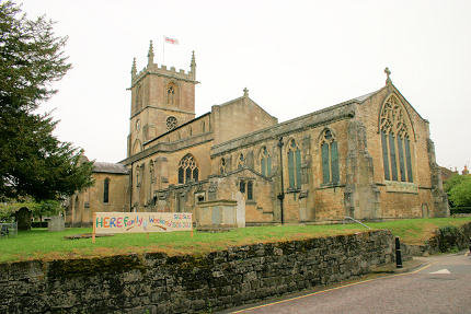
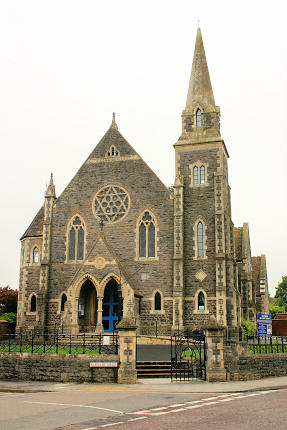
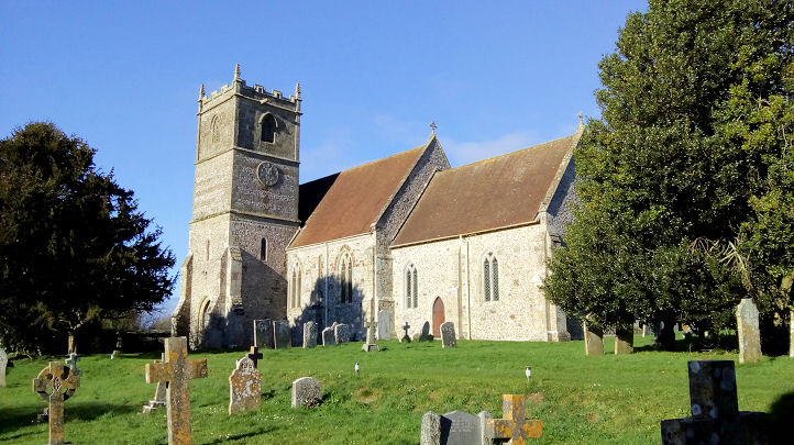
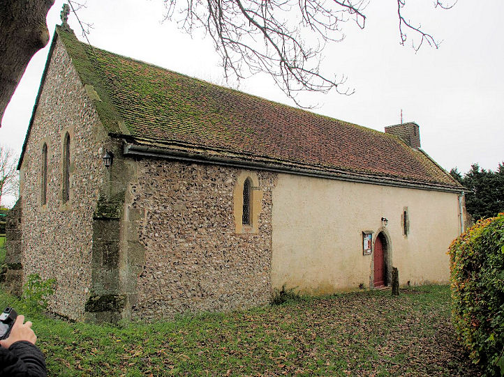
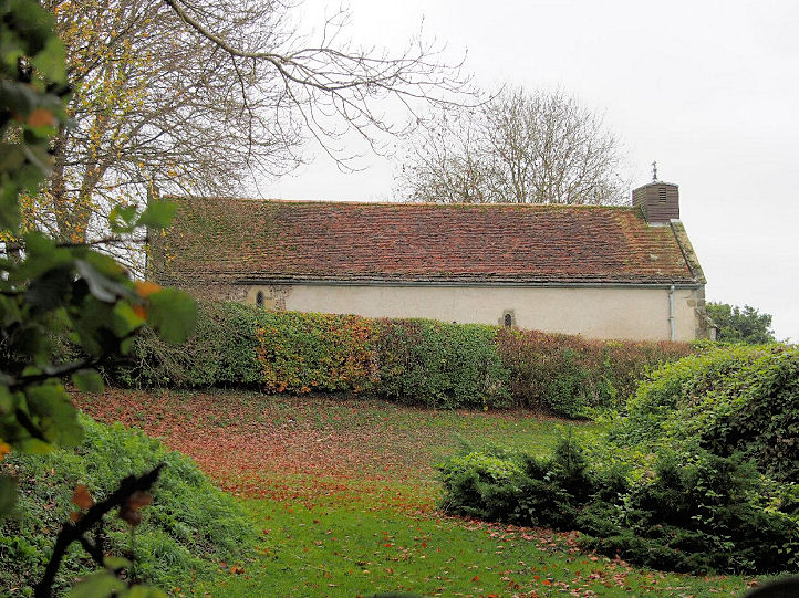
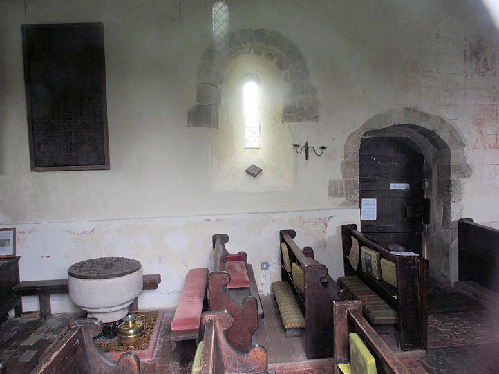
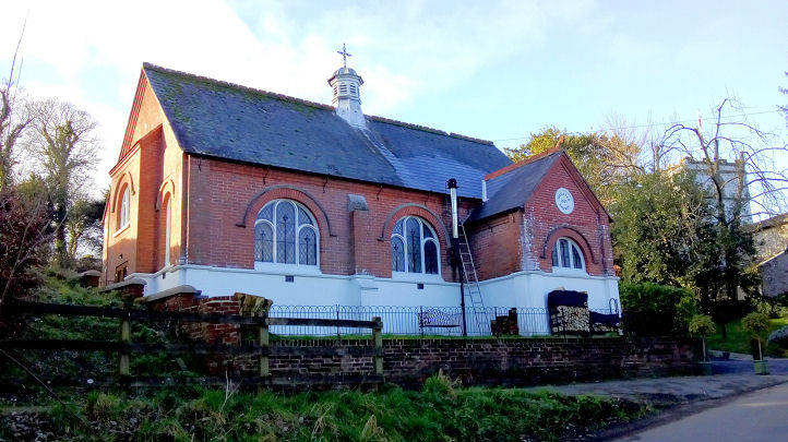
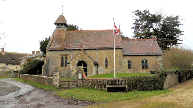
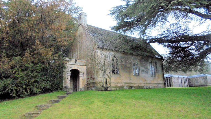
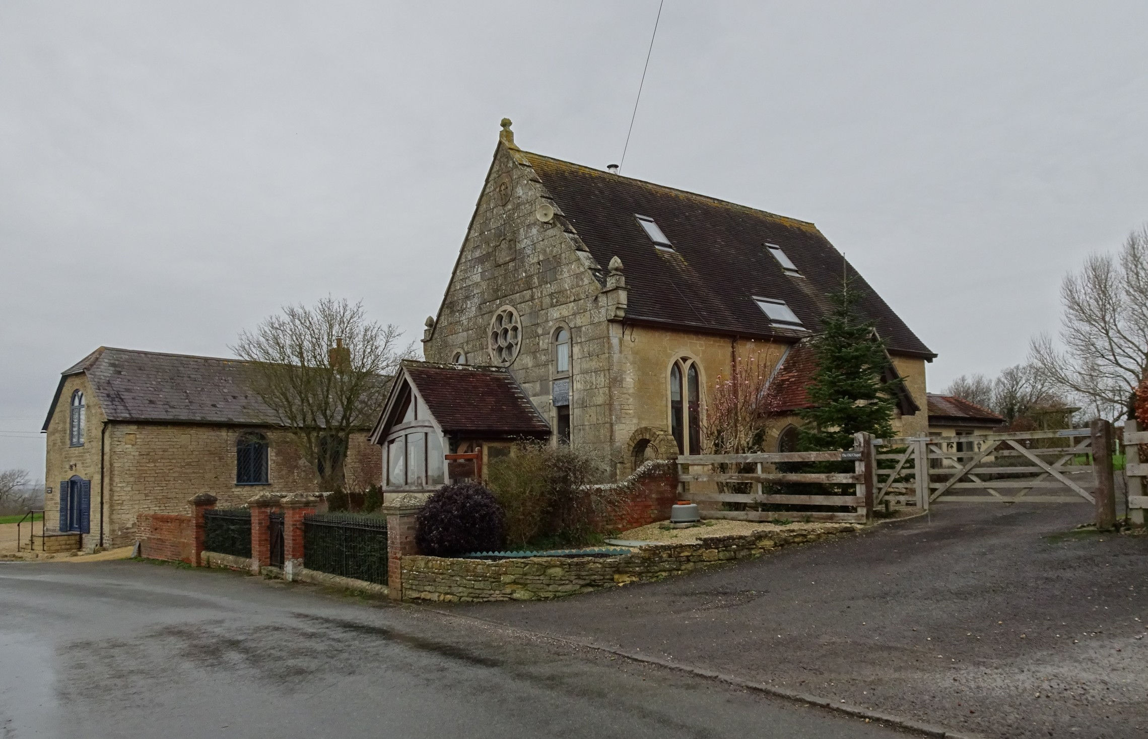
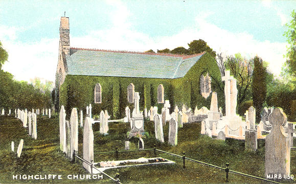
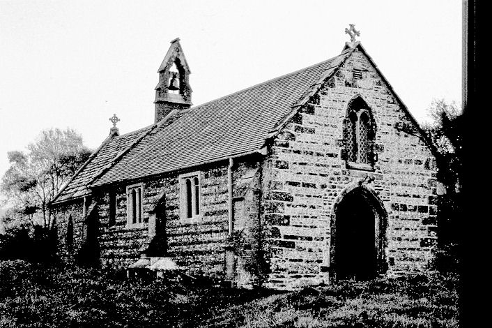
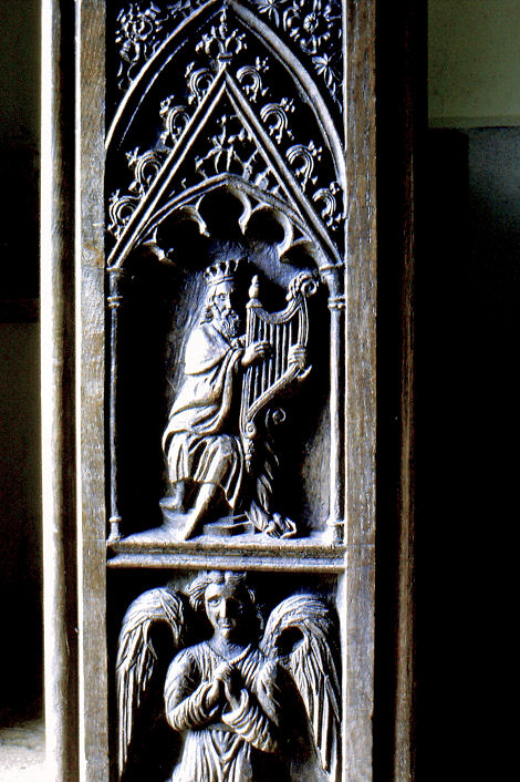
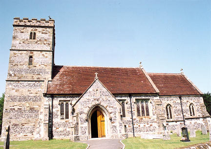
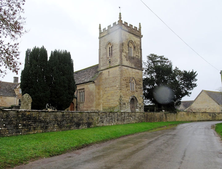
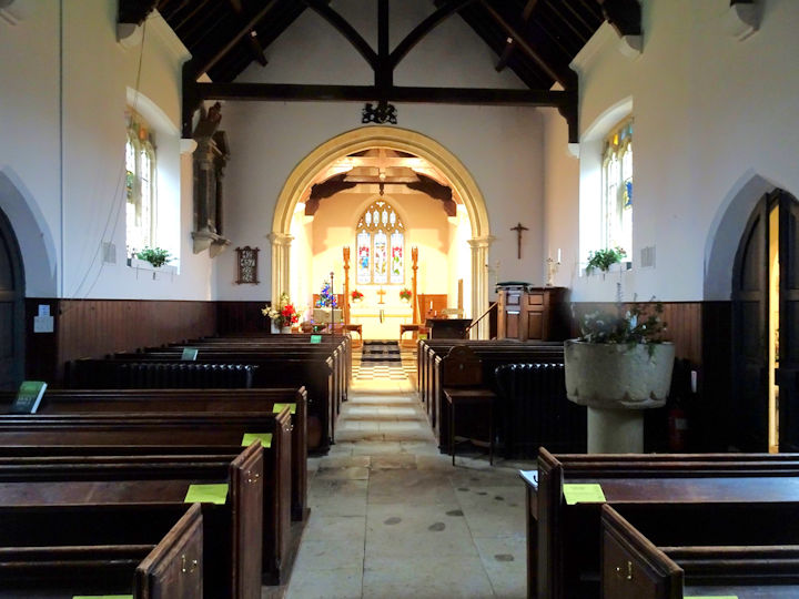
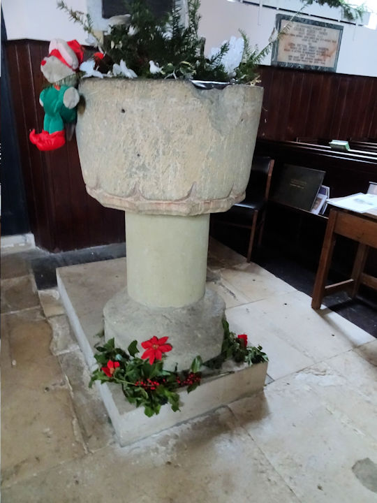
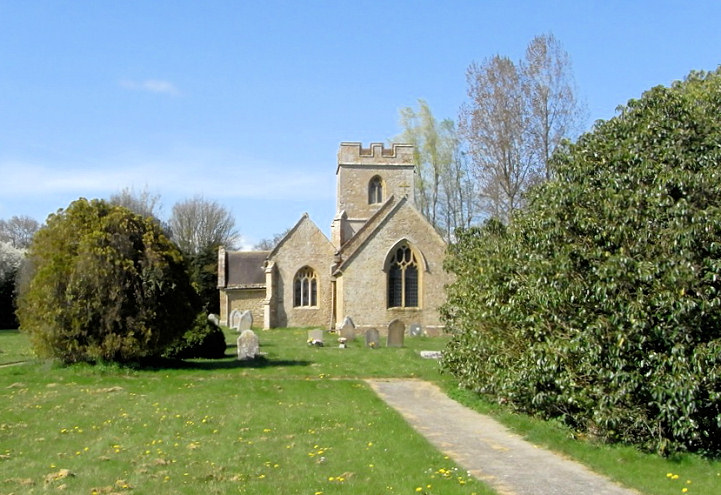
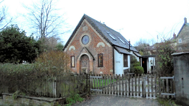
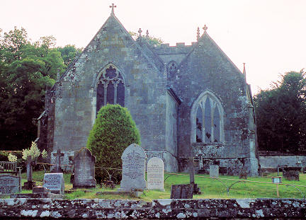
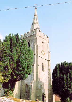
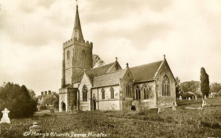
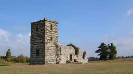
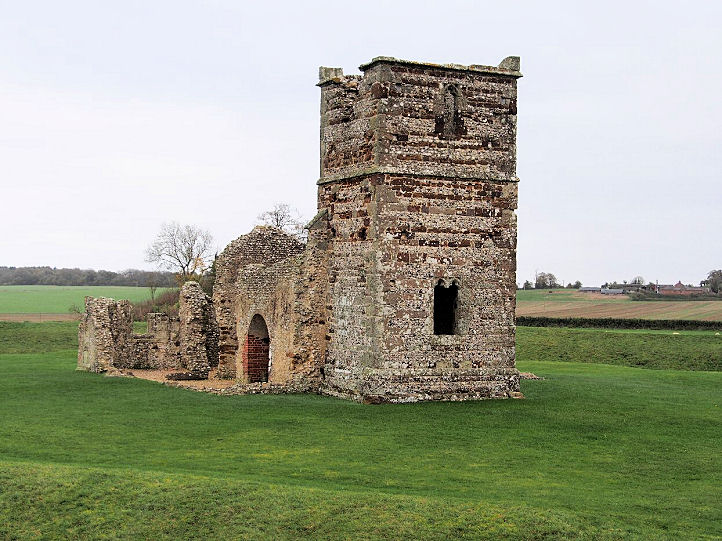
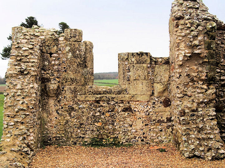
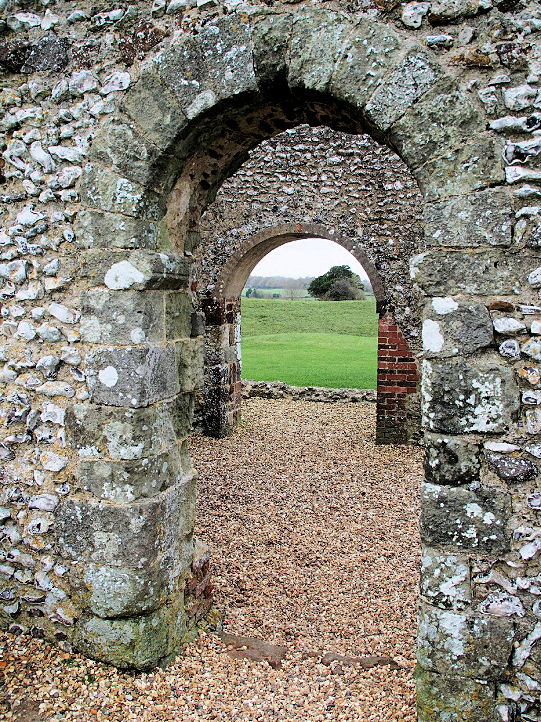
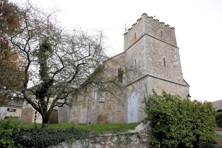
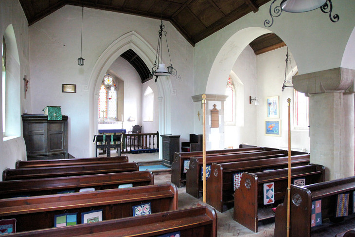
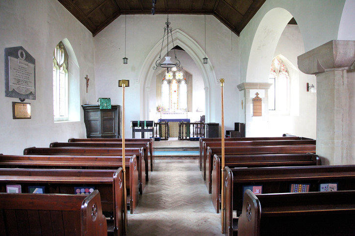
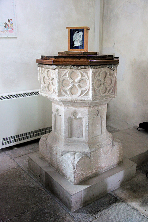
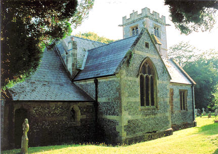
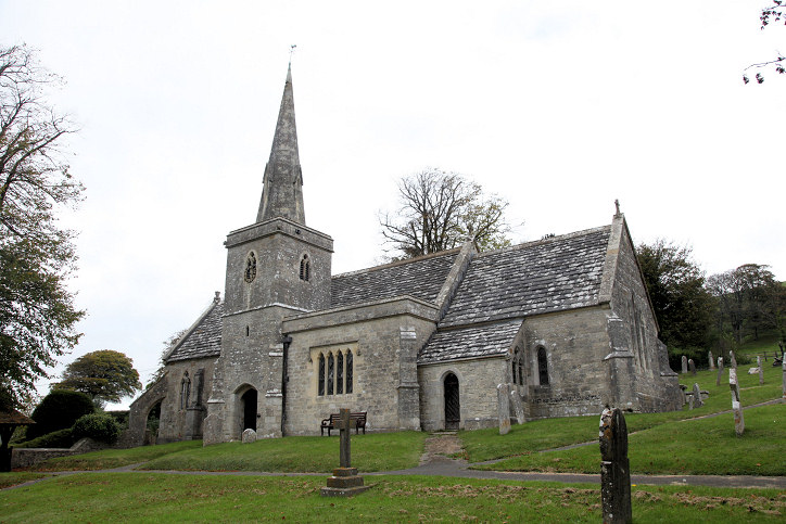
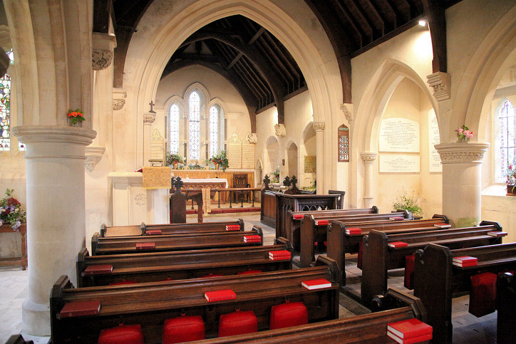
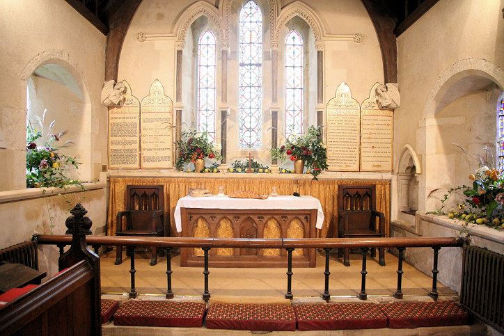
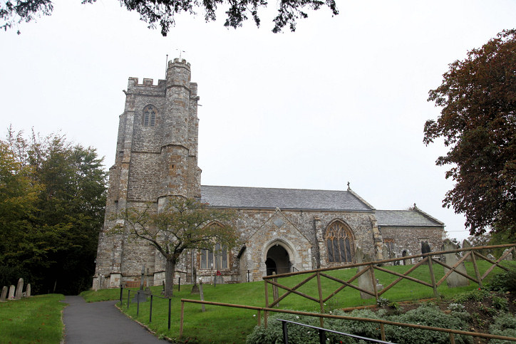
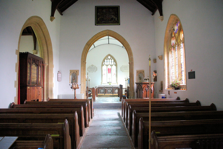
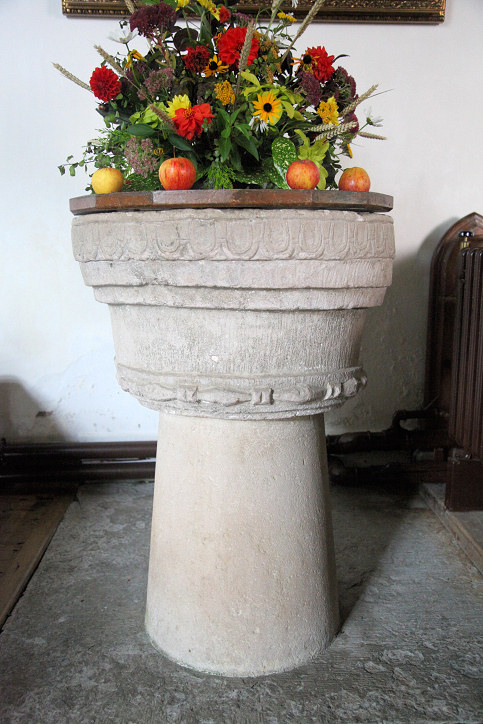
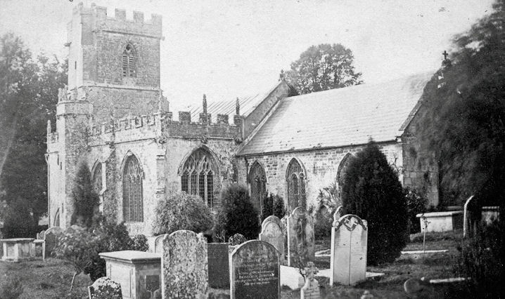
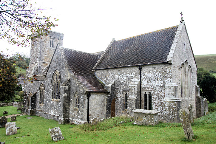
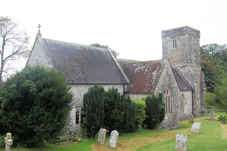
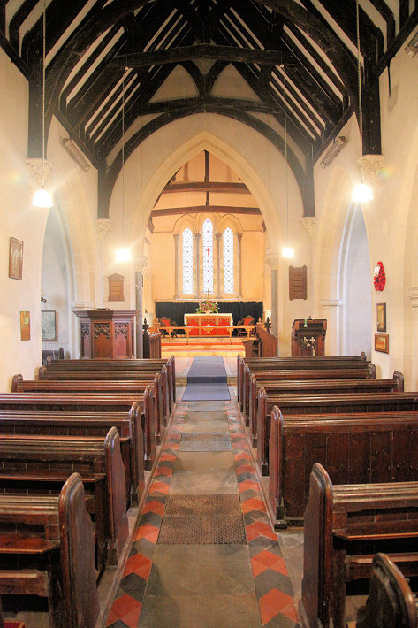
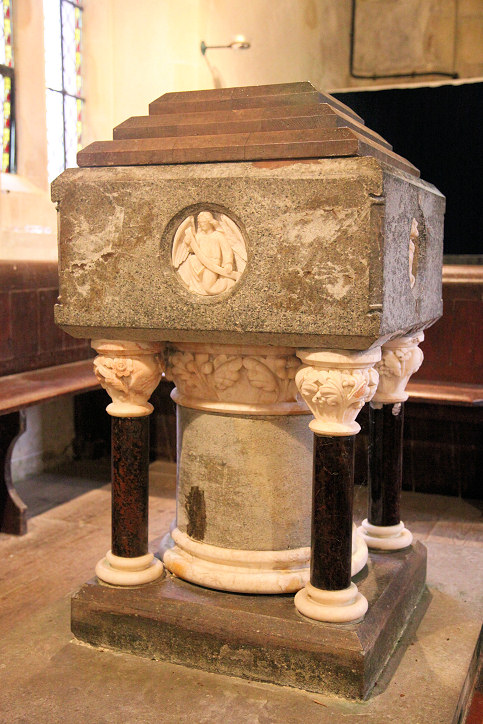
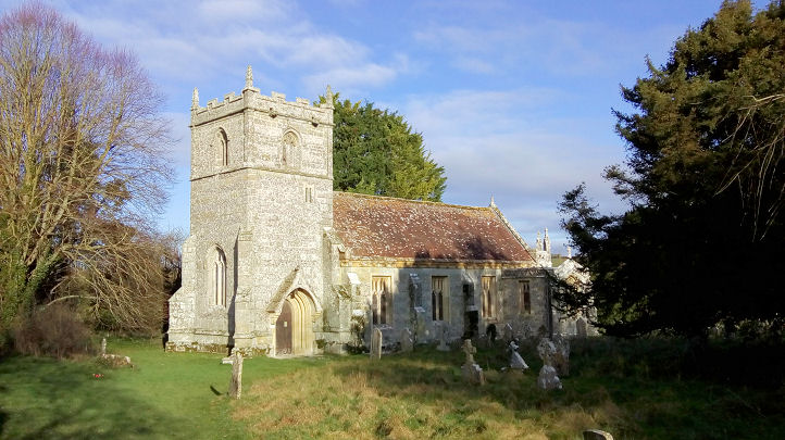
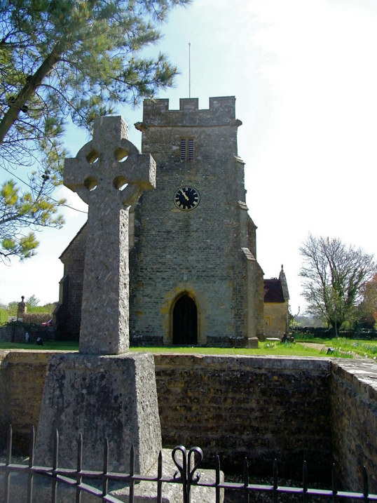
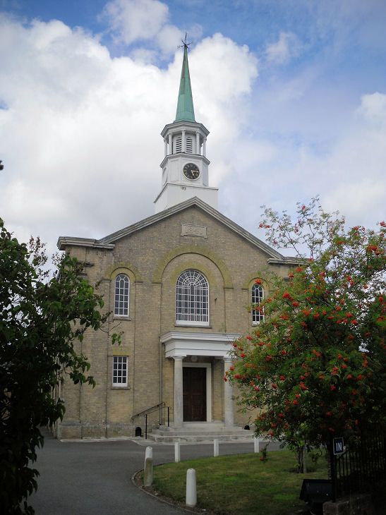
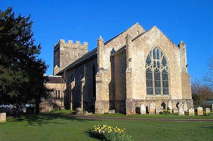
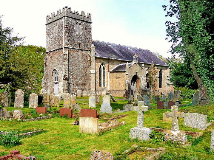
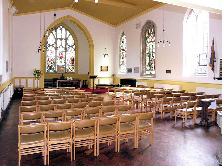
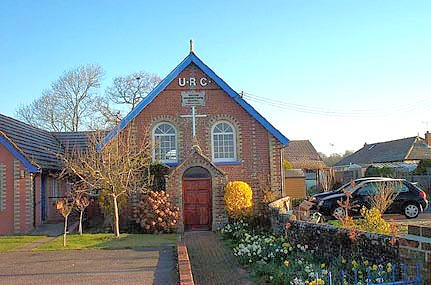
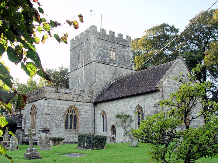
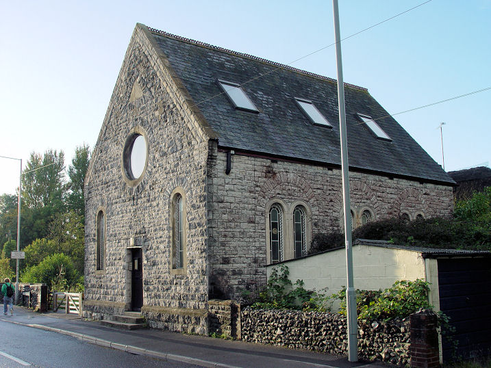
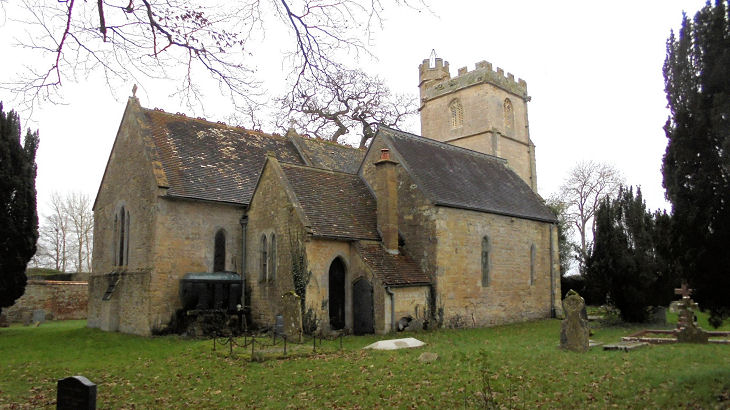
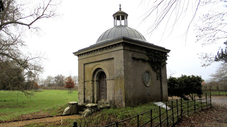
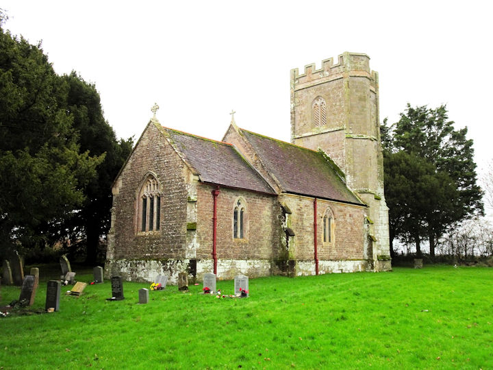
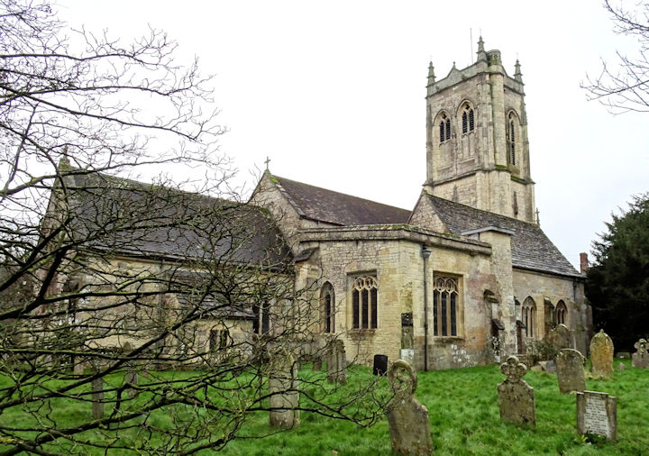
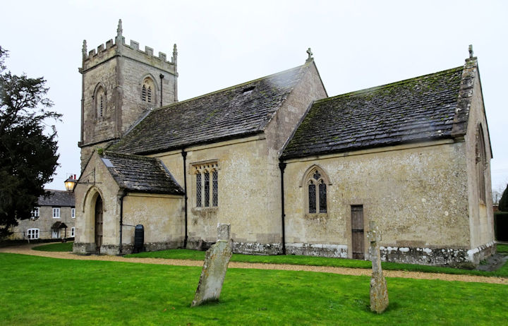
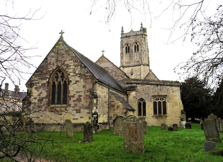
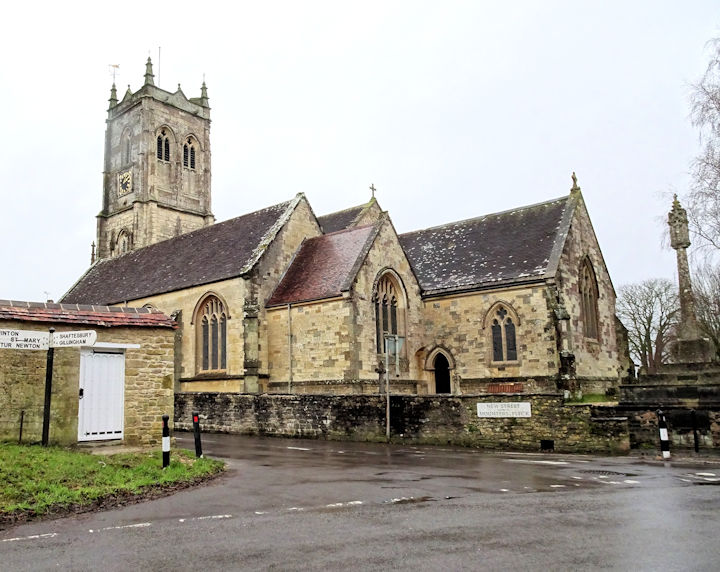
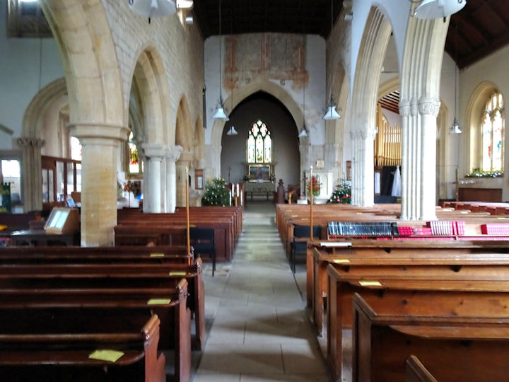
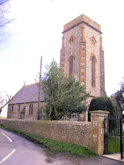
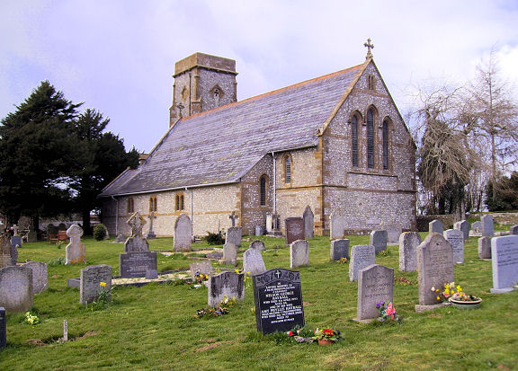
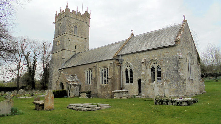
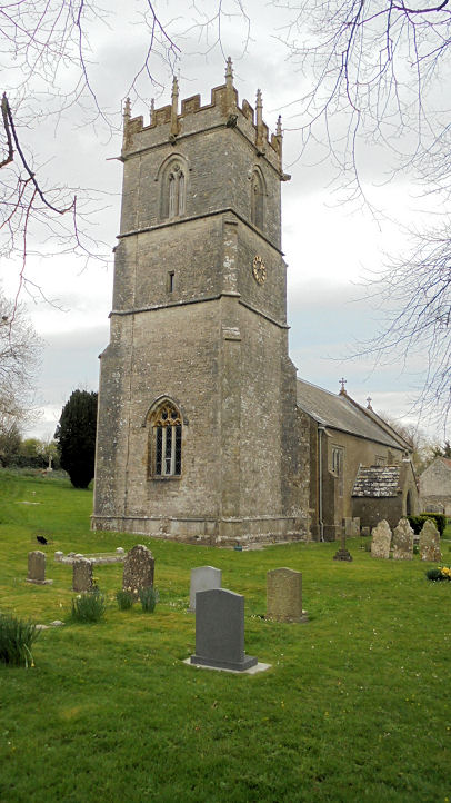
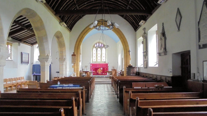
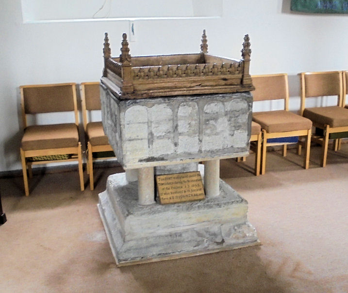
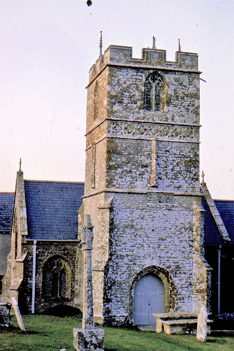
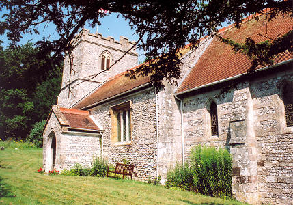
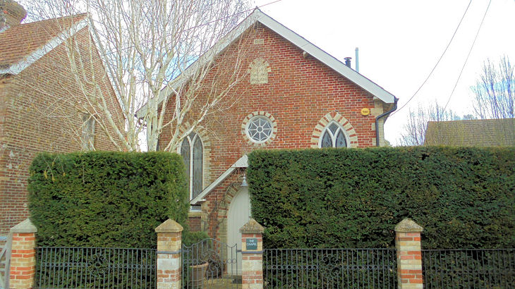
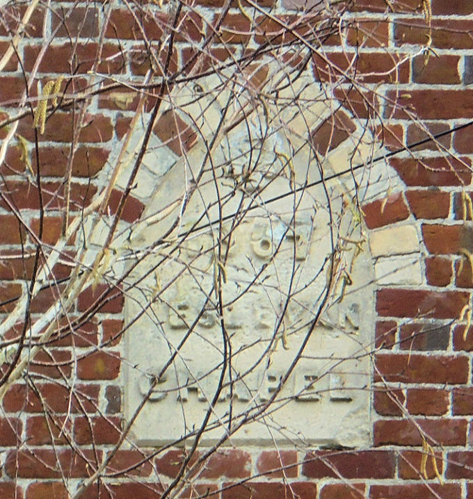
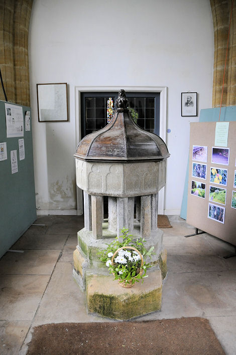
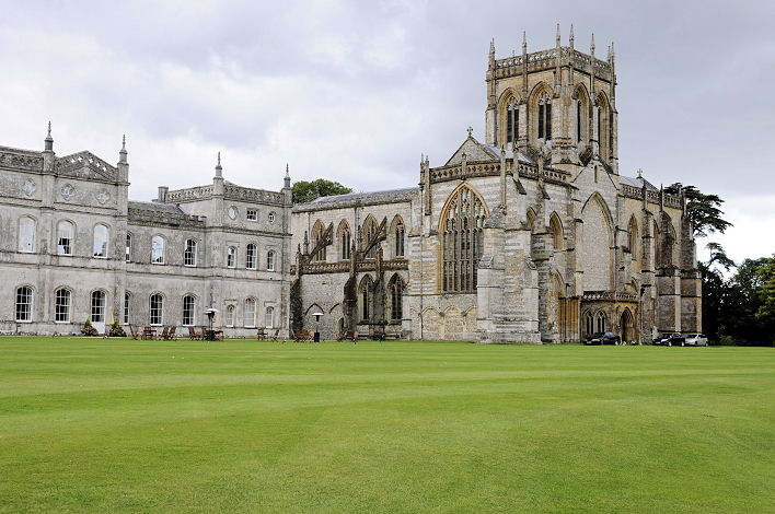
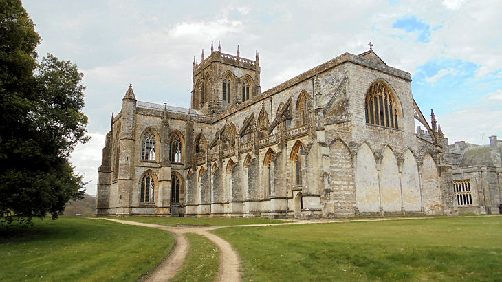
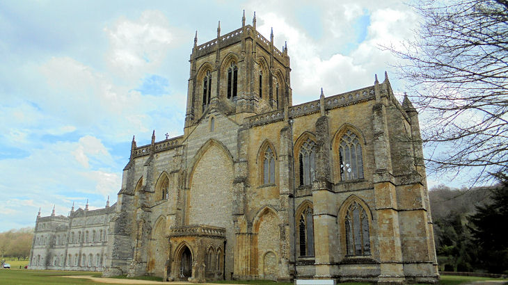
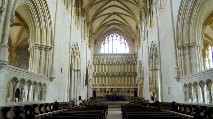
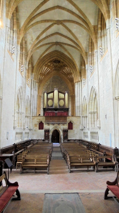
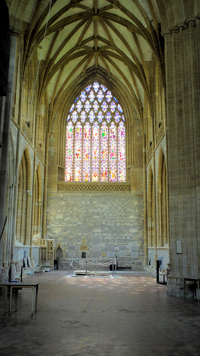
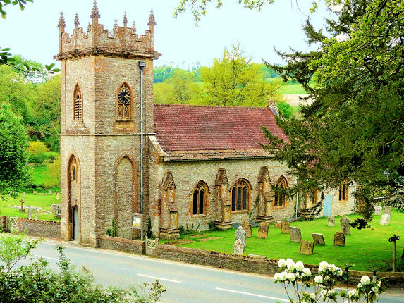
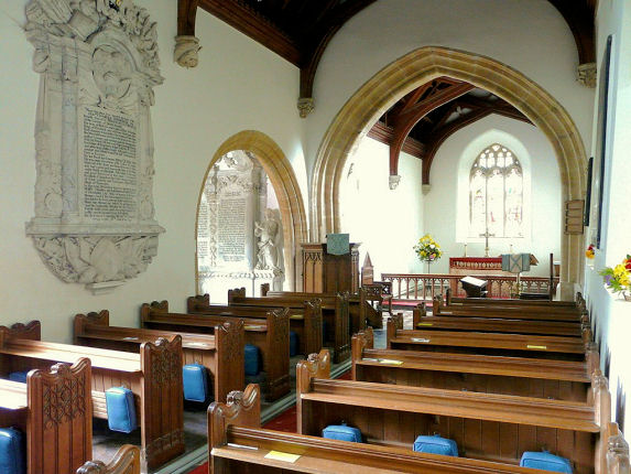
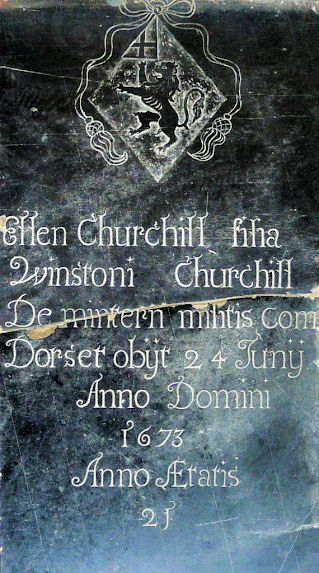
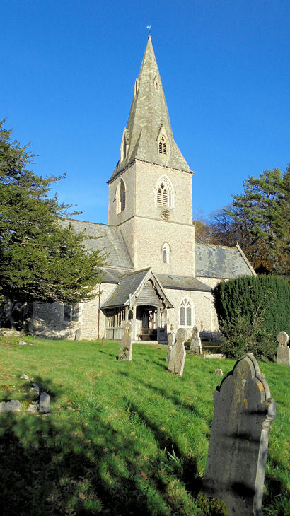
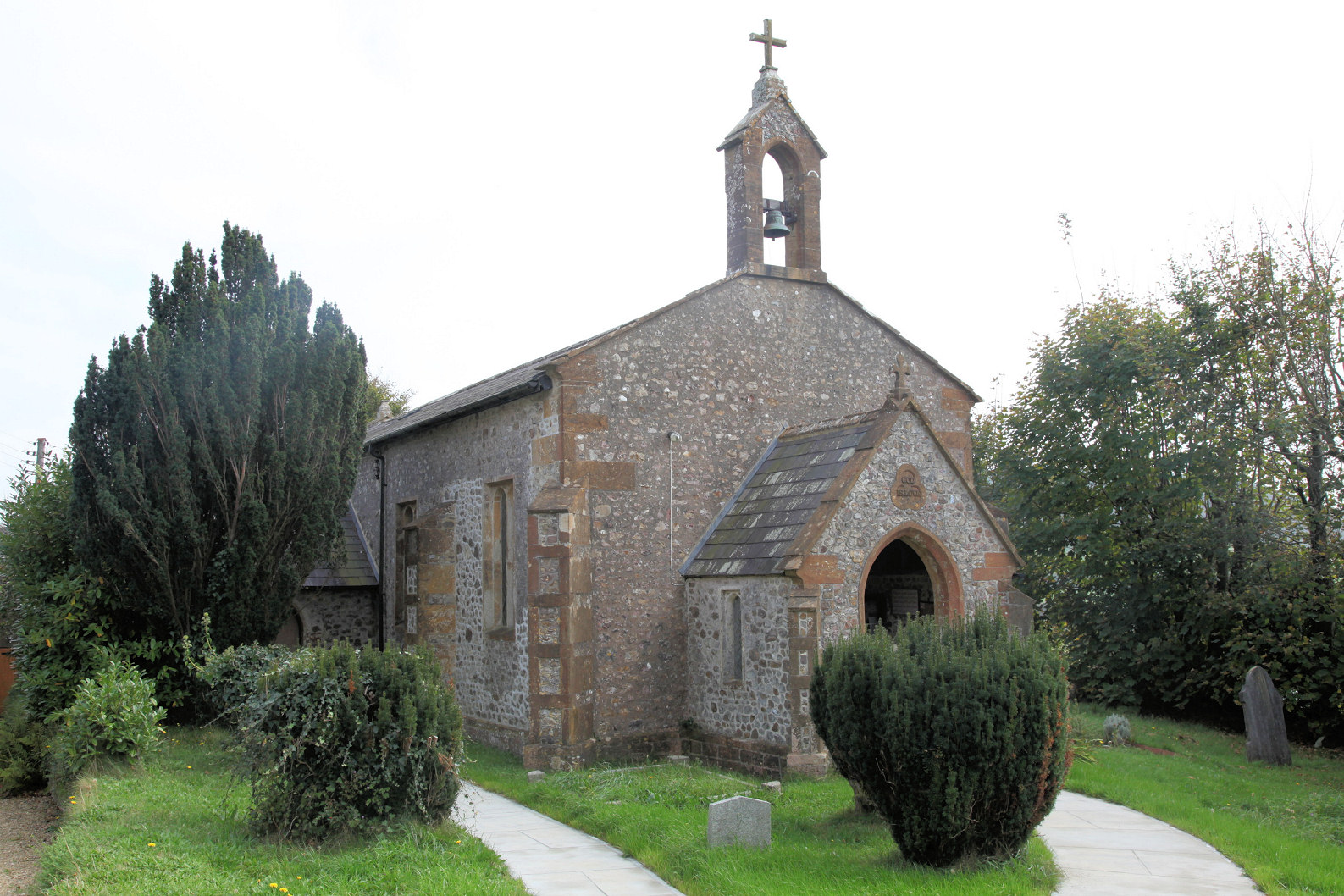
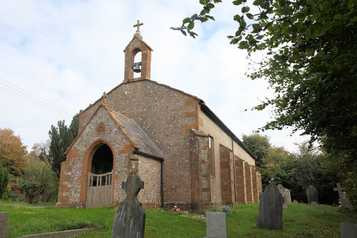
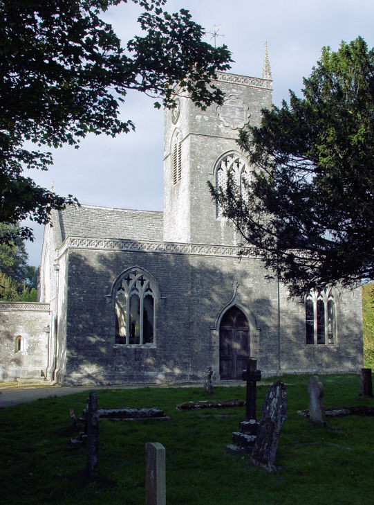
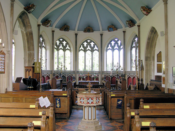
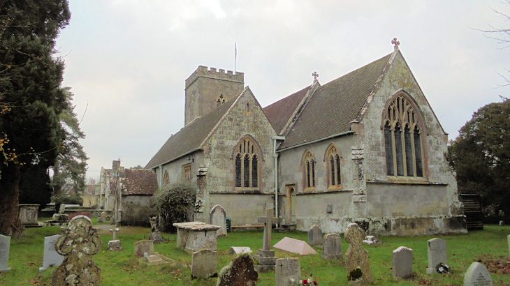
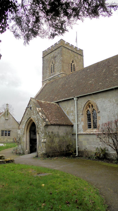
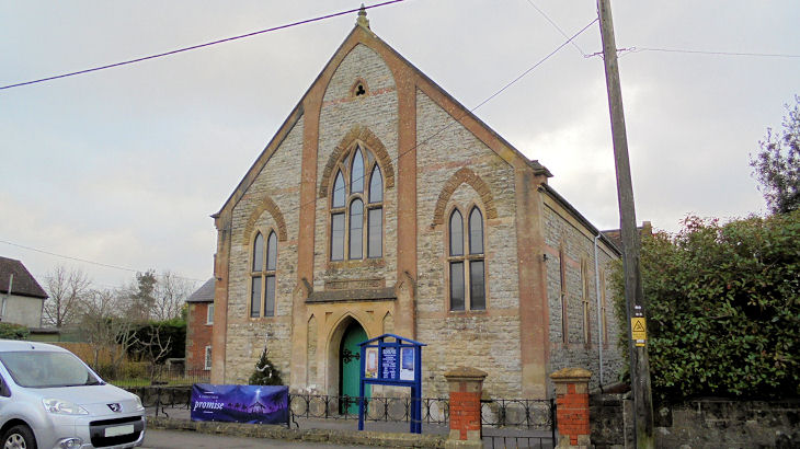
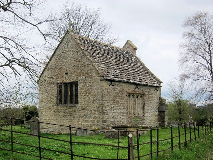
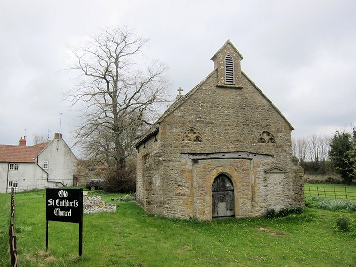
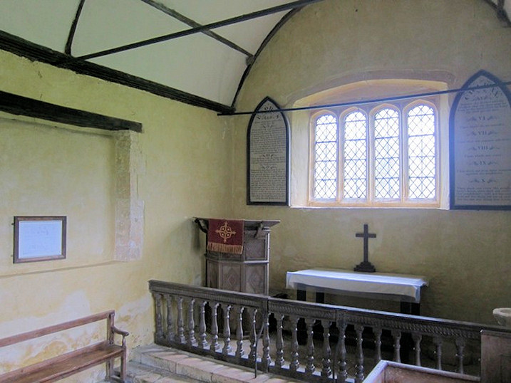
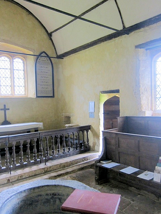
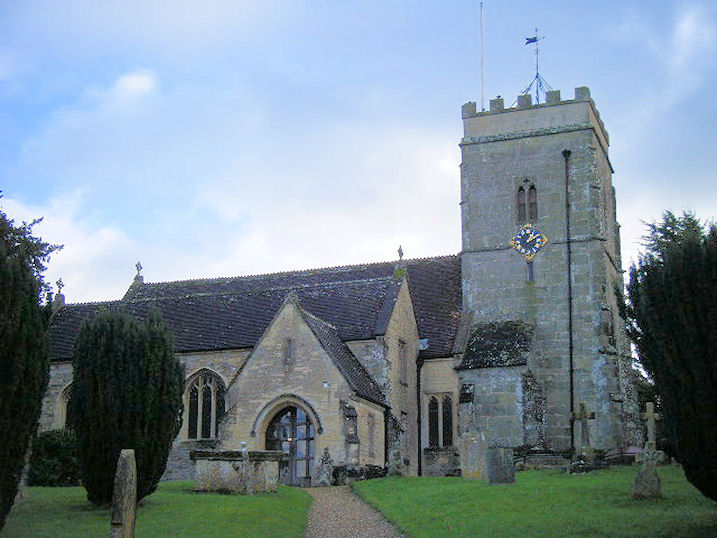
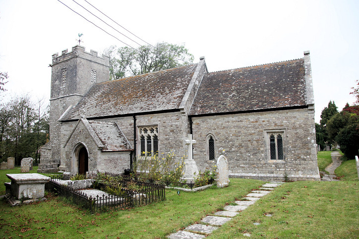
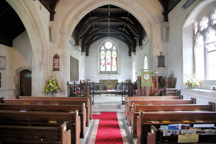
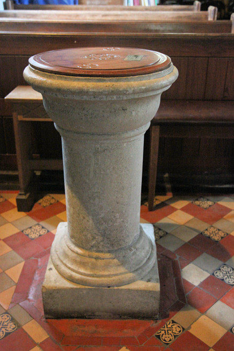
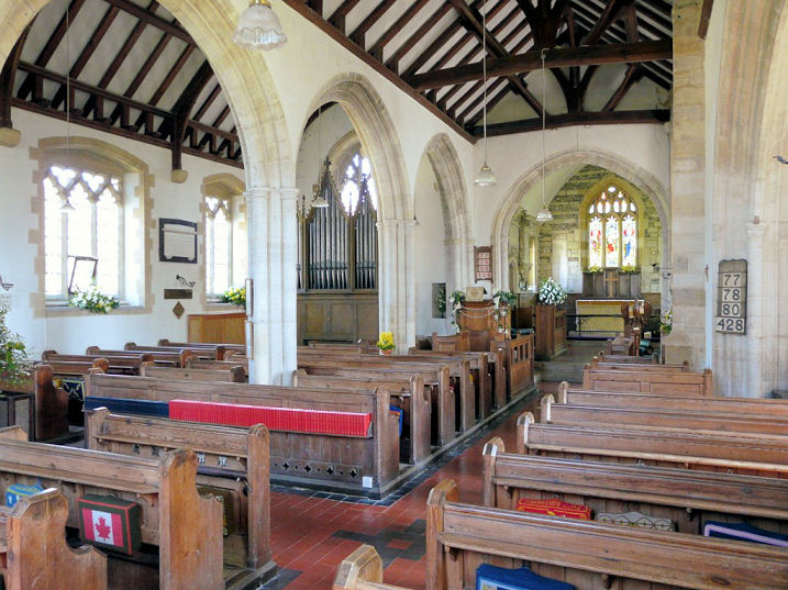
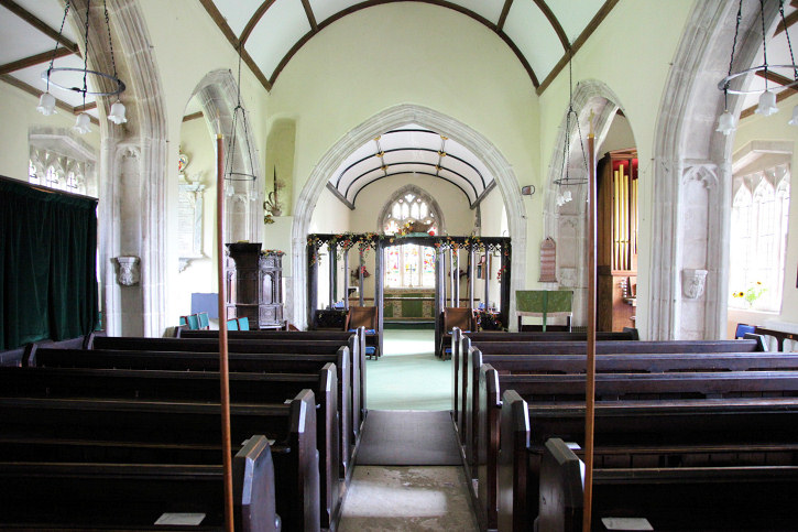
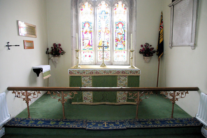
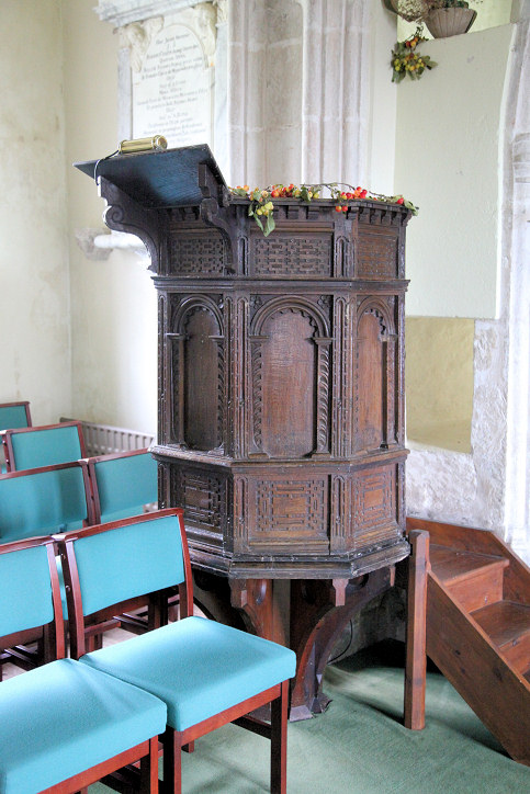
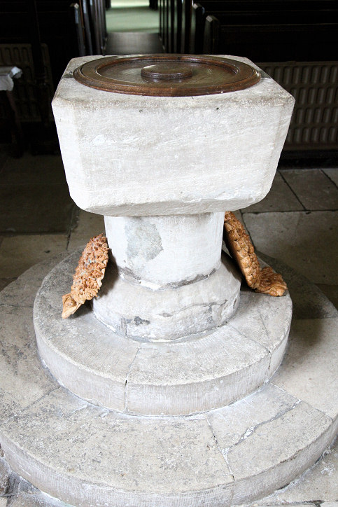
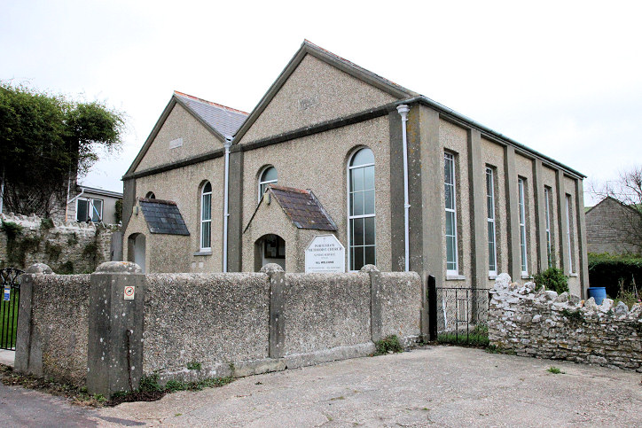
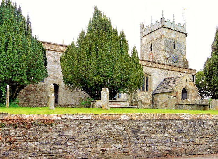
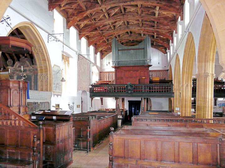
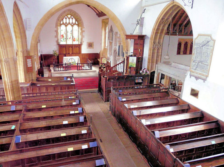
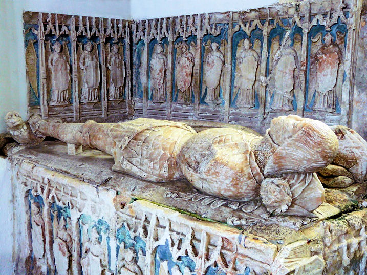
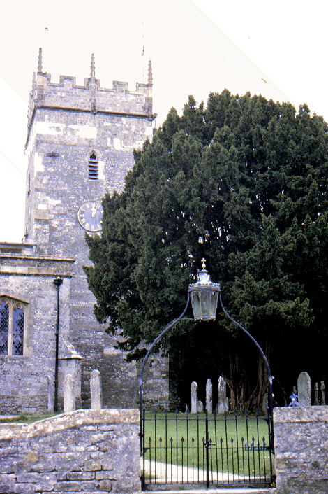
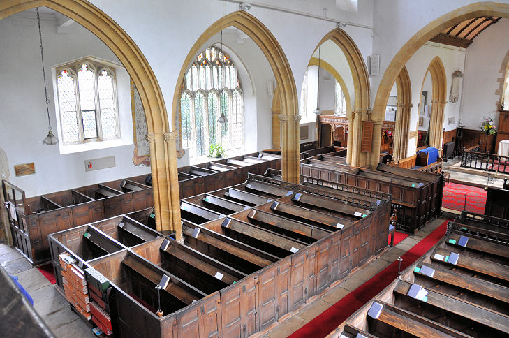
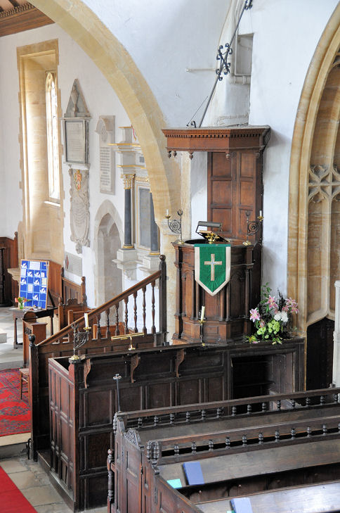
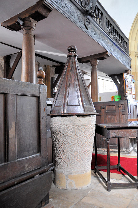
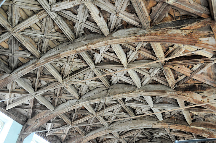
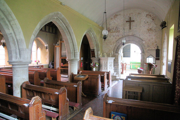
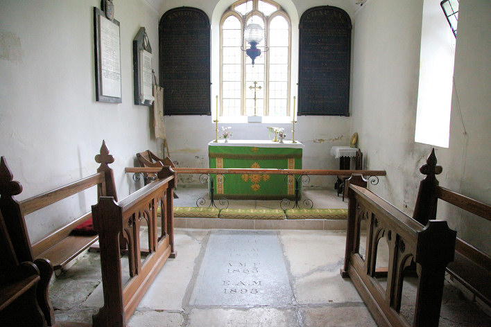
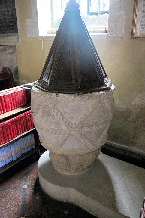
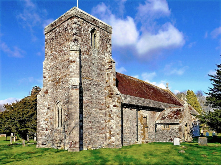
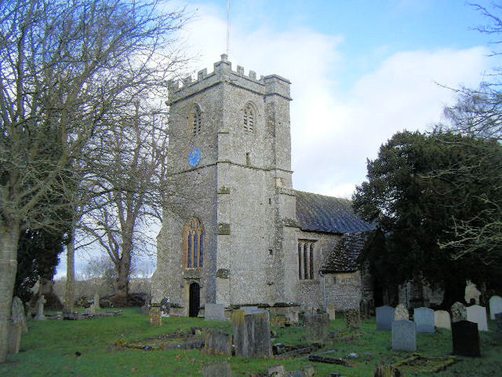
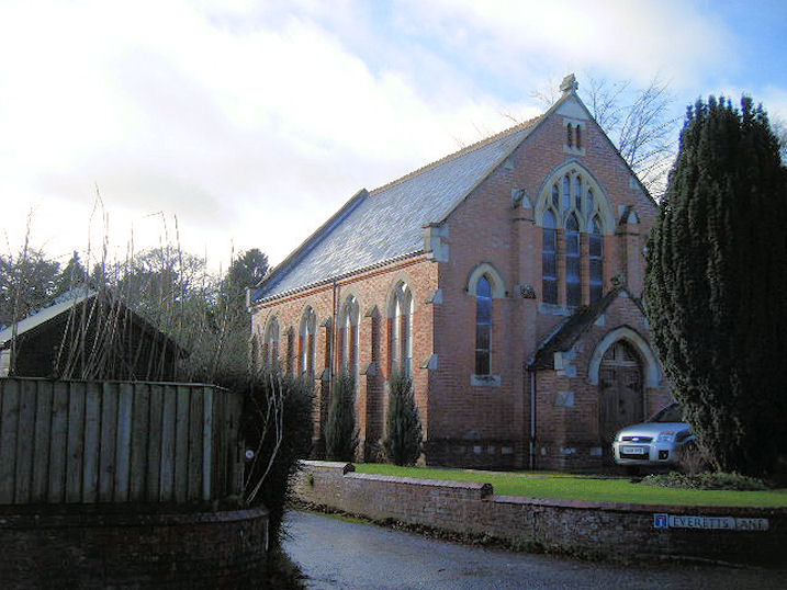
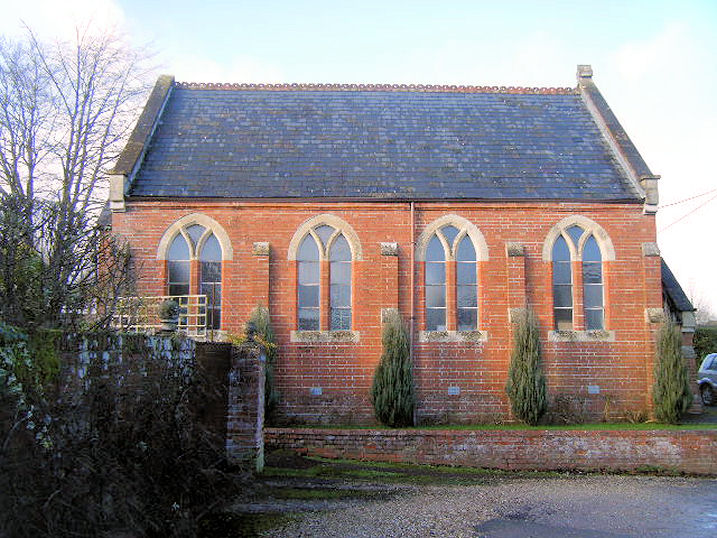
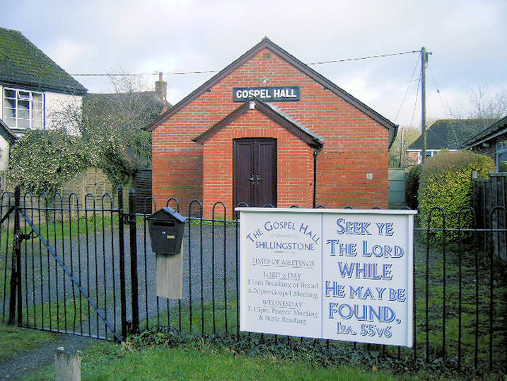
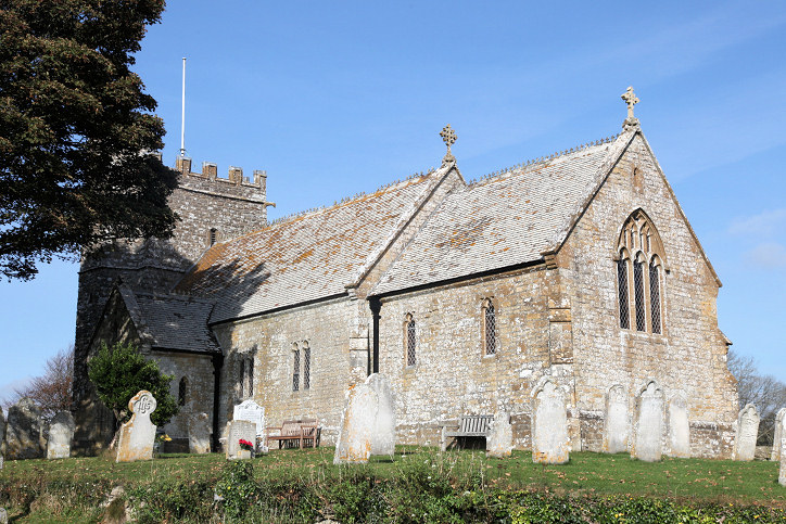
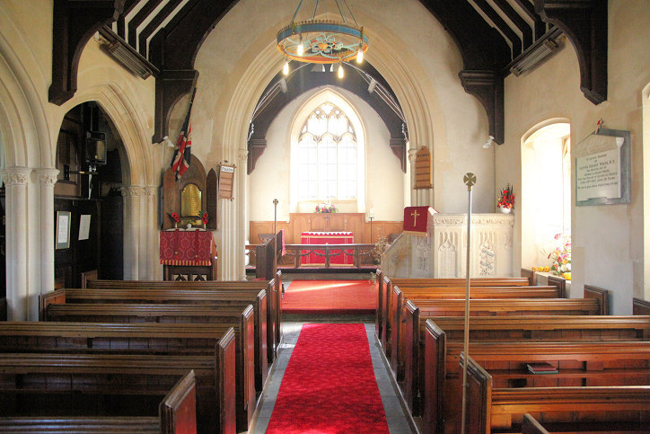
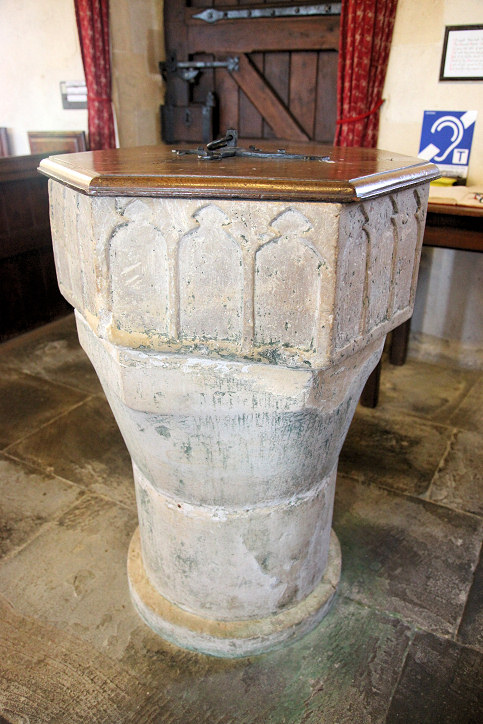
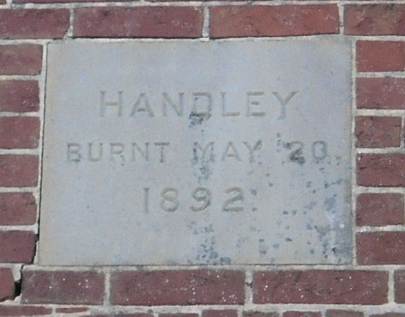
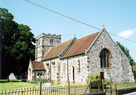
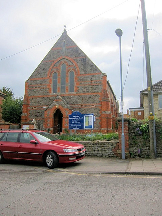
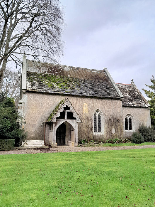
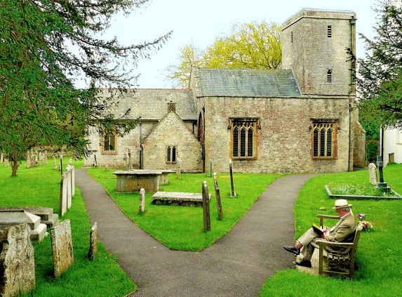
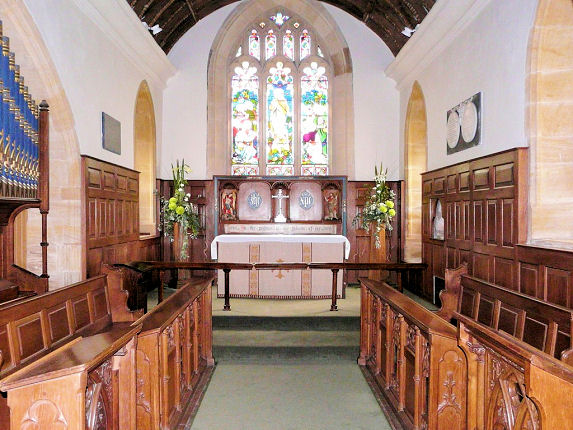
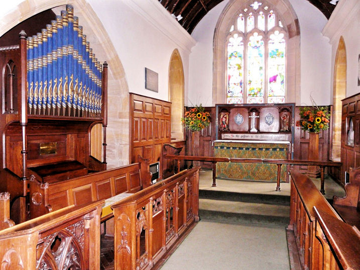
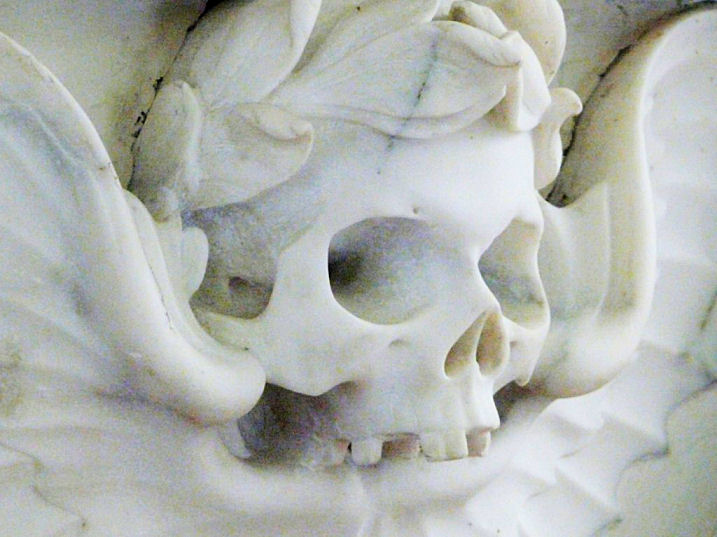
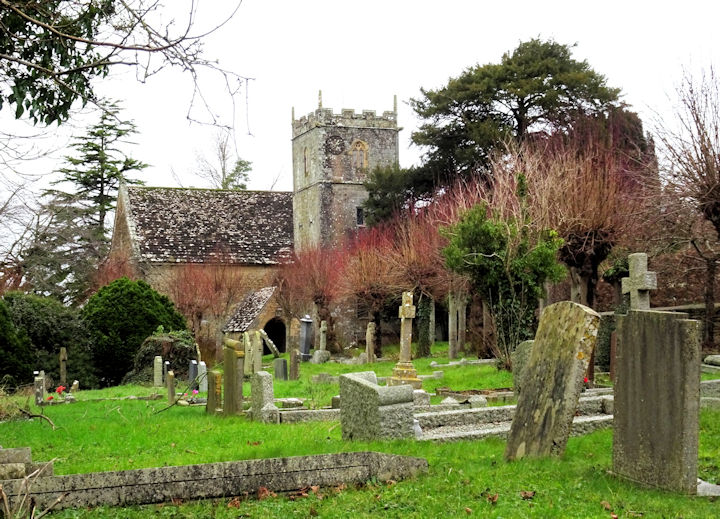
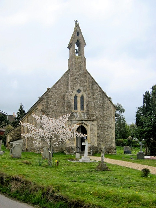
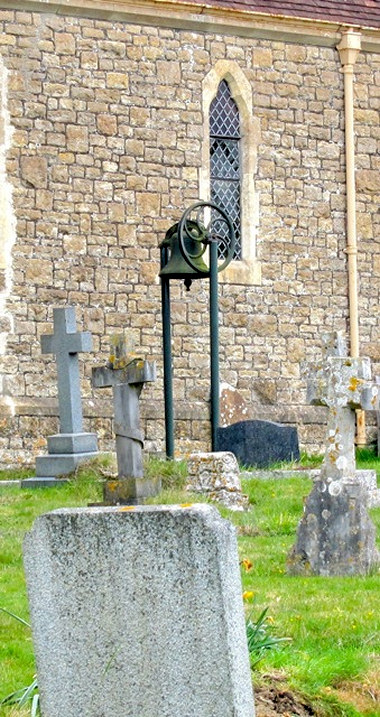
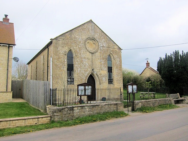
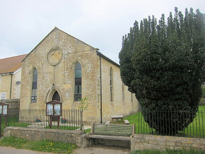
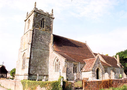
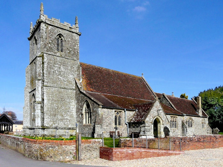
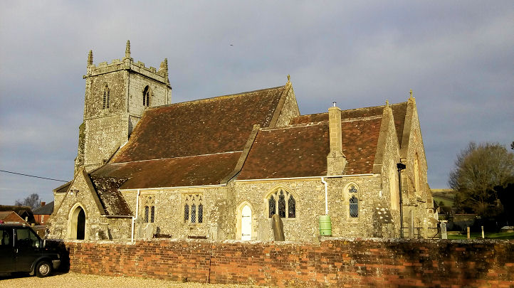
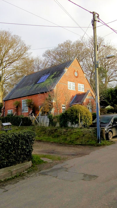
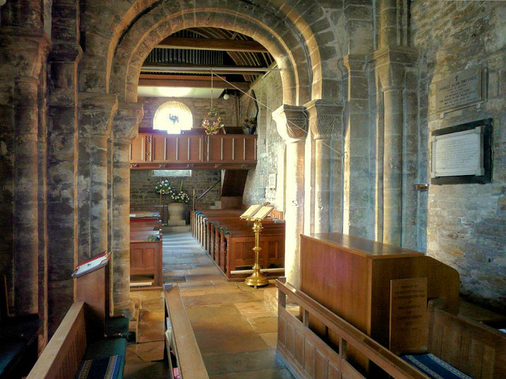
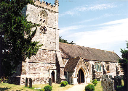
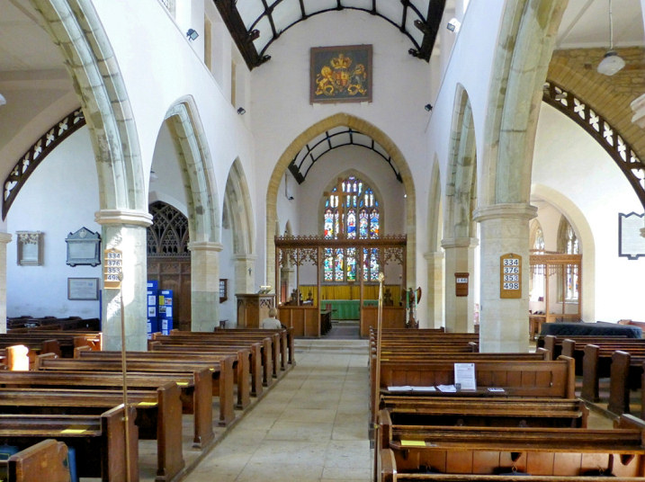
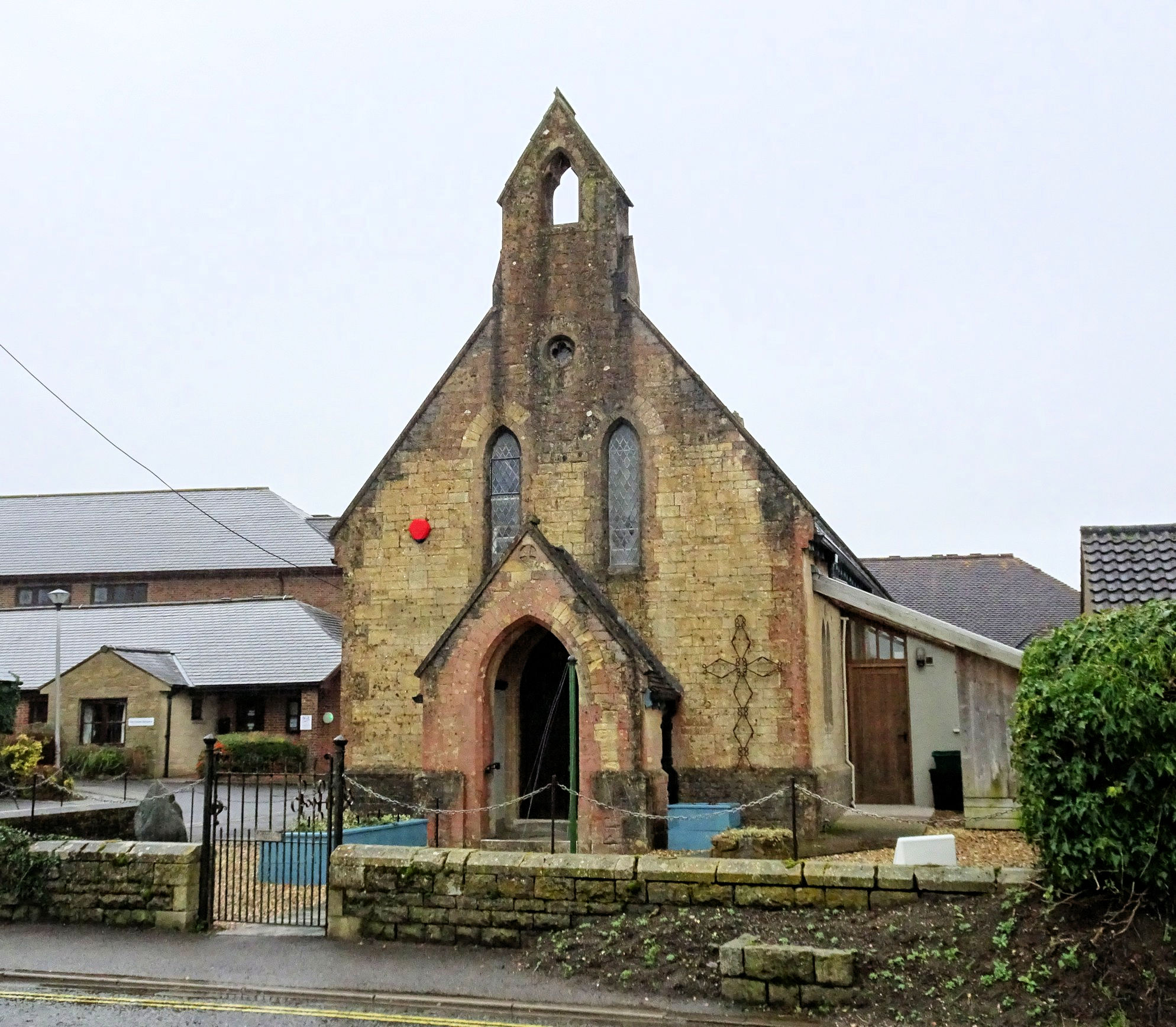
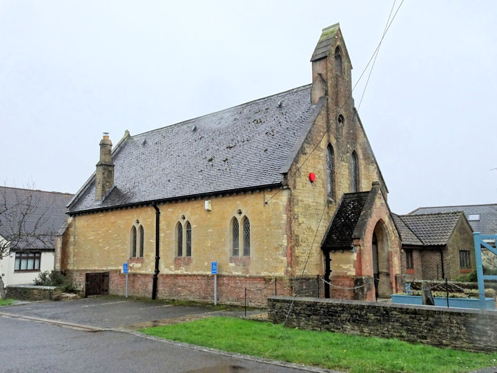
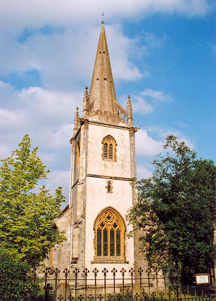
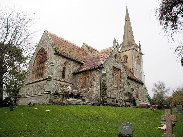
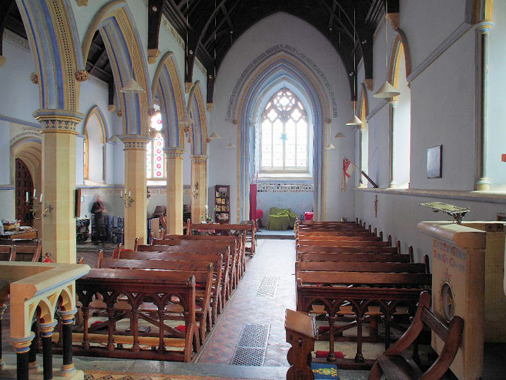
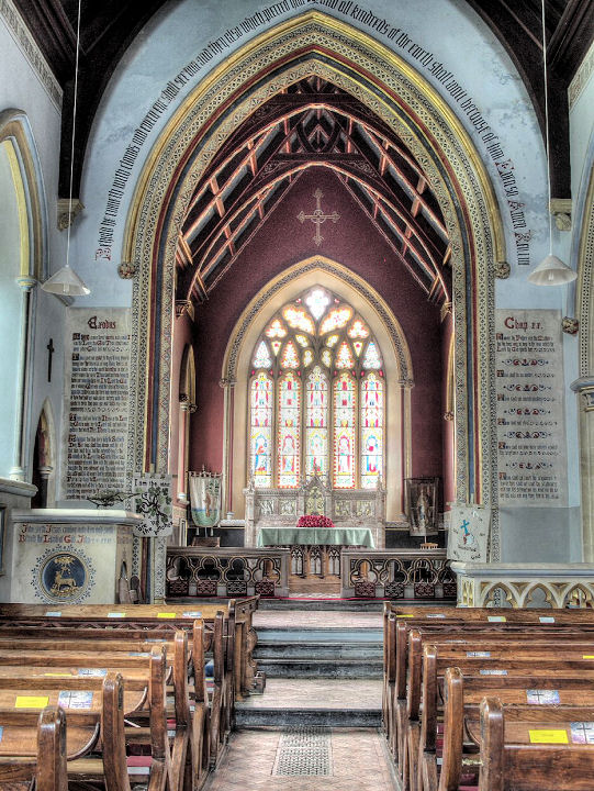
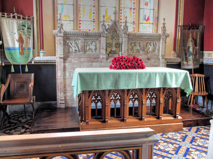
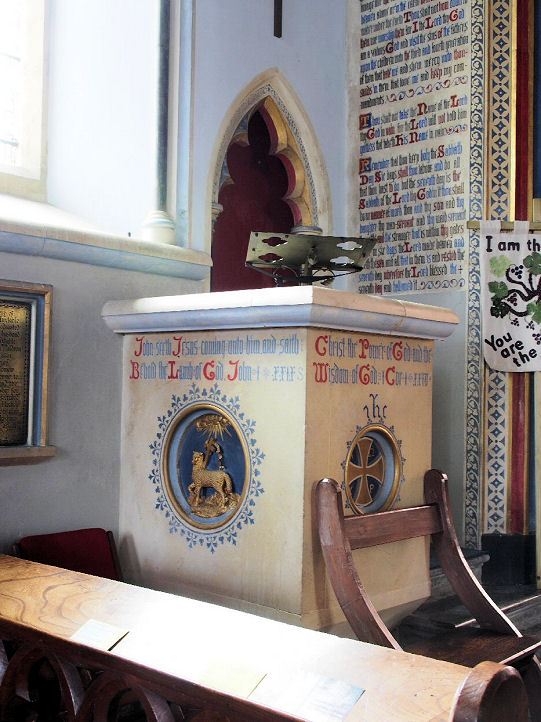
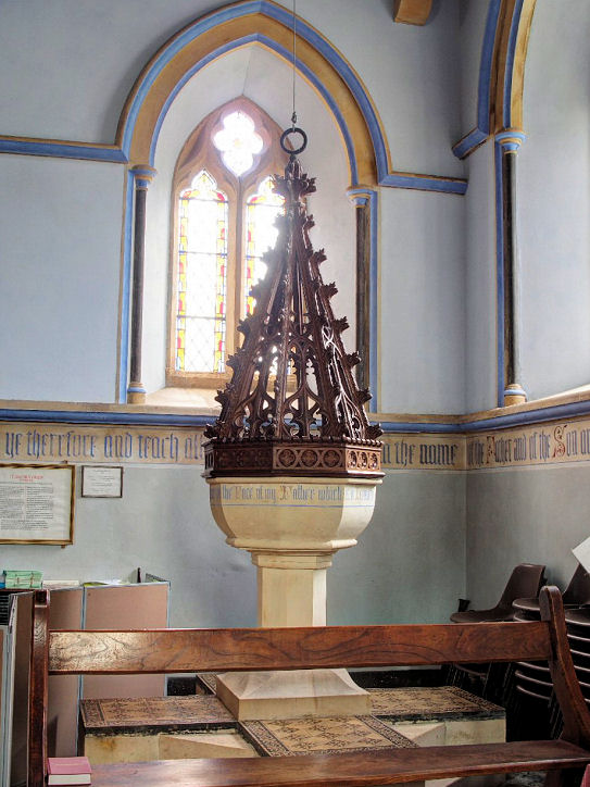
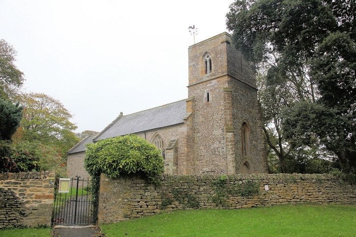
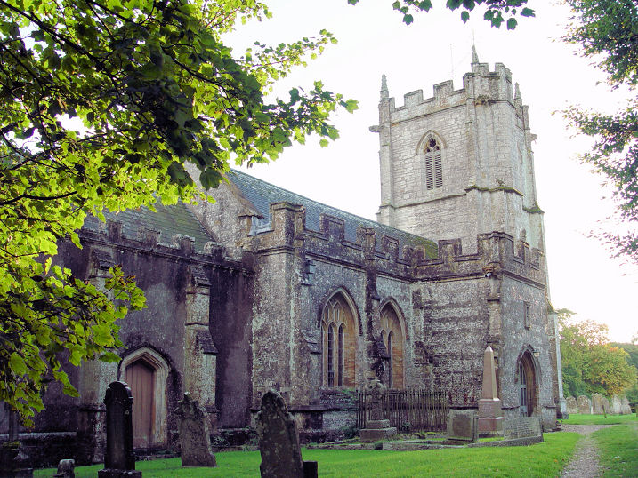
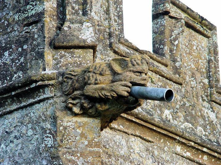
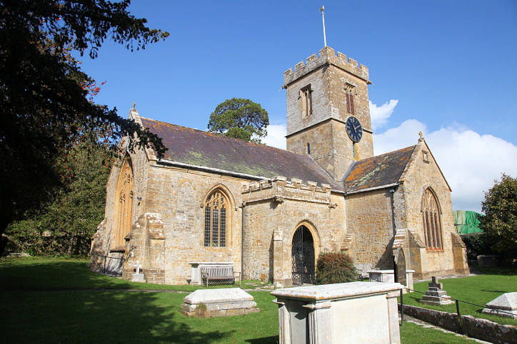
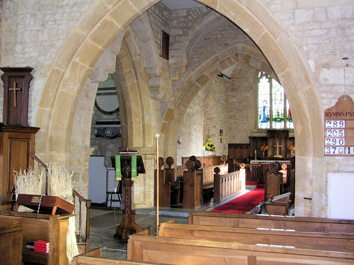
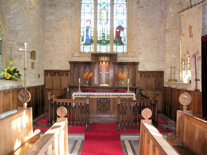
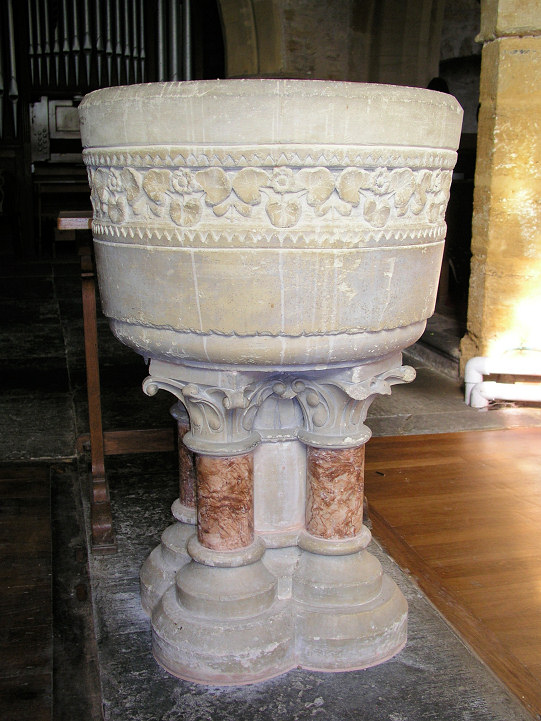
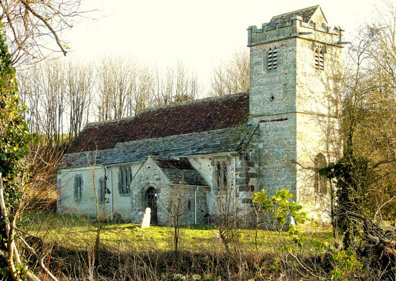
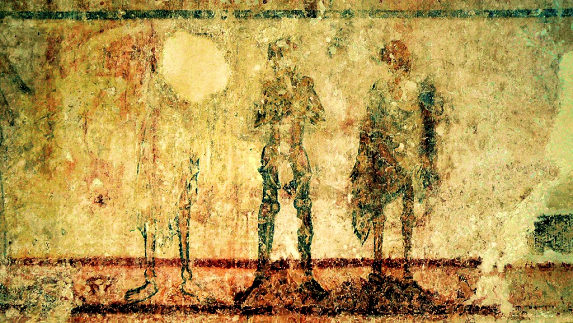
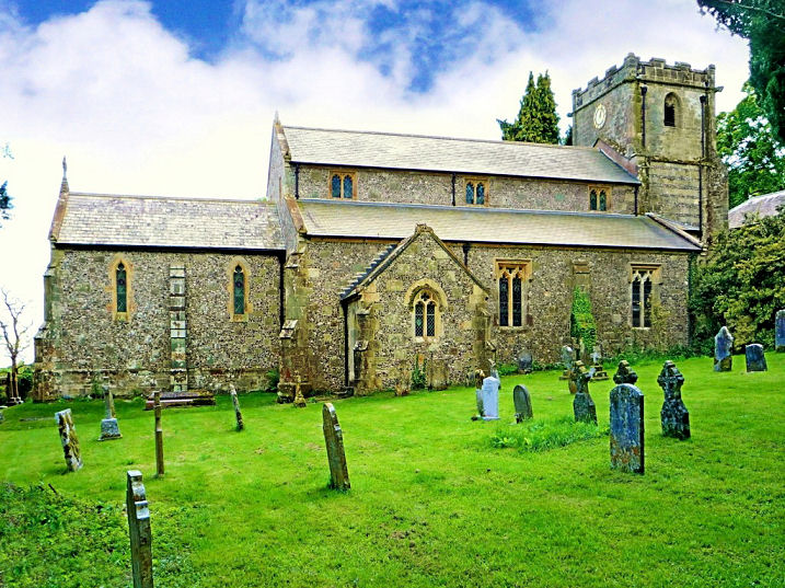
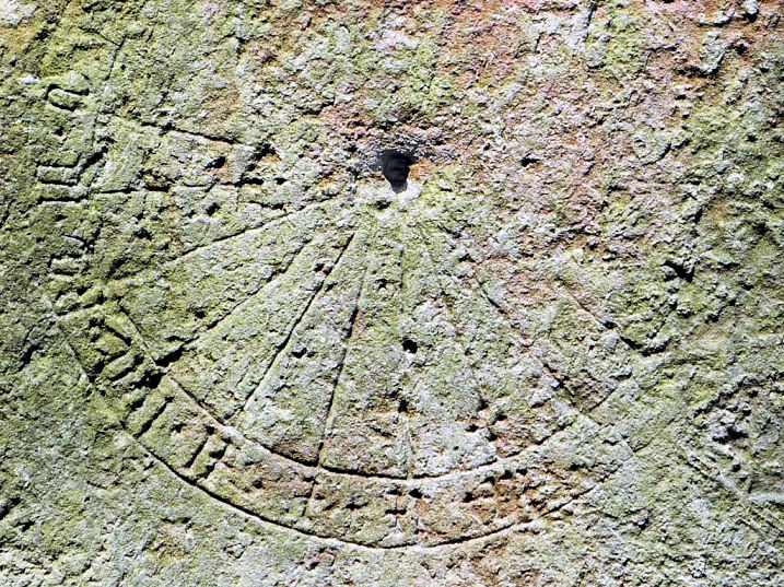
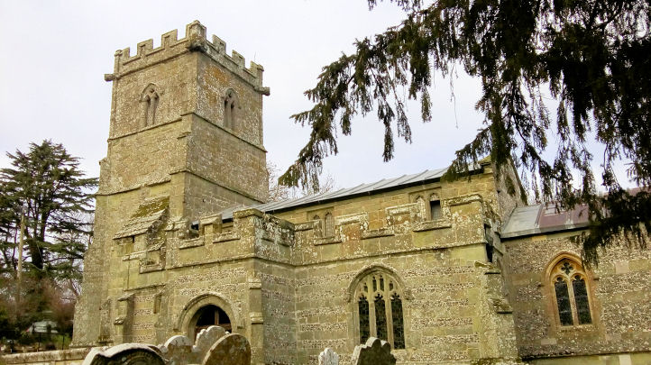
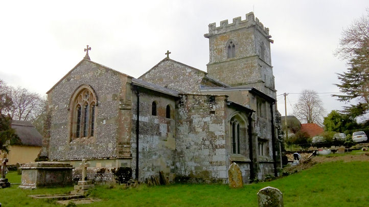
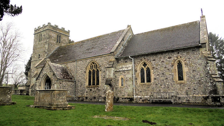
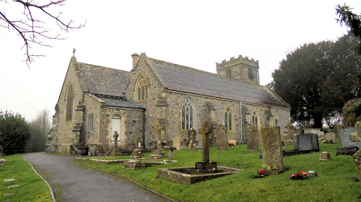
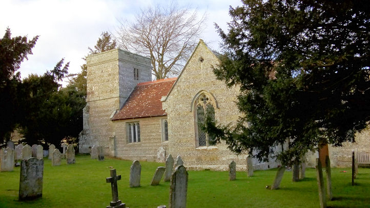
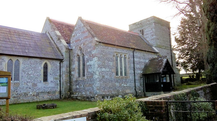
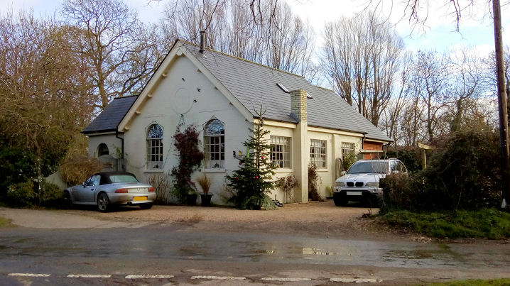
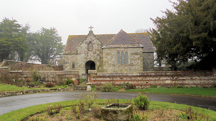
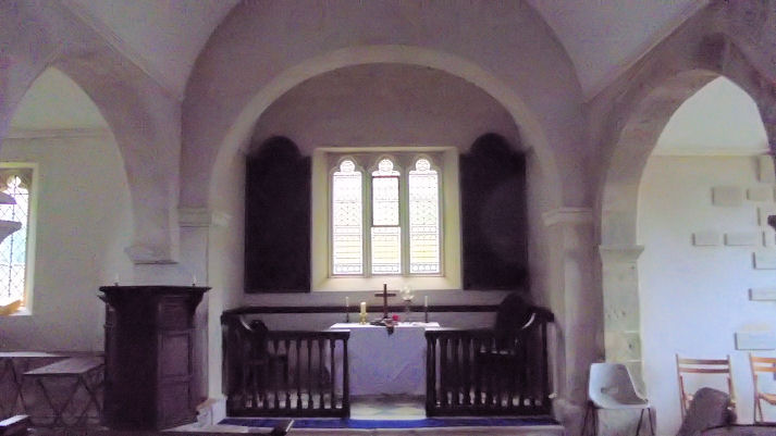
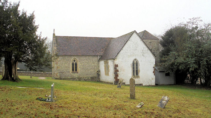
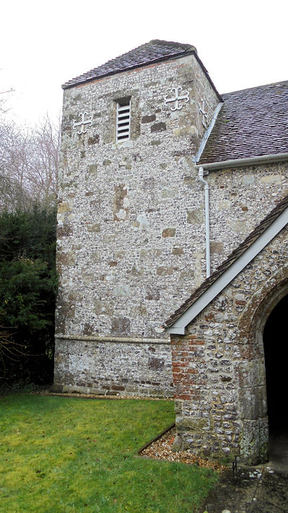
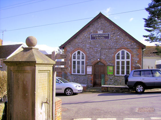
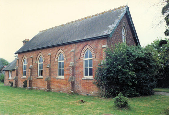
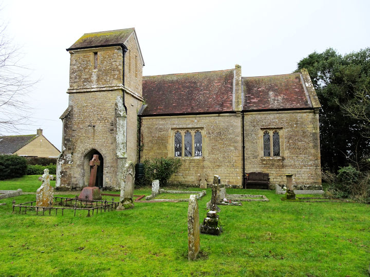
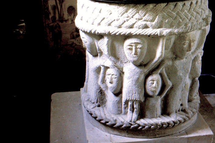
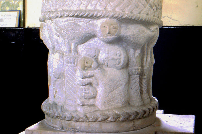
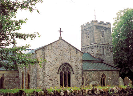
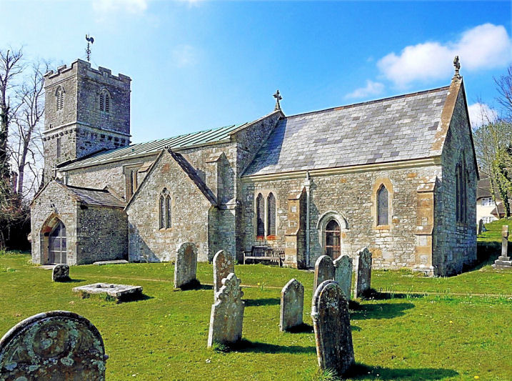
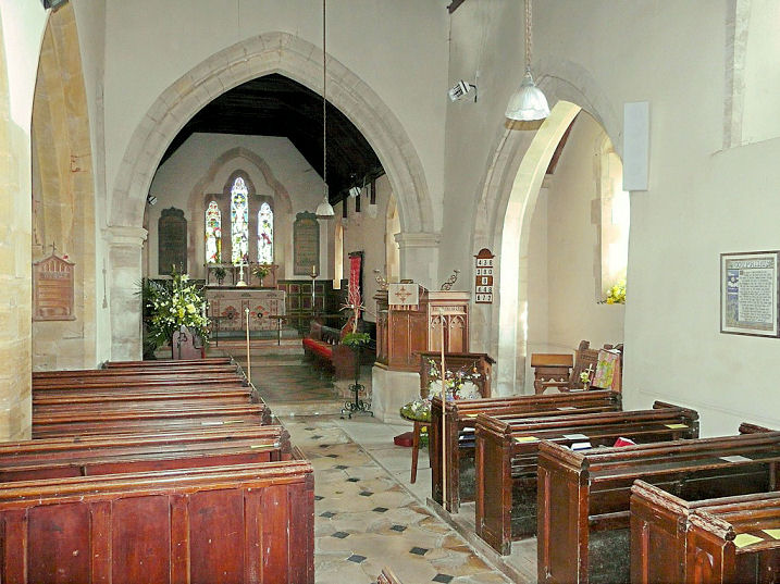
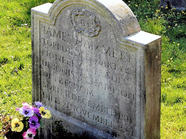
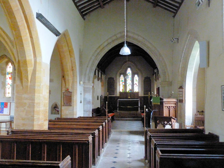
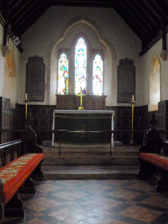
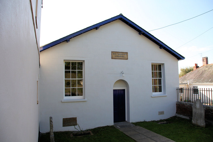
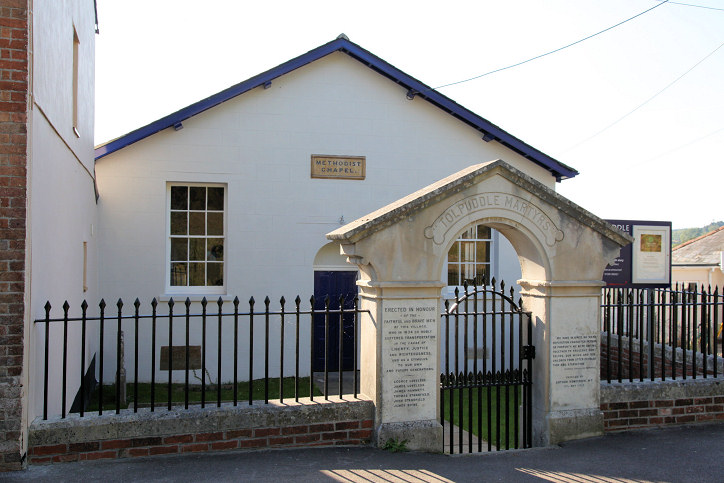
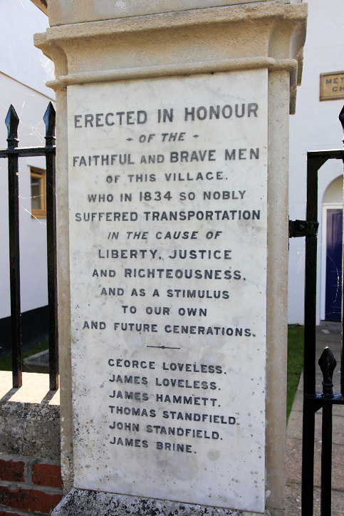
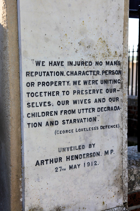
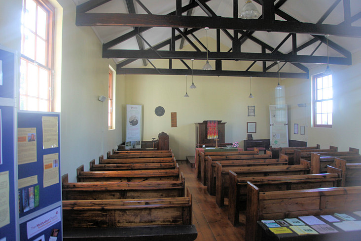
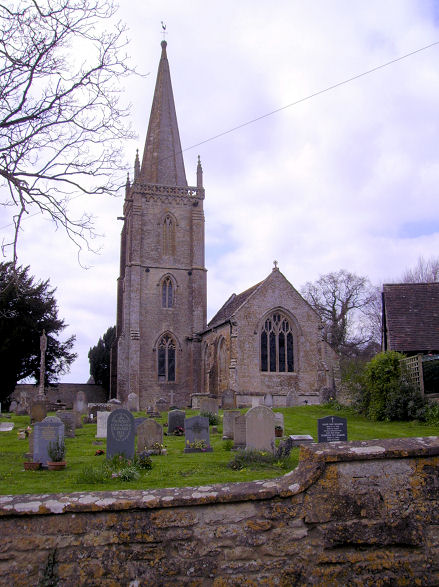
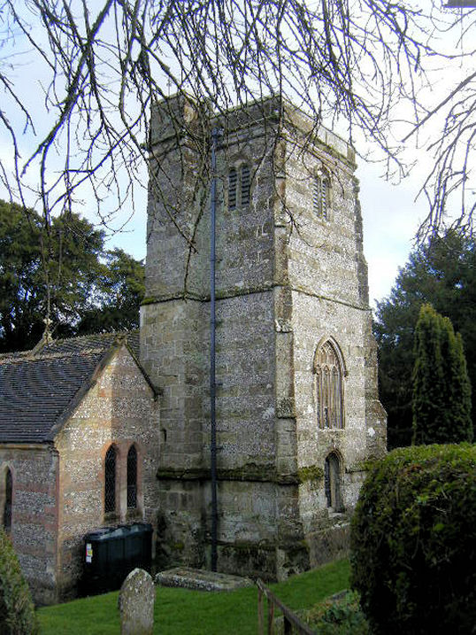
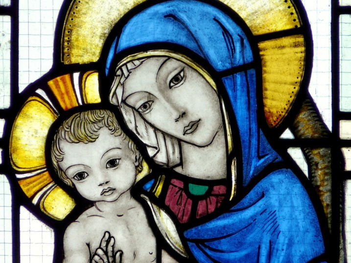
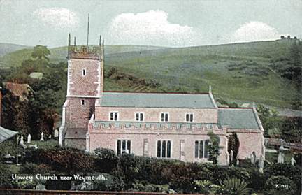
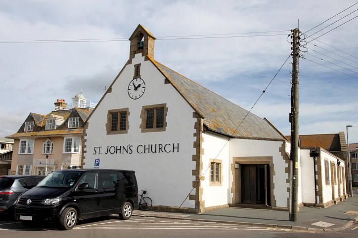
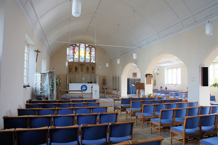
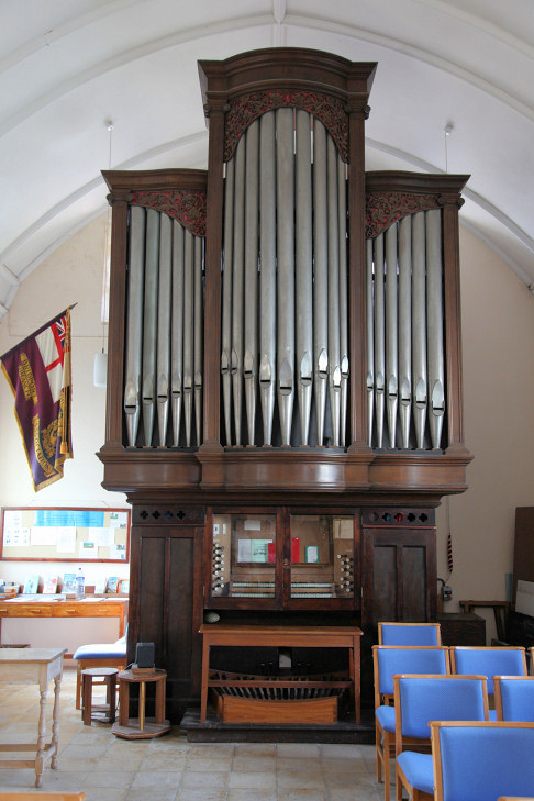
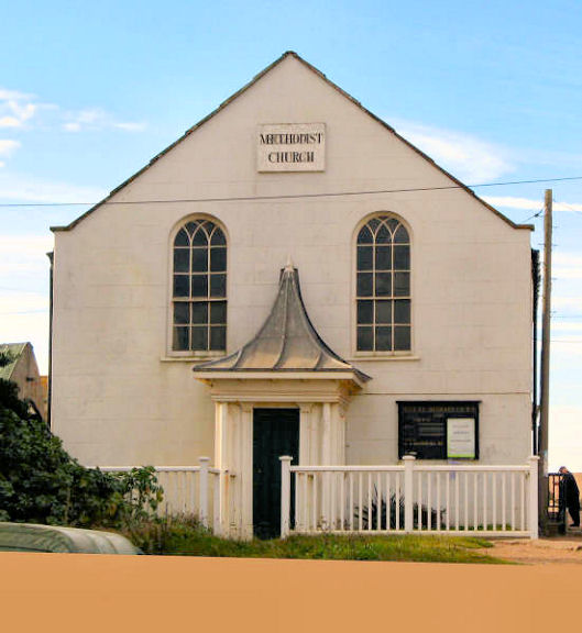
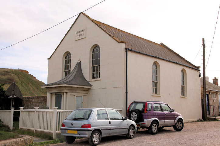
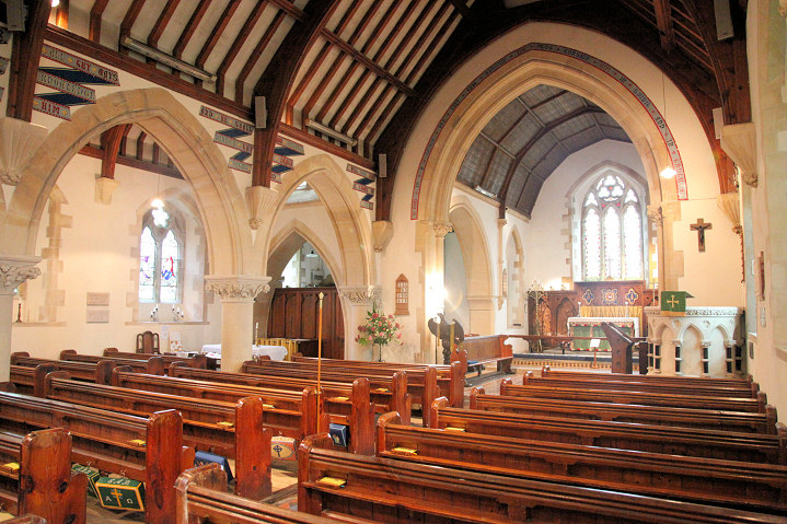
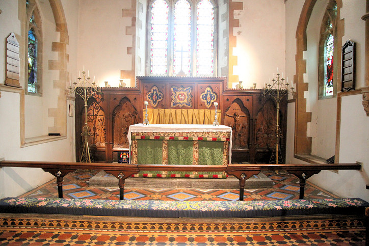
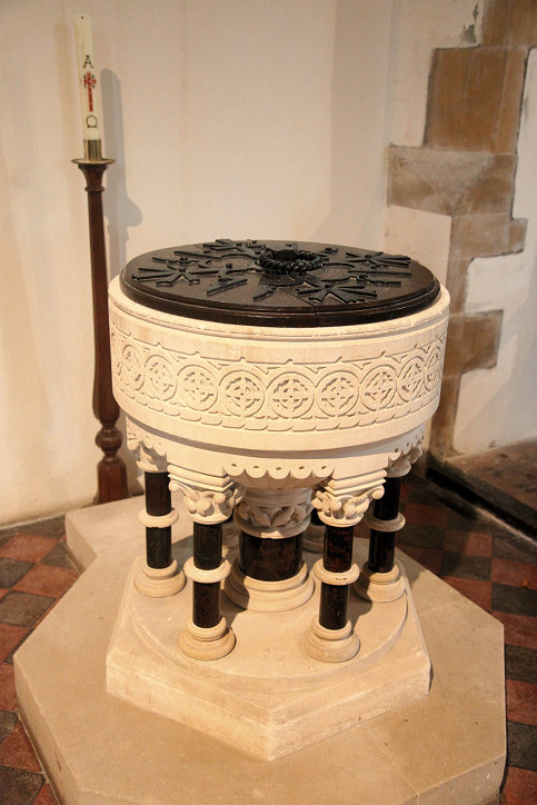
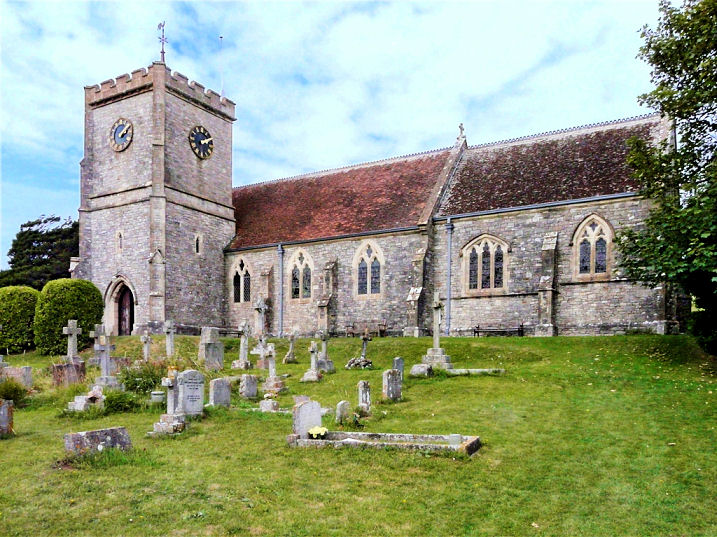
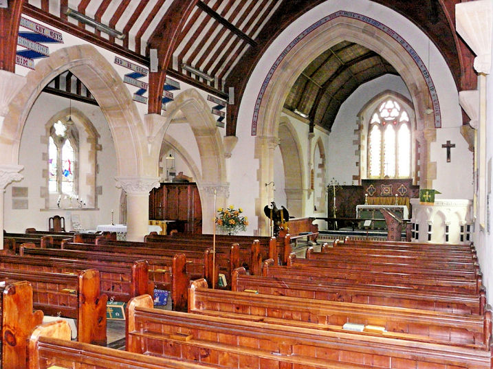
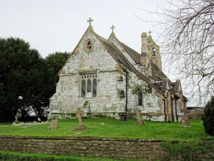
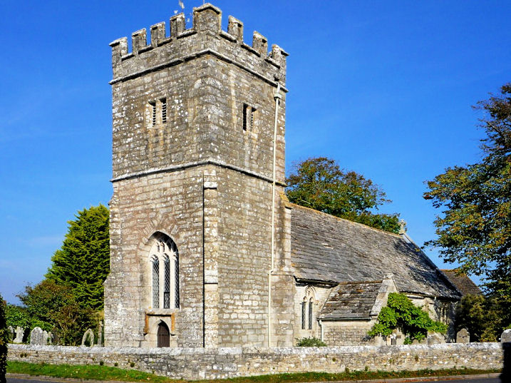
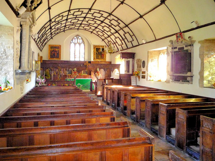
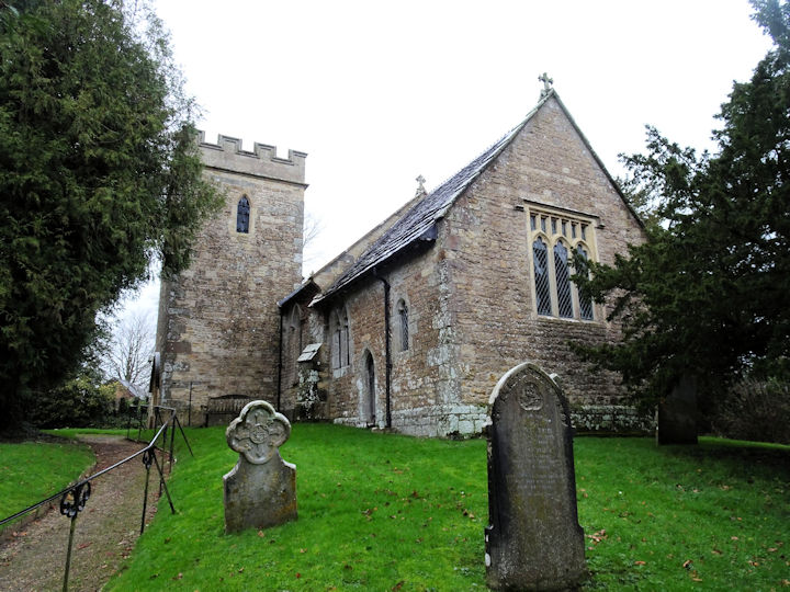
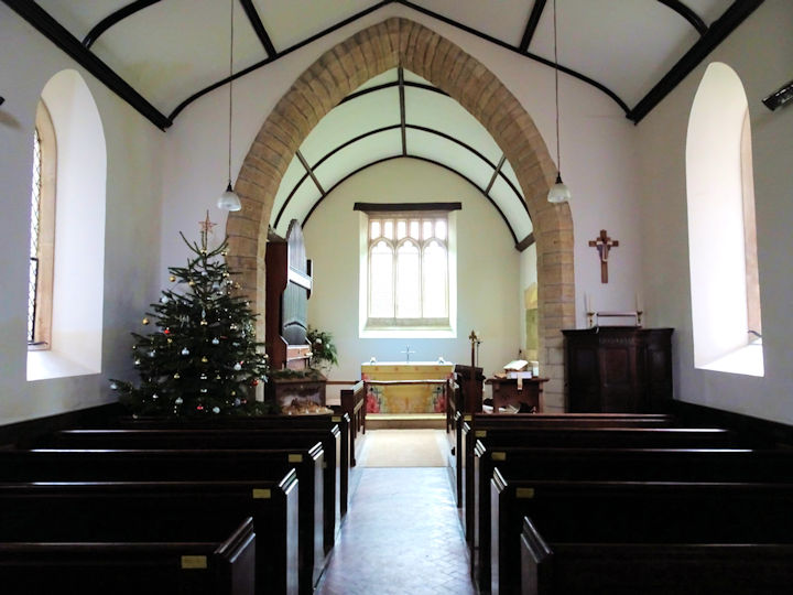
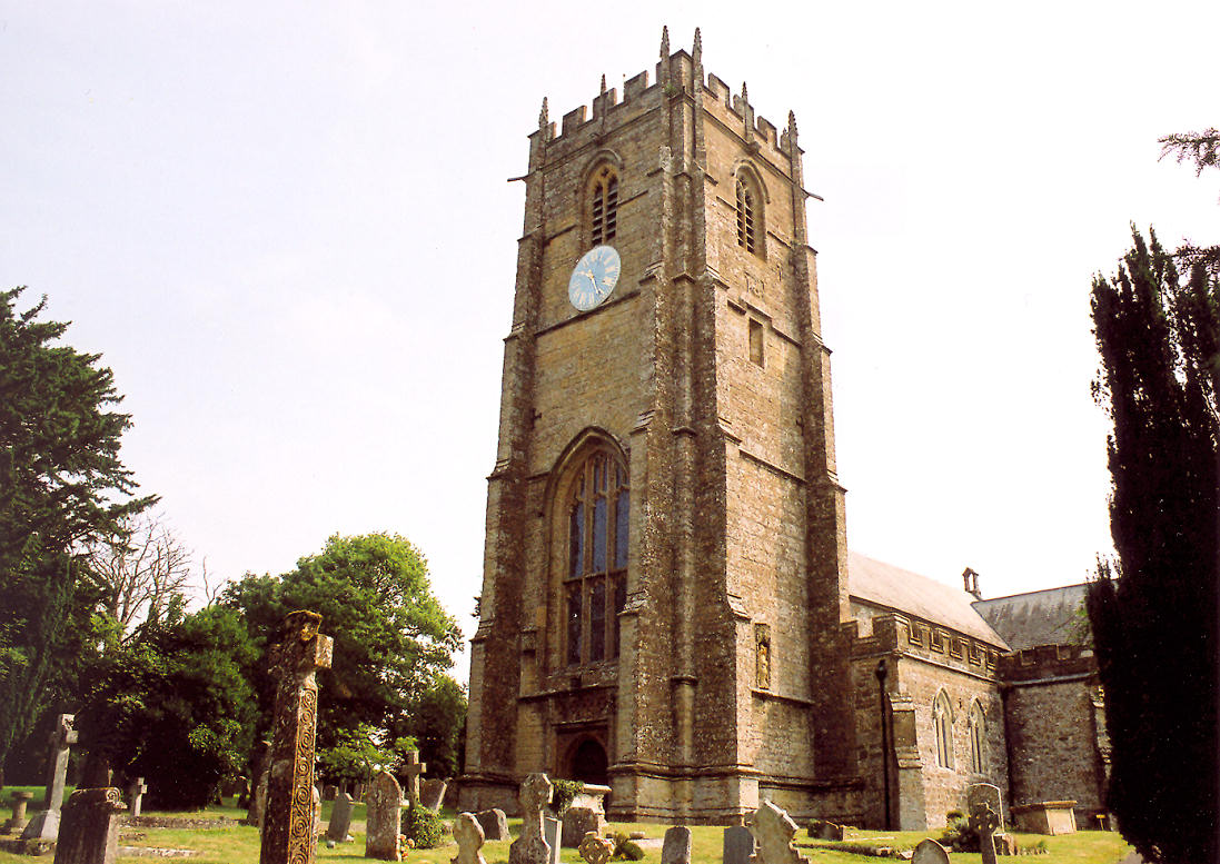
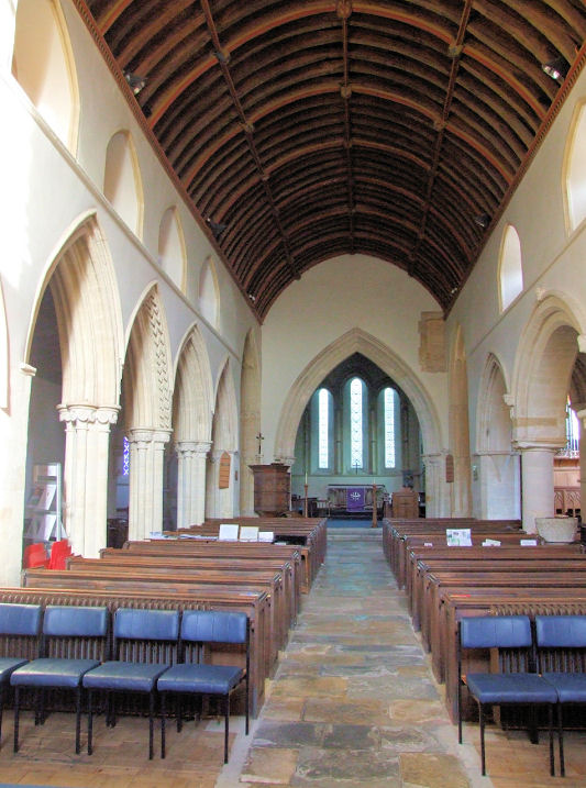
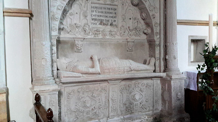
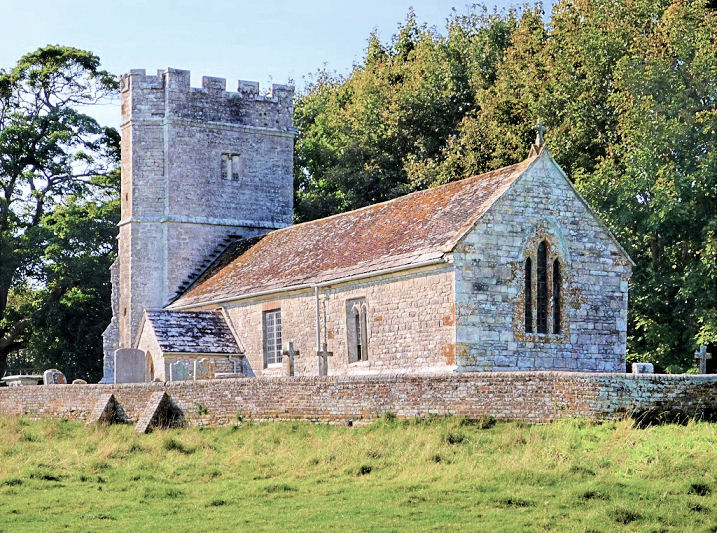
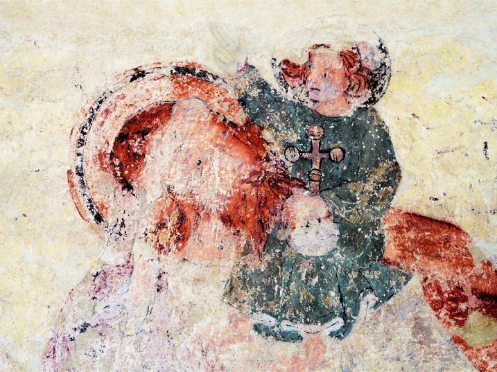
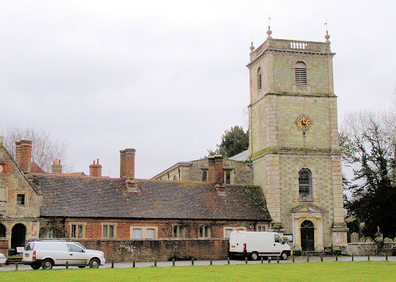
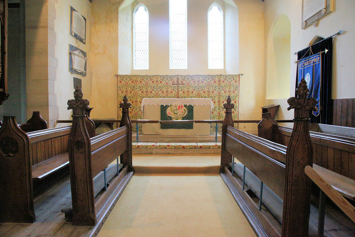
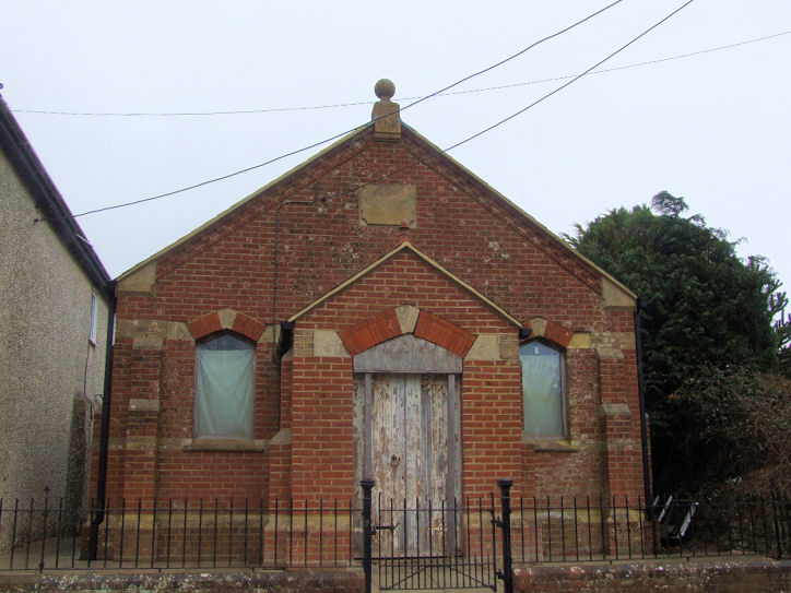
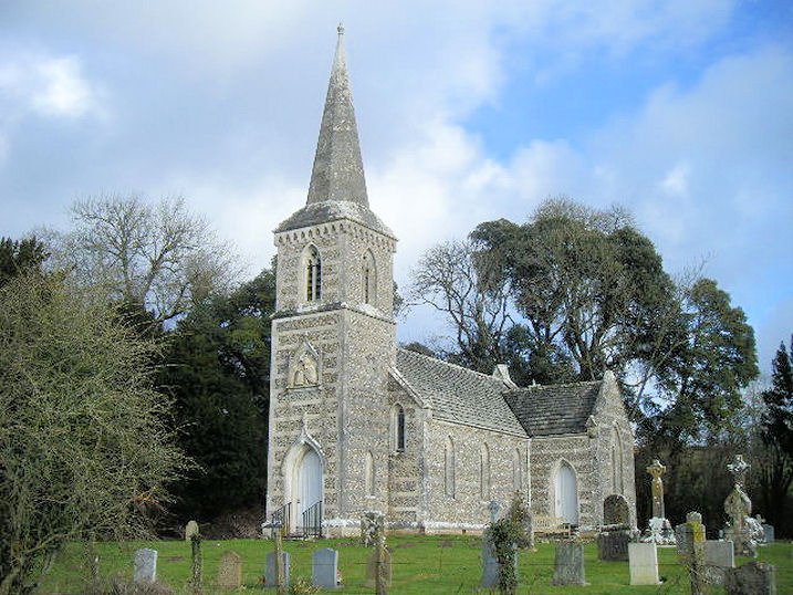
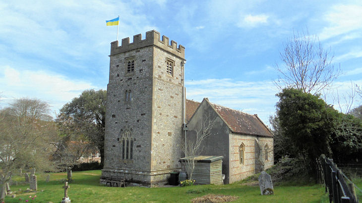
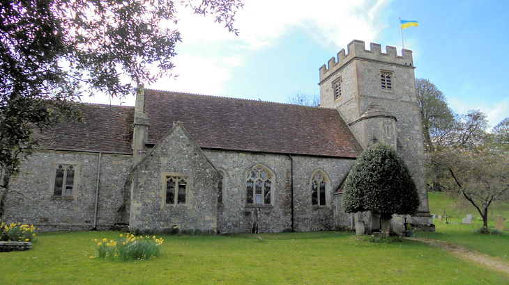
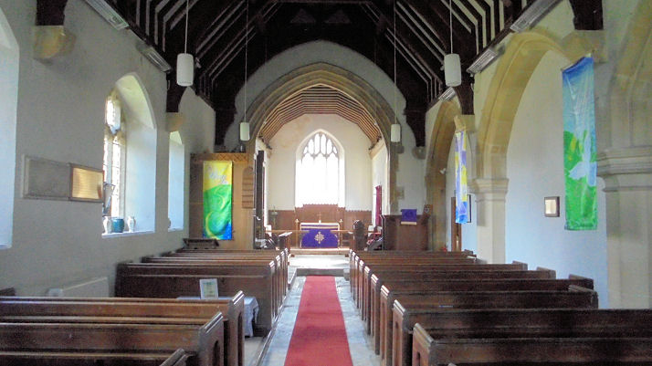
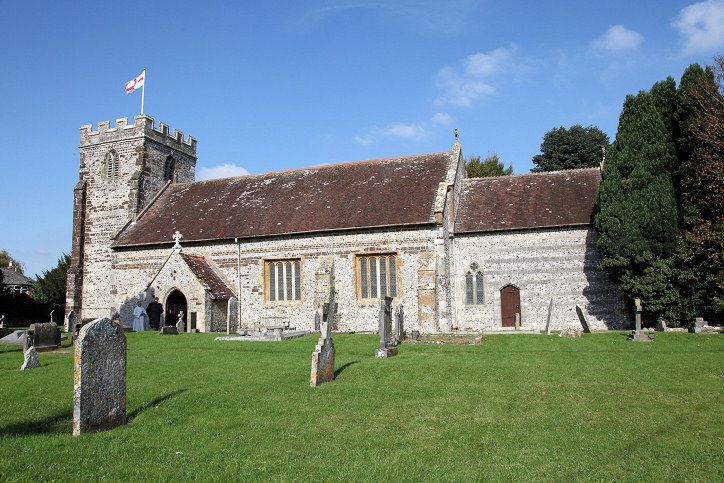
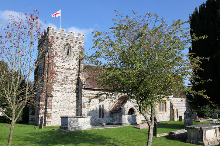
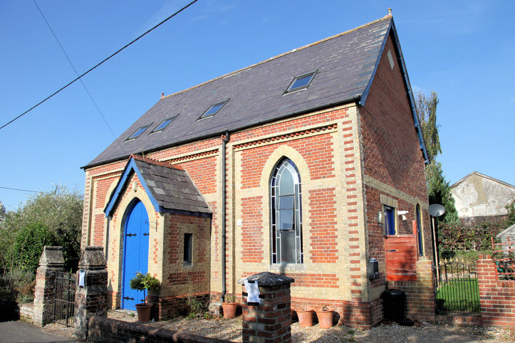
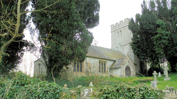
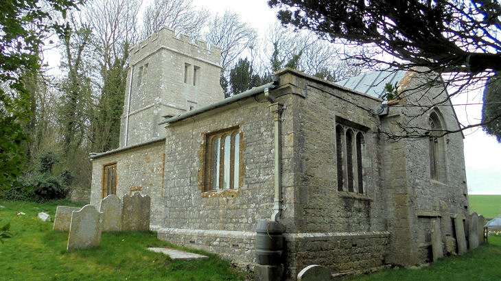
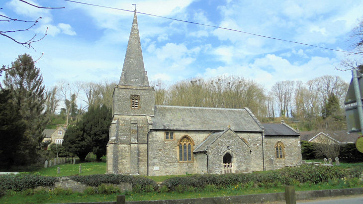
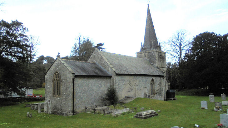
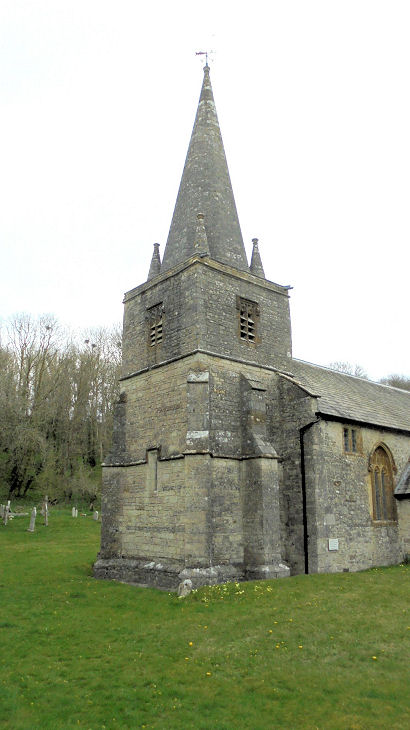
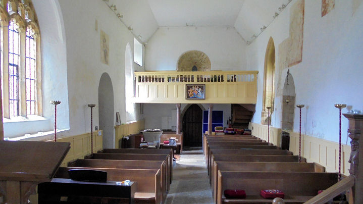
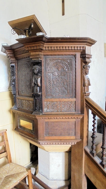
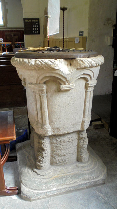
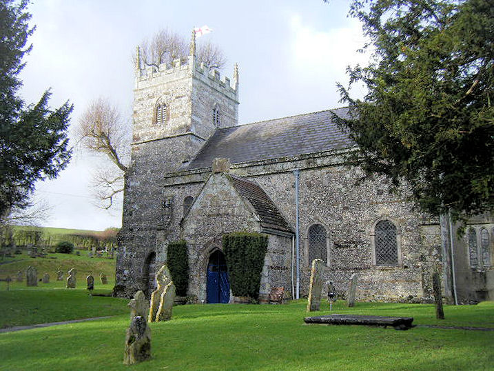
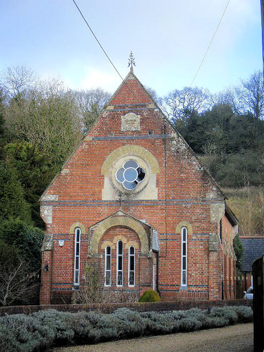
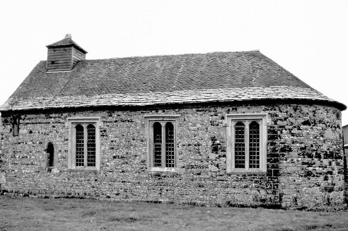
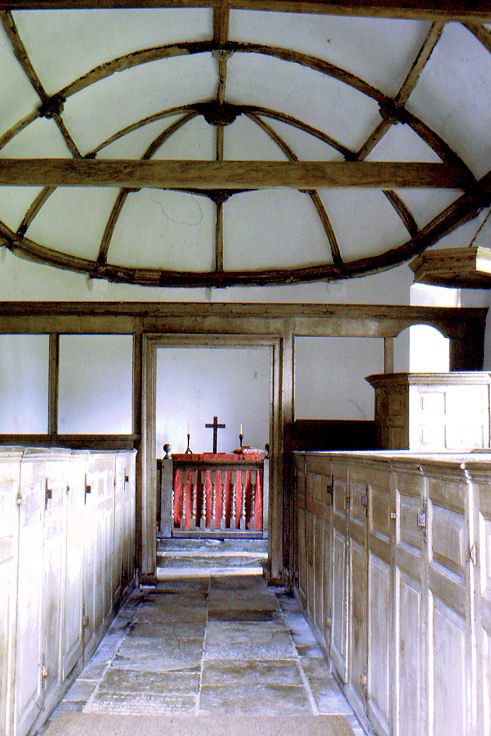
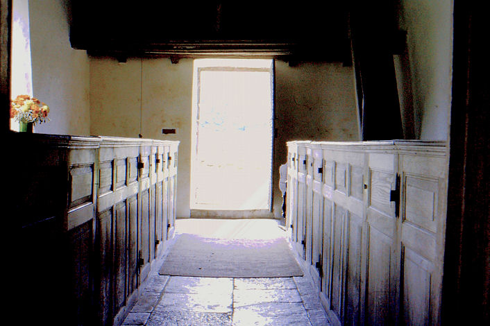
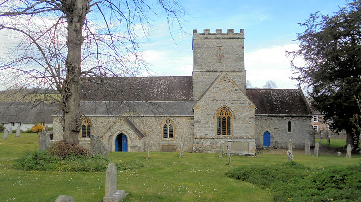
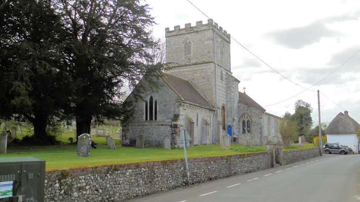
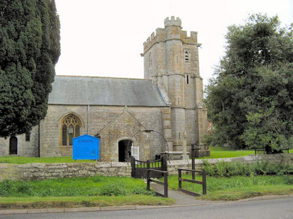
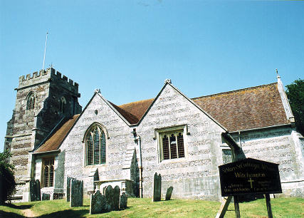
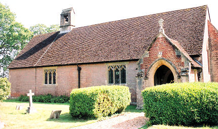
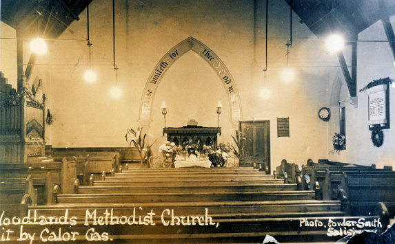
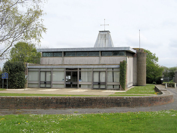
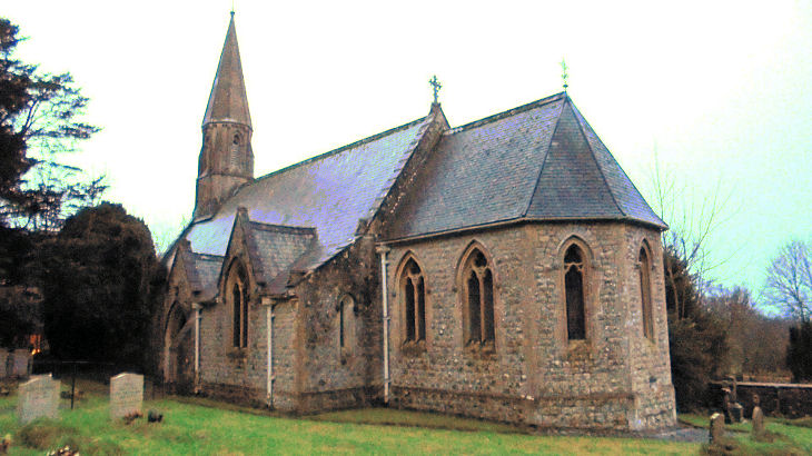
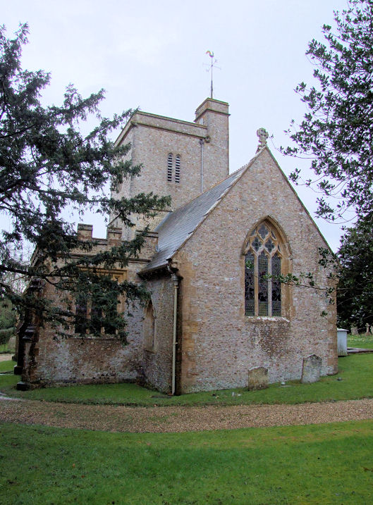
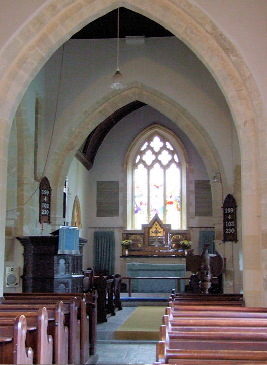
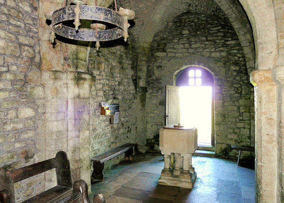
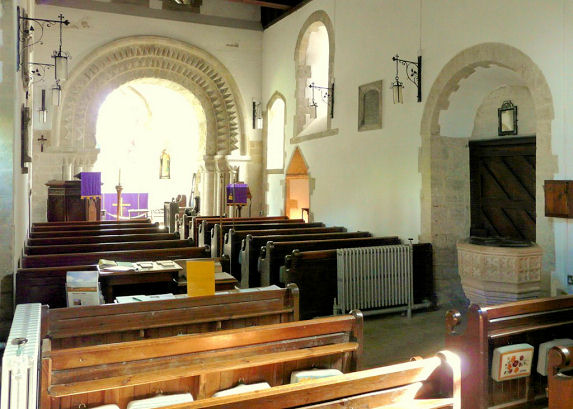