|
|
Birmingham, West Midlands
Birmingham on Wikipedia.
These sources have much useful information on
Birmingham Churches -
1,
2.
Churches in
Acock's Green,
Aston, Balsall Heath, Bearwood,
Billesley, Brandwood End,
Brookfields,
Edgbaston,
Hall Green,
Handsworth, Harborne,
Hay Mills,
Hockley, Kings Heath,
Kingstanding,
Moseley, Quinton,
Sheldon, Small Heath,
South Yardley,
Sparkhill,
Stechford,
Tyseley,
Winson Green, Yardley, Yardley Wood. Some
links will open a new page.
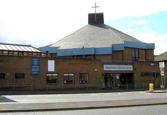
Birmingham Christian
Centre on Parade. SP 061 871. © Chris Emms (2010).
Link.
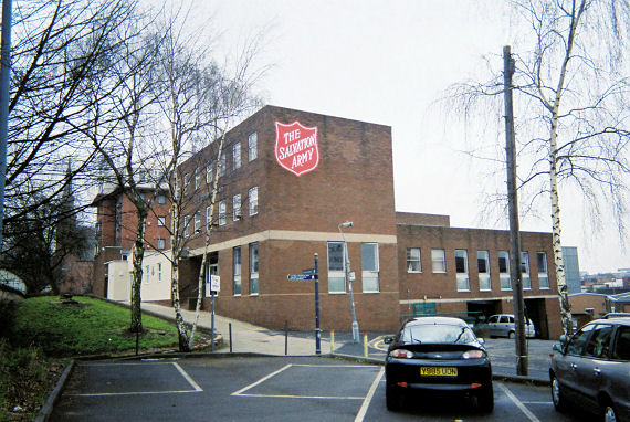
Birmingham Salvation Army Citadel on St. Chad's Queensway. © Rob Brettle.
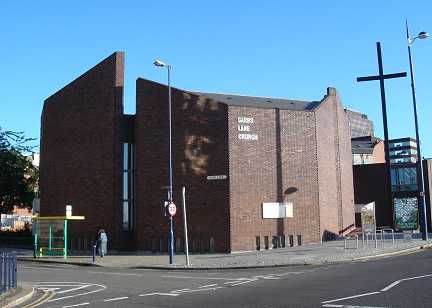
Carrs
Lane Church, (U.R.C. and Conference Centre). © Peter Morgan. Link.
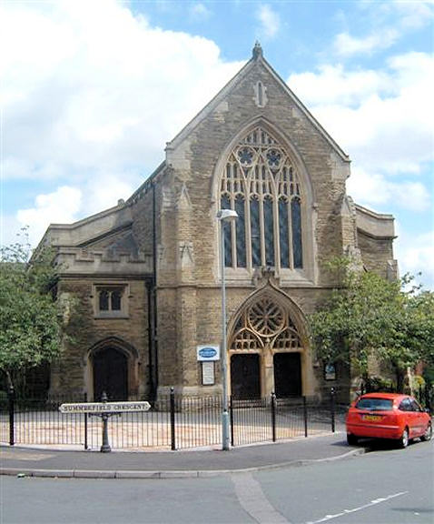
Christ Church in
Summerfield. Another view.
SP 042 872. Both © John French.
Link.
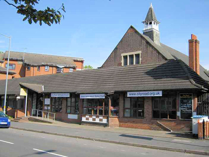
City Road Baptist Church,
on City Road. © John French.
City Road Methodist
Church at Rotton Park. SP 037 872. © Chris Emms (2010).
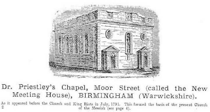
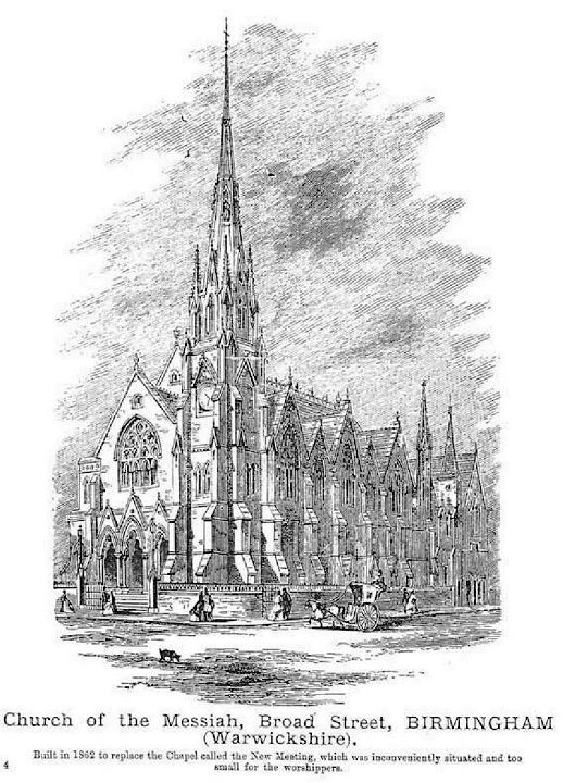
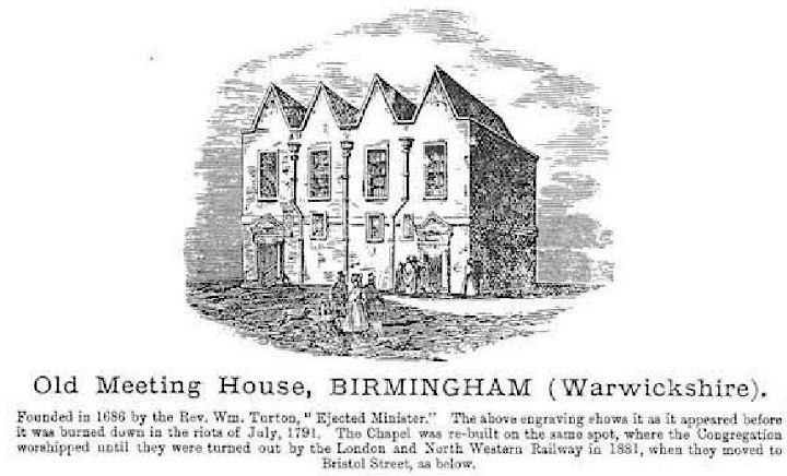
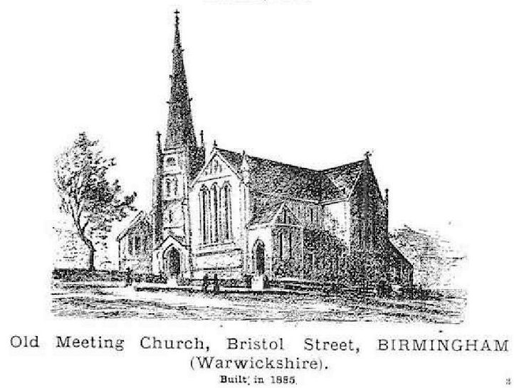
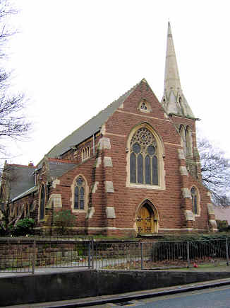
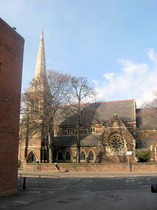
The former
Dr. Priestley's Chapel (Unitarian) on Moor Street, aka New Meeting House, was destroyed in the 1791 "Church and King Riot's". A new chapel was built (New Meeting), and this was replaced by the
Church of the Messiah (Unitarian) on Broad Street, built in 1862. The now redundant old chapel
was sold to the Roman Catholic Church. The Old Meeting House (Unitarian, founded in 1686) was
destroyed in the same 1791 riot. Another chapel was built on the same spot, and lasted until the site was acquired by the L.N.W.R for extending their
station. A new church was built in 1885 - the Old Meeting Church (Unitarian) on Bristol
Street. All © unitarian.co.uk. These, and many other old engravings on this website, are reproduced from the downloadable books on the Unitarian Church Headquarters website
here. The books are Pictures of Unitarian Churches by Emily Sharpe (1901) and the 1914 edition of
Nonconformist Church
Architecture by Ronald P. Jones M.A, (Oxon), and the images are reproduced by kind permission of James Barry of Unitarian Church Headquarters.
My appreciation also to Mike Berrell for his efforts in this regard. Link.
Holy
Trinity on Trinity Road and Birchfield Road, Birchfield. Another
view. SP 067 901. Both © Roy Graham. And another view.
© Mehmood Naqshbandi (2009).
The
Orthodox Cathedral of
the Dormition of Theotokos and St. Andreas on Summer Hill Terrace and Arthur
Place.
It was originally a Catholic Apostolic Church of 1873.
Another view. SP
0592 8721. Both © Chris Emms (2010). Link.
History page.
Our Lady of
Perpetual Succour (R.C.) on Leach Green Lane in Rednal.
SO 9937 7712. © Peter Morgan
(2023).
Link.
St. Agatha (2022
Streetview) on Stratford Road, Sparkbrook.
Another view
from Streetview in 2022. SP 0867 8479.
Link.
History page.
Grade I listed.
St. Anne on
Lilley Lane and Alvechurch Road, West Heath.
Another view.
SP 0275 7764. Both © Peter Morgan (2023).
Link.
A Streetview from
2022 shows what appears to be a small predecessor church. This is
confirmed as a church by a 1905 O.S. map.
St.
Chad, the Catholic Cathedral. © Peter Morgan. Two interior views -
1,
2, both ©
John Balaam (2013). Link.
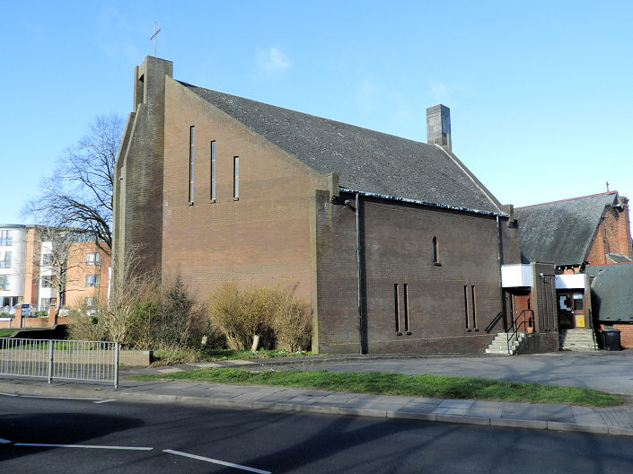
St. Francis of Assisi
at Bournville.
Interior view. Both © Aidan McRae Thomson.
Link.
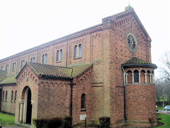
St. John and St. Peter
in Ladywood. © Aidan McRae Thomson. Link.
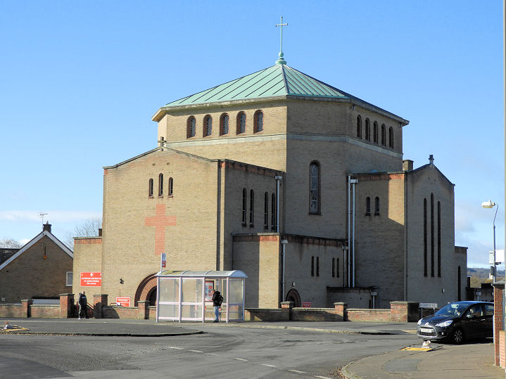
St. John Fisher
(R.C.) on Cofton Road, West Heath. SP 0265 7757.
© Peter Morgan (2023).
Link.
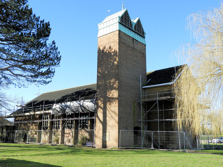
St. John
the Baptist on Longbridge Lane and Turves Green, Longbridge. It's
dated
here to 1957. SP 0179 7744. © Peter Morgan (2023).
Link.
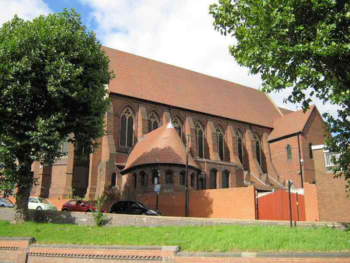
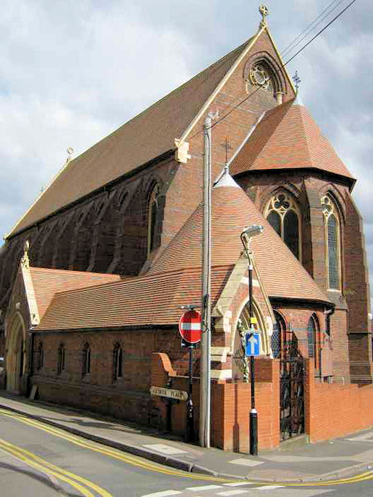
St. Laurence on
Rectory Road, Northfield, as seen by Streetview in 2022. Pevsner, in his
Worcestershire volume, observes "some
of the finest Early English work in the county".
SP 0254 7933.
Link. A good
history, with photos.
Grade I listed. The churchyard wall is also listed, as
grade II.
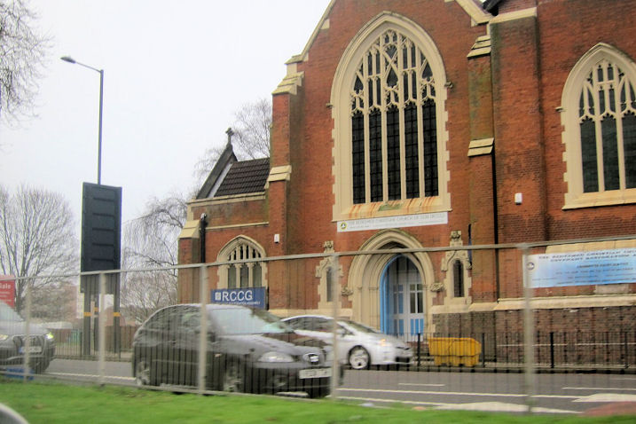
The former
St. Luke (1903) on
Bristol Road. It had a predecessor on the same site, which was built in
1842, and demolished in 1899. After the congregation moved out, it was
home to a Redeemed Christian Church of God, but they too seem to have
moved on, apparently before May 2015.
Another view. SP
068 856.
Both © Martin Richter (2015). A photo of the previous church is
available
here, which has other photos (including one of the successor church
of circa 2000 on Great Colmore Street) and a decent history.
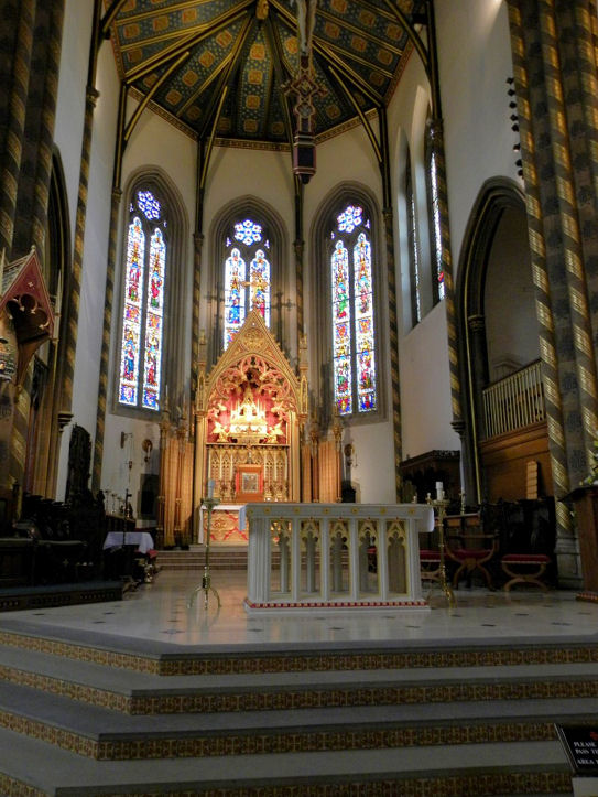
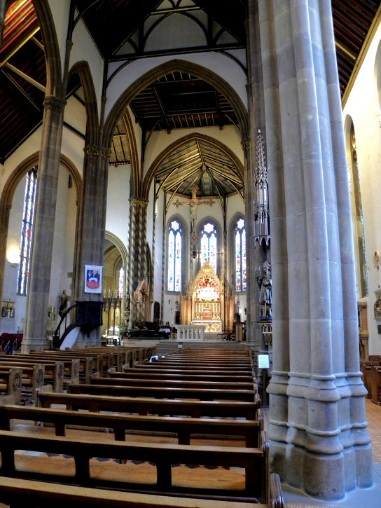
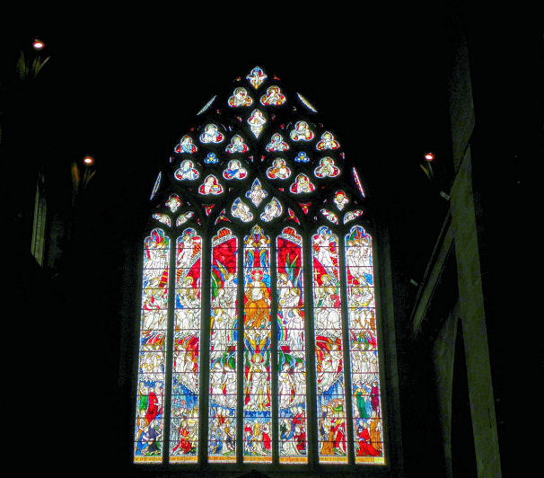
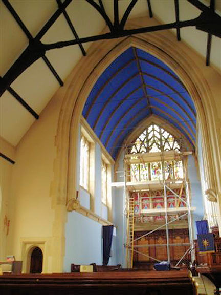
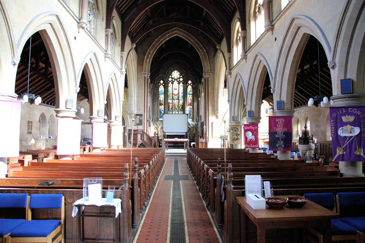
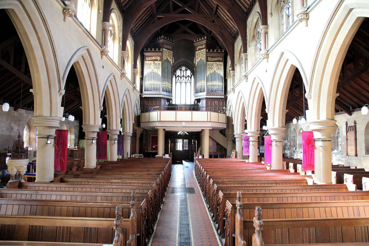
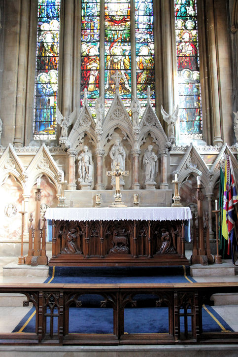
St.
Martin, in the Bull Ring. © Peter Morgan.
Another view, © Derrick
Reeves. Another view,
an interior view,
the altar and East
Window, and the
West Window, all © John Balaam (2011). Link.
Grade II* listed -
link.
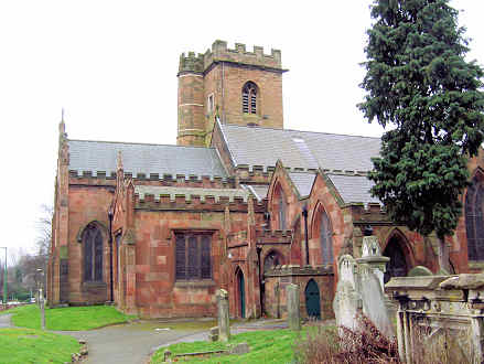
St. Nicholas at King's Norton. It's not
well seen by Streetview, but here are two views anyway -
1,
2. SP 0493 7895.
Link.
Grade I listed. A monument in the churchyard is listed as
grade II.
St.
Paul, in St. Paul's Square, in the Jewellery Quarter.
SP 0648 8747. © Peter Morgan. A 2021 Streetview provides
another view.
Link.
Grade I listed, wherein it's dated to 1776-9.
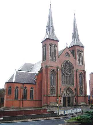
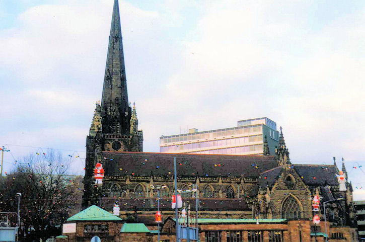
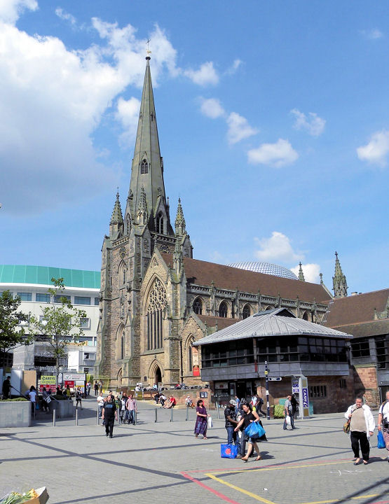
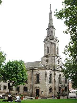
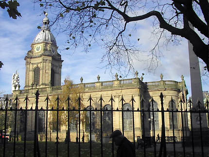
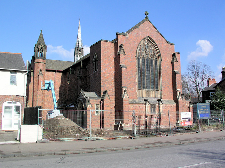
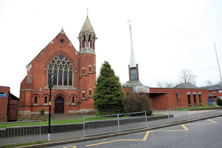
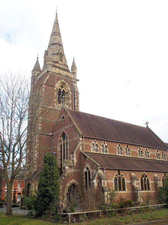
St.
Philip, originally a church, was elevated to the status of cathedral in 1905.
SP 0694 8703. © Peter
Morgan. Another view, © Peter Fowler. An old
print, captioned "The Cathedral Church of St. Philip". © Colin Waters'
Collection. Link1.
History page.
Its
grade
I listing dates it to 1709-1715. For other related listed features, see
here.
The
St. Stephen
the Martyr on Shepley Road and Edgewood Road, Rednal. Peter
describes it as "disused", but if this is correct it must be a very
recent closure, as a 2022
Streetview
shows it with a sign saying
"celebrating 70 years", and it still has a live
website. © Peter
Morgan (2023).
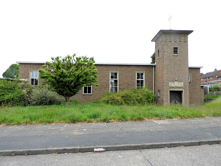
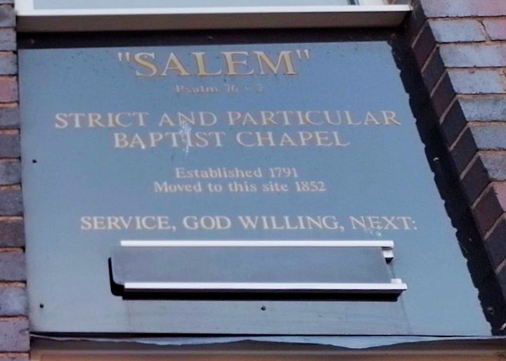
Salem Strict and
Particular Baptist Chapel on Albion Street, as seen by Streetview in
2024. The
date-stone advises that there has been a chapel on the site since
1852, the congregation having previously been on a different site or
sites since 1791. Kevin Price advises that the present building dates
from the 1950's, it having been re-built because of wartime damage. SP 0604 8750. © Alan Marsden (2024).
The adjacent building,
on the corner of Albion Street and Frederick Street, is the site of an
otherwise unidentified Chapel, shown on
on-line maps from the earliest available (1890) to the latest (1959).
Howard Richter's researches have confirmed that it was the Calvinist
(i.e. Methodist) Chapel mentioned
here as a "handsome structure in Frederick street". A map
(of 1887-8 vintage) labels it as
Salem Chapel (Particular Baptist), and this
source (see the Baptists : Strict Baptists section) fills out
it's story as follows - the chapel was registered for worship in 1851 by
a Calvinist congregation which had moved from a chapel on Bartholomew
Street. On or about 1854 the congregation changed their allegiance to
the Baptist cause. It's site was seen by
Streetview in
2024 - the single storey Salem can be seen to its left.
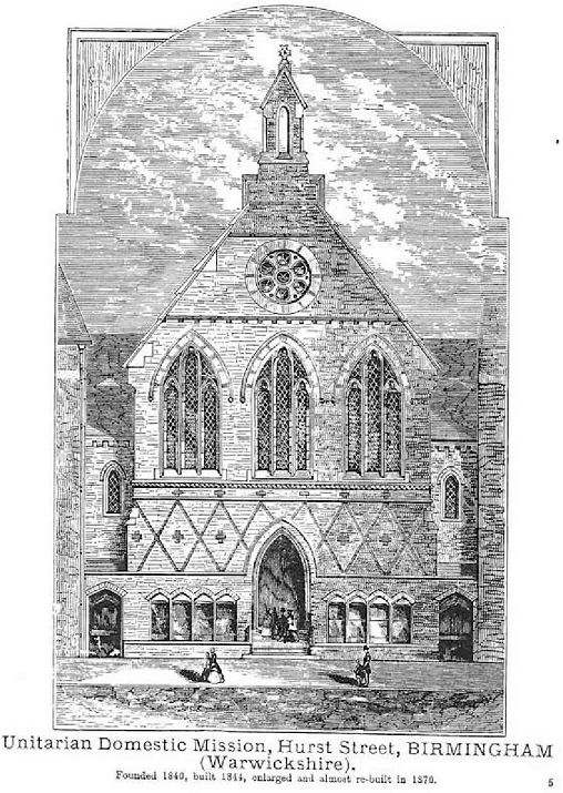
Unitarian Domestic Mission on Hurst Street. Founded 1840, built 1844, and enlarged (and largely
re-built) in 1870. © unitarian.co.uk. This, and many other old engravings on this website, are reproduced from the downloadable books on the Unitarian Church Headquarters website
here. The books are Pictures of Unitarian Churches by Emily Sharpe (1901) and the 1914 edition of
Nonconformist Church
Architecture by Ronald P. Jones M.A, (Oxon), and the images are reproduced by kind permission of James Barry of Unitarian Church Headquarters.
My appreciation also to Mike Berrell for his efforts in this regard.
Welsh Congregational Church on St. Chad's Queensway. © Rob Brettle.
Aston
Lichfield Road Methodist Church. © Rob Brettle.
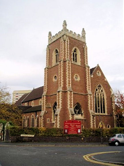
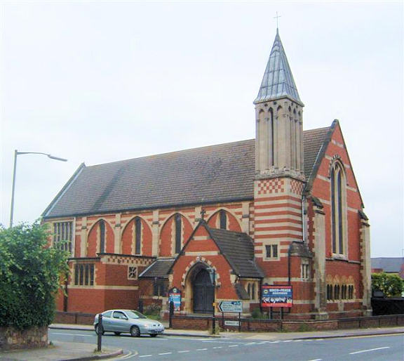
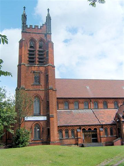
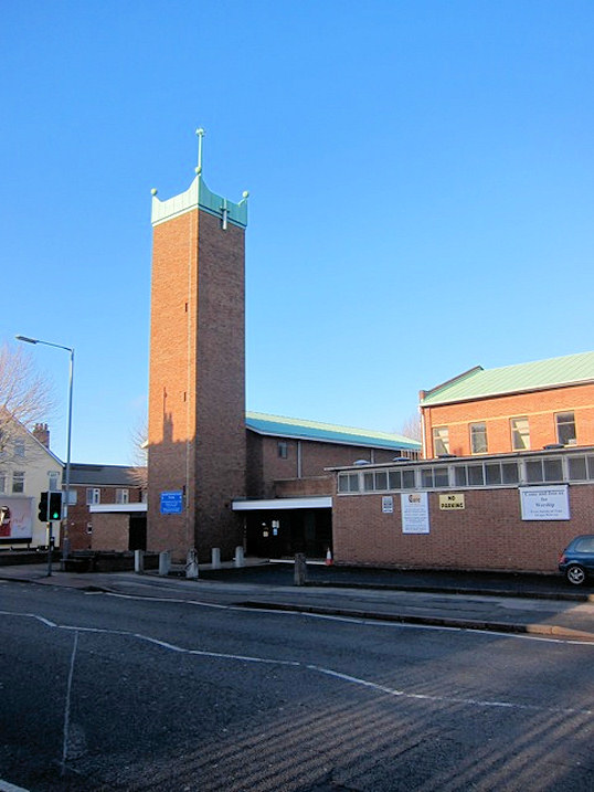
St. Peter and St. Paul.
SP 082 899. © Chris Kippin.
Link.
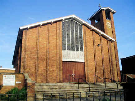
Salvation Army. © Rob Brettle.
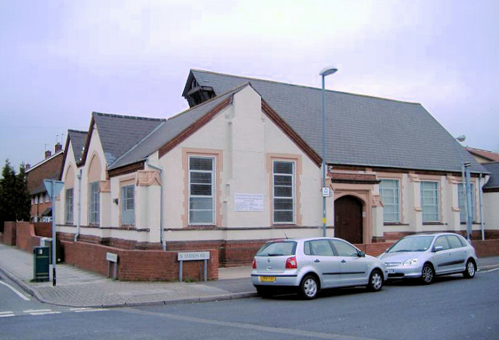
Shiloh Pentecostal Fellowship on Station Road. SP 079 903.
© Mehmood Naqshbandi (2009).
Victoria Road Evangelical Church. © Rob Brettle.
Balsall Heath
Bearwood
Redeemed Christian Church
of God on Barnsley Road. Marked on a 1975
map as Sandon Road Methodist Church, the building in John's photo was a large
addition (sometime between 1888 and 1904) to an existing Wesleyan Chapel seen
here on Google Maps. SP 024 863. © John French.
Sandon Road Methodist Church
on Sandon Road was, according to a 1975 map, a Christian Science Church (which
appears to date from the 1950's). When they departed, and the Methodists moved
in, is not, at present, known. SP 024 865. © John French.
Billesley
Assemblies of the
First Born (Pentecostal) on the south side of Brook Lane, as seen by
Streetview in 2012. As can be seen, it used to be a Baptist Church, and
was built in 1927. The sign had been blotted out by the time of the
Streetview visit in
2021. SP 0873 8133.
Link.
Community of Christ
Birmingham (2012 Streetview), on Yardley Wood Road. A better photo
is available
here.
SP 0870 8066.
Link.
Full Gospel Tabernacle, also on Yardley
Wood Road. Streetviews from
2022 and
2016. SP 0883
8099. Link.
Holy Cross stands on Beauchamp Road at SP
0877 8039. It was seen by
Streetview in
2020. Link.
Another page mentions their 75th anniversary in 2021, so built in
1936.
Masjid Abu Bakr
Billesley on Yardley Wood Road, as seen by Streetview in 2022. SP
0879 8087. Link.
A Methodist Church stood on the south side
of Trittiford Road. It was originally Wesleyan, dating from 1928, and
available maps show that it remained in use at least into the late
1950's. It's noted
here as
having closed in 1998. There are some very small photos available
here at the bottom of the page. You need to register to get a better
look. It has been demolished, and a Nursing Home now stands on the
site (2021
Streetview). SP 0895 8088.
Brandwood End
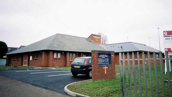
Calvary Chapel (Elim
Pentecostal) on Allens Croft Road and Brandwood Park Road, as seen by
Streetview in 2022. SP 0585 8029.
Link. The
history page dates it to 1959-62.
Monyhull Colony Church on St. Francis Drive
and Lindsworth Close originally served the nearby mental hospital (Monyhull
Colony). The BBC tells some of its story
here.
This
source says the chapel was opened in 1917 and later dedicated to St.
Francis, and re-named in 2004 to Monyhull Church. Streetview provides
two different views in 2008 -
1,
2. SP 0671 7917.
The cemetery on Woodthorpe Road has a double
Mortuary Chapel
(2022 Streetview) at SP 0705 7991. The chapels are aligned N.E.-S.W. The
N.E. chapel is labelled as Nonconformist on an old large scale O.S. map,
the other being Church of England.
Grade II listed, wherein they are dated to 1898.
St. Bede stands on Bryndale Avenue and
Doversley Road at SP 0631 7998. It was seen by
Streetview in
2020. An on-line source says that the registers commence in 1960.
Facebook.
Brookfields
A Baptist Chapel used to stand on
Spring Hill at SP 0520 8759. Dated
here to 1886, it also notes that it was still active in 1956. Since
demolished, its site was seen by
Streetview in
2021. Its frontage was closer to the road (near the low railings) than
the housing which replaced it.
What is presumably its replacement stands today on Ellen Street and
Camden Street at SP 0550 8760.
Birmingham Central
Baptist Church was seen by Streetview in 2015.
Link.
Brookfield Chapel stood on Crabtree Road.
This
source says it was originally Methodist New Connexion, and existed
by 1886. It changed hands in 1897, whereupon it was Baptist (as Zoar),
and is known to have survived at least until 1941. Its
site (on the
grass) was seen by Streetview in 2021. SP 0517 8808.
The demolished Brookfield Mission Room
stood set back from the east side of Ellen Street at SP 0566 8784. It
shows on the oldest available map (1887) but on a map of 1904 is shown
as Hall. In a
Streetview from 2023, its site was behind the grey building in the
background.
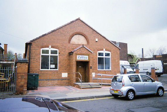
Masjid al Saifee
(Dahwoodi Bohras) stands at the north-east corner of Icknield Street and
Hingeston Street, and was seen by Streetview in 2023 -
1,
2. SP 0566 8779.
Link1.
Link2.
New Testament Church of God
on New Spring Street, as seen by Streetview in 2022. It was originally
Methodist New
Connexion, dated
here to 1893, successor to Brookfield Chapel on Crabtree Road. SP
0537 8782.
The Rock - New Testament Church of God on
George Street West, near its junction with Spring Hill. It was previously St. Peter,
the consecration of which is dated
here to 1902.
Another view. SP 0537
8758. Both © John
French.
Hall Green
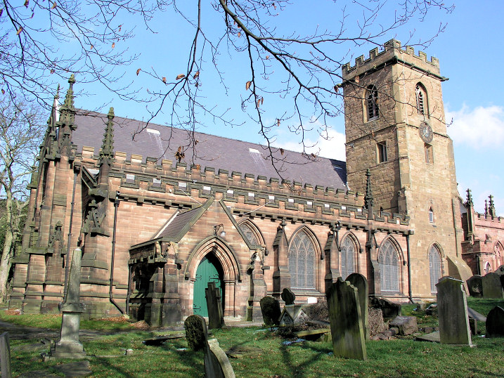
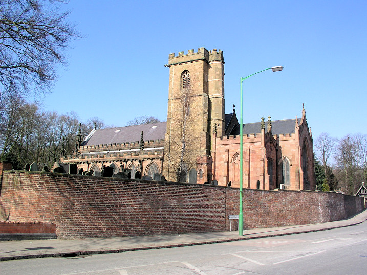
Handsworth
Beulah Hills
Apostolic Church on Bacchus Road. SP 046 887. © Chris Emms (2010).
Handsworth Cemetery on Camp Lane and Park Lane has a
Mortuary Chapel
(2015 Streetview) at SP 0294 9073. Another
2015 Streetview.
A splendid building, it's dated to 1909-10 in its
grade I listing.
Wikipedia entry.
St. Andrew on Oxhill Road. Another view.
SP 0442 9068.
Both
© Dennis Harper (2006). Link.
History page.
Grade
I listed, wherein it's dated to 1907-9.
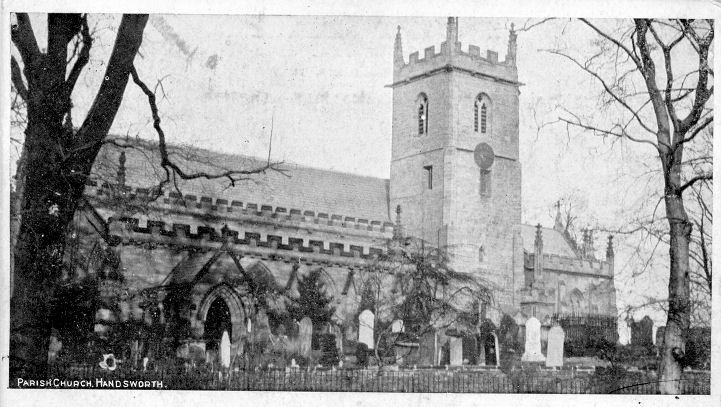
St. Mary on Hamstead Road. SP 056 903. ©
Roy Graham. Two further views - 1, 2.
both © Dennis Harper (2006), and an
old postcard view
from his collection. The card was posted in 1905.
Grade II* listed.
Harborne
Harborne
Baptist Church on Harborne Park Road.
Another view.
SP 031 844. Both © Dennis Harper (2016).
Link.
Harborne Methodist
Church (interior view only). © Aidan McRae Thomson.
St. Mary
(R.C.) on Vivian Road. Three additional views -
1,
2,
3. SP 033
843. All © Dennis Harper (2016).
Link.
St. Peter,
on Old Church Road. © Dennis Harper (2016).
Link.
Grade II listed.
Hay Mills
A Baptist
Chapel (General) shows on only one available map, that of 1888,
on the south side of Coventry Road, and west of George Road, at circa
SP 1116 8508. It isn't clear exactly which building the label is
meant to be applied to, but it would have stood somewhere to the left of
the road seen here
on a Streetview of 2022.
A Congregational Chapel used to stand on
the south side of Coventry Road at its corner with Kings Road (just a
short walk from the above Baptist Chapel), at SP 1128 8506. Present on a
map of 1905 and absent on one of 1887, it was showing as active on a map
of 1959. Photos of it can be seen
here
(scroll down), where it's dated to 1899, and demolished in 1984 for
road-widening. Its site can be seen in this
Streetview from
2022 - it stood in line with the extant terraced housing, separated from
it by two additional terraced houses, and extending roughly to the
silver car.
The Madrassa
(2022 Streetview) is also on the south side of Coventry Road, further
east at SP 1155 8500.
Facebook.
Namdhari Sangat Gurudwara (2022 Streetview)
on the south side of Coventry Road, west of Ada Road,
was converted from a large cinema. Signage was in place before the first
Streetview in
2008. The sign was later taken down, but there is a sign on the side of
the building - 2022
Streetview. It's better seen
here.
SP 1166 8500.
St. Cyprian
(2022 Streetview) on The Fordrough. Its
grade II listing (which calls it St. Cyprian and St. Chad) dates it
to 1873-4, "incorporating a slightly earlier schoolroom as its chancel".
SP 1091 8501.
Link1.
Link2.
Wikipedia entry.
Sirajam Muneera
Jamia Masjid, on Francis Road, as seen by Streetview in 2020. A more
recent photo, with signage, can be seen
here.
SP 1137 8493.
Facebook.
A Wesleyan Methodist Chapel used to stand
set well back from the north side of Coventry Road at SP 1166 8509. It
shows on maps of 1913 and 1938, but isn't labelled as a place of worship
on a map of 1951. Demolished, its
site was seen by
Streetview in 2023.
Hockley
All Saints
on All Saints Street. Link is to an external website, with a
1933 photo of the church. It was built in 1833, and demolished in 1966 (source)
or 1973 or soon thereafter (source).
More old photos
here and
here. As of 2024
its site remains undeveloped (Streetview). SP 0537 8819.
St. George in the Fields used to stand on
Tower Street and Great Russell Street, at SP 0660 8810. Dated variously
to 1821 or 1822, and demolished in 1960 or 1961 (sources differ), its
churchyard remains, and includes
grade II listed gates and the
grade II listed tomb of
Thomas Rickman,
the architect of the church. The tomb can be seen at the centre of a
2012 Streetview
of the churchyard.
Salvation Army on Nursery Road, Hockley. © Rob Brettle.
Kings
Heath.
Kingstanding
Cedar Church on
Lambeth Road, as seen by Streetview in 2022. SP 0736 9559.
Link.
Christ
the King (R.C.) on Warren Farm Road. SP
0840 9396. © Aidan McRae Thomson.
Link.
St. Mark
on Bandywood Crescent as seen by Streetview in 2017. Another view in
2012. SP 0760
9538. Link.
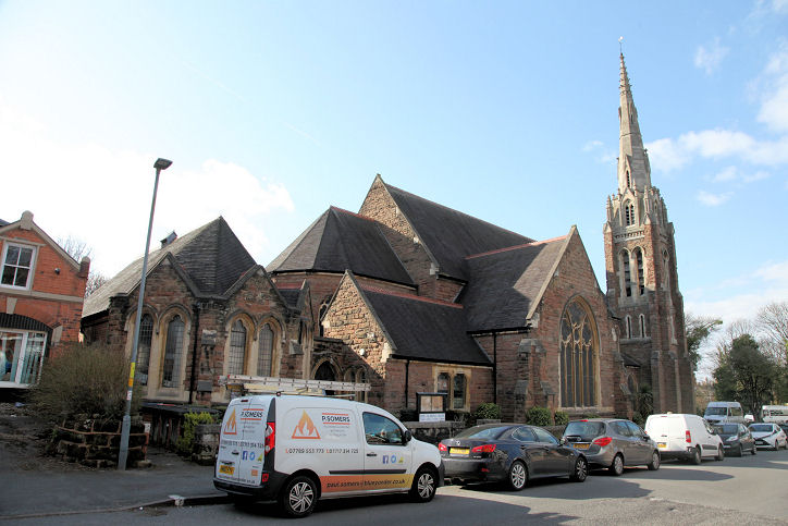
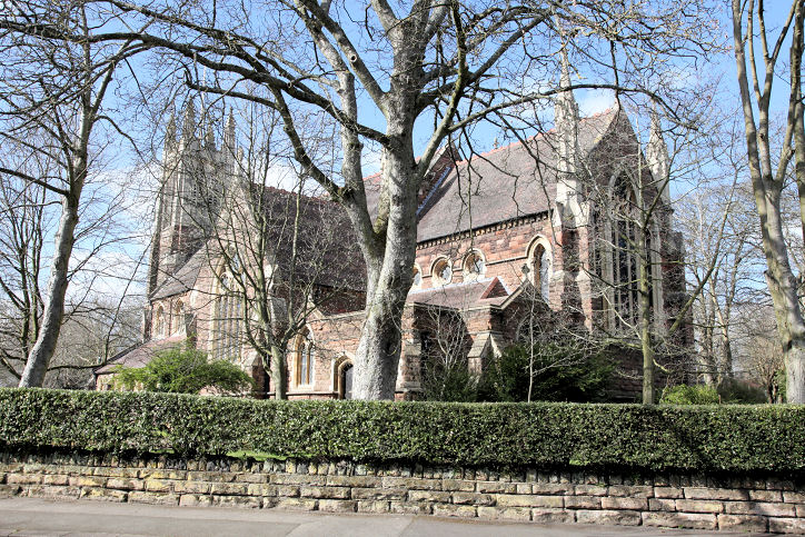
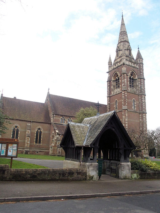
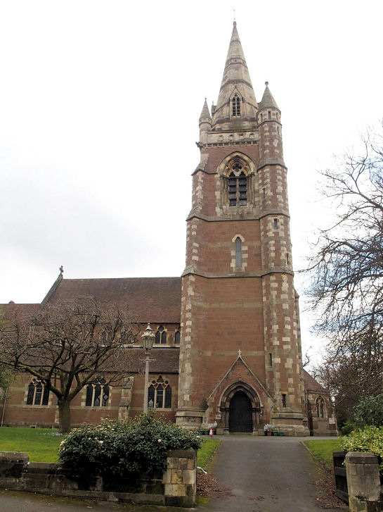
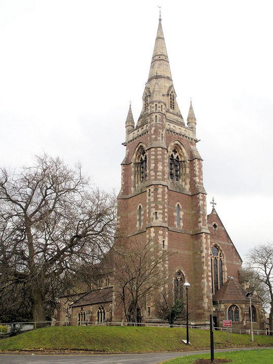
Moseley
Calvary
Church of God in Christ on Oxford Road. According to this
pdf file, this was originally a Baptist Church of 1888.
Another view.
Both © Dennis Harper (2019).
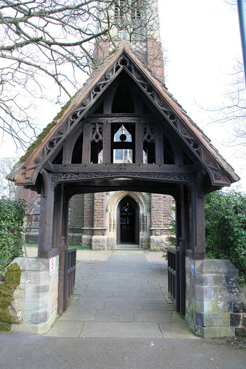
St. Agnes
on Colmore Crescent. Two additional views -
1,
2, the
lych-gate, two of the interior -
1,
2,
the altar
and the
font. All © Dennis Harper (2019).
Link.
Grade II listed.
St. Anne on
Park Hill. Three additional views -
1,
2,
3. All ©
Dennis Harper (2019). Link.
Grade II listed.
St. Columba
(U.R.C.) on Chantry Road.
Another view.
Both © Dennis Harper (2019).
Link.
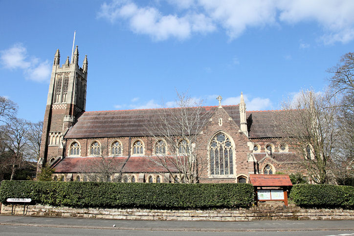
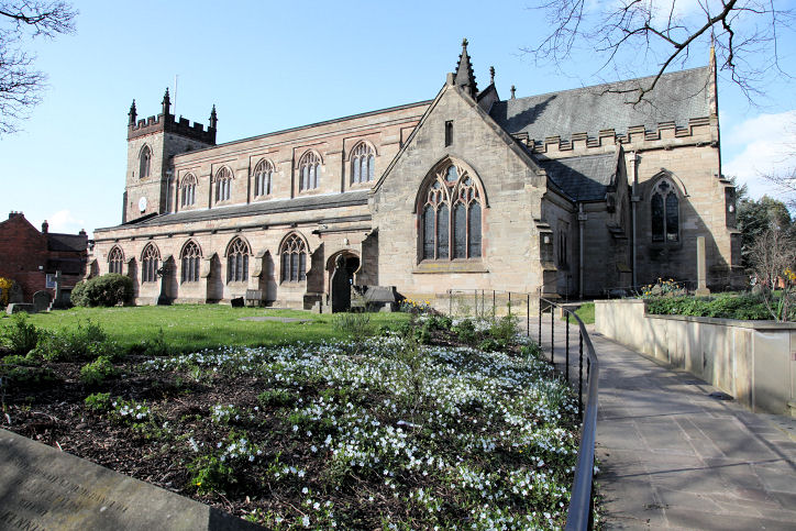
St. Mary,
on St. Mary's Row. The tower is of 1514, but most of the rest of the
church dates from a Victorian times. Two additional views -
1,
2. All ©
Dennis Harper (2019). Link.
Grade II listed.
Quinton
Christ Church. ©
Chris Emms (2010).
Link.
Quinton Methodist Church. © Chris Emms (2010).
Link.
Sheldon
Masjid Yousuf
is the former Sheldon Gospel Hall on Barrows Lane at SP 1426 8430. It shows
as a Mission Chapel (Nonconformist) on a map of 1887. The most recent
Streetview is of
2020 when it was still the Gospel Hall.
Link has an interior view.
St. Giles on
Church Road, as seen (distantly) by Streetview in 2017. SP 1520 8464.
The church website
(where there is a photo) has a comprehensive
visitors guide.
Wikipedia entry.
Grade II* listed.
St. Stephen's Indian (Malankara) Orthodox
(2022 Streetview) on Brays Road was previously Church of Jesus Christ of
Latter-day Saints, and originally Methodist. A comment
here says that it went from Methodist to LDS in the 1970's. The
National Archives holds documents pertaining to the Methodist Church
for the years 1952-73. It was LDS when Streetview went past for the
first time in 2008,
and LDS signage remained until 2016. In the 2018 and 2019 Streetviews,
there is no signage, and the current church signage was in place by
September 2020. SP 1520 8510.
Link.
St. Thomas (2020
Streetview) on Garretts Green Lane, Garretts Green. This
source dates it to 1958-60, and says it was a "replacement
of sorts to St Thomas’ on Bath Row which had been bomb damaged during
the Second World War.
Bath Row is in the city centre. SP 1404 8574.
St. Thomas More (R.C.)
on Horse Shoe Lane, as seen by
Streetview in 2020. It's dated in its
grade II listing to 1968-9, however the
church website says
it was opened in 1967. SP 1490 8424.
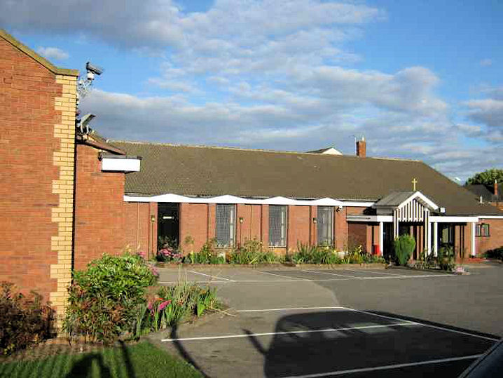
Sheldon Community Church (Assemblies of
God, Pentecostal) meets in
Mapledene Primary School
(2022 Streetview) on Mapledene Road. SP 1598 8462.
Link.
Small Heath
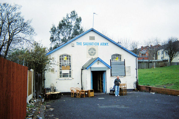
The former Salvation Army Hall on Jenkins Street. ©
Rob Brettle.
Small Heath Baptist Church. © Rob Brettle.
South
Yardley
Sparkhill
Methodist Church
on Warwick Road and Medlicott Road. Another
view. Howard Richter advises that there was an earlier Wesleyan church on this site,
showing on maps of 1904 and 1938 (it had been built in 1892), but it became a victim of WWII bombing.
The present church dates from 1959 and closed in 2022. SP 0918 8436. Both © Martin Richter (2012).
Link1
(has interior photos).
Link2.
Stechford
Tyseley
Jamia Islamia Razvia
Zia Ul Eiman (2021 Streetview) stands next door to St. Edmund on
Reddings Lane. SP 1048 8334.
Link.
The former
Methodist Church
(originally Primitive Methodist) on Warwick Road and Medina Road, as
seen by Streetview in 2022. The congregation left no earlier than 1981
(based on the dates of church documents held by Birmingham Archives),
subsequently joining with the Acock's Green Methodist congregation (for
which, see the Acock's Green page).
SP 1049 8392. Pevsner dates it to 1909-10, and describes it as a
Gurdwara (i.e. Sikh) before going on to note that the former Sunday
School immediately to its west (SP 1048 8393) had been re-fronted (in
2019) by Shree Hindu Community Centre, which is still in occupation,
apparently of both buildings, and is now known as
Shree Laxmi Narayan Mandir. The pre-work building can be seen in
a 2019 Streetview,
work in progress (2020)
and almost finished in
2022.
St. Edmund on
Reddings Lane, as seen by Streetview in 2021. It can be dated on map
evidence to the first half of the last century. SP 1048 8336.
Link1.
Link2.
Winson Green
Masjid Abu Bakr
Siddique (2020 Streetview) on Grove Street. SP 0360 8790.
Link.
Yardley
Digbeth-in-the-Field U.R.C. on Moat Lane, as seen by Streetview in
2020 and
2022. SP 1366
8531. Link.
The about
us page dates the church building to 1958.
St. Edburgha
on Church Road. SP 1349 8630. From an
old postcard (franked 1909) Steve Bulman's Collection. Two modern views from
Streetview in 2022
and 2008.
Link.
History
page.
Grade I listed, wherein it's dated to the 13th century and later.
Yardley Wood
The
Baptist Church
on Yardley Wood Road, as seen by Streetview in 2016. Available maps
can only indicate that it was built in the second half of the last
century. SP 0897 7944. Link.
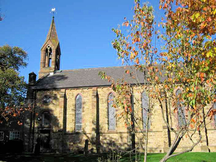
Christ Church stands on School Road at SP 0928 7951. It
was seen by
Streetview in 2022.
Link. The
about us page dates it to 1848-9.
Harvest Church
(2012 Streetview) on Priory Road is the former Dog and Partridge pub
of
1929. Earlier Streetviews show signage for Harvest Church back to
March 2019, signage for
Spirit Cafe in June 2016,
and signage for Haven Church from
September 2012 back to
the earliest Streetview in 2008. SP 0989 7963.
Link1.
Link2.
Our Lady of Lourdes (R.C.) stands on
the north-east side of Trittiford Road at SP 0959 8046. There are two church
here, the first of 1935, with the tiled roof in this Streetview, and the second
church of 1966 also seen by Streetview (both from 2020).
Link. The
history page
has a good photo.
Potter's House (Pentecostal)
on Priory Road and
Slade Lane, as seen by Streetview in 2022. It shows as a Mission
Room on a map of 1903, a Baptist Chapel in 1914, Gospel Church in 1937, and in
2018 when it closed, it was Yardley Wood Full Gospel Church (source).
A 2022 Streetview provides
another view. SP 1008 7925.
|
|