|
|
Bedfordshire
Bedfordshire on Wikipedia.
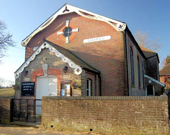
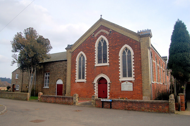
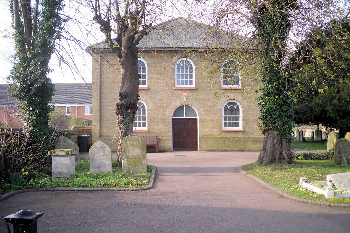
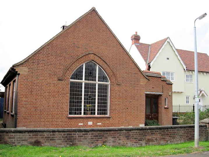
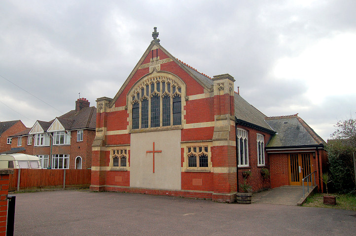
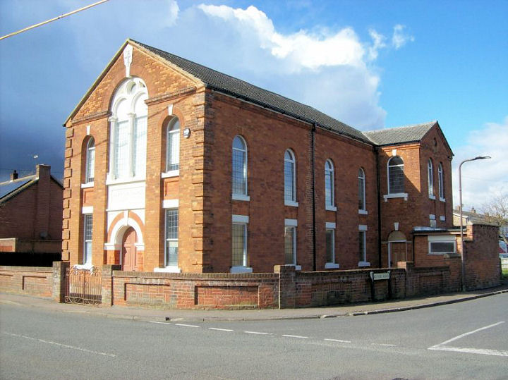
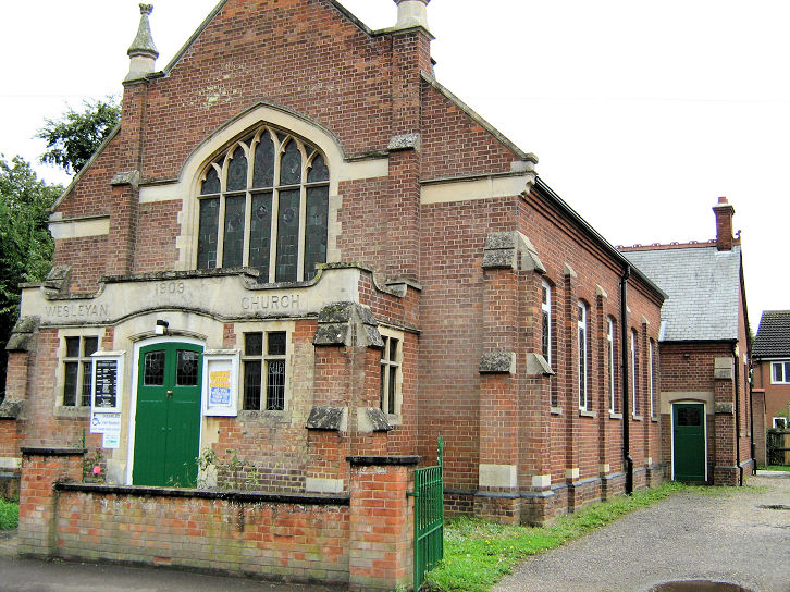
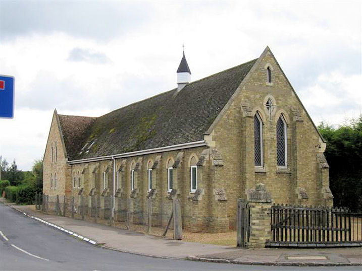
Aley Green, the Methodist Church on Mancroft Road, which was built as Wesleyan. It
pre-dates a map of 1880. TL 0678 1836. ? Bedfordshire and Luton
Archives & Records Service (2007).
Link.
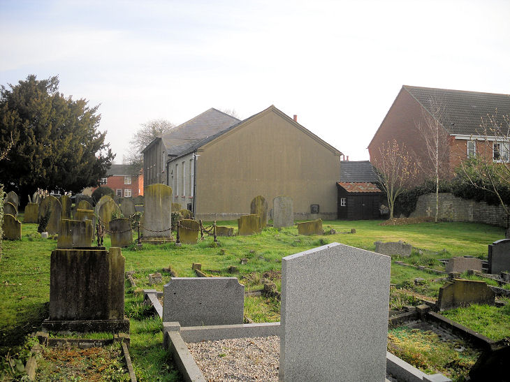
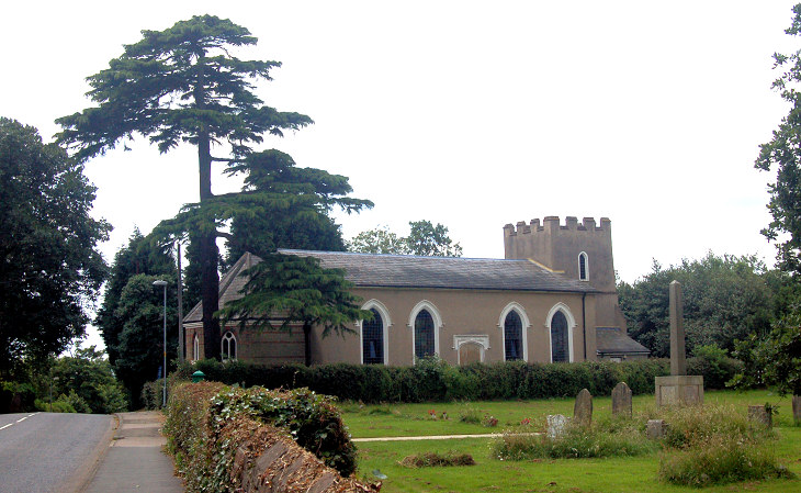
The Cemetery on Mancroft Road has a Mortuary Chapel at TL 0689 1823. It
stands immediately behind the lodge, and can be seen
here in a Streetview
of 2019.
Ampthill.
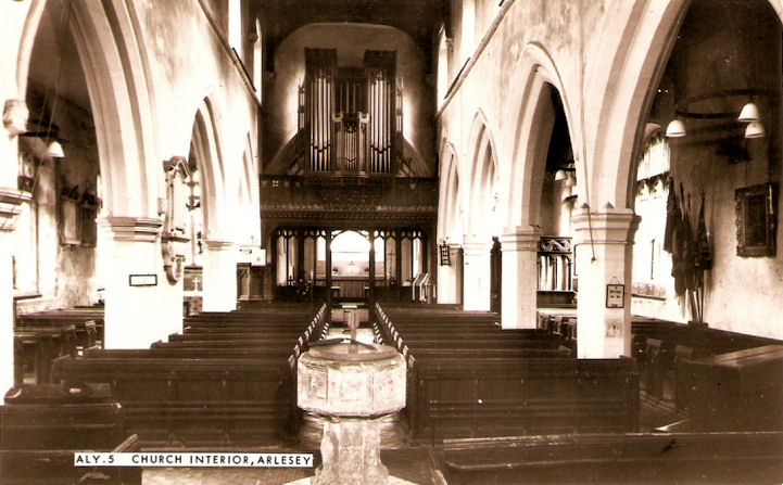
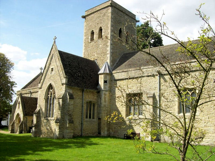
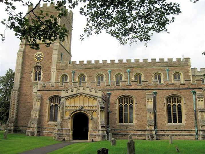
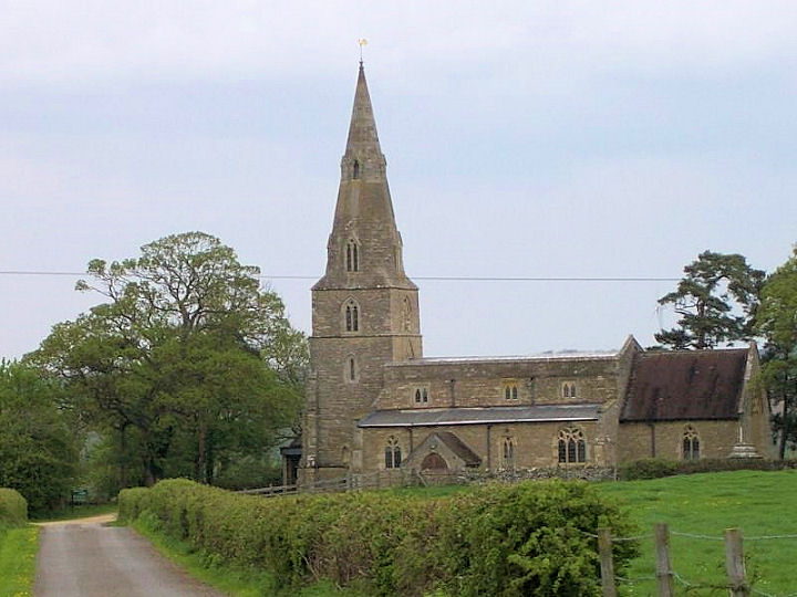
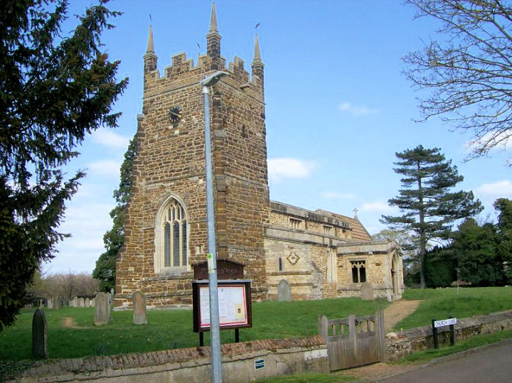
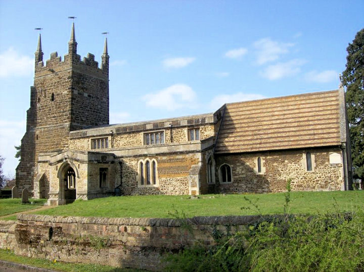
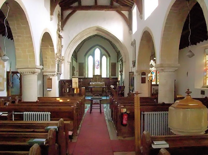
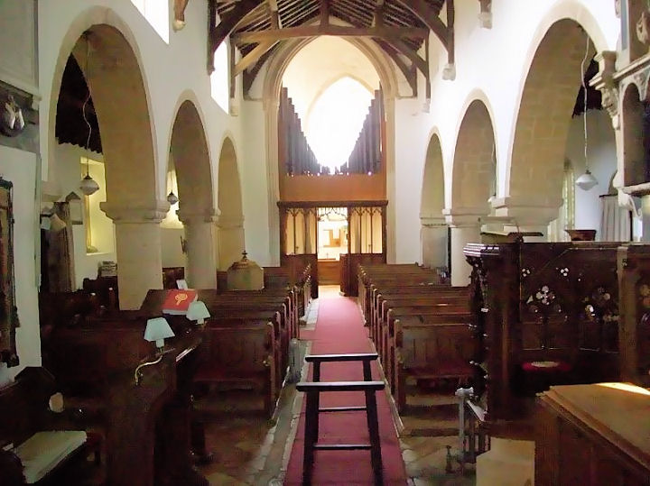
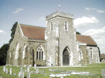
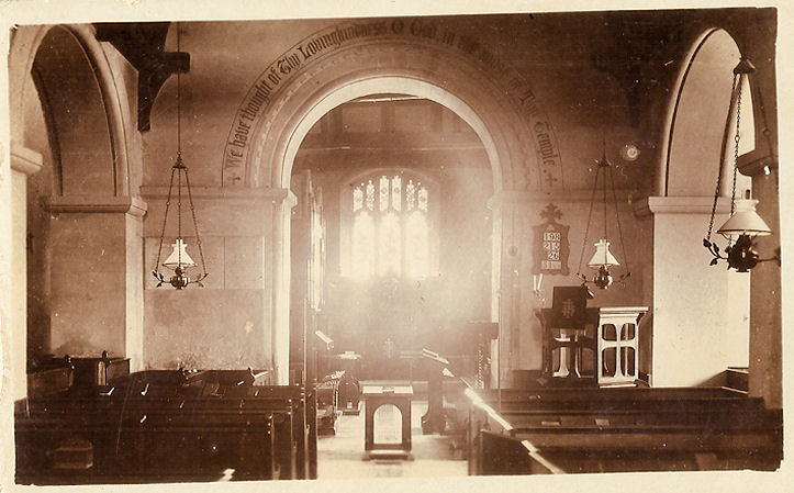
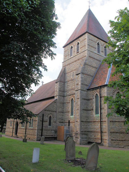
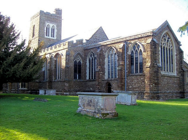
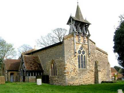
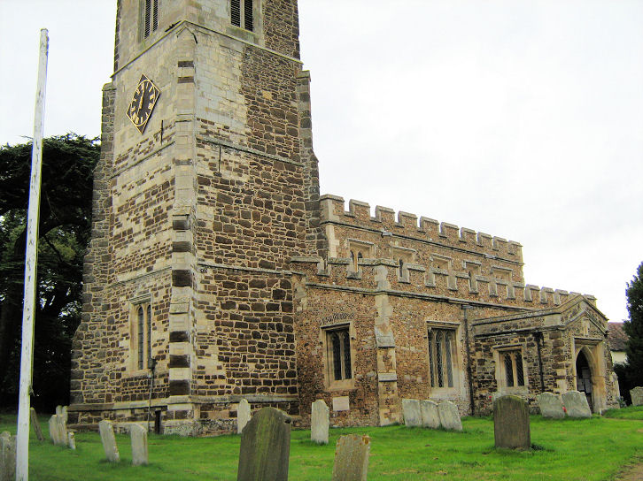
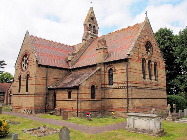
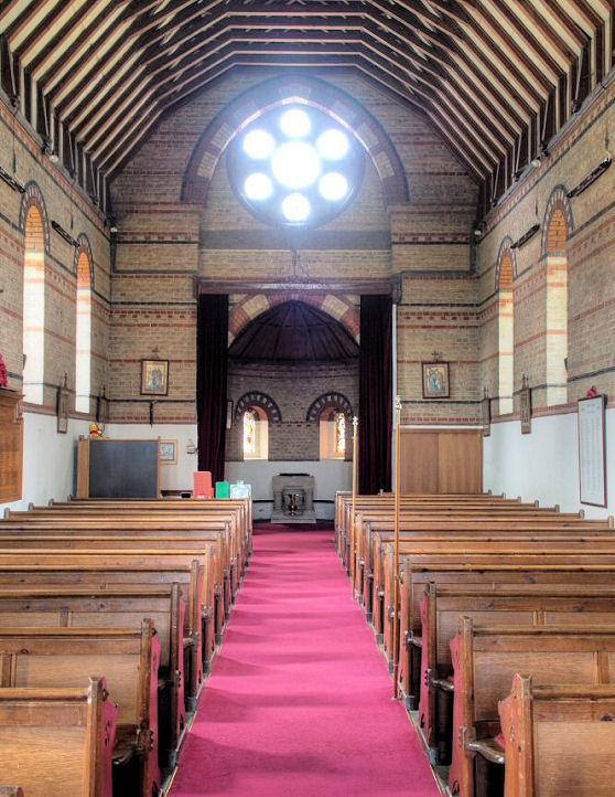
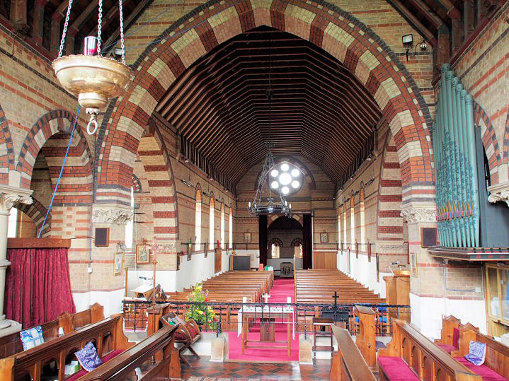
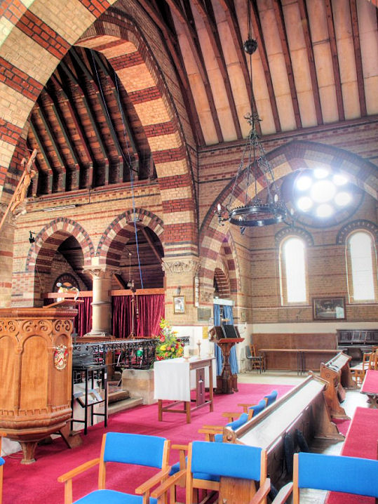
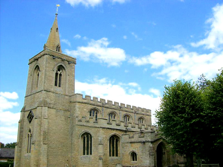
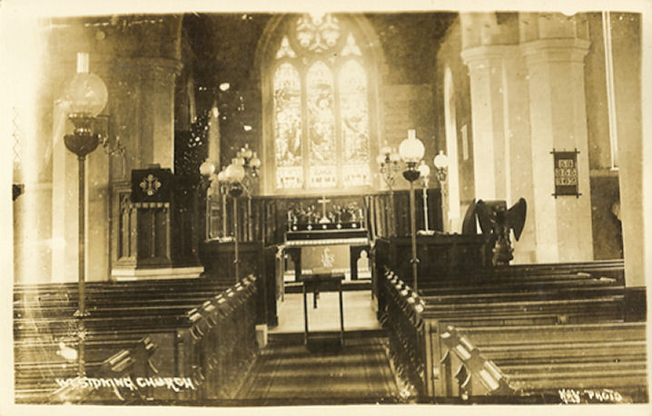
Arlesey, St. Peter. TL 1919 3754.
?
Les Needham (2010). Interior view,
from an old postcard in Judy Flynn's Collection.
Link.
Grade I listed.
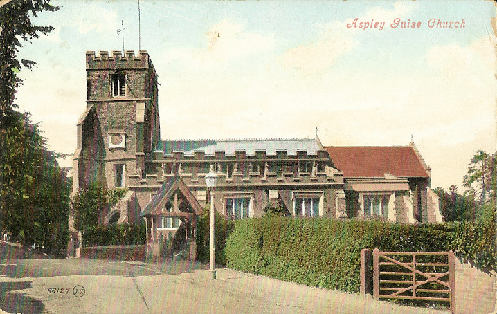
Aspley Guise, St.
Botolph. SP 9424 3625. ? Bill McKenzie. An old postcard view, from Judy Flynn's Collection.
Link.
Grade II* listed.
Courtney Memorial Evangelical Free Church on Church Street has a
date-stone for 1842. The 25" O.S. map of 1901 labels it as Mission
Room. It can be seen on a
Streetview from
2018. SP 9421 3595.
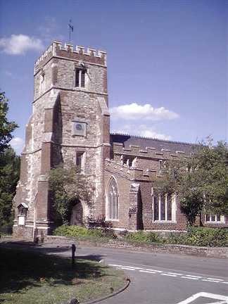
Aspley Heath, St. Michael, SP
928 354. ? Bedfordshire and Luton Archives & Records Service (2007).
Interior view, from an
old postcard in Judy Flynn's Collection. Judy advises that the Woburn
Sands referred to on the postcard is the parish name.
Link1. Link2.
Grade II* listed.
Astwick, St. Guthlac. TL 2136 3857.
? Les Needham (2010).
Grade II* listed.
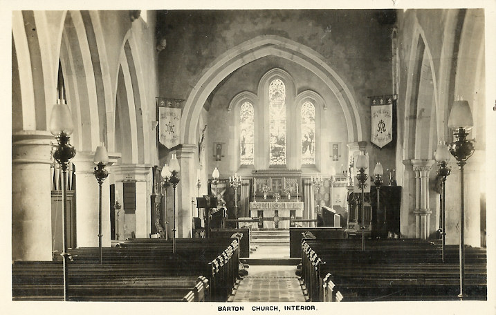
Barton-le-Clay, St. Nicholas, on Church Road. TL 0853 3041.
?
Bill McKenzie. Interior view, from an old postcard in Judy Flynn's Collection.
Link.
Grade I listed. A
Strict Baptist Chapel
stands off what is today the B655 at TL 0825 3073. ? Gerard Charmley (2021). Barton Methodist Church stands on Sharpenhoe
Road at TL 0805 3085.
Streetview saw it in 2019. The site of what may be its
Wesleyan predecessor lies a short distance west of the Methodist Church,
across the road, at TL 0794 3087. Evidently demolished, Streetview saw the
patch of scrub woodland
where it stood in 2019. A Primitive Methodist Chapel
is marked on old maps on Bedford Road. Nicholas Close didn't exist at the time,
but the chapel site now stands immediately south of it. The building on the site
today betrays no obvious signs of having been a chapel - a
Streetview from 2019.
TL 0813 3104.
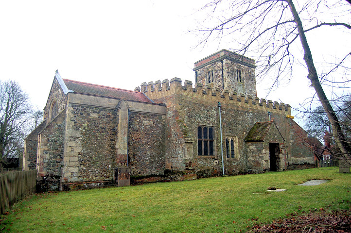
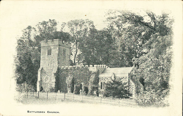
Battlesden, St. Peter and All Saints.
TL 9591 2909. ?
Bedfordshire and Luton Archives & Records Service (2008). An old
postcard view, from Judy Flynn's Collection.
Link.
Grade I listed.
Bedford.
Beeston, Methodist Church, on The Baulk.
It's labelled on older maps as Wesleyan. TL 1690 4847. ? Bedfordshire and Luton Archives & Records Service (2010).
Link.
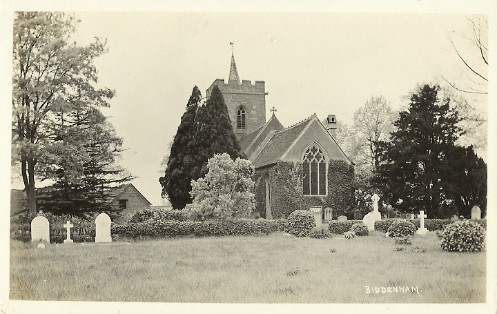
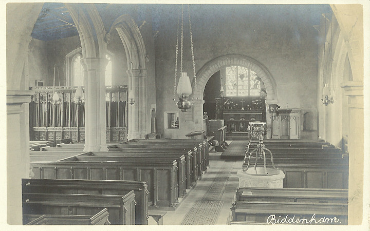
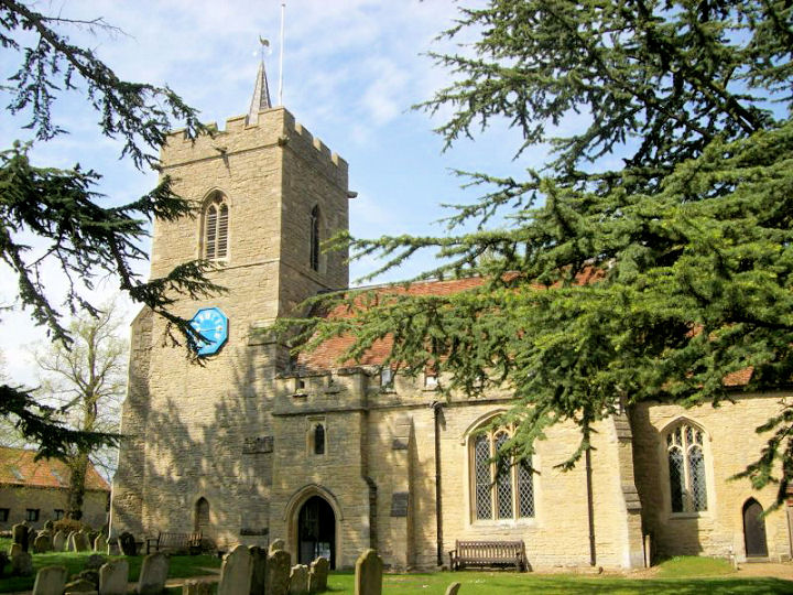
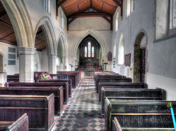
Biddenham, St. James. Interior view. TL 0141 4993. Both from Judy Flynn's
postcard collection. A modern view, ?
David Regan (2018). Link.
Grade I listed.
Biggleswade.
Billington, St. Michael and All Angels
(external link, to a photo on Wikipedia).
Interior view, from an old postcard in Judy Flynn's Collection. SP 9404
2256. Link.
Grade II* listed. A
Primitive Methodist Chapel once stood on the main road a little way
south-east of the church. Evidently demolished (see this 2009
Streetview, the chapel stood
behind the yellow bush), a low building now stands on the site (2020
Streetview). Its My Primitive Methodists
entry dates it to 1864, or perhaps slightly
earlier, and sold in 1951. TL 9421 2255. The village
Wesleyan Methodist Chapel has survived. It stands on Gaddesden Turn at TL
9410 2285, and can be seen on a
Streetview from 2009. Its My Wesleyan Methodists
entry dates it to 1835 or 1838, and sold in 1977. TL 9410 2285.
Bletsoe, St.
Mary the Virgin. Another
view. TL 0233 5833. Both � David Regan (2017).
Link.
Grade II* listed.
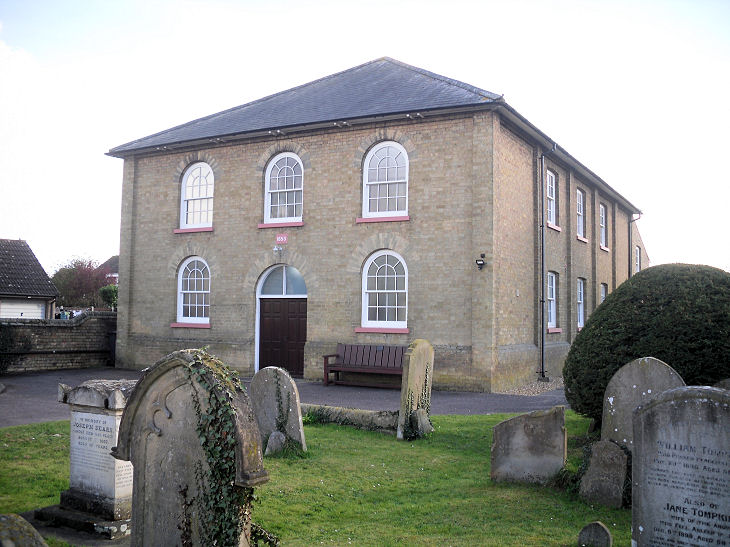
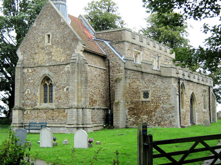
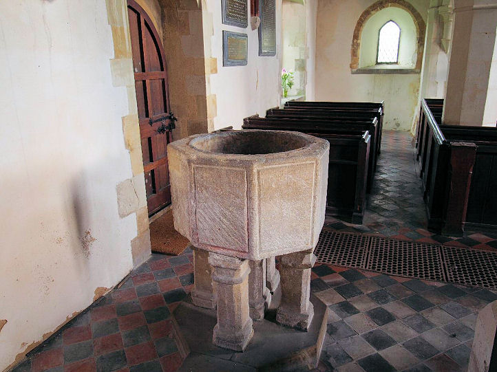
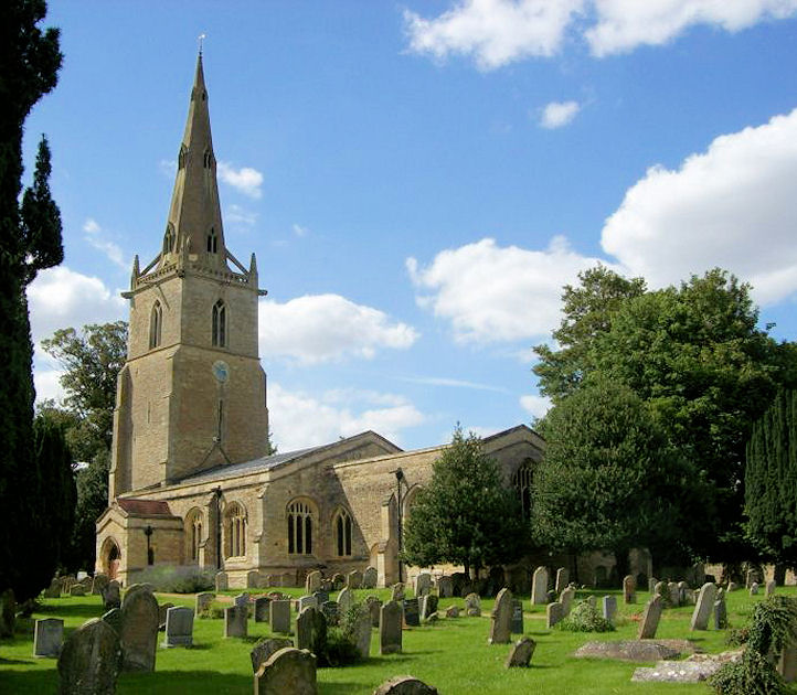
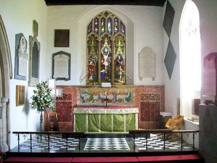
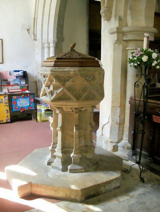
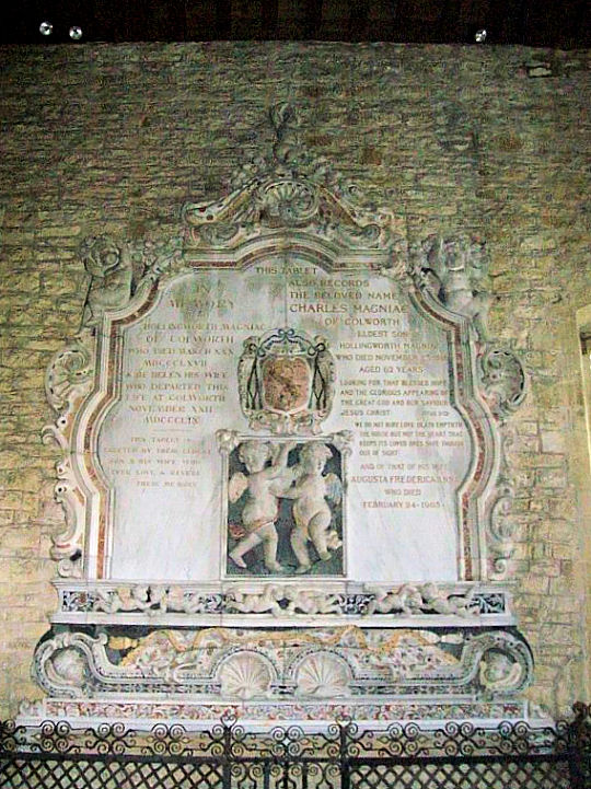
Blunham,
St. Edmund and St. James (or alternatively, St. Edmund or St. James).
TL 1530 5110. � Bedfordshire and Luton Archives &
Records Service (2007). Another view, �
Gerard Charmley (2021).
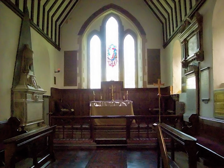
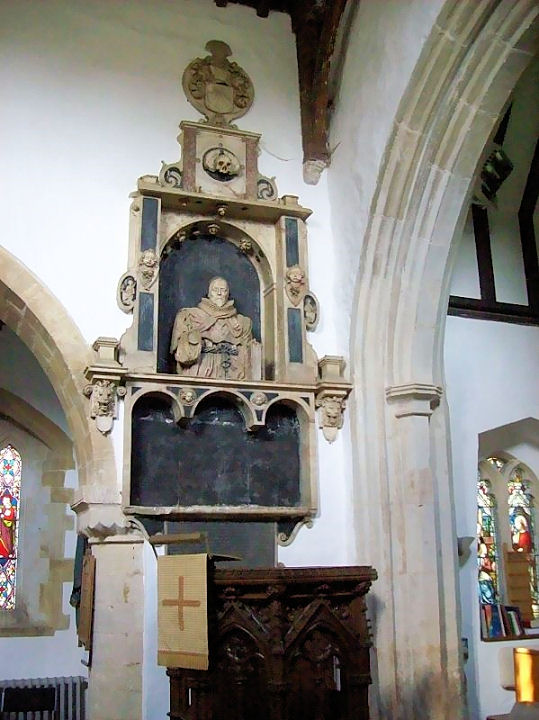
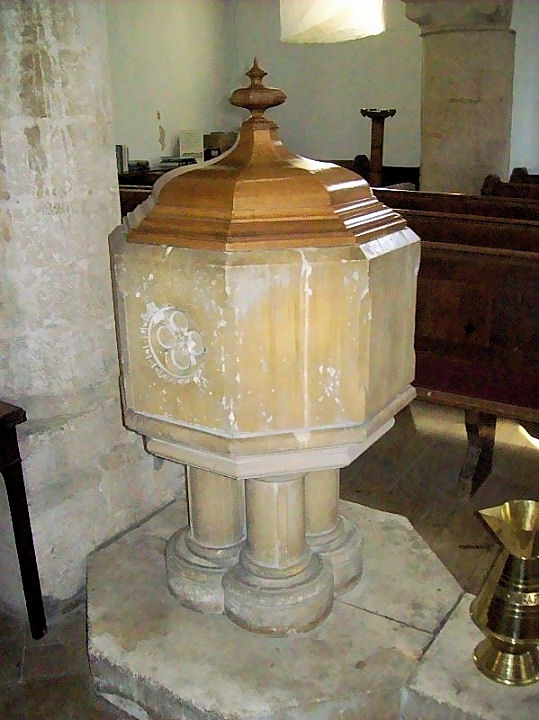
Three views of the interior - 1, 2, 3, the
reredos, a tomb, and the
font, all
� Chris Stafford (2013).
Link.
Grade I listed.
A churchyard mausoleum is also listed, at
grade II.
Family Life Church
stands off High Street at TL 1539 5138. It's marked on old maps as Baptist, and
its
grade II listing dates it to 1751, altered 1832.
Another view. Both � Gerard Charmley
(2022). By 2026 this had been re-named as King's Arms Church.
Link. Providence Baptist
Chapel (1842) stands on Park Lane, and was a splinter from the Old
Baptist Meeting (presumably the other Baptist church in this entry). The
church website has
numerous photos, and a useful
history page. � Gerard
Charmley (2021). The cemetery on Station Road has a chapel
at TL 1474 5090. It hasn't been seen by Streetview (assuming it survives) -
here's the entrance, as seen
by Streetview in 2009.
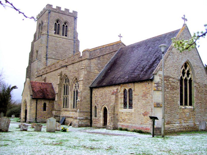
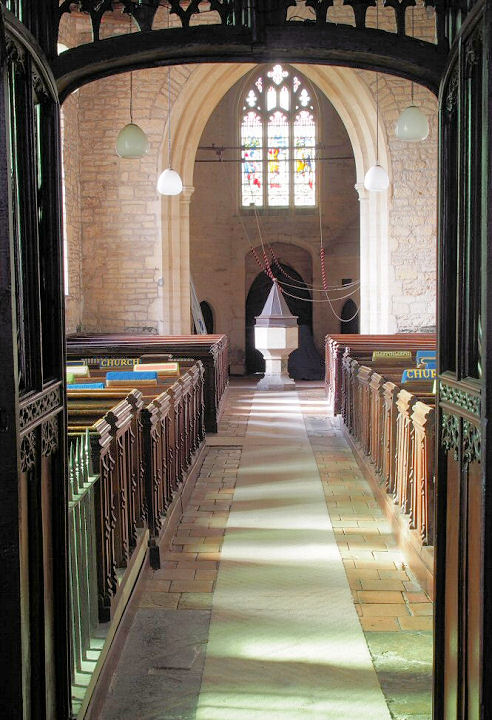
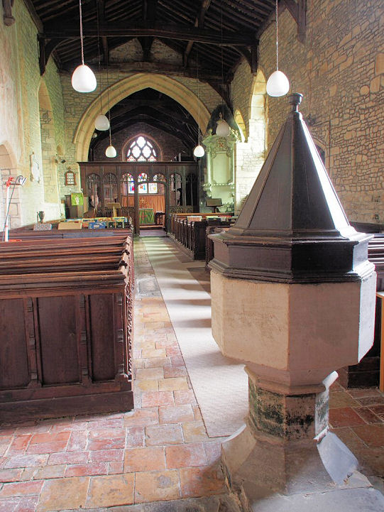
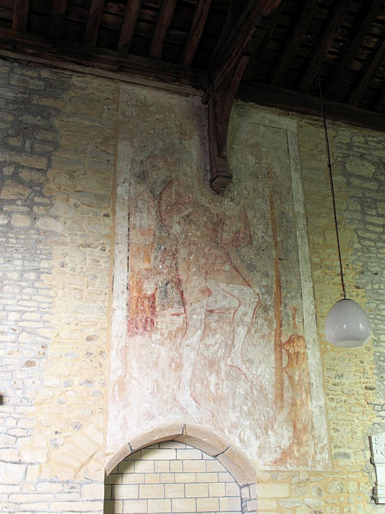
Bolnhurst,
St. Dunstan, in an isolated position to the S.W.of the
village. Another view. TL 0807 5869. Both � David Regan
(2019). Three interior views - 1,
2,
3,
wall painting, a
window, and the
organ (organ case by Pugin - see
appended listing), all � Chris Stafford (2013).
Link.
Grade II* listed.
Bromham,
St. Owen. TL 0134 5126. � Bill McKenzie. Another view, � David
Regan (2018). Link.
Grade I listed. A Baptist Church stands on
Village Road at TL 0091 5122. It was seen by
Streetview in 2019. The
Church website's
history page dates it to 1992, replacing a wooden church of the 1920's on
the same site. A photo of the earlier church can be seen
here.
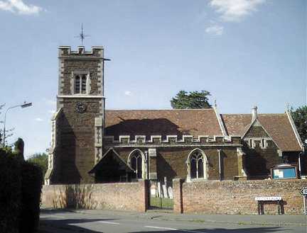
Caddington,
All Saints. TL 0640 1985. ? Bill McKenzie.
Link.
Grade II* listed. A Baptist
Church stands on Luton Road at TL 0650 1982. The modern building and its
1846 predecessor (Union Chapel) can be seen on a
Streetview from 2020.
Link.
St. Thomas the Apostle (R.C.) stands a little way south of the village on
Manor Road, at TL 0652 1902. It can be seen on a
2017 Streetview.
Link.
Campton, All Saints. TL 1299 3807. ? Bill McKenzie.
Link.
Grade II* listed. A monument in the churchyard is
listed separately as
grade II. The cemetery to the north-east of the village has a
Chapel, at TL 1334 3874. It can be seen on a
Streetview of 2009.
Cardington, St. Mary. TL 0864 4790.
? Les Needham (2010). Two additional views -
1,
2, both ? David Regan (2019).
Interior view, from an old postcard in Judy Flynn's Collection.
Link. The
grade II listing includes numerous photos, including the interior, and a
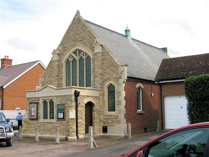
good number of fine monuments. Howard Memorial Church
(Methodist and U.R.C.) on Cople Road. Early maps label it as "Union Chapel". TL 0910 4800.
? Les Needham (2010).
Another view, ? David Regan
(2019). David suggests that the Howard in question may be John Howard, the
prison reformer mentioned
here. Link. The
village also has a former Wesleyan Methodist Chapel
at Chapel End, which was presumably the home to the local Methodist congregation
before they moved to Howard Memorial Church. It can be seen on a 2019
Streetview. TL 0933 4815.
The V.C.H.
mentions another chapel at Chapel End,
"a small chapel in connexion with the Bunyan Meeting", but I haven't been able
to locate it - unless it's Howard Memorial Church, which could conceivably come
under Chapel End.
Carlton, St. Mary the Virgin. SP 9517
5485. ? Bill McKenzie.
Link.
Grade I listed. Carlton
Baptist Church, which dates from 1760, as seen by Streetview in 2009.The pulpit,
from an old postcard in Judy Flynn's Collection. SP 9543 5525.
Grade II listed.
Chalgrave, All Saints, which sits in an
isolated position at TL 0086 2743. ? Bill McKenzie.
Link.
Grade I listed.
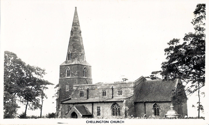
Chellington, St. Nicholas. SP 9608
5631. From an old postcard in Judy Flynn's Collection. A
modern view, ? David Regan (2018).
Link.
Grade I listed.
Clapham, St. Thomas ?Becket. TL 0340 5248.
? Bill McKenzie. Another view, from an
old postcard in Judy Flynn's Collection.
Link.
Grade I listed. The
Methodist Church on High Street is labelled on older maps as Wesleyan,
and was seen by Streetview
in 2018. It pre-dates a map of 1883-4. TL 0323 5236.
Link.
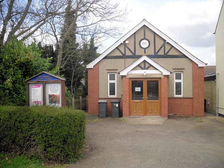
Clifton, All Saints. TL 1659 3925. ? Bill
McKenzie. Link.
Grade II* listed.
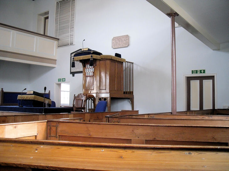
Strict Baptist Church (1853) on Broad
Street.
TL 1656 3879. ? Les Needham (2010). Two additional views - 1, 2, two
interiors - 1, 2, and the
pulpit, all ? Gerard Charmley (2015), who advises that the congregation dates from 1844, the chapel from 1859,
and had galleries added in 1863. The large memorial tablet to the left of the pulpit is to Septimius Sears (1817-1877) who was the founding minister.
Another view, ? Gerard Charmley
(2022). Providence Baptist Church (1936) on
Shefford Road. TL 1588 3892. ? Gerard Charmley (2022).
Link. A
house called Strawplaits on
Church Street is a former Baptist Chapel, which Gerard advises was a splinter
from the Strict Baptist Church - the split healing in 1900 - and subsequently
closed and converted to residential use. TL 1649 3905. ? Gerard Charmley (2022).
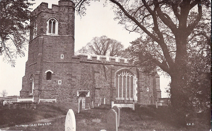
Clophill, St. Mary. TL 0899 3825. ? Bill McKenzie.
Another view, from an old postcard in
Judy Flynn's Collection. Notice that the roofline has been raised since the
church was built. An old postcard view of Clophill Old Church
(TL 0918 3885), from Judy Flynn's Collection. Now a ruin sitting some way north
of the village, see this link for its
history. The Methodist Church,
as seen by Streetview in 2016. It stands on High Street at TL 0861 3799.
Link. A Primitive Methodist Chapel once stood
on Old Silsoe Road, at TL 0830 3751. This
source dates it to 1853. The site can be seen on a
Streetview of 2009. The same
source refers to another P.M. chapel on High Street, sold in 1938, but I haven't
located it.
Cockayne Hatley, St. John the Baptist.
TL 2561 4965. ? Bill
McKenzie.
Link.
Grade I listed.
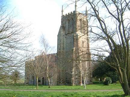
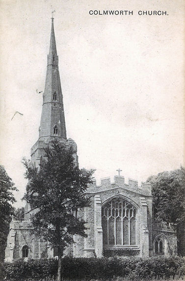
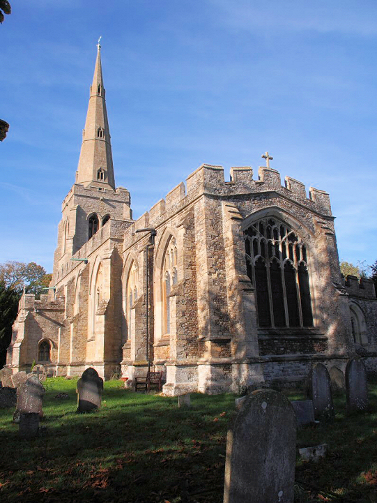
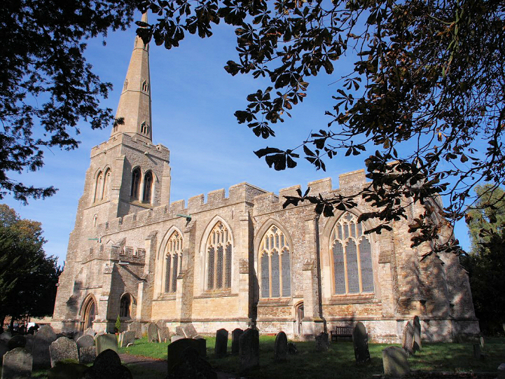
Colmworth, St. Denys (K). TL 1089 5858. From an old postcard in Reg Dosell's Collection. Two modern views -
1, 2, both
? Chris Stafford (2013).
Link.
Grade I listed.
At Chapel End, less than half a mile to the S.W. of the church, is a former
Primitive Methodist Chapel. It hasn't been seen by
Streetview, but its My Primitive Methodists
entry, which dates it to 1854-1911, has a photo.
The closure date may be suspect, as the 1" O.S. map of 1937-61 still shows it as
a place of worship. TL 1030 5823.
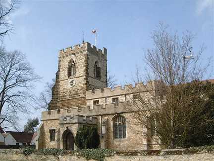
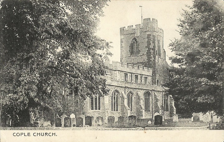
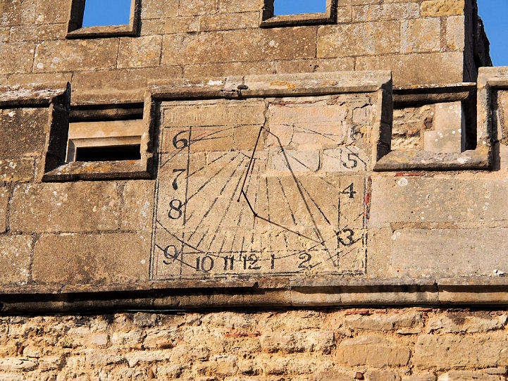
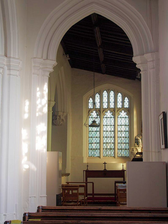
Cople, All Saints. TL 1032 4847. ? Bill McKenzie.
Another view, ? David Regan (2019). An
old postcard view, from Judy Flynn's
Collection. The sun-dial, two interior
views - 1,
2, and the
font, all ? Chris Stafford (2013).
Link.
Grade I listed. The My Primitive Methodists
entry for Cople says that a congregation met in a
cottage, but it isn't located.
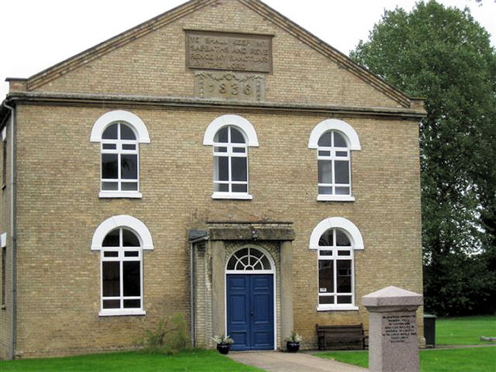
Cotton End, Baptist Church (1836). TL
0853 4553. ? Les Needham (2010).
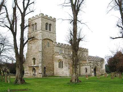
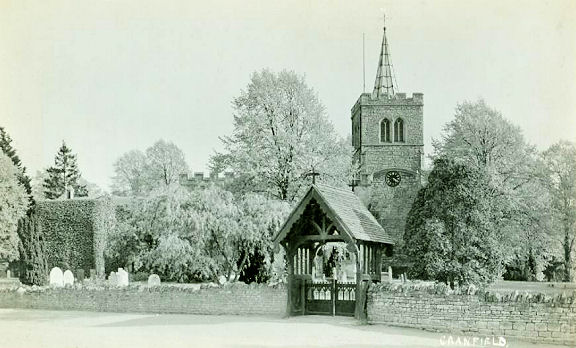
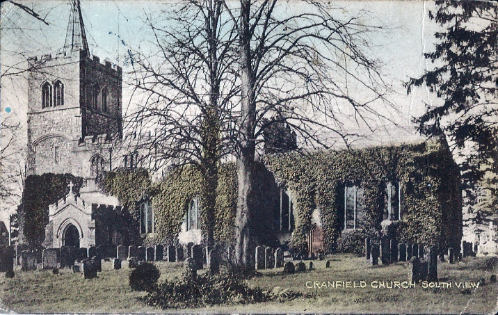
Cranfield, St. Peter & St. Paul. SP
9557 4198. ? Bill
McKenzie. An old postcard view,
showing the spire, since removed. Web sources are somewhat contradictory
regarding the date of the removal of the spire - but we can say with some
confidence that it postdates the 1" O.S. map edition of 1957, which indicates a
spire at that time. It possibly survived until 1980, but it's odd that the
grade I listing of the early 1960's makes no mention of it. From Reg Dosell's Collection.
Another old postcard, this one from Judy Flynn's Collection. Judy has told me that Pevsner mentions the "recessed
lead spire" in the edition of 1968.
Link1.
Link2. Howard Richter advises
of three other churches. There is a Methodist Church (originally Wesleyan) at SP
9528 4188 on High Street, and it pre-dates a map of 1882-3. It can be seen on
Streetview
here.
Link. A Baptist Church stands on Bedford Road at SP 9612 4257. This also
pre-dates the 1882-3 map, where it is indicated as a Baptist Chapel (General),
but the congregation is considerably older than this. It can be seen
here. Link. Shown on the same
map is a Particular Baptist Chapel at SP 954 420. It certainly existed by 1840,
and was still in use in 1901. A building with the same footprint as the chapel
on the map can be seen
here (the greenish building), but it's not at present clear if this is the
same building, or a more recent building on the same site.
Dunstable.
Dunton, St. Mary Magdalene. TL 2374
4422. ? Les Needham (2010).
Link.
Grade II* listed. A former Baptist Chapel
stands near the church, on Chapel Street, at TL 2368 4419.
Streetview saw it in
2014.
East Hyde, Holy
Trinity (1840-1). TL 1280 1735. ? Bill McKenzie. It was closed in 2008 and
subsequently re-opened as St. Charalambos (Greek Orthodox) in 2009.
Link, and
history page.
Grade II listed.
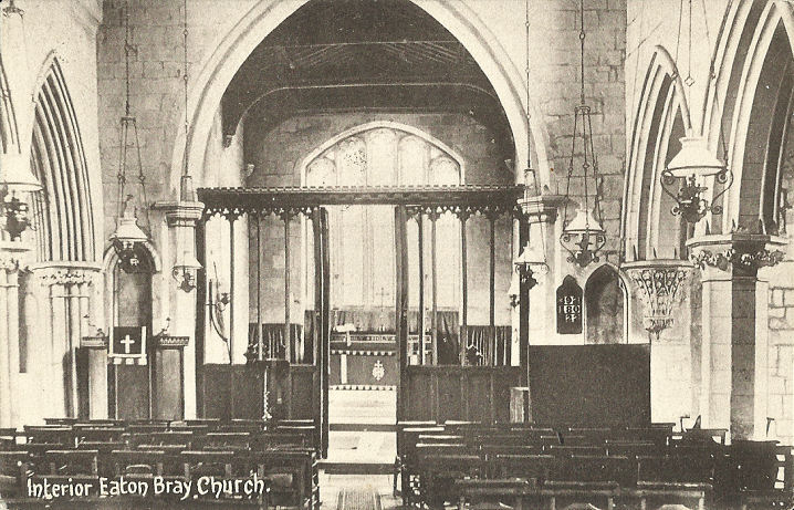
Eaton Bray, St. Mary the Virgin. SP 9699 2074.
? Bill
McKenzie. Another view, ? Judy Flynn. Interior view, from an
old postcard in Judy Flynn's Collection. Link.
Grade I listed.
The handsome Methodist Church of 1795 stands at the
northern end of the village, and can be seen here in a
Streetview from 2019. Older
maps label it as Wesleyan. SP 9697 2113.
Grade II listed.
Edworth, St. George, now in the care of the Churches Conservation Trust. TL 2222 4068.
? Les
Needham (2010). Interior view, from an old postcard in Judy Flynn's Collection.
Another view, three of the interior -
1,
2,
3, the
chancel, a bench-end carved
lion, and the
font, all ? Chris Stafford (2013).
Link.
Grade I listed.
Eggington, St. Michael and All Angels. SP
9567 2517. ? Bill
McKenzie. Link.
Grade II* listed. An
Independent/Congregational Church once stood on High Street, a little way
east of the church at SP 9583 2516. The village
Wikipedia entry says that
it was demolished in the 1970's. The house built on its site can be seen in a
Streetview from 2019. A
former Methodist Church (originally Wesleyan)
stands just west of the St. Michael at SP 9560 2515.
Streetview saw it in 2019.
The Wikipedia entry quoted from previously says it was converted into a house in
1988. Both of the chapels pre-date a map of 1882.
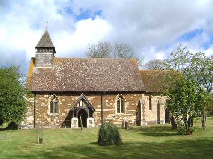
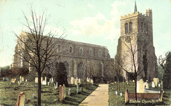
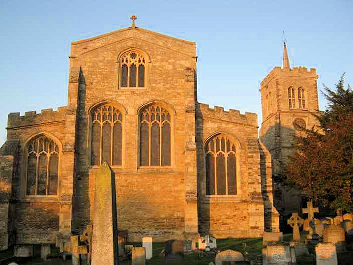
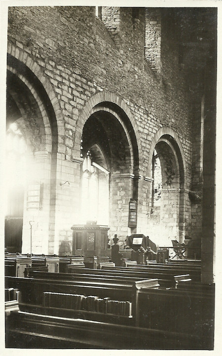
Elstow, St. Mary and St. Helena. TL 0491 4740. From an old
postcard (franked 1908) in Steve Bulman's Collection. An old
engraving, dated 1887, from Colin
Waters' Collection.
A modern view, ? Chris Emms (2011). Interior view, from an old postcard in
Judy Flynn's Collection. Link.
Grade I listed.
Eversholt, dedicated to St
John the Baptist. SP 9829 3251. ? Bill McKenzie.
Link.
Grade II* listed. There used to be a
Methodist Church (originally Wesleyan) at Wits End,
at SP 9896 3294. According to this
source, it dates from 1849, and was closed in 1972. The house now on its
site can be seen in a 2019
Streetview.
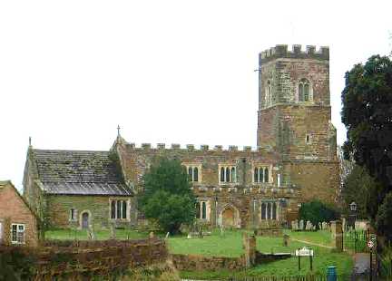
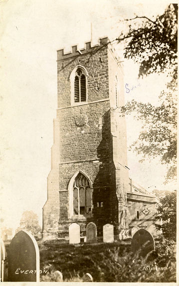
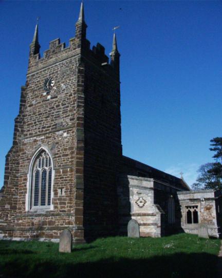
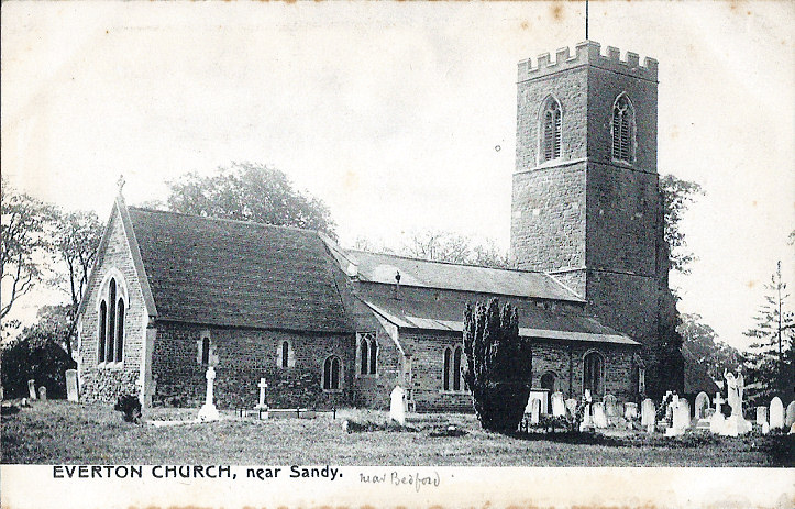
Everton, St. Mary. TL 2032 5130. This postcard (from Reg Dosell's Collection) was previously in the "Unknown" section; Garry Barr has
kindly emailed to identify this church, which looks rather different to what it is on the postcard. Compare with this
link, and
this. He has also advised of this
link which explains that the church
tower was largely destroyed by lightning in 1974. It was decided to shorten the tower when re-building.
Another old postcard view, this one from Judy Flynn's Collection. A modern view,
? Judy Flynn. Two additional views - 1,
2, two of the interior -
1,
2, the
chancel, two memorials -
1,
2, and the
font, all ? David Regan (2019).
Grade I listed. For the Methodist (previously Wesleyan) Chapel, see Gamlingay on the Cambridgeshire page.
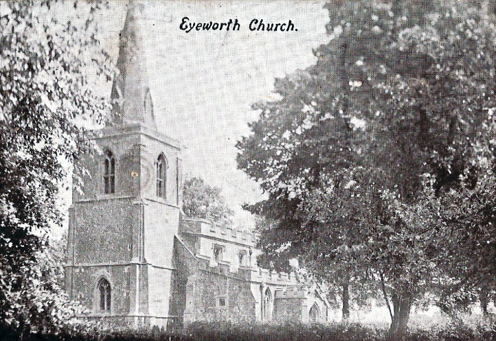
Eyeworth, All Saints. TL 2498 4559. ? Les
Needham (2010). An old postcard view, from Judy Flynn's Collection. Note the appearance of the tower before it had the
spire removed, and the tower reduced in size. This was carried out in the late
1960's, following a thunderstorm, lightning hitting the spire and causing a
fire. The repairs were dedicated in 1970.
Three additional views - 1,
2, 3,
all ? Chris Stafford (2013).
Link1 (many
photos, including interiors).
Link2.
Grade I listed. A Quaker Meeting is held in
Eyeworth Village Hall (2021
Streetview). They used to meet in the schoolroom of the Congregational Church in
Guilden Morden, Cambridgeshire. TL 2517 4590.
Link.
Eynesbury, St. Mary the Virgin. TL 1837
5984. ? Janice Tostevin. Link.
Grade II* listed. The Methodist Church of 1928
stands on Berkley Street at TL 1849 5974, and can be seen on a
Streetview from 2018.
Link. Eynesbury's
entry on the My Primitive Methodist website says that the current Methodist
Church had a P.M. predecessor "in the front street", dating from 1855. The
building shown in the 1994 photo stands just a few yards south of the present
church on Berkley Street, but it doesn't feel to be a wholly convincing
candidate. Here's a Streetview
from 2018.
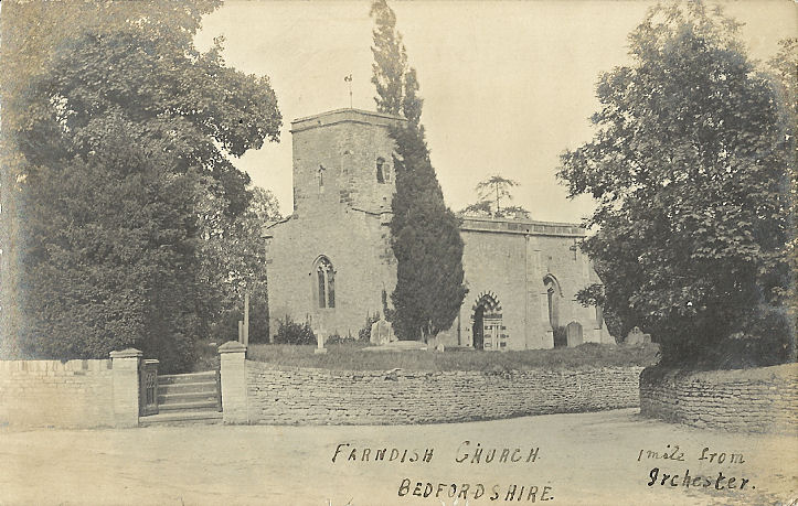
Farndish,
St. Michael and All Angels, now in the care of the Churches Conservation Trust. SP 9279 6372. From an old postcard in Judy Flynn's Collection.
Link.
Grade I listed.
Felmersham, St.
Mary. SP 9913 5784. ? Bill McKenzie. Two additional views -
1,
2, two of the interior -
1,
2, and the
altar and
font, all ? David Regan (2017),
plus another exterior, ? David Regan
(2018).
Link1.
Link2.
Grade I listed.
Flitton, St. John the Baptist. TL 0594
3585. ? Bill McKenzie. Link.
Grade I listed. An adjacent mausoleum is
separately listed as
grade I.
Flitwick, St. Peter & St. Paul. TL
0292 3422. ? Bill
McKenzie. Link.
Grade I listed.
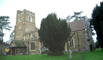
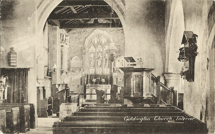
Goldington, St. Mary the Virgin, on Church Lane. Interior view. TL 0763
5100. Both from
old postcards in Judy Flynn's Collection. Link, which
has a photo showing the modern extension.
Grade II* listed. Holy Cross
(R.C.) stands on Goldington Lane and Barkers Lane, and was seen by
Streetview in 2020. TL 0752
5049. Link. Its
history
page dates it to 1957. Older maps show Bunyan
Chapel (Baptist) at TL 0769 5049. It pre-dates a map of 1884, upon
which it's labelled as Particular Baptist, and it disappears from maps in the
1960's. The road layout has completely changed, but it is commemorated in Chapel
Close. The bungalows on the site can be seen
here in a Streetview from
2016.
Great Barford,
All Saints (C). TL 1340 5171. ? Bill McKenzie. A difficult church to photograph, advises Chris, beset with conifers and on a small site.
Another view, an interior, taken through a window, and a monument
in the churchyard, all ? Chris Stafford (2013). Grade II*
listed. The
Methodist Church
(2023 Streetview) stands on Bedford
Road at TL 1266 5231. Older maps label it as Wesleyan, and it pre-dates a map of
1884. This must be a predecessor of the present church as it has a date-stone
for 1903. Genuki
dates it to 1824. A un-dated
news article discusses its closure and intended conversion.
Greenfield, the former Methodist Church (1964), now in residential use.
TL 0531 3498. ? Bedfordshire and Luton Archives & Records
Service (2011). Its predecessor (originally Wesleyan) of 1840 on the same site
was destrosed by fire in 1962. A photo of the old chapel is available
here.
Harlington, St.
Mary The Virgin. TL 0378 3055. ? Bill McKenzie. Another view.
Previously in the "Unknown" section - Ian Mead has a number of glass
negatives, from around 1900, taken by a great-Uncle who lived in the Luton area.
This one was identified by Janet Gimber.
Link.
Grade I listed. The
Methodist
Church on Sundon Road. TL 0365 3030. ? Martin Wallis. A
Streetview from 2019.
Link.
What I assume to be its predecessor stands directly opposite, and is marked on
old maps as Wesleyan. A 2019
Streetview. The 1" O.S. map of 1956 shows a cemetery
chapel in the cemetery on Baton Road, at TL 0391 3066. It may be
the small building seen in the far corner in a
Streetview from 2019.
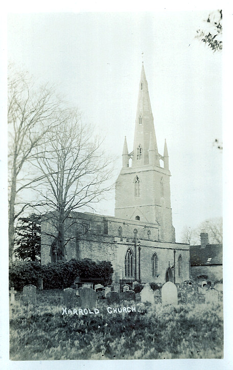
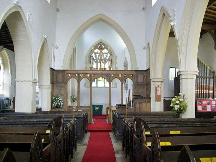
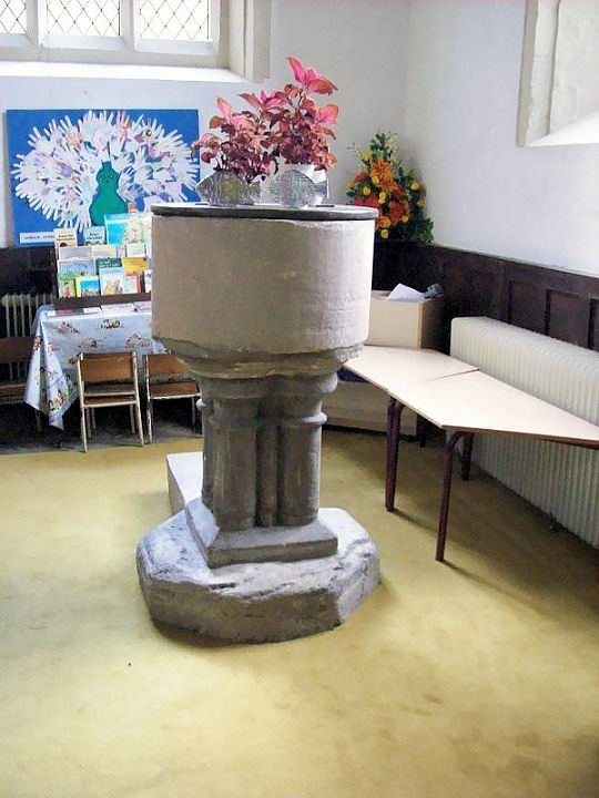
Harrold, St. Peter and All Saints. As
there is no south door or porch, entry is by the west door. SP 9539 5667. ? Bill McKenzie. An old postcard view, from Judy
Flynn's Collection. Another view, the
interior, and the
font, all ? David Regan (2017).
Link.
Grade I listed.
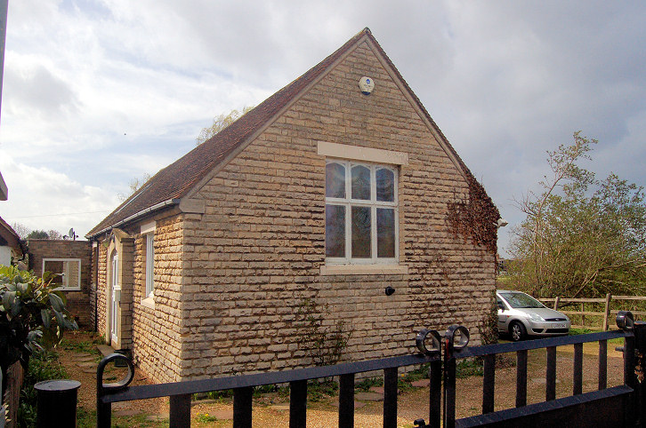
The U.R.C. (originally Congregational) stands on
High Street. It can be seen on a
Streetview from 2009, and there's a comprehensive history
here. SP 9483 5689. Harrold and Carlton Grace Baptist
Church stands on High Street at SP 9505 5683. It's labelled as Mission
Hall on the 25" O.S. map of 1901.
Link, and its useful
history page, which
dates the church to 1876. The listed buildings website has a
grade II entry for Harrold Catholic Chapel on
The Green, and it provides a grid reference of
SP 95061 56764. It describes it as a Former schoolroom and adjoining school
house dated 1847 now private dwelling and chapel. It would appear to mean
the building seen by Streetview
in 2019. O.S. maps mark the site of
Harrold Priory at SP 9503 5670. Streetview hasn't
had a good view of the site, but it's somewhere to the right of the low
buildings in the distance across the field, seen
here in 2019.
Link.
Harrowden, the former Methodist Church, originally Wesleyan (1904).
TL 0729 4742. ? Bedfordshire and Luton Archives & Records
Service (2011).
Link1.
Link2.
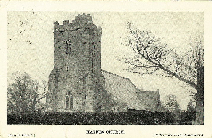
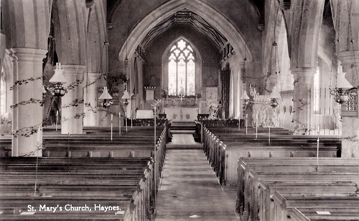
Haynes, St. Mary the Virgin, at Church End.
Interior view. TL 0811 4118. Both from old postcards in Judy
Flynn's Collection.
Link.
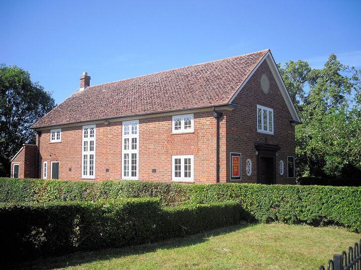
Grade II* listed. Haynes Mission Hall,
on Northwood End, TL 0998 4199. ? Gerard Charmley
(2022).
Ebenezer Strict Baptist Chapel, re-built
in 1934, on Silver End Road. Its predecessor, on the same site, pre-dates a map
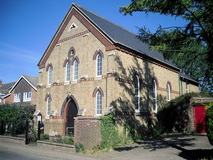
of 1883, where it's labelled as Baptist Chapel (General). TL ? Gerard Charmley (2022). The Methodist Church,
at Silver End. Older maps label it as Wesleyan. TL 1001 4235. ? Gerard Charmley
(2022).
Heath and Reach, St. Leonard. SP 9249
2771. Link.
Grade II listed. The former
Ebenezer Primitive Methodist
Chapel on Woburn Road. It's dated
here to 1864-1903.
SP 9238 2843. The former Wesleyan Methodist Chapel.
The village
Genuki entry dates it to 1877.
SP 9248 2806. All ? Bedfordshire and Luton Archives & Records Service (2008).
The village also had a Baptist Chapel which stood
back from the junction of Gig Lane with Leighton Road, at SP 9255 2813. Its
site was seen by Streetview
in 2009. It's dated in this
source (which has an interior photo) to 1822, with closure in 1978.
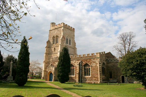
Henlow, St. Mary the Virgin. The tower.
TL 1781 3876. Both ? Bill McKenzie.
Another view, ? Thomas Curtis.
Link.
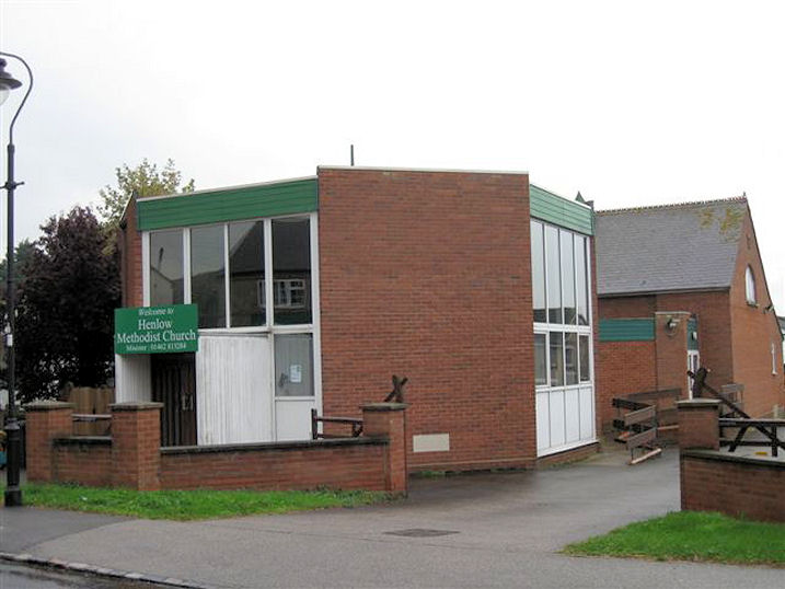
Grade I listed. Henlow Methodist Church
on High Street. TL 1769 3817. ?
Les Needham (2010).
Link.
Higham Gobion, St. Margaret. SP 1037
3279. ? Bill McKenzie.
Link.
Grade II* listed.
Hockcliffe, dedicated to St. Nicholas.
SP 9660 2697. ? Bill
McKenzie. An old postcard view, from
Judy Flynn's Collection.
List.
Grade II* listed.
Old maps show three chapels in the village, two Methodist and a Congregational.
The former Congregational Chapel stands set back
from the A5 at SP 9742 2659, and was seen by
Streetview in 2019. This
source says it was also home to the Primitive Methodists from 1913-20. A
Primitive Methodist Chapel stood on Woburn Road, at
SP 9727 2683. It's dated
here to 1861, closing in 1913, and demolished in 1933. It stood on what is
now the grass next to the corner house seen in a
Streetview from 2020. The
other Methodist Chapel was Wesleyan, dated
here to 1833-1919. A house now stands on the site (although the chapel stood
further back from the road), and it was seen by
Streetview in 2020.
Houghton Conquest, All Saints. TL 0436 4142.
? Bill
McKenzie. Interior view, from an old postcard in Judy Flynn's Collection.
Link.
Grade I listed.
The former Wesleyan Methodist
Chapel on Rectory Lane as seen by Streetview in 2009. A more recent
Streetview in 2016 shows
works in progress. This
source dates it to 1878, when it was built in front of its predecessor of
1832, which was subsequently used as a Sunday School. This earlier chapel may
just be visible in a Streetview
of 2009. An interior view of the later chapel is available
here. TL 0445 4135.
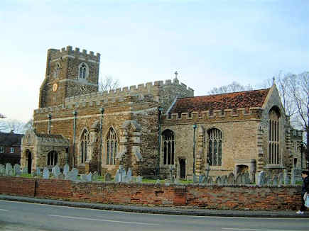
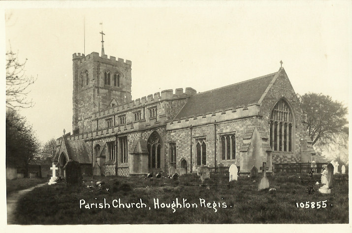
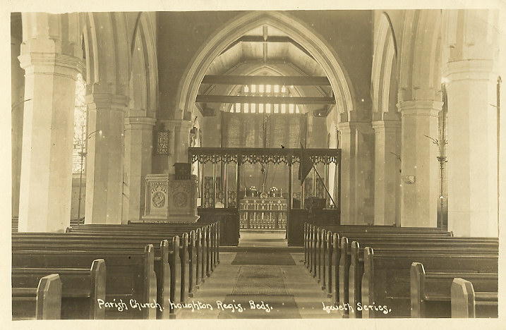
Houghton Regis, All Saints. TL 0184 2395. Interior view. Both from
old postcards in Judy Flynn's Collection. Link.
Grade I listed.
A Primitive Methodist Chapel once stood on King
Street at TL 0187 2383. It's dated
here to 1862, with closure on or before 1935. The same source mentions a
predecessor of 1844, though its location isn't given. Its site lies beneath the
building seen here in a
Streetview from 2018. The Wesleyans were also
present in the town, on the corner of Cumberland Street and Queen's Street, at
TL 0180 2372. The house now on the site can be seen in a
Streetview from 2018. The
1936-61 1" O.S. map shows two other places of worship, fairly close to each
other, south of the High Street. One was a Wesleyan
Methodist Chapel (presumably successor to the one mentioned earlier), a
little way west of Cumberland Street. Its site lies somewhere near the end of
the brick wall, seen here in
a Streetview from 2019. TL 0173 2373. A Baptist Church,
stood a bit further west again, set back from High Street at TL 0168 2373. A
photo and some history are available
here, and its site, which lies beneath a car park, can be seen in a
Streetview from 2016.
Hulcote, St. Nicholas. SP 9443 3883. ? Bedfordshire and Luton Archives & Records Service (2011).
Link.
Grade I listed.
Husborne Crawley, St. James. SP
9556 3622. ? Bill
McKenzie. Link.
Grade II* listed. A Primitive Methodist Chapel
used to stand on Crow Lane. SP 9565 3602. It stood on what is now the driveway
of the house seen here in a
Streetview from 2010. A photo of it can be seen
here, where the chapel is dated to 1867.
Kempston.
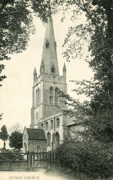
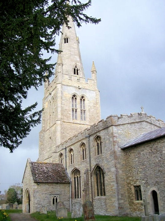
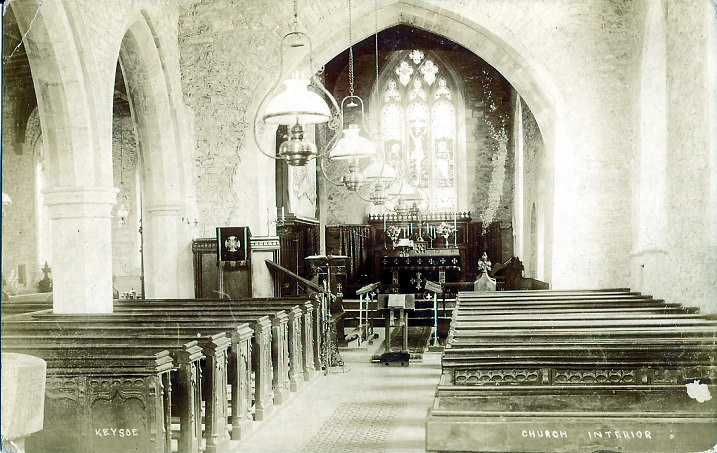
Keysoe, St. Mary the Virgin. TL 0738 6249. From Reg Dosell's postcard collection.
Another view, ? David Regan
(2019). Interior view, from an old postcard in Judy Flynn's Collection.
Link.
Grade I listed.
Knotting, St. Margaret of
Antioch. Two interior views - 1,
2, the
altar and
font. TL 0026 6347. All ? David Regan
(2017).
Link.
Grade I listed.
Langford, St.
Andrew. TL 1856 4141. ? Bill McKenzie. Another
view, ? Les Needham (2010).
Link.
Grade I listed.
Langford
Methodist Church. Older mark it as Wesleyan. TL 1854 4063. ? Les Needham (2010).
Link.
Leighton Buzzard.
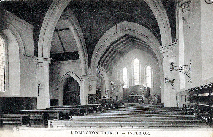
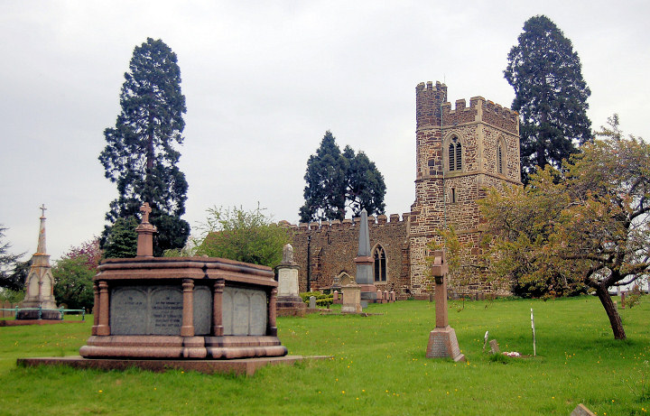
Lidlington, St. Margaret (1885), on Church Street and The Lane.
? Bill McKenzie.
Interior view, from an old postcard in Judy Flynn's Collection.
This source
says that the church was closed sometime between 2002 and 2015, and has been
converted to residential use. SP 9912 3892. It also mentions a medieval
predecessor in what is now the cemetery, a little way to the south-east, finally
demolished in 1961. The same source, and also
Genuki, says it
was also dedicated to St. Margaret, but O.S. maps are consistent in labelling it
as All Saints. Streetview doesn't have a view of the cemetery (access road
here, in 2021), and I
haven't been able to find a photo of the old church. SP 9919 3883.
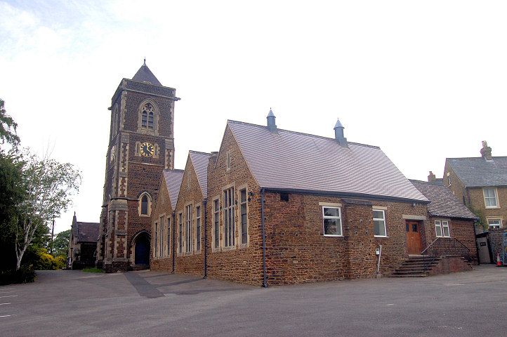
Lidlington Church, on Church
Street, as seen by Streetview in 2020. Zooming in to the roundel below the apex
shows that this was originally Bethel Primitive Methodist Chapel. It's dated
here to 1863, where it also mentions a predecessor (un-located) of 1850. SP
9900 3901. Link. The village
also had a Wesleyan Methodist Chapel on High
Street. It survives, converted into a house, and can be seen in a
2021 Streetview. It's dated
here to 1854, where it mentions an earlier chapel of 1805, again un-located.
Closure is given as 1957, or soon after, following merger with the Primitive
Methodist congregation. SP 9908 3882.
Linslade, St. Mary, which sits some
distance to the north of the town. SP 9102 2682. ? Bedfordshire and Luton Archives & Records Service (2009).
Link.
Grade I listed.
St. Barnabas on Vicarage Road.
SP 9126 2496. ? Bedfordshire and Luton Archives & Records Service (2008).
Link.
Grade II listed, wherein it's dated to 1848-9, with later additions.
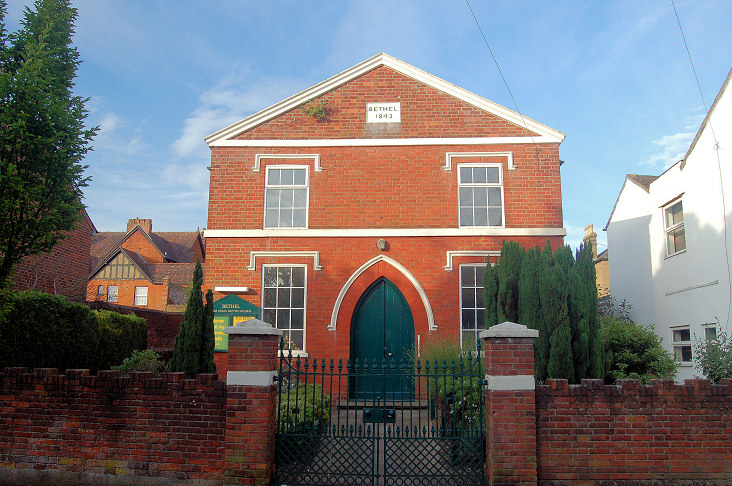
Bethel Free Grace Baptist Chapel (1843)
on New Road. SP 9139 2502. ? Bedfordshire and Luton Archives & Records Service (2008).
Link.
Jubilee Primitive Methodist Chapel stood
on
Old Road at SP 9121 2515. It pre-dated a map of 1880-91, and survived until at
least circa 1980 (there's a photo of it available
here, where it says it was closed around 1940). The residential building on
the site today can be seen in a
Streetview from 2021; the chapel occupied the central third of the site.
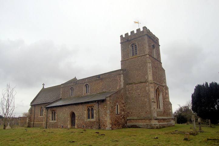
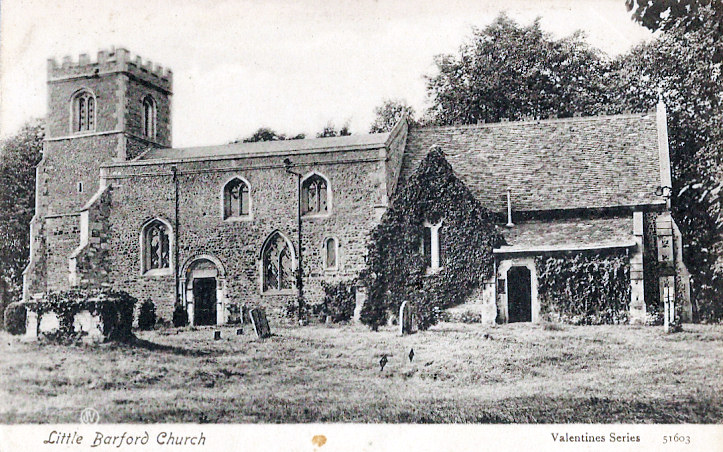
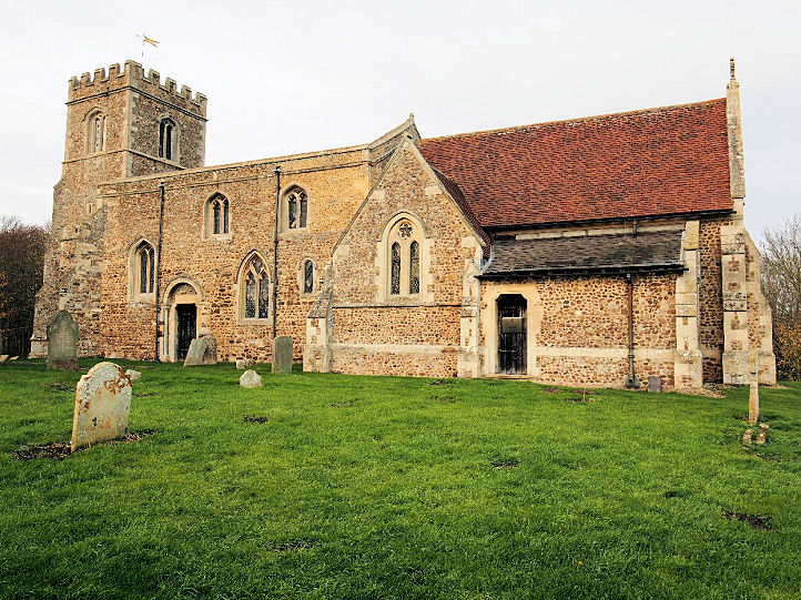
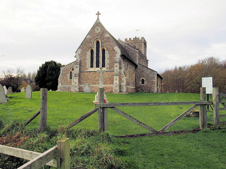
Little Barford, St. Denys. Redundant, and now in the care of the Churches Conservation Trust. TL 1776 5695.
? Bedfordshire and Luton Archives & Records Service (2010).
An old postcard view, from Judy Flynn's Collection.
Two additional views - 1,
2, two of the interior -
1,
2, a
Norman doorway, a
window, and the
font, all ? Chris Stafford (2015).
Link1.
Link2.
Grade II* listed.
Little Staughton, All Saints. Older
maps label it as St. Margaret. TL 1073 6300. ? Jim Rushton.
Link.
Grade I listed.
A former Baptist Chapel used to stand south of the
village at TL 1085 6197. Demolished following war damage, it's former Sunday
School survives. The school, and the site of the chapel, which stood parallel
with the school and closer to the headstones, can be seen in a
Streetview from 2009. A
photo of it is available
here. A new church was built in the village on High Street, opening in 1957.
Streetview saw it in 2014.
TL 1056 6265. Link.
Lower Gravenhurst, St. Mary the Virgin,
now in the care of the Churches Conservation Trust. TL 1107 3525. ?
Bill McKenzie.
Link.
Grade I listed.
Luton.
Marston Mortaine,
St. Mary. TL 9961 4115. ? Bill McKenzie.
Link.
Grade I listed.
Melchbourne, St. Mary Magdalene. Two
additional views - 1,
2. TL 0286 6539. All ? David Regan (2017).
Link.
Grade I listed.
O.S. maps mark Preceptory (Site of) at TL
0302 6585. Its site isn't visible to Streetview.
Link.
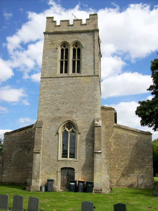
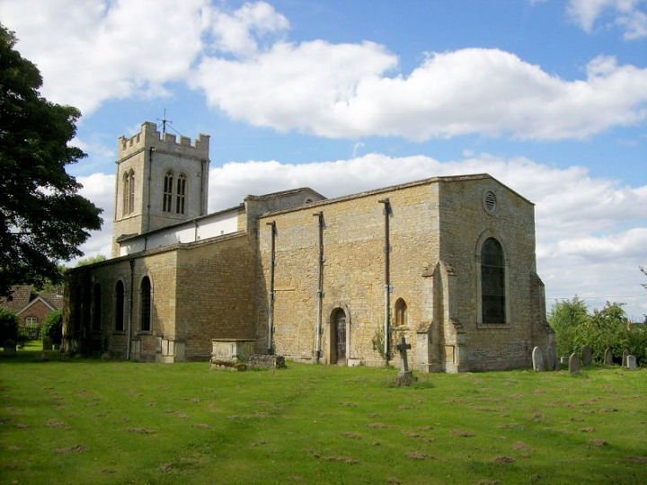
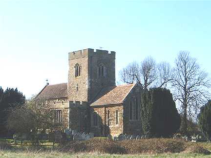
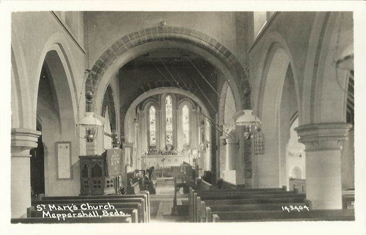
Meppershall, St. Mary the Virgin. TL
1345 3593. ? Bill McKenzie. Interior view, from an old postcard in Judy Flynn's Collection.
Link.
Grade II* listed. East of the village stands the
Chapel of St. Thomas the Martyr, at TL 1471 3622.
Now in use a farm building,
Streetview saw it in 2010.
Link.
Grade II* listed. The 1956 1"
O.S. map marks a place of worship on High Street at TL 1394 3669. This
source identifies it as a Methodist Chapel - originally Primitive Methodist.
It's dated
here to 1915, with closure in 2007 or soon after. Now demolished, it was
still standing in 2014 when it was seen by
Streetview. Its site now
provides access to a housing estate, seen by
Streetview in 2019.
Milton Bryan, St. Peter. SP 9711 3079.
? Bill McKenzie.
Interior view,
from an old postcard in Judy Flynn's Collection.
Link.
Grade I listed. The village formerly had a
Methodist Chapel, originally Wesleyan, and known as
The Chapel on the Pond. Dated
here, where there is a photo, to 1861, with closure and demolition in
1980-1. More photos are available
here. SP
9744 3007.
Milton Ernest, All Saints. TL 0200
5611. ? Bill McKenzie.
Two additional views - 1,
2, two of the interior -
1,
2, the
chancel, and the
font, all ? David Regan (2017).
Link.
Grade I listed. The village used to have a Methodist
Chapel, originally Wesleyan. It stood at TL 0177 5603, and is dated
here (where there is an illustration) to 1819, closing in 1970 and
demolished in 1976. Its site is now a parking area, seen
here by Streetview in 2021.
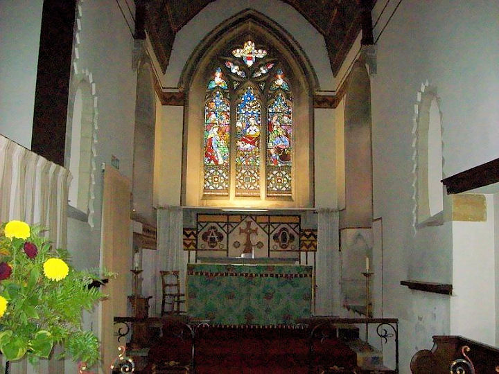
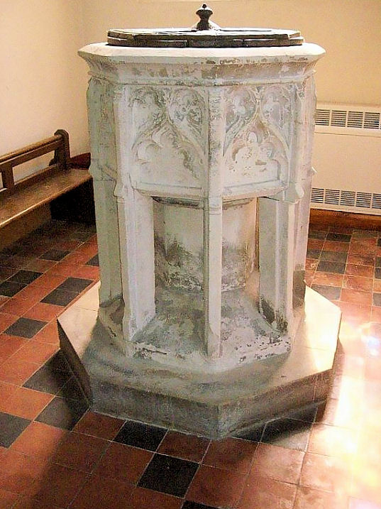
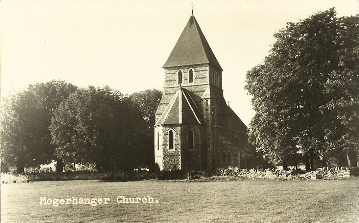
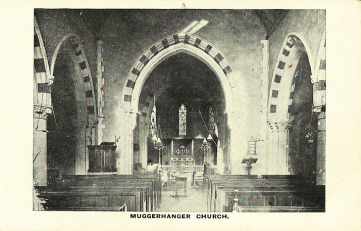
Moggerhanger, St. John the Evangelist (1860, K). TL 1423 4933.
? Bill McKenzie. Another
view, and an interior view (which is captioned "Muggerhanger"), both from old postcards in Judy Flynn's
Collection. Two modern views - 1, 2, both
? Chris Stafford
(2013). Link.
Grade II listed. The former
Methodist Church on St. John's
Road (TL 1402 4908). Originally Wesleyan, it's dated
here to 1929 - 2011, and was successor to an earlier chapel of 1844. Another
source suggests that it may have stood on the site of the present village
hall, which is on Blunham Road at TL 1444 4970, and seen
here by Streetview in 2020.
?
Les Needham (2010).
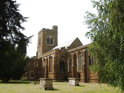
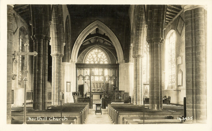
Northill, St. Mary
the Virgin. TL 1489 4654. ? Bill McKenzie. Interior view, from an old postcard in Judy Flynn's Collection.
Another view, two of the interior -
1,
2, the
altar and the
font, all ? David Regan (2019).
Link1.
Link2.
Grade II listed.
The former Methodist Church
on Sand Lane, as seen by Streetview in 2009. It was originally Wesleyan
(successor to an earlier, un-located chapel), and dated
here to 1902-3, closing in 1965. It now serves as the parish hall. TL 1500
4643.
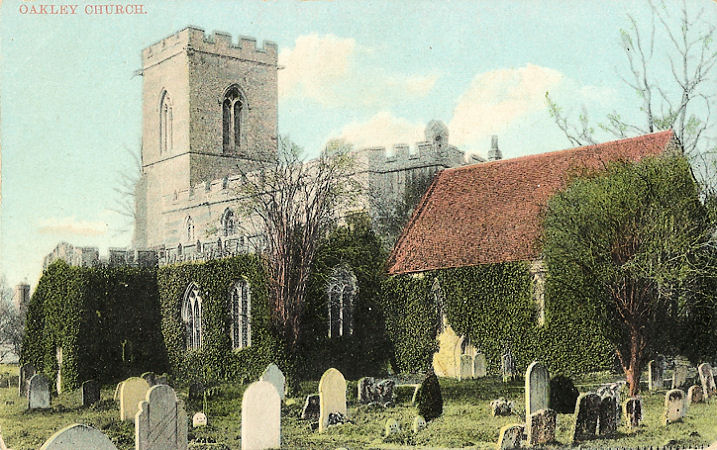
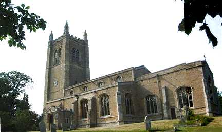
Oakley, St. Mary. TL 0106 5296. ? Bill McKenzie. An old
postcard view, from Judy Flynn's Collection.
Link.
Grade I listed. The
Methodist Church on High Street (seen
here by Streetview in 2009).
TL 0109 5393.
Link. It was preceded on the same site by an earlier Primitive Methodist
Chapel, and a photo of it can be seen
here, where it's dated to 1849.
Link.
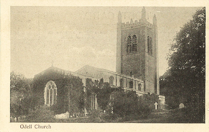
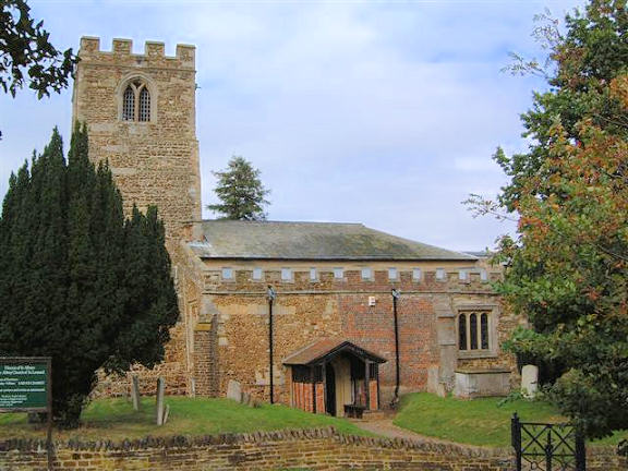
Odell, All Saints. SP 9667 5801. ? Bill McKenzie. Another view, and an
interior view, both from old postcards in Judy Flynn's Collection.
Link.
Grade I listed.
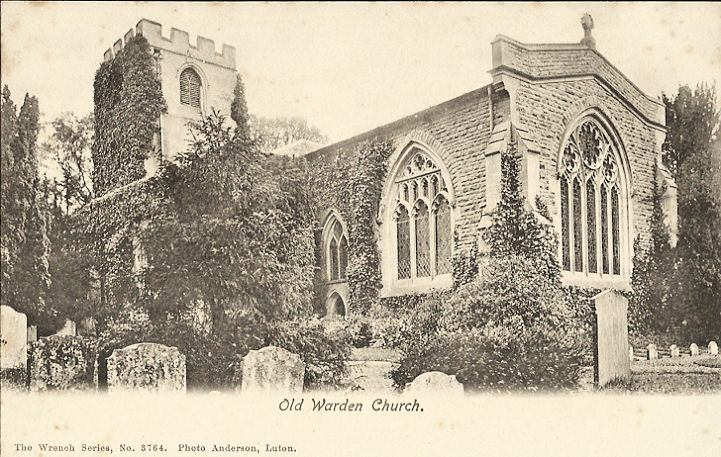
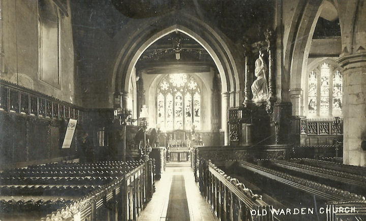
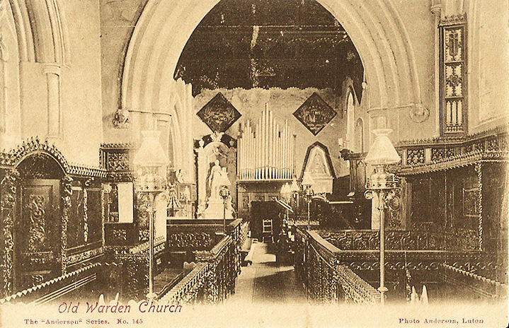
Old Warden, St. Leonard.
Another view. TL 1367 4432. Both ? Bill McKenzie. Three
old postcard views - an exterior, and two interiors - 1, 2, all from Judy Flynn's Collection.
Link1.
Link2.
Grade I listed.
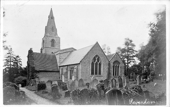
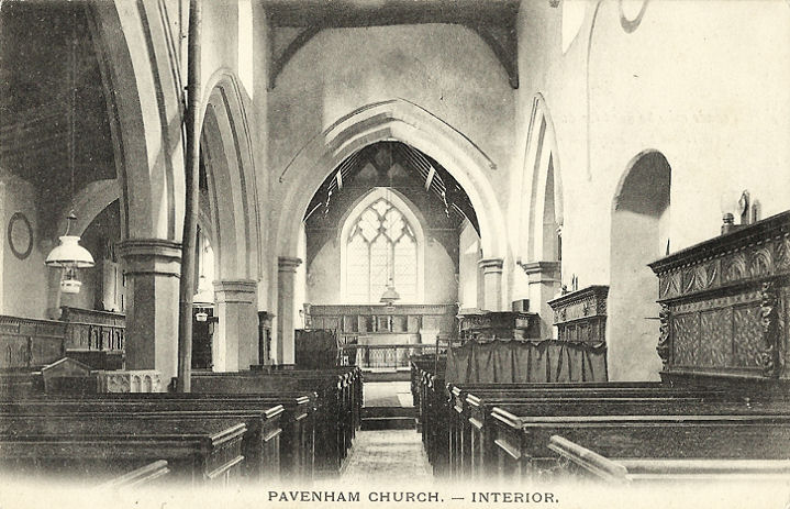
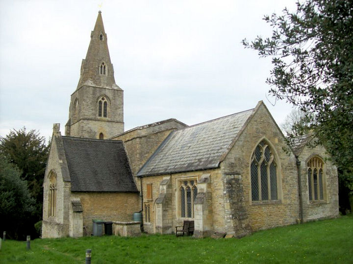
Pavenham, St. Peter. Interior view. SP 9914
5595. Both from old postcards in Judy Flynn's Collection. A
modern view, ? David Regan (2018).
Link.
Grade I listed.
Older O.S. maps show a Wesleyan Methodist Chapel on
High Street, at SP 9886 5549. The village
Wikipedia entry dates it to
1857. It seems to have still active after the war (it shows on a map from 1956).
Its site can be seen on a
Streetview from 2019. The village also had a Primitive
Methodist Chapel, dated
here to no later than 1842 - 1890's. Now converted to residential use, it
was seen by Streetview in
2019. SP 9866 5548.
Pepperstock, the former Baptist Church
on Front Street. It was evidently subsequently demolished, as housing was built
on the site, seen by Streetview (compare
2016 and
2017). SP 0851 1810. ? Bedfordshire and
Luton Archives & Records Service (2007).
Link.
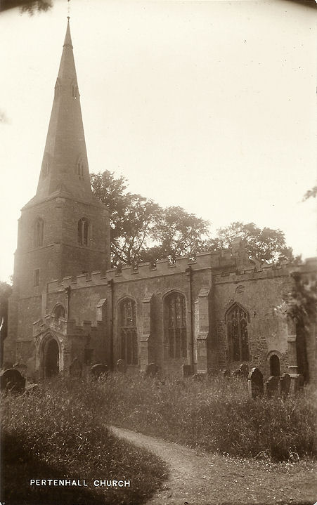
Pertenhall, St. Peter. TL 0842 6541. From an old postcard in Judy Flynn's Collection.
Grade I listed.
Older O.S. maps mark a Moravian Church at Chapel Yard, a little way to the
north-east of Pertenhall, at TL 0908 6600. The village
Wikipedia entry says that
"Little remains of the chapel itself but there are still gravestones in the
graveyard". I haven't been able to find a photo of it, and Streetview hasn't
been past the site.
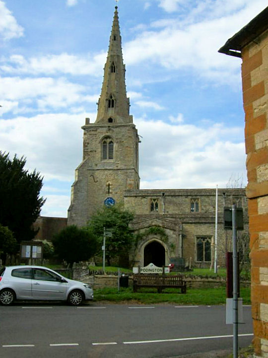
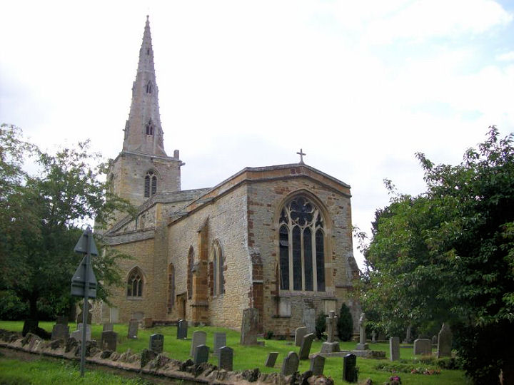
Podington, St. Mary the Virgin.
Another view. SP 9418 6268. Both ? David Regan
(2017). Link.
Grade I listed. The village has a former Wesleyan Methodist Chapel of 1902,
off Gold Street at SP 9407 6269. Barely glimpsed by
Streetview in 2009, there
are much better views of it
here, where it's dated to 1902. It also says it had a sixty year history,
implying closure in circa 1962.
Potsgrove, St. Mary the Virgin,
now in the care of the Churches Conservation Trust. SP 9515 2985. ? Bedfordshire and Luton Archives & Records Service (2007).
Link1.
Link2.
Link3.
Grade II* listed.
Potton.
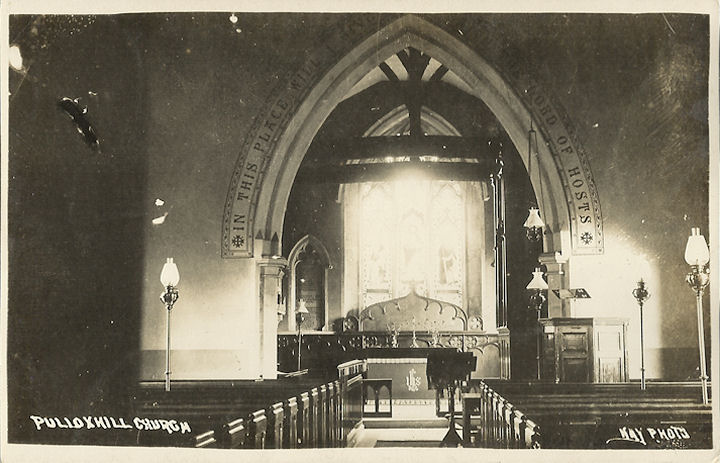
Pulloxhill, St. James the Apostle. TL 0616 3380.
? Bill
McKenzie. Interior view, from an old postcard in Judy Flynn's Collection.
Link. Grade II* listed.
Ravensden, All
Saints. Another view. TL 0777 5432. Both
? David
Regan (2018). Another view,
? Chris Stafford (2013).
Link.
Grade I listed. The former (well-disguised) Zion
Baptist Chapel stands about half a mile west of the church, at TL 0672
5428. Seen by
Streetview in 2012, it's dated
here to 1853, closing in 2016.
Renhold, All Saints.
Another view,
two of the interior - 1,
2, some of the
monuments, and the
font. TL 0888 5285. ? David Regan (2018).
Link.
Grade I listed. Renhold Chapel (Baptist, 1873)
stands rather less than a mile E.S.E. of the village, at Workhouse End.
Streetview saw it in 2012.
TL 1017 5251. Link.
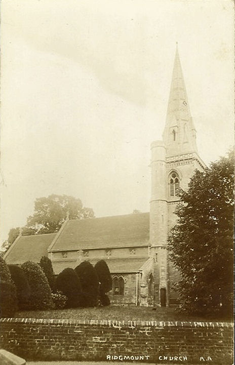
Ridgmont, All
Saints. SP 9759 3606. ? Bill McKenzie. Another view,
? Bedfordshire and Luton Archives & Records Service (2011).
Another view,
from an old postcard in Judy Flynn's Collection.
Link1.
Link2.
Grade II* listed. Outside the village, to the south-east, stand the
consolidated ruins of Old All Saints Church. Not
seen by Streetview, its history and numerous photos can be seen
here. SP
9812 3579. A former Wesleyan Methodist Chapel
stands on High Street at SP 9769 3622. Seen
here by Streetview in 2010,
it's dates are given
here as built 1853, re-built in 1991 (evidently a typo, perhaps for 1891),
and closed in 1947. A former Baptist Chapel stands
at the south end of the village at SP 9738 3581. The date-stone for 1811 can be
seen by zooming-in on a
Streetview from 2010. This
source dates its closure to 1993.
Grade II listed.
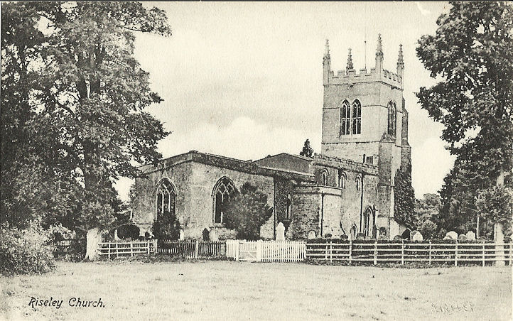
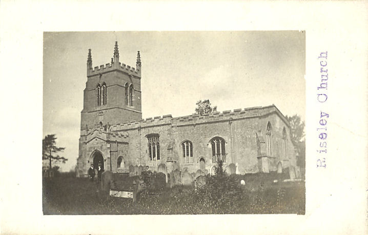
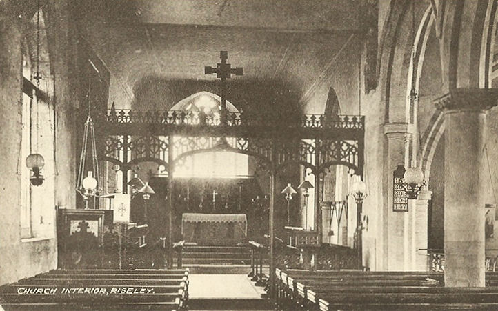
Riseley, All Saints. Another view, and an
interior. TL 039 630. All from old postcards in Judy
Flynn's Collection. A modern view, ?
David Regan (2019). Link.
Grade I listed. The 25" O.S. map of 1901 shows three chapels - Moravian,
Wesleyan and Baptist. The Particular Baptist Chapel
hasn't survived. It stood at SP 0426 6284, and is dated
here to 1838, closing in 1948. Its site on Keysoe Lane was seen by
Streetview in 2009. The
former Moravian Chapel stands on High Street at SP
0440 6302. Seen by Streetview
in 2009, the Bedfordshire Archives
entry dates its closure to 1971. The former Wesleyan
Chapel on High Street was seen by
Streetview in 2009. This
source dates it to 1807, and active at least into the 1970's. SP 0420 6282.
Grade II listed.
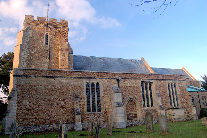
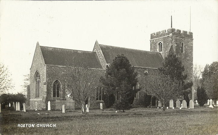
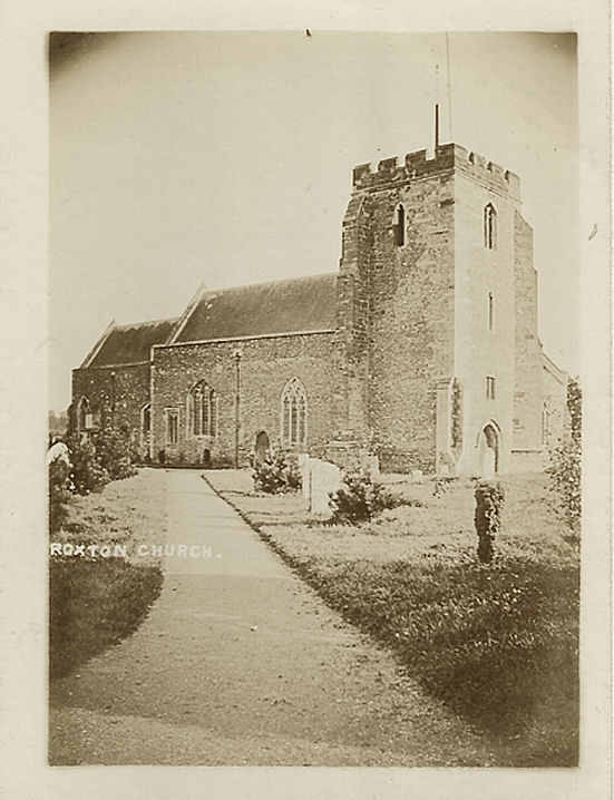
Roxton, St. Mary Magdalene. TL 1534 5452.
? Bedfordshire and Luton Archives & Records Service (2010). Two additional
views - 1, 2, both from old postcards in Judy Flynn's Collection.
Link.
Grade II* listed.
Congregational Church (1808). TL 1518 5448. ? Bedfordshire and Luton Archives & Records Service (2010).
Link.
Grade II*
listed.
Salford, St. Mary
the Virgin. SP 9359 3910. ? Bill McKenzie.
Link.
Grade I listed. The village also has a former
Wesleyan Methodist Chapel, on Broughton Road, at SP
9362 3926, which Genuki
dates to 1814, quoting from a directory of 1898. A
Streetview from 2021 shows
its poor condition.
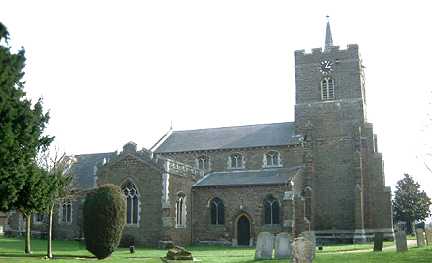
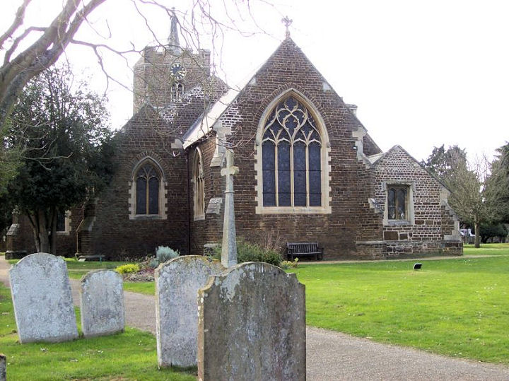
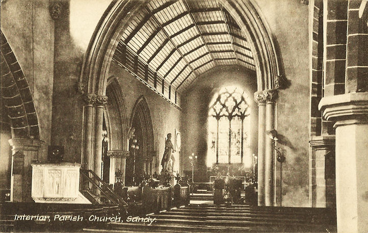
Sandy, St. Swithun (C). TL 1739 4907. ? Bill McKenzie.
Two additional views - 1,
2, both ? David Regan (2019).
Interior view, from an old postcard
in Judy Flynn's Collection. Link.
Grade II* listed.
Saint Neots Road Methodist Church at
Girtford was originally Primitive Methodist
(1910). TL 1670 4990. ? Bedfordshire and Luton Archives & Records Service (2010).
Link.
This
source mentions a predecessor of 1868 on London Road. It stood at TL 1657
5011. Its site is to the left of the building in this
Streetview of 2018.
All Saints used to stand on London Road, Girtford, at TL 1647
4952. A photo is available
here (where it's dated to 1885-1981), and the site can be seen on a
Streetview from 2009. The
Baptist Church on Bedford
Road has a date-stone for 1887. TL 1717 4927. ? Gerard Charmley (2022).
Link. Its
predecessor Chapel of 1854 is on
Pleasant Place - there's a history
here. TL 1725 4934. ? Gerard Charmley (2022).
Link.
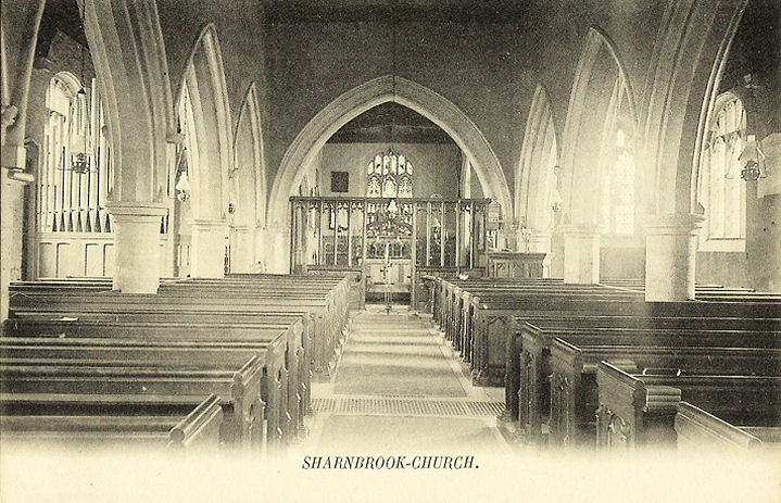
Sharnbrook, St. Peter.
Interior view. SP 9936 5959. Both from old postcards
in Judy Flynn's Collection. Another view,
the interior,
chancel,
font, and a huge
memorial tablet, all ? David Regan
(2017). Link.
A
plan and guide to the features of the church, and a
video tour.
Grade I listed.
Other listed features associated with the church can be seen
here. The Methodist Church stands on Park Lane,
and was seen by Streetview
in 2009. It was built as Wesleyan in 1911. SP 9964 5972.
Link. The 25" O.S. map of 1901 shows two Baptist Chapels. The first was
behind other buildings near the junction of High Street and Park Lane, at SP
9958 5964. I don't know if it survives, and it hasn't been seen by Streetview.
The other Baptist Chapel stands a little way back
from High Street, at SP 9973 5955. It was seen by
Streetview in 2009. Its
grade II listing, which describes it as Strict Baptist, dates it to a
restoration or re-build of 1866.
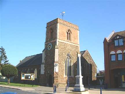
Shefford, St. Michael and All Angels, on
High Street. TL
1435 3908. ? Bill McKenzie. Link.
Grade II listed.
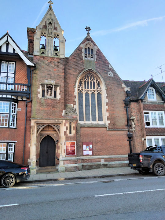
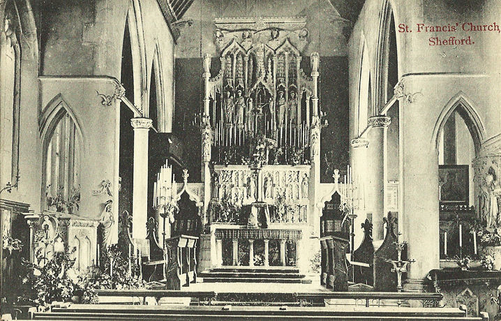
St. Francis of Assisi (R.C.) on High
Street. TL 1426 3901. ? Chris Kippin (2023).
Interior view, from an old
postcard in Judy Flynn's Collection. Link1.
Link2.
Grade II* listed.
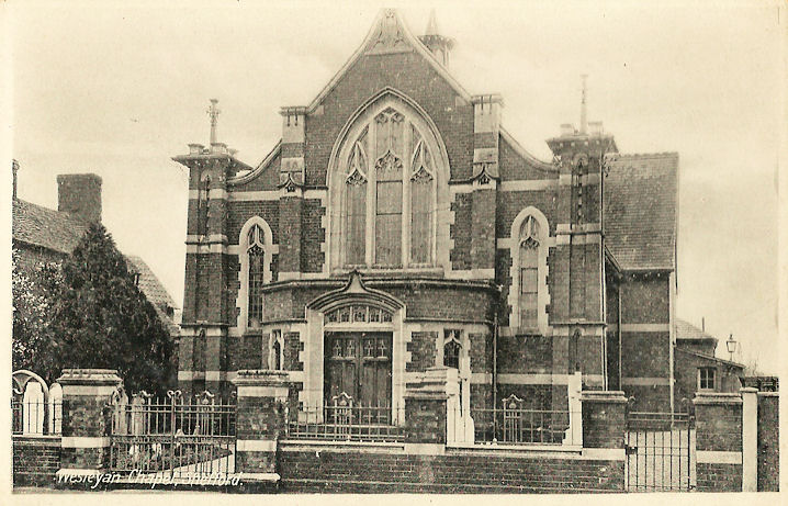
The
Methodist Church on Ampthill Road, built as Wesleyan in 1912. TL 1409 3895. From an old postcard in Judy Flynn's Collection.
A modern view, ? Chris Kippin
(2023). Link.
Grade II listed. The
Baptist Church on Bedford
Road and Stanford Road. TL 1432 3942. ? Chris Kippin (2023).
Link.
Shelton, St. Mary the Virgin. TL 0336
6880. ? Bedfordshire and Luton Archives & Records Service (2011).
Link.
Grade I listed.
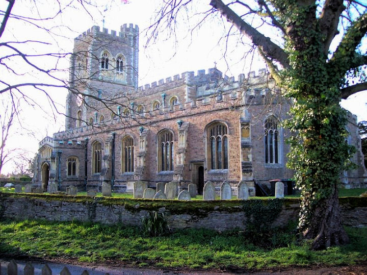
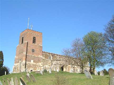
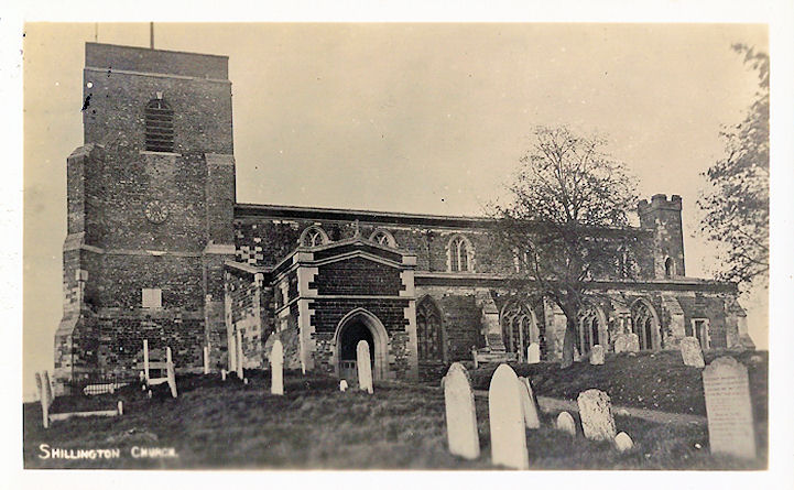
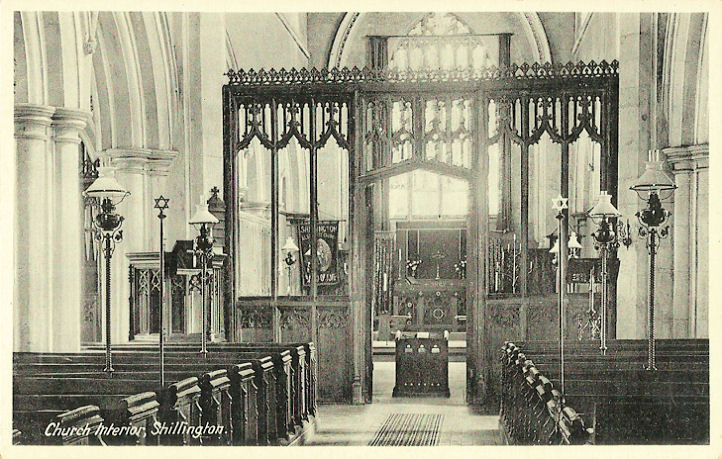
Shillington, dedicated to All Saints. TL 1237 3394.
? Bill
McKenzie. Another view, and an interior view, both from old postcards
in Judy Flynn's Collection. Link. Grade I listed.
A former Methodist Chapel stands on High Road, at
TL 1270 3400. It has a date-stone for 1872, as Wesleyan, and was seen by
Streetview in 2021. The
Congregational Church (1840) on Church Street, aas seen by Streetview
in 2009. TL 1254 3399. Link.
This
source says that there was a Primitive Methodist
Chapel on Bury Road from 1887, closing in 1995. It stood at TL 1227 3515,
and was re-built in 1906 - the date-stone can be seen in a
Streetview from 2021.
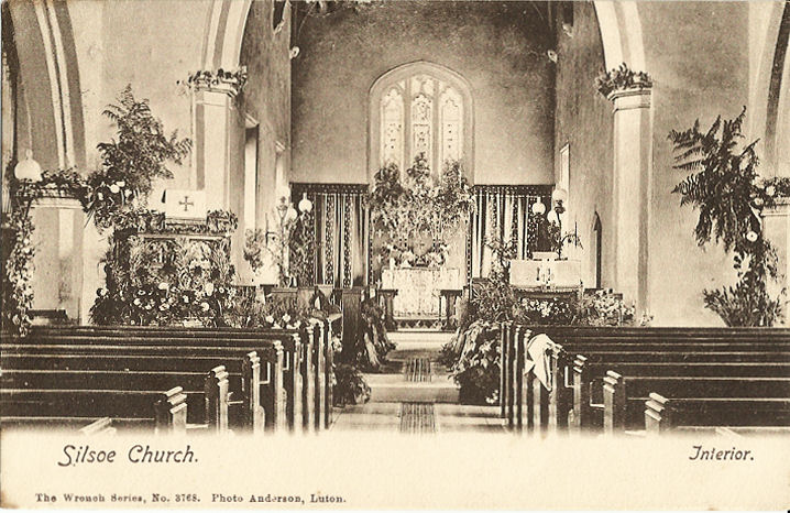
Silsoe, St. James. TL 0825 3559. ? Bill McKenzie. Interior view, from an old
postcard in Judy Flynn's Collection. Link. Grade II listed.
Souldrop, All Saints. SP 9852 6154. ? David Regan
(2017). Link.
Grade II* listed.
Southill, All Saints. TL 1459 4222.
? Les Needham (2010). Another view (the
part nearest to the camera is the vault of the Byng family, the most famous
member of which was Admiral John Byng, executed for his perceived failings in
battle - more here)
and two of the interior - 1,
2, both ? Gerard Charmley (2022).
Link.
Grade II* listed.
Strict Baptist Chapel on High Street. The Congregation
was founded in 1693, and the building dates from 1805 (see
here for a history). TL 1552 4209. ? Les Needham (2010).
Interior view, ? Gerard Charmley
(2022). Link.
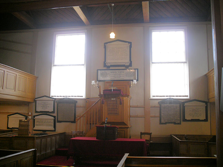
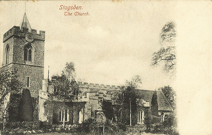
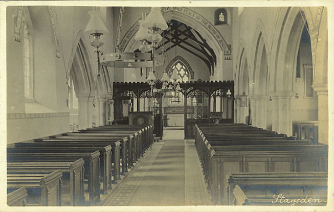
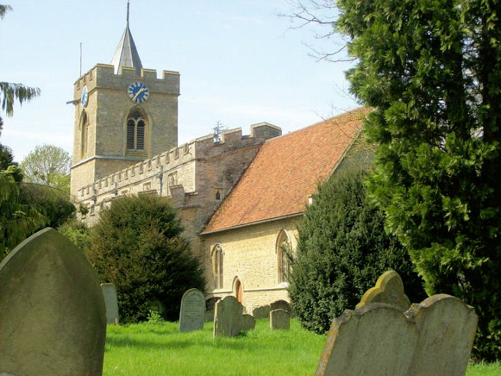
Stagsden, St. Leonard. Interior view. SP 9822 4908. Both from old postcards in
Judy Flynn's Collection. A modern view,
? David Regan (2018). Link.
Grade I listed.
Bunyan Chapel is marked on the 25" O.S. map of 1901
at SP 9816 4897, west of High Street. The part which survives can be seen in a
Streetview of 2021, and a
demolished part of it can be seen
here (where the chapel is dated to 1820) - however, the surviving part seems
to have been the chapel itself, as O.S. maps only indicate this building as a
place of worship.
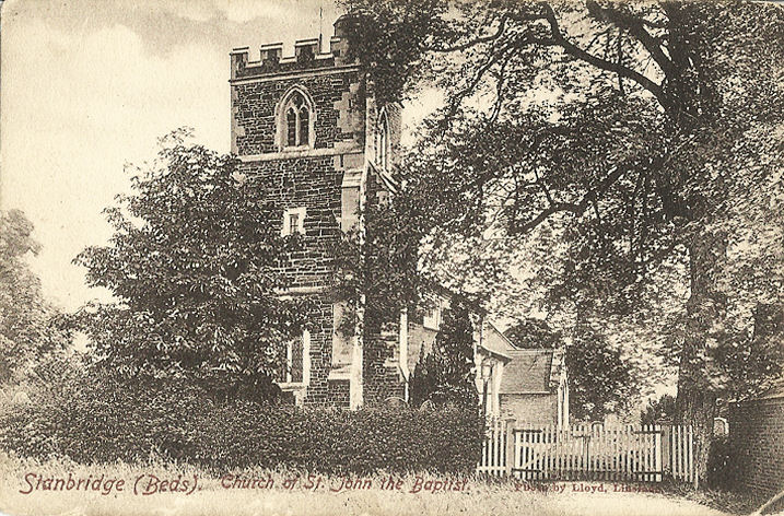
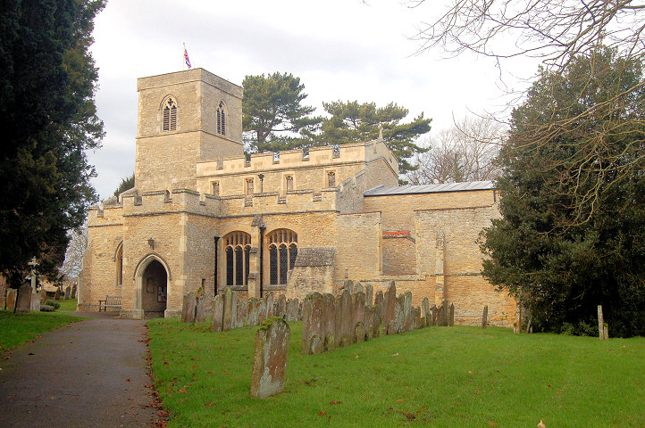
Stanbridge, dedicated to St. John the Baptist.
SP 9657 2423. ? Bill McKenzie. An old postcard view, from Judy Flynn's Collection.
Link. Grade I
listed. A Wesleyan Methodist Chapel once stood
on Mill Road, dated
here to 1870, closing no later than 1972. Streetview saw Chapel House on the
site in 2009. It also
mentions a predecessor of 1833 - whether it was on the same or a different site
isn't stated. SP 9650 2427. The village also had a
Primitive Methodist Chapel, which this
source dates to 1842, closing by 1954 at the latest. A 1910 photo and
history are available
here. A school car parking area was built on its site - see
here in a Streetview from
2009. SP 9676 2431.
Stevington, St. Mary. ? Bedfordshire and Luton Archives & Records Service (2008).
Link.
Grade I listed.
Baptist Church at West End. The congregation
dates from 1655. The present building dates from 1720. SP 9831 5372. ? Bedfordshire and Luton
Archives & Records Service (2009).
Link1.
Link2.
Grade II listed.
The former
Methodist Church on Park Road,
originally Primitive Methodist. It's dated
here to 1863-1957. SP 9917 5312. ? Bedfordshire and Luton Archives & Records Service (2008).
Link.
Stewartby, United Church on Park
Crescent. TL 0219 4230. ? Bill McKenzie.
Link, and dated
here to the 1950's.
Stopsley, Luton - see
Luton.
Stotfold.
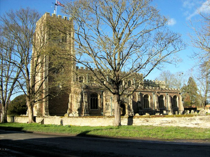
Streatley, St. Margaret. TL 0701 2860.
? Bill McKenzie.
Link.
Grade I listed.
Studham, St. Mary the
Virgin, as seen by Streetview in 2009. TL 0159 1597.
Link.
Grade I listed.
The Methodist Church. Dated
here to 1965, it replaced a Wesleyan Chapel of 1861 on the same site. TL
0221 1579. ? Bedfordshire and Luton Archives & Records Service (2007).
Link.
Sundon, St. Mary the Virgin. Another view. Both
? Bill McKenzie.
Sutton, All Saints. TL 2190 4753. ? Les
Needham (2010). Link.
Grade I listed.
Swineshead, St. Nicholas.
TL 0578 6585. Link1.
Link2.
Grade I listed.
The former Methodist Church
(originally Wesleyan), on High Street, has a date-stone for 1864. TL 0588 6577.
Link1.
Link2. Both ? Bedfordshire and Luton Archives & Records Service (2008).
Tempsford, St. Peter. TL 1619 5303. ? Judy Flynn (2012). An old
postcard view, from Judy Flynn's Collection.
Two additional views - 1, 2, and two interiors (taken through windows) -
1, 2, all
? Chris Stafford (2013).
Link.
Grade II* listed.
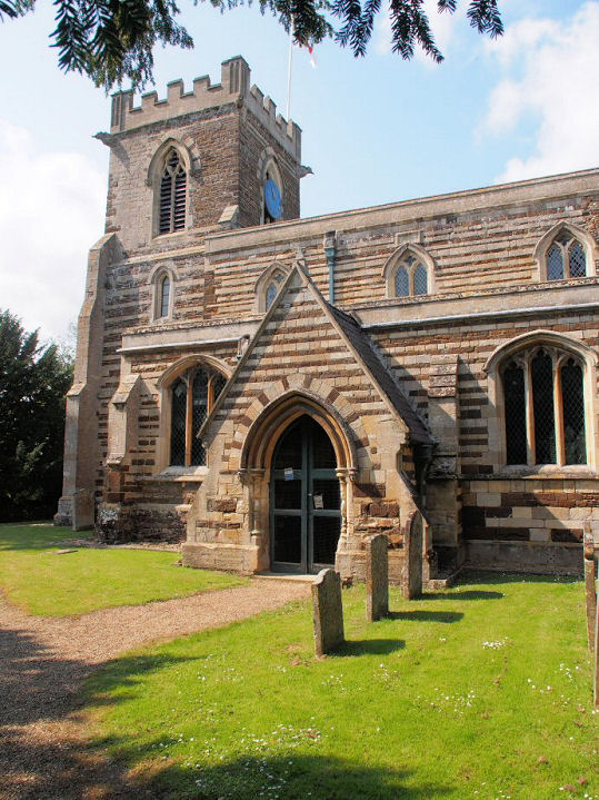
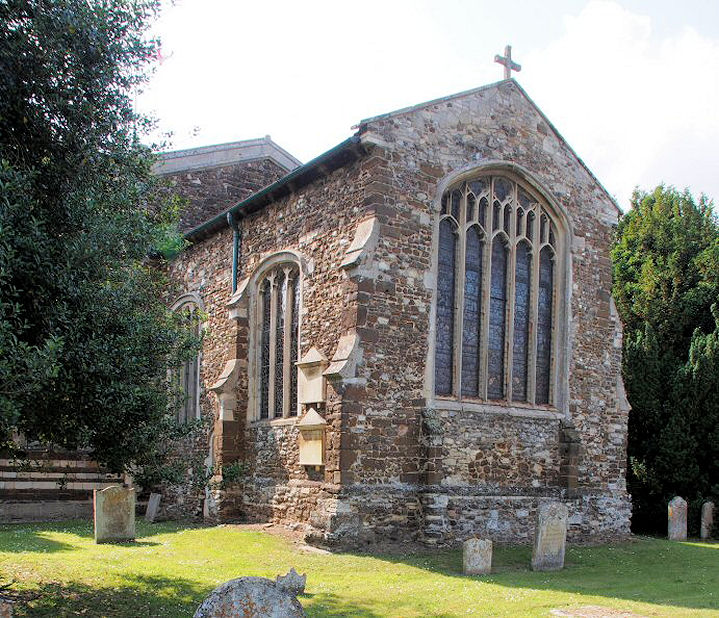
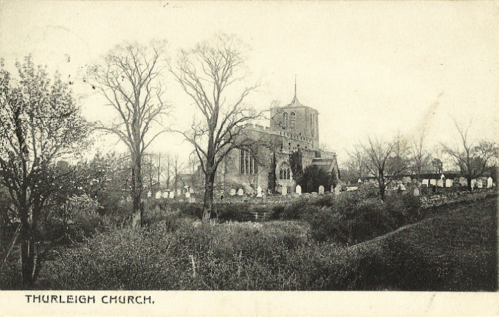
Thurleigh, St. Peter. TL 0513 5847. From an old postcard in Judy Flynn's Collection.
A modern view, ? David Regan (2019).
Link.
Grade II* listed. Baptist Church
on High Street. It has a date-stone for 1888. It seems to now be closed, as it's
labelled on Google maps as The Old Chapel Cake Company.
? David Regan (2019).
Link.
Tilsworth,
dedicated to All Saints. SP 9751 2428. ? Bill McKenzie.
Link.
Grade I listed. The village had a
Wesleyan Methodist Chapel on the green at the
eastern end of the village, at SP 9810 2429. It's dated
here (where there is also a photo) to about 1862 to circa 1991. The house
standing on the site of the chapel can be seen in a
Streetview from 2009.
Tingrith, St. Nicholas. TL 0072 3243. From an old postcard in Judy Flynn's Collection.
Link.
Grade I listed.
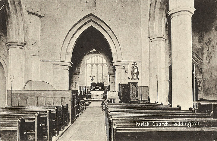
Toddington, St. George of England. TL 0101 2894.
? Bill McKenzie. Another view,
? Judy Flynn. Interior view, from
an old postcard in Judy Flynn's Collection. Link.
Grade I listed.
The Baptist Church stands on Station Road, just a
little way north-east of the church, at TL 0108 2900.
Streetview saw it in 2016.
Zooming-in shows the date-stone, which I think is for 1871.
Link. A
Primitive Methodist Chapel is shown on old maps on Leighton Road, at TL
0076 2881. It's dated
here to 1893 (where there are also photos), and it has evidently been
demolished - 2021 Streetview.
It also says that it was successor to an earlier chapel of 1846 on what is now
Conger Lane. It doesn't give its exact position, or say whether it has survived,
but this building
(Streetview 2019) looks to be a possible candidate. Can you confirm if this
speculation is correct? The Methodist Church on
High Street was originally Wesleyan, and seen by
Streetview in 2021. It
pre-dates a map of 1901. TL 0089 2869.
Link.
St. Elizabeth of Hungary (R.C.) on TL 0085 2911. It
can be seen in the background of a
2021 Streetview, and better
here, where photos of the exterior and interior continually cycle.
Totternhoe, dedicated to St. Giles of
Provence. SP 9883 20888. ? Bill
McKenzie. Link.
Grade I listed. A Primitive
Methodist Chapel is shown on a map of 1901 at SP 9904 2119. This
source dates it to 1861-1929, and its
site was seen by Streetview
in 2021. A second chapel was built on Furlong Lane in 1929. The house on the
site can be seen here in a
Streetview from 2009 - whether anything of the chapel remains is not evident. SP
9911 2124.
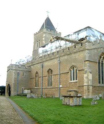
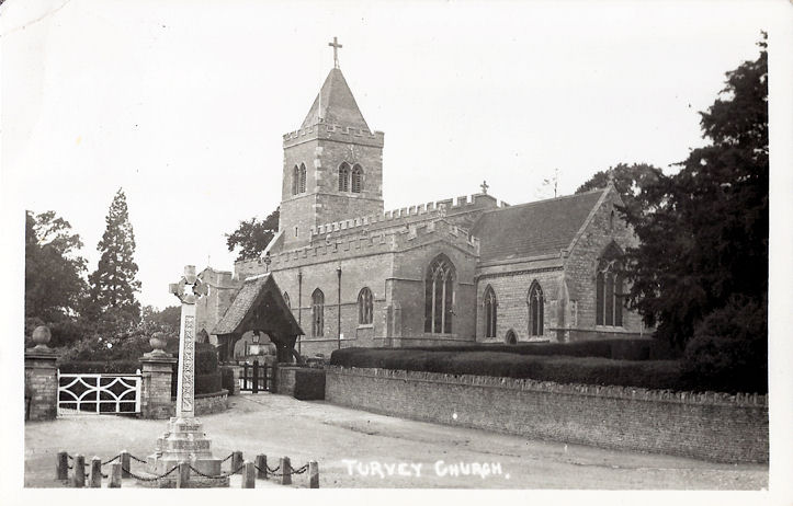
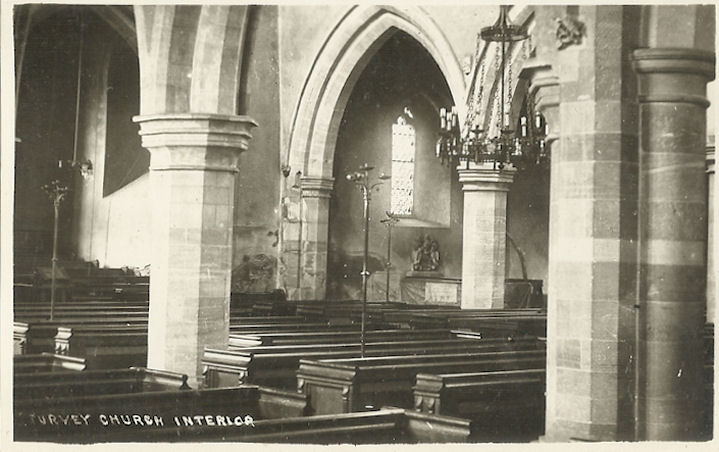
Turvey, All Saints. SP 9403 5254. ?
Bill McKenzie.
Another view, and an interior view, both from old postcards in Judy Flynn's
Collection. Another view,
? David Regan (2018).
Link.
Grade I listed.
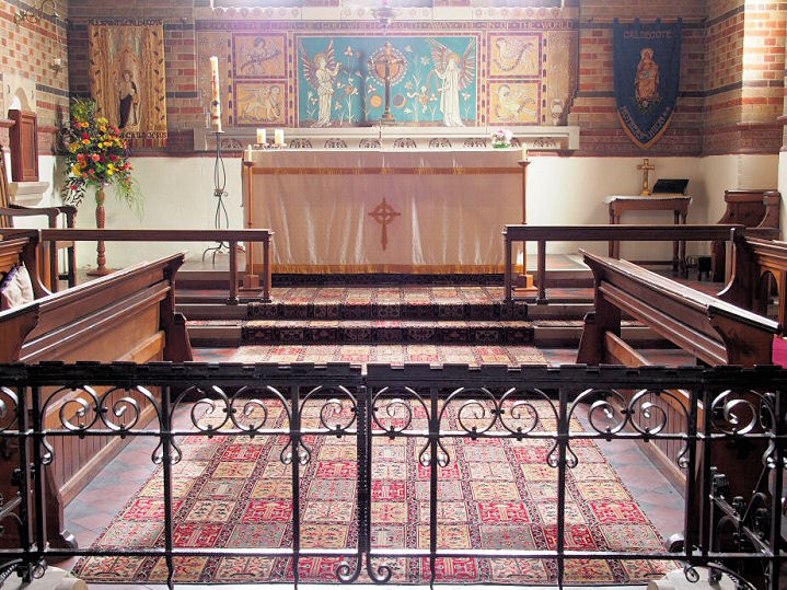
Upper
Caldecote, All Saints. TL 1668 4589. ? Les
Needham (2010). Another view, a
window, four of the interior -
1,
2,
3,
4, and the
font, all ? Chris Stafford (2013). Link.
Grade II listed. The
Methodist Church stands a little
way east of All Saints on Biggleswade Road. TL 1682 4591. ? Les Needham (2010).
Link. What is perhaps its predecessor - Wesleyan
Methodist - was seen by
Streetview in 2020. It pre-dates a map of 1883-4. TL 1655 4554.
Upper Dean, All Hallows (or All Saints, according to source consulted). Interior view.
TL 0468 6764. Both from old postcards in Judy Flynn's Collection.
A modern view, ? David Regan (2017).
Link1.
Link2
(numerous photos, inside and out).
Grade I listed.
The U.R.C. on High Street was built as Congregational in 1863.
TL 0484 6794. ? Bedfordshire and Luton Archives & Records Service (2011).
Link.
Grade II listed.
Upper
Gravenhurst, St. Giles. TL 1130 3599. ? Bill McKenzie.
Link.
Grade II* listed. A
Methodist Church stands on High Street, marked on older maps as Wesleyan.
It pre-dates a map of 1901, and was seen by
Streetview in 2010. TL 1143
3603. Link.
Upper Stondon, All Saints. Another view.
TL 1500 3556. Both ? Bill McKenzie.
Link.
Grade II listed.
Westoning, St.
Mary Magdalene. TL 0281 3279. ? Bill McKenzie. Interior view, from
an old postcard in Judy Flynn's Collection. Link.
Grade II* listed.
The Baptist Church on
Greenfield Road, as seen by Streetview in 2020. TL 0360 3282. The
church website dates it to
1986-9, and it was preceded by an earlier chapel of the 1830's on an adjacent
site. This was seen by
Streetview in 2021. This seems to be the same building labelled on the 25"
O.S. map of 1901 as Methodist Chapel (Calvinist). TL 0357 3279. The
village also has a former Methodist Church, on Park
Road at TL 0337 3254. Seen by
Streetview in 2021, it was originally Wesleyan, and dated
here to 1863-2006, where it also says that it had (for a few years) a
predecessor, though whether this was on the same site isn't stated.
Whipsnade, St. Mary Magdalene. TL 0117
1796. ? Bill McKenzie.
Link.
Grade II* listed. A former
Methodist Chapel (originally Wesleyan) stands west of the church at TL
0103 1801. Seen by Streetview
in 2021, it's dated
here to 1858-1937.
Link.
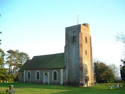
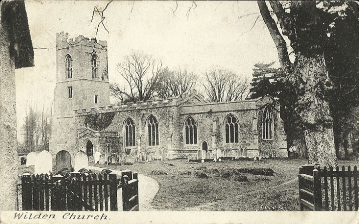
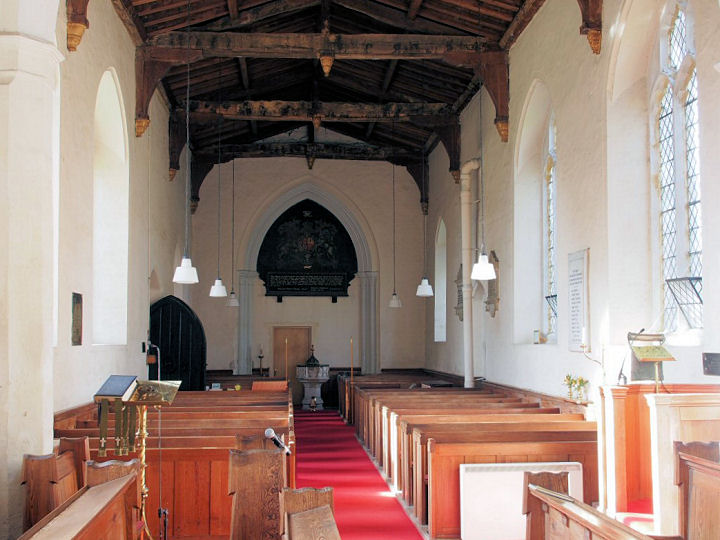
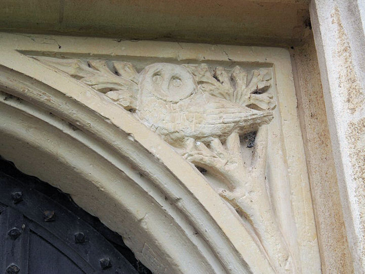
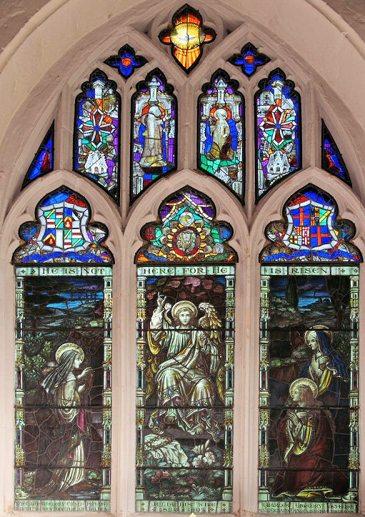
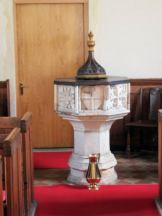
Wilden, St. Nicholas. TL 0940 5523. From an old postcard (posted in 1910) in
Judy Flynn's Collection. A modern view, ?
David Regan (2019).
Two interior views - 1,
2, a charming
stone-carved owl in a door spandrel, a
window, and the
font, all
? Chris Stafford (2013).
Link.
Grade I listed. Old maps mark a Baptist Chapel
to the east of the village, on Great Barford Road at TL 1031 5515. The
church website
doesn't appear to have been updated since 2012, so the chapel may have closed.
Many photos are available
here.
Wilstead, All Saints. TL 0627 4349. ? Stuart Hamilton.
Link.
Grade II* listed.
The Methodist Church on Whitworth Way and Cotton
End Road was seen by Streetview
in 2009. It's dated
here to 1967. TL 0662 4355. The same source provides details about its
Wesleyan predecessor, which stood on Chapel Lane at TL 0696 4375. Housing now
stands on teh site, seen here by
Streetview in 2009. A Mission Hall is marked on
the 1901 25" O.S. map at circa TL 0716 4374 (it's not exactly clear which
building is being referred to). A photo of it can be seen
here in about 1950. Wilstead Evangelical Church
is on Cotton End Road at TL 0717 4374. and was seen by
Streetview in 2021.
Link.
Willington, St. Lawrence. TL 1066 4987.
? Les Needham (2010). Another view, ?
David Regan (2019).
Link.
Grade II listed. An impressive
Dovecot stands nearby, which wouldn't normally merit inclusion, but the
grade I listing says it is
"possibly reused from Newnham Priory (dissolved 1535)".
Methodist Church (originally
Wesleyan). TL 1130 5008.
? Les Needham (2010). Another view, ?
David Regan (2019).
Link.
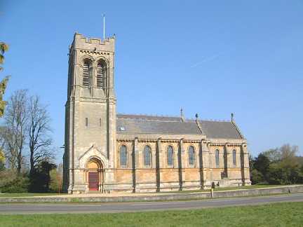
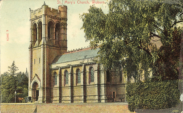
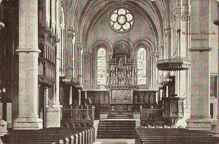
Woburn, dedicated to St. Mary the Virgin. SP 9504 3328.
? Bill
McKenzie. Another view, and an interior view, both from old postcards in Judy
Flynn's Collection.
Its
grade II* listing dates it to 1865-8.
Link. The Old Church of St. Mary has been in
use as a Heritage Centre since 1984. SP 9486 3325. ? Judy Flynn.
Grade II* listed.
A former Wesleyan Methodist Chapel stands on London
End. It was seen by Streetview
in 2010. It's dated
here to 1860, closing on or by 1963. SP 9478 3300. There was also a
Congregational Chapel of 1854-1943, with demolition
in 1988 (source,
which also has a photo). Its site hasn't been seen by Streetview. SP 9486 3300.
Wootton, St. Mary the Virgin. TL 0037
4507. Link.
Grade I listed. New Life
Methodist Church on Cause End Road was built as Wesleyan. TL 0063 4542.
Link1.
Link2. Baptist Church (1836) on
Bedford Road.
TL 0088 4524.
Link. All
?
Bedfordshire and Luton Archives & Records Service (2007).
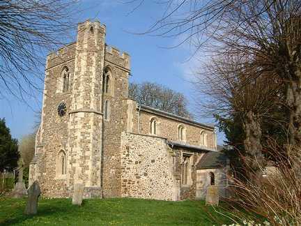
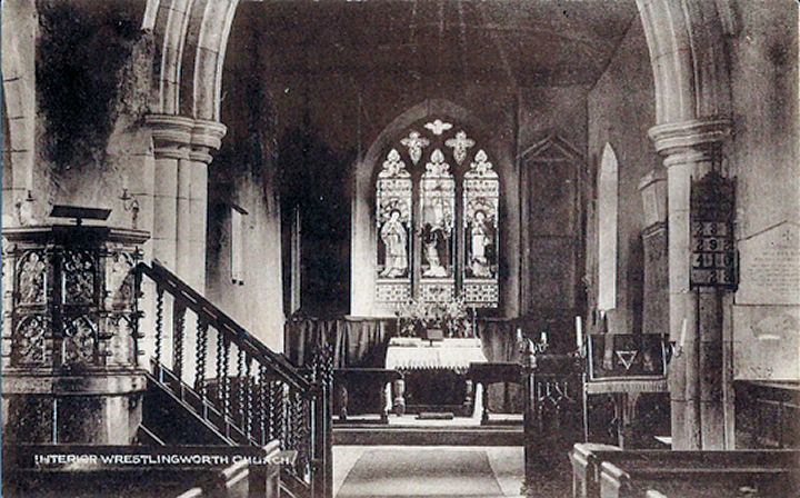
Wrestlingworth, St. Peter. TL 2592 4736.
? Bill McKenzie. Interior view, from an old
postcard in Judy Flynn's Collection. Link.
Grade I listed.
For other listed features associated with the church, see
here. A former Congregational Chapel stands on
High Street at TL 2690 4762. It was seen by
Streetview in 2008, and
Genuki
(quoting from an old directory) dates it to 1887.
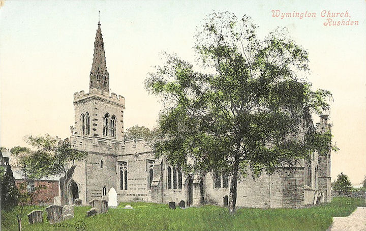
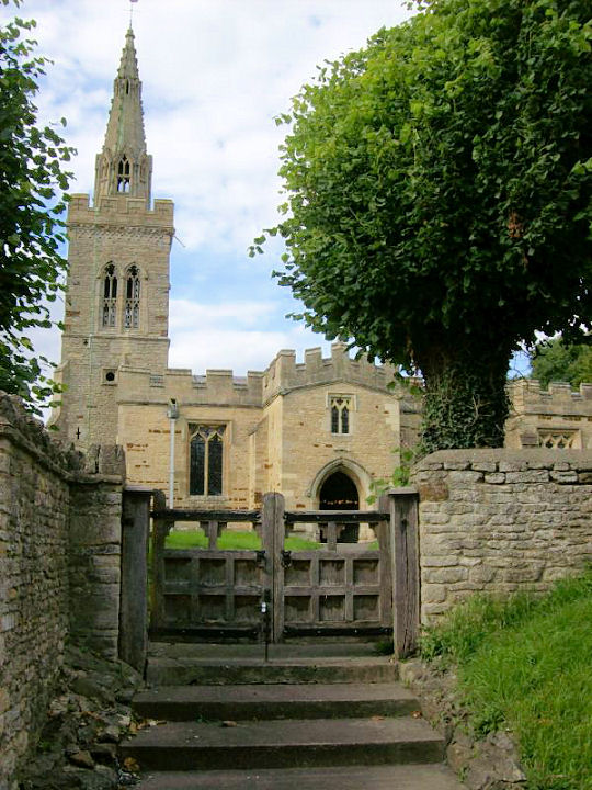
Wymington, St. Lawrence. SP 9552 6439. From an old postcard in Judy Flynn's Collection.
Two modern views - 1,
2, both ? David Regan (2017).
Link. The
grade I listing has some interior photos.
Old O.S. maps show a Wesleyan Methodist Chapel on
High Street at TL 9555 6429. The most recent
Streetview from 2021 shows
that it's now Wymington Chapel and Meeting Place. It's dated
here to
1870.
Yelden,
St. Mary. Another view. TL 0113 6715. Both
? Jim Rushton.
Link.
Grade I listed. The Methodist Chapel is on
Spring Lane, and was seen by
Streetview in 2009. It was built as Wesleyan in 1884, on the site of a
predecessor of the 1840's or early 1850's. TL 0123 6698.
Link.
|
|