|
|
East Lothian
East Lothian on Wikipedia.
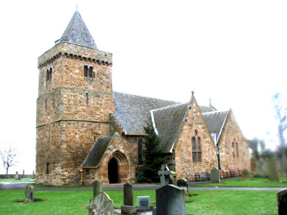
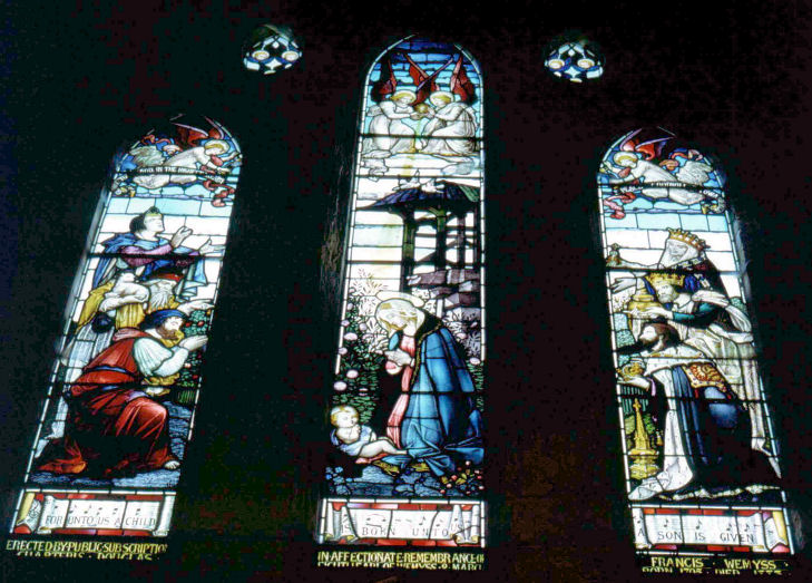
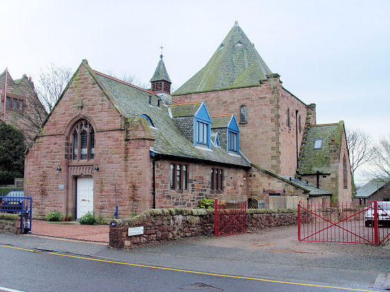
Aberlady,
the Parish Church. NT 4619 7985. © Bill Henderson.
A winter view, and the East Window, both © Revd. Norman Faulds.
Norman advises that the central panel of the window is based on Botticelli's "Madonna and Child" which is now in the
National Gallery of Scotland.
The fabric of the church is late C15 (tower), C16 and C17 (aisles), with
a Victorian renovation (1887).
Link.
Category A listed.
PoWiS.
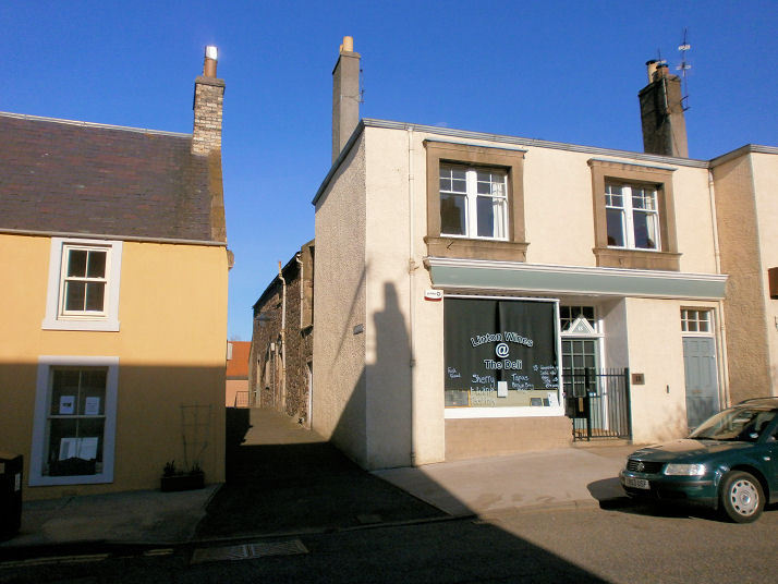
Older maps show a United Presbyterian Church,
pre-dating one of 1854, and it had gone out of use in the first half of
the lasy century. Unfortunately none of the available maps are entirely
clear which building the label is meant to apply to, but I think it
probably stood on the west side of The Wynd, at NT 4651 8000. If this is
correct, it has been demolished, and the site is now a parking area
(2024 Streetview). A little way east of the village O.S. maps mark
Convent (Remains of) at NT 4711 8015. Its
PoWiS entry calls it Luffness Carmelite Monastery. Some photos can
be seen here,
where it's called Luffness Friary.
Canmore.
Belhaven, Church of
Scotland. NT 6687 7875. © Bill Henderson.
Link.
Category B listed, wherein it's dated to 1838-40.
Bolton,
the Parish Kirk. NT 5073 7006. © James Denham. This
source says it stands on a much older site, and that it was for sale
in 2025.
Category B listed - dates it to 1809. A churchyard mausoleum is also listed
as
category B. About 1½ miles to the S.W. is the site of a
Free Church, near Pilmuir House, later U.F.
Pre-dating a map of 1855, it seems to have gone out of use by the
mid-20th century. It stood within the trees seen by
Streetview in
2010 - the
listing for the adjacent former manse says that the church has gone.
NT 4864 6906.
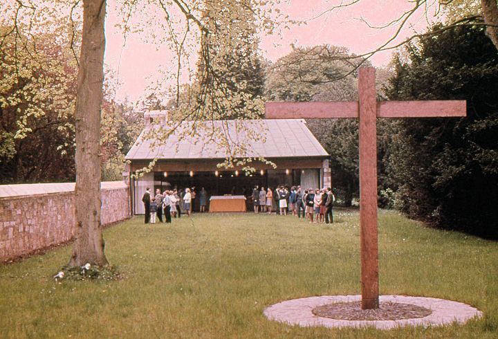
Carberry,
Carberry Tower Chapel. The tower is at NT 3631 6967. © Alex Parker.
Link.
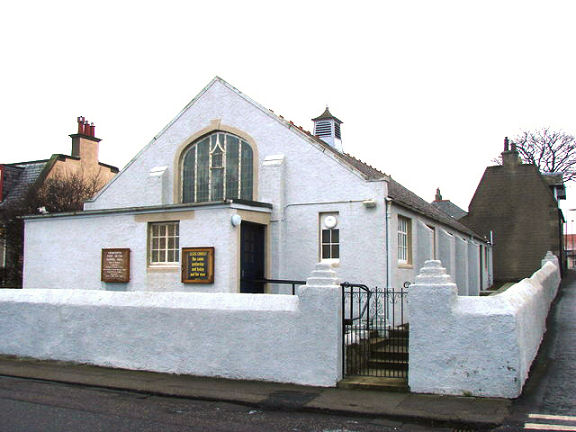
Cockenzie
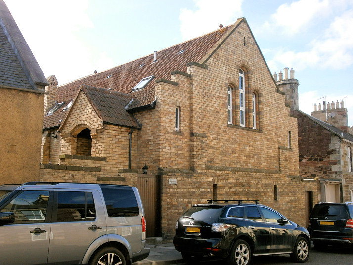
and Port Seton, Viewforth Port Seton Gospel Hall,
on Viewforth and Cope Lane. NT 4050 7585. © Bill Henderson.
Link
dates it to 1922. Cockenzie Old Parish Church
(1838) on High Street. NT 4007 7576. © James Denham. As of 2025 Google
Streetview is labelling this church as permanently closed.
PoWiS.
Chalmers Memorial
Parish Church on Gosford Road, as seen by Streetview in 2023. As of
2025, Google is also labelling this church as permanently closed,
although its website
is still active. Its
history page
dates it to 1904, as a Free Church. NT 4031 7567.
PoWiS.
Tranent with
Cockenzie Methodist Church (2023 Streetview) is on Edinburgh Road
and West Lorimer Place. Its date-stone is for 1878, as Primitive
Methodist. NT 3990 7553.
Link1.
Link2. Elcho
Place Hall (2023 Streetview) on High Street is also used for worship
- their website is here.
PoWiS
lists a Fishermen's Bethel on New Street,
but gives no further details. It pre-dates a map of 1894, and was seen
by Streetview in
2022 - unfortunately the date-stone is weathered to un-readability, and
the building is evidently now in domestic use. NT 4016 7570. The same
map also shows a F. Church (presumably Free
Church) nearby at NT 4011 7571, on School Lane. It was no loner marked
as a place of worship by the time of a map of 1955. The housing on its
site was seen by
Streetview in 2022. There was also a Baptist Chapel, shown on a map
of 1894 as Bapt. Chapel (General), on Main
Street. The map seems to be indicating a building in the middle of a
terrace on the south side of the road. If this correct it will have been
at circa NT 4016 7577, and Streetview saw the buildings on its
site (at the
left) in 2023.
Dirleton, the
Parish Church. Two more views - 1,
2. NT 5127 8422. All © Steve Bulman
(2021). Link,
which dates it to 1612, on the site of a medieval predecessor.
PoWiS. The village also
had a Free Church, now demolished. It stood off
Manse Road, south of the western corner of the village green, at NT 5146 8381.
It's dated
here to post-1843 to 1936. Its site isn't viewable on Streetview, but
the access road to where the site was is seen
here in a Streetview from
2020.
Dunbar, the Parish Church on Queen's Road.
Large scale O.S. maps say about this church as (e.g.) Church on Site of
Collegiate Church (A.D. 1342). NT 6817 7858. © Bill Henderson. Link.
Category A listed, wherein it's dated to 1818-21.
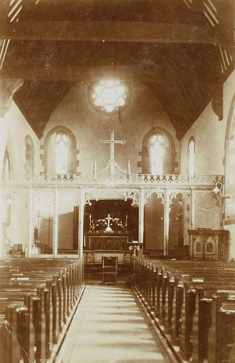
PoWiS. This
postcard view of an interior (from
John Bowdler's Collection) was in the Unknown
section for many years, before finally being identified by Janet Gimber as the
interior of St Anne's Episcopal Church, on
Westgate. Its exterior can be seen in a
2022 Streetview. NT
6781 7905.
Link.
PoWiS. Older O.S. maps also show R.C. Chap. on
Bayswell Road at NT 6778 7908.
PoWiS
calls it Our Lady of the Waves, and is dated
here to 1877. It was seen by
Streetview in 2018. A
map of 1854 shows a United Presbyterian Church at
NT 6822 7875. It had been demolished no later than 1893. Its
site was seen by
Streetview in 2022 - effectively the gap between the two blocks of housing.
Curiously, another United Presbyterian Church shows
on the same 1854 map nearby, at NT 6805 7882, on Church Street. It had also gone
by 1893, and its site
was also seen by Streetview in 2022. The towns former
Free Church (2022
Streetview) stands at the end of High Street, at NT 6801 7872. It's now in
commercial use.
Category B listed - dates it to 1850.
PoWiS. The
Methodist Church (2022
Streetview) is on Castle Street and Victoria Street, at NT 6792 7913. It has a
date-stone which says it was Wesleyan.
Link. PoWiS.
Discovery Church is based in a house on Grahame
Place, but meets in a number of locations. I think it's one of the houses on the
street seen in a Streetview
from 2022. Link.
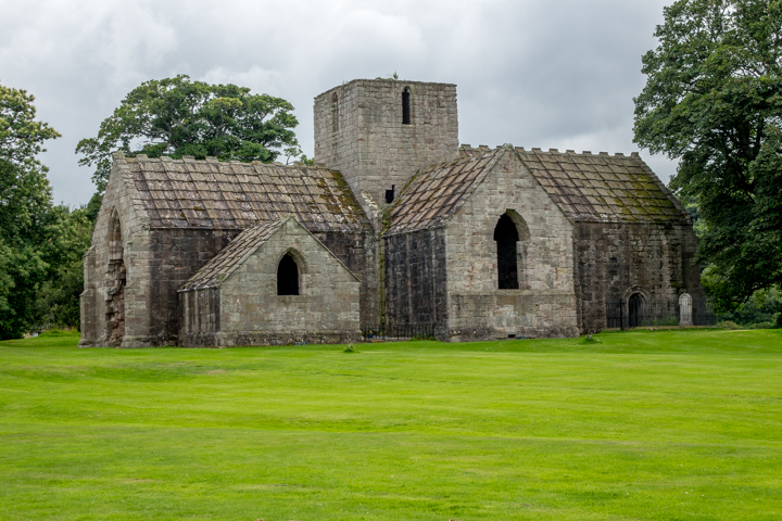
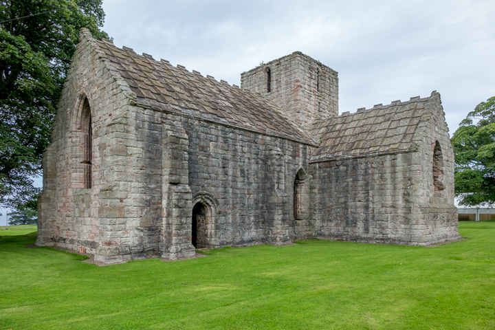
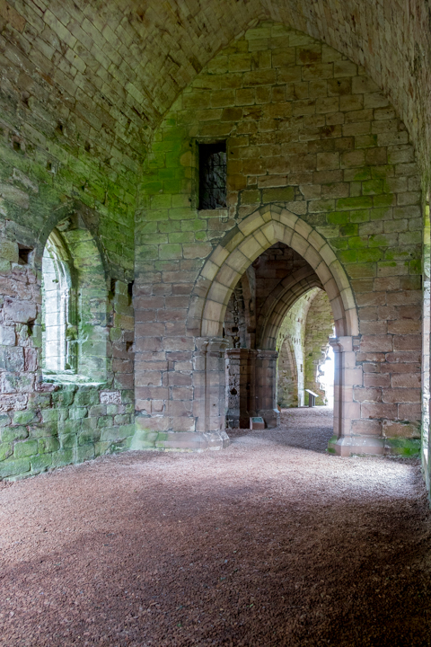
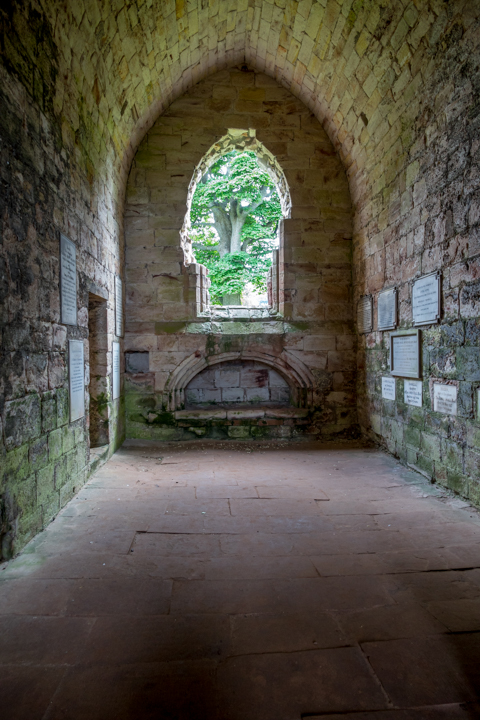
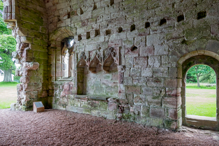
Dunglass, the substantial remains of
the C15 Dunglass Collegiate Church. Another
view, and three of the interior - 1,
2,
3. NT 7666 7189. All © Steve
Bulman (2017).
Link. Canmore.
PoWiS.
East Linton, Prestonkirk Church (CoS). Another
view. NT 5925 7781. Both © Howard Richter (2013).
Link.
Category A listed.
PoWiS
dates it to 1770, possibly on the site of a chapel founded by St. Baldred, who
died in the early 7th century. The former
St. Kentigern (R.C., closed before 1990) on High Street, now a private residence.
Another view. NT 5914 7732. Both
© Howard Richter (2013). The former
Free Church. It pre-dates 1879, when it is reported as being "improved". The spire is of the "Rhenish helm" type,
and rare in Britain. NT 5521 7719. © Howard Richter (2013).
PoWiS. Three views of the former
United Presbyterian Church on The Square - 1,
2, 3. What may be this building shows on the OS map of 1854-5; it is
certainly shown on the 1894 map, and on the next map (1907, which is after the union) it shows as "U. F. Church". It continues as such on the 1938 map, but by
the 1957 edition it shows as "U. F. Church (Dis.)". There is some indication that it was subsequently in use as a Masonic Hall. NT 5919 7731. All © Howard Richter (2013).
PoWiS
dates it to 1770, closing in 1910, and confirming its later use as a Masonic
Hall.
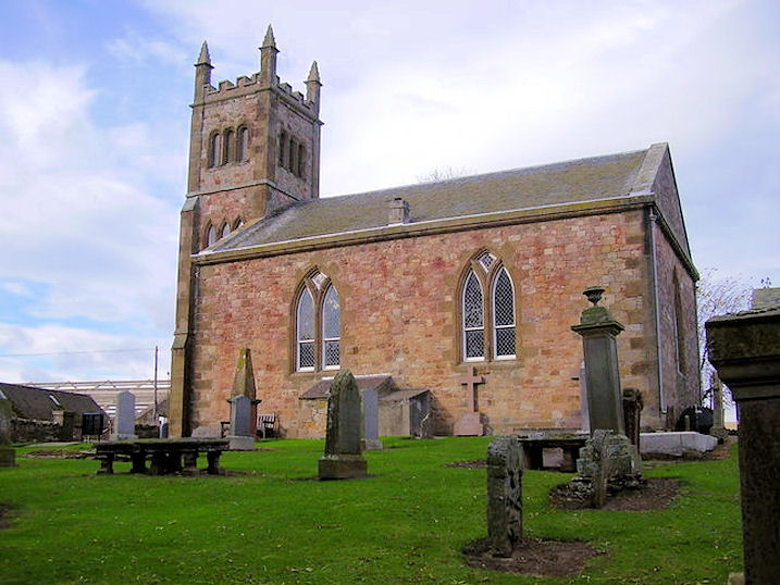
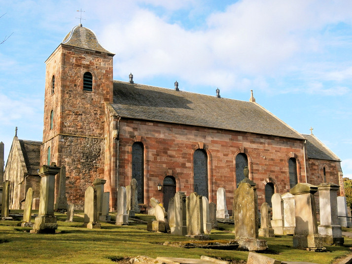
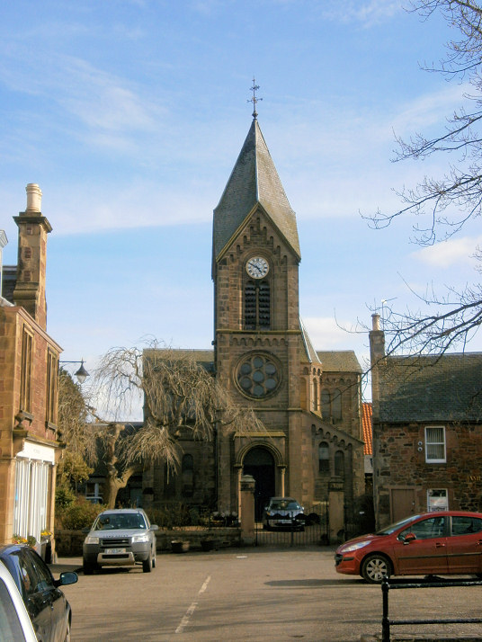
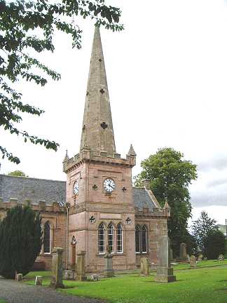
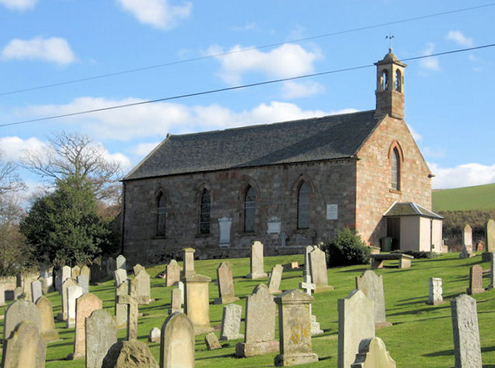
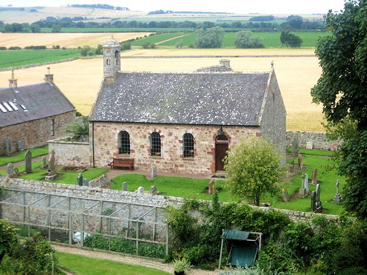
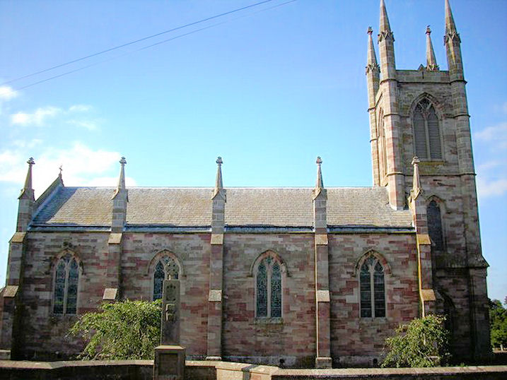
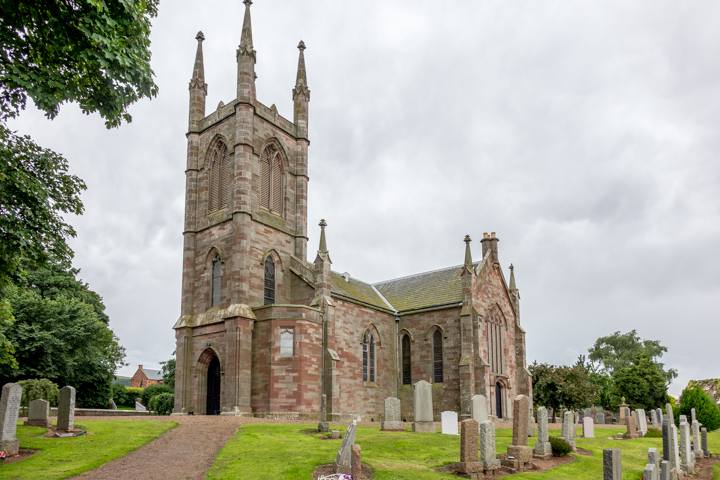
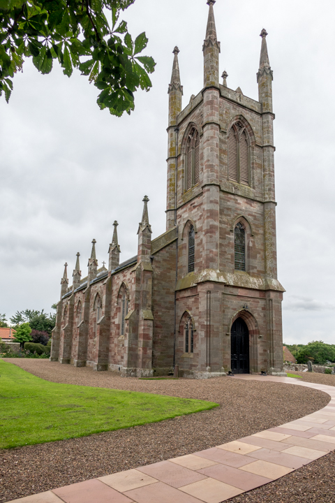
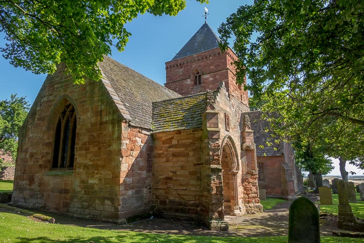
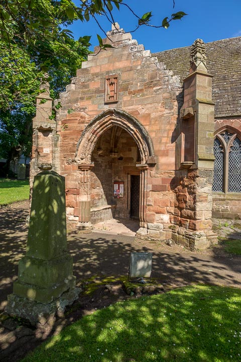
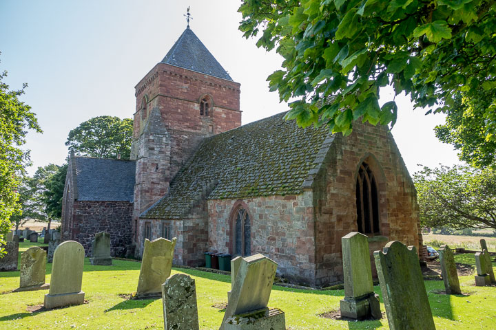
East Saltoun, the parish church.
NT 4744 6787. © Bill McKenzie.
Link, dates it to 1805, on an older site. A
2024 webpage has a comment that the church is expected to be closed.
Category A listed.
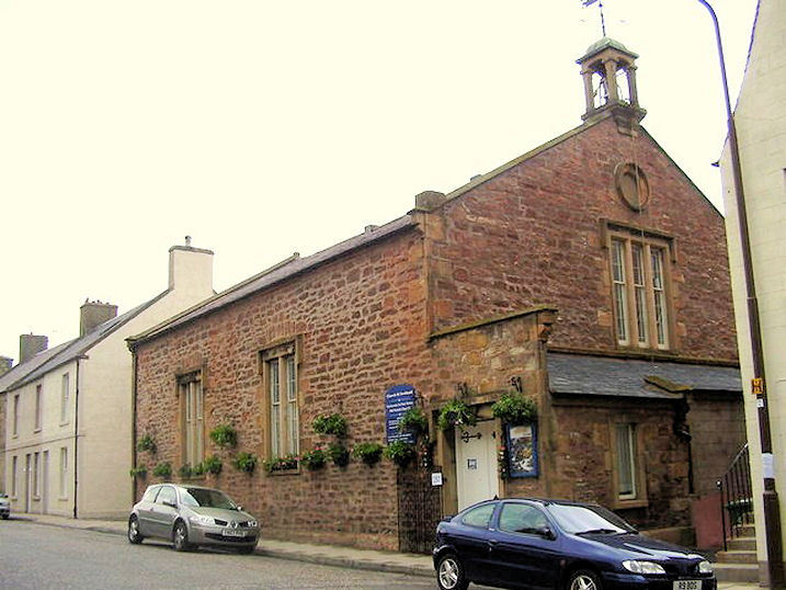
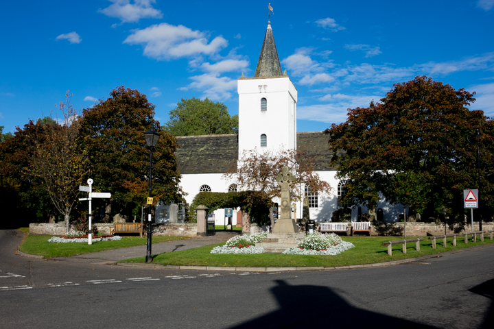
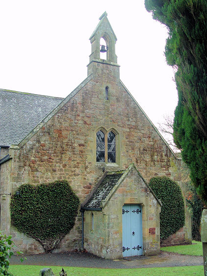
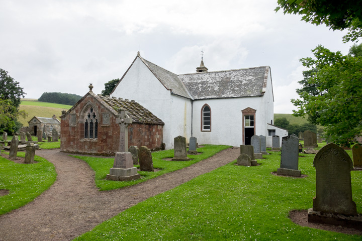
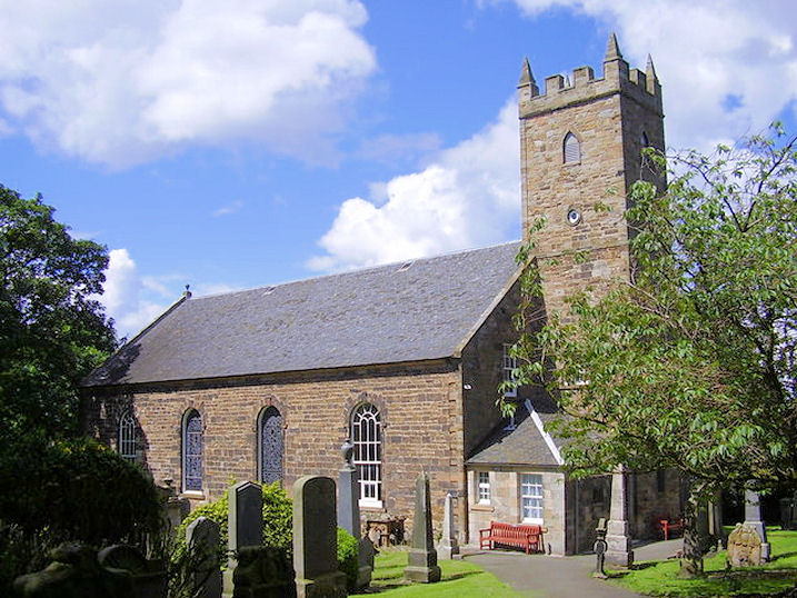
Garvald, the Parish Kirk.
NT 5907 7091. © James Denham.
Link.
Category B listed.
PoWiS. The village also has a former Free Church,
which now serves as the
village hall (2011 Streetview). NT 5867 7082.
Category C listed - dates it to 1843.
PoWiS.
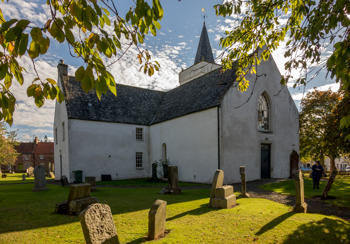
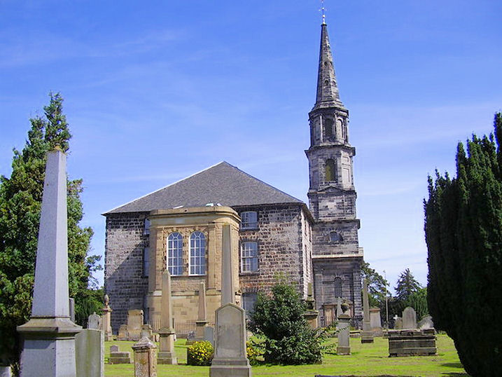
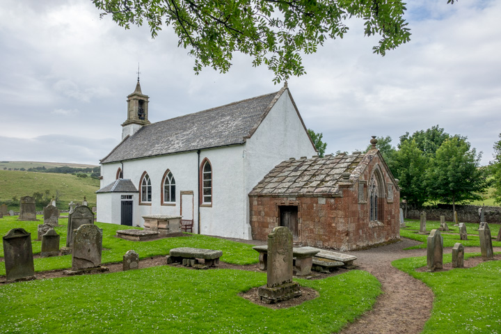
Gifford, the Yester Parish Church. Jim
Napier and James Denham advise that the Rev. John Witherspoon, son of the
one-time vicar here (also John Witherspoon), was the only cleric to sign the
American Declaration of Independence (though he signed as Governor of Princeton
and Principal of Princeton College), and that the American system of government
owes much to this Presbyterian influence.
Another view. NT 5348 6810. Both © Steve Bulman (2021).
Link.
Grade A listed, wherein it's dated to 1708-10. The village also had a
Free Church. According to its
Genuki
entry, it pre-dates a map of 1853, and has been converted into two houses -
the one nearer the road being seen in a Streetview from 2011
here. TL 5370 6809.
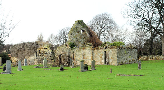
Gullane, the ruins of St. Andrew.
NT 4804 8271. © Steve Bulman.
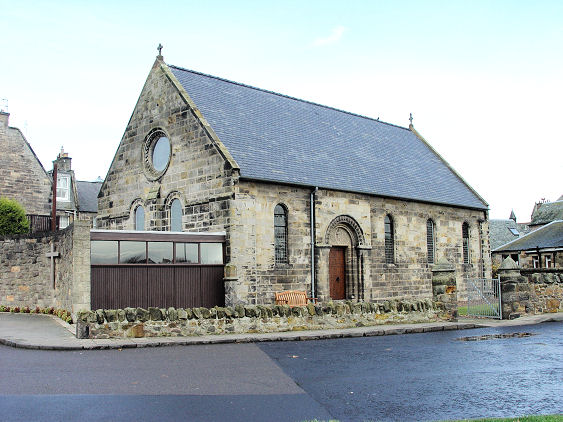
PoWiS. Gullane Parish Church (CoS)
on East Links Road.
NT 4829 8271. © Steve Bulman.
Link.
PoWiS dates it to 1908, as a United Free Church.
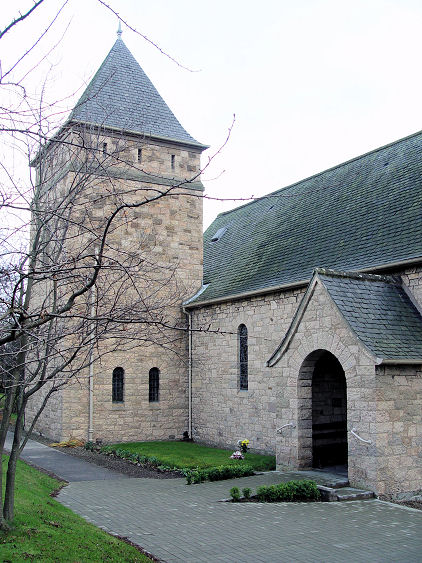
St. Adrian (Episcopal) on Sandy
Loan.
Another view.
NT 4799 8284. Both © Steve Bulman.
Link.
Category B listed, dates it to 1926.
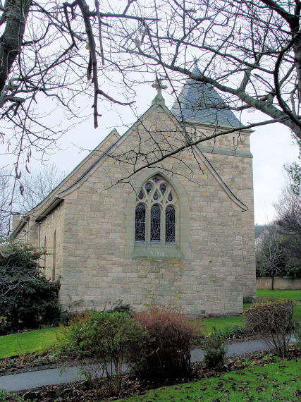
PoWiS. The former St. Peter on
Main Street. NT 4835 8277. © Steve
Bulman.
Category A listed - dates it to the late 19th century with enlargement and
additions in 1908. To the north of the town by the coast are the remains of the
Chapel of St. Patrick. Its
PoWiS entry
doesn't date
it, but it's presumably medieval. A photo can be seen on its
Genuki
page. NT4828 8437.
Canmore.
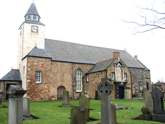
Haddington,
St. Mary. NT 5188 7362. © Bill McKenzie.
Link.
Category A listed.
PoWiS.
Haddington West (CoS)
on Court Street is labelled on older maps as a Free Church. NT 5119
7389. © Steve Bulman. Link.
Holy Trinity (Episcopal) on Church
Street.
PoWiS
dates it to 1769-70. NT 5180 7387. © Steve Bulman.
Link.
Category B listed. St. Mary
(R.C.) on Poldrate, as seen by Streetview in 2021. It's dated
here to 1862. NT 5178 7354.
The remains of the 12th century
St. Martin on Bullet
Loan, as seen by Streetview in 2022. NT 5209 7394.
PoWiS.
A map of 1855 shows West United Presbyterian Church
off Court Street, at NT 5124 7393. Only a small tower survives, seen by
Streetview in 2020.
PoWiS
dates it (presumably incorrectly, unless the date refers to a re-build) to 1860.
The former St. John
(2022 Streetview) on Newton Port and Fortune Avenue. According to its
PoWiS entry,
it's now used as a church hall. NT 5147 7408.
Category B listed - dates it to 1838. On the 1855 map, immediately
south-east of St. John, was St. John's Free Church,
at NT 5149 7408. By the time of a map of 1895 it was disused. Whether the
building on its site
(2022 Streetview) is a conversion or a later building is unclear.
Humbie, Humbie Kirk (CoS).
Another view. NT 4608 6371. Both © Steve Bulman.
Link
- dates it to 1800.
Category B listed.
Innerwick, Church of Scotland.
NT 7207 7394. © James Denham (2010). It has evidently been closed - an
un-dated
sales brochure has numerous interior photos. A 2024
news item says it was closed two years before.
Category C listed - dates it to 1784.
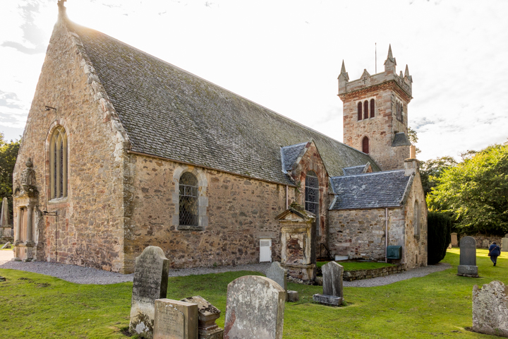
Inveresk, St. Michael's Parish Kirk
on an older site. NT 3442 7207. © James Denham.
Link.
Category A listed, wherein it's dated to 1803-5.
Morham,
Church of Scotland. NT 5566 7259. © James Denham (2010). 2023
news story, which tells of closure.
Category A listed.
Musselburgh.
North Berwick.
Oldhamstocks, Church of
Scotland. NT 7380 7065. © James Denham (2010). Two more views -
1,
2, both © Steve Bulman
(2017).
Link -
advises that the final service was held in January, 2025. Category
A listed. See
here for related listed features. Older O.S. maps also show a
Free Church in the village. It pre-dates
one of 1854, and had gone out of use by 1938. It seems to survive,
converted, and was seen by
Streetview in
2011. NT 7390 7058.
Port Seton - see
Cockenzie above.
Prestonpans. Previously listed as Cockenzie and Port Seaton Old Parish Church, James
Denham has advised that this church is Prestongrange Parish Church.
NT 3882 7456. © Bill Henderson.
Link.
Category A listed - dates it to 1596.
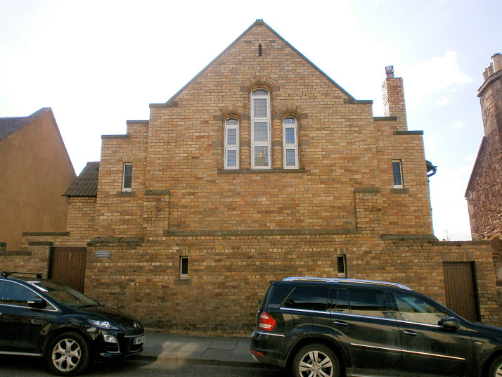
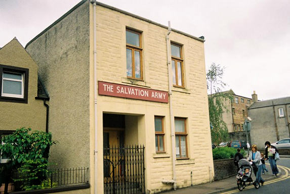
Salvation Army Hall on Kirk
Street. This is perhaps the same building as shown on old maps as a Free Church
Hall, or was built on the site of it. NT 3875 7450. © Rob Brettle.
Link.
Lighthouse Central Church
(2022 Streetview) is at the junction of Ayres Wynd and Orchard Crescent,
and is a former Free Church. Its
category C listing dates it to 1878, replacing an earlier church on the same
site. NT 3870 7439. St.
Gabriel (R.C.) on West Loan, as seen by Streetview in 2022. NT 3886 7405.
Link. The
history
page dates it to 1965.
Category B listed.
Stenton, the Parish Kirk.
It's dated
here to 1829. NT 6220 7428. © James Denham. Two more views -
1,
2. Both © Steve Bulman (2017). Category B listed. The remains of the Old
Parish Church stand a short distance away - the tower was seen by
Streetview in 2022.
NT 6215 7427.
Category B listed.
PoWiS.
Tranent,
the Parish Kirk. NT 4026 7338. © James Denham.
Link.
Category B listed - says the church is dated 1799,
"incorporating medieval fragments".
Salvation Army Hall on Winton Place
and Lindores Drive. NT 4055 7285. © Rob Brettle.
St. Martin of Tours (R.C.)
on High Street, as seen by Streetview in 2023. NT 4095 7265.
Link - dates it to 1969, the third church on the site. Old maps show that
one of the predecessors stood where the church
car park (2023
Streetview) is now. A map of 1854 shows a Free Church
just a little way S.E. of the site of the later catholic church. It had closed
by the mid-20th century. Its
site was seen by Streetview in 2023. NT 4108 7263. The 25" map of 1894 shows
an adjacent F.C. Mission Hall north of the church.
It seems to have survived as
The Blair Halls (2022 Streetview). NT 4106 7264.
Kingdom Hall of Jehovah's
Witnesses (2020 Streetview) stands between Church Street and Fowler Street
at NT 4039 7328. The former
(Primitive) Methodist Church on Bridge Street, as seen by Streetview in
2016. This
source provides dates of 1870. Older Streetviews show that it had been
closed by 2008, when it was for sale. NT 4027 7287. A
United Presbyterian Church shows on a map of 1854 set back from Church
Street at NT 4048 7307. Its
category B listing dates it to 1827-30, and also says that it was built on
the site of a 1776 church building. It now serves as the CoS church halls, seen
by Streetview in 2021.
Whitekirk,
St. Mary. NT 5963 8152. © Bill Henderson.
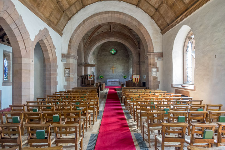
Three further views - 1,
2,
3, two interior views -
1,
2, and the
font, all © Steve Bulman (2017).
Link.
PoWiS.
Category A listed.
|
|