The Churches of Britain and Ireland
|
Musselburgh The Baptist Church (2023 Streetview) is on New Street and The Volunteer Arms. Although obviously an old building, the latest available on-line map (1960) doesn't label it as a place of worship. It seems to be the same building as the Fisherrow Coast Mission listed on PoWiS. NT 3402 7298. Link. The Congregational Church on Links Street, as seen by Streetview in 2022. Its category C listing dates it to 1801. NT 3409 7289. Link. Older O.S. maps show a Free Church (2023 Streetview) directly facing the southern end of the bridge over the river, at NT 3427 7258. Later the High Kirk, its PoWiS entry dates it to 1843, closing in 1992. Category B listed. Gospel Hall (2023 Streetview) on New Street. NT 3393 7295. Harbour Church (2023 Streetview) on New Street is being labelled as permanently closed by Google Streetview in 2025. NT 3384 7294. Hope Church is in a rather handsome building at the corner of Bridge Street and Ladywell Way. It was seen by Streetview in 2023. NT 3409 7278. Link. PoWiS lists it as an Assembly of God church. Its category C listing has it as St. Andrew's Church Hall, and dates it to 1829, re-fronted in 1889. Northesk Parish Church (2012 Streetview) is on Bridge Street. NT 3405 7275. Link. Category B listed - dates it to 1838. Our Lady of Loretto and St. Michael (R.C.) on Newbigging, as seen by Streetview in 2022. NT 3462 7251. Link. Category B listed - says it was re-built in 1903. St. Andrews High Church (CoS) on Millhill, as seen by Streetview in 2023. NT 3452 7277. Link. St. Peter (Episcopal) on High Street. NT 3479 7276. © Bill Henderson. Link. Category B listed, wherein it's dated to 1865. The former Salvation Army Hall, a nursery when photographed. Can you advise where this is or was? - the nursery doesn't seem to be still going. © Rob Brettle. Howard Richter advises that this building used to stand on High Street at NT 3374 7284. It was complete in 2008, demolished by August 2010, and replaced by 2023 - all Streetviews.
|
||
29 July 2025
© Steve Bulman
Contact Details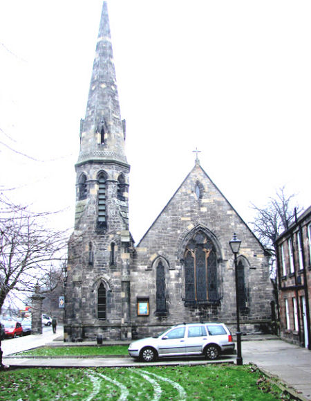