|
|
Borders
Borders on Wikipedia.
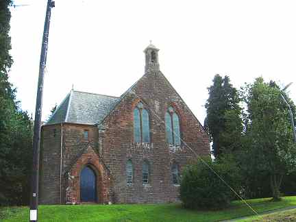
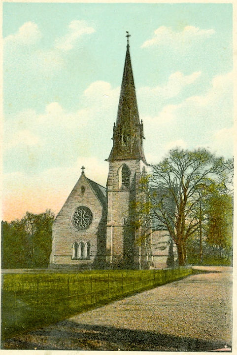
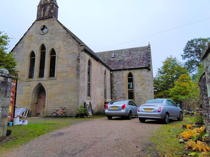
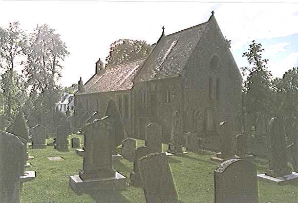
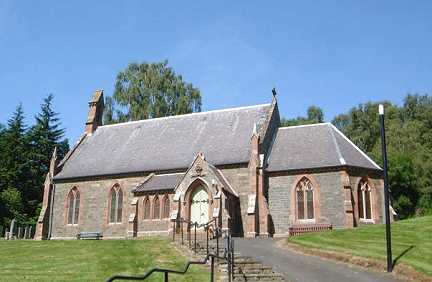
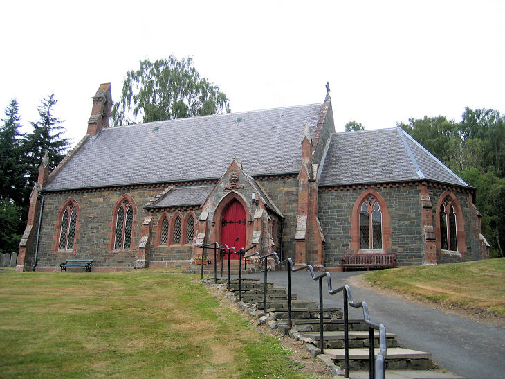
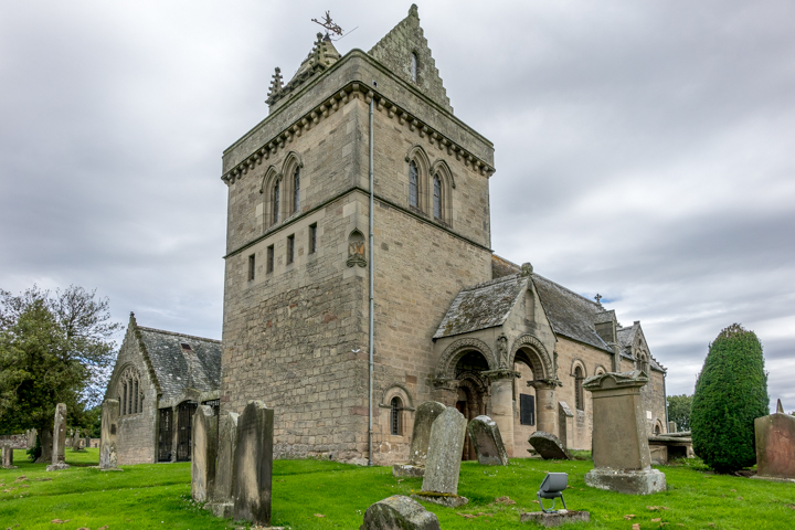
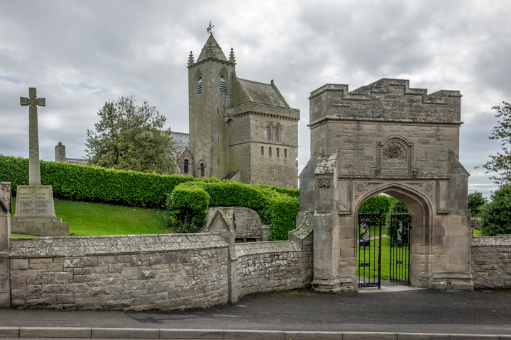
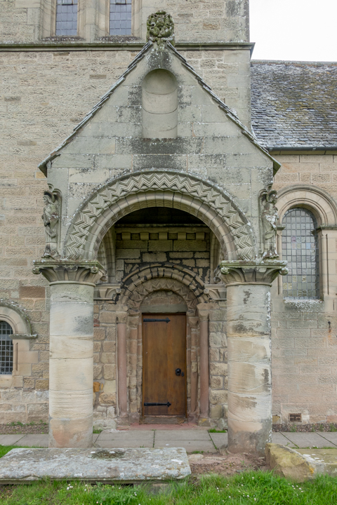
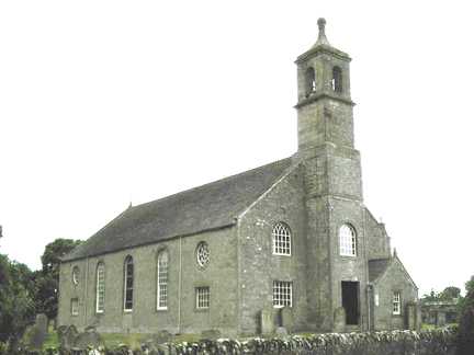
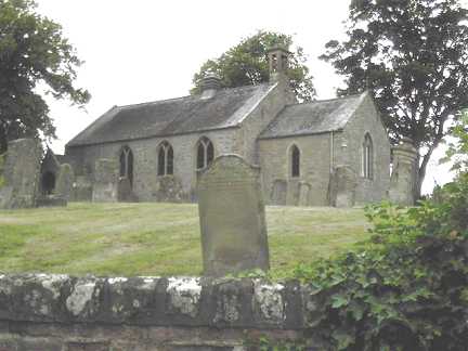
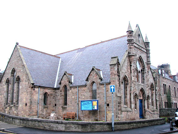
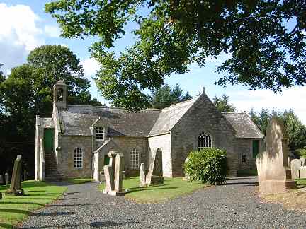
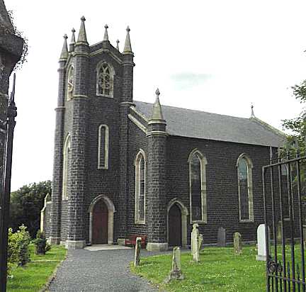
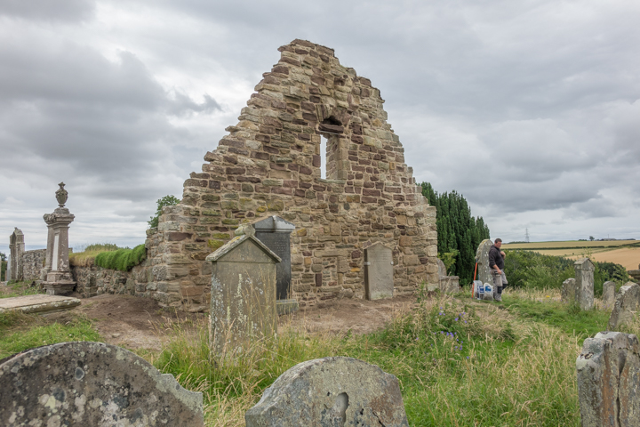
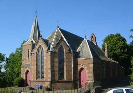
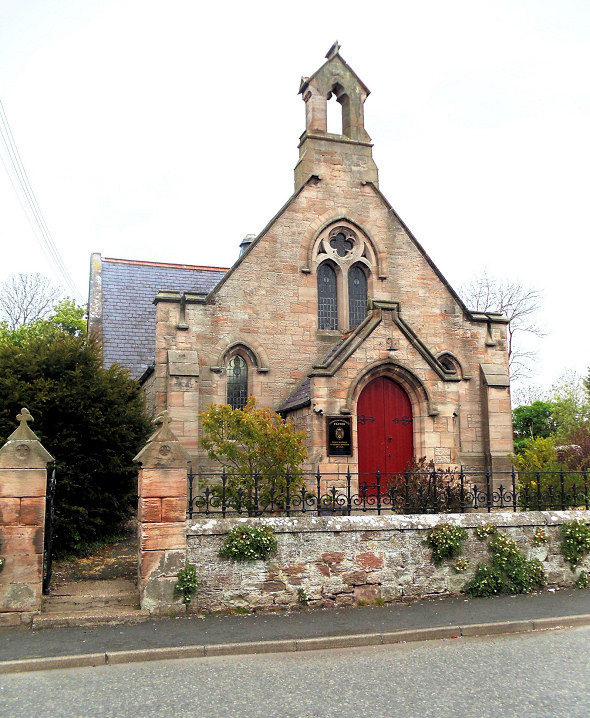
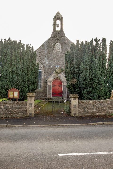
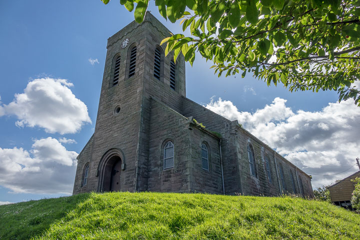
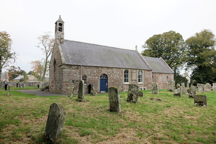
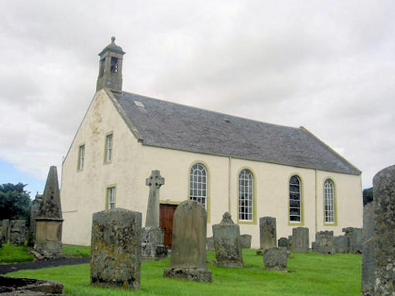
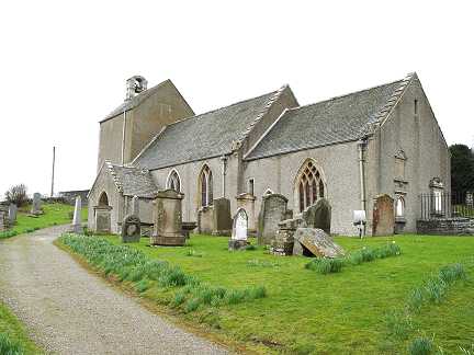
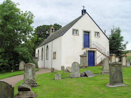
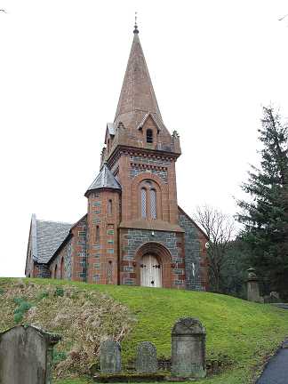
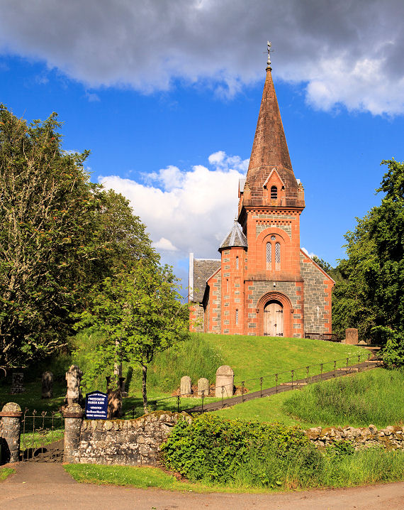
Ancrum, Church of
Scotland. It's dated
here to 1888/90. NT 6267 2458. © Bill McKenzie. It was successor to
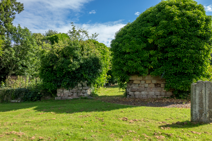
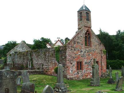
what is today known as Old Ancrum Kirk, or Ancrum Old Parish Church,
which stands further west close to the river, at NT 6215 2488. Not seen
by Streetview, this
source dates it to 1761-2, on the site of 12th century church, and
it says
it was "reduced to a romantic ruin by Sir William Scott of Ancrum" soon
after the present church opened. A photo can be seen
here.
Category B listed. Old O.S. maps show a Free
Church at NT 6291 2450. It's dated
here to 1851, and maps imply it survived as an active church into
the 1950's at least. It hasn't been seen by Streetview, and I haven't
been able to find a photo.
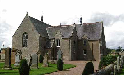
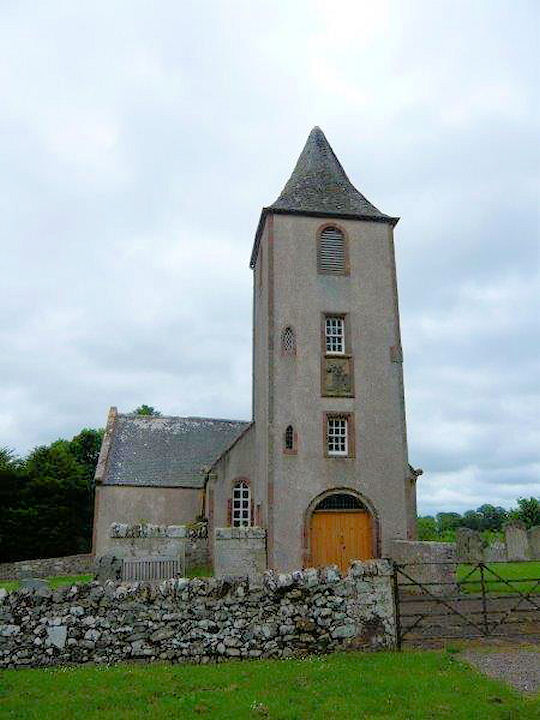
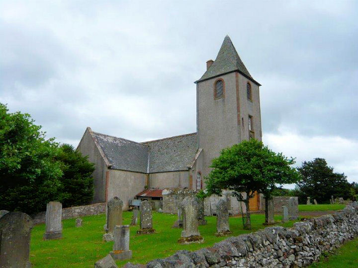
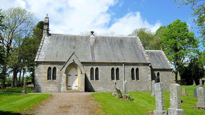
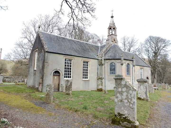
Ashkirk, Church of Scotland.
NT 4660 2199. © Bill McKenzie. Another view,
and an interior view, both © Ina Penneyston (2011).
Link.
Category B listed.
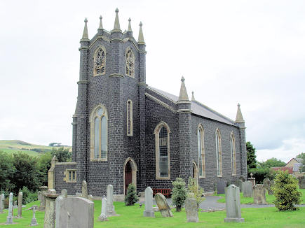
Ayton, the Parish Church. Its
Category A listing dates it to 1864-6. NT 9273
6087. From an old postcard in Reg Dosell's Collection. A
modern view,
©
Steve Bulman (2017).
A short distance away, still within the
churchyard, stand the remains of the
Old Parish Church (St. Dionysias).
Little could be seen because of the ivy covering it, but some 1960's
photos on the Canmore entry are more revealing,
here and
here. NT 9279 6095. ©
Steve Bulman (2017).
Category B listed.
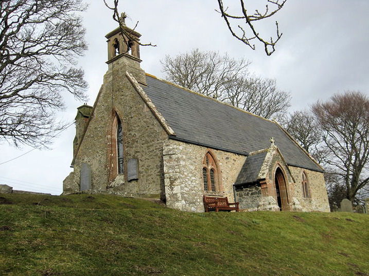
Bankend, the
former Castleton Old Church (CoS). Replacing a medieval predecessor on a
different site, it dates from 1808 and was closed in 1952. NY 4971 8948.
© Alan Marsden (2021).
Link. The site
of the medieval church is marked on O.S. maps at NY 5083 8982, at the centre of
a burial ground, which can be seen
here in a Streetview from
2021.
Bonkyl - see Preston,
below.
Bowden, Church of Scotland. NT 5543 3015. © Bill McKenzie.
Link.
Category B listed.
The churchyard itself is also
Cat. A listed. Older O.S. maps show a Free Church
at NT 5552 3059. Pre-dating a map of 1898, it survived into the 1960's at least,
but was demolished at some point - a bungalow now stands on the site, seen
here by Streetview in 2021.
Caddonfoot, Church of Scotland.
NT 4507 3476. ©
Bill McKenzie. Another view, © Ina Penneyston (2011).
Link1.
Link2.
Calzeat, the Broughton, Glenholm & Kilbucho
Parish Church. It's dated
here to 1804, and there's an illustration of how it appeared before
its spire was removed. NT 1136 3570. The former Free Church, now
a museum to the writer John Buchan. It pre-dates a map surveyed in 1856. NT 1140
3562. Both © Steve Bulman (2017).
Cavers - see Hawick, below.
Chirnside, CoS. This
source says there is some 12th century fabric, but it is mostly of
an 1878 re-build, with later additions. NT 8696 5603. © Bill McKenzie.
Three more views - 1,
2,
3, and the
door, all © Steve Bulman
(2017).
Category B listed. The Chirnside Community Centre is marked on older maps as a Free Church,
dated
here to 1783. NT 8700 5656. © Steve Bulman (2017). Old maps also
show a United Presbyterian Church, off what
is now the B6355, at NT 8706 5663. This
source dates it to 1857, with demolition in 1980. Its site lies
under a row of houses, visible in the background above the sandstone
gate pillars, in this
2021 Streetview.
Cockburnspath, St. Helen.
Another view. NT 7745 7105.
Both © Steve Bulman (2017). Category
A listed. A former
Free Church stands at the junction of Callander Place and Hoprig
Road, at NT 7722 7097. It's dated here to 1890, and was seen by
Streetview in 2008.
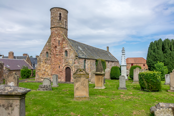
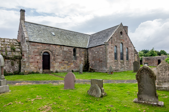
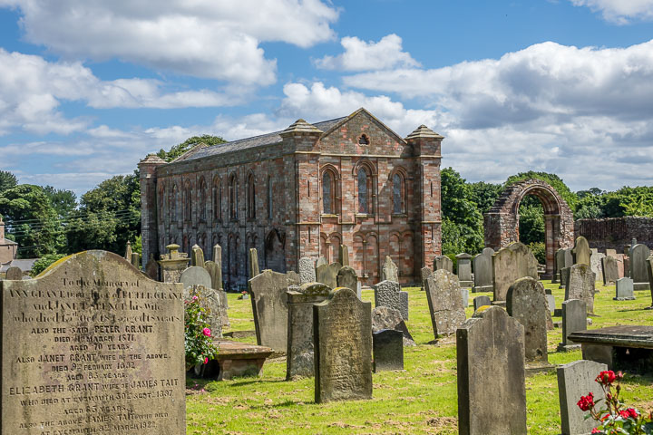
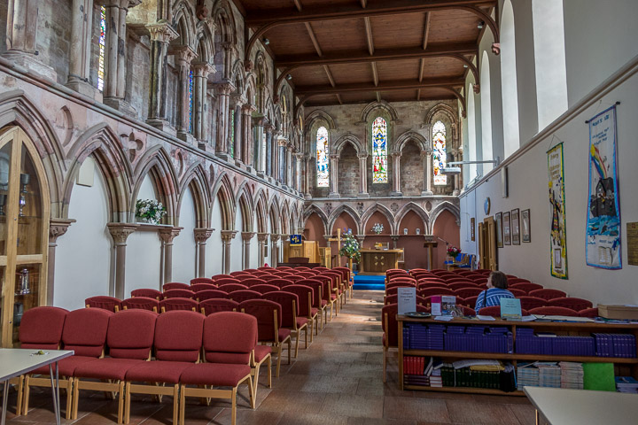
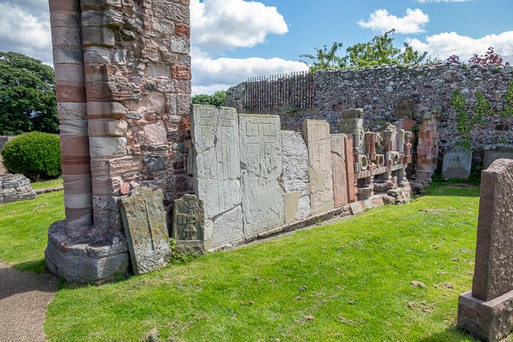
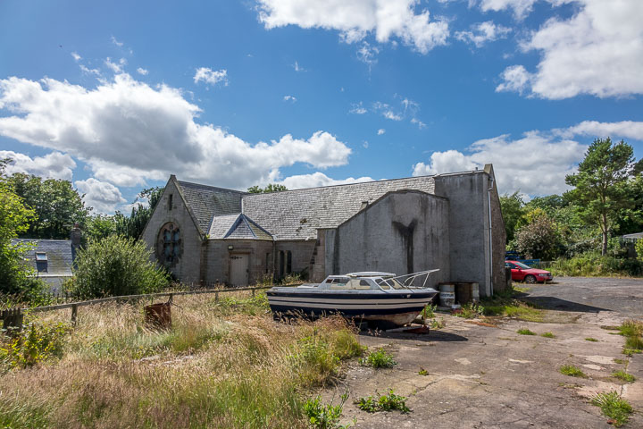
Coldingham, the remains of the Priory
on High Street. The parish church occupies the choir of the Priory Church. Two
further views - 1,
2, and two interiors -
1,
2. Some architectural fragments
and grave covers have been assembled
into a wall. NT 90390 65953.
Link1. Link2. The former
(and semi-derelict) United Presbyterian
Church, behind the garage on the corner of School Road and Bridge Street.
Pevsner dates it to 1870, and says that it was built on the site of a church of
1793. It was closed on or before 1952. NT 90210 65929. All © Steve Bulman
(2017).
Coldstream.
Crailing, Ale and Teviot United Church (CoS,
C). Pevsner dates it to circa 1775. NT 6821 2504. © Bill McKenzie.
Another
view, © Bill Henderson (2014). Link.
Category B listed. The
structure on its south side which I photographed in the hope that it
was perhaps a previous church is described by Pevsner as a burial
enclosure. © Steve Bulman (2024).
Lothian Hall is the former
Crailing United Free
Church (20201 Streetview), dated by Pevsner to 1900-1, and the
village hall since 1931. NT 6876 3473. A little over ¼ of a mile to the
S.S.E. in the grounds of Crailing House is the site of a church within a
burial ground. Not visible to Streetview, its
Canmore entry (where
there are photos of the site and monuments) says
it was "dismantled in 1754". NT 6885 2427.
Cranshaws, the Kirk, dating from 1899, though on
the site of an earlier church. Its
Category A listing says it was built on the site of a predecessor of
1739. NT 6923 6185. © Bill Henderson. Two more views -
1,
2, two of the interior -
1,
2, all © Steve Bulman
(2017).
Link.
The remains of the Old Parish Church stand
a little over ½ a mile to the west, at NT 6836 6167. Not visible to
Streetview, some photos are available on the
Canmore entry.
Denholm, Ruberslaw Parish Church (CoS), built as a Free Church in 1845. NT 5688 1849. ©
Bill Henderson (2014).
Link.
The 6" O.S. map of 1899 shows a Mission Hall off
Leydens Road, at NT 5691 1859. What appears to be the same building is shown on
a map of 1861, marked as Church (Congregational). From the
2009 Streetview it's not
apparent that anything of it survives, but it stood where the building with the
red door stands now, or perhaps a little to its rear.
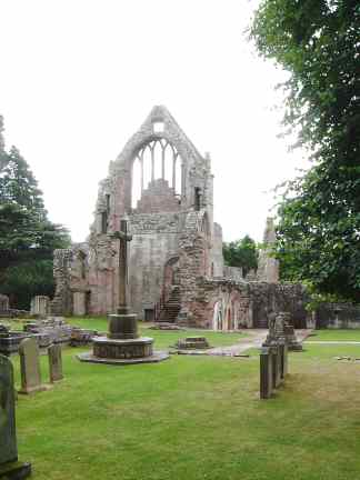
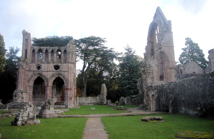
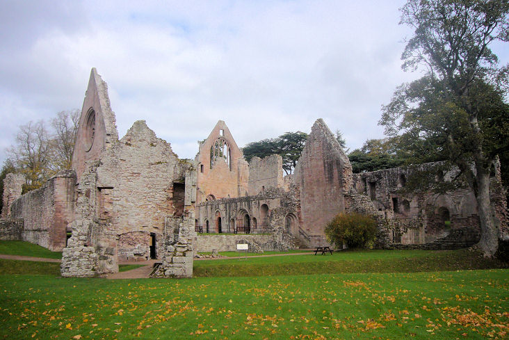
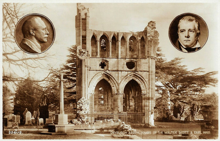
Dryburgh, the Abbey Church of St. Mary the Virgin. NT
5913 3168. © Bill McKenzie. Two further views -
1, 2.
Both © James Murray (2009).
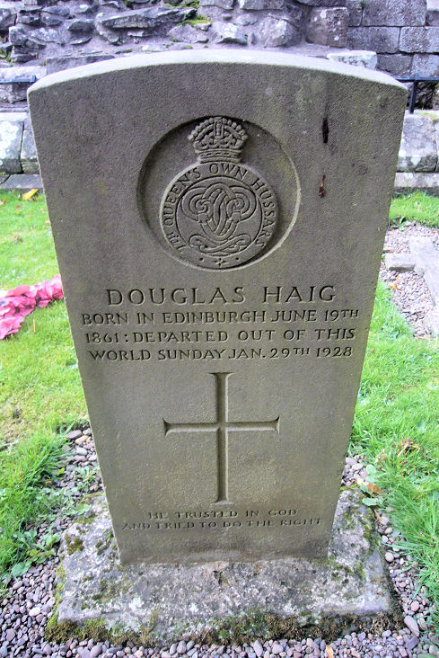
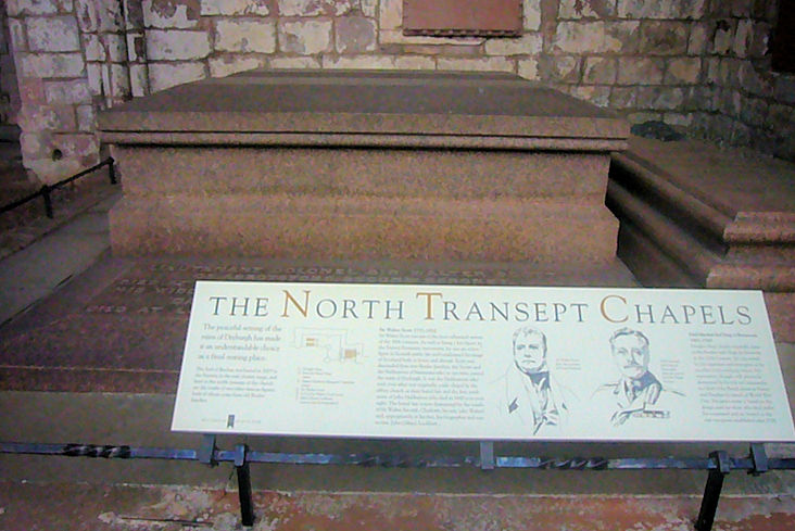
Douglas Haig
(Earl Haig), the WWI general, is buried
here, and
here lies Sir Walter
Scott. Both © James Murray (2009). Two old postcards show the same subjects -
1,
2, both from Christopher Skottowe's
Collection. An old photo
showing the font is available
here.
John Bowdler was trying to discover the location of the same font - clearly labelled as "The
Old Celtic Font, Dryburgh Abbey", but John has searched for modern photos
showing the font in situ, without success. So has the font been moved somewhere
else? It does appear to have been moved, though it remains on the site - Jay
Priest has found a photo of the font (labelled as basin) on this
website, where there are many other photos of the Abbey. It appears to be no
longer on the base in John's photo (though it seems unlikely that that
base was the original).
Link.
Grade I listed. Other listed features associated
with the Abbey can be found
here.
Duns.
Earlston, the
Parish Church. NT 5806 3875. © Bill McKenzie. Link.
Category C listed. Older O.S. maps show a U.P. Church on High Street at NT
5774 3855. POWiS dates it
here to 1792, a re-build of an earlier church of circa 1750, says that it
was variously Free Church and CoS, and also known as St. John's. It was
demolished in 1985. An old photo is available
here. Its site was seen
by Streetview in 2021. West Free Church stood near
the west end of High Street, at NT 5740 3848.
It's dated
here to 1778, as Antiburgher, later Free, U.P., and CoS. Closed in 1887, it
was long used as a church hall, later in commercial use. An old photo can be
seen
here, and its site in a
Streetview from 2021.
Eccles, the Parish Church. Its
category B listing dates it to 1774. NT 7639 4132. © Bill McKenzie.
Link.
The slight remains of St. Mary's Convent stand in
the churchyard. According to this
source,
"parts of the sandstone walls remain upstanding, densely overgrown with ivy".
The wall may be one seen by
Streetview in 2021 -
immediately to the left of the tallest grave monument. Can you confirm?
The village hall is shown on older maps as a
Free Church - seen
here by Streetview in 2021.
This
source dates it to 1883. NT 7636 4144.
Eckford, CoS. NT 7062 2706. © Bill McKenzie.
Link1.
Link2.
Category B listed.
Eddleston, the Parish Church, an 1829
church on the site of a 12th century one. NT 2440 4721. © Steve
Bulman.
Link.
Category B listed.
Edgerston, the parish church. Its
category B listing dates it to 1838. NT 6846 1171. © Bill Henderson.
Evidently now closed, as it was being offered for sale in 2018.
Ednam, CoS. The
category B listing dates it to 1900, but its saying "the present church"
implies an earlier building, and pre-1900 maps confirm this. However, this
source has it as being built in 1805, and "recast" in 1902, whatever
that means. NT 7370 3716. © Bill McKenzie.
Link.
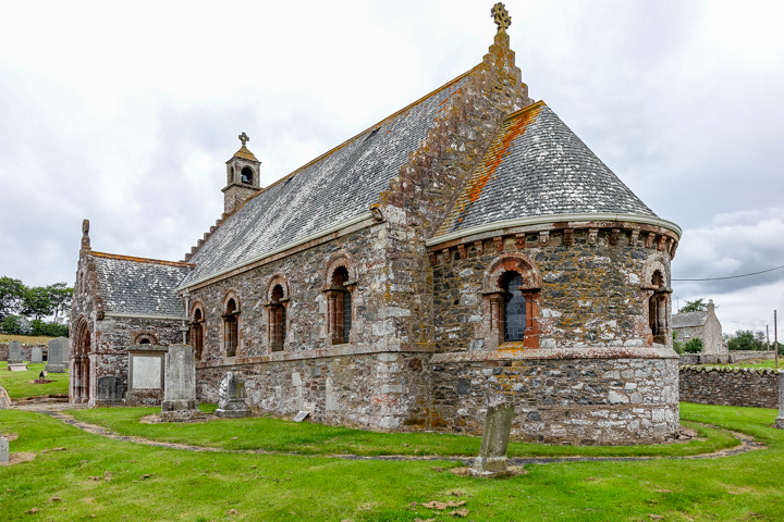
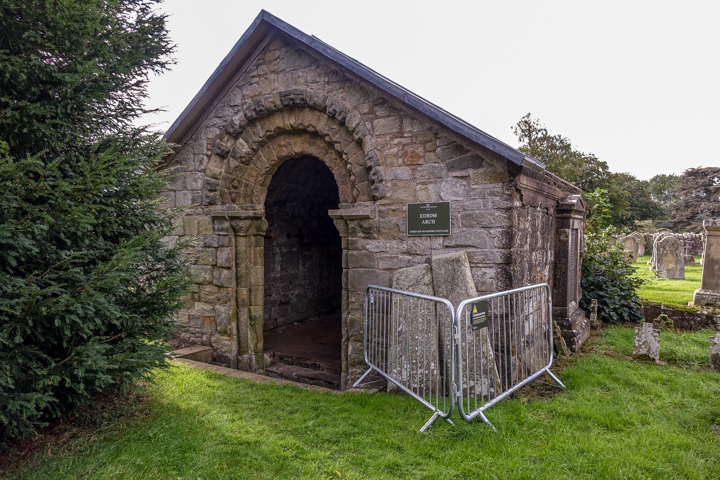
Edrom, the Parish Church. NT 8276 5584. © Bill McKenzie.
Two additional views - 1,
2. The
Edrom Arch at the rear of the church must be what according to the The
Buildings of Scotland is Logan Aisle, which it describes as a
"rectangular burial enclosure .... open archway in the east wall presumed to be
the re-set main doorway of the medieval church". All © Steve Bulman (2021).
Category A listed.
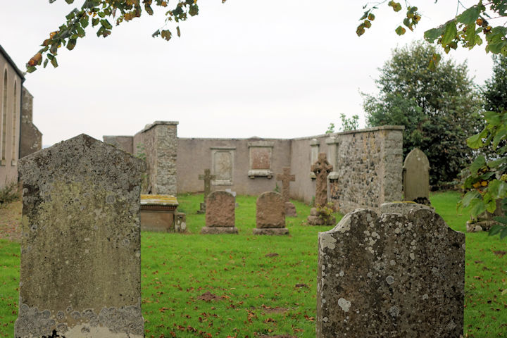
Ettleton. The cemetery just south
of Newcastleton at one time had a church, though nothing now remains to indicate
its exact position. According to the Borders edition of the
Buildings of Scotland, it fell into disuse circa 1604. It has spectacular
views across Liddesdale. Another view.
It has several fine monuments, of which
this is an example. A number
of fragments from the old church
have been collected together. NY 4723 8632. All © Steve Bulman (2015).
Link.
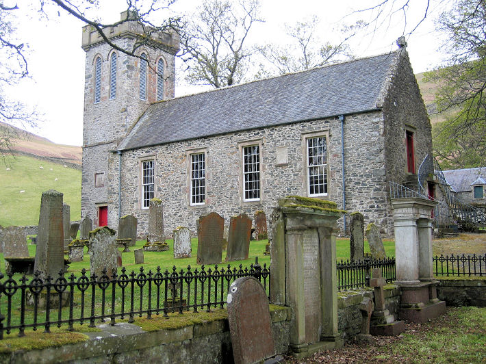
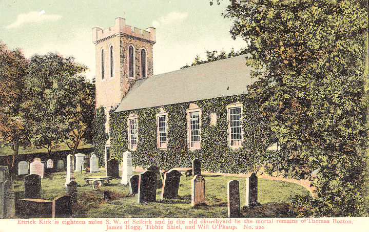
Ettrick, Ettrick Kirk (CoS). NT 2599 1451. © Ina Penneyston (2010).
An old postcard view, from Steve
Bulman's Collection.
Link.
Grade B listed.
Eyemouth,
the Parish Church on Victoria Road and Coldingham Road. NT 94409 64050. © Bill McKenzie.
Another view, © Derek Robertson.
United Congregational Church on Albert
Road. NT 94415 64091. © Derek
Robertson. Another view, © Bill
Henderson. St. Andrew (R.C.) on
Victoria Road. NT 94452 64043. © Bill
Henderson. The Old Parish Church
(1811) on Manse Road was converted in 1981 to be the town museum and tourist
information centre. NT 9454 6429. © Steve Bulman (2017).
St. Ebba, off Paxton Terrace. Circa
NT 9427 6438. © Steve Bulman (2017). Link.
Fogo, the parish
church. NT 7725 4919. © Bill
McKenzie. Link.
Category A listed, wherein it says it was "predominantly rebuilt 1755".
Galashiels.
Gavinton, Langton Church. The
church website
dates it to 1872, on the site of a predecessor of 1798. NT 7668 5221. © Bill
McKenzie. Category
B listed. Old maps show a Free Church standing
to the west of the village, at NT 7648 5208. It survives, converted, and was
seen by Streetview in 2011.
This
source calls it Langton Free Presbyterian Church, and dates it to 1843.
Nearby, O.S. maps show a Church (Site of)
and a Chapel (Site of). The church, at NT
7624 5253, stands in a former burial ground, near Langton House, and, according
to this
website it was the Old Parish Church, and perhaps has some scant remains
still visible. The chapel, at NT 7572 5271, is dated
here to 1680, where it says some foundations remain visible. Neither site is
visible on Streetview, and I've been unable to find any photos.
Greenlaw, Church of Scotland. Its very
brief
category A listing dates it to 1675, with later additions. It had a medieval
predecessor. NT 7116 4616. © Bill
Henderson. Another view, © Steve Bulman
(2017). Link.
Old maps show a Free Church on West High Street, at
NT 7100 4602. Presumably it was this Free Church which is mentioned on
Genuki as being in
existence by the time of an 1866 directory. Its
site was seen by Streetview
in 2022. Mentioned in the same directory is a United
Presbyterian Church. One shows on old maps on The Square at NT 7120 4602.
It seems to be in use as a garage in 2022 (Streetview).
Hawick.
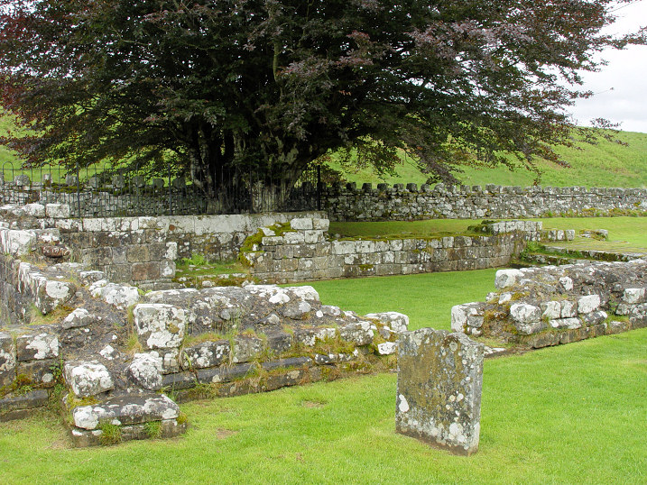
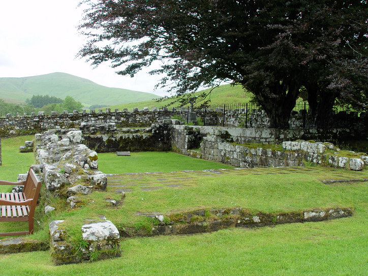
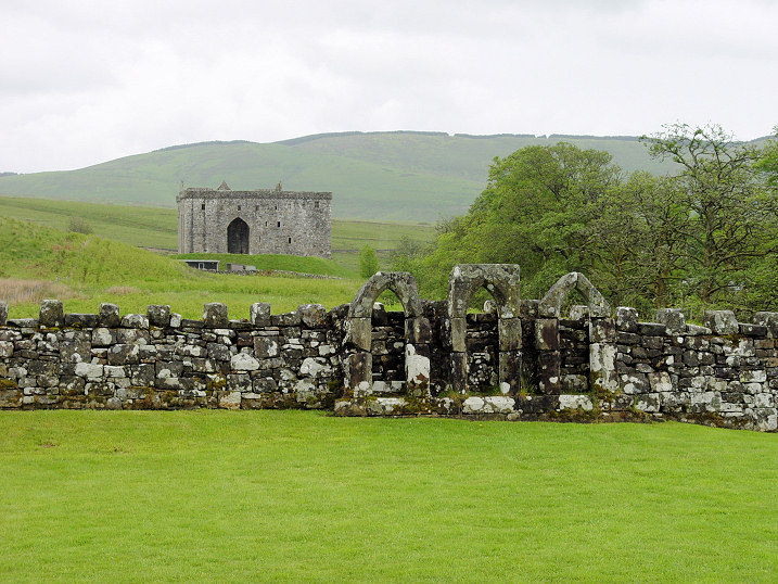
Hermitage, the remains of the medieval (C13/C14) chapel.
Another view. Some re-erected window stonework stands against a field
wall; the neighbouring Hermitage Castle stands guard nearby. NY 4933 9599. All © Steve Bulman (2012).
Link.
Category A listed.
Innerleithen.
Jedburgh.
Kelso.
Kilbucho - see Mitchelhill, below.
Kirk Yetholm,
the Parish Church. NT 8257 2809. © Bill McKenzie.
Link.
Category B listed, wherein it's dated to 1835-7.
Kirkton, the Parish Church (CoS). It's
dated
here to 1841, where it says that it replaced an earlier church "probably on
the same site". NT 5403 1395. © Bill Henderson.
Category C listed. A 2022
news report says that it was closed in 2014, and it was to be converted into
a house.
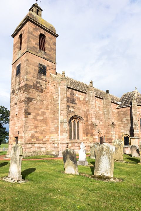
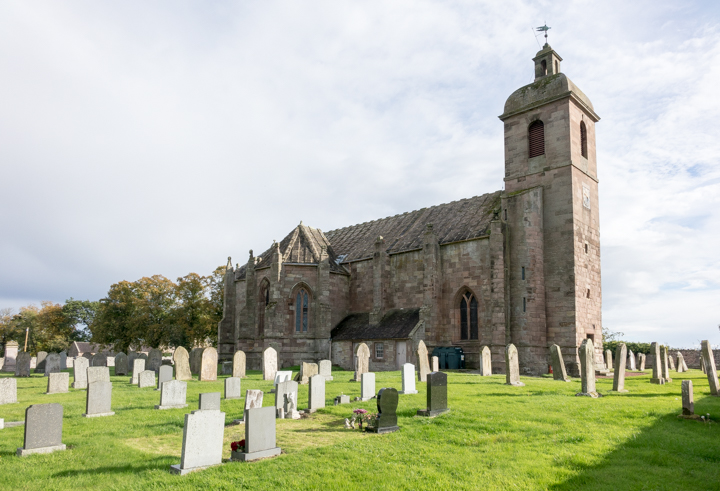
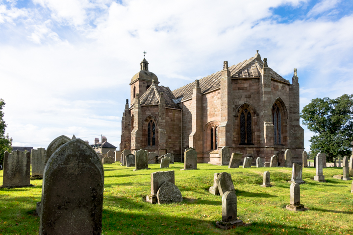
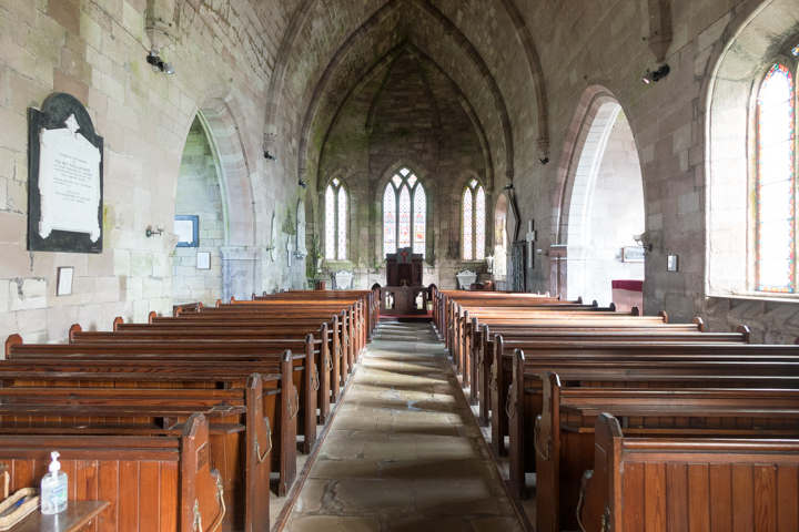
Ladykirk,
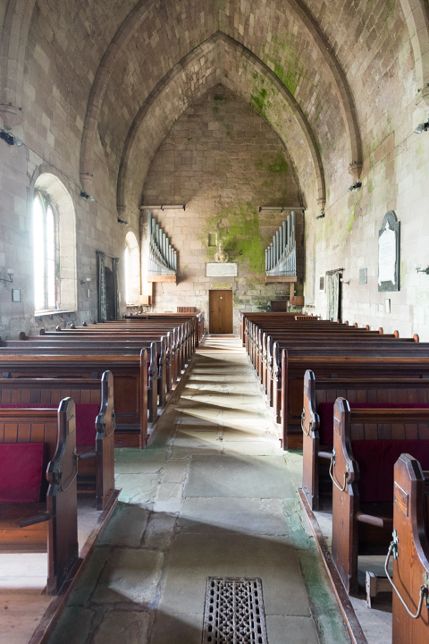
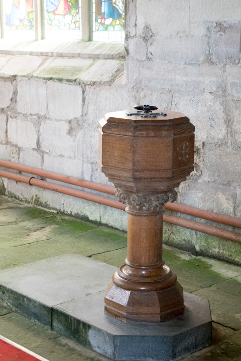
Church of Scotland. NT 8888 4766. Two additional views -
1, 2,
two of the interior - 1,
2, and the
font, all © Steve Bulman (2021).
Link.
Grade A listed.
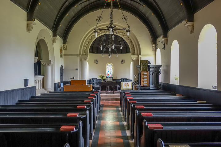
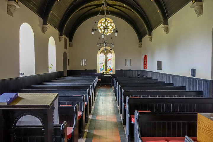
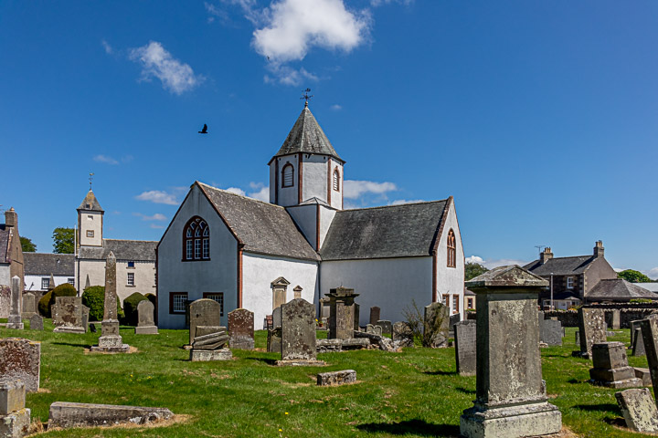
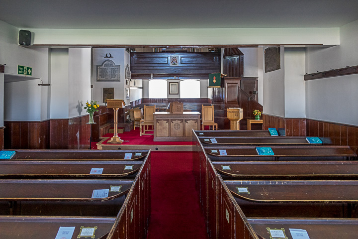
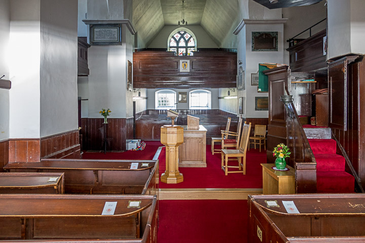
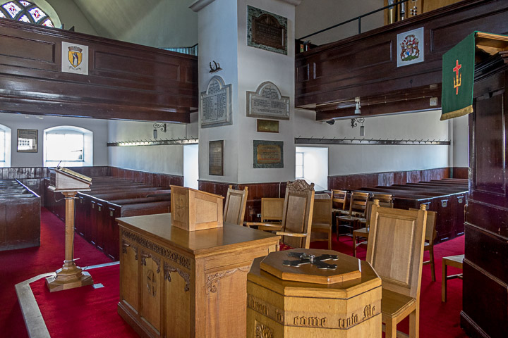
Lauder, St. Mary (CoS, 1673).
Another view, and three of the interior -
1,
2,
3. NT 5309 4754. All © Steve Bulman
(2019).
Link1.
Link2.
Link3.
Category A listed. Older O.S. maps show two other churches. A
United Presbyterian Church stood on West High
Street at NT 5279 4778. It pre-dated a map of 1862, and survived into the 1960's
at least. Demolished at some point, its
site was seen by Streetview
in 2021. The other was a Free Church, set back from
the north side of High Street on Kirk Wynd and Castle Wynd, at NT 6318 4759. It
is presumably the same building which now serves as the parish church hall,
which was seen by Streetview
in 2021. It also pre-dates the 1862 map, and had ceased to be active by the time
of a map of 1962.
Legerwood, Church of Scotland. NT 5940
4342. © James
Denham (2010). Link.
Category A listed.
Lennel, the remains of the medieval Old
Parish Church. Two more views - 1,
2. NT 8575 4117. All © Steve Bulman
(2017).
Canmore entry.
Category B listed.
Lilliesleaf, CoS. NT 5391 2531. © Bill McKenzie. Link1.
Link2
dates it to 1771.
Category B listed. O.S. maps mark Burial Vaults and remains of Church
in the churchyard to the south-east of the present church - presumably a
predecessor. The remains aren't visible on Streetview. The churchyard, including
these remains, is
category B listed. A little over half a mile E.N.E. of the church is a
cluster of buildings (Chapel Farm), one of which is labelled
Chapel on O.S. maps. Aerial views suggest it
survives, but it isn't visible on Streetview, and I haven't been able to
discover anything about it, other than a brief
news report about the discovery of an old skeleton. NT 5475 2563. A map of
1921 shows a United Free Church south of the main
road through the village, at NT 5358 2518. What appears to be the same building
is present but not labelled as a place of worship on a map of 1899 - the same
applies to a map of 1963. The
building survives - presumably converted to residential use - and was
seen by the Streetview van in 2021, from a street running parallel to the main
street (from where the church is screened by dense vegetation).
Lyne, Church of Scotland. NT 1918 4052. © James Denham
(2010). Link.
Category B listed.
Melrose.
Minto, the Parish Church (CoS), was
completed in 1831 as part of the planned village designed for the 2nd Earl of
Minto. There was an earlier medieval church nearby which this one replaced. NT
5668 2013. © Robert Tofts. Link1.
Link2.
Category B listed. The earlier church stood less than half a mile to the
E.N.E., at NT 5720 2031. Older O.S. maps label it as
Church (Remains of), but this
source says that nothing of the church survives. Another
source implies some remains, and has a number of photos of gravestones. Also
see
here. The site hasn't been seen by Streetview.
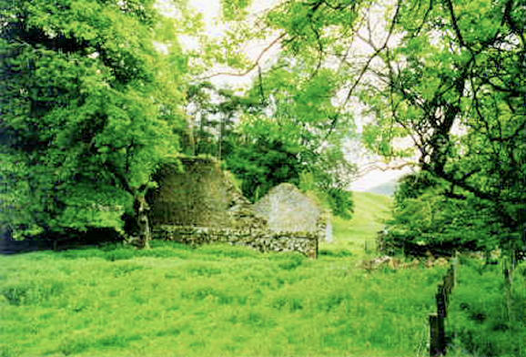
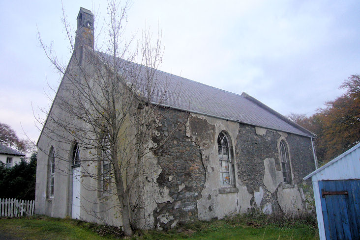
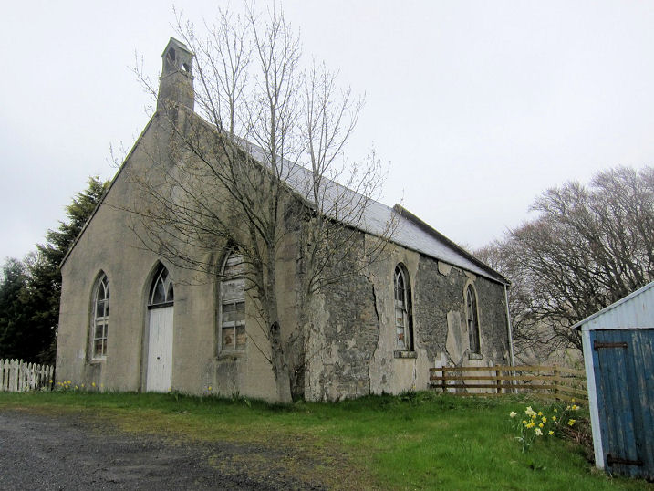
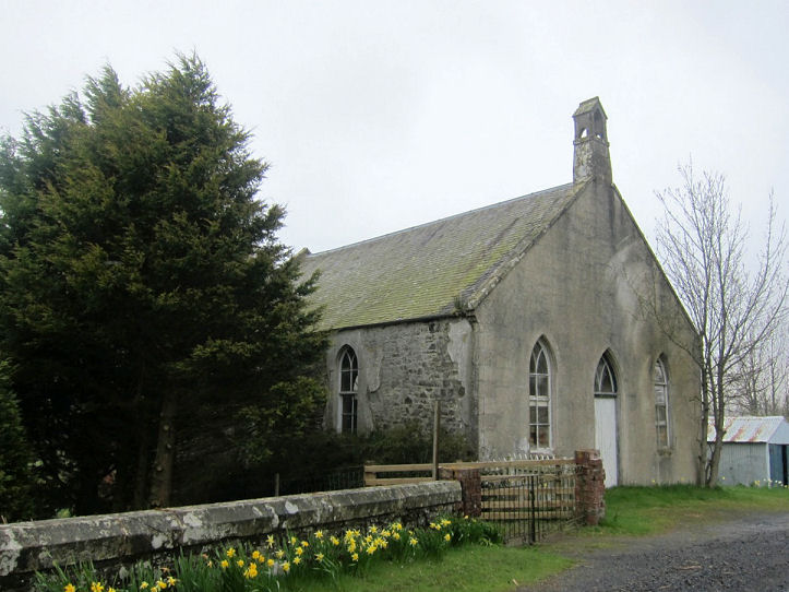
Mitchelhill,
the ruins of Kilbucho Church. Medieval, this
source says it "was abandoned some time after 1810". NT 0654 3375. © Tim Tomlinson.
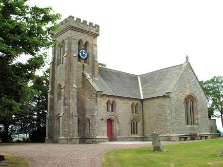
Newcastleton, the Parish Church (CoS, 1888)
on Montagu Street. NY 4819 8766. © Steve Bulman (2012).
Link. The former
Burgher Church (1804), now a heritage centre.
Older O.S. maps label it as U.P. Church. NY 4817 8721. © Steve Bulman (2012).
Two other churches show in the town on older O.S. maps. A
Free Church stood on Langholm Street at NY 4823 8758. It now serves as
the village hall, and was seen by
Streetview in 2021. It has
date-stones for 1853 and 1956, the latter perhaps for when it became the hall.
Link. The other one is marked as E.U. Church
and still stands on South Hermitage Street at NY 4828 8750. This
source advises that it was originally Congregational, and dates it to 1850.
Streetview saw it in 2021.
The former Castleton Parish Church stands about 1½
miles to the N.E., at NY 4971 8948. Seen by
Streetview in 2021, when it
appeared to be undergoing conversion to residential use.
Link, wherein it's dated to 1808.
Category B listed. Its predecessor, St. Martin,
stood about ¾ of a mile to the E.N.E. at NY 5084 8981. It was demolished in 1808
and the masonry removed to allow the building of Castleton Parish Church (source).
It stood in a substantial graveyard, which survives - it was seen by
Streetview in 2021.
Newtown St. Boswells (including St. Boswell's), Newtown Church (CoS)
- marked on older maps as U.P. Church. NT 5805 3152. © Bill McKenzie.
Link.
Category C listed, wherein it's dated to 1867. The Old
Parish Church stands on the banks of the River Tweed, to the S.E. of the
town, at NT 6063 3053. This
source says that only the foundations remain, located within a graveyard -
seen here by Streetview in
2021. It also says that this church is reputed to have had two predecessors, on
different sites, but doesn't locate them. Old maps show a
Free Church in the town on what is today the B6404 at NT 5942 3102. Now
the parish church, it's dated
here to 1844. Streetview
saw it in 2016. St. Columba's College has a Chapel,
mentioned
here. Not seen by Streetview, a photo is available
here (scroll down).
NT 5867 3187. The school may no longer exist, as a
news
article from 1993 discusses its proposed closure. Do the buildings survive?
Paxton, Church of Scotland (1907).
Its
category C listing dates it to 1908. NT 9342 5306. © Bill Henderson (2012).
Link says it used to be United Free.
Peebles.
Polwarth, the former Church of Scotland, sold
in 2006 (thanks to Jim Napier). It's dated
here to 1703, and had at least three predecessors.
Another view. NT 7800 4949. Both © Bill McKenzie (2013). Link.
Category A listed.
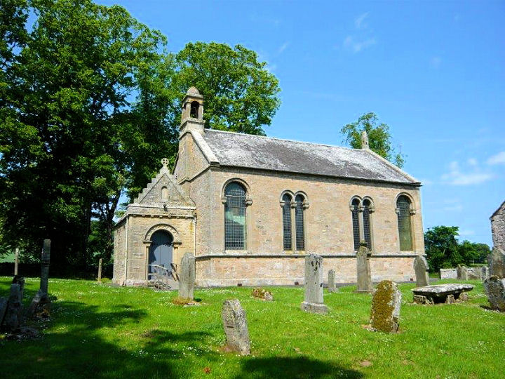
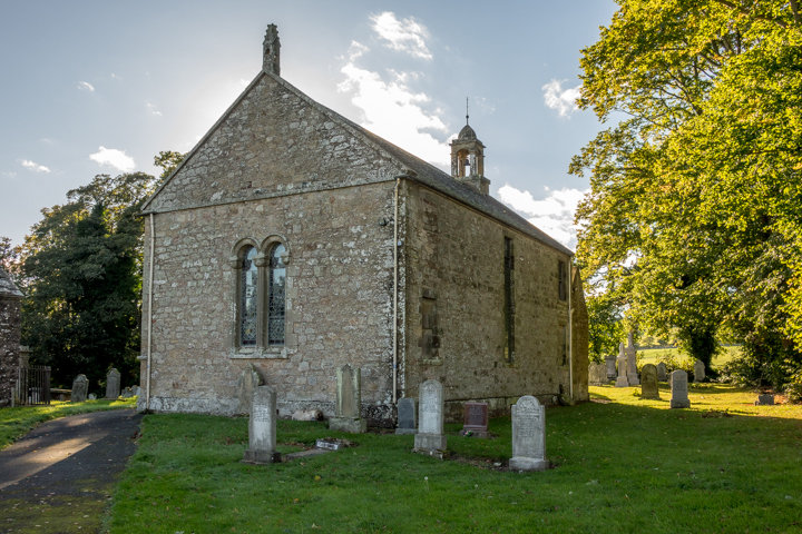
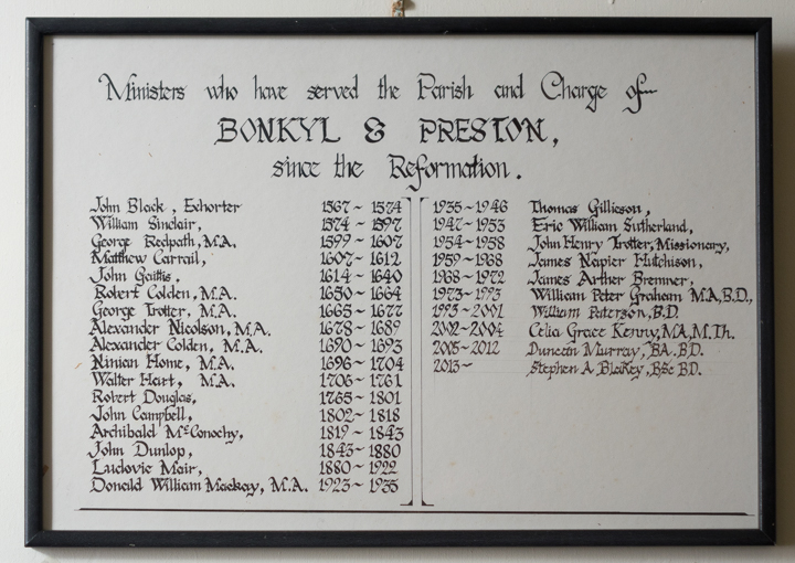
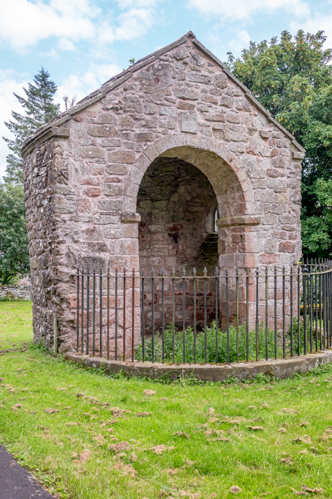
Preston, Bonkyl Kirk (CoS), which stands about 2 miles distant
from the village at NT 8086 5960, was built in 1820. © Bill McKenzie (2013).
Another view. A
list of Ministers "since the
Reformation" hangs inside the entrance lobby. Unfortunately the entrance to the
church proper was locked on both of my visits. The
surviving apse from its medieval predecessor stands adjacent.
Another view. All © Steve Bulman (2017 and
2021).
Link.
Grade B listed.
Reston, Church of
Scotland. The
church website dates it to 1880, as a Free Church.
Another view. NT 8785 6210. Both © Steve
Bulman (2021).
Grade C listed.
Roxburgh, the
Parish Church, dated
here to 1752,
"probably on the site of an earlier church".
NT 7001 3069. © Bill McKenzie. Category
B listed.
St. Abb's. NT
91721 67368. © Bill
McKenzie. Two additional views - 1,
2, both © Steve Bulman (2017).
Link, which
advises that it opened in 1891 as St. Abb's Free Church, and closed before
2011.
St. Boswell's - see Newtown St. Boswell's, above.
Saughtree, Liddesdale Parish Church,
dated
here to 1872. NY 5611 9682. © Bill
McKenzie (2010).
Selkirk.
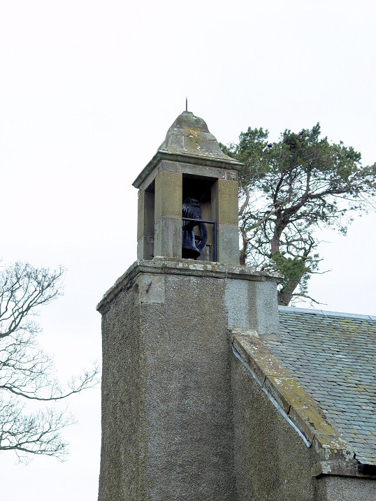
Skirling, the Parish Church (1720, CoS).
The bellcote has a sun-dial
beneath. NT 0752 3900. Link.
Category B listed. A former
Free Church (now residential) stands nearby at NT 0757 3916. The very brief
category C listing dates it to circa 1846. All © Steve Bulman (2013).
Smailholm, the Parish Church.
Another view. The church notice board
had pinned to it a newspaper clipping discussing the planned conversion into a
residence. NT 6487
3641. Both
© Steve Bulman (2024). Its
Canmore entry
has numerous photos. Link.
Category B listed. Older large scale O.S. maps mark, at NT 6401 3400 "F.C.
Meeting House". Aerial views show that it no longer exists, and its site hasn't
been seen by Streetview - access to it was down this
path (2023 Streetview)
on the right. I assume this to be Free Church Meeting House, but it
isn't marked as a place of worship. Can you advise what this was?
Sprouston, the Parish Church. NT 7566
3532. © Alan Blacklock. Link.
Category B listed, wherein it's dated to 1781.
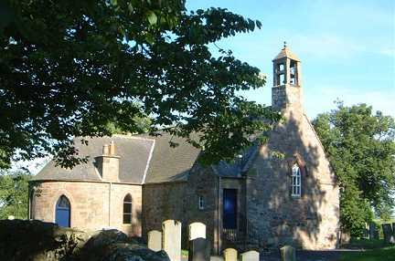
Stichill, Church of Scotland. NT 7111
3828. © Bill McKenzie. An interior photo can be seen
here.
Link.
Category B listed. A former U.P. Church stands
a little way to the N.E. at NT 7132 3843. Seen by
Streetview in 2021,
Canmore dates it to 1877, and "disused in 1994".
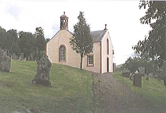
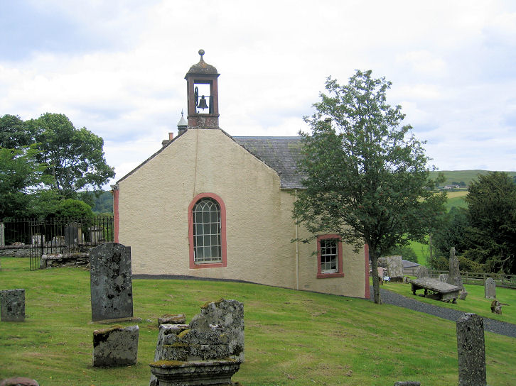
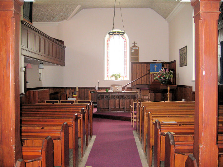
Stobo, the Kirk, reputedly of C6 foundation.
NT 1828 3765. © Steve Bulman. Link.
Category A
listed.
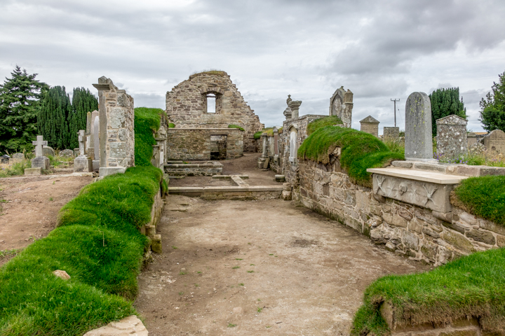
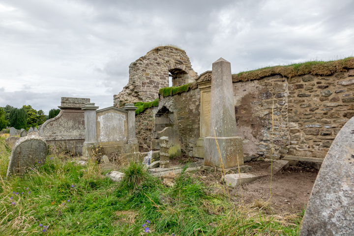
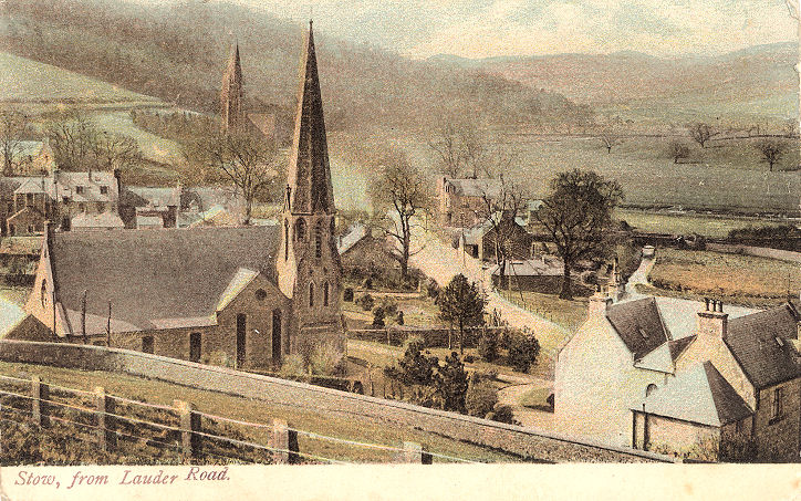
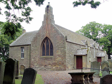
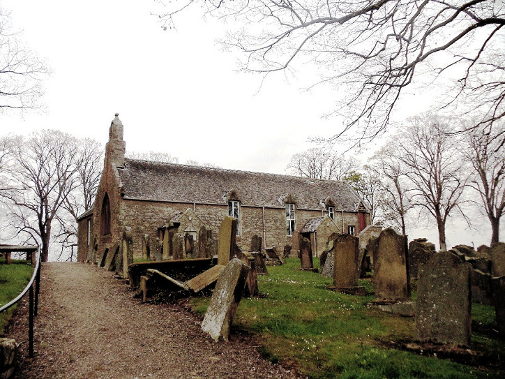
Stow, the ruinous Old Parish Church. NT 4592
4456. © Tom McLean. Another
view, © Bill Henderson. Its
Canmore entry has more photos.
Category B listed. The demolished
United Free Church (and earlier United Presbyterian). NT 4598 4475. From an
old postcard in Steve Bulman's Collection. In the background of that postcard can
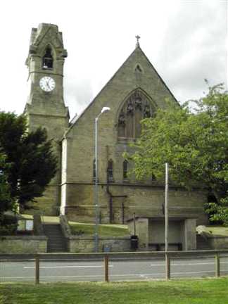
also be seen St. Mary of Wedale (1873-6), better seen by
Streetview in 2022. NT 4590
4437. Link.
Category B listed.
Swinton,
the former Free Church, dated
here to 1866. NT 8353 4748.
© Bill McKenzie. The Parish
Church.
This
source dates it to 1729, on an ancient site.
NT 8387 4764. © Steve Bulman. Another
view,
© Bill Henderson (2012).
Category B listed. According to this
source, the property known as Fiddler's Ha' (10, Coldstream Road) is
a former Free Church of 1843. No available maps
show it, but Streetview saw
the property in 2021. NT 8389 4749.
Traquair,
the Parish Church, also known as Kirkbride. NT 3200 3346. © Steve Bulman.
Link. Category
B listed. Traquair House, which stands almost a mile and a half to
the N.N.E. of the church, has its own Catholic place of worship,
variously described as Chapel or
Oratory. Not visible on Streetview, I
haven't been able to find an exterior photo, but there are several of
the interior
here, where it's dated to 1829. NT 3305 3552.
Link. Mentioned
here and
here is a possible precursor of the parish church standing in a
lonely spot S.W. of the present church, at NT
3140 3290. The site, if such it is, hasn't been visited by the
Streetview van.
Tushielaw, the former Tushielaw Free Church, which has been disused for decades. My appreciation to Janet Gimber for the
identification. NT 3035 1778. © James Murray (2009). Two additional views -
1,
2, both © Howard Richter (2013).
The church must post-date 1893, since neither it, nor the adjacent manse appear
on the OS map of that year. Both are shown on the edition of 1924. Strangely,
Pevsner gives the date as "mid C-19".
Link.
Tweedsmuir, the
parish kirk (1874). NT 1007 2453. © Steve Bulman. Another view, © John Cannon.
Link1.
Link2.
Grade B listed.
Upsettlington, the site of
the vanished Convent Chapel (somewhere in the field). O.S. maps mark the
site of a chapel at NT 8872 4684.
Pevsner mentions
(in the Ladykirk entry) that the predecessor of Ladykirk had been
a chapel at Easter Upsettlington, since at least as far back as the 13th
century.
Link.
Walkerburn,
the Parish Church. NT 3640 3724. © Steve Bulman. Its
category B listing dates it to 1875, with subsequent enlargement. Its
Canmore entry has more photos, including the interior. O.S. maps show a
Congregational Chapel almost immediately opposite
the previous church, at NT 3640 3719. It pre-dates a map of 1898. A building
certainly survives there, but rampant undergrowth prevents a good enough view to
decide if it's the church -
Streetview 2022.
Whitsome,
the former Whitsome Kirk, as seen by Streetview in 2021. This
source dates it to 1803, and says it was in
"full ecclesiastical use" in 2003. The Streetview suggests it may now be closed
and converted - or has it just recently had a refurbishment? NT 8604 5049.
Category C listed. The Old Parish Church ruin
stands in a graveyard to the S.E. of the church, at NT 8623 5034. What, if
anything survives of the church itself is unclear from on-line sources. Large
scale O.S. maps mark only a Watch House, presumably against the
depredations of the "Resurrection Men", but this could of course still have been
part of the church. This
source, discussing
Whitsome Old Parish Church Site says
"This is a 13th century church ruin...". Its
Canmore entry includes some photos of the watch house, but doesn't say if
it's part of the former church.
Here's a distant Streetview of the churchyard and watch house in 2021.
Yarrow,
the Ettrick and Yarrow Parish Church. NT 3576 2778. © Alan Marsden
(2025).
Link - advises of a
building date of 1640, but restored following a fire in 1922.
Category B listed.
Yetholm,
the Kirk Yetholm Parish Church. It's dated
here to 1837. NT 8257 2809. © Steve Bulman.
Link.
Category B listed.
|
|