|
| Lewis, Western Isles
Lewis
on Wikipedia.
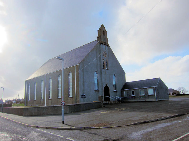
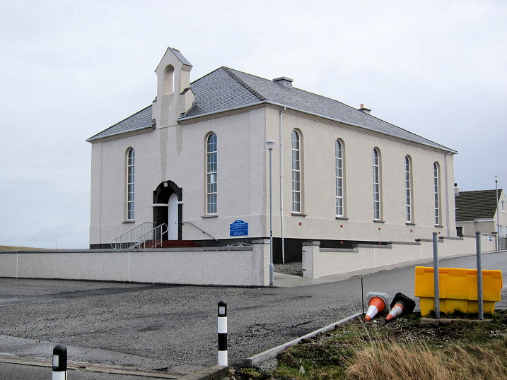
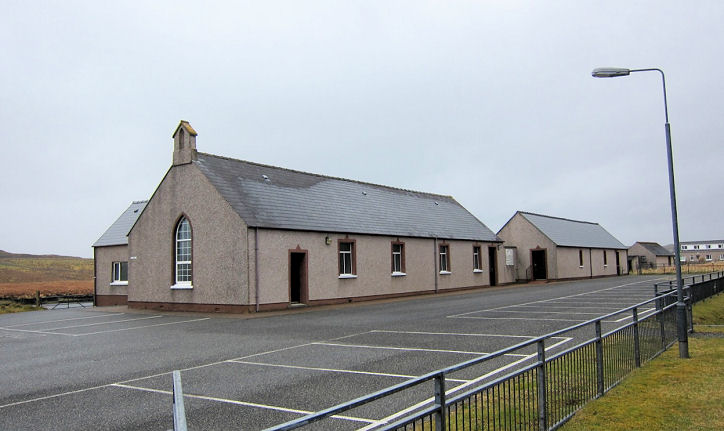
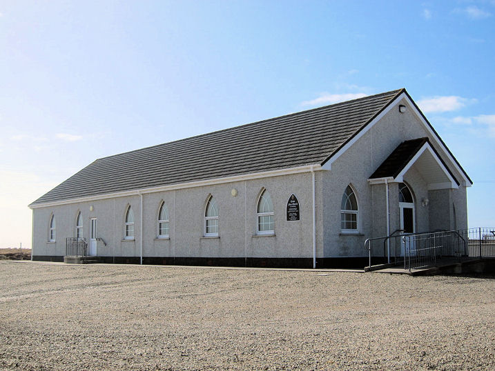
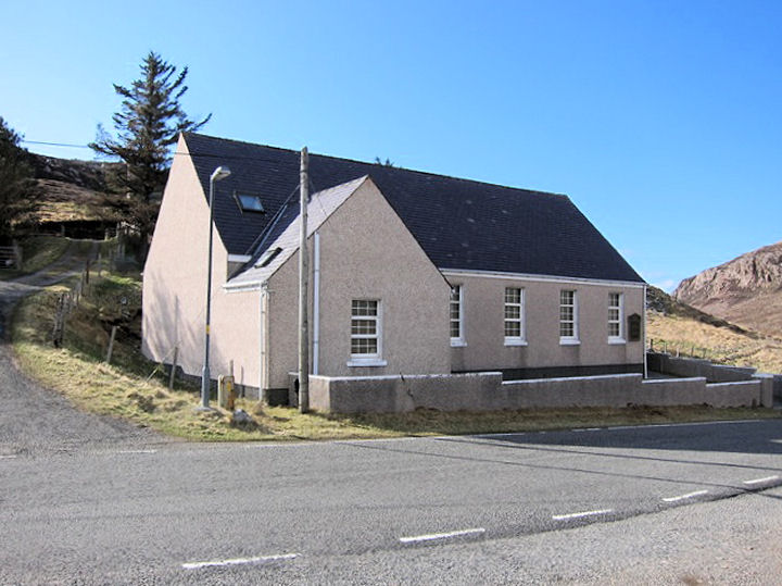
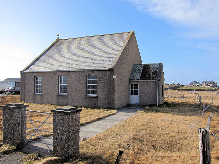
Achmore,
the Free Presbyterian Church, at NB 3092 2955, as seen by Streetview in
2022. It seems to be relatively modern as it isn't shown as a place of
worship on a map of 1960 (though there is a building on the site, with a
different alignment), and is shown on a map of 1973.
Link. There
used to be a Free
Church at NB 3152 2914, seen by the first Streetview visit in 2009,
but was demolished at some point before 2022 -
Streetview shows
the building which was built on its site. A map of 1973 shows a
Mission House (CoS?) at NB 3183 2895. The
building on the site today (2024
Streetview) has the same footprint, but whether it was a conversion
or replacement is unclear.
Aribruach, the
Free Church Meeting House, seen by Streetview in 2024. It's dated
MCMXLIX - 1949. NB 2477 1755. Just a few yards further east is a
CoS Meeting House,
at NB 2481 1757, seen by Streetview in 2024. Both seem to be "former",
and both can be seen in a
Streetview from
2024.
Back, Back Free
Church. There are also references to the settlement being known as Coll.
Another view. NB 4825
4005. Both © Martin Richter (2013). The brief
Canmore entry.
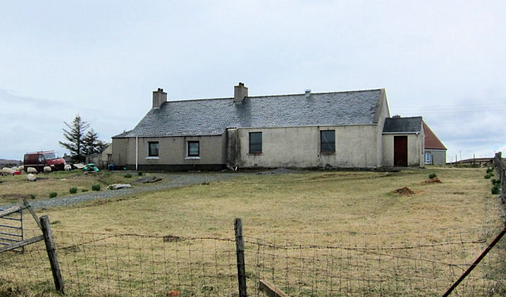
Barvas, former
church, of (so far) unknown denomination, now converted to residential
use. Map evidence suggests that it was built after 1897, and was closed
before 1958. Older maps show it with the symbol for a church with spire,
now evidently taken down. Two additional views -
1,
2. NB 366 513. All
© Martin Richter (2013). Howard Richter speculates that this may have
been a replacement for a demolished church which stood at NB 360 514.
The Church of Scotland at NB 359
494 doesn't appear to have an on-line presence. It can also be
seen here, on a 2009
Streetview. A local informant advised that it was opened in 1909. Howard Richter also notes another current church -
a Free Church at NB 353 489.
Link (includes a photo).
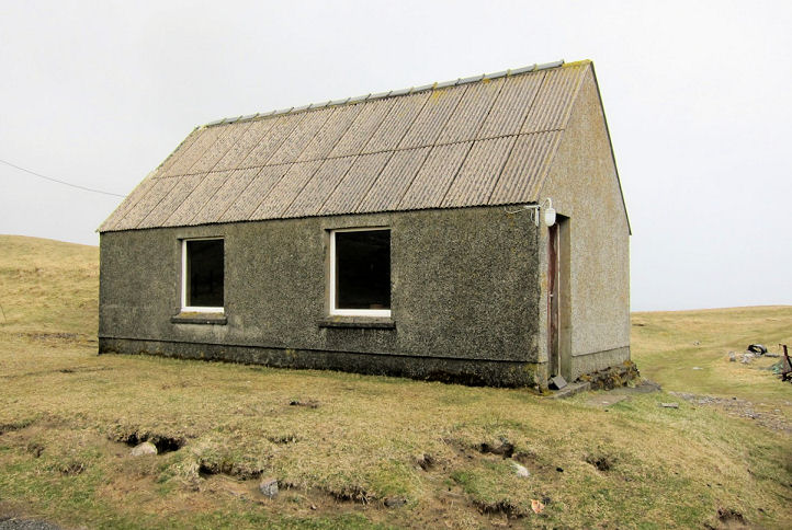
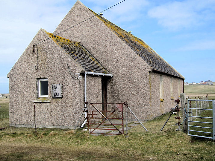
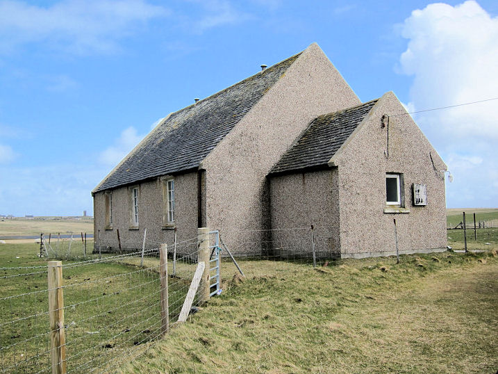
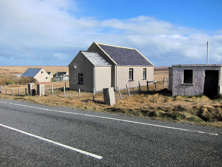
Bhaltos, the former Mission Hall (CoS). Martin was advised by a local informant that it had been disused for
"at least ten years", and is now leased to a crofter. It must
pre-date 1972, when it shows on an OS map of that year. NB 088 364. © Martin Richter (2013).
Two Meeting Halls show on a map of 1897
(affiliations not shown), one at NB 0945 3682, the other at NB 0953 3673
- the latter hasn't survived. It stood about 100 yards from the
2024 Streetview
camera, roughly at the second line of fencing near the shoreline. The
surviving one is now in residential use, and was
seen in 2009.
Borve,
the Free Church, as seen by Streetview in 2022. Still active at that
time, at the next visit in 2024 it was for sale. It pre-dates a map
surveyed in 1895. NB 4085 5600. The former
Church of Scotland
is now in residential use - 2024 Streetvew. It was already "former" at
the time of the first Streetview visit in 2009, when it being offered
for sale. NB 4072 5590. Just yards away from the Free Church is a former
Mission House
(2024 Streetview). None of the available maps show its affiliations. It
can be seen on a map surveyed in 1971. NB 4090 5604.
Bragar,
the remains of a Free Church, as seen by Streetview in 2009. NB 2871
4774.
Breasclete (on Great Bernera
island), Church of Scotland - two 2009 Streetview -
1,
2. This
source
dates it to the late 1870's. NB 1595 3665. The
Free Church, as seen by Streetview in 2009 -
1,
2. NB 1598 3676.
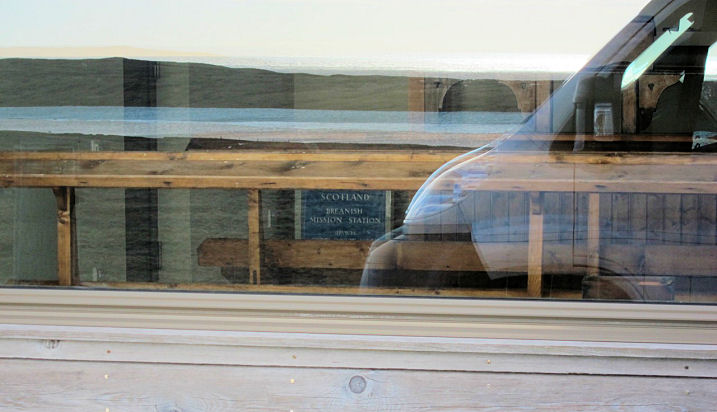
Breanish, the
site of the former Mission Station (CoS), now re-developed as a
holiday cottage. The long, north-south aligned Mission building can be
seen from above
here by zooming in on the red marker on the satellite image near the
bottom of the page. The church sign, and pews, can be seen
here in a photo taken through
a window. The Mission must post-date 1899, when it doesn't show on the
OS map of that year, and was still extant for the 1972 edition. Proper
dates of building and demolition not currently known. NA 993 264. Both © Martin Richter (2013).
Callanish,
Free Church of Scotland.
Another view. NB 218 340.
Link. The former(?)
Mission Hall (CoS) at NB 219 336. Current status is uncertain, but
from its absence from the Church of Scotland website, and its condition,
it is probably closed. All © Martin Richter (2013).
Carloway,
a Streetview of the Free Church (left,
link) and Church of
Scotland (right,
Facebook).
NB 2056 4248. The Free Church is
category B listed, wherein it's dated to 1884.
Col - see Back, above.
Cross, Free
Church (1888).
Another view. NB 508 622.
Canmore entry. Cross
Free Church (Continuing). NB 4972 6132. Their
website advises that it was opened in 2003. The
Church of Scotland
stands at NB 5059 619. The
Canmore entry advises that it was originally a United Free Church,
built in 1910. All © Martin Richter (2013).
Crossbost,
the Free Church, as seen by Streetview in 2024. Its
category B listing gives a date
of "possibly circa 1843". NB 3875 2456. There's also a Meeting House, at
NB 3971 2437. Possibly now "former", it's
2009 Streetview
suggests it may have still been active at that time. Its appearance in
2024 suggests it
may have been converted for secular use.
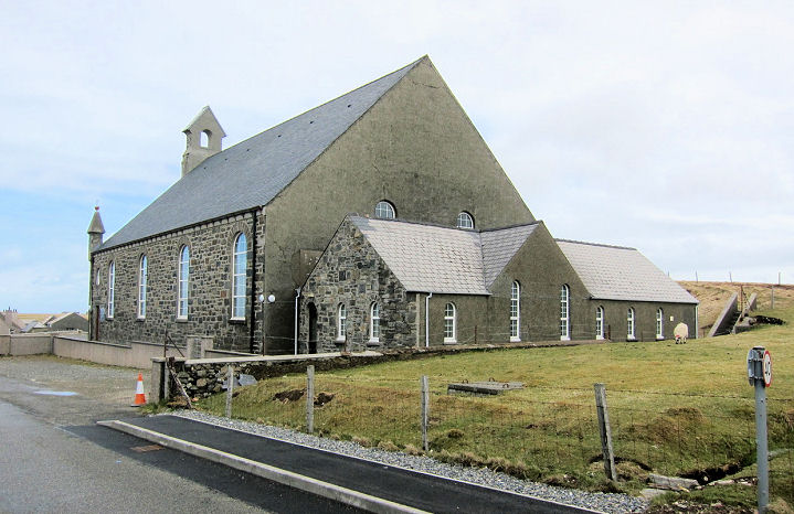
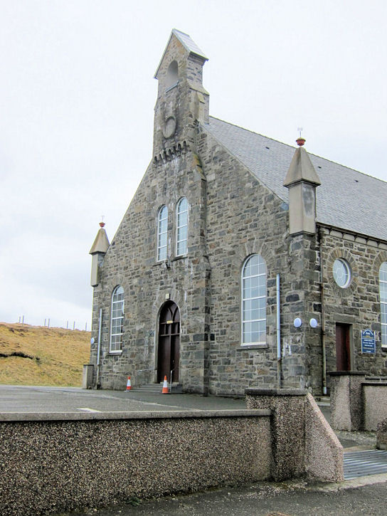
Eoropie, St. Moluag
(Episcopal).
NB 5195 6515. The northernmost church on Lewis, it was restored from a
ruin in 1912. The building itself is of uncertain age, though old, and
it stands on an ancient site. © Martin Richter (2013).
Link1.
Link2.
Link3.
Link4.
Kinloch, Church of Scotland, dating from 1911.
NB 3223 2203. © Donnie
Macleod (2002).
Lionel, Free
Presbyterian Church.
Another view.
NB 5256 6367.
Canmore entry.
Lionel Meeting House of Cross Free Church. Old maps show that the
present building had a predecessor nearby. The present church is at NB
5232 6416, parallel to the road; the earlier building stood at NB 5234
6414, at 90 degrees to the road. The maps to which I have on-line access
only de-limit it's dates as having been built between 1853 and 1897; the
present church between 1974 and 1992. A
Church of Scotland
Mission stands quite close to the meeting house, on the other side
of the road, at NB 5235 6418.
Another view.
All © Martin Richter (2013).
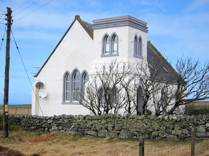
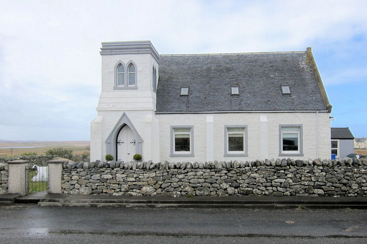
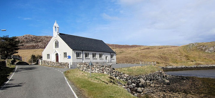
Miavaig, Uig Church of
Scotland. Another view. This
link has some history, from wherein we learn that it was originally
the Free Church (at Ceann Langabhat, or Miavaig) from 1843, Uigen Church
(CoS) from 1972, and that it united
with the nearby Baile na Cille Church in 1979. Baile na Cille church
(1829) which is
Grade B listed stood at NB 053 343. Still in use in 1998, it was
subsequently closed, and was for sale in 2009 - see on Google Maps
here. There is a comprehensive history (with photos) of it
here. More
here. NB
087 348. Both © Martin Richter (2013).
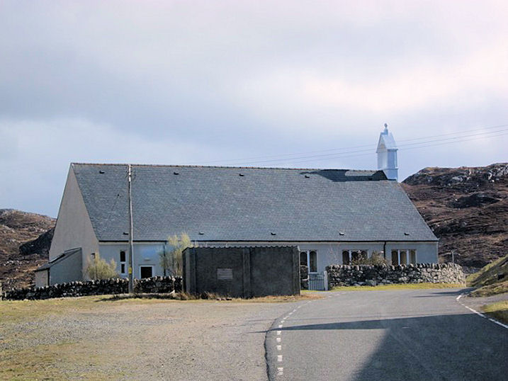
Free Presbyterian
Church of Scotland. NB 0870 3485. © Martin Richter (2013).
Link.
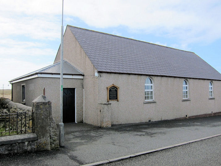
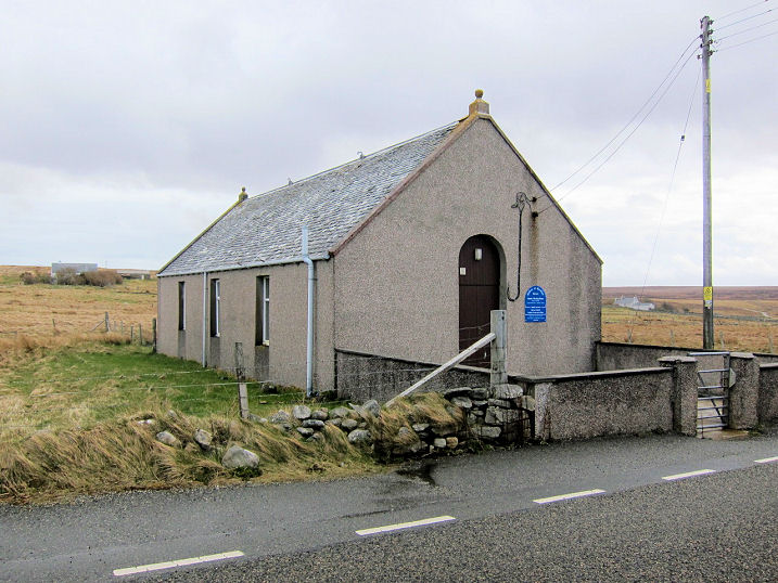
North Tolsta, Free
Church. NB 5377 4754. © Martin Richter (2013). Nearby is a
Free Presbyterian Church, seen
by
Streetview in 2024. A date-stone for 1921 can be seen. NB 5376 4746.
Link.
Shader, Church of Scotland.
NB 3887 5424. © Martin Richter (2013).
Free
Church.
Another view. NB 3896 5434. Both © Martin Richter (2013). Both
churches get a (brief) mention
here.
Skigersta. Howard Richter advises that
Skigersta at one time had a Free
Presbyterian Church, which stood at NB 5459 6182, on the south side of a
minor road which runs north-east towards the coast. The site can be seen
on a 2009 Streetview
here. Old maps indicate that the building, which was rectangular,
was aligned with its long axis parallel to the road heading off into the
distance. Its far end was beyond the nearest lamp-post, and heading
towards the small fence-line. A line of darker vegetation can be seen
which may possibly show the line of a wall. Not marked on a map of 1911,
it was in place by 1931, and was still extant on a broadly-dated map of
1974-1992.
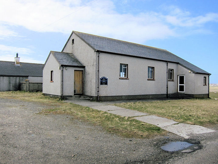
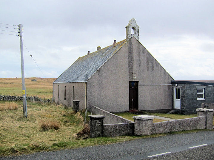
South Dell, the
former South Dell Meeting Hall (Church of Scotland).
Another view.
NB 4877 6108. A un-dated property website
entry has some more photos, including the interior. The former
Ness Free Church
(1844-5) stands nearby. It had a "Sold" sign in 2013.
Another view.
NB 4877 6113.
Canmore entry. All © Martin Richter (2013).
Stornoway.
|
|