The Churches of Britain and Ireland
|
Bishop Auckland, County Durham My thanks to Howard Richter for his researches into the churches of Bishop Auckland.
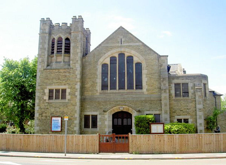
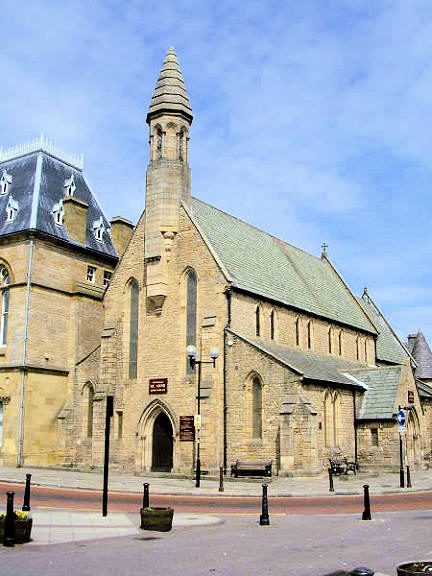
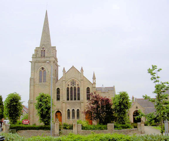
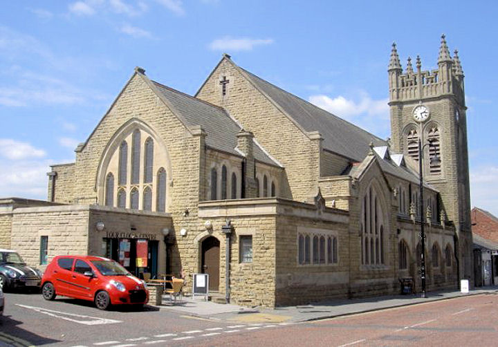
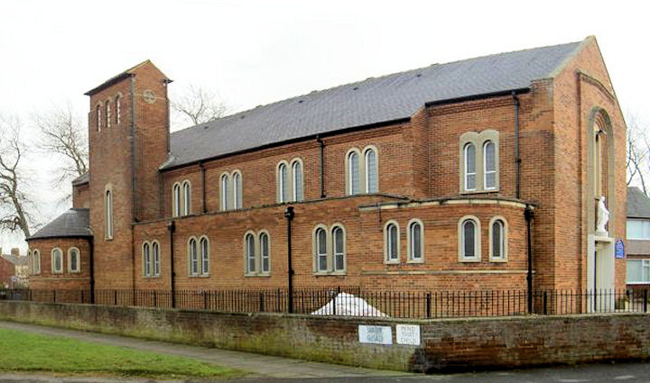
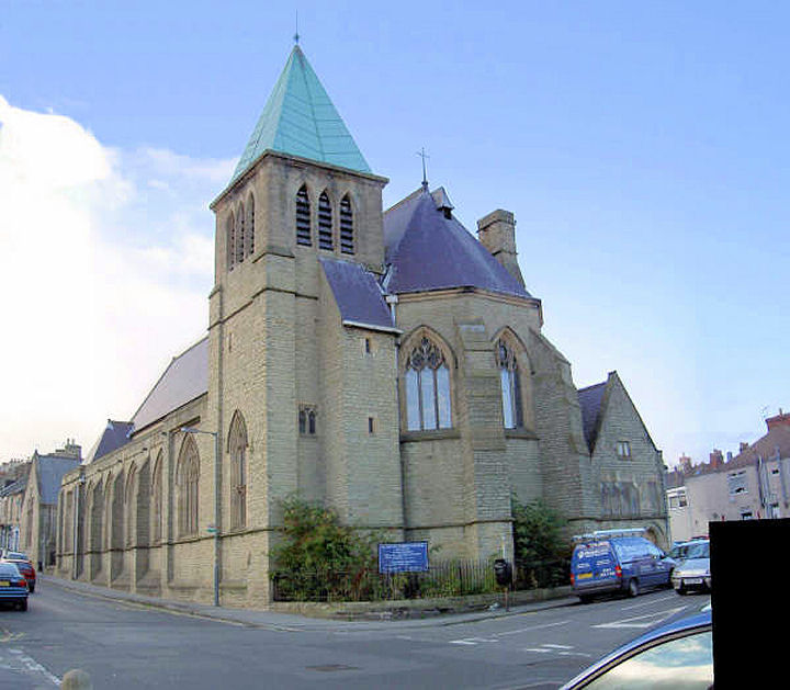
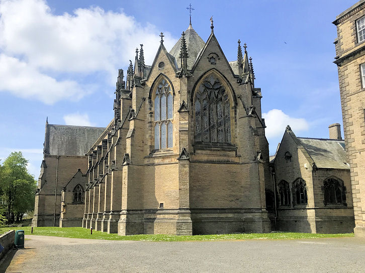
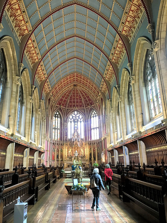
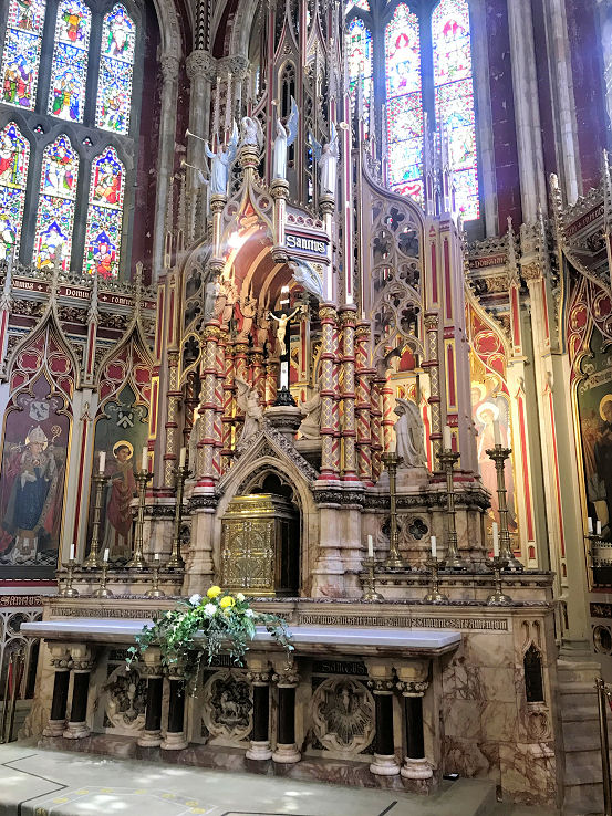
The site of the demolished Baptist Church on Waldron Street, as seen on a 2016 Streetview. An old directory records it as opening in 1879. Map evidence suggests it was closed before 1920, and had been replaced by the present houses by 1939. Howard Richter has suggested that it could possibly be the predecessor of the Baptist Church in the next entry. NZ 2078 2976. Baptist Church on Westfield Road and Cockton Hill Road. NZ 209 289. © Alan Blacklock. According to the church website, the church was built in 1910, though the congregation, which was founded in 1873, had previously met in a tin tabernacle on another site. See also the previous entry. The former Batts Mission Hall on Dial Stob Hill, at NZ 2117 3035, as seen by the Streetview van in 2009. Now in secular use, note the ghosts of arched windows. The first map to label it as Mission Hall is of 1939, although the same building (or one with the same footprint) is shown on earlier maps. On a map of 1962 it's labelled as Batts Mission Hall, but the label had gone by the 1979 edition. An disused Anglican Cemetery Chapel stands in the cemetery off South Church Road, at NZ 2153 3934. The Streetview van only provides this poor image of it, largely obscured by trees, to the left of the cemetery lodge. Church of St. Anne on Market Place. NZ 211 301. © Alan Blacklock. Grade II listing, which dates it to 1846-8, and says that it stands on the site of a medieval forerunner. The vacant site of a demolished Congregational Chapel of 1876 on Victoria Street/Avenue, and what is now Kingsway. It was later a Salvation Army Hall, labelled as such on a map of 1962. NZ 2115 2987. A Friends' Meeting House of 1842 (date from Kelly's directory of 1890) once stood off Newgate, accessed from a courtyard down a passageway. The Halifax now stands on the site (seen on a 2015 Streetview here). At the rear was a burial ground extending to Westgate Road. Seen here in 2014, it has been surfaced over and is now a car park for the Halifax. This source provides dates of 1665 for the original building, a re-build in 1840, with demolition no later than 1913. Gibbon Street Christian Community Centre on Tenter Street, as seen by the Streetview van in 2014. Built between 1980 and 1988, it stands on the site of an 1869 Primitive Methodist Church, for which see the Methodist Church entry, below. It's likely that the P.M. Chapel became United Methodist at some point, as there is a reference to it being a former U.M. church in the mid-1940's. NZ 2083 2986. An Independent Chapel is shown on old maps on Great Gates, at NZ 2100 2983. Pre-dating a map of 1857, the date of its demise is so far unknown. It stood on the parking area in front of the building seen here in a 2014 Streetview. Kingdom Hall of Jehovah's Witnesses stands on the A688 at NZ 2140 2848. Its access from St. Aidan's Drive is seen here in a 2014 Streetview, but the building itself is better seen here from the main road in 2018. It was preceded by a building between Newgate and Regent Street at NZ 2112 2991. Now demolished, its site can be seen on this 2018 Streetview, between the brick-built sub-station enclosure with green gates, and the white van. Methodist Church on Cockton Hill Road and Acacia Road. This was built as Primitive Methodist in 1903. NZ 2095 2900. © Alan Blacklock. Link, which says the present building was successor to a church of 1869 on the corner of Tenters Street and Gibbon Street (see also Gibbon Street Christian Community Centre, above), in turn the successor to a small chapel on William Street, in use by the P.M.'s from 1842. The site was to the right of the yellow van, seen here on a 2014 Streetview. The William Street chapel stood at about NZ 2103 3002, and the Tenters Street one at NZ 2083 2986. Two 2018 Streetviews of the present church - 1, 2. An old postcard image is available here. Grade II listed. The former Methodist Church on Newgate Street, now the Four Clocks Centre. It was built as Wesleyan in 1908-14. NZ 2100 2945. © Alan Blacklock. Two 2018 Streetviews - 1, 2. Grade II listed. Its demolished Wesleyan predecessor, of 1842, was on Bondgate at NZ 2102 3013. An old photo of it can be seen here, and the site as it is today, on a 2018 Streetview here. It stood roughly where the marked out parking spaces are on either side of the double street-lamp. There's a minor mystery here, in that it is still marked as a "Ch." on a map of 1939, though the Methodists had moved on decades before, so who was in residence? Or perhaps it had just remained unoccupied? A Mission Hall is marked on a map of 1897. Later a Sunday School, it stood immediately north of what is now the Methodist Church on Newgate Street. Whether there was any connection is uncertain. It can be seen here, and here (at the end of the alley) in 2015 Streetviews. A 2021 Streetview shows it from the rear, and the linking wall between church and former Mission is possibly support for the suggestion that the Mission was also Methodist. NZ 2099 2949. A demolished Mission Hall once stood at the junction of Peel Street and Frederick Street, at NZ 2118 2948. It first shows on a map of 1897, and a map of 1979-80 shows it still extant at that time. Its 2014 Streetview shows the still vacant plot. The church opposite the far end of Peel Street is the former Wesleyan Methodist on Newgate, noted above. Another Mission Hall which survives (though now in secular use) is labelled on a map of 1939 at the junction of Union Street and Railway Street. NZ 2015 2937. Here's its 2018 Streetview. A Presbyterian Church once stood on South Church Road at NZ 2118 2957. Later Trinity U.R.C., it was demolished and replaced by housing. In a 2009 Streetview the church site is marked by the block of three-storey houses. The first available map to show it (though just as "Church") is from 1897. Succeeding maps label it the same way, until the edition of 1962, which shows it as "Trinity Church (Presb.)". The latest map available to me (1989) labels it as a place of worship, implying demolition at a date later than this. St. Joseph - see St. Peter's Chapel, below. The demolished St. Luke stood on West Auckland Road at NZ 2039 2699. The site, seen here on a 2016 Streetview, now forms part of an industrial estate. Map evidence indicates that it was built between 1880 and 1898. See also Woodhouse Close Church, below. St. Mary (R.C., 1956) on Woodhouse Lane. NZ 206 284. © Alan Blacklock (2010). Link. A 2018 Streetview. St. Peter (1873-5) stands at the corner of Prince's Street and Gibbon Street at NZ 208 297. © Alan Blacklock. Grade II listed. St. Peter's Chapel, which originally served as the Great Hall to Auckland Castle. NZ 2140 3025. From an old postcard in Christopher Skottowe's Collection. Its grade I listing says that it was converted from a 12th century domestic building into a chapel in 1661-5. Another fascinating article describes why the conversion into a chapel was necessary, and of the discovery of the remains of a long-vanished chapel. A modern view, and three of the interior - 1, 2, 3, all © Peter Morgan (2022). Link. Another chapel in the castle is dedicated to St. Joseph - two interior views - 1, 2, both © Peter Morgan (2022). St. Wilfrid (R.C.) on West Road. NZ 2065 2995. © Alan Blacklock. Link. South Road Chapel once stood on the corner of Adelaide Street and Newgate. A map of 1857 labels it as Methodist Association, so it's a strong possibility that it was originally Wesleyan. Later United Methodist, the latest map to show it with certainty is of 1939, and the site was vacant by 1962. Baptism records are mentioned here for 1876-1935. Shops now stand on the site as seen by the Streetview van in 2016, and the church itself can be seen here, just behind the "Edward Hay" sign. It is reproduced from a book discussed here. NZ 2102 2960. Town Head Methodist Church on Newton Cap Bank was originally Wesleyan. It disappears from maps between 1962 and 1967, having first been labelled in 1939, though there is a Sunday School on what appears to be the same site as far back as 1897. The vacant site can be seen here on a 2009 Streetview. NZ 2055 3010. Wear Vale Christian Centre on South Church Road, seen on a 2014 Streetview. The tower of St. Peter is distantly visible at the far end of the street, and the former Methodist Church on Newgate Street is to the left of the Wear Vale C.C. NZ 2107 2964. Link. A Wesleyan Methodist Chapel (Cockton Hill Methodist Mission) once stood at the junction of Roman Road and Morland Street. It was replaced by a filling station in the 1970's. NZ 2084 2846. The Streetview van saw it in 2009. Woodhouse Close Church (1962) on Proudfoot Drive, as seen in a 2016 Streetview, was built as Methodist. Since the demolition of St. Luke (for which, see above), it's now also home to that congregation, and also a U.R.C. congregation. NZ 204 280. Link. Of available on-line maps, a mystery church appears on only one, the 1" of 1955-61, on the north side of Durham Chare. Shown only as a "+", can you advise its denomination, or provide a little history for it? A 2014 Streetview shows Durham Chare - the church was about half-way along on the left. NZ 2110 2994. Peter Reynolds has been in touch, and suggests that this is an error on the part of the Ordnance Survey - the map is evidently not error-free, as it marks another church a little way north, while not marking St. Anne's, suggesting that its position is wrongly indicated.
|
||
20 August 2024
© Steve Bulman