|
|
City of Edinburgh
Edinburgh on Wikipedia.
Churches in
Broughton, Bruntsfield & Merchiston, Calton,
Canonmills, Craigmillar,
Cramond,
Dean,
Duddingston and Willowbrae,
First New Town, Gayfield, Gorgie,
Grange,
Granton,
Ingliston, Leith,
Merchiston,
Moray Estate,
Morningside,
Newington,
Northern New Town,
Old Town, Pilrig, Portobello,
South
Queensferry,
South Side, South West, Stockbridge, Western New Town.
Some links will open another page.
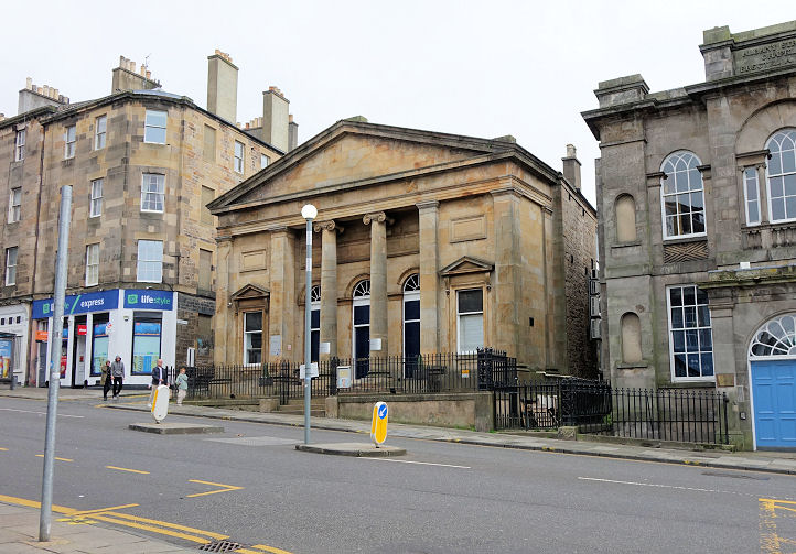
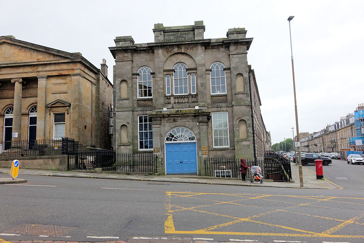
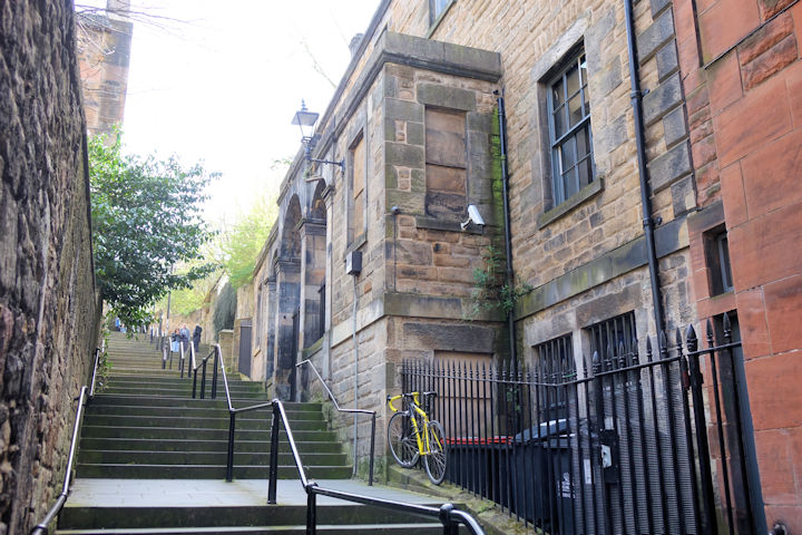
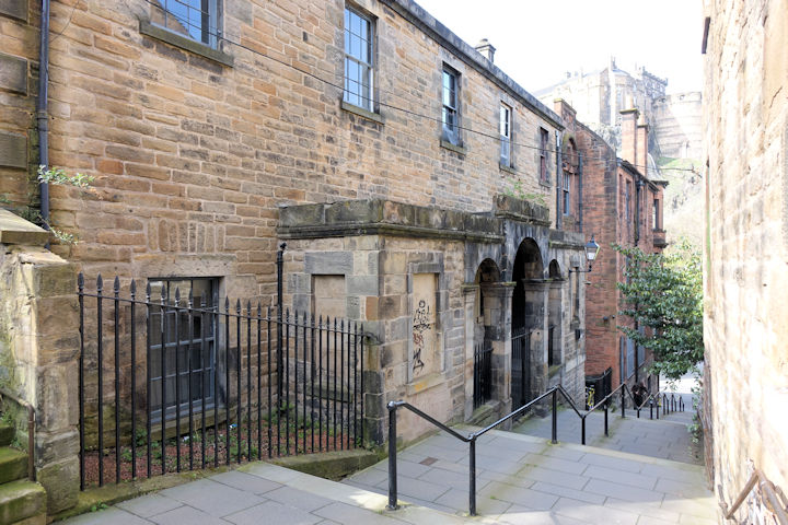
Broughton
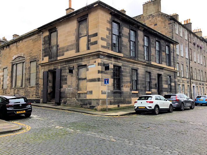
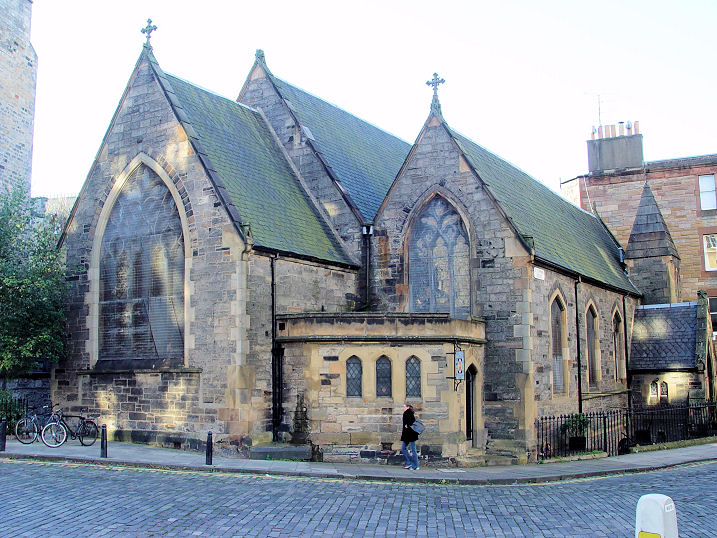
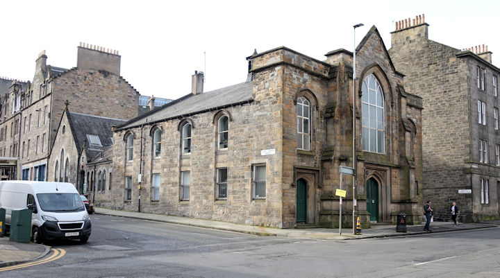
The former Glasite
Meeting House on Barony Street and Albany Lane. Its
grade A listing dates it to 1836. Kevin advises that this was the
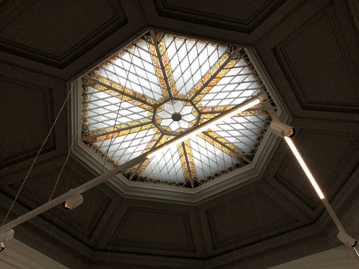
final Glasite place of worship when it closed in 1988. The main worship
room is now in use as an art gallery. It had no windows, just a large
cupola to let in
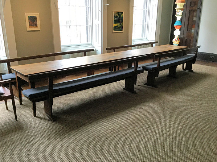
light. After worship the congregation gathered in the
Feast Room for lunch
(the feast table is original), and the typical fare gave it the nickname
of the Kale Kirk. NT 2571 7451. All © Kevin Price (2021). Some
background on the Glasites is available
here on Wikipedia.
More photos can be seen
here, including one of the church notice board.
Bruntsfield & Merchiston
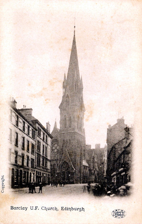
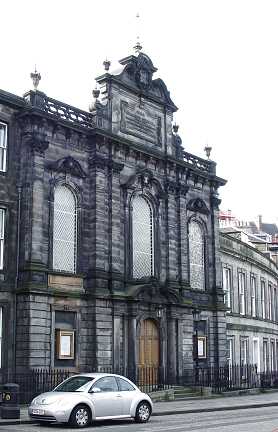
Barclay
Viewforth Church, (CoS, formerly Free
Church) on Bruntsfield Place. Edinburgh Chinese Christian Church also meet here
(link).
NT 2492 7259.
© Steve Bulman (2023). An old postcard view, from Reg Dosell's Collection.
Link.
Category A listed, wherein it's dated to 1862-4.
Bruntsfield Evangelical Church,
on Leamington Terrace and Westhall Gardens. A map of 1896 labels it as a United Presbyterian
Church. Another view. NT 2469 7233.
Both
© Steve Bulman (2023). Link.
Category B listed, where it's dated to 1882-3.
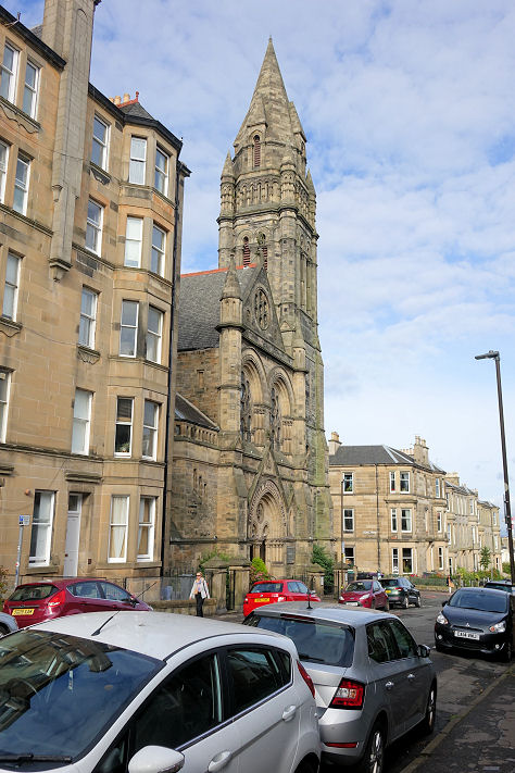
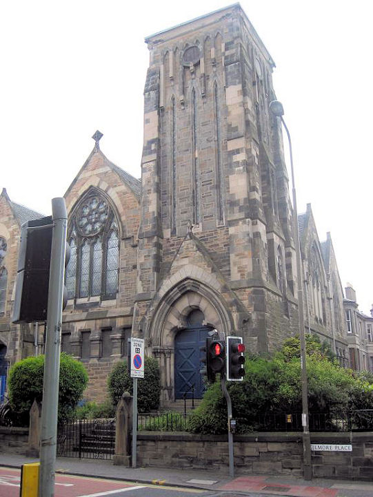
Free Presbyterian Church of
Scotland on Gilmore Place and Upper Gilmore Place. It's dated in
Pevsner to 1880. NT 2462 7265.
© Steve Bulman (2023).
Link.
Methodist Church on Dunbar
Street. © Steve Bulman.
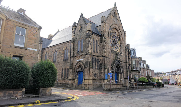
Viewforth Parish Church (St. David & St. Oswald, CoS) on Gilmore Place. NT 243 725.
© Mehmood Naqshbandi (2009). Link.
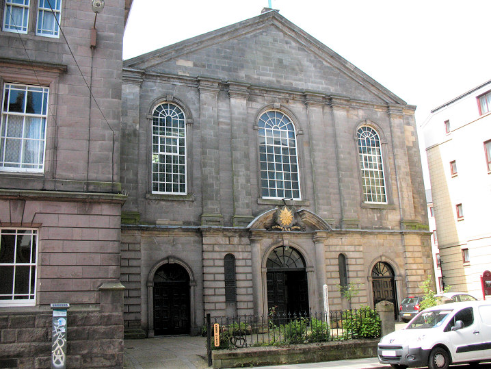
Calton
Greenside Parish Church (1839, tower 1852, CoS) on Royal Terrace.
© Steve Bulman. Link.
The former Lady Glenorchy's Low Calton
Church or Lady Glenorchy's Free Church, on Leith Walk. Its
Wikipedia entry dates it to 1845-6, successor to an earlier church, the site
of which is marked on a map of 1854 at circa NT 2598 7392, and which now lies
beneath the east end of Waverley Station. Wikipedia has a photo of the first
church taken during its demolition. It also says that only the frontage remains
of the second church, the rest having been demolished in 1986. NT 2608 7437. ©
Steve Bulman (2024).
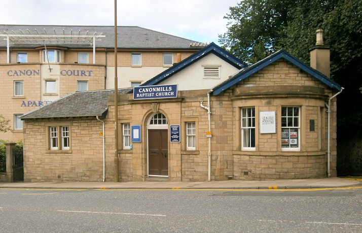
Canonmills
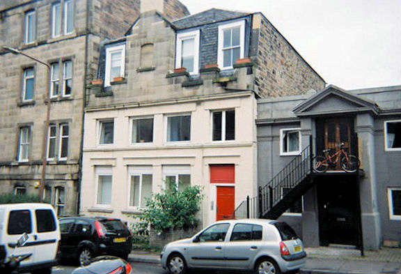
Canonmills Baptist Church on Canonmills. NT 2530 7505. The congregation have only been here since 1988,
their previous home (now demolished) was on Dublin Street. Architects drawings for the old church dated 1856 are available
here. It stood at about NT 2557 7449. © Howard Richter (2013).
Link (history).
Craigmillar
The former St. Andrew (Episcopal, 1900 [Pevsner]) on Newcraighall Road, now in secular use. Closed on
or before 1977, when it became an arts centre (see here
- note also the contradictory date for the church of 1904). NT 311 716.
© Howard Richter (2013).
Grade B listed.
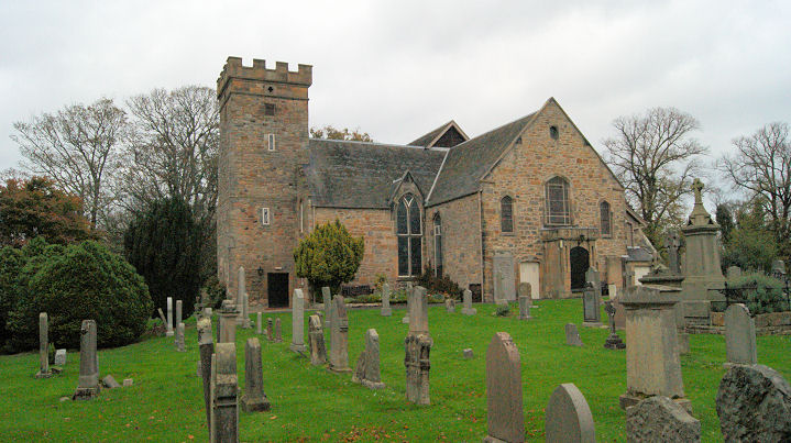
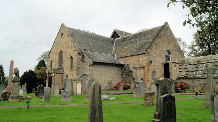
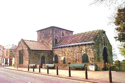
Cramond
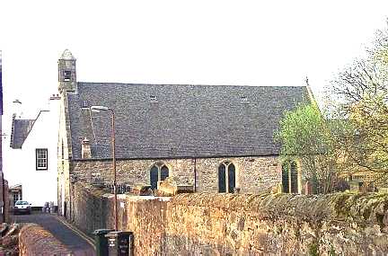
Cramond Kirk (CoS) on Cramond Glebe Road. The present church dates from the 15th century (the tower), though it
stands on the site of earlier churches, and ultimately, a Roman Fort. Another view. Both ©
Norman Cummings (2014). Link.
Dean
Bristo Baptist Church (1935) on Queensferry Road and Dean Path. The spire of Dean Parish Church is visible
at right. NT 238 741. © Steve Bulman (2013). Link, which includes an interesting history, and which
lists numerous previous buildings used for worship before the present church was built.
The former Dean Free Church (1888) on Belford Road and Douglas Gardens, now in secular use.
Another view. Circa NT 238 737. Both © Steve Bulman (2013).
Dean Parish Church (1903, on the site of an earlier church) on Dean Path and Ravelston Terrace.
Another view. NT 238 741. Both © Steve Bulman (2013).
Link.
A distant view of the former Holy Trinity Episcopal Church (1837-8) on Dean Bridge and Queensferry Road. Since
1957 it has been used as an electricity sub-station. NT 242 741. © Steve Bulman (2013).
Grade B listed.
Duddingston and Willowbrae
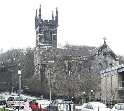
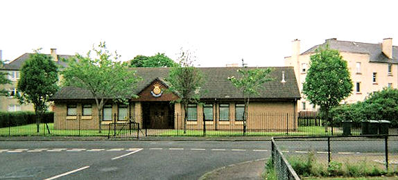
Holyrood Abbey Church of Scotland on London Road and Marionville Road. It opened in 1900 as Abbeyhill
United Free Church. It has a "jolly interior" according to Pevsner. NT 274 744.
© Howard Richter (2013).
Link1, with history here.
Link2.
News item.
Grade B listed.
First New Town.
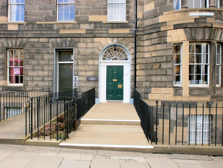
Gayfield
Christadelphian Church on Gayfield Place. NT 262 746. © Howard Richter (2013).
Another view, © Steve
Bulman (2024). Link.
Gorgie
Parish Church (CoS). © Rob Brettle.
Former Salvation Army hall. © Rob Brettle.
Grange
Salisbury Church,
earlier the United Presbyterian Church. Many thanks to Jean Walker for advising that it is
now redundant, and being used as a lighting showroom. The congregation moved to Mayfield,
and is now known as the Mayfield-Salisbury Church of Scotland (see Newington, below). © Steve Bulman.
Granton
Granton Salvation Army Hall on
Warddieburn Avenue. © Rob Brettle.
Ingliston
The Prayer Room at Edinburgh
Airport. © Janet Gimber (2016).
Leith.
Moray Estate
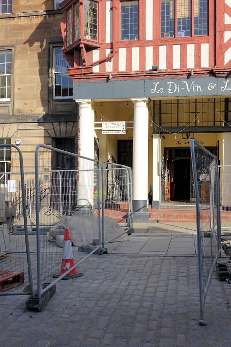
A building on Randolph Place
has a doorway between two columns with a sign saying St. Anne's
Oratory.
Coflein (which locates it on Randolph Lane) describes it as a
private chapel. This
source dates it to 1931-2006. Another sign above the door reads
Polska Kaplica (Polish Chapel), so perhaps the chapel is in use
again. NT 2453 7383.
© Steve Bulman (2023).
Morningside.
Newington
Duncan Street Baptist
Church, on Duncan Street. © Steve Bulman. Link.
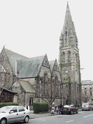
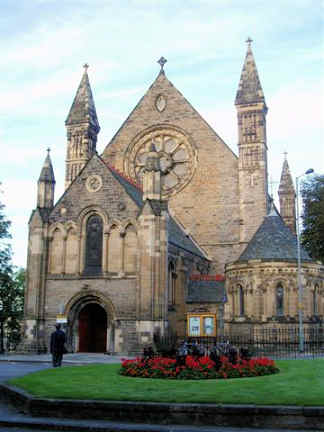
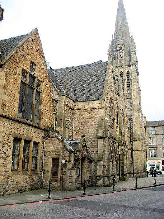
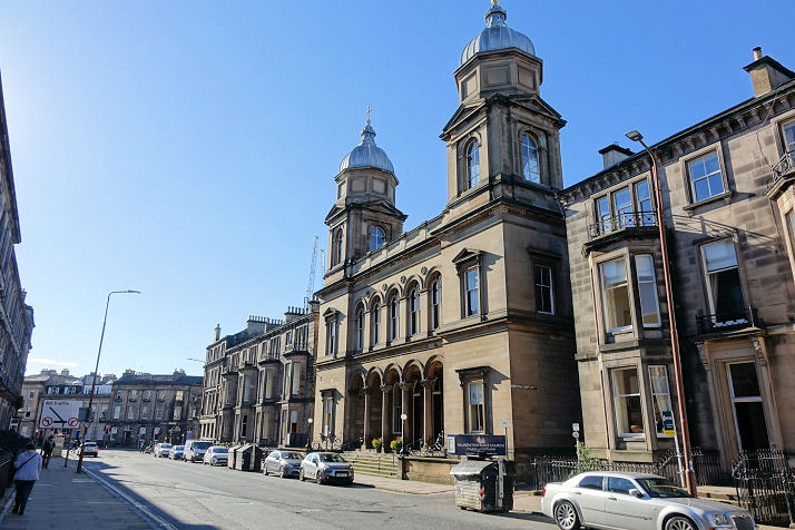
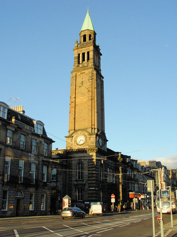
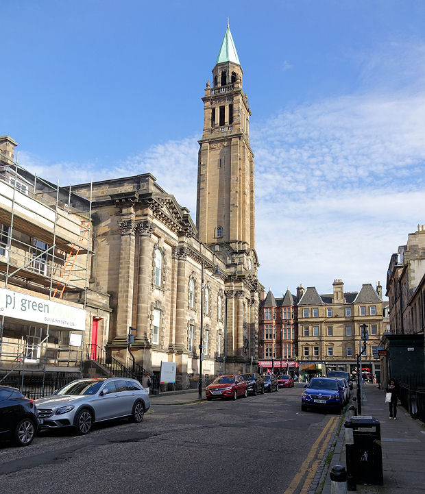
Mayfield Salisbury Parish Church (CoS) on West Mayfield and Mayfield Road. ©
Steve Bulman. Link.
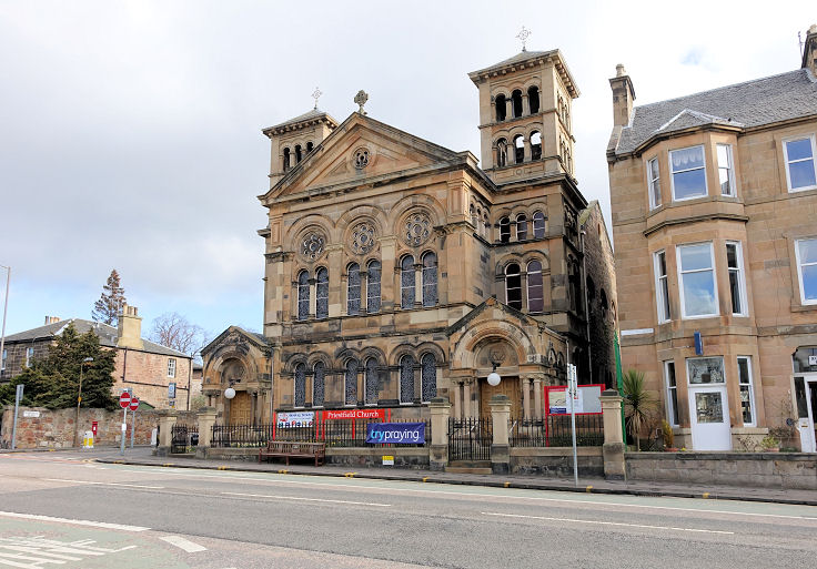
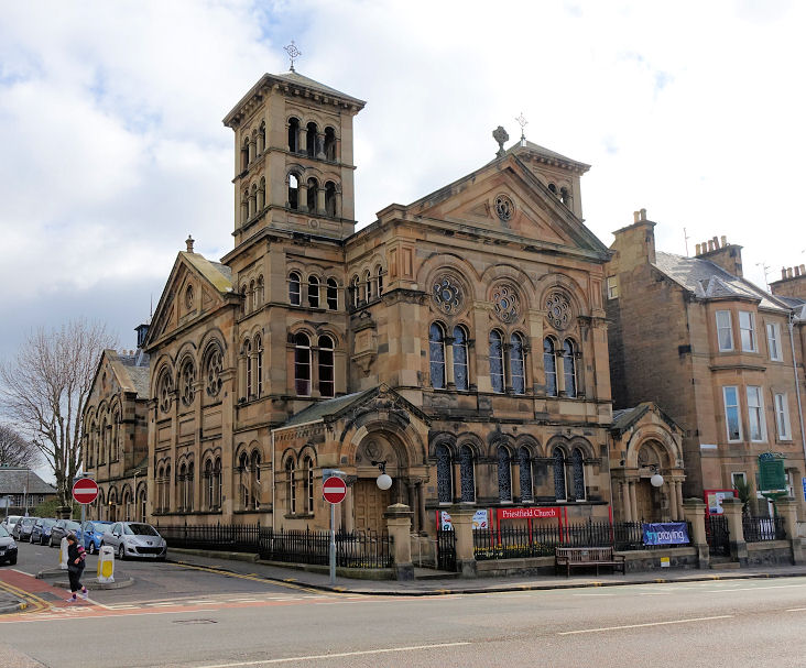
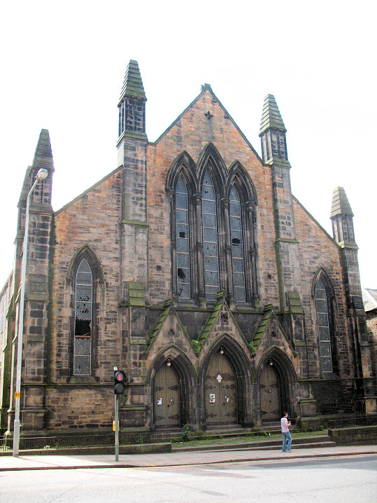
Priestfield Church on Dalkeith Road, built as Rosehall United Presbyterian in 1877.
Another view. Both © Steve Bulman (2015). Link.
Northern New Town
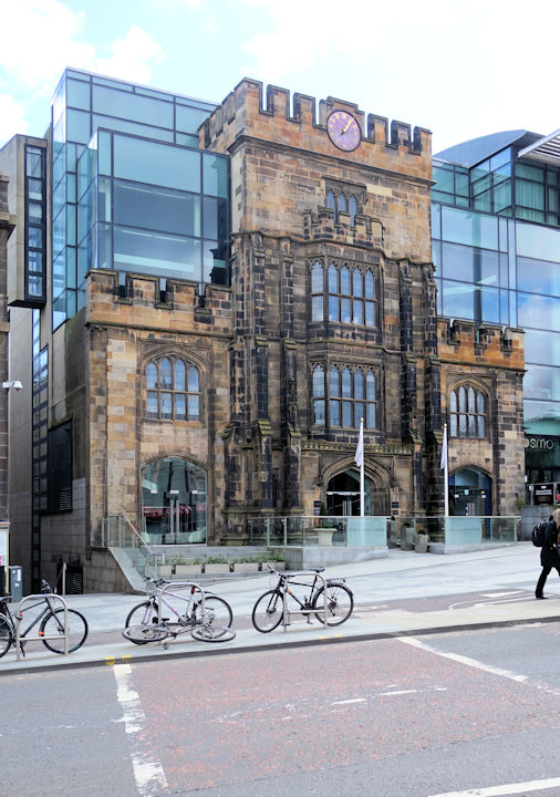
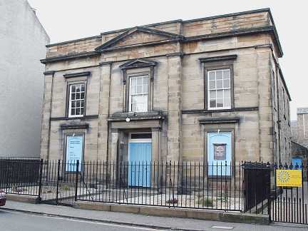
The former Catholic Apostolic Church on
East London Street,
now the
Mansfield Traquair Centre.
NT 2577 7472. © Aidan McRae Thomson.
Link.
Category A listed, wherein it's dated to 1872-85.
Immediately adjacent to the Congregational Chapel
on Broughton Street is a former
Gaelic Church
(so labelled on the 1895 large scale O.S. map). According to its
Canmore entry, it was also at some point a Catholic Apostolic Church. NT
2587 7445.
© Steve Bulman (2023).
Old O.S. maps show a
Congregational Chapel on the
southern side of the junction of Broughton Street and Albany Street, at NT 2587
7446. Its
Canmore entry, which dates it to 1816, says it has also been a Church of the
Nazarene, but it's now Edinburgh Assay Office.
Old maps mark a Deaf and Dumb Church on York Lane
at NT 2583 7443. I think its seen
here in a Streetview from
2023, but it was possibly on the vacant site to its right.
The 1895 large scale O.S. map marks St. James's Church
at the northern corner of the Broughton Place and Mansfield Place junction.
Canmore, which just dates it to the 19th century, says it was Episcopal.
Streetview saw the building
on the site today in 2023. NT 2582 7460.
St. Mary (2023 Streetview,
CoS) stands on Bellevue Crescent at NT 2558 7478. Its
Canmore entry dates it to 1824.
Link.
Across Albany Street from the Congregational Chapel, on the northern corner of
the junction of Broughton Street and Albany Street, stood
St. Mary's Free Church.
Canmore (which has photos) dates it to 1859-60, with demolition on or just
before 1983. Offices were built on the site. NT 2583 7449.
© Steve Bulman (2023).
The former St. Stephen on St. Vincent Street, for sale in 2013. NT 249 745. © Steve Bulman (2013).
Link (with interior views).
St. Vincent (1857, Episcopal) on St. Vincent Street. NT 249 745. © Steve Bulman (2013).
Old Town.
Pilrig
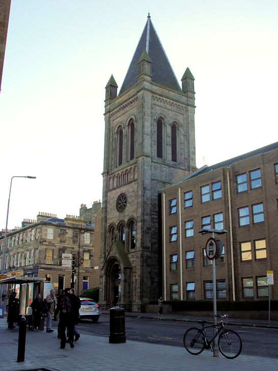
St. Paul (CoS) on Pilrig Street. Also known as Pilrig and Dalmeny Street Church, it was built in 1861-3 as a Free
Church. NT 265 751.
© Mehmood Naqshbandi (2009). Another view,
© Steve Bulman
(2015).
Link.
Former Salvation Army Hall, on McDonald
Road, now in secular use.
© Rob Kinnon-Brettle. Rob reports (2017) that the building has been demolished.
Portobello.
South
Queensferry
The Auld
Vennel Kirk (now used as an art gallery). © Bill Henderson.
The Parish Church. © Bill Henderson.
The Priory
Scottish Episcopal Church. © Bill Henderson.
South Side.
South West
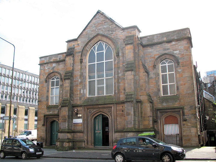
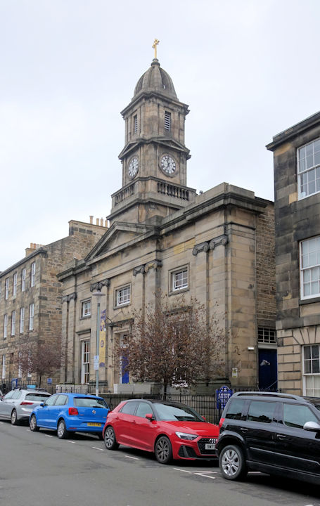
Catholic Church of the Sacred Heart on Lauriston Street. © Janet Gimber (2012).
Link.
Chalmers' Territorial Free Church is marked
on a map of 1895 at the S.E. corner of the junction between West Port and Lady
Lawson's Street, at NT 2512 7321. An
office block stands on its site today. © Steve Bulman (2024). Its
Canmore entry has photos. An earlier map (1880) shows what must be its
predecessor (it has the same name) further east on the south side of West Port,
at NT 2521 7325. This building is shown on the 1895 map as Mission Hall.
The buildings on the site today were seen by
Streetview in 2018.
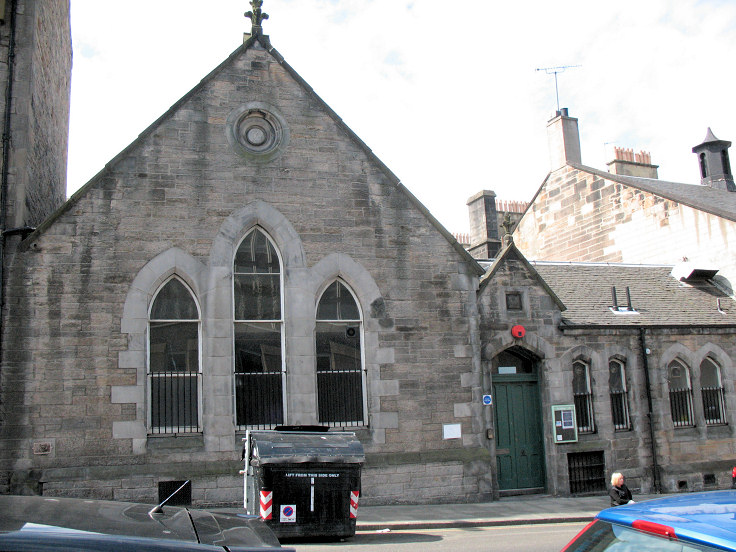
The derelict Lauriston United Presbyterian Church (1859). © Janet Gimber (2012).
Link.
Portsburgh Church shows on The Vennel on a
map of 1854. Dated by Pevsner to 1828, he also says that it was proposed in 1984
to demolish it, but this evidently never happened.
Another view. NT 2531 7326. Both © Steve
Bulman (2024).
St. Catharine's Convent of Mercy (R.C.) on Lauriston Gardens (St. Catherine in Pevsner). © Janet Gimber (2012).
Link.
The former St. Cuthbert's Free Church on
the corner of Spittal Street and Lady Lawson's Street, now in use as a clinic.
It pre-dates a map of 1854. The
church hall which stands at the rear of the church on Lady Lawson's Street
is later. NT 2501 7327. Both © Janet Gimber (2012).
Another view, showing both church and
church hall, © Steve Bulman (2024).
St. Mark (Unitarian) on Castle Terrace.
© Steve Bulman. Link.
Stockbridge
St. Bernard (CoS) stands on
Saxe-Coburg Street (originally West Claremont Street). It was, according to
Pevsner, originally St. Cuthbert's Chapel of Ease, dating from 1823 - however
its
category B listing says it was first known as Claremont Street Chapel. NT
2474 7480. © Steve Bulman (2024).
Link.
Category B listed.
The former Salvation Army Hall at
13 Hamilton Place.
© Rob Brettle.
The former Stockbridge Free Church on Deanhaugh Street. Only the tower survived the demolition in 1980.
NT 2456 7460. ©
Steve Bulman (2013).
Western New Town
Palmerston Place Church (CoS) on
Palmerston Place is dated by Pevsner to 1873-5, as United Presbyterian. NT 2414
7337. © Steve Bulman (2022). Link.
The former Roseburn Free Church on
Hampton Terrace, later Wester Coates Parish Church, and now home to the Scottish
Bible Society. It's dated in Pevsner to 1867-8. NT 2332 7317. © Steve Bulman
(2022).
St. George West on Stafford Street and Shandwick Place. Originally St. George's
Free Church, built in 1866-9. NT 2450 7359. From an old postcard in Reg Dosell's
Collection. A modern view, © Steve Bulman (2013).
At some point after my 2013 visit, the church was re-named as
Charlotte Chapel (Baptist), following the re-location of the congregation
from Charlotte Street Baptist Chapel (on Rose Street), for which see the
Old Town page.
Another view,
© Steve Bulman (2013).
Link.
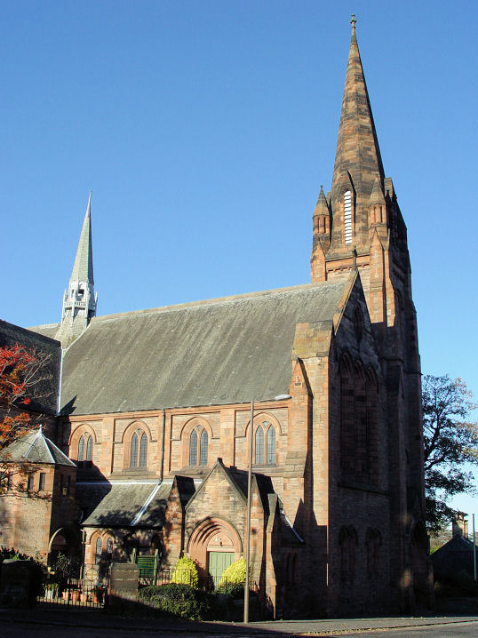
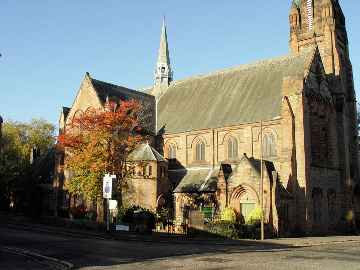
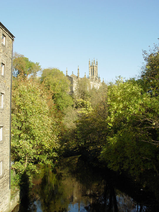
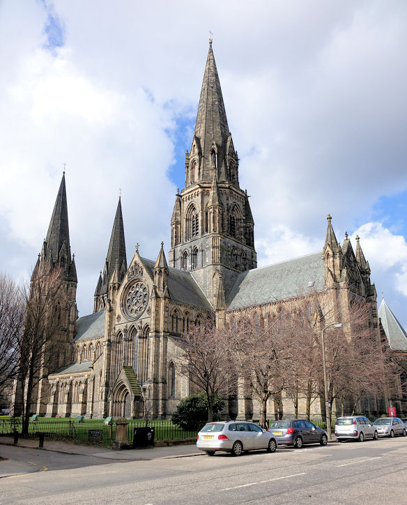
St. Mary's Episcopal Cathedral on Palmerston Place.
By G. G. Scott, building commenced in 1874, and wasn't completed until 1917. NT
2414 7351. © Steve Bulman (2015). Four more views -
1,
2,
3,
4, the main
door with fabulous ironwork,
four of the interior - 1,
2,
3,
4, the
altar,
organ, and
pelican lectern. NT 2414 7350.
All © Steve Bulman (2022).
Link.
Category A listed.
St. Thomas on Rutland Place, now a bar.
Pevsner dates it to 1842-3, as CoE. It must have closed as a church no later
than 1958, which is when Pevsner says a floor was inserted.
NT 2465 7364. © Steve Bulman (2022).
Link.
|
|