|
|
East Ayrshire
East Ayrshire on Wikipedia
Auchinleck.
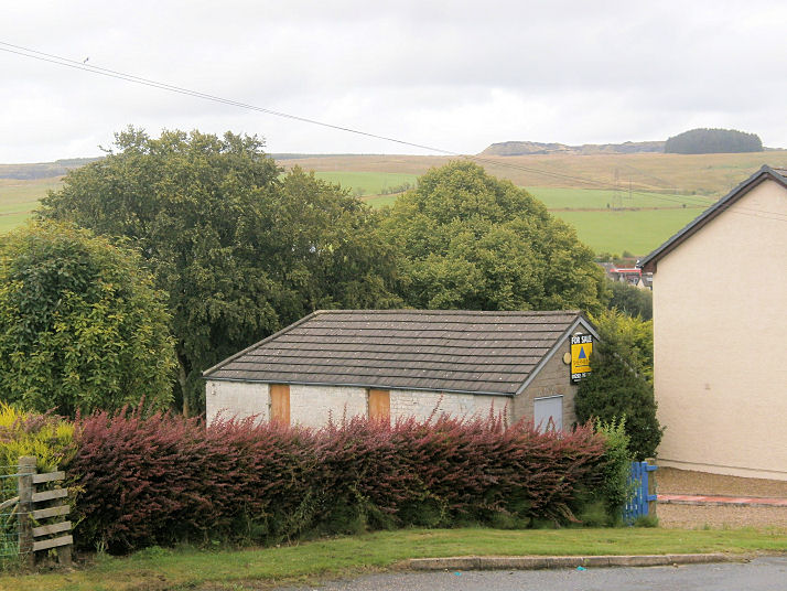
Bankglen, the site of Bank
Free Church, seen by Streetview in 2009. A tin tabernacle, a
photo of it can be seen
here, where it's dated to 1875. NS 5998 1250.
PoWiS. The same source also has a photo of its stone successor
(latterly CoS), built across the road in 1899. It was still showing as
active on a map of 1955, but has since been demolished -
site seen by
Streetview in 2024. NS 6002 1246.
PoWiS dates its demolition to 1961.
Bellsbank -
see Dalmellington (Lamloch and Bellsbank).
Birnieknowe, the
site of the demolished St. Patrick (R.C.), as seen by the Streetview van
in 2009. It stood among the trees, fairly close to the road. A photo of
it can be seen here. NS 5748
2233. Its
PoWiS entry dates it to 1864-7, with closure in 1964 and demolition in 1977.
Catrine.
Connel Park, the
site of the demolished New Cumnock Baptist Church. It first shows on a
map of 1909, and survived at least up to 1961.
PoWiS dates it to 1900, or soon after. It was
succeeded by Lanehead Terrace Baptist Church in New Cumnock, for which
see the New Cumnock page. NS 6053
1261.
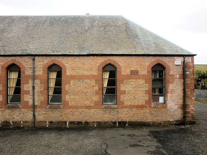
Crosshouse, the Parish Church (CoS, opened 1882) on Kilmarnock Road.
Another view. NS 3945 3840.
Both © Martin Richter (2013).
Link1.
Link2.
PoWiS. Gospel Hall
on Annandale Gardens. Another view. NS 3952 3829.
Both © Martin Richter (2013).
Link.
PoWiS.
Cumnock.
Dalmellington.
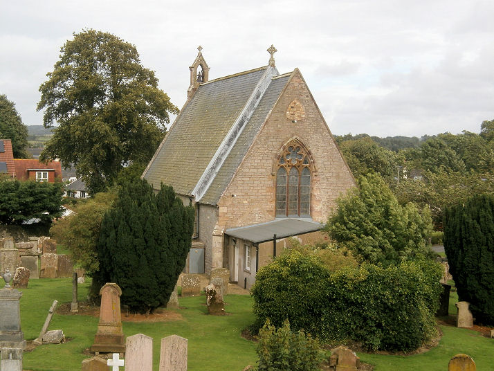
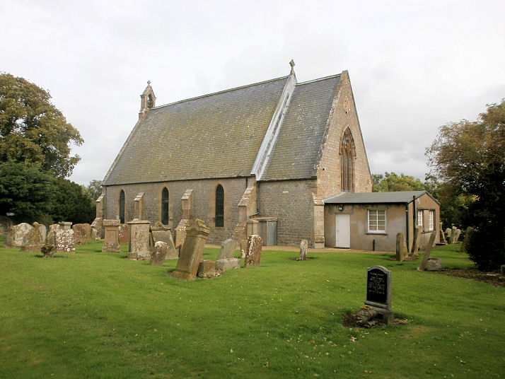
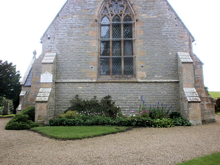
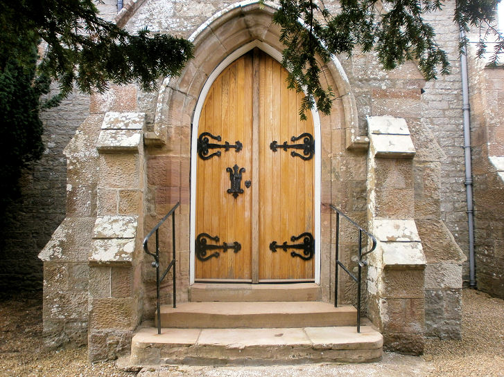
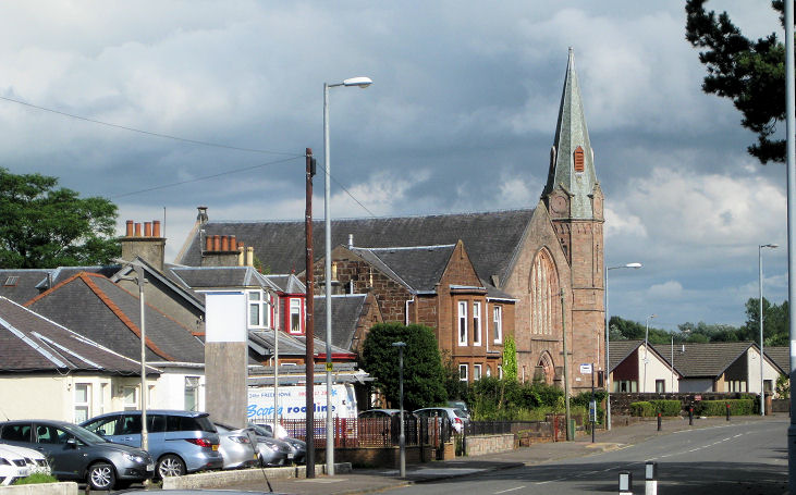
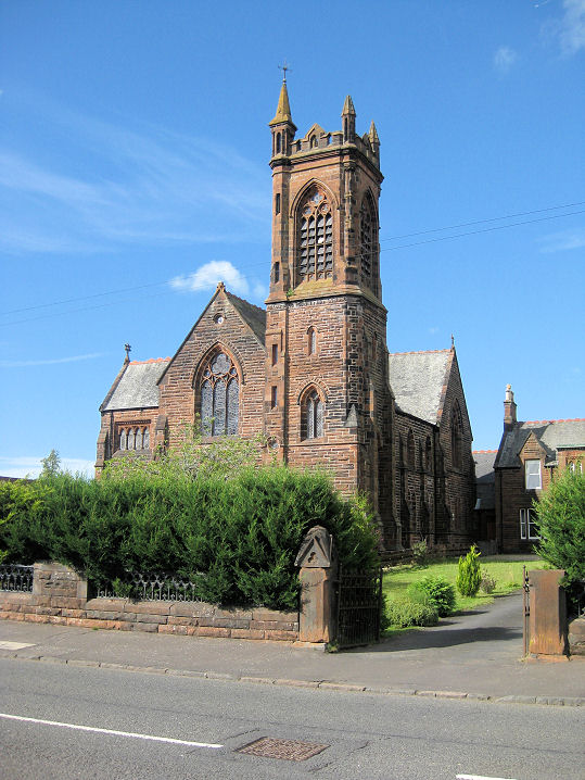
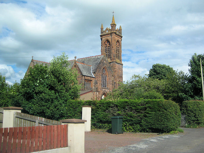
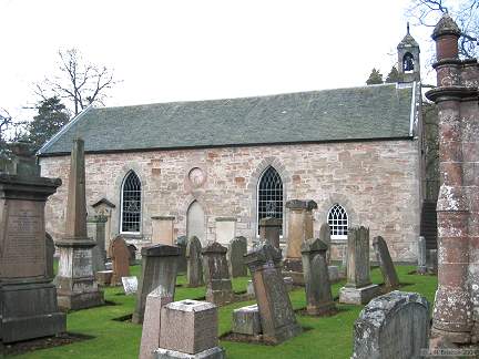
Dalrymple, the Parish Church
(CoS). Three further views - 1,
2,
3. NS 3618 1461. © Howard
Richter (2014).
Category B listed - dates it to 1849.
PoWiS discusses earlier churches. The
site of
Dalrymple Free
Church, which is now unoccupied. The White Horse pub, a few yards away
(seen at the right here)
was originally the manse. The church was built in 1864, enlarged in the
1890's, and seems to have closed between 1936 (for when the National
Archives of Scotland have minutes), and the later 1950's, as the O.S.
map for 1957-8 doesn't show it. The 1946 edition shows it as a U.F.
church, though it may have been closed by then. It had been preceded by
a wooden church, known as the "Spale Kirk", built in 1846, which shows
on the 1858 O.S. map on Garden Street as Free Church. It was presumably demolished
at some point subsequent to the building of the Free Church of 1864. It
stood at NS 3589 1459. The congregation didn't have a permanent
home before the wooden church. NS 3618 1461. Both © Howard
Richter (2014). PoWiS.
Darnconner, a vanished mining village, used
to have a Kirk, now demolished. Map evidence shows
that it was built by 1896, and it seems to have gone out of use in the
late 1950's. Howard Richter has kindly drawn my attention to a photo
here, which shows
the church behind and to the left of the manse, in 1966. The Streetview
van hasn't approached the site. NS 5763 2397.
PoWiS advises that there had been a predecessor Mission Church on
the same site (or nearby), a tin tabernacle, of 1874, the main church
following in 1897, closed in 1939, with demolition in 1979.
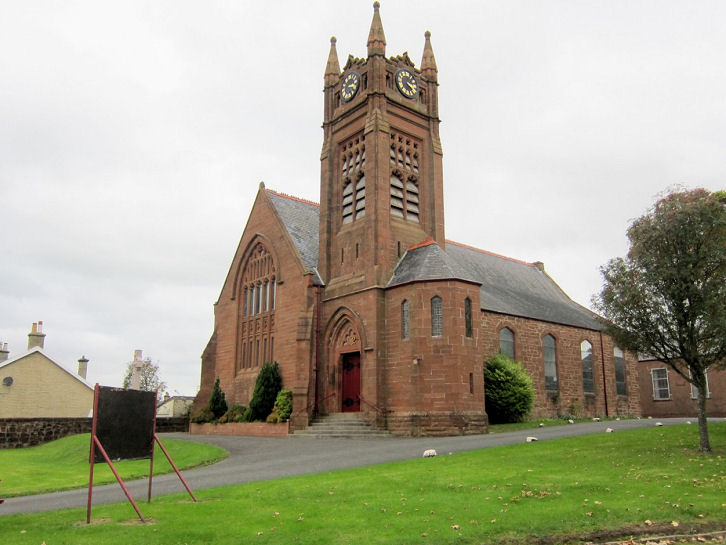
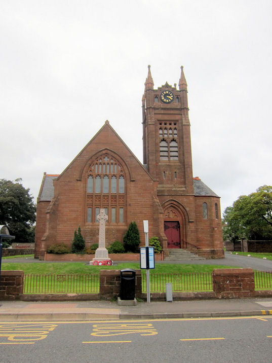
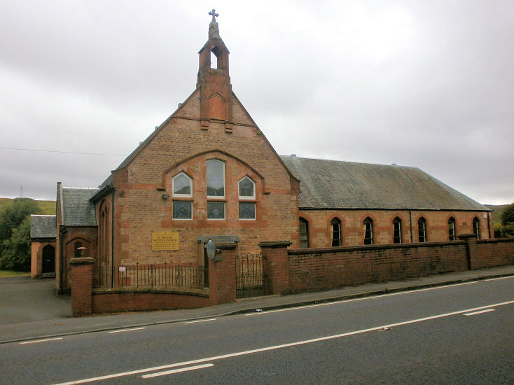
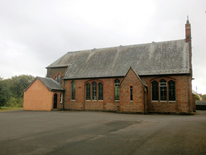
Darvel, the Parish Church (CoS, 1887-8) on Hastings Square, originally known as
Central Church. NS 5632 3745. © Martin Richter (2013).
Link.
PoWiS.
Category B listed. The former
Free
Church, later known as Easton Memorial Church, closed in 1992 following union with the then Central Church. NS 5621 3748.
© Martin Richter (2013).
PoWiS. The former
Evangelical Union Church on West Main Street. According to the website for the parish church, this
church closed in 1965. NS 5621 3748. © Martin Richter (2013).
PoWiS. The
former Original Secession Church
(1883) on West Donnington Street. Marked as "O.S. Church" on the 1896
map, "O.S. Ch." on the 1910, it shows as "Hall" on the 1964, 1970 and
1991 editions.
PoWiS says it was also Our Lady of the Valley (R.C.), closing in
2013. NS 5634 3760. © Howard Richter (2014). The former
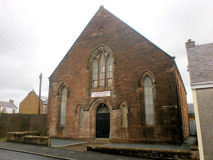
United Presbyterian Church
(1884) on Ranoldcoup Road. Old maps show what may be a church and
school on the same site (though not the same building) in 1858, as it
say "Free Church" and "School" on separate lines. It isn't clear whether
this is a Free Church School, or a Free Church and a school. The
1896 marks the present building as "U.P. Church" in 1896, and the 1910
as "U.F.Ch.", but the maps of 1964, 1970 and 1991 mark it as "Hall". As
the sign shows, it's currently being used by the local Scouts.
Another view. NS 5636 3743.
Both © Howard Richter (2014).
PoWiS. Flame
Church on Cross Street, as seen by Streetview in 2024.
Link.
PoWiS says the existing cottages were bought and converted in 2000.
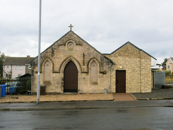
Drongan, Schaw Kirk
on Lane Crescent, as seen by the Streetview van in 2009. NS 4409 1844.
Facebook.
PoWiS - dates it to 1954-6. St. Clare
(R.C.), on Watson Terrace, also as seen in 2009. NS 4404 1855. A
2025 news article dates it to 1958, and tells of its intended demolition.
PoWiS.
PoWiS also lists a former
Brethren Church
(2023 Streetview) on Littlemill Road - and dates it to 1958-2014. It
also says that the congregation is older, but its meeting place is not
known.
Dunlop, the Kirk on
Main Street, as seen by Streetview in 2010. Various sources differ as to
the age of the current church, and how long there has been a church on
the present site - the
church website,
the church
entry on Wikipedia, and the
Clan Dunlop
website.
PoWiS
calls it Laigh Kirk. Its
category B listing dates it to 1835, with predecessors on the same site
from 1766 and 1641. In the churchyard are a tomb and a schoolhouse,
both listed as category A -
tomb,
schoolhouse. NS 4047 4941. The former Free Church
on Main Street was originally U.F.C., and now serves as the Parish
Church Hall. It can be seen
here on a 2010
Streetview. An old photo is available
here. NS 4088 4948.
PoWiS. Its
grade C listing dates it to "soon after .... 1843". O.S. maps,
mark, to the north of the village at NS 4079 5033,
St. Mary's Chapel (Site of). Its
site, to the
left of the road, was seen by Streetview in 2024.
PoWiS.
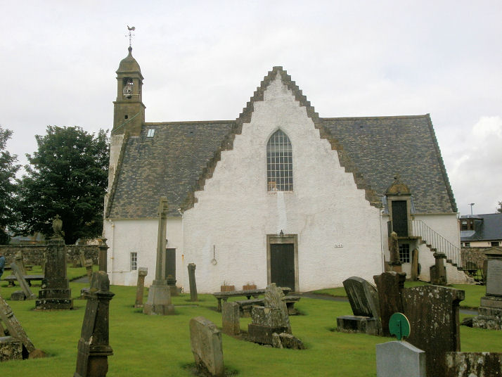
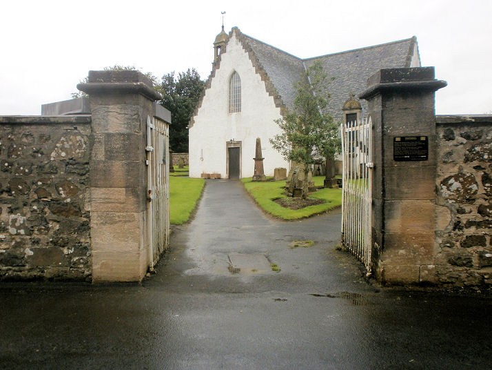
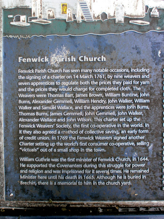
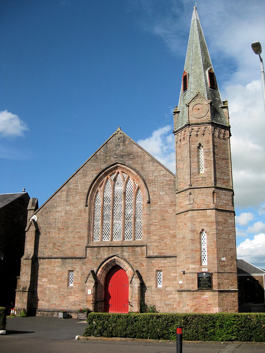
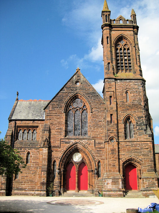
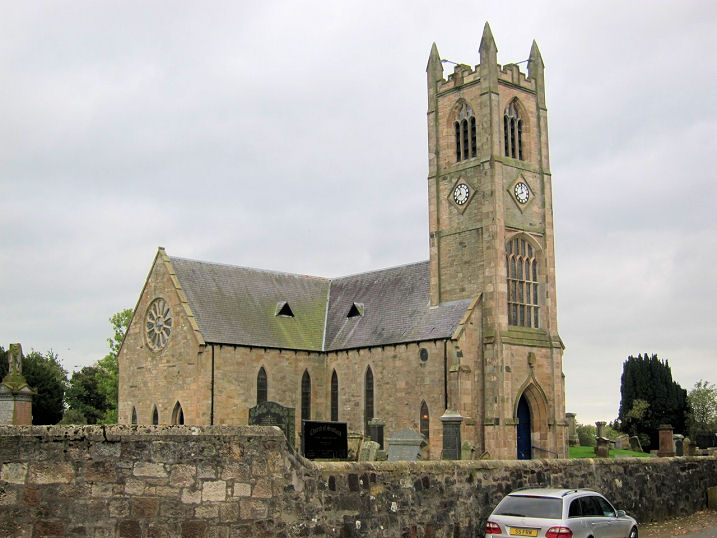
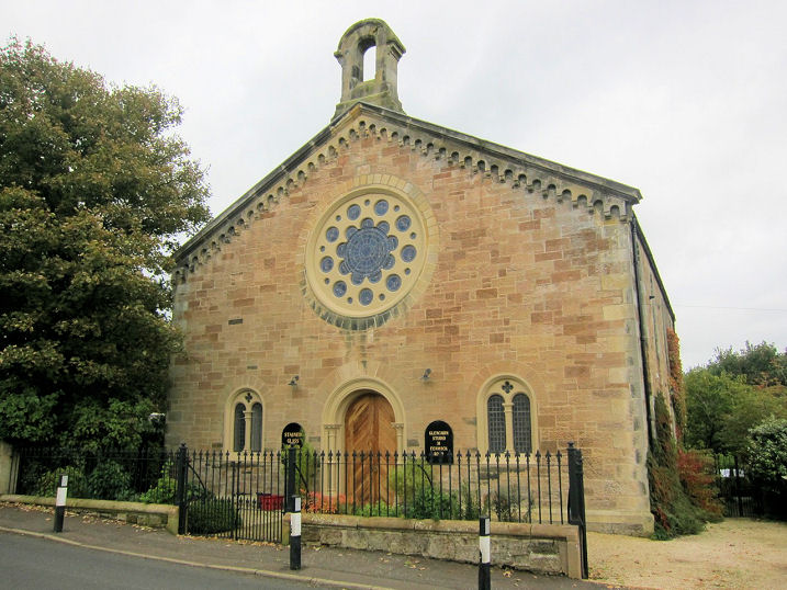
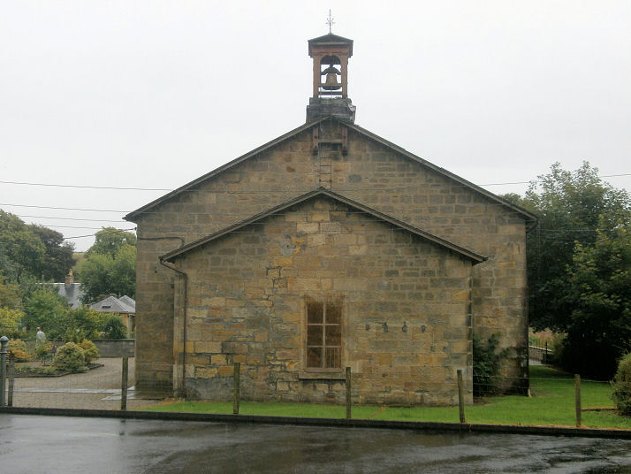
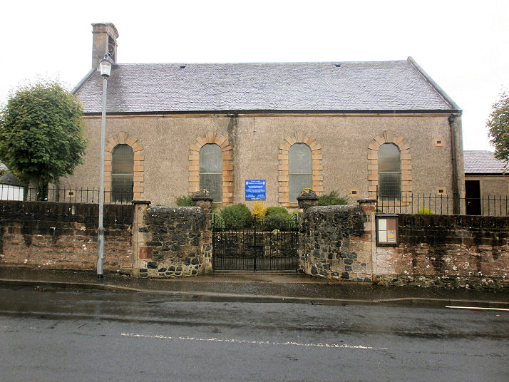
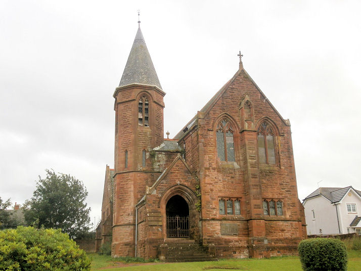
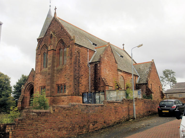
Fenwick, the Parish Kirk.
Originally dating from 1643, the church was largely destroyed in a fire
in 1929, caused by the church boiler emitting sparks. Three additional
views - 1,
2,
3, and an unusual feature - the
sentry box, to discourage the "resurrection men"!
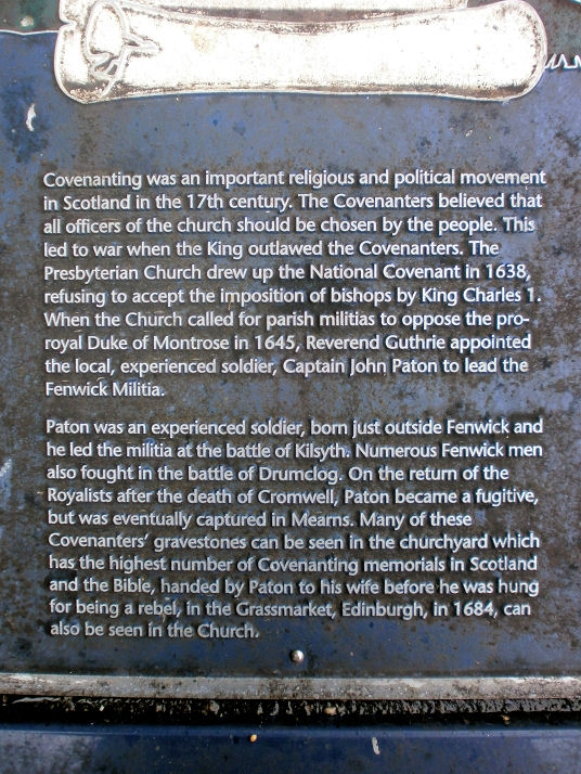
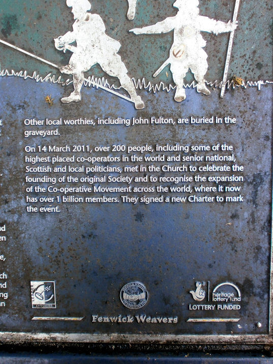
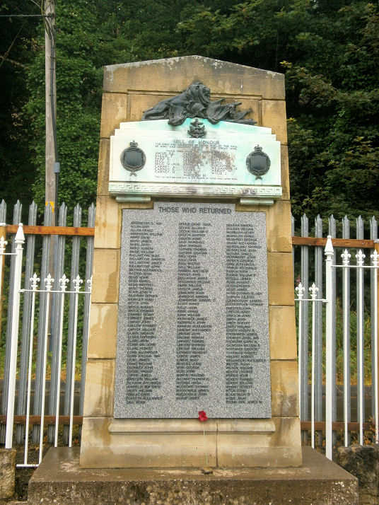
Plaques in the churchyard explain the church's
connections with the Covenanters, and weavers -
1,
2,
3. NS 4648 4348. All © Howard Richter
(2014). Link1,
see also the history page
here.
Link2. The
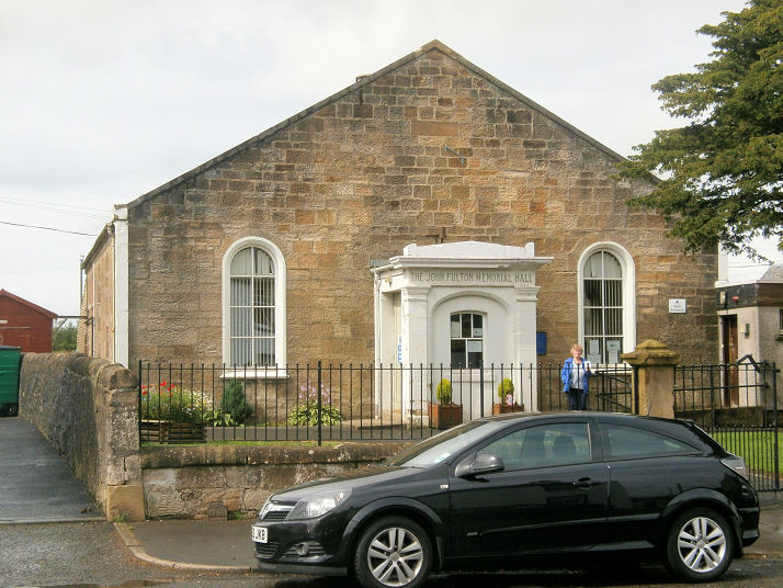
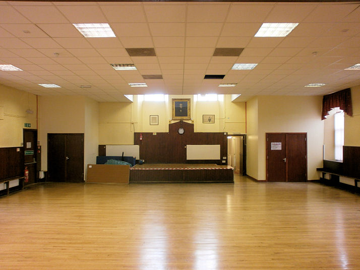
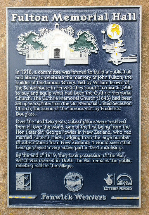
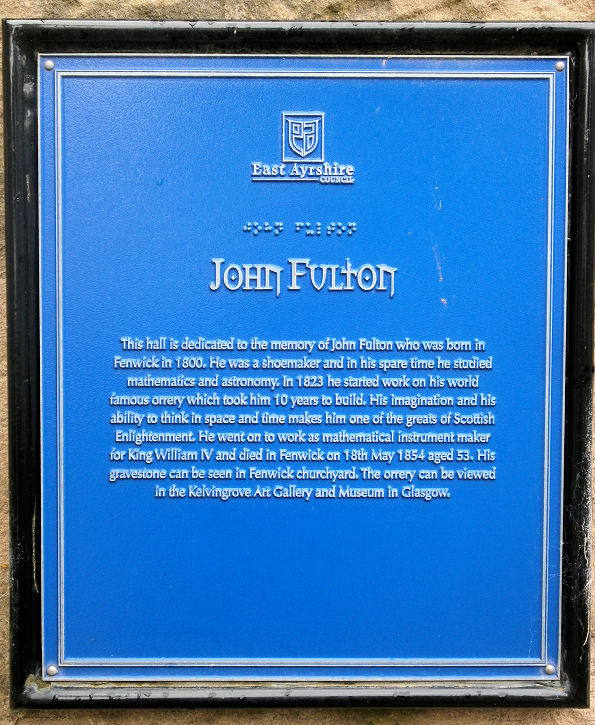
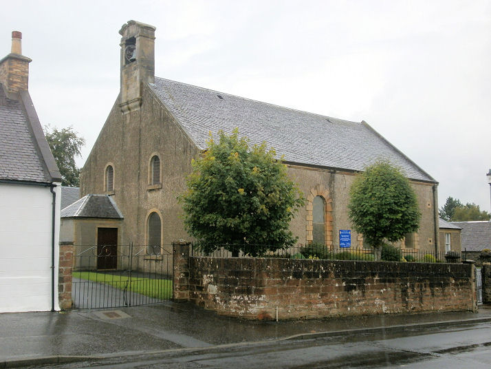
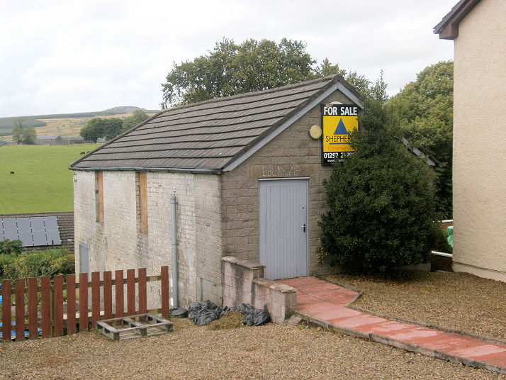
former United Free Church
(1843), now in use as the village hall. The 1896 map shows it as "Free
Church", the 1910 as "U.F. Church" and the 1965 as "John Fulton Memorial
Hall". Following the closure of the church (date so far not known), it
re-opened as the Memorial Hall in 1920.
Interior view. Two plaques
provide a little history - 1,
2. For the orrery
mentioned on them, see
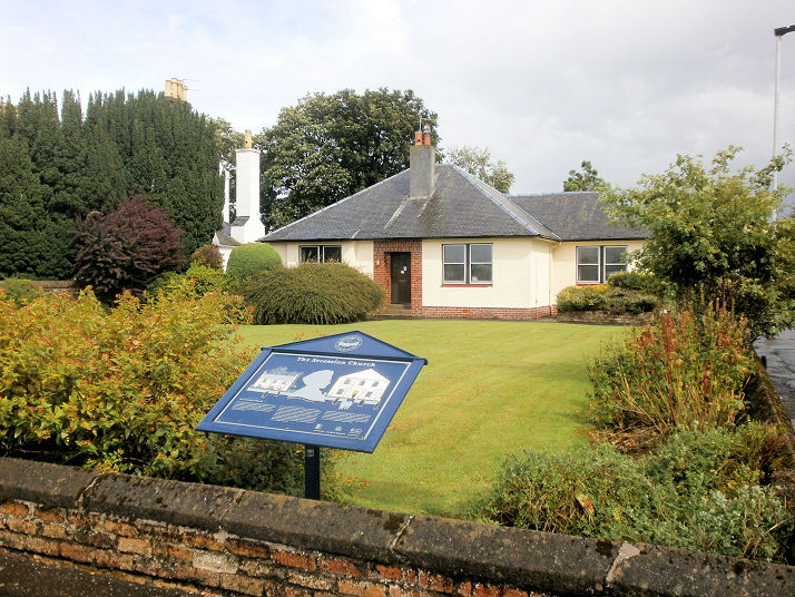
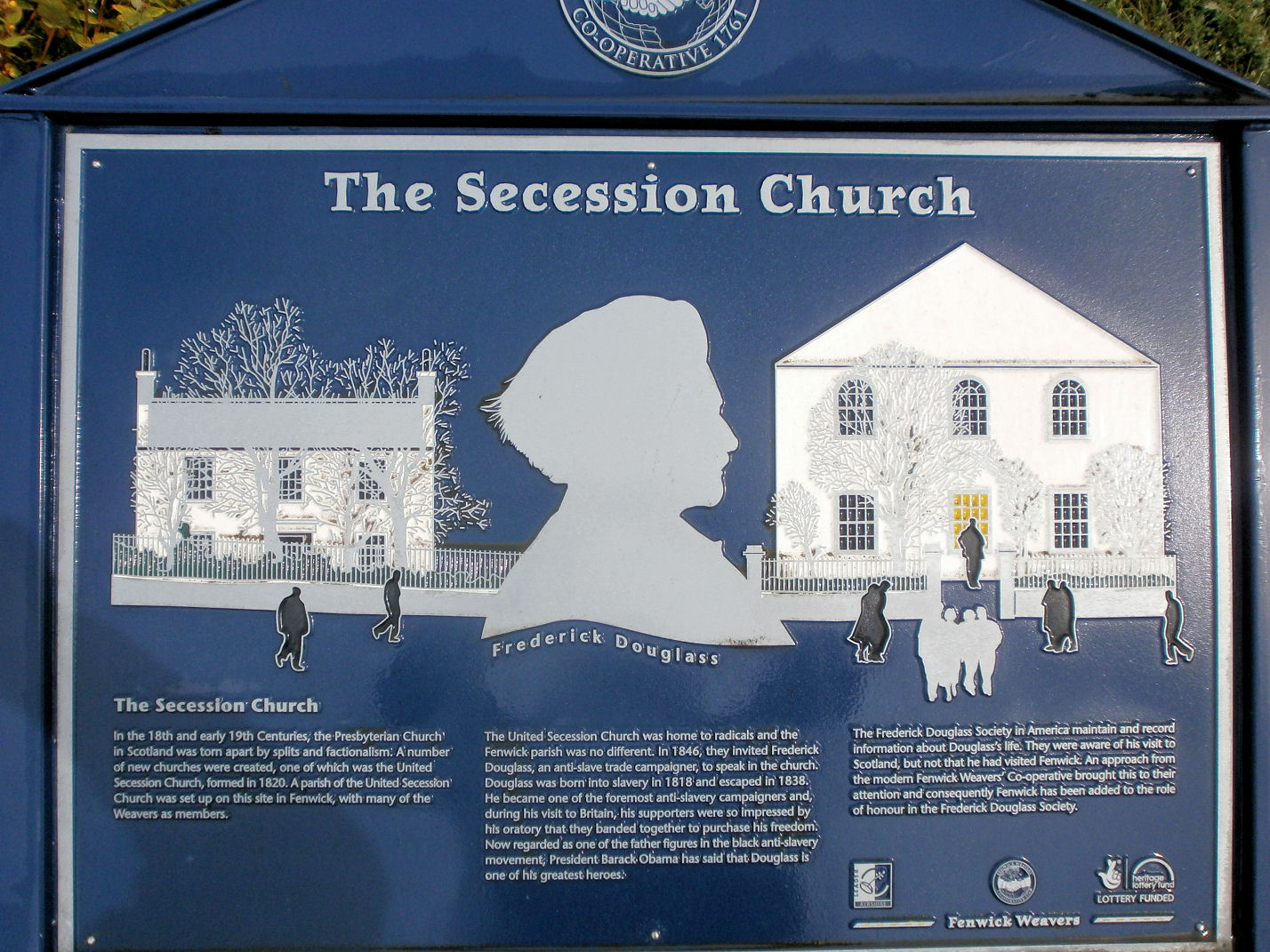
here. NS 4633 4363. All © Howard Richter (2014). The site of the United
Secession Church. A
plaque gives a little
history, and what may be presumed to be an illustration of the church.
The church was built between 1820 and 1846 (evidence from the plaque),
and maps tell us that it was United Presbyterian "U. P. Church" in 1896,
United Free "U.F. Church" in 1897, and that it had been demolished and
replaced by a police station by 1958. Maps also show that the church was
closer to the road than the present-day bungalow. NS 4631 4337. Both © Howard Richter
(2014).
Galston.
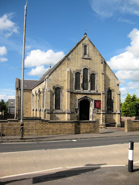
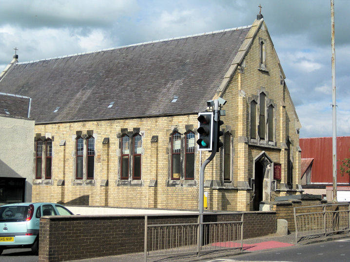
Hurlford, Church of Scotland, built as a Free Church in 1857.
Another view. NS 4541 3708.
Both © Martin Richter (2013). Link1.
Link2.
Category C listed, which says that the organ is
a particularly fine instrument. See here for related listed features. The former Hurlford Kirk (1875) on Main Road. The congregation merged with
that of the Free Church in 1996, whereupon this church closed. Two additional views - 1,
2. All © Martin Richter
(2013).Category B listed. NS 4525 3718. St. Paul (R.C.) on Galston Road.
Another view. A school in 1896 and 1910 (from old maps), this
link says the building dates from the 1850's, but this one
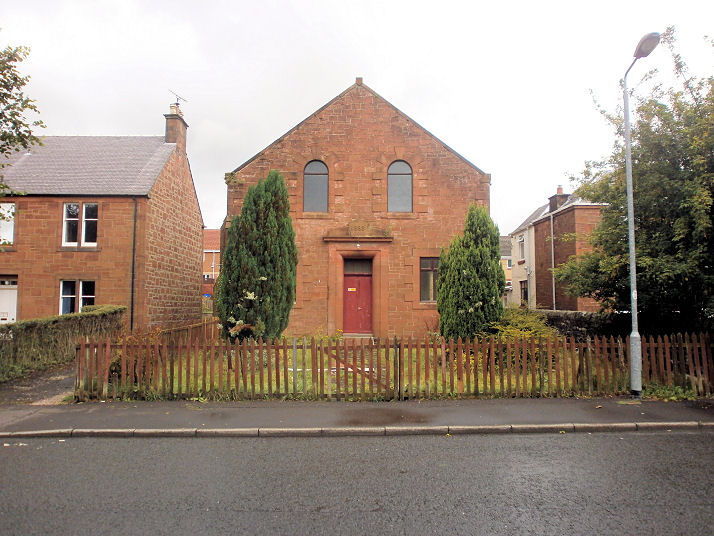
says 1883. NS 4580 3695. Both © Martin Richter (2013). The former United Presbyterian Church (1897-8) on Mauchline Road,
now converted to residential use. From map evidence, it was built after 1896, and before 1910,when it shows as United Free. This
source quotes Hansard (1948), from which
the church "has been
derelict for 16 years". It also says that it was in use as a hostel during WWII. What other use was made of it between 1932 and 2007 is at present
unclear. NS 4554 3665. © Martin Richter (2013).
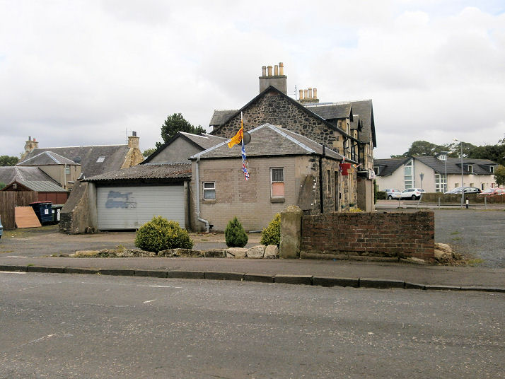
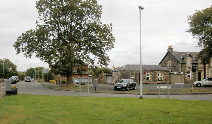
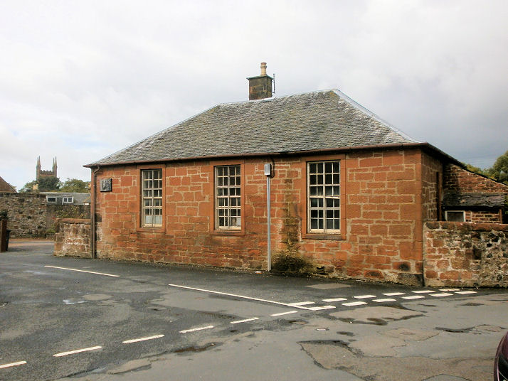
Kames, the
site of the demolished Church of Scotland, as seen by Streetview in 2009
(later housing has since blocked this view). Its
PoWiS entry dates it to 1901-4, closing in 1952, and demolished in
1957. A photo can be seen
here, where it says that some of its stained glass windows were
transferred to Muirkirk parish church.
Kilmarnock.
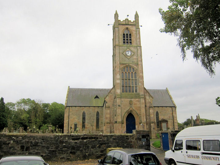
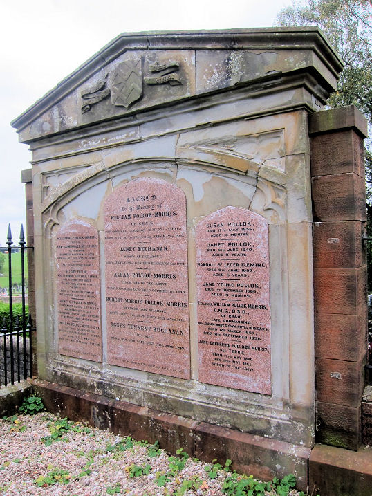
Kilmaurs, St. Maurs Glencairn Parish Church (CoS). Another view. This huge
memorial is very typical of Scottish churchyards. NS 4146 4077.
All © Martin Richter (2013). Link1.
Link2.
PoWiS dates it to 1887-9, on the site of an earlier church or
churches. A brief
category B listing.
Maxwell and Kilmarnock United Free Church (1844 - date-stone)
on Crosshouse Road.
Another view. NS 4092 4108. Both © Martin Richter (2013). Link.
PoWiS. There is an interesting history of the United Free Church
here. The closed Glencairn United Presbyterian Church on
Fenwick Road, now in use as a stained glass studio. At least the second church on this site, it was built in 1864 to replace an earlier (and smaller)
church, which shows on the 1857 OS map. NS 4126 4124. © Martin Richter (2013).
PoWiS.
Category C
listed. Google maps show a Plymouth Brethren
Christian Church on Kilmarnock Road. The indicated building was
seen by Streetview
in 2024 - unfortunately I can't read any of the signage to confirm that
this is the correct building. NS 4127 4092. PoWiS, which doesn't have an
entry for the present Plymouth Brethren hall, does have an entry for
what may be assumed to be a predecessor, on Fenwick Road, calling it a
Brethren Church. It dates it to 1933-1968 (at least). Demolished, a
house has been built on its
site (2024
Streetview). NS 4116 4123. The same entry also mentions an earlier
meeting, in Stewart's Hall, but I haven't been able to locate
this. O.S. maps show Site of Monastic Church of
St. Maur a little way S.W. of the parish church, off Kirkton Road
at NS 4142 4071. Its site is somewhere beyond the fence line, as seen in
a Streetview
from 2009.
PoWiS.
Knockentiber, the
site of the demolished Mission Hall on
South Hook Road, as seen by Streetview in 2015. Its frontage was roughly
in line with the fence. Map evidence shows it was built before 1896, and
it seems to have gone out of use in the 1960's. NS 3967 3914.
PoWiS calls it the Brethren Plann Hall. A little way to the
south, O.S. maps mark Supposed Site of Chapel,
at NS 3968 3903, quite close to the site of Busbie Castle. If the maps
are accurate, it would have stood behind the house seen in a
Streetview from
2024.
PoWiS.
Lethanhill was a
now-vanished mining village.
Aerial views show that almost the entirety of the village has gone, and
a forest planted on its site.
It had a Mission Hall. Old maps imply it
was built between 1897 and 1909, and it was demolished by 1961. A war
memorial has been left in situ. Although not seen by Streetview, its
Canmore
entry includes photos
here. NS 4349 1037.
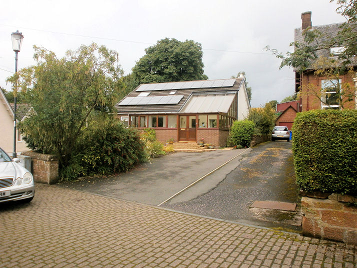
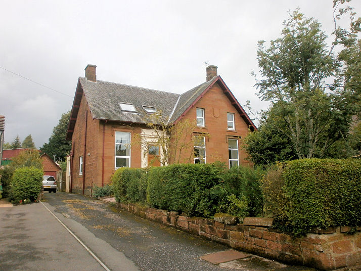
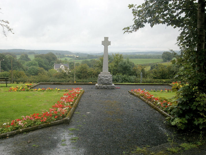
Lugar, the former Parish Church,
now converted to residential use.
This
source says it was originally an industrial building of 1845,
converted into a church in 1867.
Another view, and the handsome
war memorial. NS 5909 2134. All
© Howard Richter (2014).
Lugton, the site of
a demolished Mission Hall (where the house
now stands), as seen by Streetview in 2009. It pre-dates a map of
1896-7, and later maps label it as Lugton Hall, suggesting it
went out of use by 1967. NS 4134 5286.
PoWiS says that the church was originally at a slightly different
location (NS 4130 5280) and moved prior to 1895.
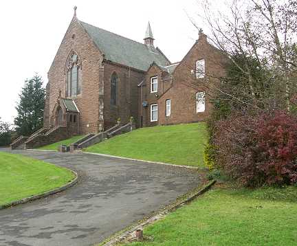
Mauchline, the Parish Church (CoS).
Opened in 1829, it replaced an older church demolished in 1827. NS 4980
2722. © James Murray (2009).
PoWiS.
Category B listed. The former Mission Hall.
The church board is beside the downspout at the left of the building -
"Mission Hall" can still just be made out. Two further views -
1,
2. NS 4998 2726. All ©
Howard Richter (2014).
PoWiS says it belonged to the Ayrshire Christian Union to about 1955
from when it was shared with a Christian Brethren congregation, but it
was closed soon after. A United Presbyterian
Church stood on The Knowe, at NS 4972 2736. The
site is now occupied by a
bungalow (the building on the left of the photo). O.S. maps show it as
U.P. Church in 1896, Mauchline North Church in 1959 and
1972. Another view. In the
old photo of the church, linked to at the end of this entry, the house
immediately to the right of the church is still standing, see
here.
PoWiS dates it to 1884, on the site of a predecessor. All © Howard Richter
(2014). A photo of the church is available
here.
A Free Church once stood behind some shops
on Loudoun Street, at NS 4979 2714. Access to it was through the
alley seen by
Streetview in 2009.
PoWiS calls it Abbey United Free Church, dating it to 1884-5,
on the site of a predecessor of 1844. Another
source dates its demolition to 1969, and includes exterior and
interior photos. PoWiS
also has an
entry for a Christian Brethren
congregation meeting in the Lesser Temperance Hall on Kilmarnock Road.
An old photo of it can be seen
here (number 8) - behind the man driving the cattle. The hall has
gone - the site
was seen by Streetview in 2024. NS 4985 2732.
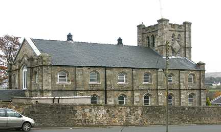
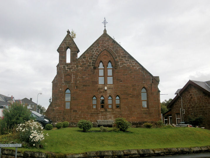
Muirkirk, the parish church on Kirk Green. NS 7004 2775. ©
Martin Briscoe. Link.
Category B listed.
PoWiS dates it to 1812-14, possibly on the same site as its
predecessor of 1633. Unknown Church
on Wellwood Street, now identified
as St. Thomas (R.C.) by Janet Smith, to whom many thanks.
NS 6995 2778. © Martin Briscoe.
Link dates it to 1906.
PoWiS. The former St. Thomas (R.C.)
on Kirk Green at NS 7004 2769 now serves as the church hall. © Howard Richter (2014).
PoWiS. The former
Free Church on Glasgow Road. NS 6961 2745.
© Howard Richter (2014). A
Streetview shows
that it had been demolished by March 2021.
PoWiS.
Evangelical Union Church. NS 6963 2751. © Howard Richter (2014). A
U.P. Church once stood on Main Street at NS
6960 2723. The site,
now a car park, was seen by Streetview in 2010.
PoWiS - dates it originally to 1823, as a United Secession Church,
and demolished in 1972. Coflein also has an
entry for a Salvation Army Church,
meeting in the Temperance Hall on Main Street. Demolished, its
site was seen by
Streetview in 2024. NS 6985 2751. A former
Plymouth Brethren Hall is also mentioned by
PoWiS, on Glasgow Road at NS 6963 2735. Dated to no later than 1895,
closing in 1978, and subsequently converted to residential use.
2024 Streetview.
New Cumnock.
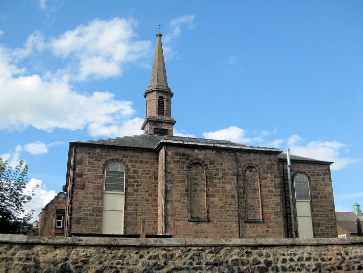
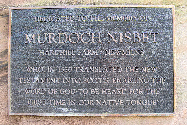
Newmilns, Loudoun Church (CoS) on
Main Street. An 1844 church on an older site. Another view,
and the commemorative tablet to Murdoch Nisbet, of whom more on Wikipedia
here. NS 5376 3733. All ©
Martin Richter (2013).
Facebook.
PoWiS.
Category B listed.
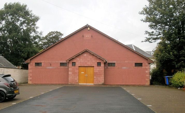
Townhead Church (Brethren, 1994) on Main
Street. NS 5391 3740. © Howard Richter (2014).
Link.
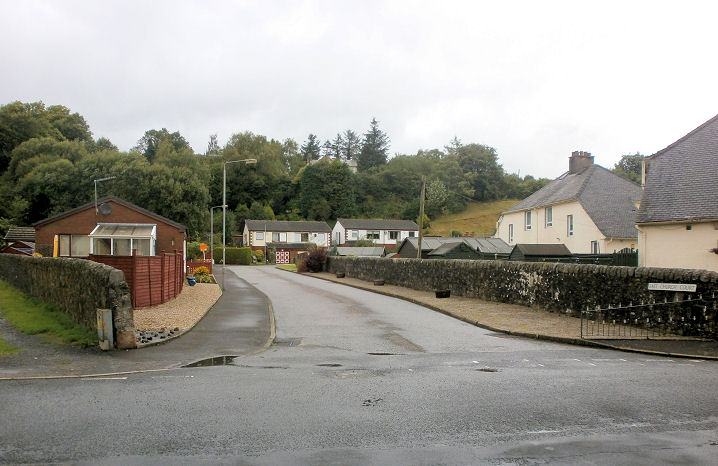
PoWiS. The site
of the demolished East Church, replaced by housing and now called East Church
Court. The church was built in 1846 (PoWiS), and is marked on the 1858 and
1896 maps as "Free Church", in 1910 as "U.F. Church", and in 1964 as "Loudoun
East Church". It was demolished in 1986, subsequent to the joining of the
congregations of Loudoun Church and East Church. NS 5392 3747. © Howard Richter
(2014). A demolished United Presbyterian Church off
High Street (then Doitburn Street) pre-dates a map of 1858, and was demolished
in the years preceding the compilation of a map of 1964. The site can be seen on
a Streetview of 2011. NS
5359 3742.
PoWiS. PoWiS has an
entry for a Brethren Church on Drygate Street.
It isn't shown on any available maps, but a general view of the street can be
seen on a Streetview
from 2022.
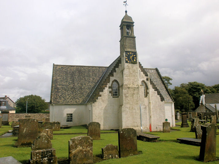
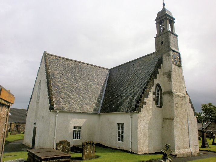
Ochiltree, the Parish Church on
Main Street. 1798, re-built in
1897-8.
Another view. NS 5055 2110.
Both © Howard Richter (2014).
Category B listed.
PoWiS. Based on map evidence, a Free
Church stood at NS 5065 2105 before 1858, and was still extant in
1959 (although probably out of use by then). The
site is now a small park.
Two further views - 1,
2. All © Howard Richter
(2014).
PoWiS dates it
to "shortly after 1843". The old cemetery to the east of the village is
the site of the predecessor of the present parish church, and dedicated
to St. Conal -
PoWiS. 2009
Streetview. NS 5404 2130.
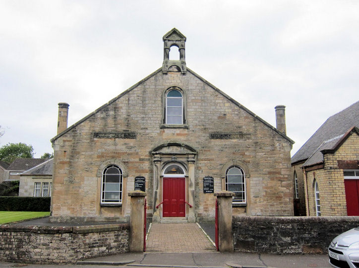
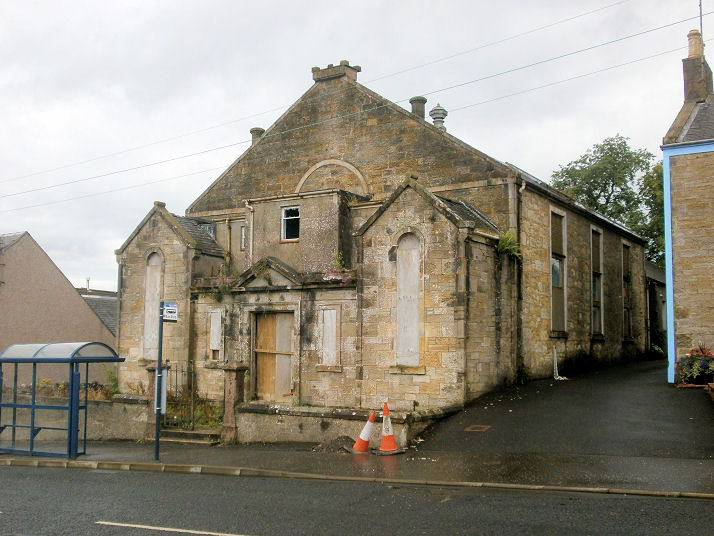
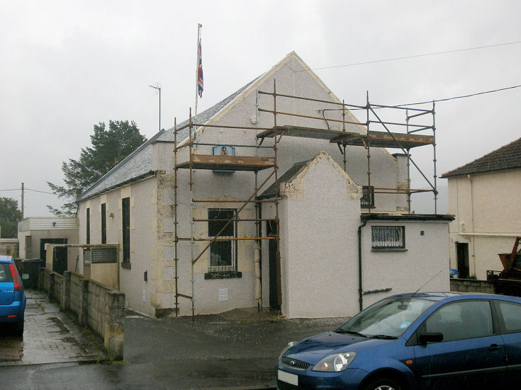
Pathhead, the former Gospel
Hall. NS 6194 1437.
© Howard Richter
(2014).
PoWiS.
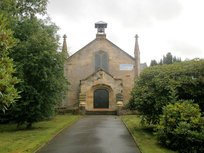
Patna, Waterside Church of
Scotland (1837) on
Main Street. Two further views - 1,
2. The adjacent
church hall dates from 1898. NS
4122 1064. All © Howard Richter (2014). As of 2025 Google Streetmaps is
labelling the church as permanently closed.
PoWiS.
The former Free Church, on
Main Street. Map evidence suggests it was built after 1896, and before
1909, when it shows as U.F. Church (PoWiS
says 1901-3). It continued showing on O.S. maps at
least up to the 1985 edition (United Free Church). Evidently now
closed, this photo
on an external website, is from 2006, and the church appears to be being
looked after, so was possibly still active at that date.
Another view. NS 4150 1055.
Both © Howard Richter (2014). It had been preceded by an earlier church at circa NS 4143 1056, which
shows on the 1857 map, and it continued in use as the church hall, at
least until 1962, when it is shown as such on the O.S. map of that year.
PoWiS dates it to 1838 (as United Secession), and demolished
after 2002. The first
Streetview
(2009) shows that it been demolished by then. The former Ebenezer Gospel Hall
on Main Street, which was for sale in 2014.
PoWiS dates the church to 1990 (when they bought the building,
closing it in 2011. Another view. NS 4129 1068.
Both © Howard Richter
(2014).
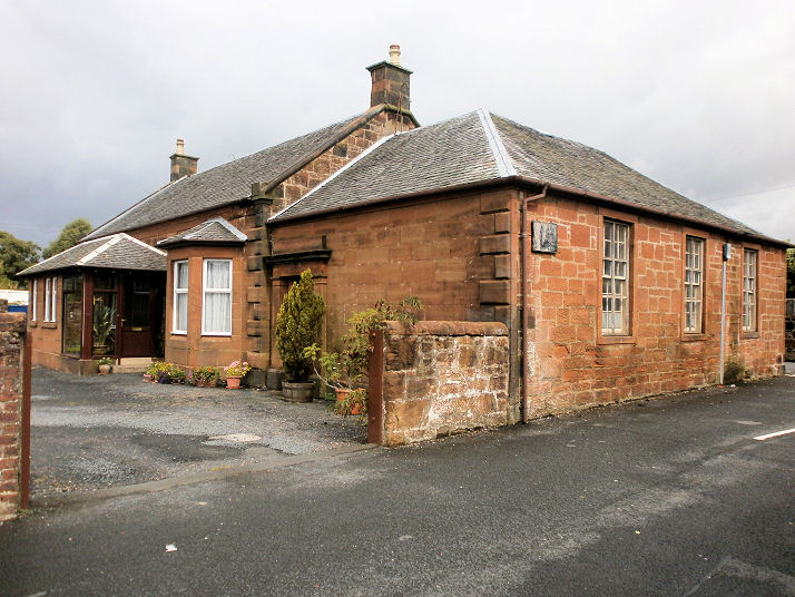
Rankinston has had three churches at one
time or another. The village has recently been visited by the
Streetview van, so all of the Streetviews which follow date from 2023.
The former
Shaw Kirk
(CoS)
on Littlemill Place at NS 4508 1453.
Another view.
PoWiS.
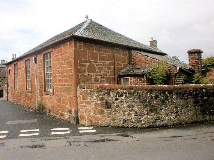
The demolished
Rankinston Mission Hall
used to
stand across the road from Shaw Kirk - its site now marked by the patch
of grass. NS 4511 1453.
PoWiS.
Both of the preceding churches appear on a map of 1961,
revised in 1959. The
site of the demolished Baptist Mission Hall
on Kerse Terrace at
NS 4513 1375. It pre-dates a map of 1911.
PoWiS.
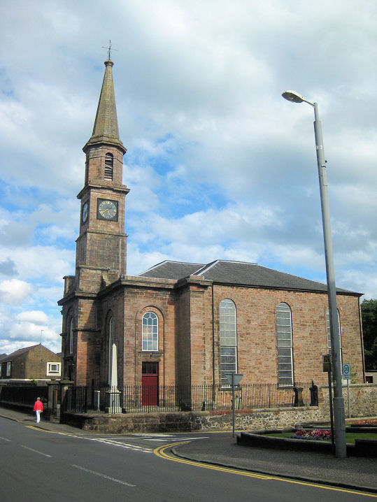
Sorn, the parish
church. NS 5502 2675. © Martin Briscoe.
Facebook.
Category B listed - dates it to 1658, with substantial later works
in 1826.
PoWiS.
Stair, a photo of the Parish Church of 1864 can
be seen on
Wikipedia. Its
history page
(no longer available) says it stands on the site of a predecessor of 1706. NS 4395 2360.
Category C
listed.
PoWiS. PoWiS also has an
entry for Stair United Free Church (a
tin tabernacle), built prior to 1868, closing shortly after 1900. I
haven't been able to locate it with available on-line maps.
Stewarton.
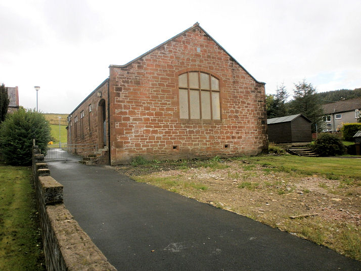
Trabboch, the derelict former Free Church
(1843-4), as
seen by the Streetview van in 2009. A map of 1860 labels it as Shaw Church or
Stair Free Church. It has a Buildings At Risk
entry, which
advises that it had been offered for sale since at least 2014. Its Canmore
entry includes an old
photo. NS 4466 2051. Video
tour.
Category C listed.
PoWiS dates its closure to 1956.
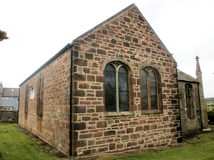
Waterside, the former Parish
Church (CoS) now converted to residential use. NS 4362 0881.
© Howard Richter (2014).
Category C listed.
PoWiS, wherein it's dated to 1894-5, closing soon after 1980.
St. Francis Xavier (R.C.).
Two additional views - 1,
2. A convent (demolished)
stood on what is now the car
park. NS 4452 0807. All © Howard Richter (2014). It's dated by
PoWiS to 1895, the convent added in 1905.
Link.
|
|