The Churches of Britain and Ireland
| Bridgend
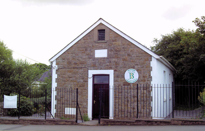
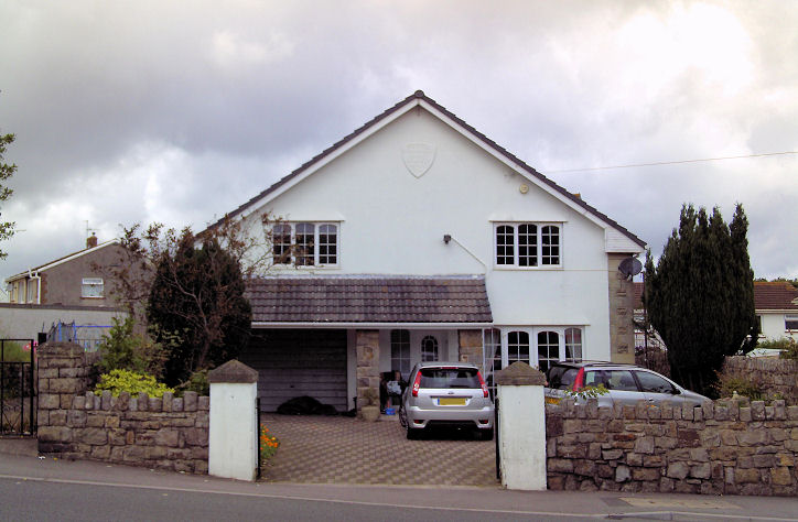
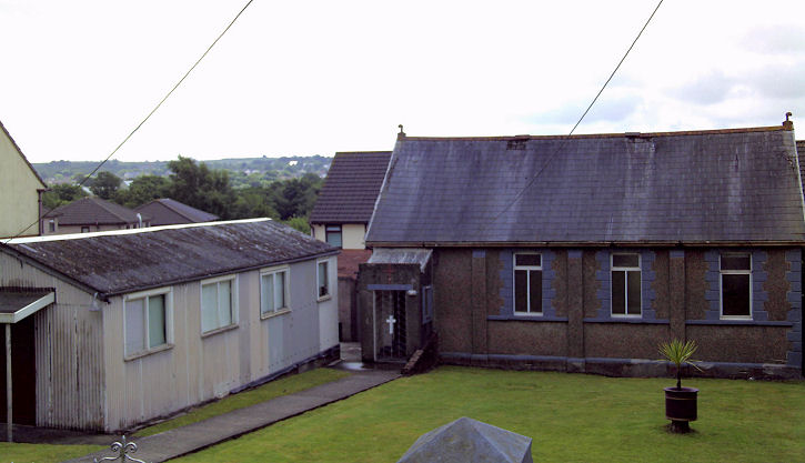
Aberkenfig.
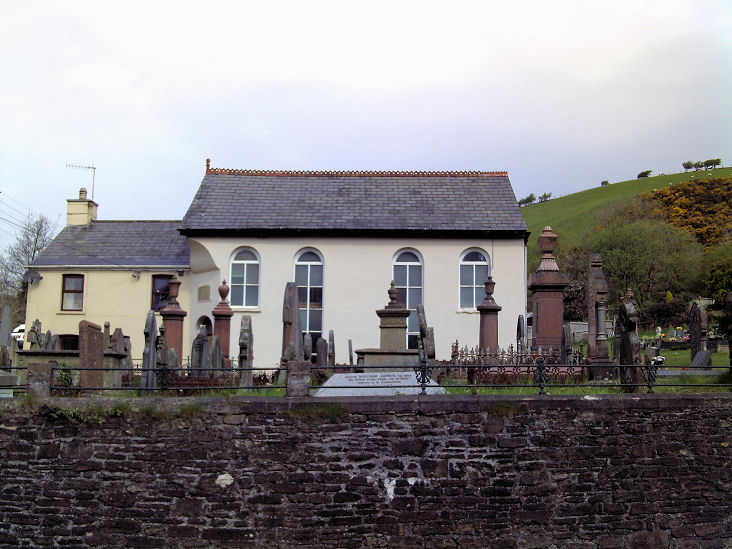
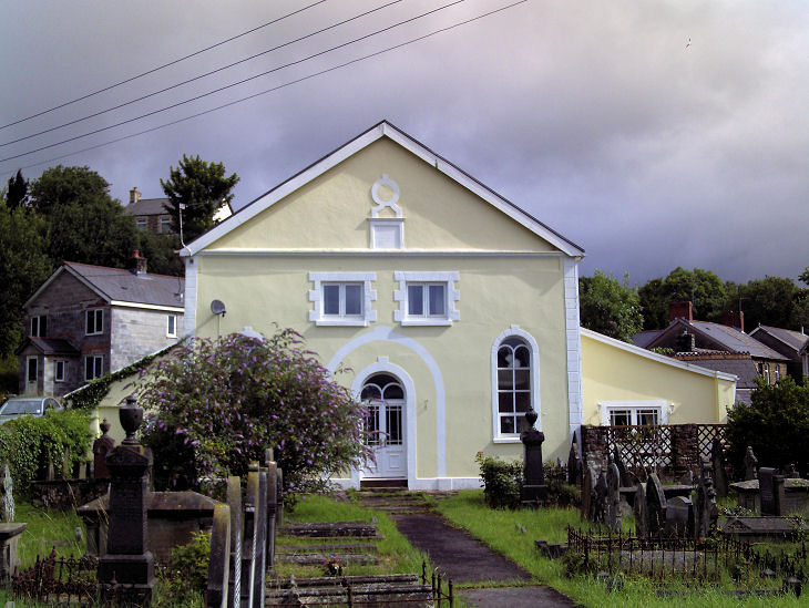
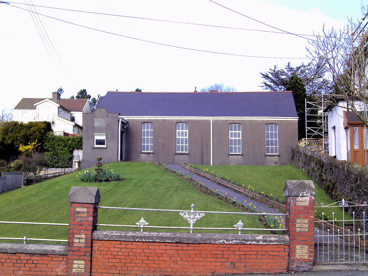
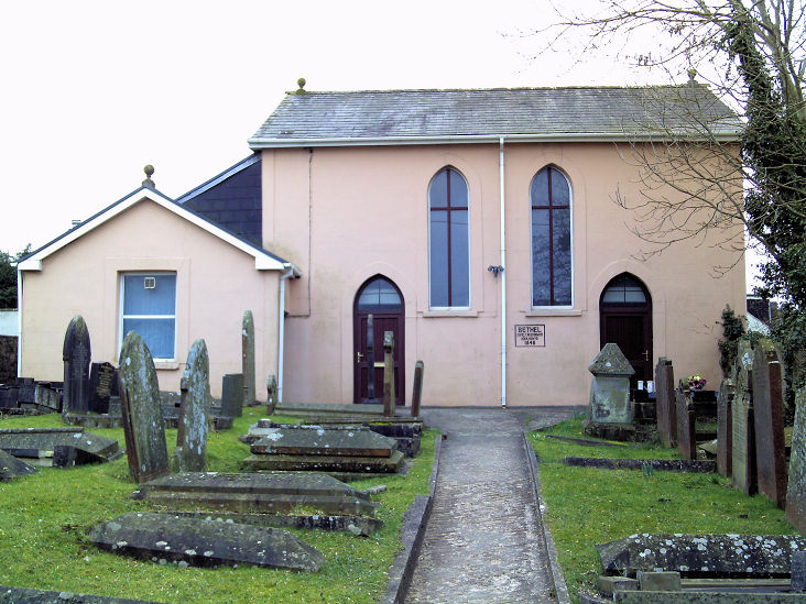
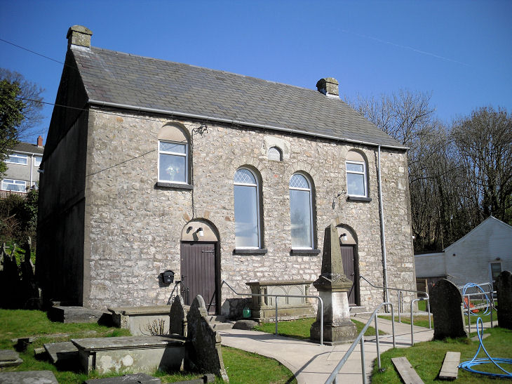
Blackmill, Paran
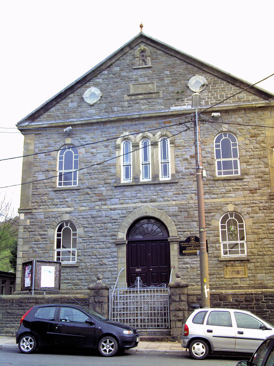
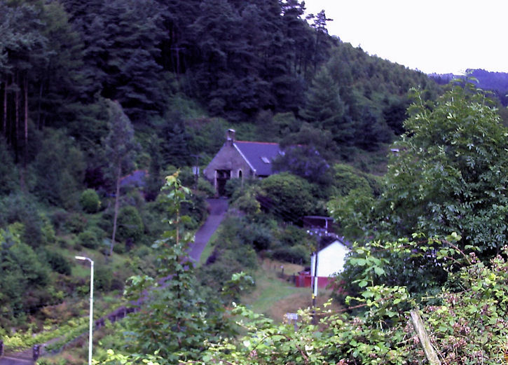
Welsh Baptist Church. SS 9342 8680. © Gervase N. E. Charmley.
Link.
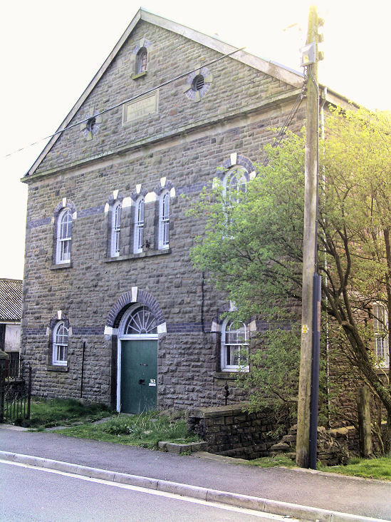
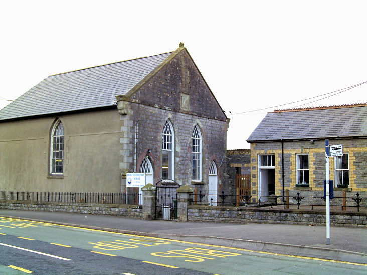
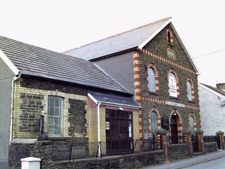
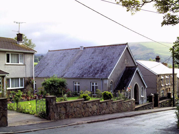
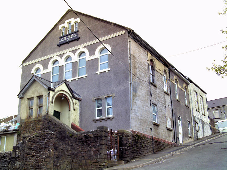
The former Wesleyan
Methodist Chapel on Graig Terrace, dating from 1885. SS 9360 8689. © Gervase N. E. Charmley.
Coflein mentions a
Mission Church, also on Graig Terrace, at
SS 9379 8697, dating it to 1914, demolished post-WWII. Its site, now occupied by
housing, was seen by
Streetview in 2022.
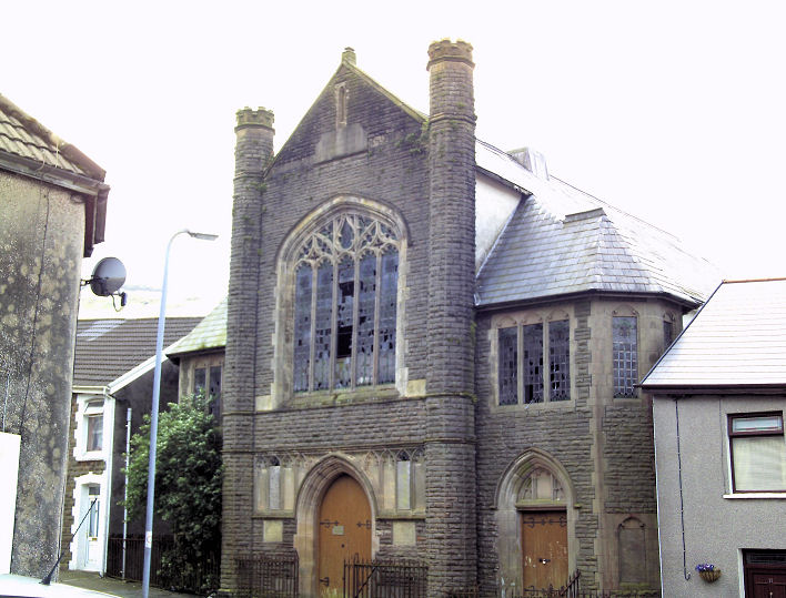
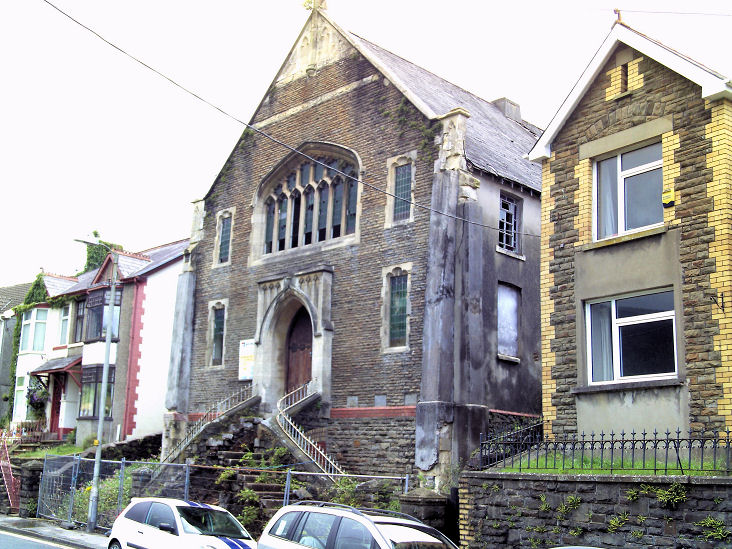
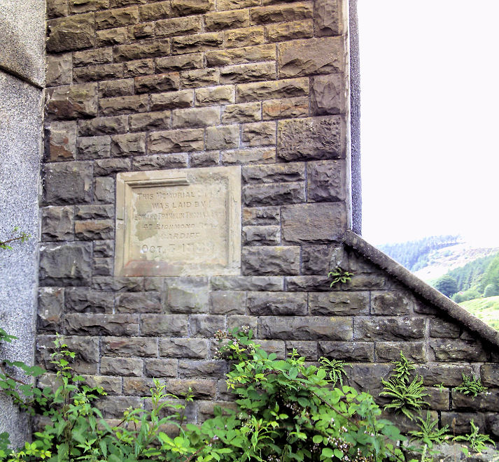
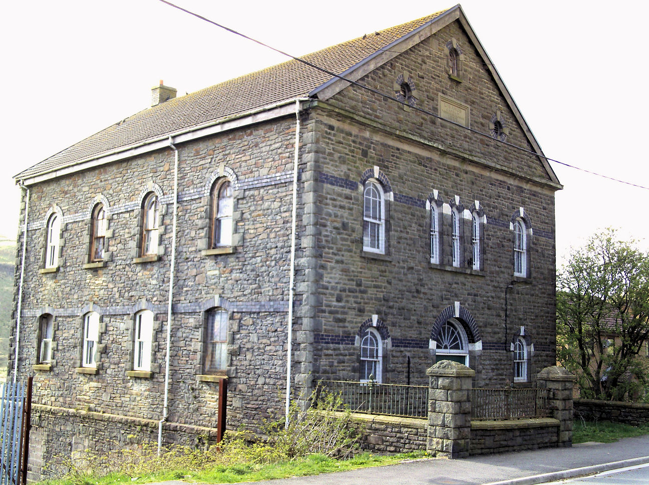
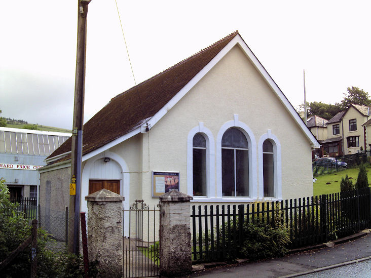
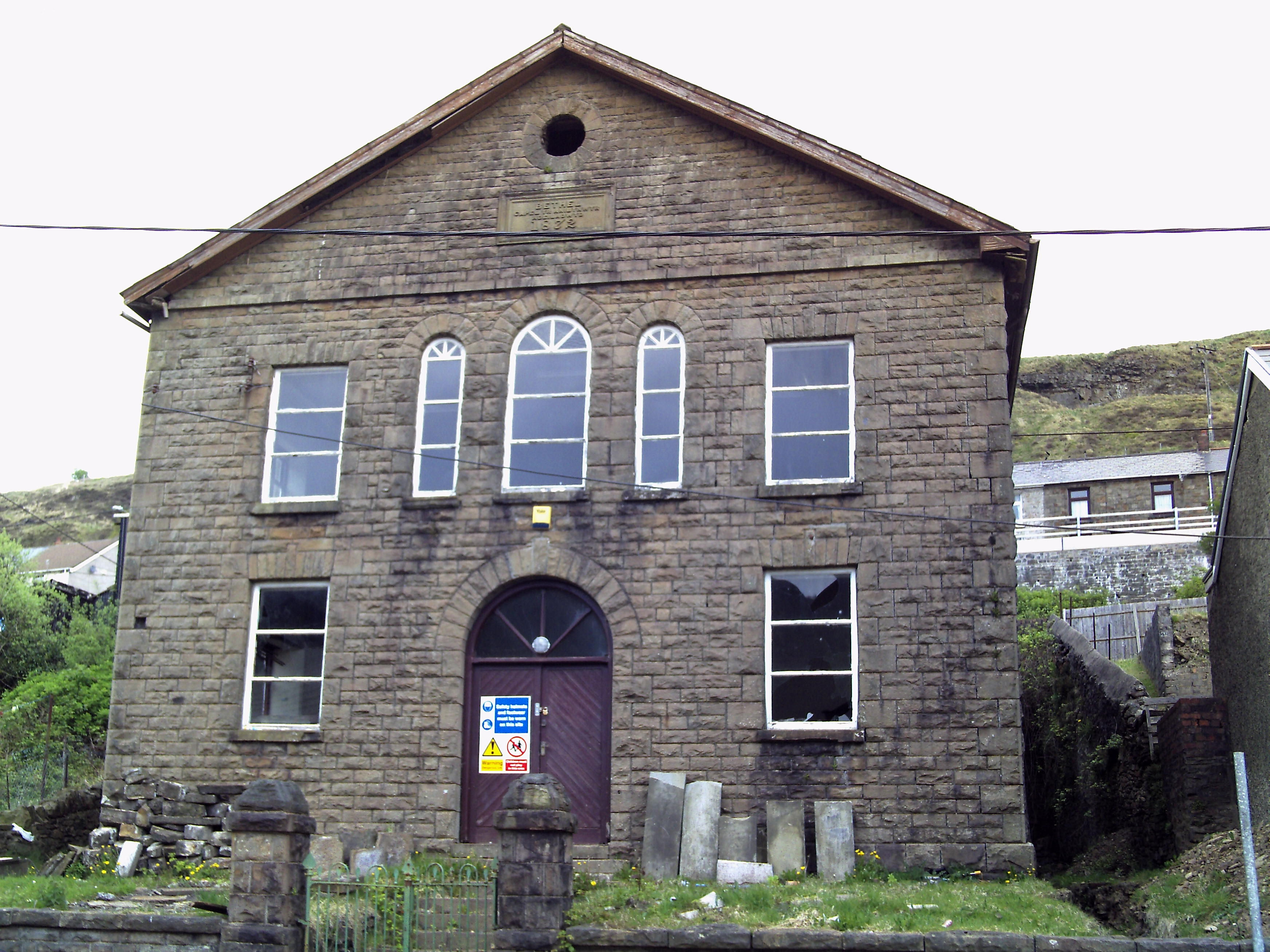
Caerau. Evanstown, Calfaria Welsh Baptist Chapel. Its Coflein entry dates it to 1897, with closure "by 2015". SS 9785 8958. © Gervase N. E. Charmley.
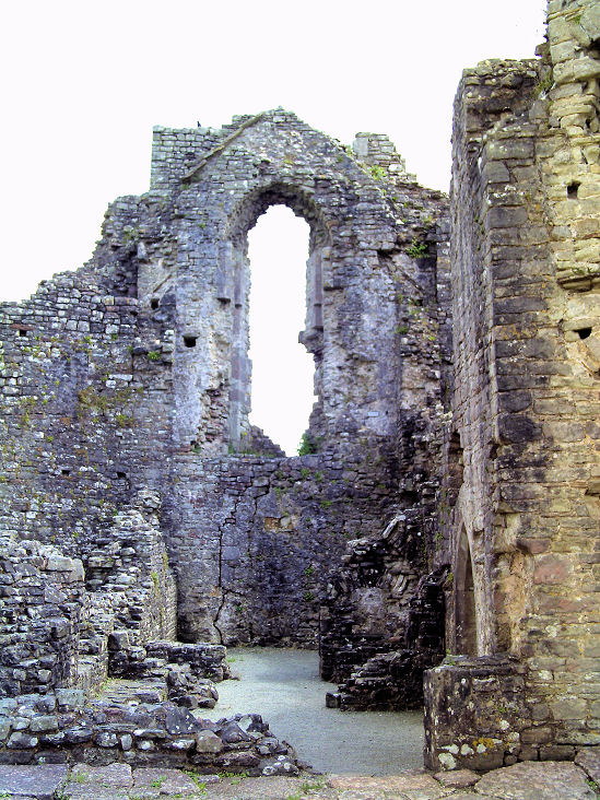
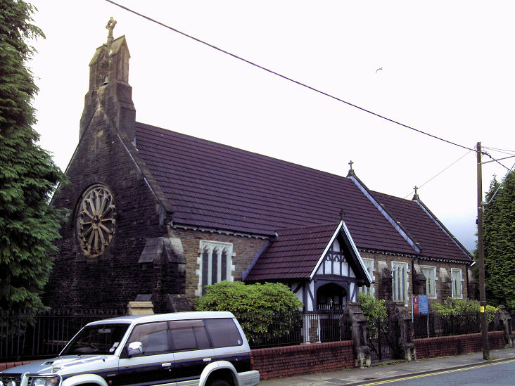
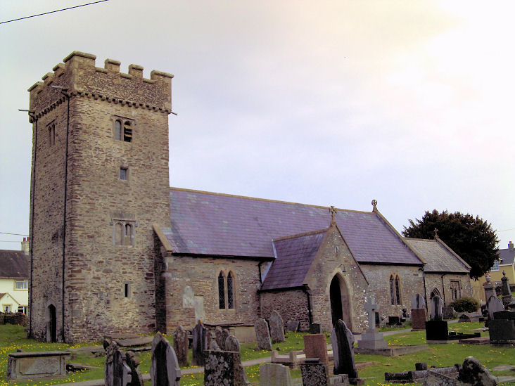
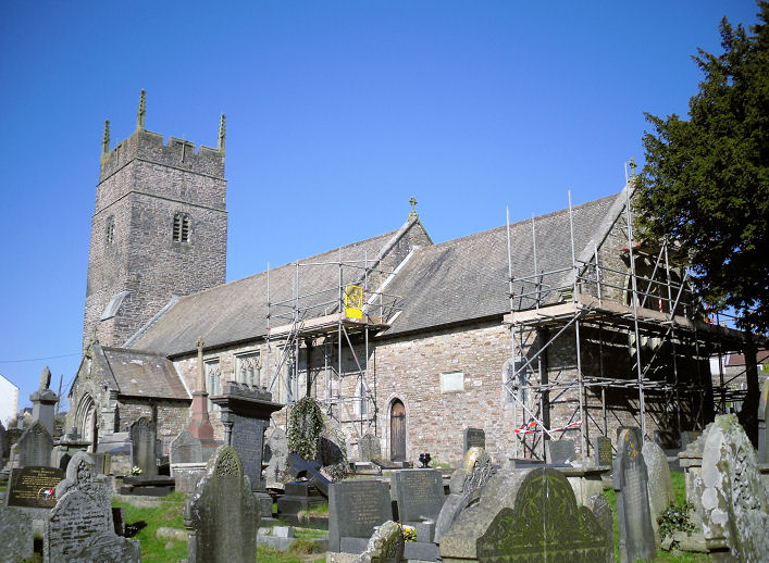
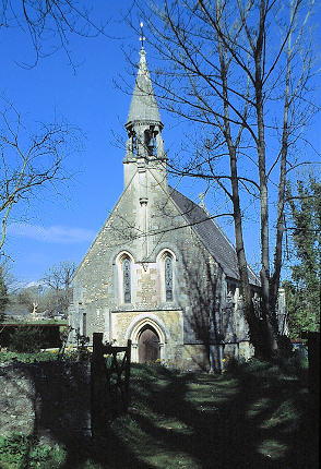
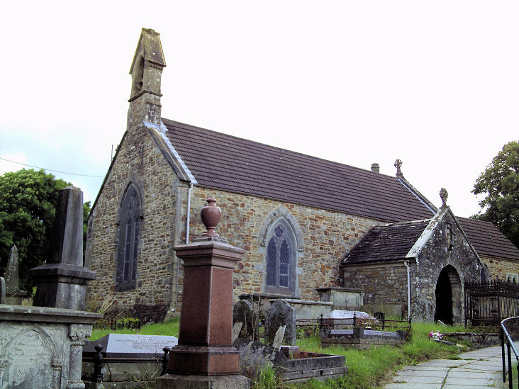
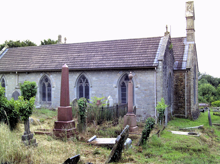
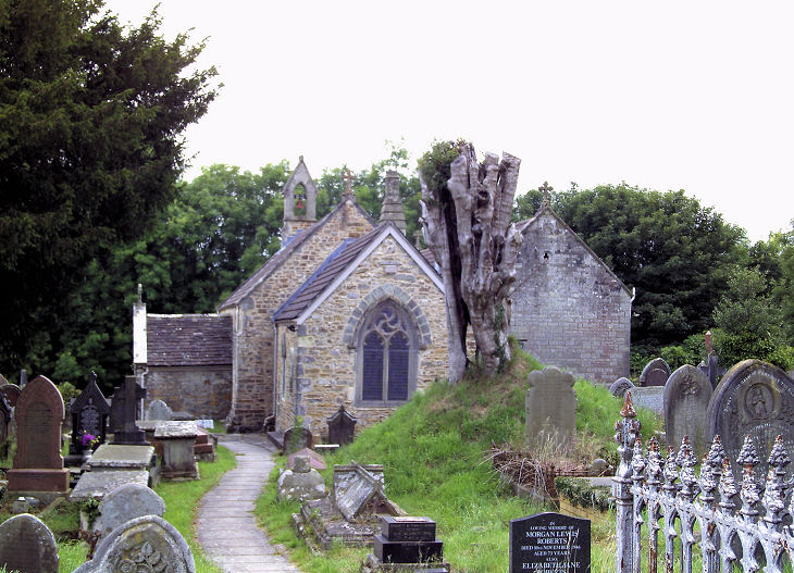
Garth, St. Mary the Virgin.
Coflein dates it to 1891. SS 8638 9040. © Gervase N. E. Charmley. Link.
O.S. maps show Ebenezer Chapel (Welsh Independent)
off Bridgend Road at SS
8650 9015. Pre-dating the oldest available map
of 1899, its Coflein
entry dates it to 1868, re-built 1904-11, and says it was derelict
by 1998. It remained so in 2022 when the Streetview van took its only
image. Another
chapel, shown on a 1949 map, stood on Heol Elfed, according to
Coflein, which calls it Horeb, but
doesn't say what its affiliations were. The O.S. map showing it is small
scale, so one has to rely on the Coflein map to locate it. It appears to
have been demolished. As far as I can judge, it would have stood
somewhere in the view seen
here, in a
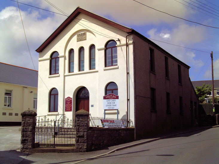
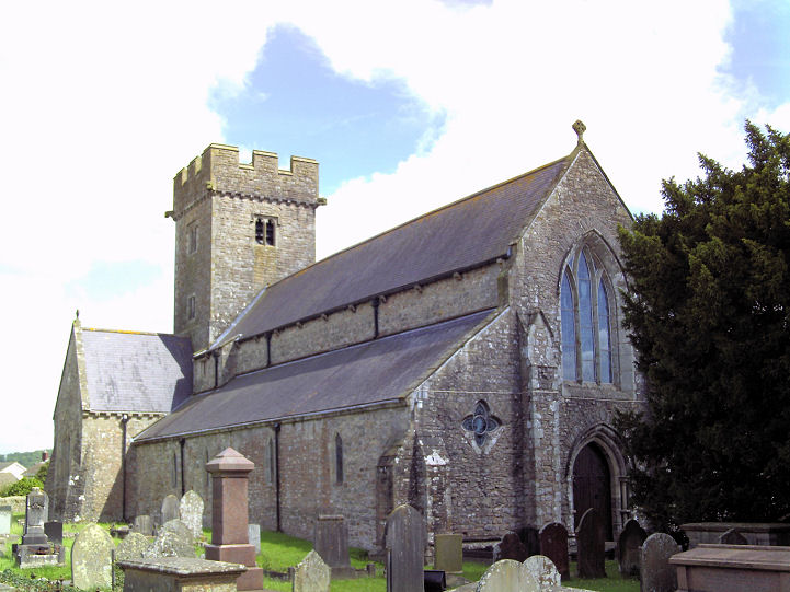
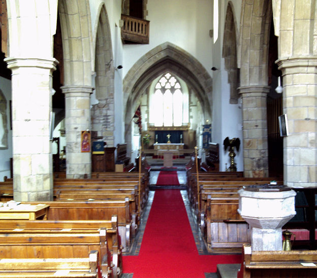
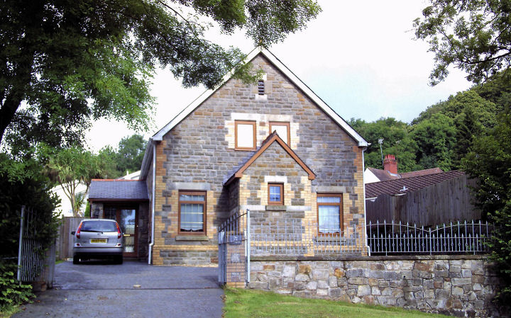
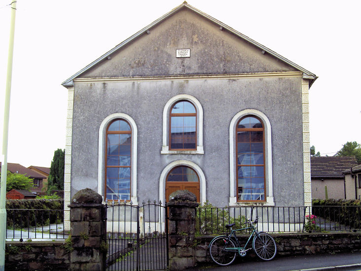
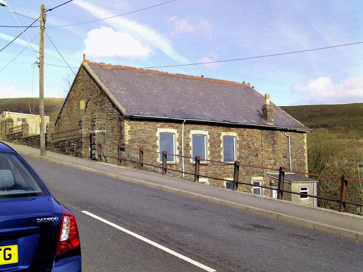
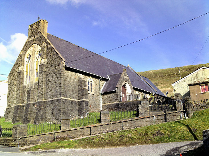
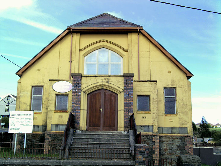
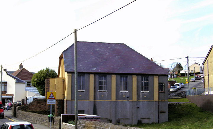
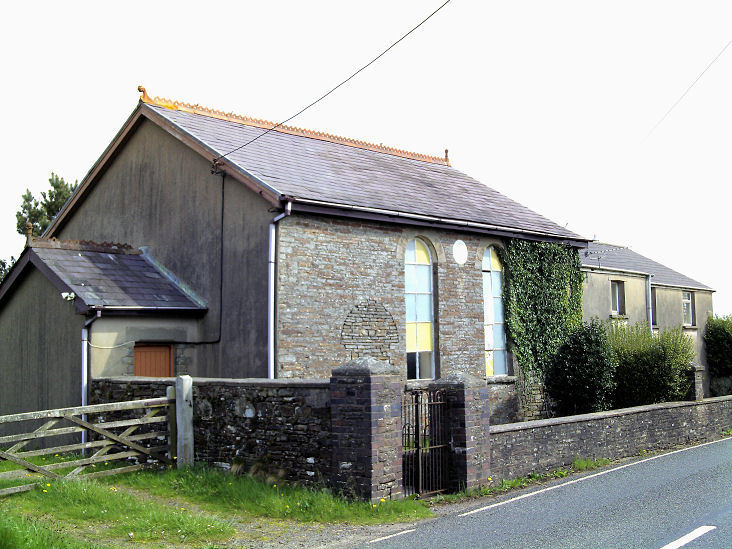
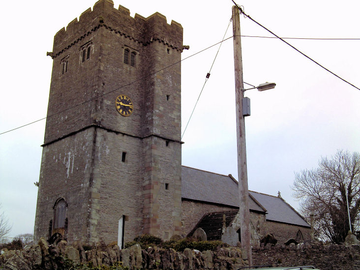
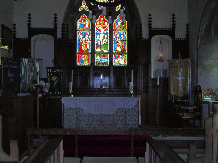
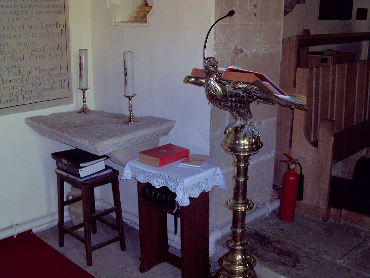
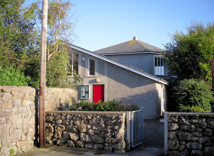
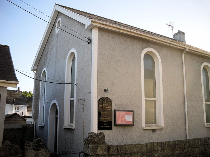
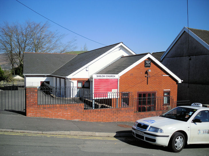
Streetview of 2022. Kenfig Hill, Pyle - see Pyle. Laleston, St. David. Interior view. A re-used medieval altar slab in the NE of the nave. SS 8753 7986. All © Gervase N. E. Charmley. Link. Grade I listed. A cross in the churchyard is listed as grade II. Bethel Baptist Church. SS 8767 7978. © Gervase N. E. Charmley. Link. The former Horeb Chapel is labelled on older O.S. maps as Calvinistic Methodist, but on its grade II listing (where it's dated to 1831) as Welsh Presbyterian. SS 8776 7982. © Gervase N. E. Charmley.Llangeinor, St Ceinwyr, as seen by Streetview in 2022. Link. Grade II* listed. A grave cover in the churchyard is listed as grade II. Calfaria Baptist Chapel on High Street. Gervase advises that it was planned to replace it with a bigger chapel, but the scheme never happened. Link dates it to 1924. SS 9147 8764. © Gervase N. E. Charmley. Llangynwyd, the Parish Church, St. Cynwyd. SS 8537 8883. © Gerard Charmley (2011). Link. Grade II* listed. For listed features associated with the church, see here. Older O.S. maps show two chapels in the village near the church, both on Llan Road - Bethesda Chapel (Welsh Independent), and Capel y Babell (Calvinistic Methodist). Bethesda survives, converted to residential use, and it was seen by Streetview in 2022. It has a date-stone above the porch door, but I can't read it. The National Archives references documents for the period 1861-2004. SS 8575 8889. Babell stands a little further away to the north-east, at SS 8585 8893. It too survives, also converted, and was seen by Streetview in 2022. Maesteg. Mawdlam, St. Mary Magdalene. SS 8066 8194. © Gerard Charmley (2010). Link. Grade II* listed. A tomb in the churchyard is listed as grade II. Merthyr Mawr. © David Gallimore. Nant-y-Moel, St. David, the former parish church, now a private residence. Horeb English Baptist Church (1894). The former Bethel Independent Chapel (1872), which Gervase says has been gutted. All © Gervase N. E. Charmley. Nantyffyllon. Newton, Porthcawl - see Porthcawl. North Cornelly, Pyle - see Pyle. Nottage, Dewi Sant (CiW). Link. General Baptist Chapel (now Unitarian, originally founded 1789 by Arminian Baptists). Both © Gerard Charmley (2010). Ogmore Vale, St. David (CiW). Bethlehem Independent Church. Christchurch (Methodist and U.R.C.), originally Bethel Primitive Methodist. The former Ogmore Vale Presbyterian Church, now a youth centre. The former Wesley Church, originally Wesleyan Methodist. Pwll-y-Pant Cemetery Chapel. Kingdom Hall of Jehovah's Witnesses, which was perhaps previously a chapel - can you confirm? An inscribed foundation stone bears the date 1895. My appreciation to Janet Gimber who has advised that this was Philadelphia Baptist Chapel. Before the Witnesses, took over, the building spent some time as a "club", according to an old map. All © Gervase N. E. Charmley. Pantygog, Salem Baptist Chapel - a "tin tabernacle". © Gervase N. E. Charmley. Pen-y-Bryn, Capel Pen-y-Bryn (Calvinistic Methodist). © Gerard Charmley (2010). Pen y Fai, All Saints. Smyrna Baptist Chapel. Both © Gerard Charmley (2011). Pencoed. Pont Rhyd-y-Cyff, the former Ainon Welsh Baptist Church on Station Road. The National Library of Wales holds documents for the years 1890-1974. Its date-stone shows a date of 1888(?), but it's curious that maps of the early 20th century don't show a building here. SS 8695 8900. © Gervase N. E. Charmley. This building is marked as a chapel on maps, but has no visible denomination - can you supply it? My appreciation to Howard Richter for advising that this was built as a school (before 1898, as it appears on a map of that date). By 1940 it shows as a church, and on a 1964 map, is St. Stephen's Church (CiW). Both © Gervase N. E. Charmley. Shiloh Apostolic Church on Llan Road. © Gerard Charmley (2011). Link. Moriah Chapel on Station Road, as seen by Streetview in 2022. The date-stone for 1876 can be seen. Older O.S. maps label it as Jerusalem Chapel (Calvinistic Methodist). SS 8718 8900. Yet another Station Road chapel has been demolished. All available maps identify it only as Capel. It stood on the north side of the road, just west of the railway bridge, at SS 8704 8901. It doesn't appear to have been active after WWI. Its site was seen by Streetview in 2022. The property name (Ainon House) suggests that it was the predecessor of the previously mentioned Ainon. If correct, then the dates mentioned for the other Ainon includes both Ainon's, and the date-stone of this first chapel was built into the second. Pontycymer. Pont-y-Rhyl, a distant view of the former St. Mary (CiW). Its Cofelin entry dates it to 1891-2. SS 9045 8959. © Gervase N. E. Charmley. Early O.S. maps mark a Mission Room near to the church at SS 9049 8954. It ceases to be labelled in the early 20th century, so it's possible that it was the predecessor of St. Mary. In a 2010 Streetview, its site will be somewhere up the grassy bank - the roof of St. Mary can be seen among the trees in the background. Old maps also mark Carmel Chapel at SS 9047 8963, a short distance N.E. of the church. It survived at least up to the mid-20th century but was closed and demolished at some point. Its site (Streetview 2022) remains undeveloped. Another chapel is shown on old maps - as Nazareth Chapel (Welsh Meth.), at SS 9073 8936. Genuki dates it to 1887, closed by 1998. From an aerial view I think it survives, but it isn't visible on Streetview. Porthcawl. Price Town, the former Bethany English Calvinistic Methodist Church (1896, re-built 1905 - Coflein) on Hill Street and Oakfield Terrace. SS 9379 9206. Howard Richter advises that (judging from old maps) the chapel extension comprised the nearest section with the two arched windows on the right-hand side; the building has been converted into flats. It appears to have still been a church when the 1992 OS map was published, but the closure date is not currently known. A former chapel on Hill Street and Ogwy Street. Janet Gimber has advised that this was probably Hope Congregational Chapel, which Howard Richter has confirmed, and he also provides the building date of 1898. The building is not marked as church or chapel on the 1992 map, so was probably closed by then. SS 9375 9204. Both © Gervase N. E. Charmley. Link1. Link2 (another photo, on an external site). Howard Richter also advises that there was a Free Gospel Mission showing on the 1961-2 OS map at SS 9372 9193, since demolished. Streetview saw the site in 2008, and as of 2022 the site remains vacant and completely overgrown. Link. Pyle. Rhiwceiliog, Soar (or Zoar) Calvinistic Methodist Chapel on Church Street. The smaller building is the vestry. SS 9725 8434. © Gervase N. E. Charmley. Link.
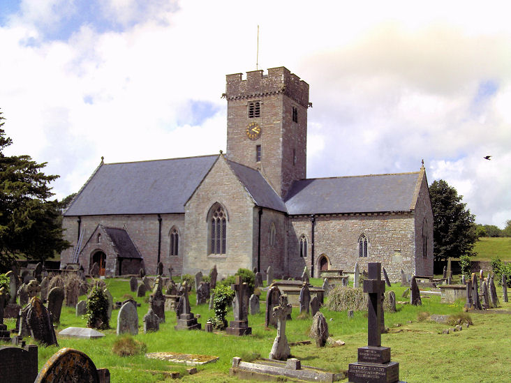
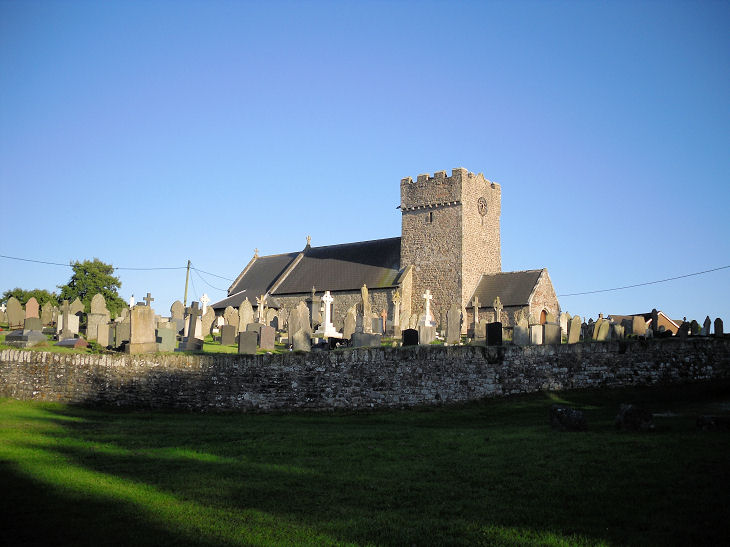
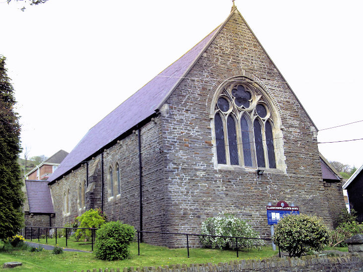
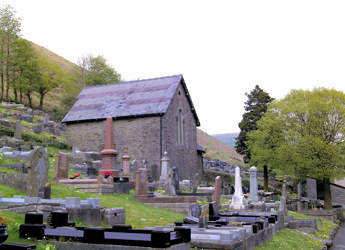
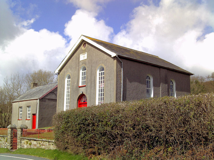
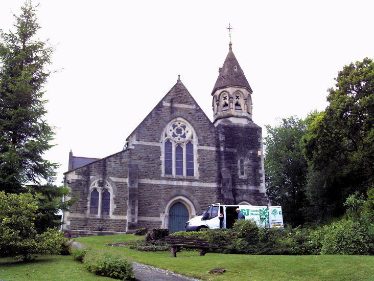
Sarn, Llansantffraid
Church (St. Ffraid or St. Bride). The medieval church was doubled in size by the addition of a new aisle in
the C19. Two further views - 1, 2.
SS 8968 8348. All © Gervase N.
E. Charmley. Link.
Grade II listed. For listed monuments, a cross, etc., see
here.
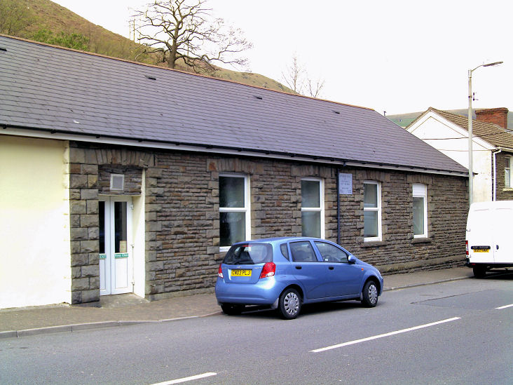
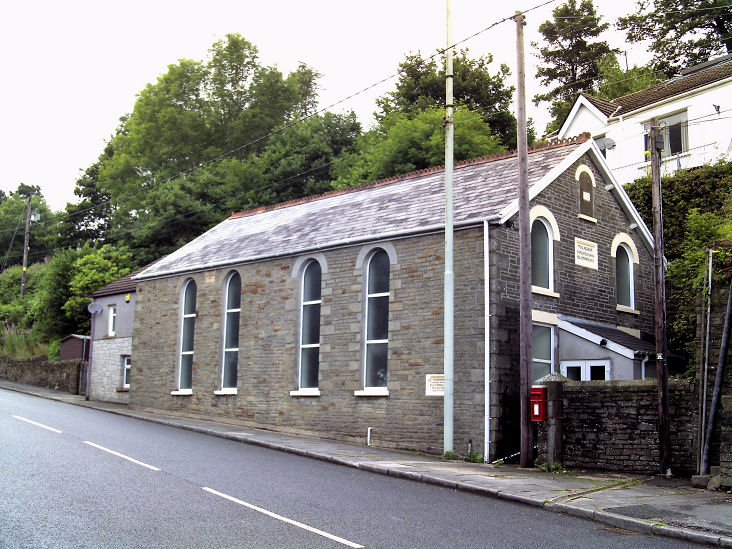
Tondu, Wesley
Church Centre, originally Wesleyan. It pre-dates a map of 1899. SS 8924
8418. © Gervase N. E. Charmley.
Link. The same map
shows, just a short distance to the south, Capel
Jerusalem (Baptist), at SS 8926 8407. It's dated in its
Coflein entry to
1884, demolished before 1997. Its site - the grassed area - was seen by
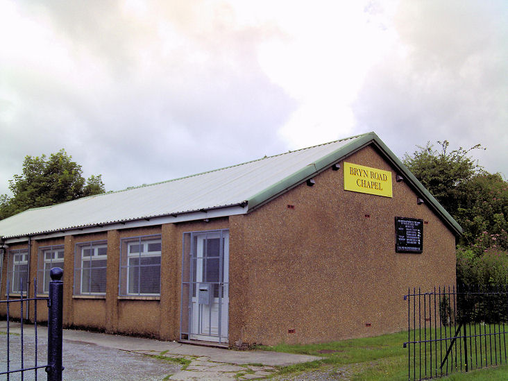
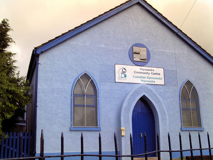
Streetview in 2022. Ynysawdre (between Aberkenfig and Brynmenyn), Bryn Road Chapel (Brethren). SS 8989 8446. © Gervase N. E. Charmley. A former Mission Hall stands adjacent, now in use as a community centre. Janet Gimber (who advised that this building was a Mission Hall) has been unable to discover the mother church. SS 8989 8444. © Gervase N. E. Charmley. Link.
|
||
09 April 2026
© Steve Bulman