The Churches of Britain and Ireland
| Ludlow, Shropshire
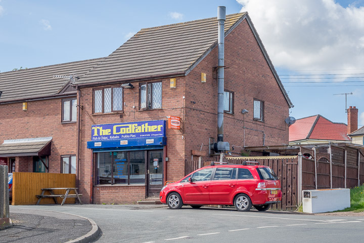
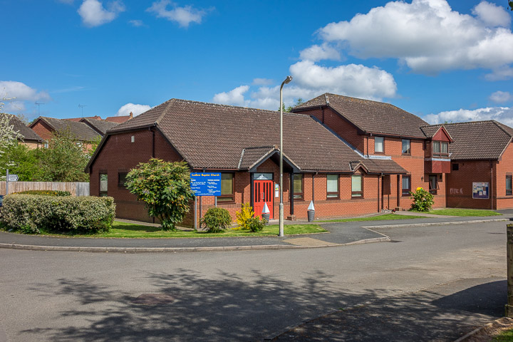
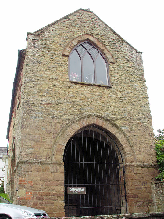
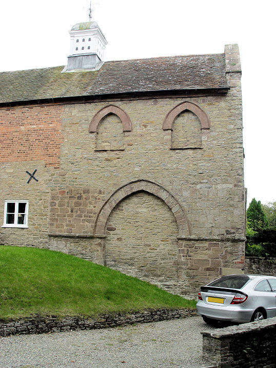
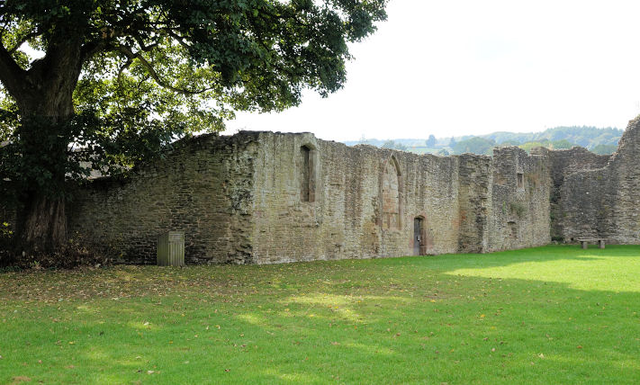
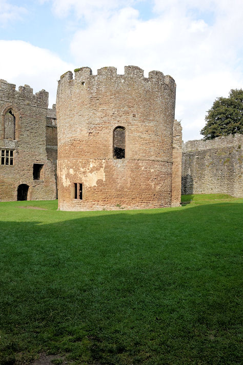
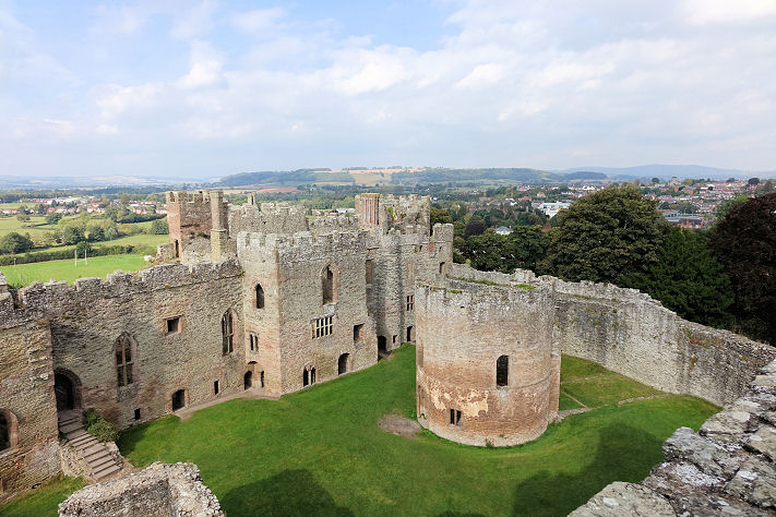
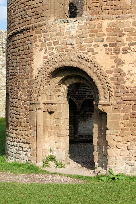
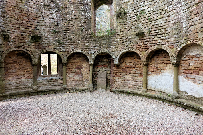
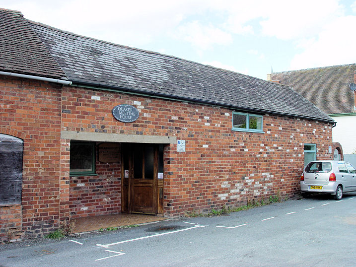
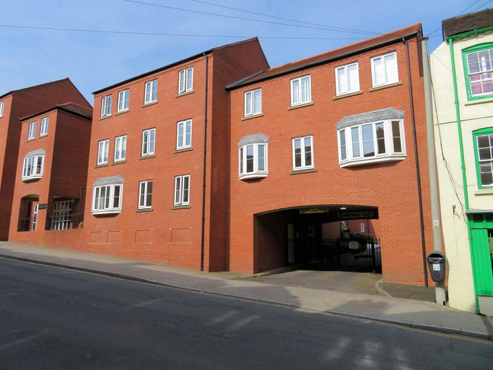
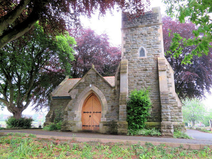
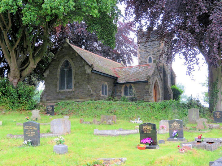
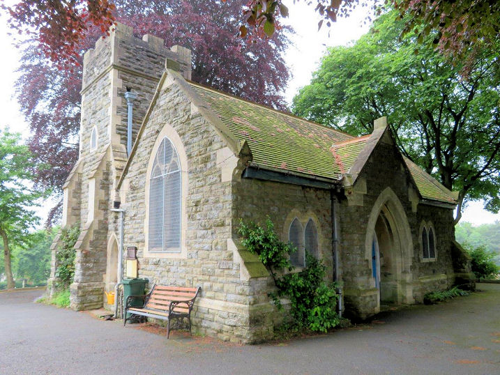
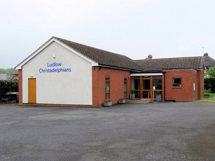
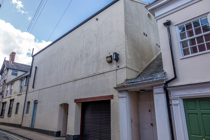
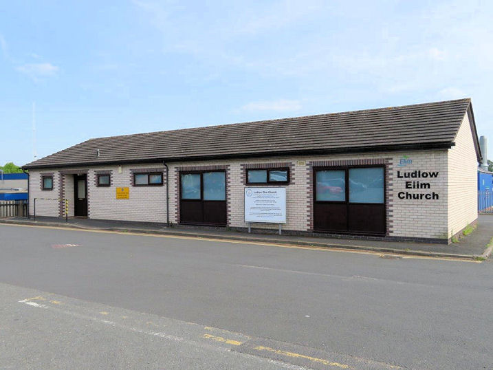
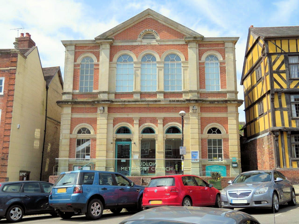
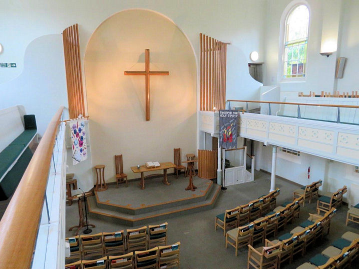
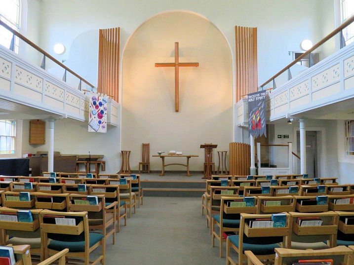
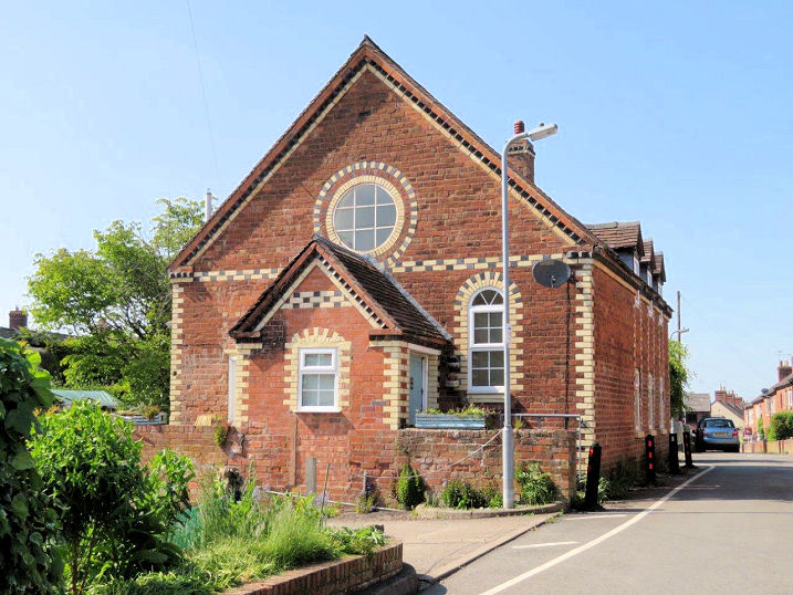
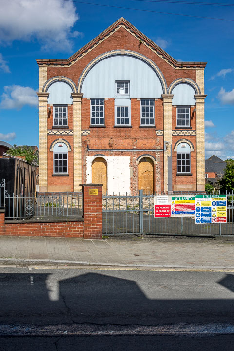
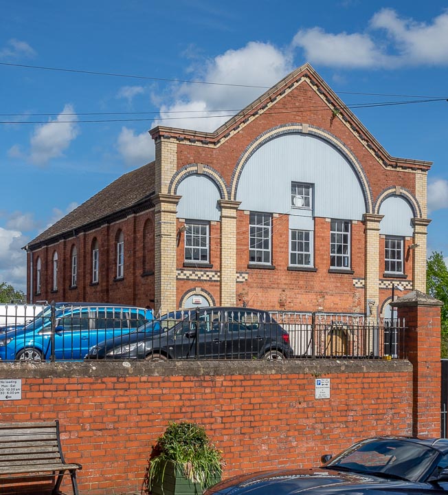
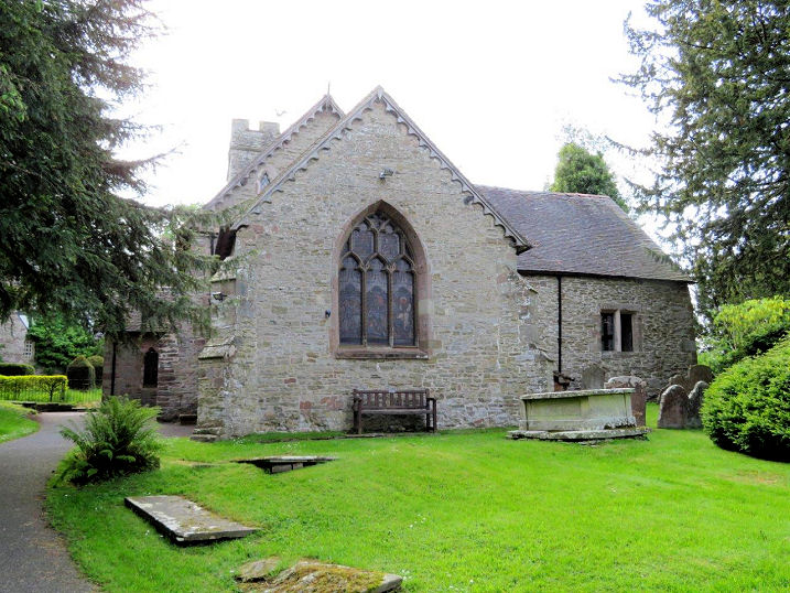
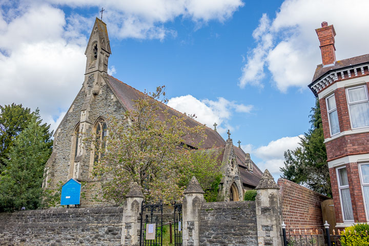
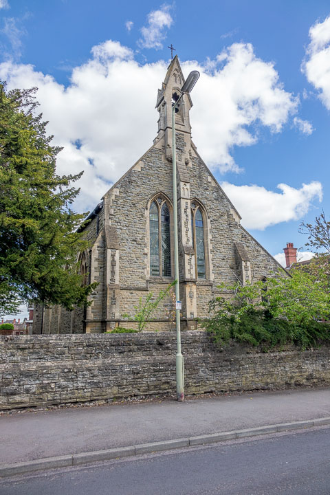
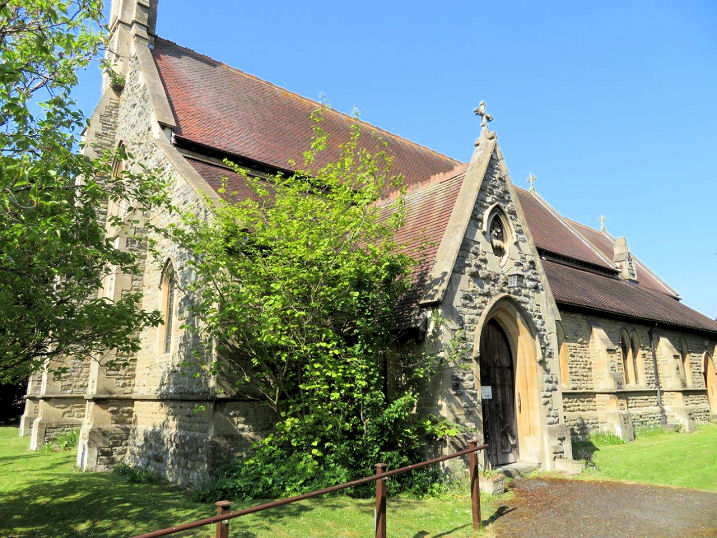
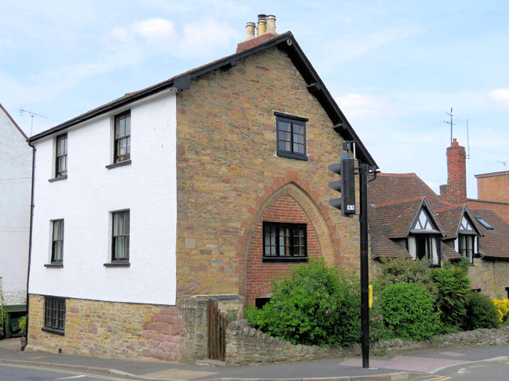
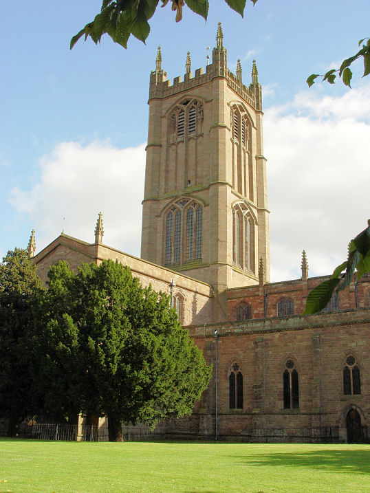
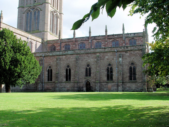
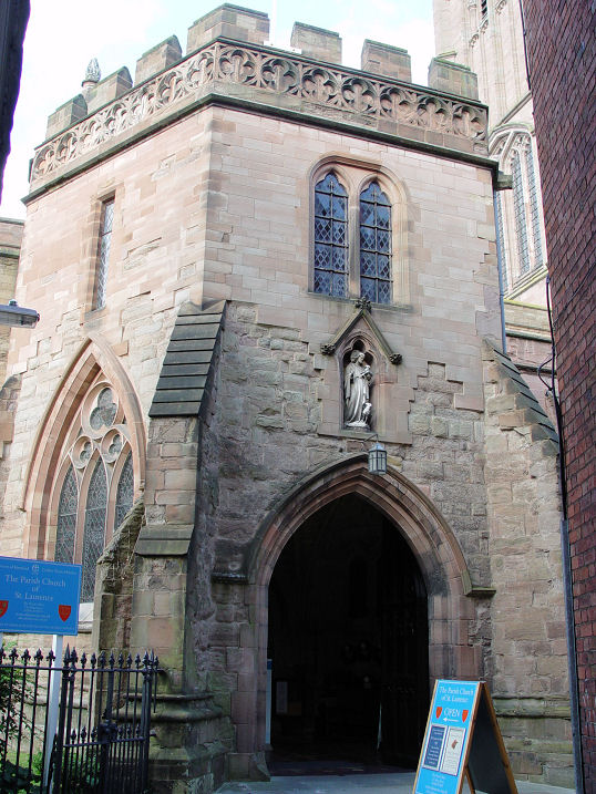
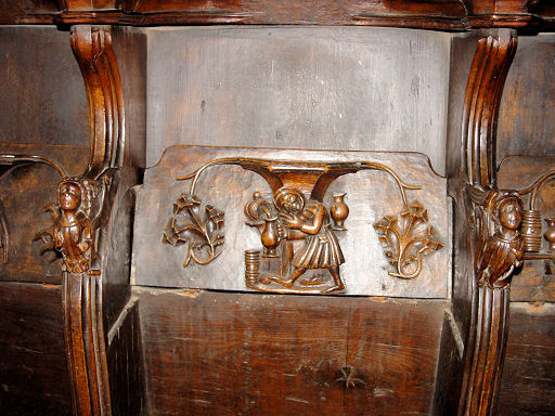
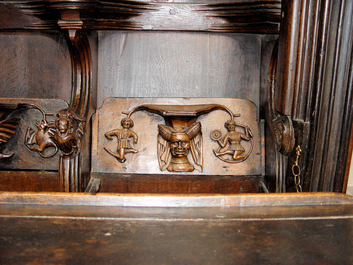
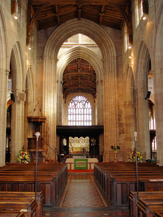
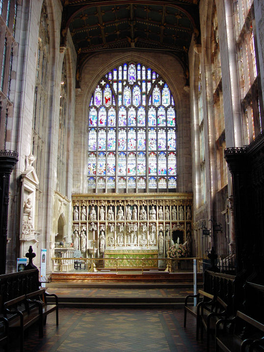
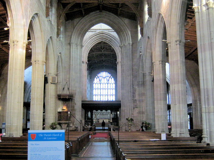
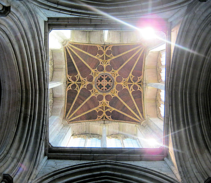
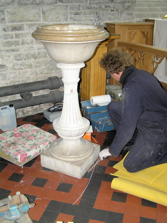
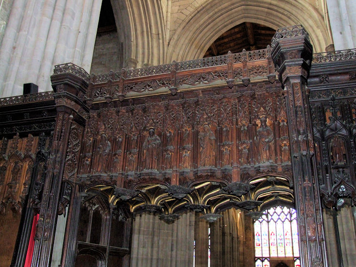
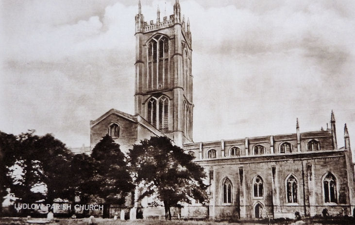
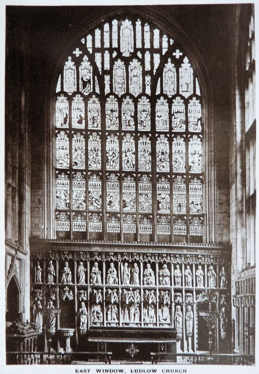
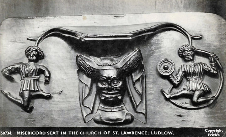
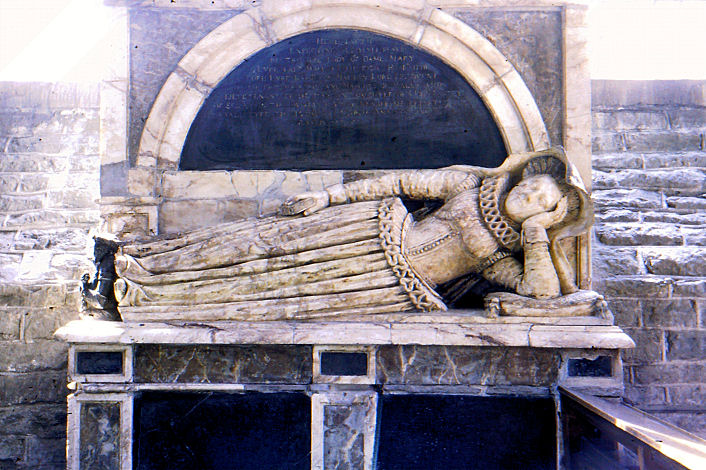
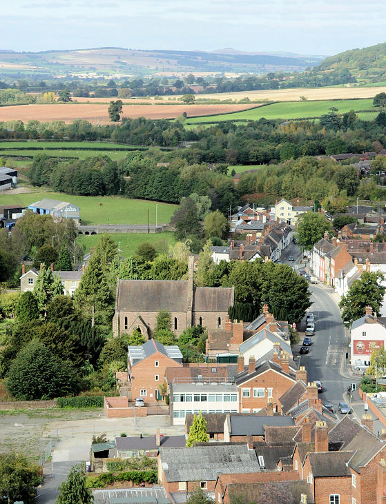
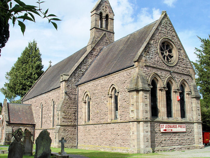
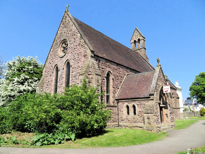
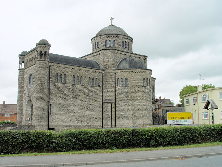
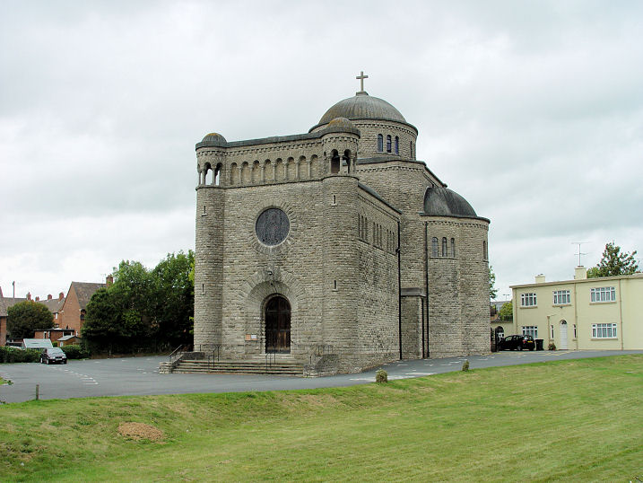
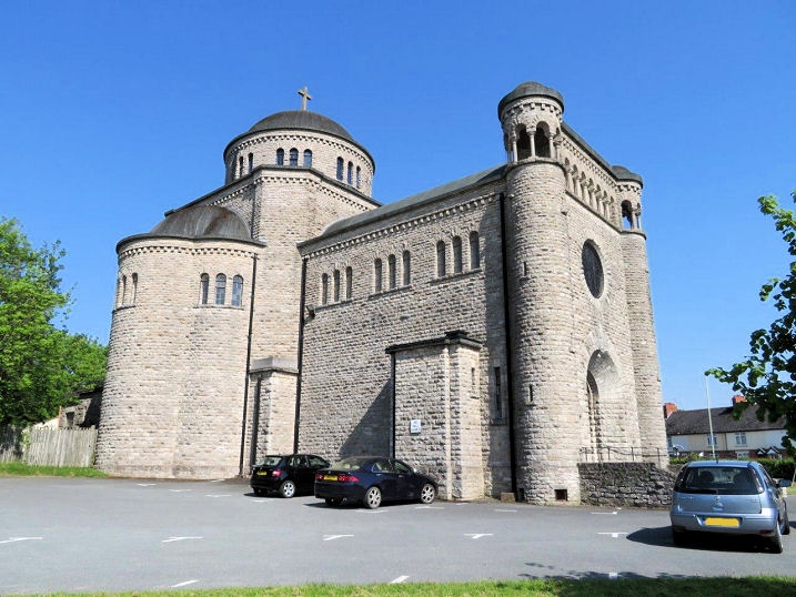
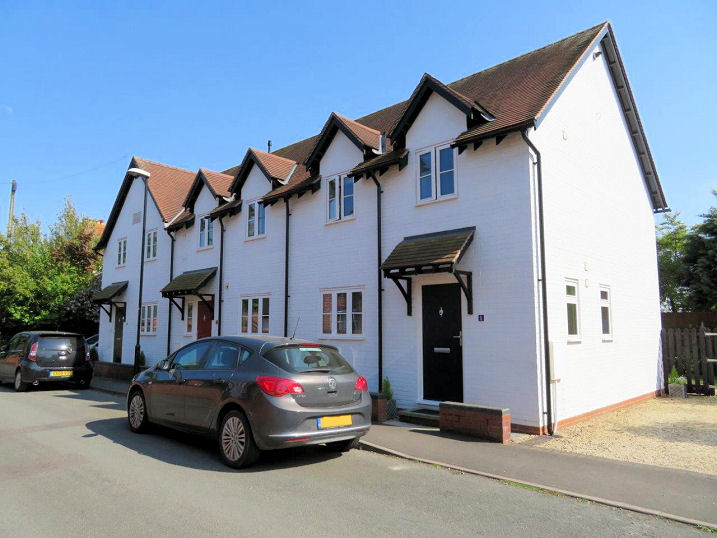
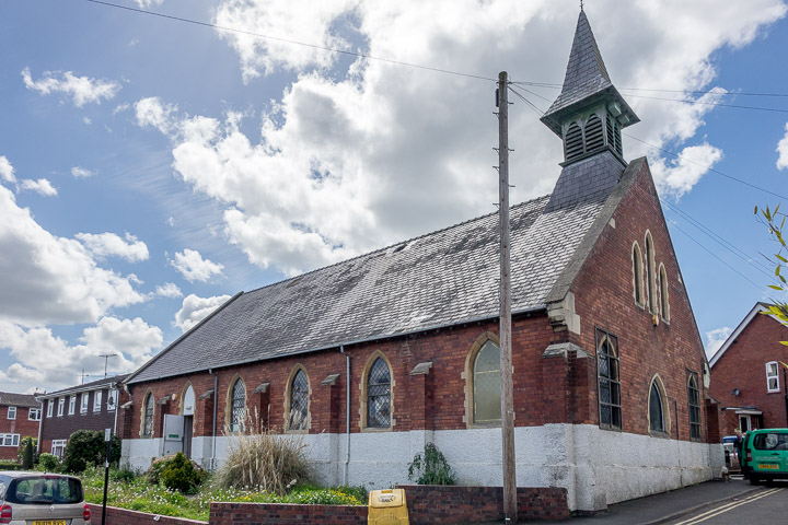
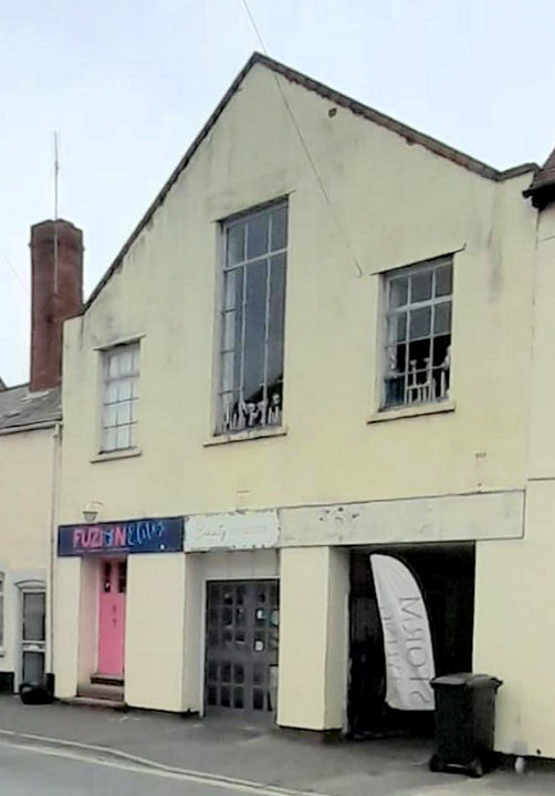
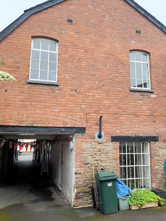
No above-ground traces remain of the monastery founded by the Austin Friars in the mid 13th century, though remains were found in 1861 when the ground was being levelled for construction of the cattle market. Today the site lies beneath Smithfield Car Park, and adjoining gardens. Ludlow Elim Church can also be seen in Carole's photo, at the extreme right. SO 51683 74578. © Carole Sage (2018). Link. The site of the former Baptist Church, on Rock Lane, now occupied by a chip shop. SO 51962 74833. The present Baptist Church is nearby, on Rock Lane and Sandford Road. SO 52105 74901. Both © Steve Bulman (2018). Link, with a history page here, which implies that the old chapel was Ebenezer, built in 1868. Remnant of the former Chapel of St. Thomas of Canterbury. Another view. SO 50882 74449. Both © Steve Bulman (2009). Grade II* listed. Ludlow Castle has two chapels. The first is the Chapel of St. Peter, dating from the early 14th century. SO 50838 74534. Much more interesting is the Chapel of St. Mary Magdalene, thought to be 12th century. Three additional views - 1, 2, 3. SO 50837 74635. All © Steve Bulman (2014). Grade I listing for the castle includes both chapels. A former Congregational Chapel (circa 1830) stands behind these houses on Old Street. Originally called Old Street Independent Chapel, access was through the passageway where the car is parked in the photo. It was still open in the mid-1970's, but was subsequently closed and converted for residential use. SO 51241 74591. © Carole Sage (2018). A not very helpful photo of the chapel is available here, but the building is almost completely obscured by shrubs. More useful are two sketches here. Grade II listed. See also the following entry. The site of Corve Street Non-conformist Chapel. Attested on a map of 1884, it seems to have survived at least until 1954, but had gone by 1969. Standing to the rear of properties on the West side of Corve Street, the chapel backed on to the bank of the River Corve. Access must have been though one of several passageways shown here. Circa SO 5107 7524. Both © Carole Sage (2018). This website mentions an Independent Chapel on Corve Street from about 1736 until about 1830, when the congregation built Old Street Independent (later Congregational) Chapel (for which see the Congregational Chapel entry, above). Whether this was the same building later used by the Non-conformist congregation, or was a different building, is unclear. Can you advise? Friends Meeting House on St. Mary's Lane. SO 511 754. © Steve Bulman (2011). Link. A Gospel Hall used to stand on a site off Old Street. Showing on old maps for 1884 and 1903, the building is just marked as "hall" on the 1924 edition. Since redeveloped, the exact location of the hall is now covered by a parking area, accessed through the archway seen in this photo. SO 51321 74639. © Carole Sage (2018). Henley Road Cemetery has a small chapel. The cemetery was opened in 1914, so the chapel probably dates from the same time. Two additional views - 1, 2. SO 51987 75497. All © Carole Sage (2018). Ludlow Christadelphians meet in The Old Gospel Hall, formerly Cleeview Gospel Hall, on Clee View. Probably built soon after WWII, Carole has found a reference to the original occupiers leaving in 2007. SO 51895 75446. © Carole Sage (2018). The Christadelphians had previously met for almost 100 years in a building on Brand Lane. My appreciation to Roy Payne for clarifying which building had been the church. SO 51209 74510. © Steve Bulman (2018). Ludlow Elim Church stands in Smithfield Car Park. The building was previously a St. John's Ambulance Brigade Hall. The Elim Church had previously occupied a former Salvation Army Barracks (1888) which can be seen here. SO 51665 74583. © Carole Sage (2018). Ludlow Methodist Church on Broad Street (1879) was originally Wesleyan, and successor to the Wesleyan Chapel off Lower Broad Street (for which, see Wesleyan Methodist Chapel, below). Two interior views - 1, 2. SO 51148 74538. All © Carole Sage (2018). The former New Street Primitive Methodist Chapel (1870). Map evidence shows that it was still in use in 1963-4, but had closed by 1975 and converted for residential use. SO 51462 75419. © Carole Sage (2018). Link. A handsome timber-framed building on Old Street is known as The Old House of the Town Preacher and Lecturer, and bears the date of 1661. Whether there was a chapel in the building, or associated with it, is at present not known to me, so if you have any knowledge of this, please let me know - even if you are certain there wasn't a religious connection, please let me know so I can remove the entry. SO 51276 74617. © Carole Sage (2018). Grade II listed. The Bull Hotel on Bull Ring was, according to the information board, where a Presbyterian meeting took place in 1693, causing it to be attacked by rioters. Whether this was a regular meeting or not is unclear. SO 5122 7475. © Steve Bulman (2025). The former Primitive Methodist Chapel (1870) on Old Street. Another view. SO 51329 74586. Both © Steve Bulman (2018). Link1, which gives a closure date of the late 1950's - this is contradicted by the 1963/4 O.S. map which implies that it was still in use at that time. Link2. St. Catherine's Chapel used to stand on Ludford Bridge. First mentioned in a document of 1407, it seems to have been very small, standing in the triangular refuge on the west side of the bridge, above the northernmost pier - just left of where the group of pedestrians is standing in the . Another view. Also visible in each photo is the surviving fragment of St. John's Hospital Chapel, for which see below. Can you advise when the bridge chapel was removed? SO 51253 74217. Both © Carole Sage (2018). Nothing remains of the chapel as such, but the bridge itself is grade I listed. St. Giles at Ludford. A difficult church to photograph well, it was probably an eleventh century foundation. SO 5129 7411. © Carole Sage (2018). Another view, three of the interior - 1, 2, 3, a fine tomb, and the font, all © Steve Bulman (2025). Link1. Link2. Grade II* listed. St. John the Evangelist on Gravel Hill and Poyner Road. Another view. SO 51535 75129. Both © Steve Bulman (2018). Another view, © Carole Sage (2018). Link. A blocked archway survives of St. John's Hospital Chapel (more properly, the Hospital of the Holy Trinity, the Virgin Mary and St. John the Baptist), now part of St. John's House, just east of Lower Broad Street. Founded in the early 13th century, it fell victim to Henry VIII in 1537. SO 51262 74252. © Carole Sage (2018). Grade II* listed. St. Laurence (O) is a difficult church to photograph, presenting a satisfactory view from one side only. Another view. The porch. Allegedly the largest parish church in England, the interior has much of interest, including the misericords - 1, 2, 3. Interior view, and the chancel. The C15 window in the Chapel of St. John, which was the chapel of the Palmers' Guild. The tower can be climbed, and the view makes it well worth it. SO 5116 7470. All © Steve Bulman (2009). The tower, interior view, and looking up into the tower, all © Simon Edwards (2011). The font, another undergoing repair, and two views (1, 2) of the screen which separates the main crossing from the chancel, all © John Bowdler (2013). Another view, the East window, and a close-up of one of the misericords, all from old postcards in Christopher Skottowe's Collection. The tomb of Dame Mary Eure (d. 1612), and her husband, who died 5 years later. © Christopher Skottowe. Link. Grade I listed. The former St. Leonard's Church on Corve Street, taken from the top of St. Laurence's tower. Thanks to Janet Gimber for the identification, and for advising the current usage as the premises of a printing company. SO 51093 75077. © Steve Bulman (2009). Another view, © Steve Bulman (2011). Two additional views - 1, 2, both © Carole Sage (2018). An earlier Chapel of St. Leonard stood a little further north, at SO 5108 7517. More information is available here, wherein it says that the chapel was demolished circa 1760. Immediately north of the church, in what is now the graveyard, once stood a Carmelite Friary. Nothing visible remains. Founded in 1350, its exact site is uncertain. More on the Carmelite Friary here. SO 511 751. © Carole Sage (2018). St. Peter (R.C.) on Henley Road. Another view. SO 516 754. The architect (G. Rinvolucri) designed a church in a similar style in Abergele - see St. Therese on the Abergele page. Both © Steve Bulman (2011). Another view, © Carole Sage (2018). Link, which includes photos of the interior here. Before St. Peter's was built, Ludlow's Catholics met in a church on Julian Road, at about SO 51568 75049. When St Peter's was built, the old church continued in use as a parish hall (until at least as late as the mid-1970's), but it was subsequently converted for other uses, and later demolished and a row of houses called Church Cottages built on the site. © Carole Sage (2018). An even earlier "Mass Centre" existed in a rented room in a house on Old Street, but the building has not been identified as yet - can you advise? The former St. Stephen on St. Stephen's Close, is now in commercial use. Another view. SO 51462 74751. Both © Steve Bulman (2018). Another view, free from cars, © Carole Sage (2018). The former Salvation Army Hall of 1888, on Lower Gaylesford. Now in commercial use, it was also home to an Elim Church for a time. Another view (the rear), and the Young People Hall (Sunday School). Circa SO 5138 7472. All © Rob Kinnon-Brettle (2022). A medieval cross used to stand somewhere close to the old toll house at the junction of Weeping Cross Lane and Temeside. An open-air service was held here annually. Circa SO 517 743. © Carole Sage (2018). The former Wesleyan Methodist Chapel (1800, extended in 1835) off Lower Broad Street was the predecessor of the Ludlow Methodist Church on Broad Street (for which, see above). As far as Carole has been able to ascertain, the building was never used as a place of worship after the Wesleyans vacated in about 1879. SO 51153 74321. © Carole Sage (2018). Link (with photo). The former
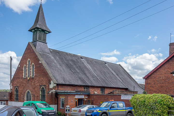
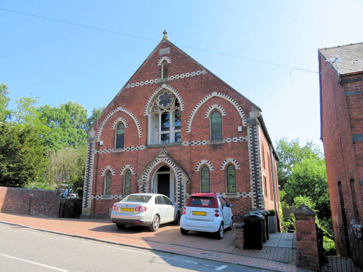
Zion Primitive Methodist
Chapel (1878) on New Road. As Zion Methodist Church, it closed circa
2003-4 and was subsequently converted into flats. SO 51395 75354. ©
Carole Sage (2018).
Link1.
Link2.
|
||
04 July 2025
© Steve Bulman
Contact Details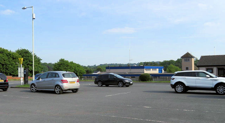