| Altrincham, Greater Manchester
Altrincham on Wikipedia.
Churches in Bowdon,
Broadheath,
Dunham Massey, Hale, Hale Barns, Ringway, Timperley
(some links will open another page).
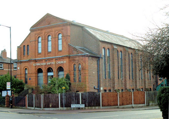
Altrincham Baptist Church on Hale Road. SJ 7680 8725. © Mike Berrell.
As can be seen on a recent
Streetview, a new entrance foyer has been added since Mike took his photo.
Link.
Altrincham Methodist Church on Woodlands Road.
Older maps label it as Wesleyan, and it pre-dates one of 1882. SJ 7692 8831. © Mike Berrell.
Link.
A map of 1878 shows a
Baptist Chapel on The Downs at SJ 7664 8757. It
seems to have gone out of use by the end of the 19th century, as maps from the
time don't label it as a place of worship. It must have long survived however,
as Ian Harwood recalls seeing a pulpit in the furniture shop it later became. It
may yet survive behind a more recent frontage, as seen by
Streetview in 2022.
An otherwise
unidentified Church is shown on older O.S.
maps on Regent Street (earlier, Chapel Road) at SJ 7664 8772. Present by 1898,
it survived as a place of worship into the mid-20th century at least. I suspect
it was the Wesleyan Methodist Chapel mentioned
here (on page 216) where it says it was later Congregational. Genuki has
these
here (the Wesleyan, 1788-1866) and
here (Congregational, 1866-1890), but Genuki has an incorrect grid
reference. And assuming that the O.S. was correct in showing a place of worship
here in 1951, what had it become after the Congregationalists? The site had been
cleared by 2009, when it was a car park (Streetview),
but by the time of the latest Streetview visit in 2022, it was a building site (Streetview).
The former Exclusive Brethren Meeting Room on Ashfield Road, now in secular
use. SJ 7703 8739. © Mike Berrell (2010).
First Church of Christ, Scientist on Ashley Road. SJ 7667 8726. © Mike
Berrell. As can be seen from Streetviews from
2019 and
2020, one of the
buildings on the site has been demolished.
Facebook.
Oldfield Brow Congregational Church (Congregational and Baptist), aka The
Church on the Brow, on Seamons Road and Taylor Road. SJ 7551 8845. © Mike Berrell (2010). Link.
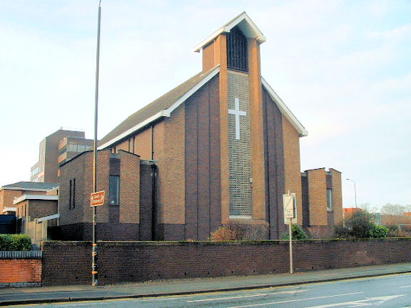
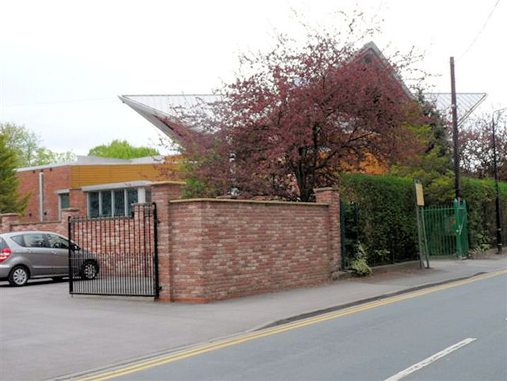
Presbyterian Church of Wales (1903) on Willow Tree Road. SJ 7678 8720. © Mike
Berrell (2012). Link.
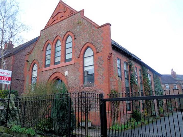
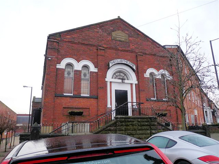
The former
Primitive Methodist Chapel (1875 - 1960) on Oxford Road.
It has been The Club
Theatre since 1962. SJ 7673 8745. © Mike Berrell (2012).
Link.
St.
George, on Church Street. SJ 7674 8818. © Mike Berrell.
Link. Grade II listed -
link.
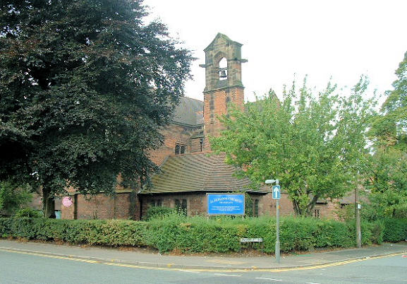
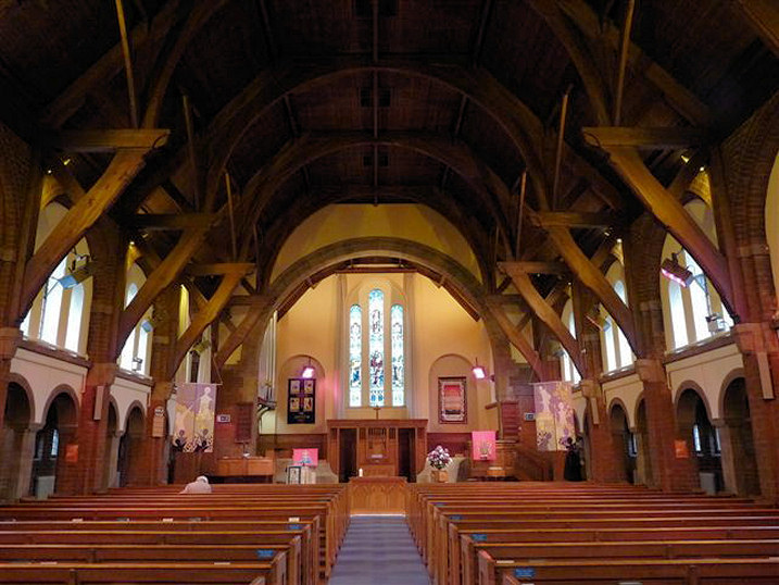
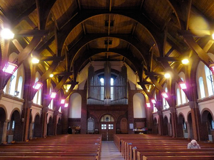
St. John the Evangelist
on St. John's Road. SJ 7662 8737. © Mike Berrell.
Link (pdf).
Grade II listed, wherein it's dated to 1865-6.
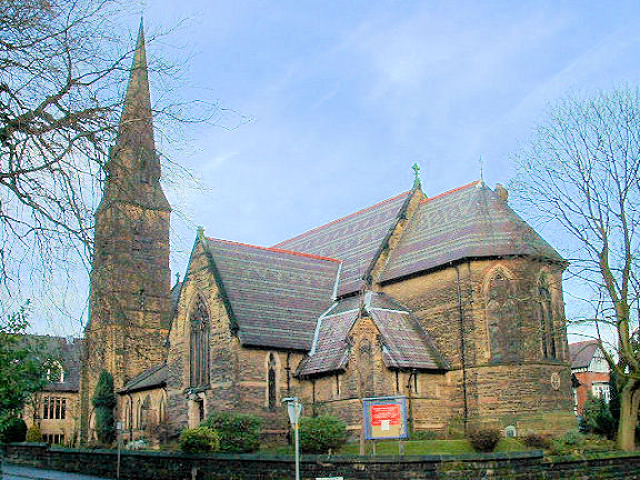
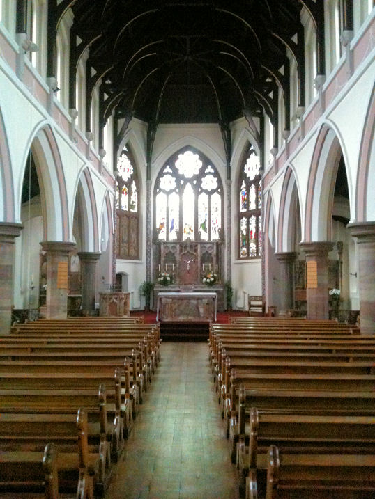
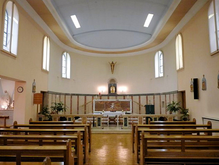
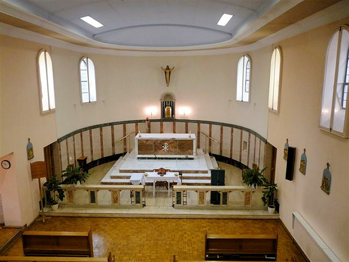
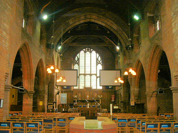
St. Vincent de Paul
(R.C.) on Bentinck Road. SJ 7641 8779. © Mike Berrell.
Interior view, © Carl Hogan (2014). Link.
Former
Salvation Army Hall, on
Central Way. Rob advises that after the Salvation Army left the building,
another church took it over, but on a recent visit, it seems that they too have
gone, the building having been subjected to considerable vandalism. Circa SJ
7673 8785. © Rob Brettle. Ian Harwood advises of another S.A. Hall on New
Street, active up to perhaps the 1960's. or early 1970's. Can you advise exactly
where this was?
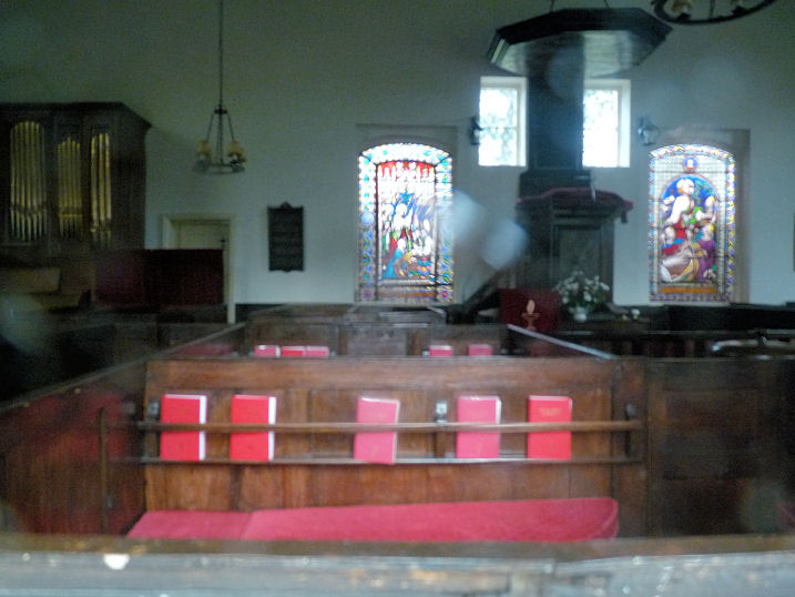
Unitarian Chapel on Dunham
Road. SJ 7664 8803. © Mike Berrell. Two interiors -
1,
2. The
list of ministers
commences in 1814. All © Mike Berrell (2015).
Link.
Another
Unitarian Chapel stood on Shay Lane (now
Shaw's Road). It's shown on a map of 1878 as Unitarian Chapel
(Disused). The covered street market on Central Way is now on the
site, seen by
Streetview in 2022.
The
Upper Room Christian
Fellowship (Bowdon Downs Church), on Bowdon Road.
Another view. SJ 7622
8737. Both © Mike Berrell.
There used to be a
Wesleyan Methodist Chapel on Borough Road.
Genuki dates it to 1884-1966. This source says it had been "entirely
rebuilt" not long before 1935. A building called
Chapel House
(2023 Streetview) now stands on the site.
Bowdon
Bowdon Vale Methodist Church on Priory Street. SJ 7601 8599. © Mike Berrell (2012).
Link.
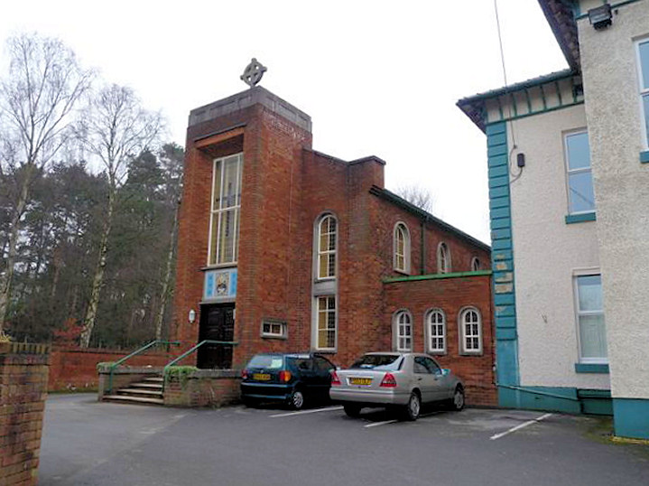
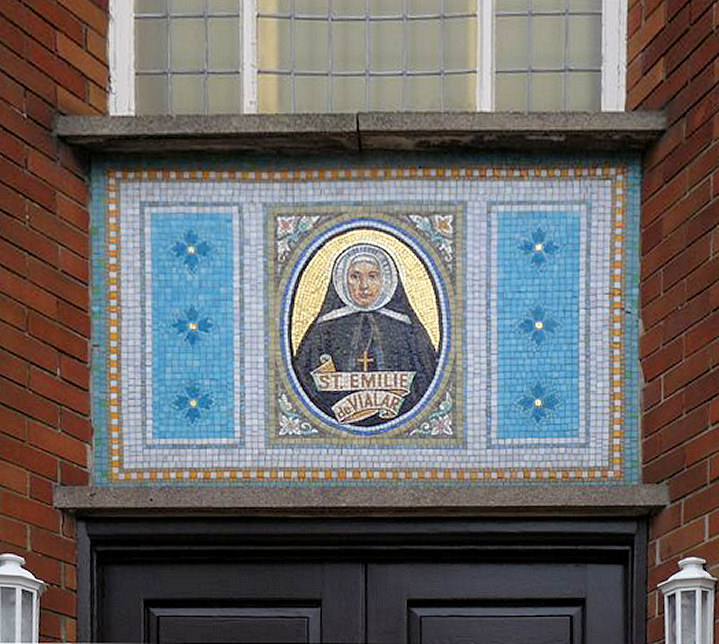
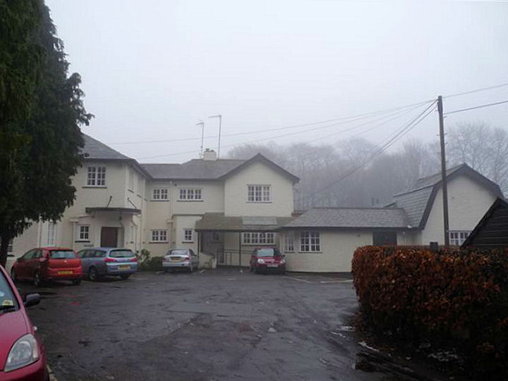
Convent of St Emilie de Vialar (R.C.) and Lady of the Vale Nursing
Home on Grange Road. The mosaic illustration of the saint. Three interior views -
1, 2,
3. SJ 7663 8609. All © Mike Berrell (2012).
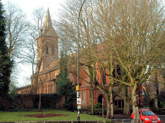
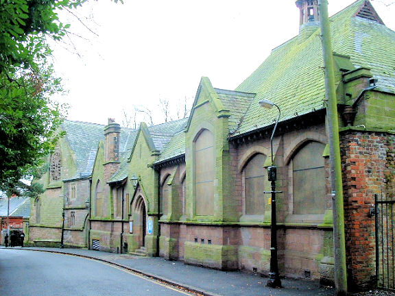
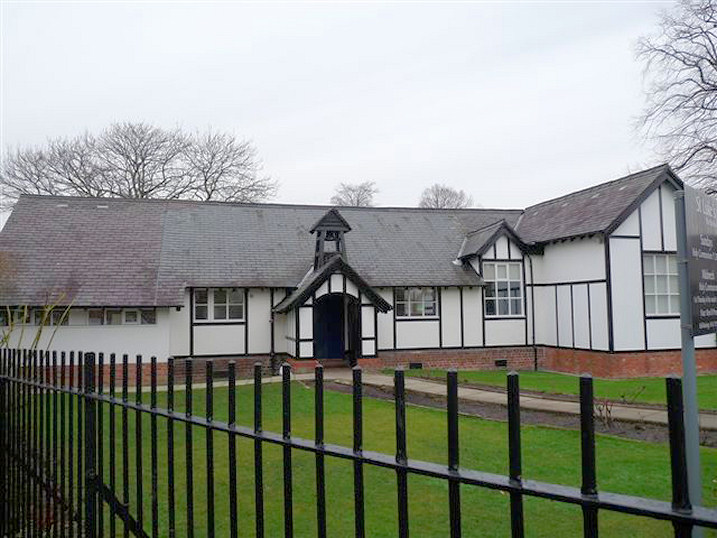
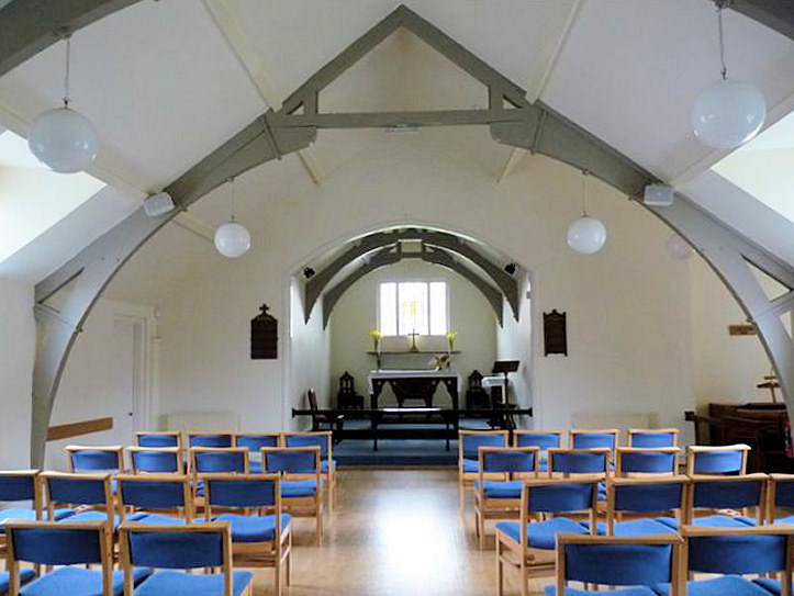
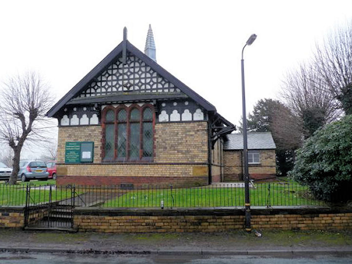
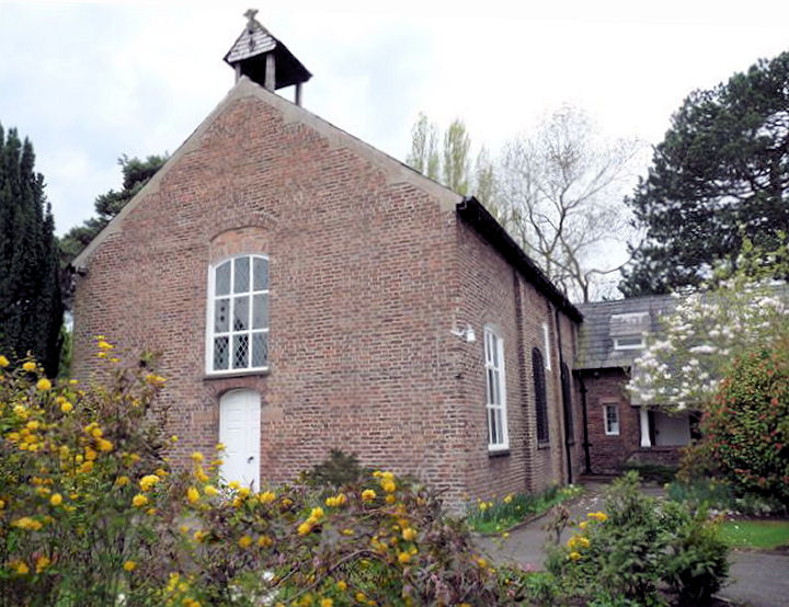
St. Luke on Vicarage Lane.
A map of 1898 labels it as Mission Room. Two interior views -
1, 2. SJ 7603 8617. All © Mike
Berrell (2012). Link.
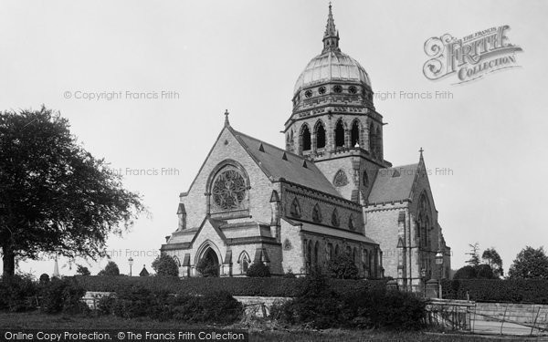
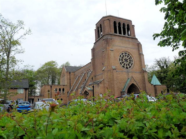
St. Mary the Virgin
on Bowdon Park Road. SJ 7586 8685. © Mike Berrell.
Link.
Grade II* listed. For other listed features associated with the church, see
here.
South Manchester Synagogue
on
The Firs. SJ 7604 8718. © Mike Berrell.
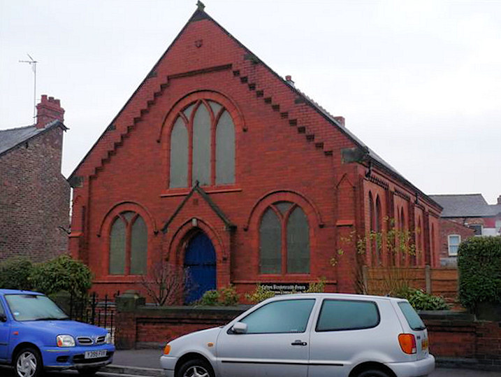
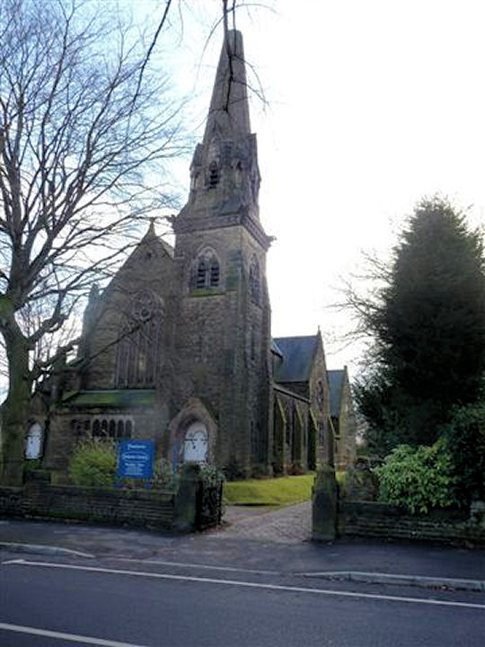
Trinity U.R.C. on Delamer Road.
This has previously been incorrectly listed here as Baptist. On a map of 1898
it's labelled as Presbyterian. Its
grade II listing dates it to 1872. SJ 7640 8728. © Mike Berrell (2010).
My appreciation to Stephen Collins, who has advised (in 2022) that the church
has closed, and been converted into flats, and of this
link, which has interior photos, post-conversion.
A Wesleyan Methodist Chapel used to stand
at the junction of Enville Road and Delamer Road. Ian Harwood advises
that it was known locally Dome Chapel, after its green copper dome. It's dated
here to 1874, was consecrated 6 years later, and still shows as an
active place of worship on a map of 1961. It was demolished in 1968 (source).
There's a photo
here, and the residential property now on the site was seen by
Streetview in
2022. Much more
here (where it's called St. Paul), where Pevsner is quoted as
follows
- This Gothic monstrosity with a crossing dome is being demolished.
One regrets its disappearance. It was the most ambitious ecclesiastical
building in Bowdon.
Broadheath
A Congregational Church
used to stand on Navigation Road at SJ 7678 8899. It's dated by
Genuki to 1860-1972. Since demolished, the building on its site was
seen by Streetview
in 2020.
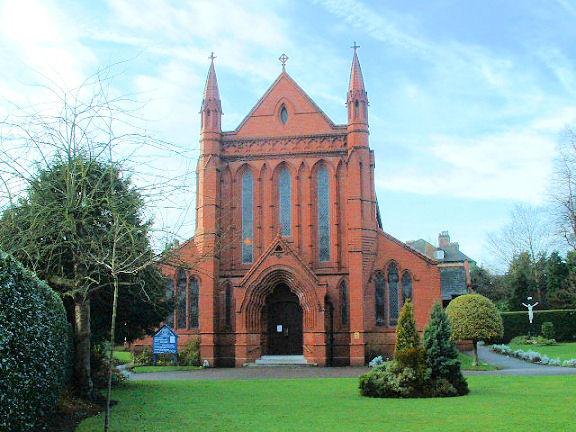
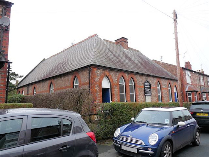
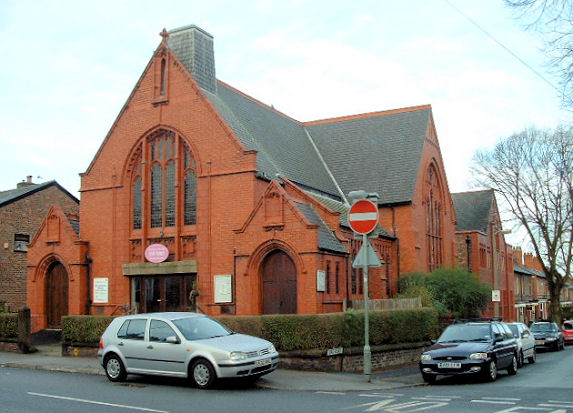
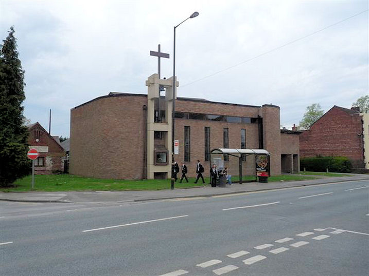
Devonshire Road Evangelical Church. SJ 7657 8888. © Mike Berrell.
Link.
St. Alban
(1900) on Manchester Road. Interior view. SJ 7669
8958. Both © Mike Berrell. Link.
Grade II listed.
Old maps show a Wesleyan Methodist Chapel
on Manchester Road, at SJ 7671 8947.
Genuki dates it to 1897-1966. At some point it was demolished - the
building on the site today can be seen in a
Streetview from
2021.
Dunham Massey
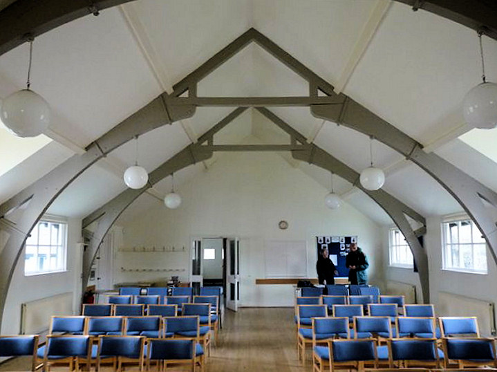
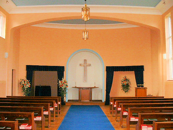
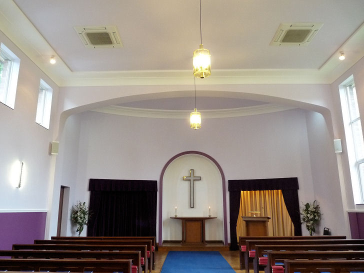
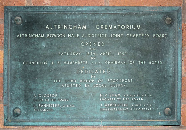
Crematorium Chapel, Altrincham Crematorium and Dunham Lawn Cemetery (1959) on Whitheouse Lane.
Interior view. SJ 7381 8977.
Both © Mike Berrell. Another view, © Mehmood Naqshbandi.
Since Mike took his interior photo, the chapel has been re-decorated as this additional interior shows.
The date-stone. Both © Mike Berrell (2014). Link.
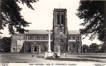
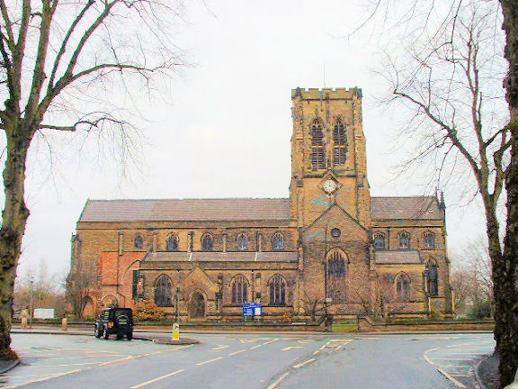
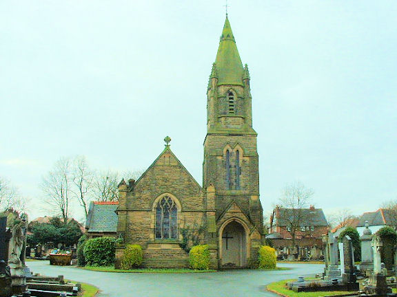
St. Margaret (1853-5), on Dunham Road. SJ 7602 8786.
From an old postcard in Steve Bulman's Collection. A
modern view, © Mike
Berrell. Link1.
Grade II* listed.
Sinderland Green
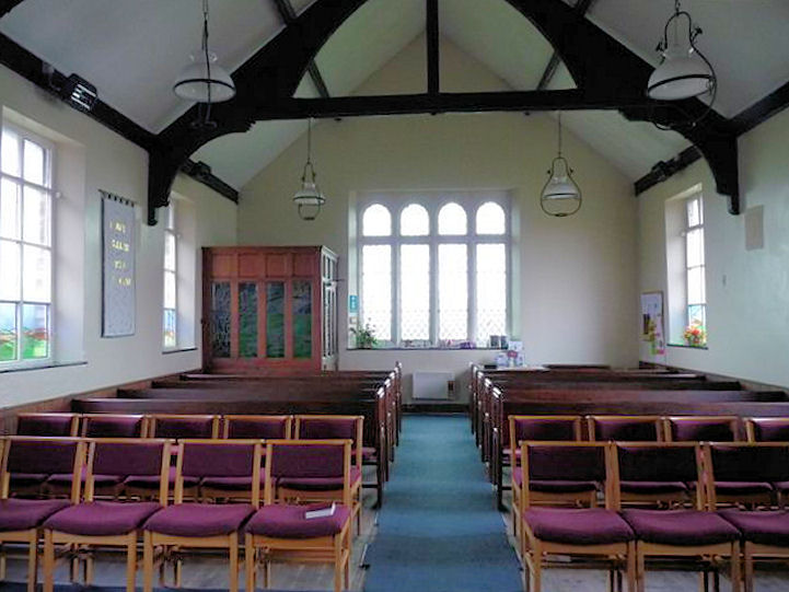
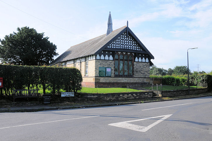
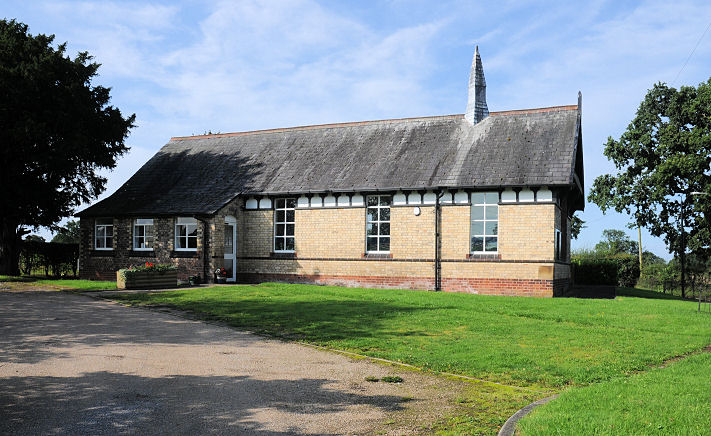
Wesleyan Methodist Chapel (1881) on Sinderland Lane/Red House Lane.
It pre-dates a map of 1898, where it's
shown as Wesleyan. Its
Genuki entry says it was "founded in 1881".
Two interior views -
1,
2. SJ 7326
9000. All © Mike Berrell (2012). Two extra views,
1,
2, both
© Karel Kuča (2019).
Link.
Hale
Altrincham U.R.C. (Trinity Hale Church) on
Cecil Road. SJ 7726 8626. © Mike Berrell.
Two interior views - 1, 2, both
© Mike Berrell (2012).
Link.
Hale Cemetery Mortuary
Chapel, Hale Road. SJ 7797 8684. © Mike Berrell.
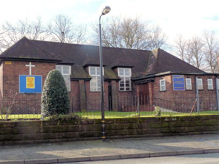
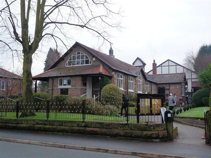
Hale Methodist Church,
on Hale Road. SJ 7735 8713. © Mike Berrell. Since Mike took his photo the
frontage has been rebuilt, and now looks like
this (2022
Streetview).
Islamic Cultural Centre and Mosque (2003) on Grove Lane was
formerly St David's Mission Church (CoE, 1914 - 2002). SJ 7828 8713. © Mike Berrell (2012).
Link.
St. Peter on Harrop
Road. SJ 7736 8655. © Mike Berrell. Link.
Hale Barns
All Saints
on Hale Road. SJ 7914 8589. © Mike Berrell (2010).
Link.
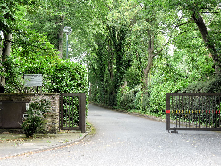
The Brethren's
Meeting Room (Plymouth Brethren Christian Church) isn't visible form
Hale Road on which it stands. Circa SJ 790 862. © Mike Berrell (2014).
Link.
Christian Brothers of
St. Ambrose (R.C.) on Wicker Lane.
Interior view.
SJ 790 859. Both © Mike Berrell (2012).
Hale and District Hebrew Congregation on Shay Lane. SJ 7908 8612. © Mike Berrell (2010).
Link.
Hale Chapel (Unitarian, 1723) on Chapel Lane. SJ 7914 8544. © Mike Berrell (2010).
Interior view (taken through a window), © Mike Berrell (2011).
Link.
Holy Angels
(R.C.) on Wicker Lane. Two interior views -
1,
2. SJ 7904
8597. All © Mike Berrell (2010).
Link.
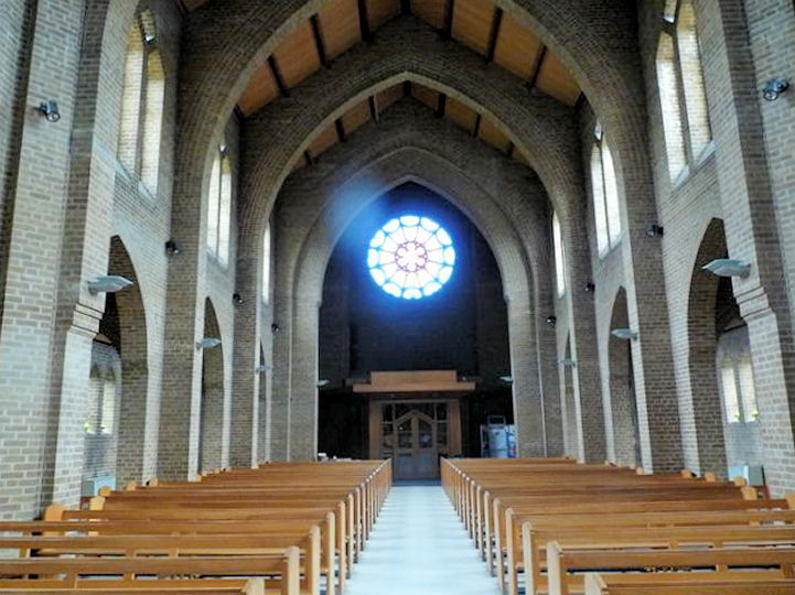
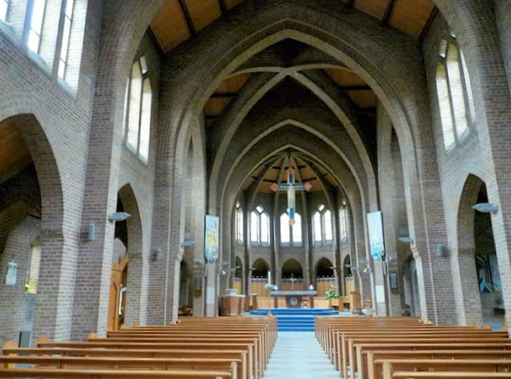
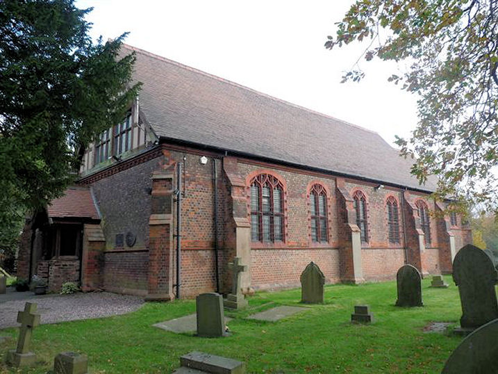
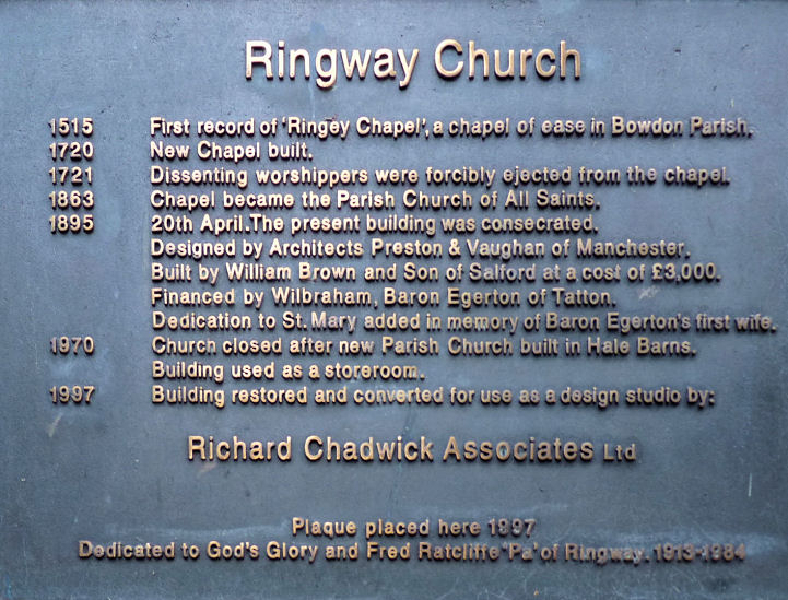
Ringway (see also Ringway,
Manchester)
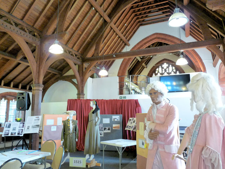
Ringway Life Building (Seventh-day Adventist) on Sunbank Lane was originally All Saints and St.
Mary (built 1895, though the congregation was founded in 1515). A plaque has some history. SJ
8090 8469. © Mike Berrell (2011).
Two interior views -
1,
2, and the
East window.
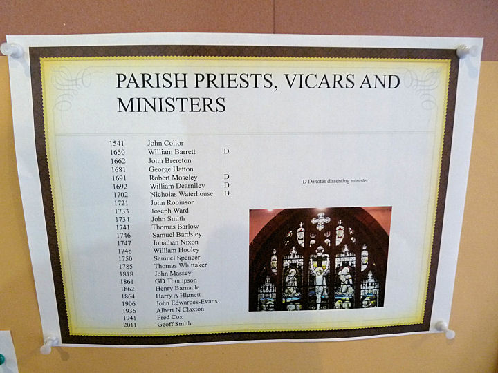
The list of
incumbents commences in 1541. All © Mike Berrell (2015).
Link.
|