|
|
Berkshire
Berkshire on Wikipedia.
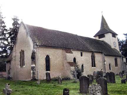
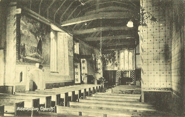
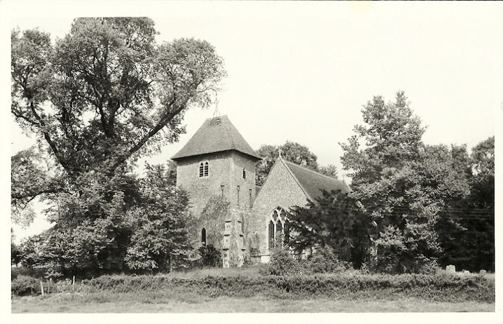
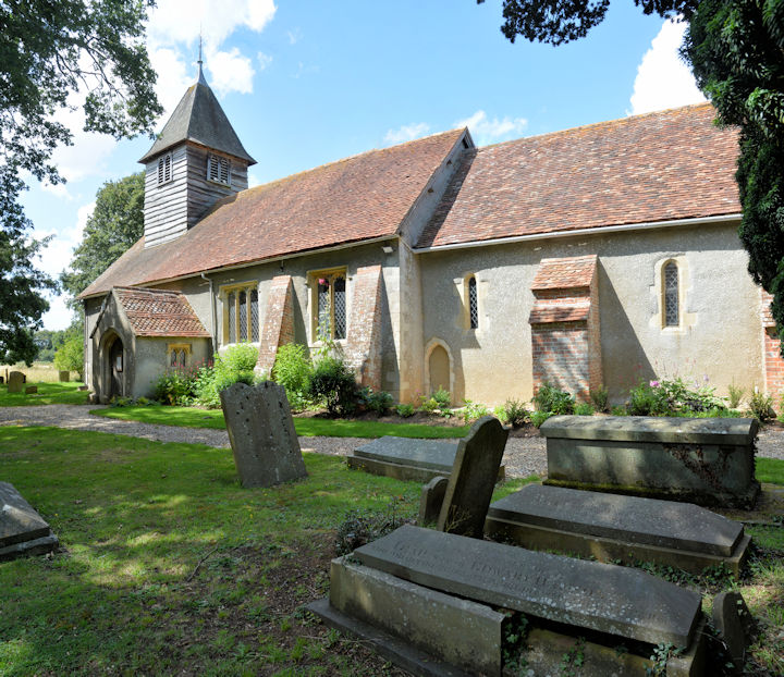
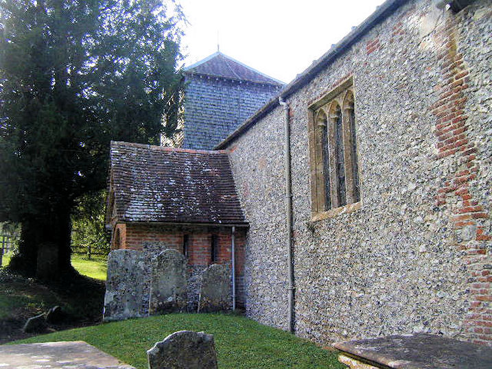
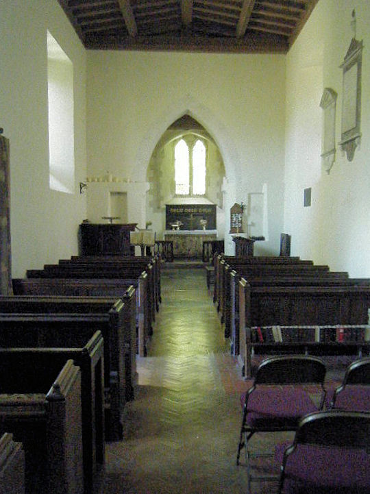
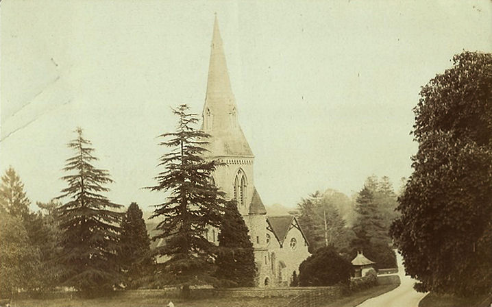
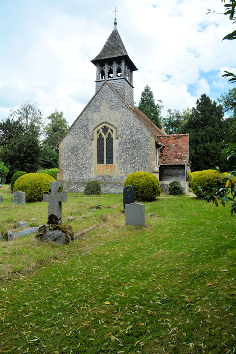
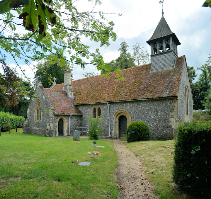
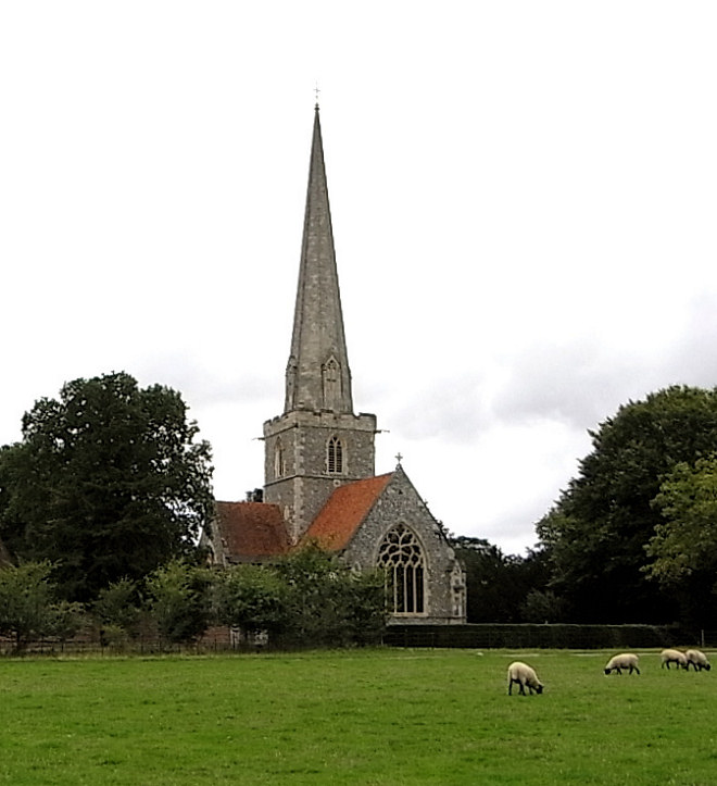
Aldermaston, St. Mary the
Virgin. SU 5966 6498. © Jill Bennett.
Another view, © Roy Graham.
Interior, from an old postcard in
Judy Flynn's collection.
Link.
Grade I listed. For listed churchyard features, see
here.
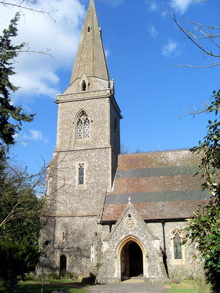
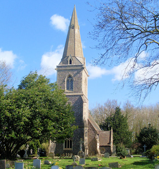
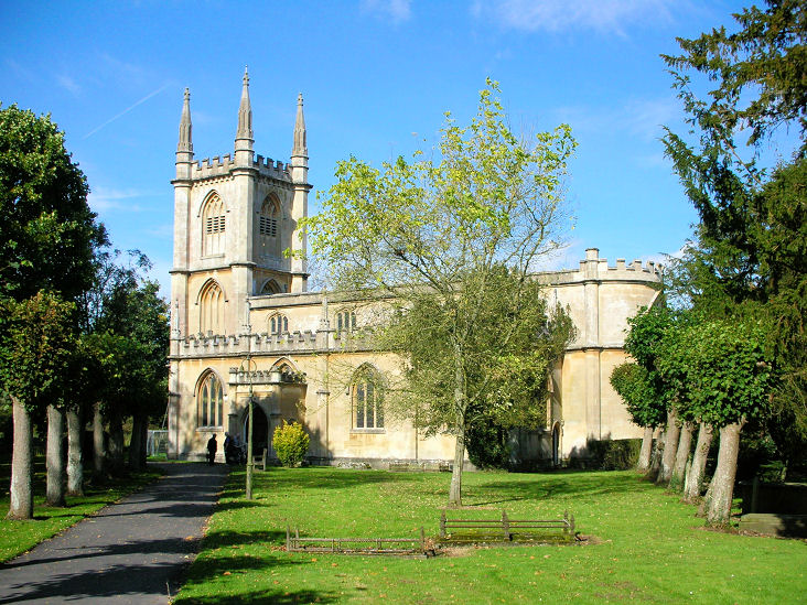
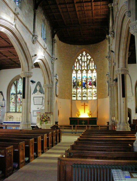
Aldworth, St. Mary the
Virgin. Interior view. SU
5540 7938. Both © Marion Hall.
Another view, from an old
postcard in Judy Flynn's collection.
Link.
Grade I listed. The former
Ebenezer Primitive Methodist Chapel stands
on Ambury Road at SU 5554 7964. It's dated
here to 1864 (closing in the 1940's), successor to an un-located
predecessor of 1835. It was seen by
Streetview in 2010.
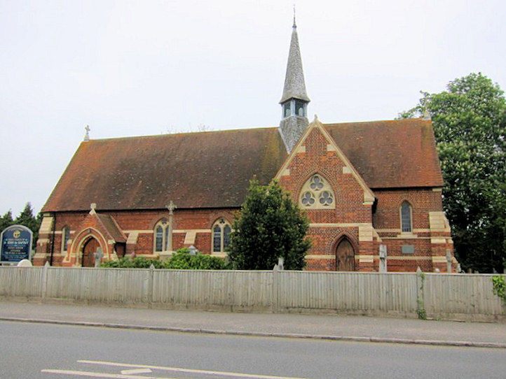
Arborfield, St. Bartholomew dates
from 1862. Another view. SU
7578 6782. Both © Ian Miller.
Link.
Grade II listed. It was preceded by another St. Bartholomew, now
ruinous. It stands about half a mile to the WNW, at SU 7498 6803. It
hasn't been seen by Streetview, but a photo of it is available on its
grade II listing. Another photo can be seen
here.
Ascot.
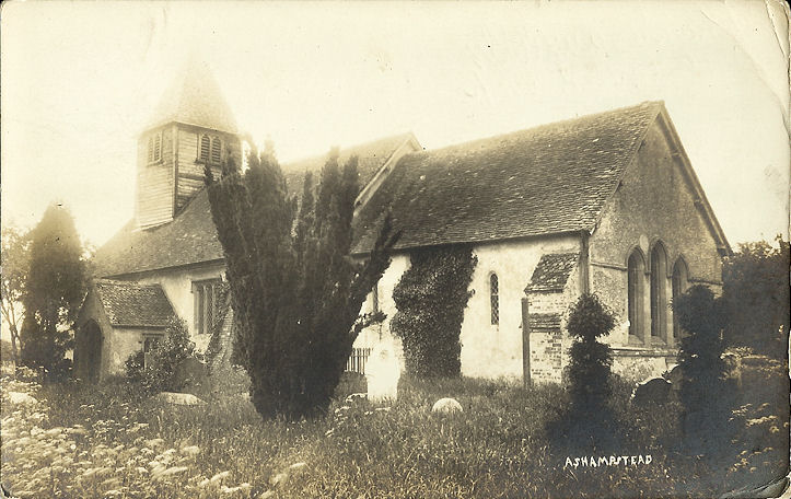
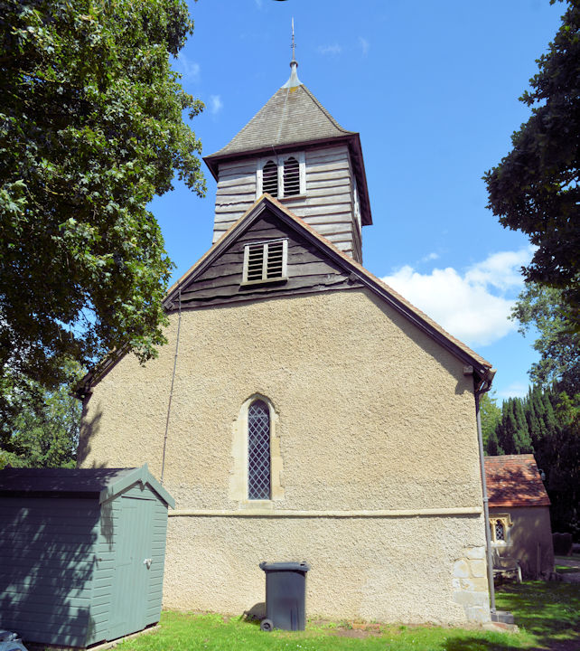
Ashampstead, St. Clement.
Interior view, showing some of the church's fine wall paintings. SU
5641 7679. Both © Marion Hall. An
old postcard view, from Judy Flynn's Collection. Two more
views -
1,
2, both ©
Karel Kuča (2023).
Link.
Grade I listed. Two tombs are listed separately - they can be found
here. A former Baptist Chapel stands on
Chapel Lane, Ashampstead Green, at SU 5649 7734. It's identified
here as Bethel, originally Particular Baptist, of 1834. It was still
active in 1960.
Streetview saw it in 2009.
Avington, St. Mark and St. Luke,
much admired by Pevsner, and Nick! SU 3728 6796. © Nick Hopton.
Link, wherein it says "Avington Church is in private ownership
and is only open to the public during services, usually five times a
year".
Grade I listed.
Barkham, St. James. SU 7839 6642. © Ian Miller.
Two interior views - 1,
2, both ©
Karel Kuča (2023).
Link.
Grade II listed.
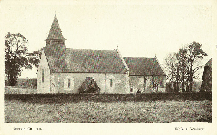
Beedon, St. Nicholas. SU 4823 7812.
From an old postcard in Judy Flynn's collection.
Link.
Grade I listed.
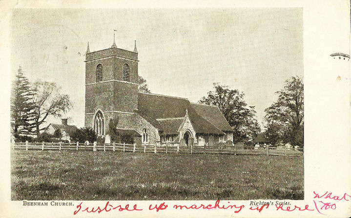
Beenham, St. Mary. SU 5907 6848. From
an old postcard in Judy Flynn's collection.
Link.
Grade II* listed.
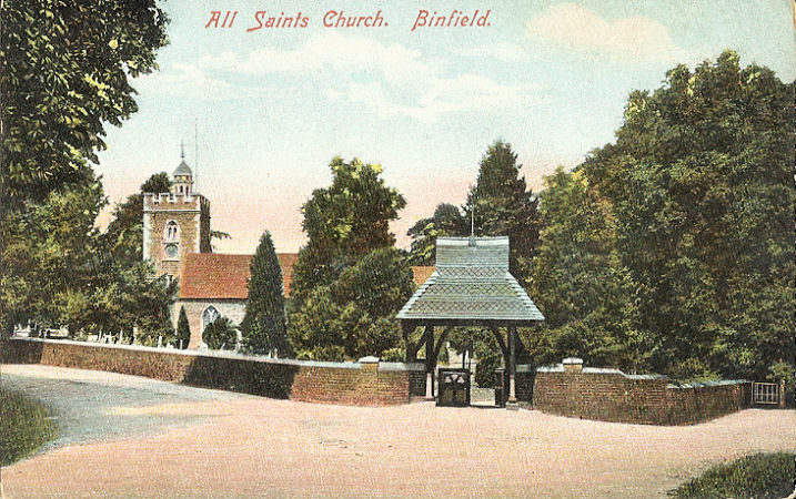
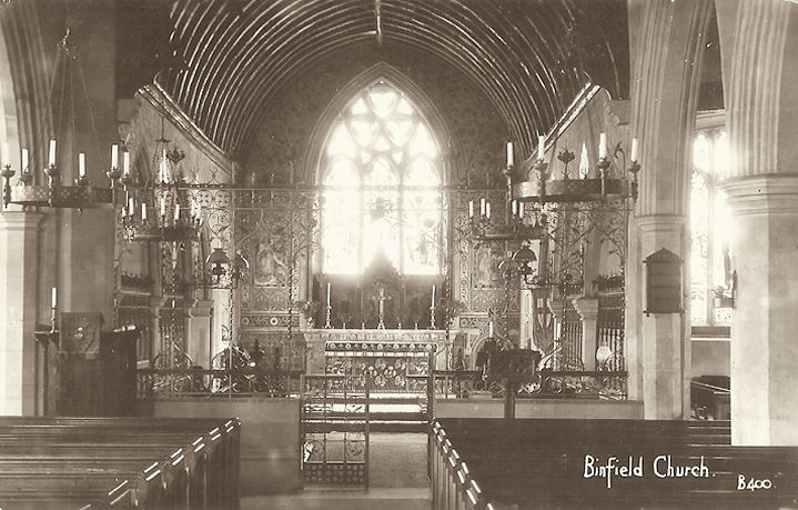
Binfield,
All Saints. Interior view. SU 8455 7216.
Both from old postcards in Judy Flynn's collection.
Link.
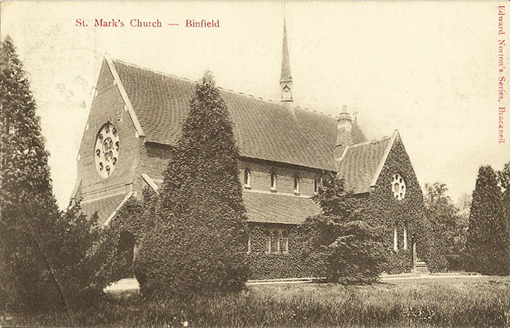
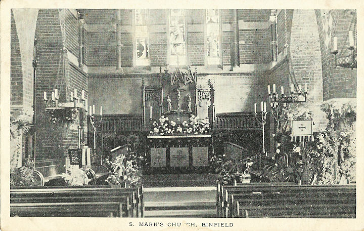
Grade II* listed. St.
Mark, and an interior view. SU 8451 7007.
Both from old postcards in Judy Flynn's collection.
Link.
Grade II listed.
There are also numerous other related listed features
for both churches
here.
Binfield Free Church stands on Chapel Lane at SU
8445 7041. Older maps label it as Mission Chapel. A photo is available
here.
Link. The
history page dates it to
1875. Newbold Seventh-day Adventist Church Church
(aka Newbold Church) meets in
Newbold College of Higher
Education (2025 Streetview) on Popeswood Road. ST 8458 7012.
Link.
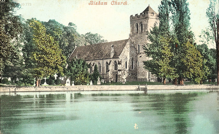
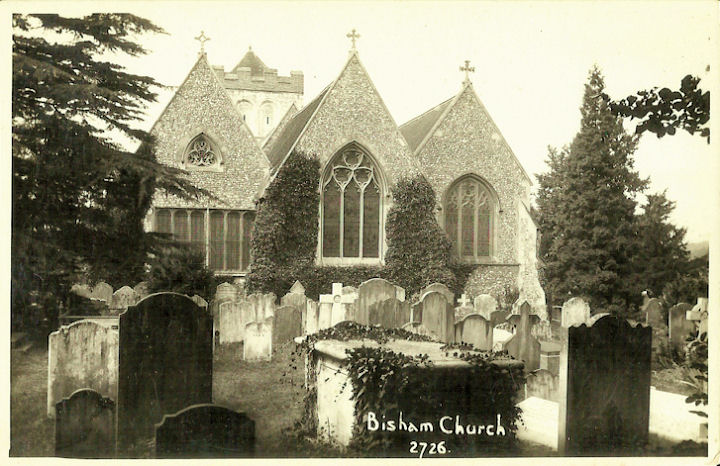
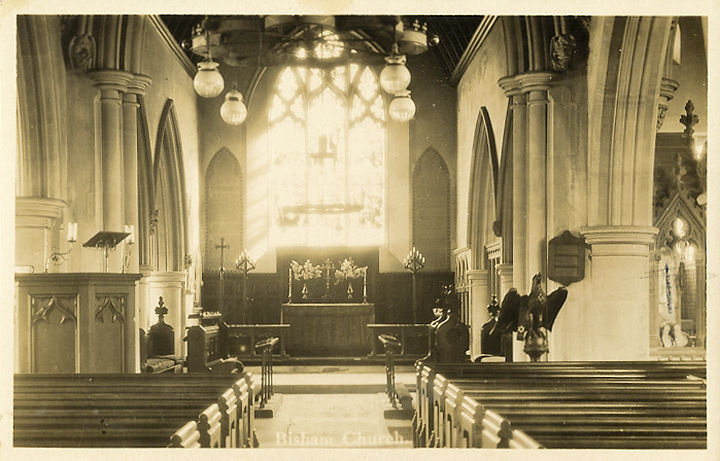
Bisham,
All Saints. Another view, and an
interior view. SU 8480 8541. All from old postcards in Judy Flynn's collection.
Link.
Grade II* listed - has a modern photo. The lych-gate is
also listed, as
grade II. Just a little way south is the site of Bisham Priory/Monastery.
Although O.S. maps label it as Remains of the Abbey of St. Saviour and of St.
Mary A.D. 1138 (Benedictine), the
Bisham Abbey entry on
Wikipedia says "Nothing remains of the abbey church or its associated
buildings". Photos of the Manor House can be seen on Wikipedia. SU 8470 8501.
Boxford, St. Andrew. SU 4287 7163. ©
Nick Hopton.
Link.
Grade II* listed. The several listed tombs can be found
here. A former Methodist Chapel stands on the
road heading north on the west side of the river at SU 4259 7164. Originally
Wesleyan,
Genuki dates it to "before 1810" to "closed after 1977". Now converted to
residential use, it was seen by
Streetview in 2011.
Bracknell.
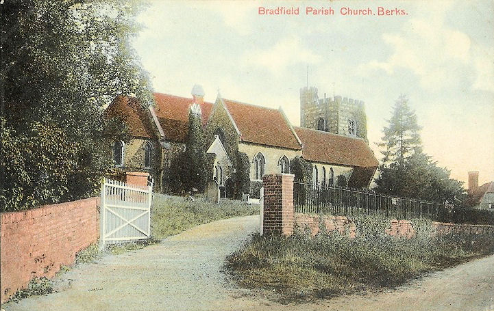
Bradfield,
St. Andrew on Ashampstead Road.
A 2014 BBC
news item records it closure. SU 6034 7258. From an old postcard in Judy Flynn's collection.
Link.
Grade II* listed.
For listed churchyard features, see
here.
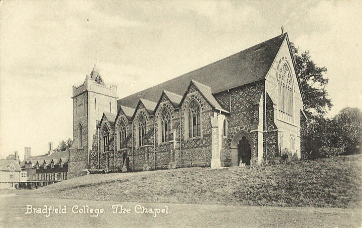
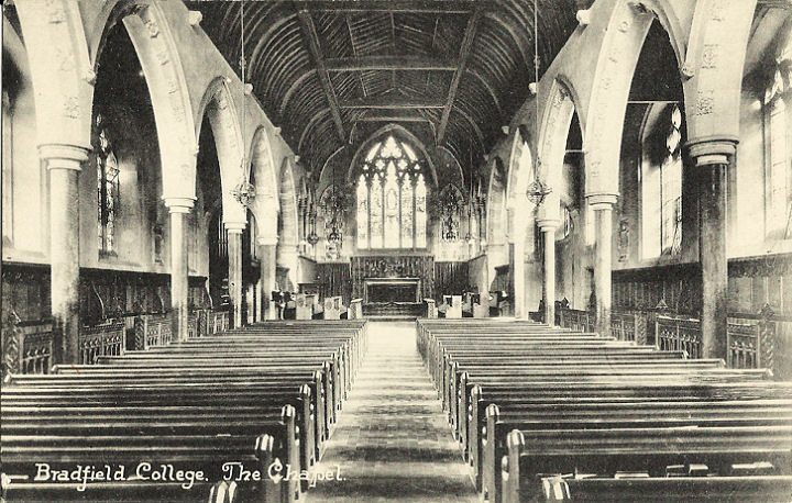
Bradfield College Chapel (1890-1), and an interior view.
SU 6038 7248.
Both from old postcards in Judy Flynn's
collection. A modern view,
© Paul E. Barnett (2022).
Grade II listed.
St. Simon and St. Jude was the chapel
for the mostly demolished Bradfield Union Workhouse, which stood about half a
mile south of the village. The chapel has also gone - it stood within the
woodland area seen in a
Streetview from 2021.
Genuki provides dates of 1835-1960's. I haven't been able to find a photo of
it. SU 6051 7156.
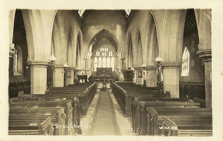
Bray, St. Michael. SU 9017 7970. ©
Barbara Barklem.
Another view, from
© Christopher Skottowe (1950).
An
interior view, from an old postcard in
Judy Flynn's collection.
Link.
Grade II* listed.
Jesus Hospital Chapel. SU 9019 7936.
Also from Judy Flynn's collection.
Grade I listed.
Cemetery Chapel. SU 9041 7843. ©
Paul E. Barnett (2016).
Brightwalton, All Saints. SU
4271 7930. From an old postcard in Reg Dosell's Collection. A
modern view, © John and Judy Flynn.
Link.
Grade II* listed, wherein it's dated to 1862, by Street. A former
Methodist Chapel (originally Wesleyan) stands in Brightwalton Green, at
SU 4266 7863. Genuki dates it to before 1819
to after 1974. It was seen by
Streetview in 2011.
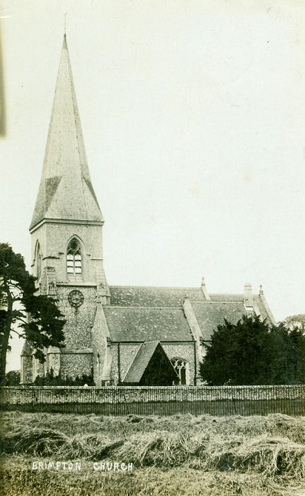
Brimpton, St. Peter (1868, on an
older site). © Jill Bennett. Another view.
SU 5573 6470. © Roy Graham. An old
postcard view (card franked 1911) from Reg Dosell's Collection.
Link.
Grade II listed.
Bucklebury, St. Mary the Virgin.
SU 5530 7086. © Jill Bennett. Link.
Grade I listed. Several tombs are listed separately
here.
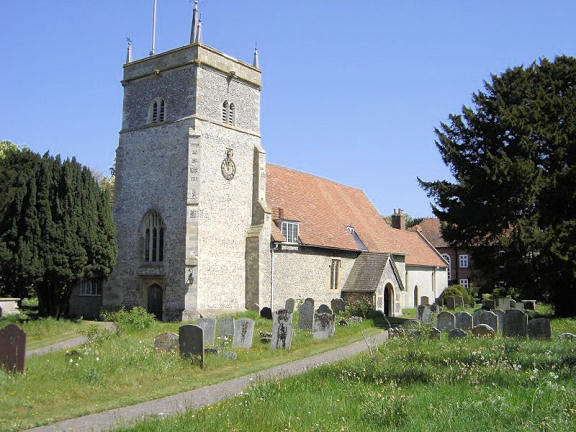
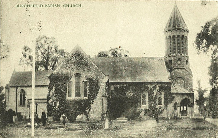
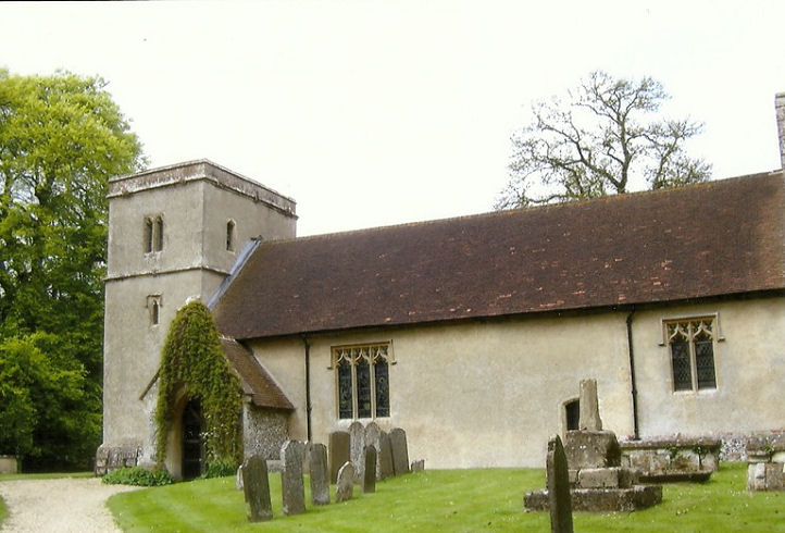
Burghfield, St. Mary the Virgin on
Church Lane. SU 6710 6839. From an old postcard in Judy Flynn's collection.
Link.
Grade II listed.
Caversham.
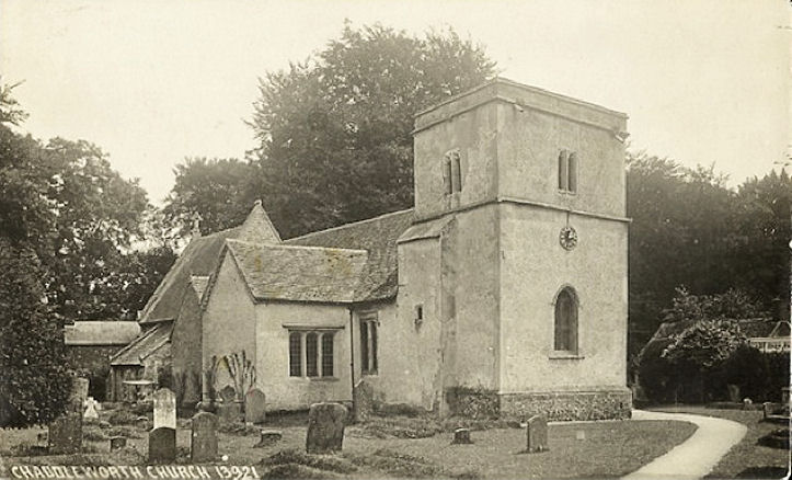
Chaddleworth, St. Andrew.
SU 4115 7793. © John and Judy Flynn. An
old postcard view, from Judy Flynn's collection.
Link.
Grade I listed. For listed features in the churchyard, see
here. A former Methodist Chapel stands on Tower
Hill at SU 4128 7766. It's labelled on a map of 1899 as Wesleyan, and on large
scale maps, it can be seen to have consisted of two separate buildings. The more
northerly one, is seen here
by Streetview in 2010. Its neighbour stood where the
house driveway is, seen in
2011. Whether these were both chapels, or a chapel and a schoolroom is unclear.
Map evidence suggests it was closed by 1959.
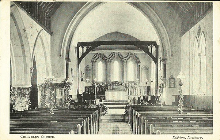
Chieveley, St. Mary the
Virgin, as seen by Streetview in 2009. Its
grade II* listing has better images. SU 4744 7409.
Interior view, from an old postcard
(franked in 1915) in Judy Flynn's Collection.
Link. A
former Wesleyan Methodist Chapel (or the building
which replaced it) stands on Graces Lane at SU 4772 7377. It was seen by
Streetview in 2009.
Genuki has dates of "founded before 1804" and closing "after 1915". The
village also had a Primitive Methodist Chapel, on
High Street, at SU 4757 7389. It has a date-stone for 1914.
Link says it was closed in the 1970's. The same source dates its predecessor
to 1804. This must surely be the P.M. Chapel marked on a map of 1899 on Green
Lane at SU 4765 7355. Evidently demolished, its
site was seen by Streetview
in 2009.
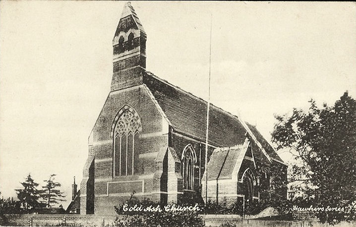
Cold Ash, St. Mark. SU 5109 6996. ©
Jill Bennett. An old postcard view,
from Judy Flynn's collection.
Link. There used to be a
Primitive Methodist Chapel on Collaroy Road, at SU
5137 6949. This
source (with photo) dates it to 1824, though the P.M.'s only moved in in
1837 (who had it before?), with closure in 1969 and subsequent demolition. The
houses built on the site can be seen in a
Streetview from 2021.
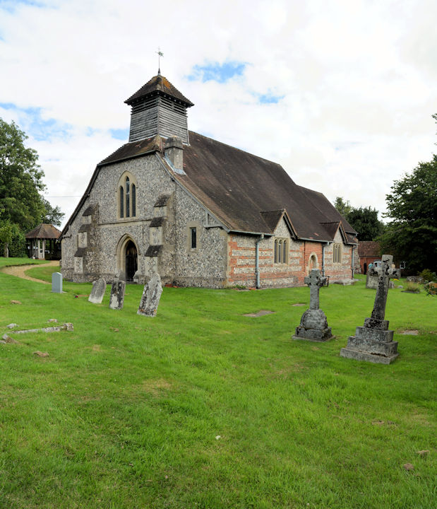
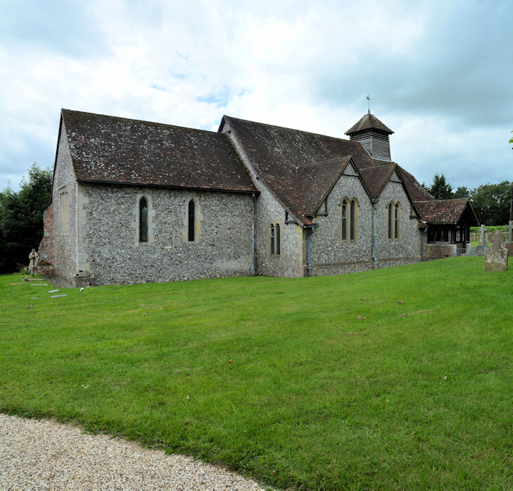
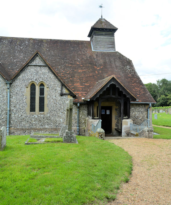
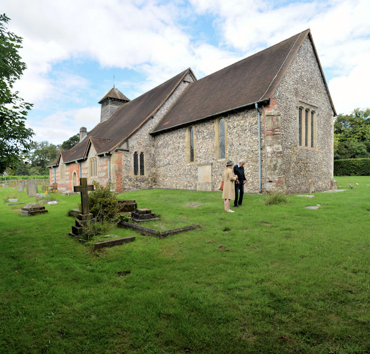
Combe, St. Swithun, and the
interior. SU 3681 6074. All
© Chris Kippin (2018). Two more views - 1,
2, and
another interior, all ©
Karel Kuča (2023).
Link.
Link2.
Grade I listed. For related listed features see
here.
Compton, St. Mary and St. Nicholas.
SU 5263 7966. From an old postcard in Judy Flynn's Collection.
Link.
Grade II* listed. Old O.S. maps mark Salem Chapel
on High Street, at SU 5208 7994.
Genuki,
which says it was Baptist, provides dates of "before 1877" to "closed before
1912". Streetview saw the
site in 2012 - does anything of the chapel survive? The village also has a
former Methodist Church, on Newbury Lane at SU 5178
7969. Streetview saw it in
2009, where a date-stone can be seen (not closely enough to read it), with
another sign below saying Rebuilt 1869. It was Primitive Methodist, with
Genuki
dating it to "before 1836" to "after 1979".
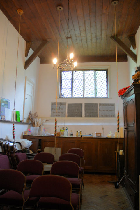
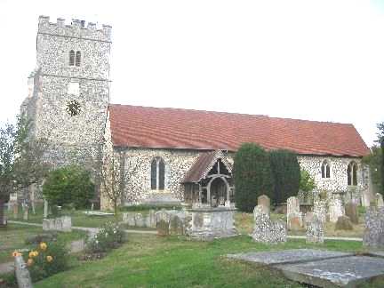
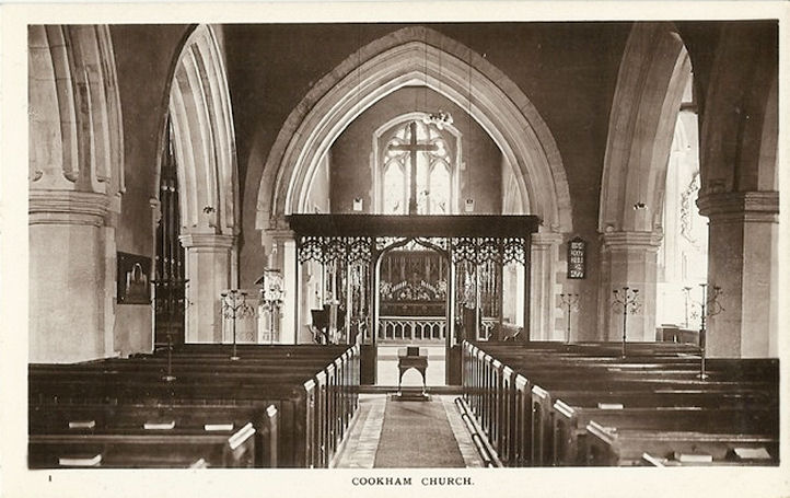
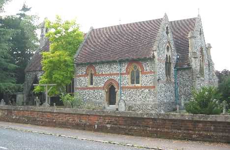
Cookham, Holy Trinity. SU 8971 8551.
© Barbara Barklem. Interior view,
from an old postcard in Judy Flynn's Collection.
Link.
Grade II* listed. The Wesleyan predecessor of
the present Methodist Church in Cookham Rise stands on Sutton Road and High
Street. Now the Stanley Spencer Gallery, it was seen by
Streetview in 2021. It's
dated here
to 1846. SU 8970 8533.
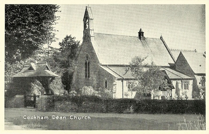
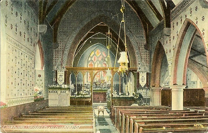
Cookham Dean, St. John the
Baptist. SU 8714 8511. © Marion Hall. Old postcard views of the
exterior and
interior, both from old postcards in Judy Flynn's Collection.
Link.
Grade II listed, wherein it's dated to 1849. Older O.S. maps mark a
Primitive Methodist Chapel less than ¼ of a mile to the north of the
church, at SU 8709 8548. Its My Primitive Methodists
entry dates it to 1858 (a re-build of an earlier chapel of 1842) until 1972.
An old photo is available
here (click
on the Our History tab). A building survives on the site (though with a
slightly different footprint), but Streetview hasn't seen it.
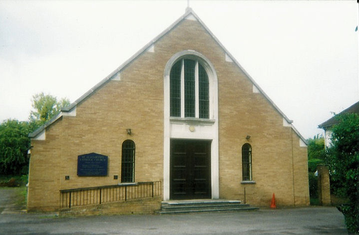
Cookham Rise, St. Elizabeth (R.C.)
on Lower Road. SU 8824 8520. © John and Judy Flynn.
Link. The
history page dates
it to 1884, with several later extensions. The
Methodist Church is also on
Lower Road, and was seen by Streetview in 2021. It was originally Wesleyan, of
1905. SU 8856 8508.
Link.
Cranbourne, St. Peter. SU 9267
7216. © Barbara Barklem. Link.
Grade II listed. The war memorial in the churchyard is listed as
grade II. A small former Wesleyan Methodist Chapel
stands on North Street, at SU 9269 7292.
Genuki dates its foundation to 1865 (I think the date-stone says
1867), and closed after 1933. It was seen by
Streetview in 2021.
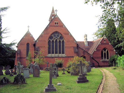
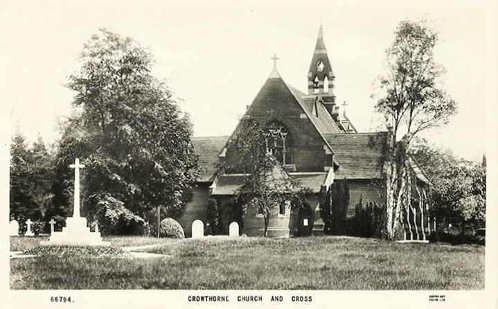
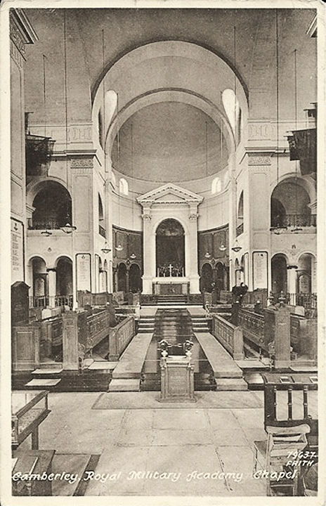
Crowthorne, St. John the Baptist.
Its
grade II listing dates it to 1873-90. SU 8379 6393. © Roy Graham. Old
postcard views of the exterior and
interior, both from old postcards in Judy Flynn's Collection. Judy advises
that the small apse showing on the first postcard has been replaced with a large
square extension. Link.
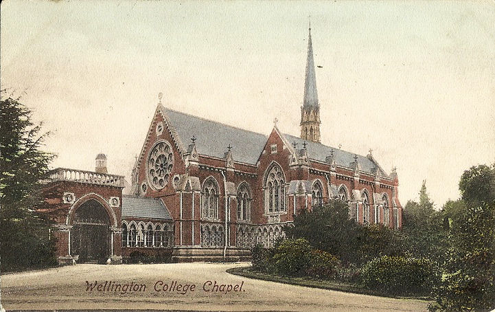
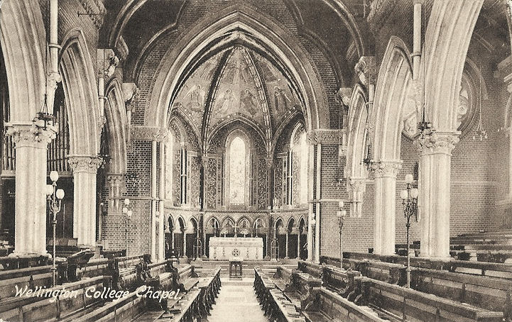
Wellington College Chapel (from a
postcard dated 1907). Interior view
(dated 1920). SU 8323 6340. Both from old postcards in Judy Flynn's collection.
The
Methodist Church, on B3348,
as seen by Streetview in 2021. Old maps label it as Wesleyan. SU 8416 6420.
Link (has interior views
- use arrows). The Baptist Church is on High
Street, at SU 8406 6394. It was seen by
Streetview in 2019.
Link. This page dates it to
1953, with a later frontage, successor to an earlier chapel (1914, un-located)
of which there is a photo. Holy
Ghost (R.C., seen by Streetview in 2021) is on New Wokingham Road. SU 8334
6434. Link.
Wokingham Vineyard Church meets in Edgbarrow School on Sandhurst Road (a
general view of the school,
from Streetview in 2021). Circa SU 841 633.
Link.
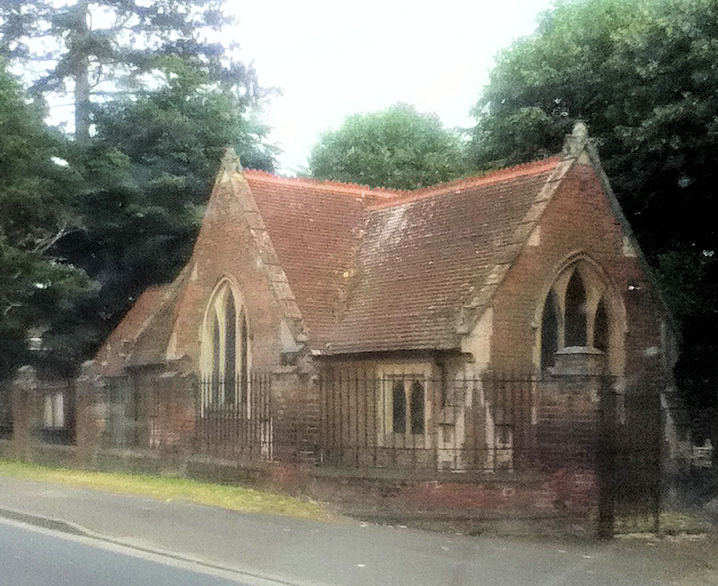
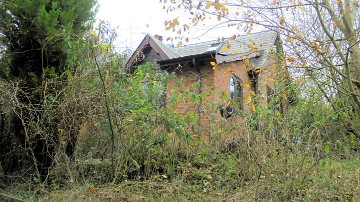
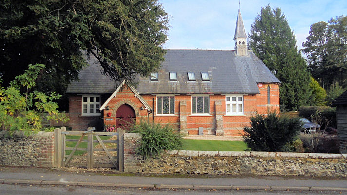
Curridge, the former Curridge
Mission Church, now part of a school.
Another view. SU 4900 7173. Both © Victor Markham.
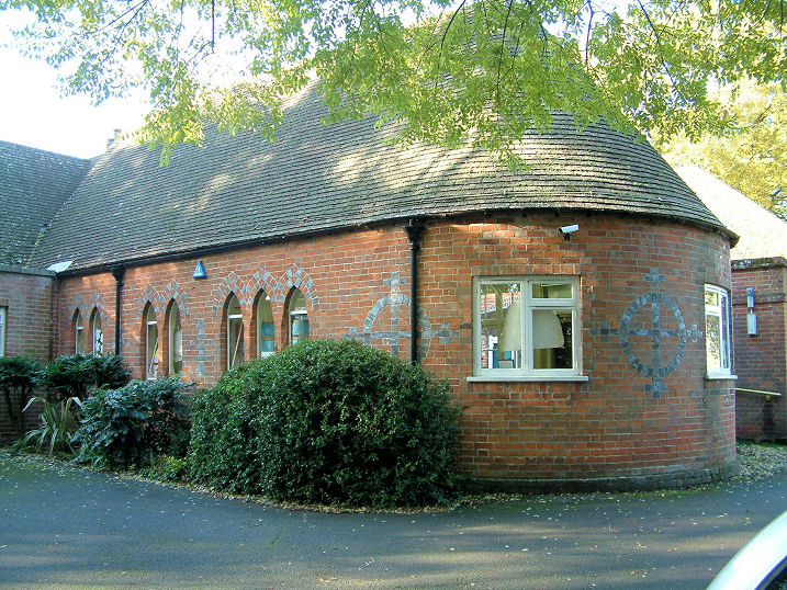
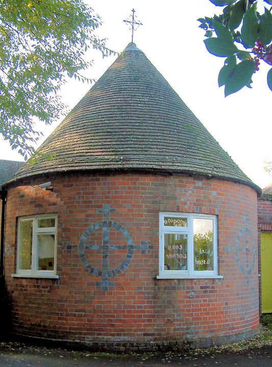
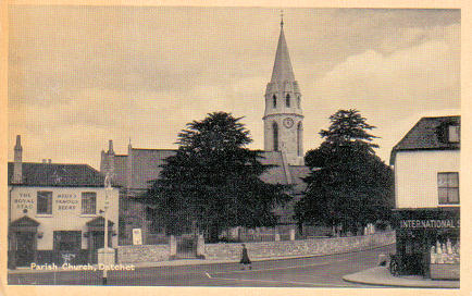
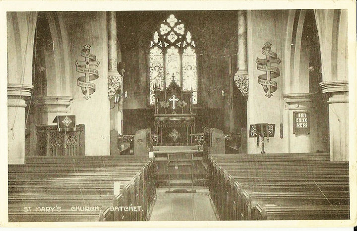
Datchet, St. Mary the Virgin. SU 9882 7712. From an old postcard
in Steve Bulman's Collection. Another old
postcard view, this one from Reg Dosell's Collection. This
interior view, also from an old postcard, is from Judy Flynn's collection.
Link.
Grade II listed. St.
Augustine (R.C.) on Eton Road, as seen by Streetview in 2011. SU 9818 7796.
Link. The Cemetery on Ditton Road
has a Mortuary Chapel, at SU 9970 7705. It was seen
by Streetview in 2022. The
Baptist Church on London
Road, as seen by Streetview in 2022.
Link. The
history page
doesn't date the present church, but it does have an old photo of its
predecessor, which pre-dates a map of 1881. It's unrecognisable today as a
former church - 2022 Streetview.
SU 9873 7697.
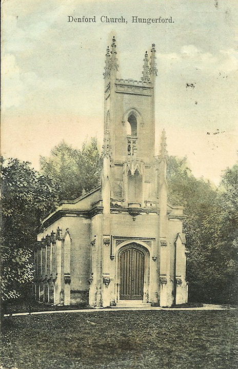
Denford, the demolished Holy Trinity
(1832 - 1956). This stood in the grounds of the Denford Park House. Its site
hasn't been seen by Streetview. SU 3603 6928. From an old postcard (franked in
1909) in Judy Flynn's Collection.
Link1.
Link2.
Earley, Reading - see the
Reading page.
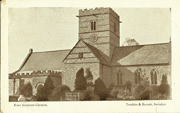
East Garston, All Saints. SU 3613
7706. From an old postcard in Judy Flynn's collection.
Link.
Grade II* listed.
East Ilsley, St. Mary. SU 4933 8092.
© Tim Tomlinson.
Another view, © Bill McKenzie. Link.
Grade I listed. For other listed features in the churchyard, see
here. The Baptist Church
on Cow Lane, as seen by Streetview in 2021. Streetview suggests that it has
closed; the National Archives
references
documents pertaining to the church for the years 1832-2012 which may support
this. SU 4937 8115. St. Patrick
(R.C.) on Old Stanmore Road, seen by Streetview in 2009.
Link,
which advises that it is an old barn, converted in 1947. SU 4915 8102.
East Shefford (aka Little Shefford), St.
Thomas Old Church - now in the care of the Churches Conservation Trust. A photo
is available
here. The interior, from an
old postcard in Judy Flynn's collection. SU 3906 7468.
Link.
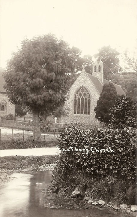
Eastbury, St. James the Great
(1951-3). Interior view. SU 3461
7719. Both from old postcard in Judy Flynn's collection.
Link.
Grade II listed. O.S. maps mark Site of Church
at SU 3478 7717. This will be the Chapel of St. James, mentioned
here as
being ruinous in 1786. Its site isn't well seen on Streetview, but it stood
somewhere within the trees seen in the background
here in 2009. There used to
be a Wesleyan Methodist Chapel at SU 3469 7716. The
National Archives
references
documents pertaining to the chapel for the years 1822-1966. Housing now stands
on the site, seen here by
Streetview in 2009. There was also a Primitive Methodist
Chapel, at SU 3477 7710. It's dated
here to 1839. Might it survive? - see
here in a Streetview from
2009.
Easthampstead - see Bracknell.
Eddington, St. Saviour. Dedicated
in 1868, it was closed circa 1956 (according to this
site, which has numerous photographs), and has since been converted to
residential use. SU 3442 6914.
© Chris Kippin (2018).
Interior view, from an old postcard
(franked 1917), in Judy Flynn's collection.
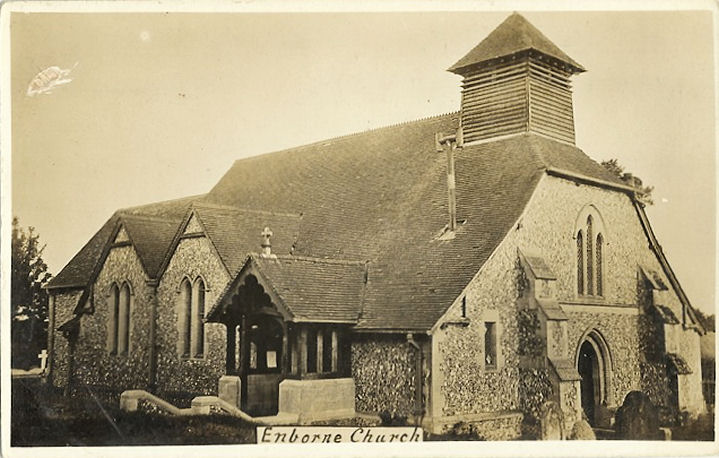
Enborne, St. Michael and All Angels.
SU 4358 6577. From an old postcard in Judy Flynn's collection. Four modern views
- 1,
2, 3,
4, all ©
Karel Kuča (2023).
Link.
Grade I listed.
Englefield, St. Mark.
Interior view. SU 6237 7200. Both from old postcards in Judy Flynn's
collection. Link.
Grade I listed. For the listed lych-gate and tombs, see
here.
Eton.
Eton Wick, St. John the Baptist. SU
9519 7834.
Link.
Grade II listed, which dates it to 1866-7 by Blomfield.
St. Gilbert
(R.C., built in or before 1964, when the church was blessed).
Another view. SU 9485 7844.
Link, which announces its closure in 2019. All © Martin Richter (2012). The
Methodist Church, as seen by Streetview in 2018, is on Alma Road. It
has a date-stone for 1886, as Primitive Methodist. SU 9468 7865.
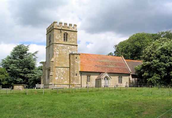
Farnborough, All Saints, with Norman nave and Perpendicular
tower. SU 4352 8194. © Nick Hopton.
Link.
Grade I listed. A cross base in the churchyard is listed as
grade II.
Fawley, interior view of St. Mary.
SU 3912 8138. From an old postcard in Judy Flynn's collection. This
link has an exterior photo.
Grade II listed.
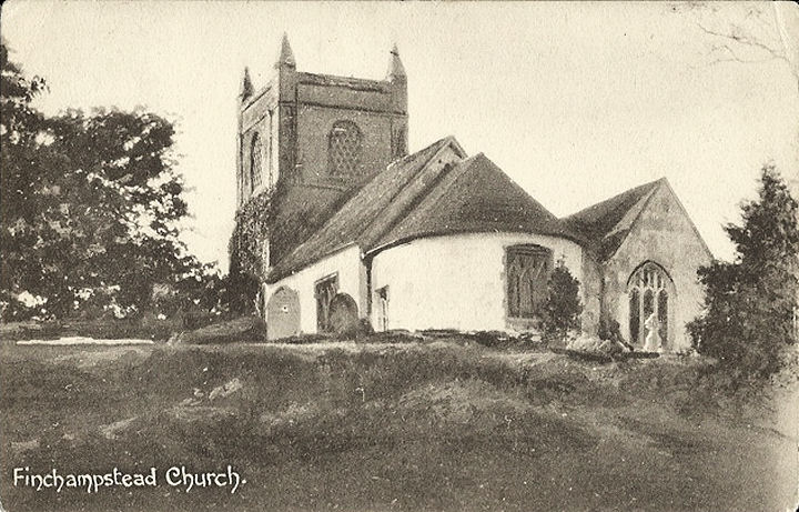
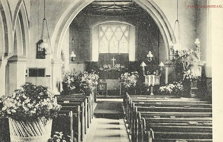
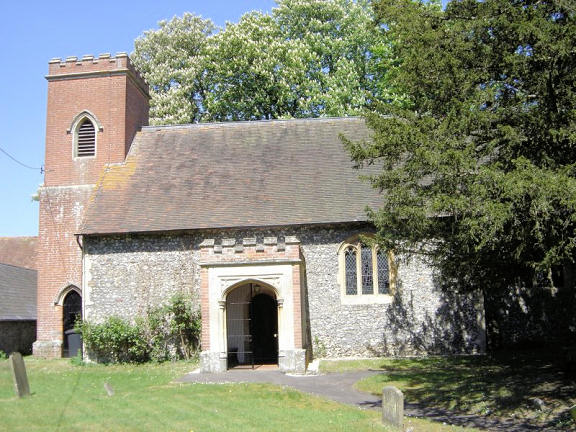
Finchampstead, St. James.
Interior view. SU 7928 6381. Both from old postcards in Judy Flynn's
collection. Link.
Grade I listed.
Frilsham, St. Frideswide.
Another view. SU 5380 7320. Both © Jill Bennett. An old
postcard view (franked 1909), from Judy Flynn's collection.
Link1.
Link2.
Grade II* listed.
Great (or West) Shefford, St. Mary. SU 3801 7537. From an old
postcard in Reg Dosell's Collection. Link.
Grade II* listed. The 25" O.S. maps of 1880 and 1899 show two adjacent
Methodist Chapels on Wantage Road. These were Wesleyan,
at SU 3854 7524, and Primitive at SU 3855 7524.
Their site was seen by
Streetview in 2009. Photos of the P.M. are available
here. One of these chapels (probably the P.M.) had closed or been demolished
by the time of a map of 1960. A new chapel had been built by this time, a little
further east, at SU 3859 7525. I've been unable to discover its affiliations.
Its site was seen by
Streetview in 2021.
Greenham, St. Mary the Virgin.
Interior view. SU 4859 6571. Both from old postcards in Judy Flynn's
collection, the interior one is franked 1904.
Link.
Grade II*listed.
Church of Jesus Christ of
Latter-day Saints on Pinchington Lane, barely glimpsed on a Streetview of
2009. Better is the photo
here. SU 4830 6525.
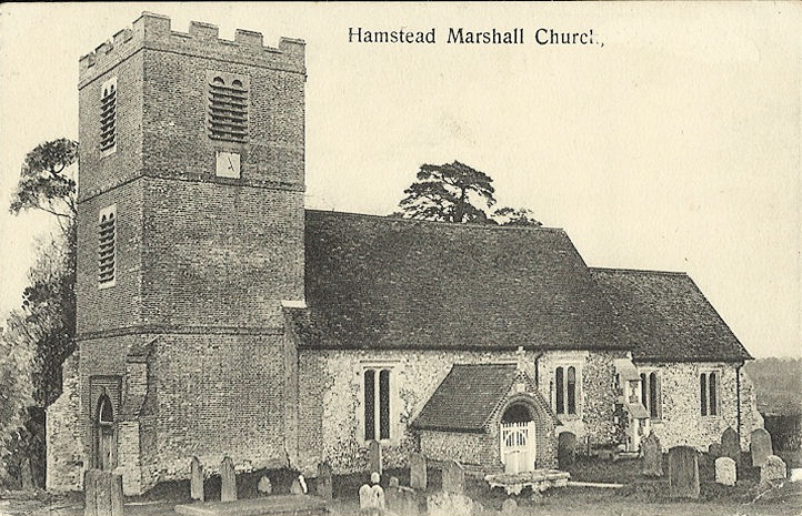
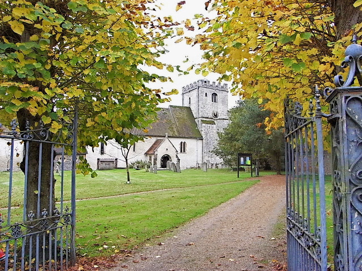
Hampstead Marshall, St.
Mary. SU 4200 6674. © Nick Hopton. An
old postcard view, from Judy Flynn's collection.
Link.
Grade II* listed.
Hampstead Norreys, St. Mary the Virgin. SU 5293 7626. ©
Marion Hall.
Link.
Grade I listed. For listed churchyard features, see
here. A former Primitive Methodist Chapel
stands to the south-west of the village, at SU 5226 7604. Genuki dates
it to "before 1851" to "after 1920". It was seen by
Streetview in 2011.
The village also had a Wesleyan Methodist Chapel,
which Genuki dates to "before 1802" to "after 1960", but
here (where there is a photo) it says 1854. A
2014 Streetview. SU
5296 7631.
Heathlands, St. Sebastian
(1864). SU 8245 6545. From an old postcard in Judy Flynn's Collection. A
modern view, from Streetview in 2009.
Link.
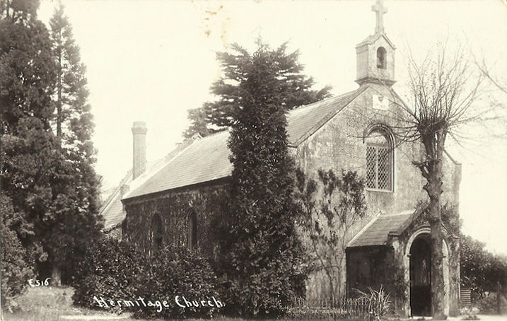
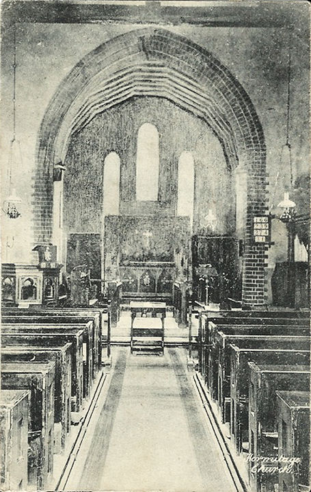
Hermitage, Holy Trinity.
Interior view. SU 5068 7295. Both from old postcards in Judy Flynn's
Collection. Link
has a better photo, showing the changes made since the postcard was
published.
Hoe Benham, the former
mission room. Now called Chapel Cottage, information about it is
hard to come by, but it's probably this chapel which is mentioned
here as having been enlarged in 1875. SU 4097 6956.
© Chris Kippin (2021).
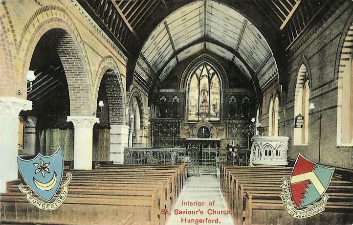
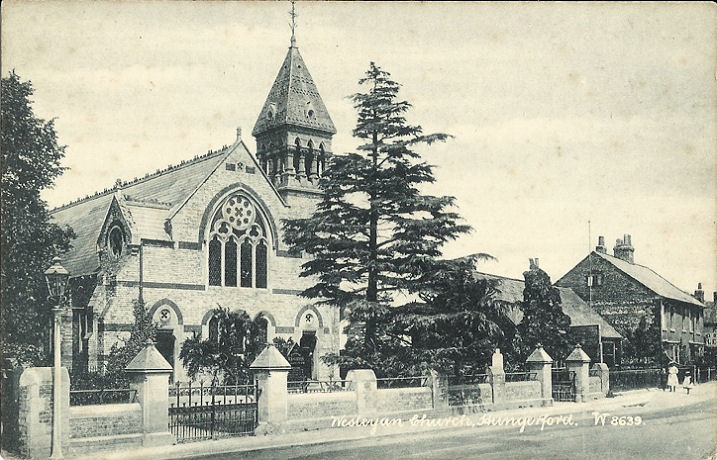
Hungerford, St. Lawrence.
Interior view. SU 3341 6871. Both © Tim Hollinghurst. Link.
Grade II* listed. For listed churchyard features, see
here. The Wesleyan
Methodist Church on Charnham Street was closed in 1970, and
demolished the following year. The site today is behind a modern row of
houses, seen by
Streetview in 2021.
SU 3398 6894. From an old postcard in Judy Flynn's collection. The
Methodist Church is on Bridge Street, at SU
3390 6881. Originally Primitive Methodist, it's dated
here to 1866 or soon after.
Link. U.R.C. on High Street, originally
Congregational. Its date-stone is for 1840. It was seen by
Streetview in 2021.
Link.
Grade II listed. Our Lady of Lourdes
(R.C.) on Priory Road, as seen by
Streetview in 2018.
SU 3365 6790. Church on the Rock meet in
The Croft Hall (Streetview
in 2009), on Parsonage Lane. SU 3355 6888.
Link.
Hungerford Newtown,
the former St. Mary. It's dated
here to 1869-70, and was sold in 2005 and subsequently converted to
residential use. SU 3564 7150.
© Chris Kippin (2021).
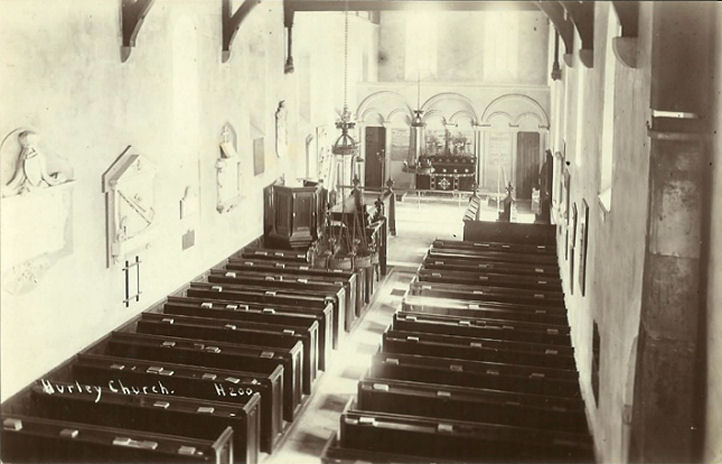
Hurley, St. Mary the Virgin.
Another view. SU 8256 8408. Both © John and Judy Flynn.
Another view, ©
Karel Kuča (2023).
Interior view, from an old
postcard in Judy Flynn's collection.
Link.
Grade II* listed. For related listed features see
here.
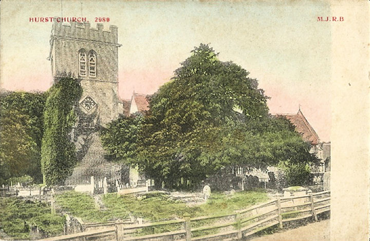
Hurst, St. Nicholas. SU 7949
7298. From an old postcard in Judy Flynn's collection. Streetviews
provide modern views, in
2021 and 2009.
Link.
Grade I listed. For listed features in the churchyard, see
here.
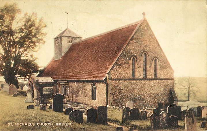
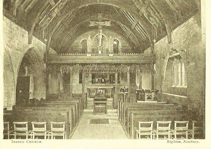
Inkpen, St. Michael.
Interior view. SU 3578 6377. Both from old postcards in Judy Flynn's
collection. A modern view, and the lych-gate, both ©
Karel Kuča (2023).
Link.
Grade II* listed. Old maps show a Primitive
Methodist Chapel on Craven Road, at SU 3600 6420.
Genuki dates it to 1860, and it is still shown as active on a map
revised by 1922 but had closed by 1956. A double garage stands on the
site, seen
here by Streetview
in 2009 - the brickwork looks recent enough to suggest that no trace of
the chapel remains. Someway east of the village, on Post Office Road, is
a former Wesleyan
Methodist Chapel (2016 Streetview). It's better seen
here. It pre-dates a map of 1877, and shows as still in active use
on one of 1959. SU 3739 6446.
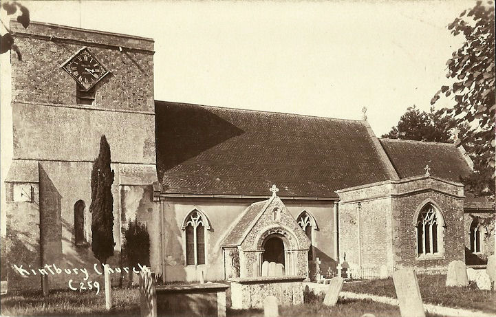
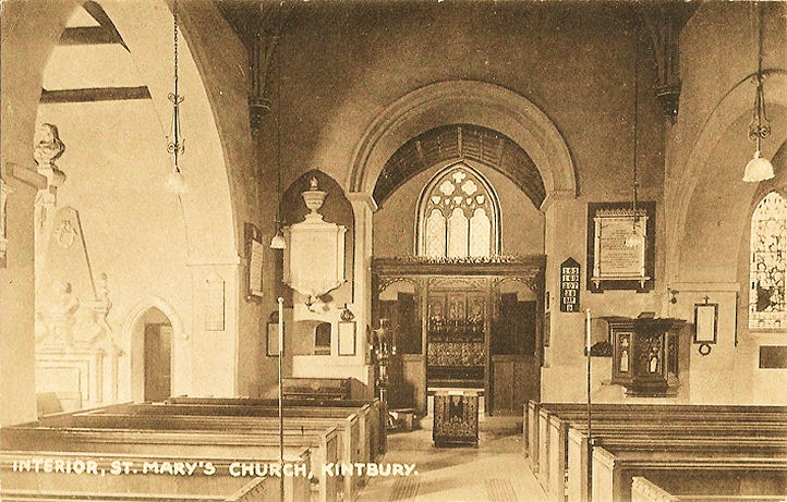
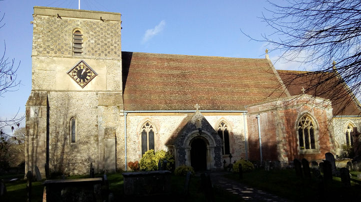
Kintbury, St. Mary the Virgin.
Interior view. SU 3832 6701.
Both from an old postcards in Judy Flynn's collection. A
modern view,
© Chris Kippin (2018).
Link.
Grade II* listed.
Methodist Church on Inkpen
Road. Older maps label it as Wesleyan.
Another view. SU 3830 6680. Both
© Chris Kippin (2018). An estate agents'
video dated 2021 implies that it has recently closed. The former
Zion Primitive Methodist Chapel on High Street, as seen by
Streetview in 2021. It has a date-stone for 1853. SU 3816 6684. There
was evidently an earlier chapel dating to 1839 - see
here - though whether it was on the same site or not is so far
unknown.
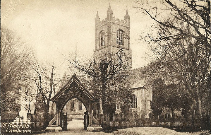
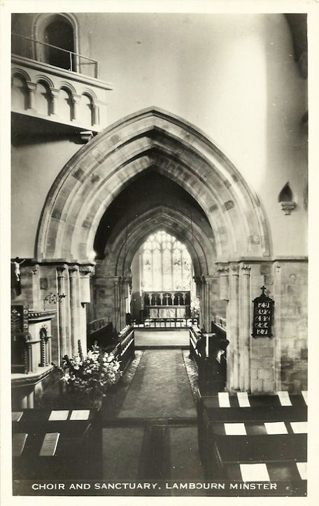
Lambourn, St. Michael and All Angels.
Interior view. SU 3261 7896. Both from old postcards in Judy Flynn's
collection.
Link.
Grade I listed.
Sacred Heart (R.C.) on Baydon Road was seen
by Streetview in
2021.
Link has interior photos. Old maps show a
Primitive Methodist Chapel off High Street at SU 3253 7881. Not
seen by Streetview, there's a photo of it
here,
where it's dated to 1859-1950's.
Link. This source
says that the local Methodist Congregation now meets in the Memorial
Hall on Oxford Street, seen
here by Streetview
in 2021. SU 3270 7893. The photo shown on the left of that webpage must
be the former Methodist Church - originally
Wesleyan, on Chapel Lane at SU 3266 7900.
Genuki dates it to "before 1800" to 2016.
Langley Marish - see the
Slough page.
Little Shefford - see East Shefford, above.
Littlewick Green, St.
John the Evangelist. SU 8413 8023. © John and Judy Flynn. Link.
A Methodist Church shows on O.S. maps, off
Jubilee Road at SU 8402 8002. Wesleyan on older maps,
it, or its replacement, was seen and blurred on a
Streetview from 2016 (earlier Streetviews are also blurred). The
National archives
references documents pertaining to the church for the years
1864-1955. I haven't been able to find a photo.
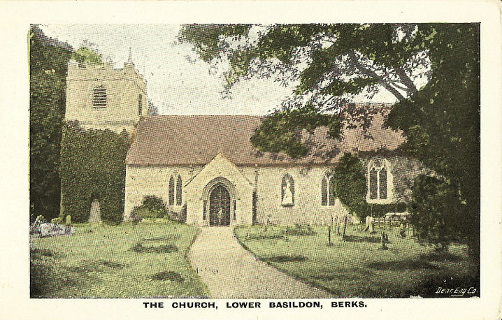
Lower Basildon, St.
Bartholomew - now in the care of the Churches Conservation Trust. SU
6116 7927. From an old postcard in Judy Flynn's collection.
Link.
Grade I listed.
Maidenhead.
Marlston, St. Mary. Two more
views - 1,
2. SU 5290 7197. All
Karel Kuča (2023).
Link.
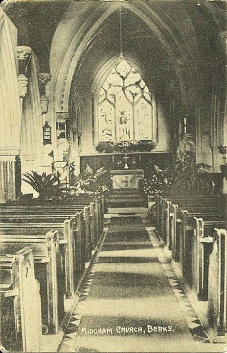
Midgham, St. Matthew. SU 5560
6718. © Jill Bennett.
Another view, © Derek Collier.
Interior view, from an old postcard
in Judy Flynn's Collection.
Link.
Grade II listed.
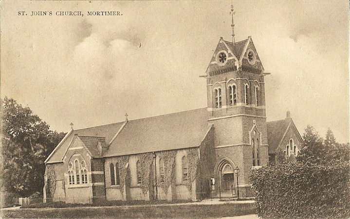
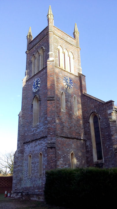
Mortimer Common, St. John the
Evangelist. SU 6543 6456. From an old postcard in Judy Flynn's Collection. Link.
The Methodist Church on West
End Road, as seen by Streetview in 2019. SU 6527 6458. It's dated
here to 1972, successor to an earlier chapel, originally
Primitive Methodist, on Drury Lane, 1867-1956. It
was seen by Streetview in
2019. SU 6532 6406.
Link.
Newbury.
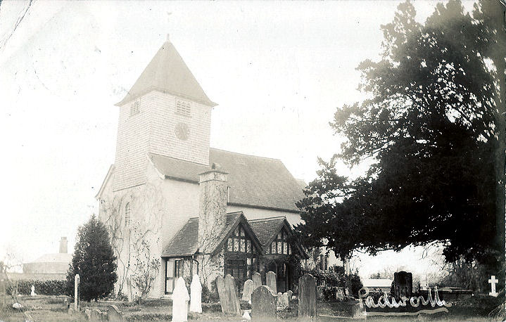
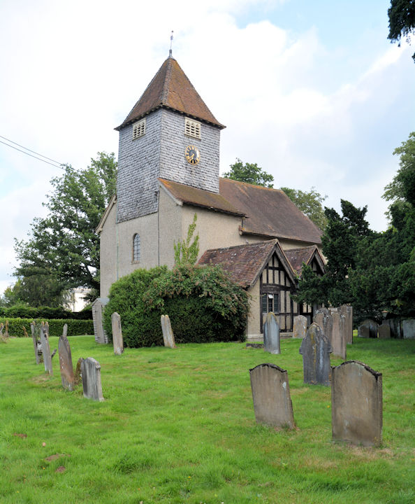
Padworth, St. John the Baptist. SU 6133 6616. From an old
postcard (posted in 1906) in Judy Flynn's Collection. Three modern views
- 1,
2,
3, and the
lych-gate, all
Karel Kuča (2023).
Link.
Grade I listed.
Pangbourne,
St. James the Less. SU 6342 7643. © Peter Morgan.
Interior view, from an old postcard in
Judy Flynn's Collection.
Link.
Grade II* listed.
St. Bernadette (R.C.) on Horseshoe Road, as seen by Streetview in
2021. SU 6382 7618.
Link. Old
O.S. maps show two "Chap.", but don't identify them more closely
- and neither of them have survived. The more northerly stood at the
junction of Thames Avenue and Whitchurch Road, at SU 6356 7664.
Genuki identifies it as Primitive Methodist, "before 1899",
"closed after 1973". There's now a house on the
site, seen by
Streetview in 2021. The site of the other, also on Whitchurch Road at SU
6356 7656, is now occupied by an
optician's, seen by
Streetview in 2021.
Genuki identifies this one as Congregational.
Genuki also mentions a Friends' Meeting House, but I haven't been
able to locate it.
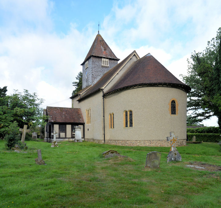
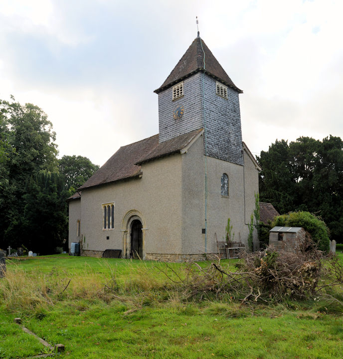
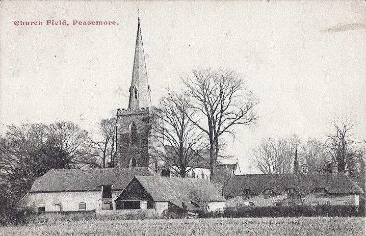
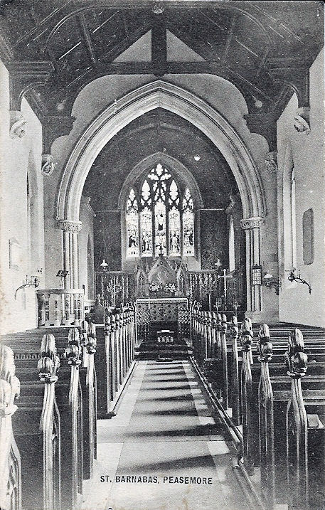
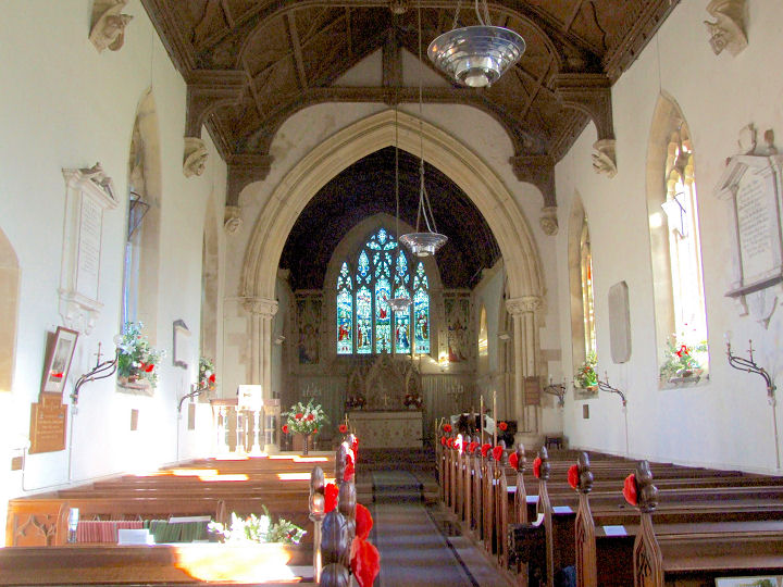
Peasemore, St. Barnabas on Field
Road and Prince's Lane. Although the base of the tower is 18th century,
most of the church dates from the mid-19th.
Interior view. SU 4580 7708. Both from old postcards in Judy Flynn's
Collection, posted respectively in 1918 and 1913. A
modern view, and the
interior, both © Richard Roberts
(2018). Link.
Grade II listed. Ebenezer Primitive Methodist
Chapel
shows on old maps a little way west of the village, at SU 4543 7740.
It's dated
here (where there is a photo) to 1831, with an enlargement in 1853.
Demolished in 1922, the bungalow on the site was seen by
Streetview in 2011.
It was succeeded by Memorial Chapel
(there's a photo of this chapel too, on the afore-mentioned source).
Whether it was on the same site isn't clear, however there is another
place of worship shown on Field Road on mid-20th century maps at SU 4575
7741. If it wasn't the Memorial Chapel, what was it? This has also been
demolished, and its site was seen by
Streetview in 2011.
Reading.
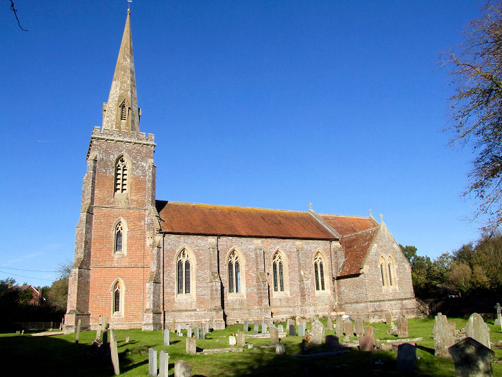
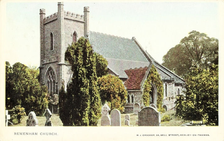
Remenham, St. Nicholas.
SU 7707 8417. From an old postcard in Judy Flynn's Collection.
Link.
Grade II listed.
Ruscombe, St. James. SU 7981 7630. ©
Marion Hall.
Link.
Grade I listed. A number of tombs in the churchyard are listed separately -
they can be seen
here.
St. Nicholas Hurst - see Hurst, above.
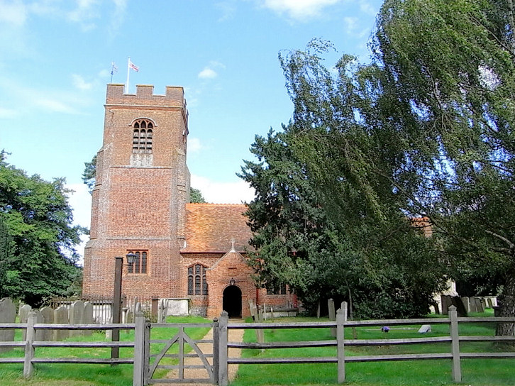
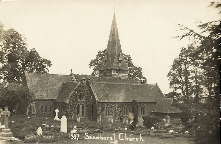
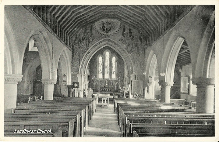
Sandhurst, St. Michael and
All Angels on Lower Church Road.
Interior view. SU 8258 6186.
Link.
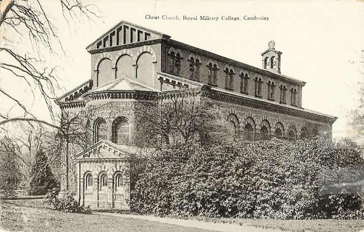
Grade II* listed. Royal
Memorial Chapel (Christ Church).
Interior view. SU 8577
6096.
Link.
Grade II listed. All from old postcards in Judy Flynn's Collection. The
Baptist Church on Yorktown Road and
St. John's Road. SU 8402 6133. © Paul E. Barnett (2018).
Link.
St. Mary's Mission Church used to stand on
Wellington Road at SU 8427 6168.
Genuki (which has a photo) dates it to 1889-1998. Demolished by 2009 (Streetview),
its site remained undeveloped in 2019 (Streetview).
Immaculate Conception (R.C.) on
Yorktown Road. SU 8374 6148. © Karel Kuča (2023).
Link.
Sandhurst and Yately Methodist Church
is on Scotland Hill. SU 8327 6176. © Karel Kuča (2023).
Link.
St. George is on Owlsmoor Road, and was seen by
Streetview in 2021. SU 8493
6250. Link.
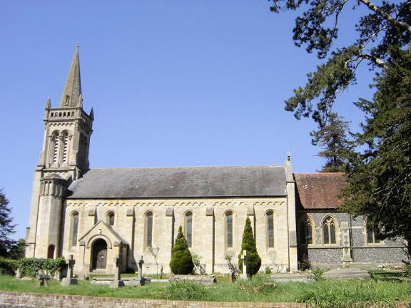
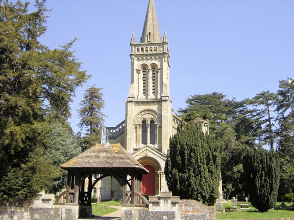
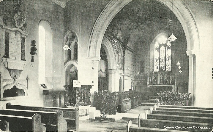
Shaw-cum-Donnington, St. Mary.
Another view. SU 4749 6830. Both © Jill Bennett.
Interior view, from an old postcard in Judy Flynn's Collection.
Link.
Grade II listed. The cemetery on Long Lane has a
Mortuary Chapel, at SU 4812 6849. Map evidence dates it to between 1900
and 1949. It was seen (distantly, and poorly) by
Streetview in 2009.
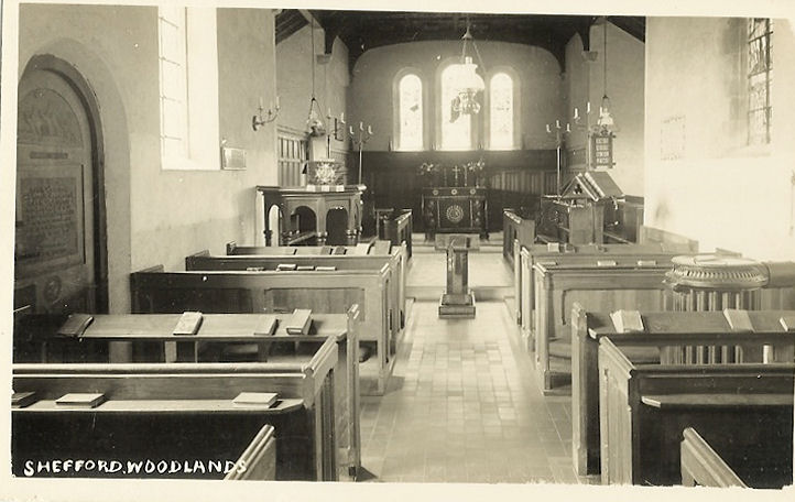
Shefford Woodlands, St. Stephen. Originally a Wesleyan Methodist Chapel,
it was sold to the Church of England in 1911. SU 3658 7315. © Chris
Kippin (2021). The
interior, from an old postcard
in Judy Flynn's collection.
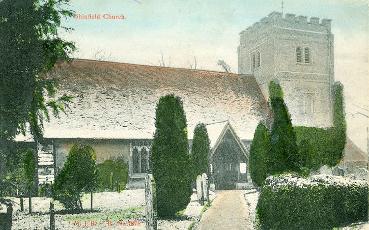
Shinfield, St. Mary. SU 7297 6818.
© Ian Miller. An old postcard view,
from Reg Dosell's Collection, and an
interior from Judy Flynn's Collection.
Link.
Grade I listed.
Shinfield Baptist Church on
Fairmead Road dates from 1908. SU 7339 6805. © Ian Miller.
Link.
Shottesbrooke, Collegiate
Church of St. John the Baptist. SU 8415 7712. © Marion Hall.
Link.
Grade I listed. Some gravestones are listed separately - they can be found
here.
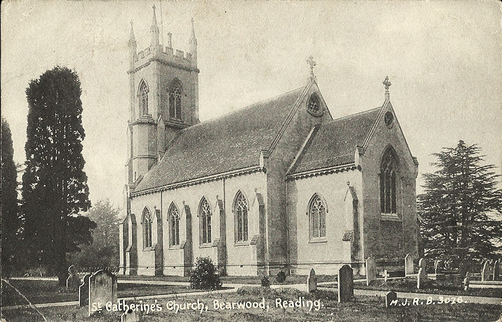
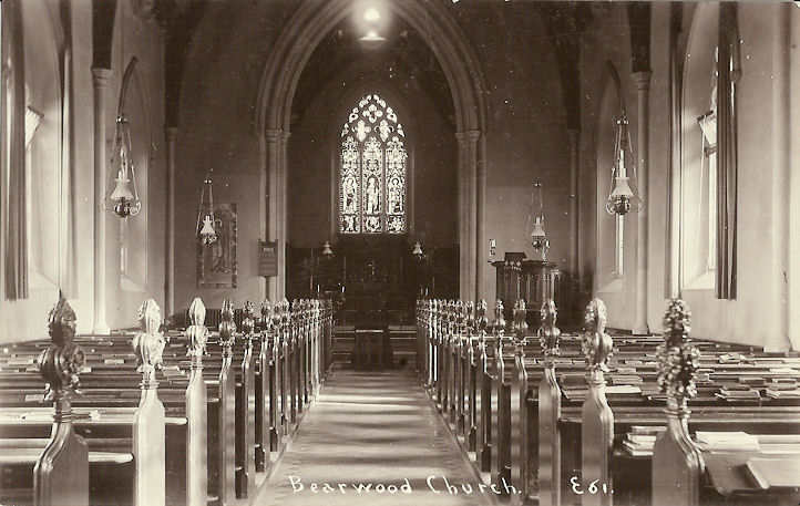
Sindlesham, St. Catherine at
Bearwood. Interior view. SU 7804
6915. Both from old postcards in Judy Flynn's Collection.
Link.
Grade II listed.
The Gate
Sindlesham (Baptist) on Bearwood Road and King Street Lane, as seen
by Streetview in 2021. It pre-dates a map of 1899, where it shows a smaller
footprint than today. SU 7769 6993.
Link.
Slough.
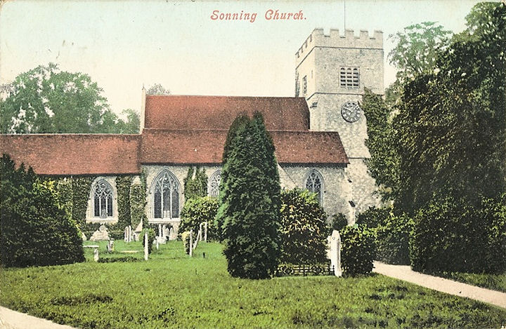
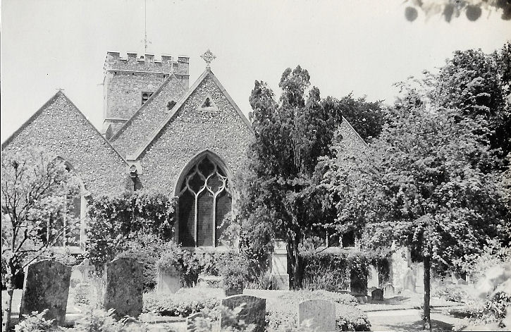
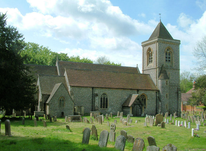
Sonning, St. Andrew. SU 7558 7557. ©
Paul & Janet Humphreys at
http://www.berkshirecam.net. An old postcard
exterior and
interior, both from old
postcards in Judy Flynn's Collection. Two more views, from 1939 -
1,
2, both from Christopher Skottowe's
Collection.
Link.
Grade II* listed. A former Congregational Chapel
stands off High Street at SU 7567 7547. It pre-dates a map of 1883 (surveyed in
the 1870's). Its 2012 Streetview
suggests that it has been converted to residential use.
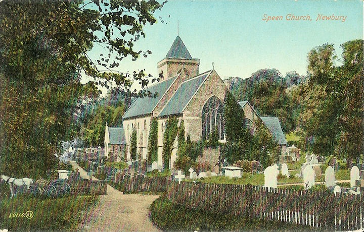
Speen, St. Mary the Virgin. SU 4552
6782. © Victor Markham. An old postcard
exterior and
interior, both from old postcard
from Judy Flynn's Collection. Link.
Grade II listed. Numerous churchyard tombs are listed separately - they can
be found
here.
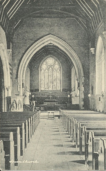
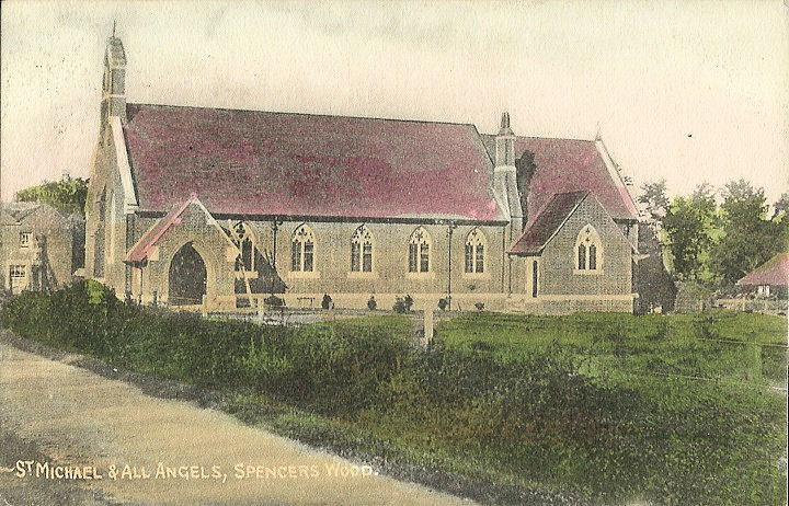
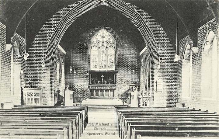
Spencers Wood, St. Michael and
All Angels (card posted in 1919). The
interior (card posted in 1924). Old maps show that it dates from the first
decade of the 20th century. SU 7158 6708. Both from old postcards from Judy
Flynn's Collection. Link.
A former Congregational Church (later U.R.C.)
stands on the main road to the south at SU 7150 6658. Seen by
Streetview in 2009, it also
dates to the first decade of the 20th century. What is presumably its
predecessor (and later a Sunday School) shows on a map of 1900 as
Independent Chapel, at SU 7156 6659.
Streetview hasn't seen it or its site - does it survive?
Stanford Dingley, St. Denys.
Two interior views - 1,
2. SU 5754 7170. All © Nick
Hopton (2010). Two more views -
1,
2, both © Karel Kuča
(2023).
Link.
Grade I listed. Two churchyard tombs are also listed - see
here for details.
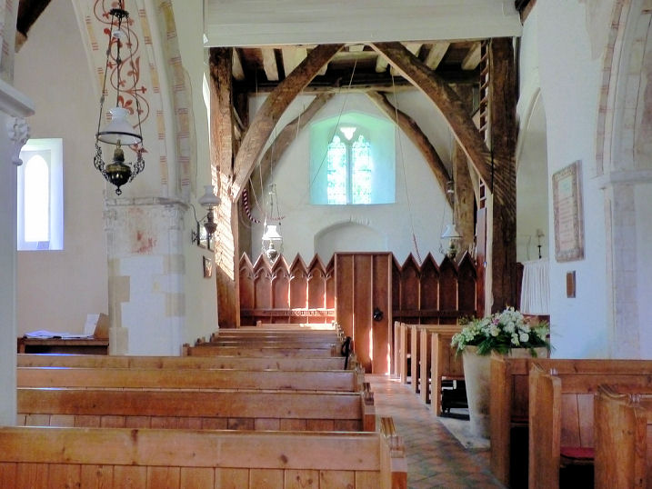
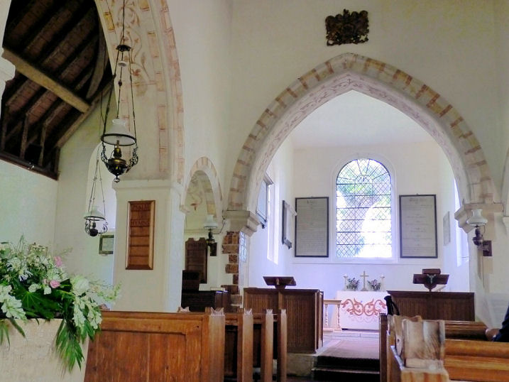
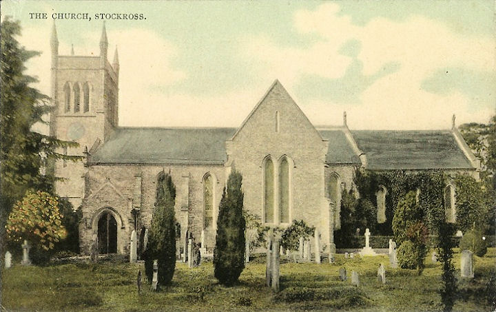
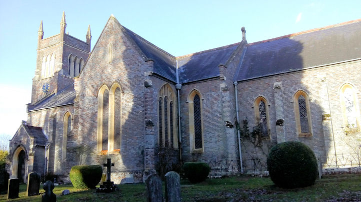
Stockcross, St. John. SU
4342 6834. From an old postcard (franked 1908) in Judy Flynn's collection. Two
modern views - 1,
2, both
© Chris Kippin (2018).
Link.
Grade II listed. Old O.S. maps show a Methodist (originally Wesleyan) Chapel
on Chapel Road, at SU 4339 6874.
Genuki dates its foundation to "before 1849", with closure "after 1971".
Evidently demolished before 2009, when Streetview made its first visit, seeing
the house on the site.
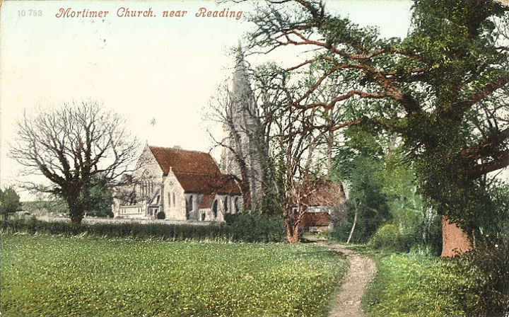
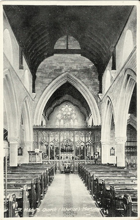
Stratfield Mortimer, St. Mary
(1869).
Interior view. SU 6682 6409.
Both from old postcards (and both posted in 1906) from Judy Flynn's Collection.
Link.
Grade II listed.
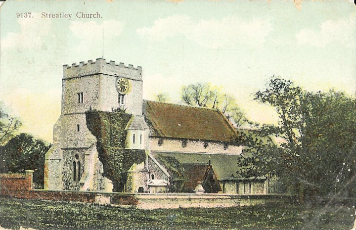
Streatley, St. Mary. SU 5945
8088. From an old postcard in Judy Flynn's collection.
Link.
Grade II listed. The 25" O.S. map of 1912 shows Zion
Baptist Chapel on The Coombe, at SU 5881 8071. It's dated
here to circa 1870, "replaced by a new chapel in 1931" and "closed
in the 1980's", and "The site is now occupied by a private house".
Whether it replaced the old chapel on the same site is unclear, but in any event
I can't find another place of worship on the 1" O.S. map of 1960, when the newer
church was allegedly still active. The building on the 1870 site (is this the
old chapel?) can be seen on a
Streetview of 2009.
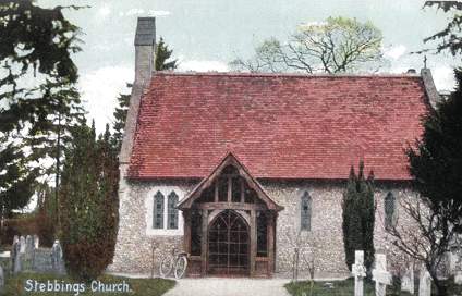
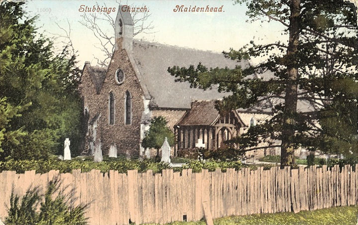
Stubbings, St. James the Less
(1849-50). The postcard of "Stebbings" Church had been on the website for rather
a long time, listed under Stebbing, Essex. The Rev. Tim Goodbody, of Stebbing,
has been in touch to say that this isn't his church. I listed it under Stebbing
rather than Stebbings because I couldn't find any trace of a Stebbings
place-name in the UK, and under Essex, because I could find only one Stebbing.
We have Sue Hedger to thank for solving this mystery - it is in fact Stubbings,
in Berkshire. Sue says
she isn't aware of a name change, so this has to be lain at the door of the
postcard manufacturer for getting it wrong! Older O.S. maps label it as St.
Philip and St. James. From an old postcard in Steve Bulman's Collection. Another
postcard view, this one from Judy Flynn's collection, and postmarked 1909. A
modern view, and the
porch, both ©
Karel Kuča (2023). SU 8502 8166.
Link1.
Link2 (See photos under "Remembrance Sunday").
Grade II listed, wherein its dated to 1850-4.
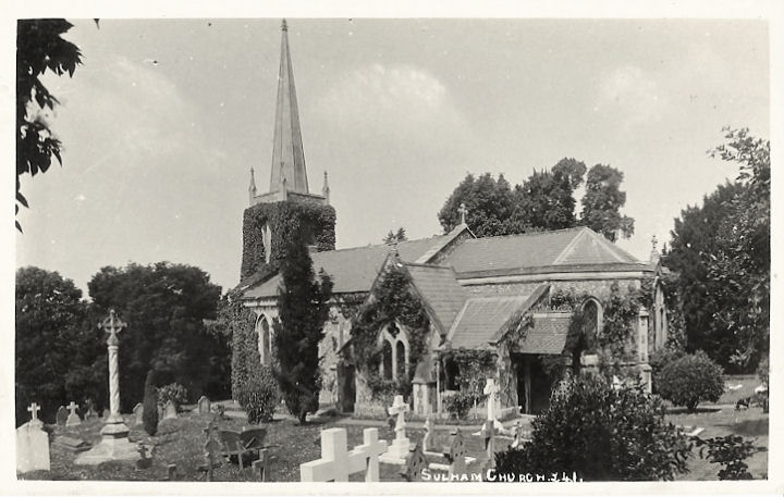
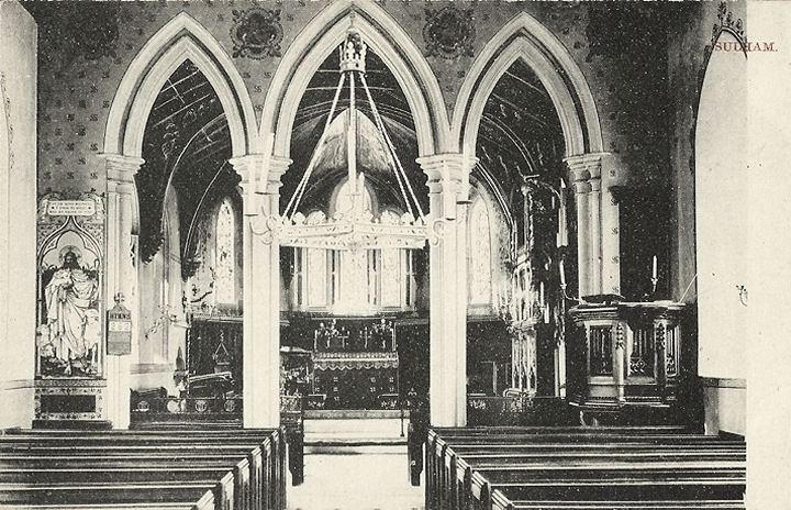
Sulham, St. Nicholas. Judy advises that the spire has been removed.
Interior view. SU 6451 7422.
Both from old postcards in Judy Flynn's Collection.
Link.
Grade II listed.
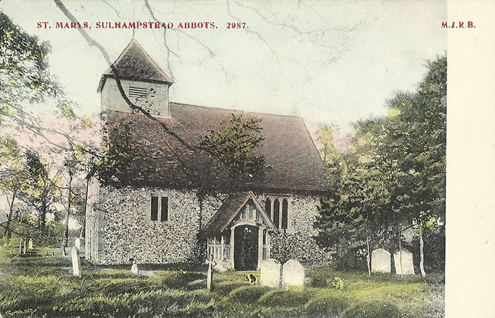
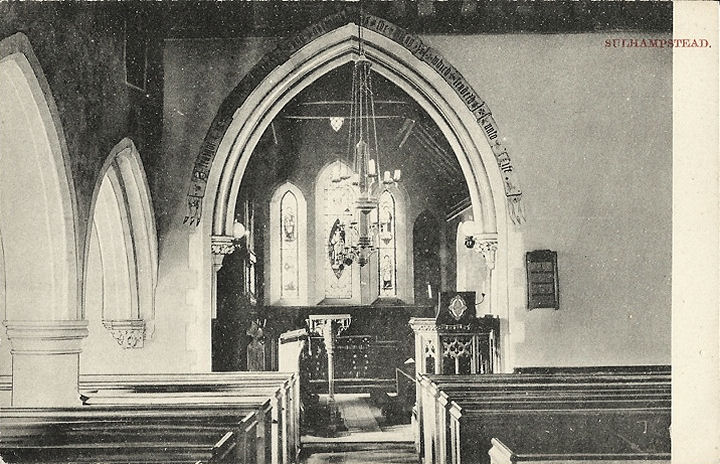
Sulhamstead Abbots, St. Mary. According to this
source,
it was once dedicated to St. Bartholomew.
Interior view. SU 6450
6795. Both from an old postcards in Judy Flynn's collection.
Link.
Grade I listed.
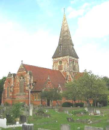
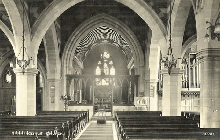
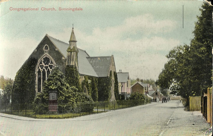
Sunningdale, Holy Trinity. SU
9536 6755. © Barbara Barklem.
Interior view, from an old postcard in Judy Flynn's collection. Link.
Grade II listed. The railings and gates are also listed, twice - they can be
found
here. The former
Congregational Church (1865) on
High Street is now in residential use. SU 9526 6769. From an old postcard in
Judy Flynn's collection. Hope Church, also on High
Street, is a former Baptist Chapel - seen by
Streetview in 2019. SU 9535
6764. Link.
Sacred Heart (R.C.) on
Lawson Way, as seen by Streetview in 2008. SU 9605 6727.
Link. Small scale mid-20th
century O.S. maps mark a place of worship on Rise
Road at SU 9464 6724. I've been unable to discover what it was, but it's
possibly the Primitive Methodist Chapel mentioned
here.
The small scale of the maps means that one can't be too precise about its exact
location, but it was somewhere near
here (Streetview, 2016).
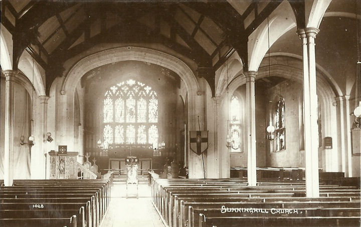
Sunninghill, St Michael & All
Angels. SU 9398 6862. © Barbara Barklem.
Interior view, from an old
postcard in Judy Flynn's collection. Link.
Grade II listed. Two churchyard monuments are listed separately - they can
be found
here. The 1" O.S. map 1961 shows a place of worship
on School Road at SU 9351 6784. It was seen
(distantly) by Streetview in
2009, but I haven't been able to discover what it was.
Swallowfield, All Saints.
Two more views - 1,
2, and the
porch. SU 7318 6480. All ©
Karel Kuča (2023).
Interior view, from an old
postcard in Judy Flynn's collection - posted in 1911.
Link.
Grade I listed.
Thatcham.
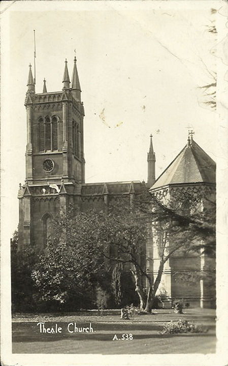
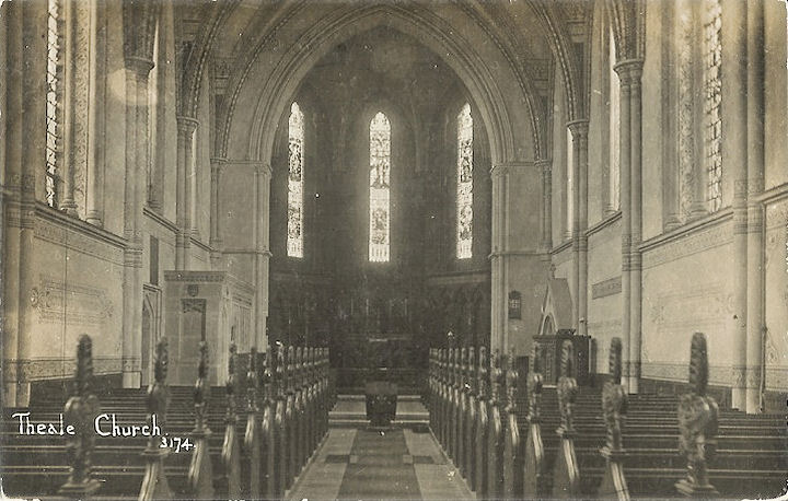
Theale, Holy Trinity. SU 6402 7129.
From an old postcard in Steve Bulman's Collection. Postcards of the
exterior, and
interior, both from Judy Flynn's Collection.
A 2010 Streetview provides a
modern view. Link.
St. Luke (R.C.) on
Englefield Road, seen by Streetview in 2018. SU 6409 7141.
Link. There used to be a
Congregational Chapel (later U.R.C.) on High
Street, at SU 6440 7134. Its site, the access way to a car park, was seen by
Streetview in 2018. There
was also a Primitive Methodist Chapel on High
Street, at SU 6454 7144. The right-most part of a modern office block now stands
on the site, seen by
Streetview in 2017. It's dated
here to 1869.
Three Mile Cross, United Church
(Methodist and U.R.C.), originally Wesleyan (1876). SU 7149 6775. © Ian Miller.
It's evidently now closed - see
here for a 2014 news item.
Three Mile Cross Church
(Streetview in 2021) is on Mitford Close. SU 7151 6793.
Link.
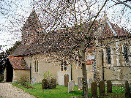
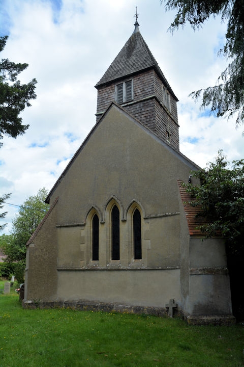
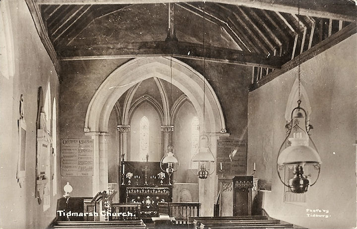
Tidmarsh, St. Laurence. SU 6348
7455. © Peter Morgan.
Another view, ©
Karel Kuča (2023).
Interior view, from an old postcard in Judy
Flynn's collection. Link.
Grade I listed. A tomb in the churchyard is listed separately as
grade II.
Tilehurst - see the
Reading page.
Twyford, St. Mary the Virgin (card
posted in 1909). A tower was added soon after as this
1910 postcard shows.
Interior view. SU 7885 7588. All from
old postcards in Judy Flynn's Collection.
Link.
U.R.C. on Waltham Road and Station
Road. SU 7884 7595. © John and Judy Flynn.
Link.
St. Thomas More (R.C.) on
Loddon Hall Road, as seen by Streetview in 2020. SU 7912 7643.
Link. A
Wesleyan Methodist Chapel is shown on older O.S.
maps on Wargrave Road at SU 7870 7610. It was seen by
Streetview in 2008, when it
was Twyford Mens Club - its date-stone for 1853 can be seen. More recent
Streetviews show it as a snooker club. It had closed as a church by 1947.
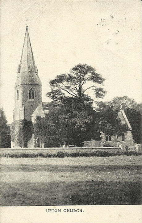
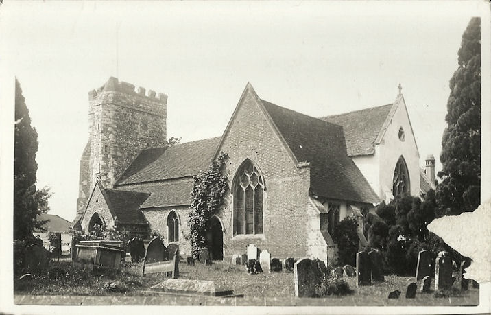
Ufton Nervet, St. Peter. It's
now redundant. SU 6347 6752. From an old postcard (franked 1905)
in Judy Flynn's collection.
Grade II listed.
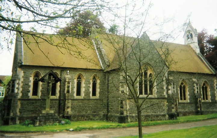
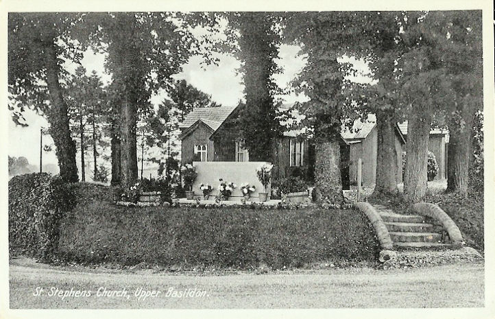
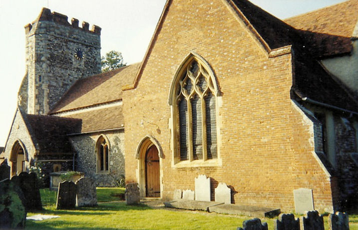
Upper Basildon,
St. Stephen. Judy says that this may have been a temporary building
before the present one was built, in 1965, implying that it no longer
exists. From an old postcard in Judy Flynn's collection. The present
St. Stephen was seen
by Streetview in 2009. SU 6011 7597.
Link has some
interior views. An Independent Chapel shows
on older maps off Darby Lane, at SU 5977 7624. Demolished, it stood at
right angles to the left of the white house, seen by
Streetview in 2014.
Upper Woolhampton,
St. Peter. Two more views - 1,
2, and the
porch. SU 5772 6770. All ©
Karel Kuča (2023).
Link.
Grade II listed. The churchyard war memorial is also listed as
grade II. Older O.S. maps show R.C. Chapel
as part of St. Mary College, at SU 5770 6809. It's now called St. Mary,
and was seen by
Streetview in 2021. Its
grade II listing dates it to 1848.
Link. Nearby is
the Monastery of St. Edmund, King and Martyr,
aka Douai Abbey Church, which is dated in its
grade II* listing to 1928-33. SU 5770 6821.
Link.
Waltham St. Lawrence, St.
Lawrence. SU 8295 7697. © John and Judy Flynn. Two old postcards from
Judy Flynn's collection show the
exterior and
interior (the latter card
dated 1939).
Link.
Grade II* listed. The lych-gate is listed as
grade II.
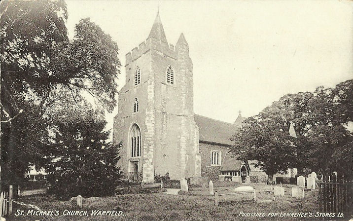
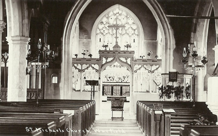
Warfield, St. Michael the Archangel.
SU 8800 7220. © Barbara Barklem. Two old postcards from Judy Flynn's
collection show the exterior
(card dated 1906) and interior
(card dated 1923). Link.
Grade II* listed. A monument in the churchyard is listed as
grade II.
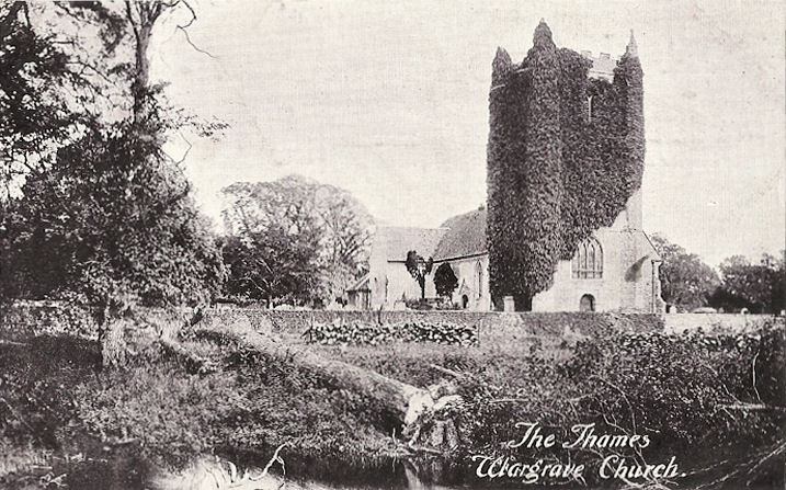
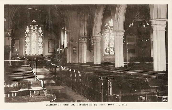
Wargrave, St. Mary the
Virgin.
Another view, with a
hand-written addition saying Burnt down by Suffragettes (1914) May
31st. This interior view
is from after the re-build. SU 7827 7846. All from old postcards in Judy
Flynn's collection. Link.
This
article explains the events of the fire.
Grade II* listed. Two tombs and a mausoleum in the churchyard are
listed separately - they can be found
here.
A former Congregational Church is marked on
O.S. maps, off High Street, at SU 7862 7869. Genuki provides dates as
follows - "founded in 1835. It closed in 1981". The best
view I can find on
Streetview is the one from 2019, but it's poor - a better photo can
be seen
here.
Grade II listed. Our
Lady of Peace (R.C.) on Braybrooke Road, as seen by Streetview in
2009. It's dated
here to 1963.
Link.
Warren Row, St. Paul's Mission
Church. A photo of the interior can be seen
here
(scroll down). SU 8121 8070. © John and Judy Flynn.
Welford, St. Gregory. SU 4088 7316. ©
Jill Bennett.
Link.
Grade II* listed. A headless cross in the churchyard is listed as
grade II.
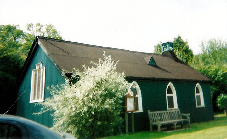
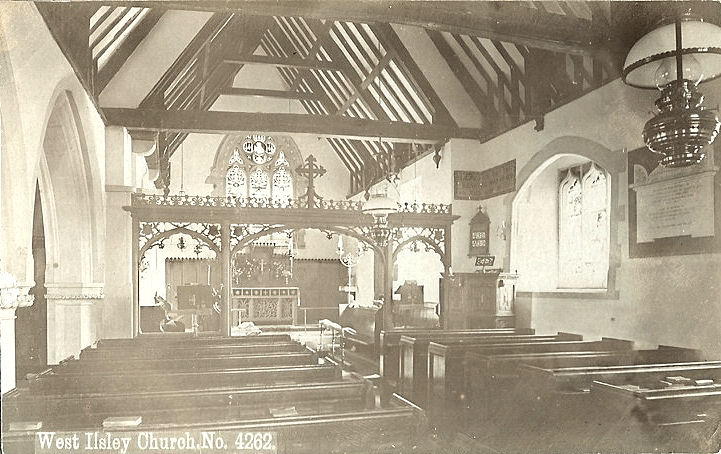
West Ilsley, All Saints. SU 4734
8249. © Bill McKenzie.
Interior view, from an old
postcard in Judy Flynn's collection.
Link.
Grade II listed. Old maps show a Baptist
Chapel at the east end of the village, at SU 4763 8235. It's
dated
here to 1866, and was seen by
Streetview in 2014.
West Shefford - see Great Shefford,
above.
West Woodhay, St.
Laurence (interior, card posted in 1907). SU 3905 6310.
From an
old postcard in Judy Flynn's collection.
Link, wherein it's dated to 1882.
Grade II listed. It had two known predecessors at West Woodhay
House, one of which is given on O.S. maps at SU 3853 6320. The link
already provided for the current church says that foundations of these
are visible in the gardens of the house, but nothing is visible on
Streetview because of vegetation, and I haven't been able to find a
photo.
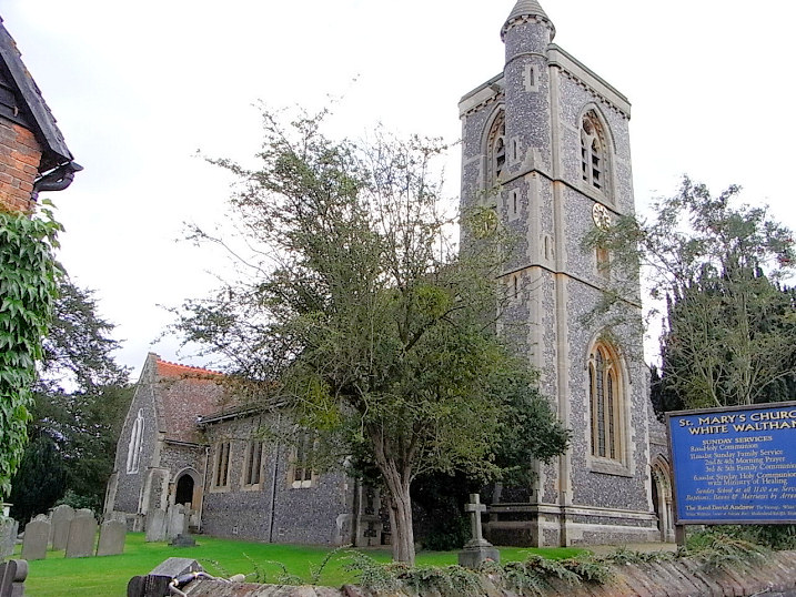
White Waltham, St. Mary. SU
8548 7752. © Marion Hall.
Link.
Grade II* listed. A tomb and a headstone are listed separately -
they can be seen
here.
Wickham, St. Swithin. SU 3947
7152. From an old postcard in Judy Flynn's collection. A
modern view,
© Chris Kippin (2021).
Link1.
Link2.
Link3 (with photos of the flying elephants!).
Grade II* listed.
Windsor.
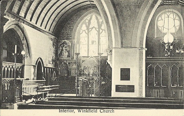
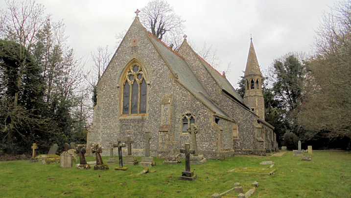
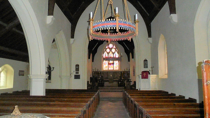
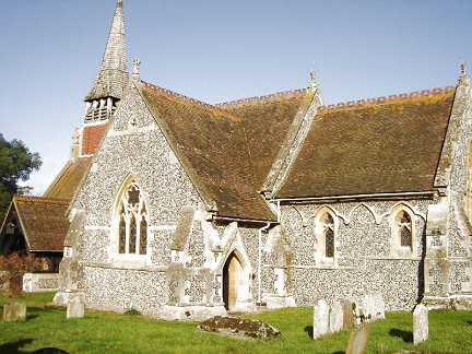
Winkfield, St. Mary. SU 9042
7244.
© Barbara Barklem.
Interior view, from an old
postcard in Judy Flynn's collection.
Link.
Grade II* listed. Two churchyard tombs are listed separately - they
can be found
here.
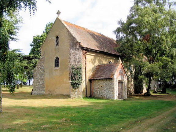
Woodlands St. Mary,
St. Mary, which is now in the care of the Churches Conservation Trust.
The
interior. SU 3338
7501. Both © Chris Kippin (2021).
Link.
Grade II listed.
Woolhampton, St. Peter. SU 5772 6770. © Jill Bennett. Link.
Grade II listed. The war memorial in the churchyard is also listed
as
grade II. Older O.S. maps show an
Independent Chap. (later Congregational, and U.R.C.) off Bath
Road at SU
5736 6682.
Genuki dates it to 1831, closed "after 1970". The house now on its
site can be seen in a
Streetview from 2021. I haven't been able to find a photo of it
on-line. Pre-dating an O.S. map of 1883, an R.C.
Chapel is shown north of Woolhampton, at SU 5770 6808, part of
St. Mary's College. The latter is now usually known as Douai Benedictine
Abbey. Link. This
page has an
outline history, with links to more detailed history.
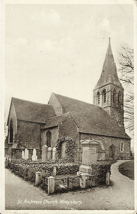
Wraysbury, St. Andrew, on St. Andrew's Close, off Windsor Road.
TQ 0013 7394. From an old postcard in Judy Flynn's Collection.
Link.
Grade II* listed.
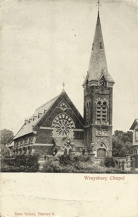
Baptist Church on High Street. Its
Wikipedia article dates it to 1862, successor to an un-located
chapel of 1827. TQ 0054 7413. From an old postcard in Judy Flynn's
Collection.
Link.
Yattendon, St. Peter and St. Paul. SU 5542 7455. © Jill Bennett. Link.
Grade I listed. A churchyard tomb is separately listed as
grade II. The 25" O.S. map of 1899 shows a Primitive
Methodist Chapel on the north side of Chapel Lane at SU 5531 7440. It
pre-dates a map of 1900 (revised in 1898), and seems to have still been active
into the 1950's, at least. No trace of it can be seen on a
Streetview from 2009.
|
|