The Churches of Britain and Ireland
| Woodbridge, Suffolk
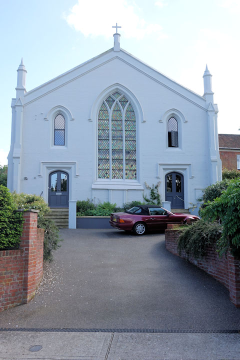
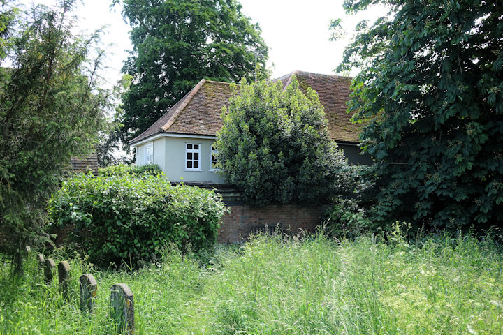
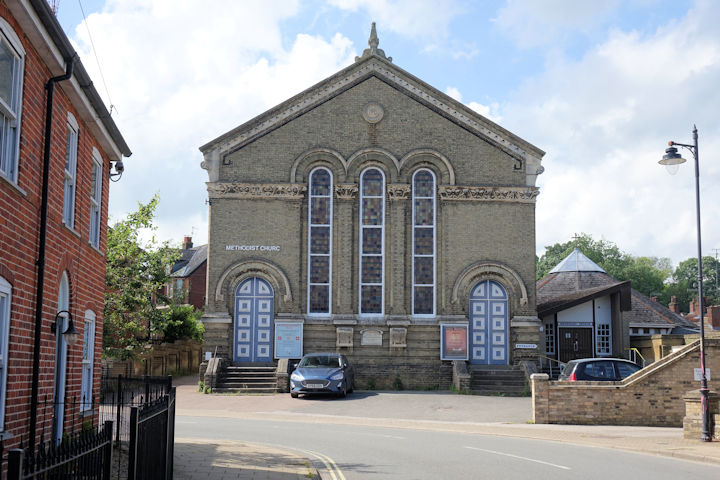
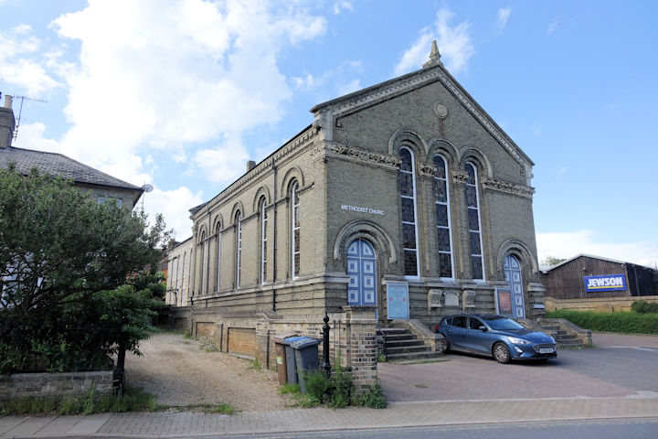
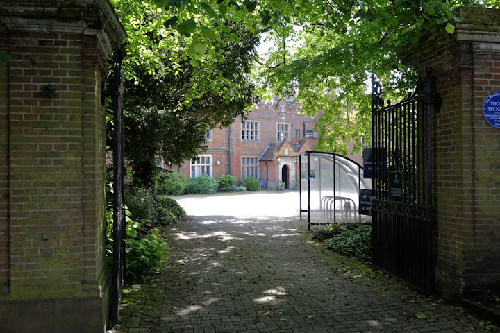
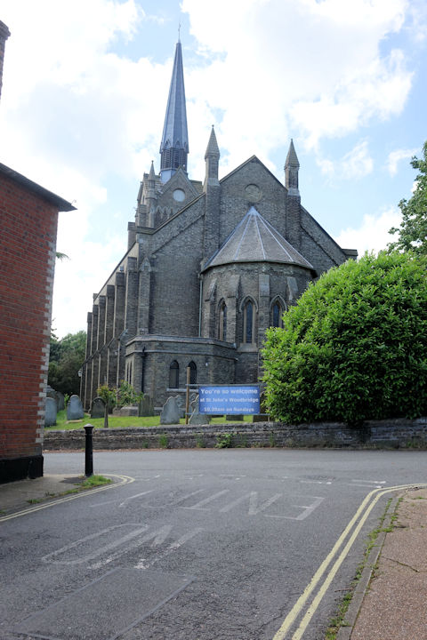
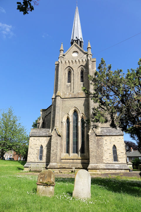
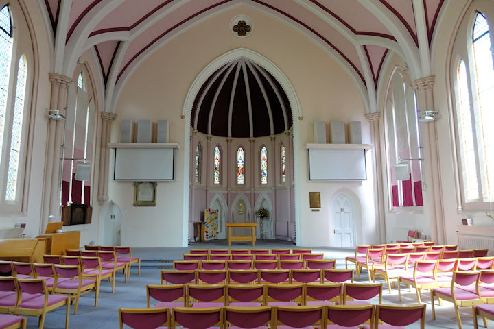
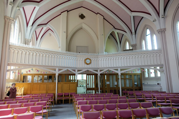
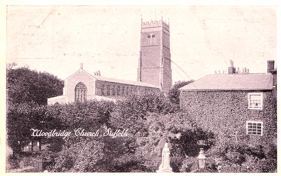
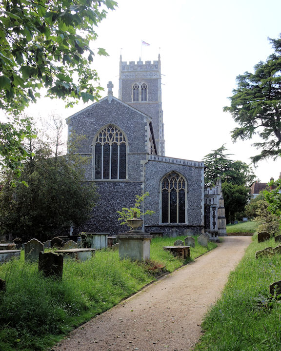
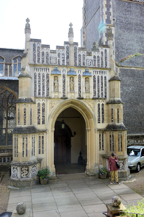
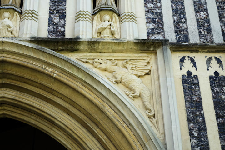
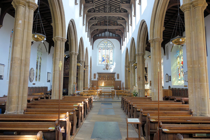
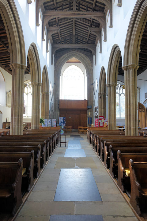
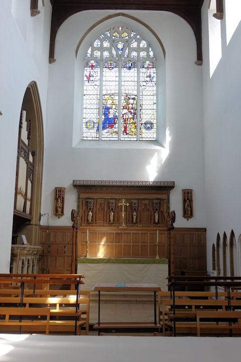
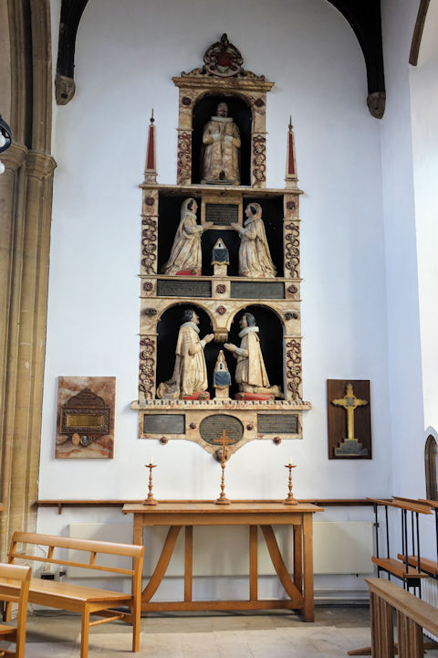
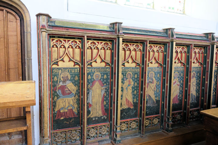
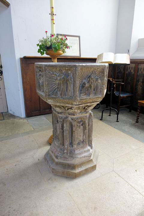
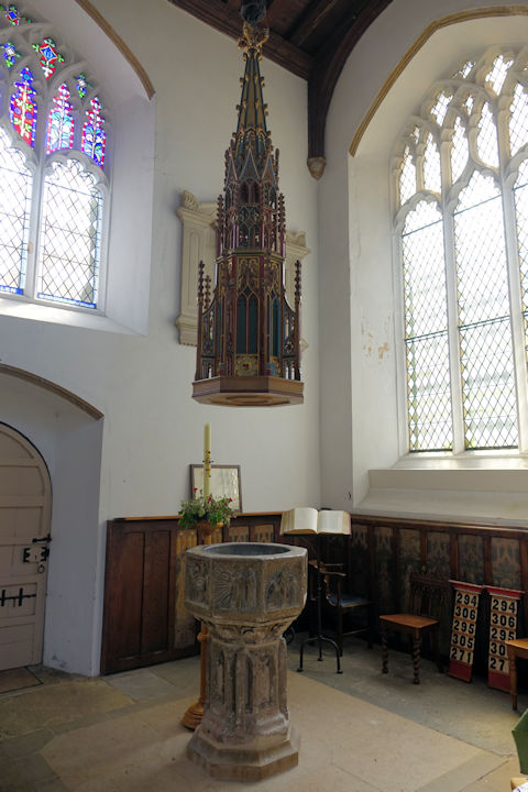
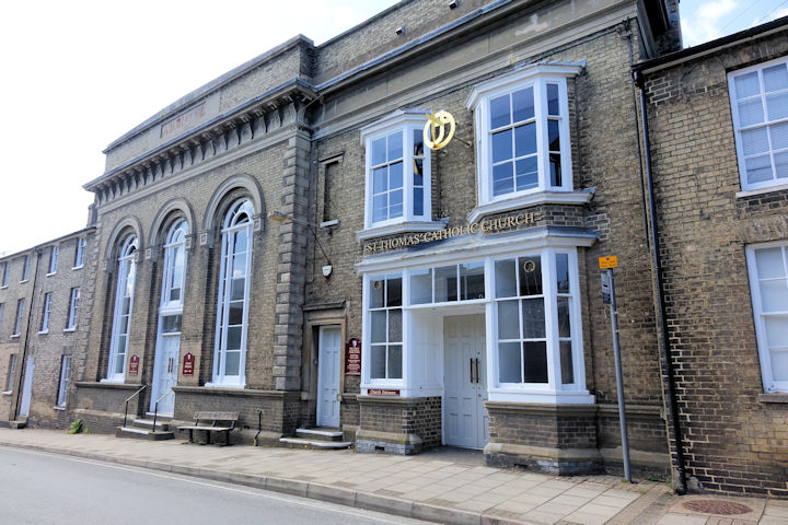
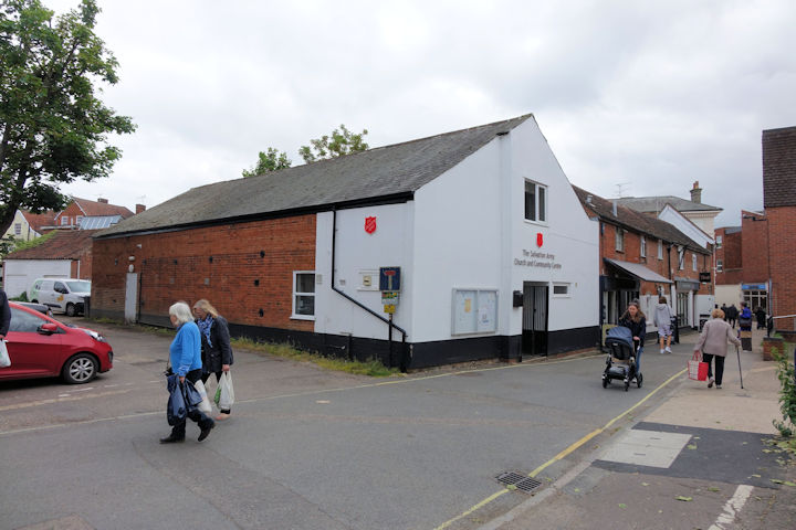
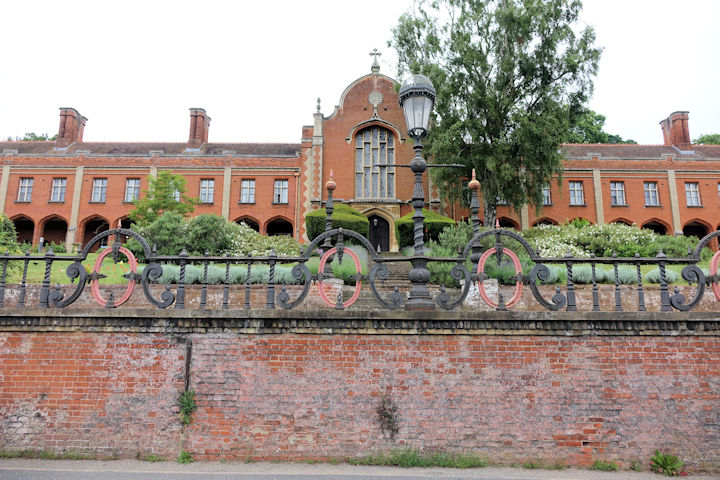
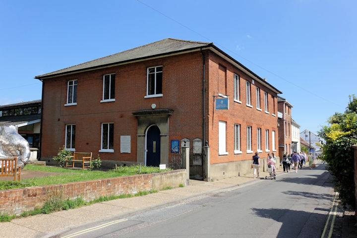
The former Baptist Chapel on Chapel Street. Its grade II listing, which calls it Beaumont Chapel, dates it to 1841. A map of 1881 labels it as Beaumont Chapel (Congregational). TM 2706 4922. © Steve Bulman (2024). A former Friends' Meeting House stands on Turn Lane, photographed from the adjacent former burial ground. Its grade II listing dates it to 1678. TM 2713 4897. © Steve Bulman (2024). The Methodist Church is on St. John's Street, and was originally Wesleyan, dated here to 1871-2. Another view. TM 2751 4928. Both © Steve Bulman (2024). Link. Grade II listed. The source already given says that there was an earlier chapel on Brook Street, of circa 1829. A map of 1880 (by which time the congregation will have moved into their new chapel) labels it as Mission Hall. It survives, converted to residential use, and was seen by Streetview in 2023. TM 2751 4895. The cemetery on Cemetery Lane has two Mortuary Chapels. The more northerly, Church of England (2023 Streetview), at TM 2653 4880, the other, Nonconformist (2011 Streetview) at TM 2647 4870. Just to west of St. Mary is The Abbey, a house on (part of) the site of an Augustinian Priory. It's now in use as a school. TM 2710 4905. © Steve Bulman (2024). Link. St. John on St. John's Hill and Castle Street. Another view, and two of the interior - 1, 2. TM 2740 4926. All © Steve Bulman (2024). Link. Grade II listed, wherein it's dated to 1842-4. St. Mary the Virgin on Church Street. TM 2706 4908. From an old postcard in Geoff Watt's Collection. A modern view, the porch (with dragon carving), two of the interior - 1, 2, the chancel, a handsome monument, painted panels, the font and its cover, all © Steve Bulman (2024). Link. Grade I listed. The churchyard walls, etc., are also listed, as grade II. A map of 1880 shows St. Thomas's R.C. Chapel on Crown Street (or Crown Place), at TM 2742 4890. Its Genuki entry calls it St. Thomas of Canterbury, dating it to 1850, and closing when the new chapel was built on St. John's Street. This page on the present church website dates it to 1872-1929, and has some small photos of it. I don't know if the building survives - the Streetview van hasn't been down Crown Street. St. Thomas of Canterbury (R.C.) on St. John's Street. Its grade II listing dates it to 1850, originally as the Literary and Mechanics’ Institute hall, converted to a church in 1929-30. TM 2742 4921. © Steve Bulman (2024). Link. Salvation Army Church and Community Centre on New Street. What seems to be the same building is marked on a map of 1904 as "S.A. Bks.". TM 2742 4910. © Steve Bulman (2024). As of the time of writing however, the S.A. webpage gives the location as St. John's Church Hall on St. John's Street - 2023 Streetview. Although not mentioned in its grade II* listing (which dates it to 1840), O.S. maps mark a Chapel at the centre of Seckford Hospital - now a care home. TM 2656 4916. © Steve Bulman (2024). Link. Woodbridge Quay Church on Quay Street formed with the merger of the Baptist congregation, with that of the U.R.C. who were the incumbents. It was originally Congregational, dated in its grade II listing to 1805, though the congregation was founded in 1651. It stands on the site of an earlier church. TM 2734 4888. © Steve Bulman (2024). Link.
|
||
21 July 2025
© Steve Bulman