The Churches of Britain and Ireland
|
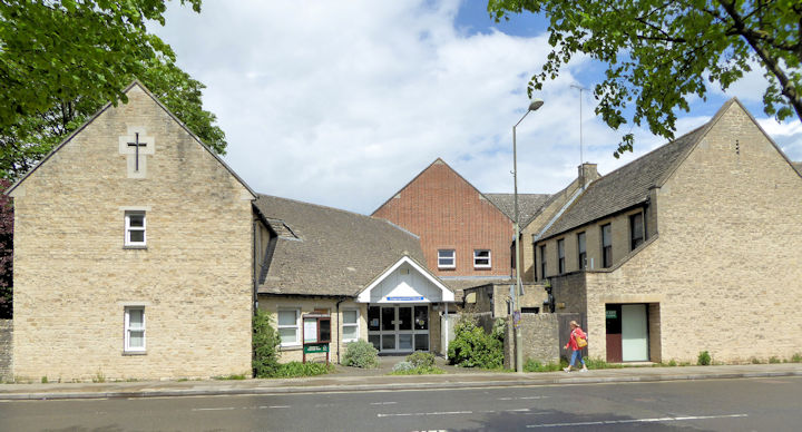
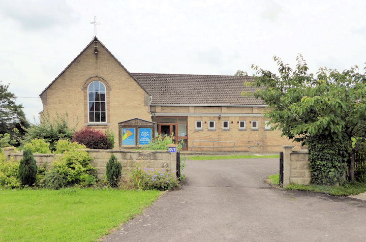
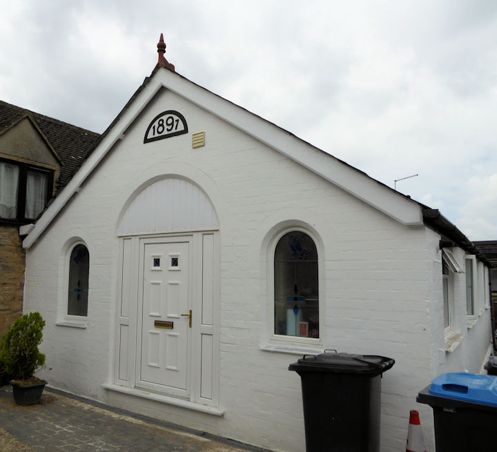
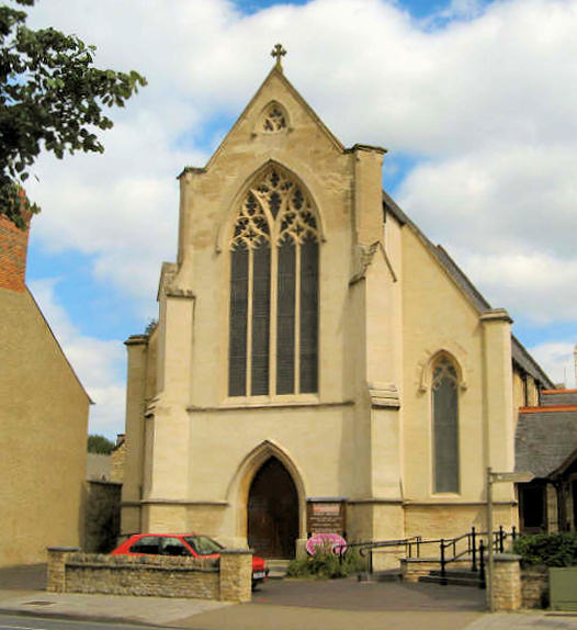
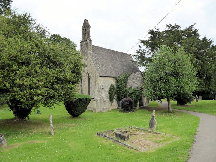
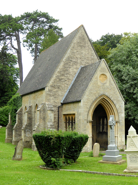
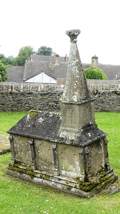
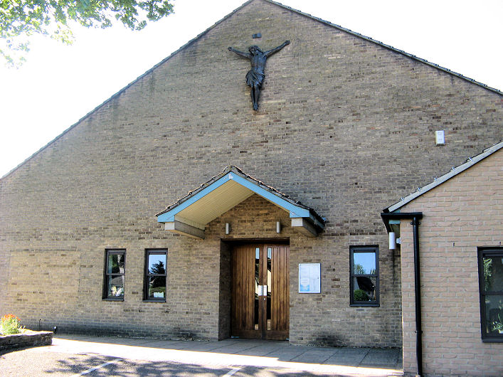
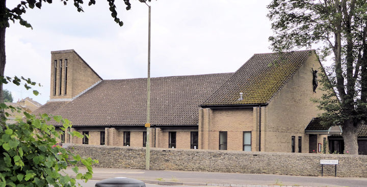
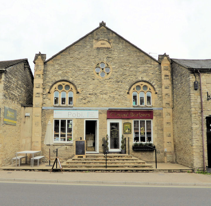
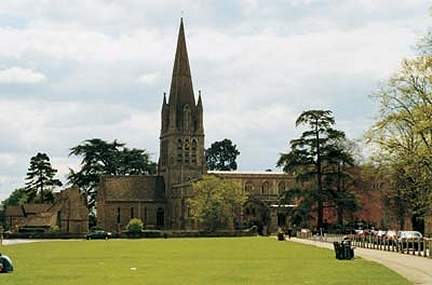
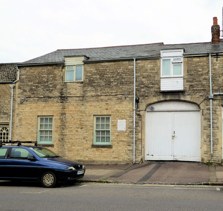
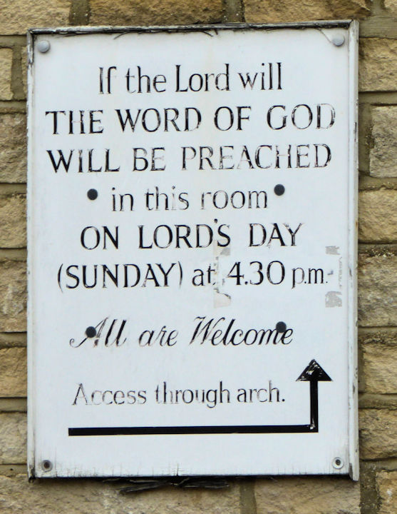
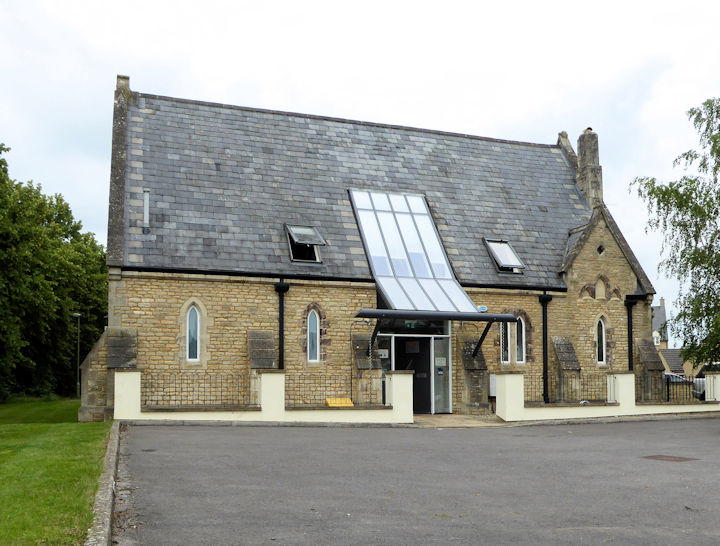
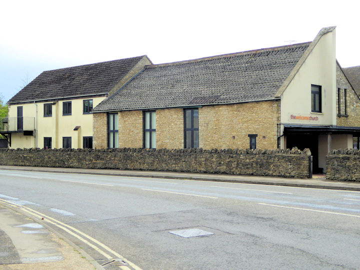
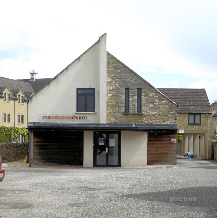
Witney, Oxfordshire Congregational Church on Welch Way. SP 3560 0991. © Graeme Harvey (2011). Another view, © Janet Gimber (2023). Link. A former Congregational Meeting House (2022 Streetview) stands on Meeting House Lane, at SP 3551 0964. It seems to be the same building labelled on a map of 1884 as Temperance Hall, and in Grade II listed - dates it to the early 18th century. There used to be a Congregational Chapel on the west side of High Street, at SP 3559 0981. It's labelled on a map of 1884 as Independent Chapel, and survived in active use at least into the 1950's. Demolished at some point, shops were built on the site (2022 Streetview). Davenport Road Methodist Church, on Davenport Road. It post-dates a map of 1960. SP 3479 1007. © Janet Gimber (2023). Link. Elim Christian Fellowship (2023 Streetview) on West End. This source says it was previously St. Hugh of Lincoln (R.C.). SP 3577 1047. Holy Trinity Church on Woodgreen was seen by Streetview in 2015. Its grade II listing dates it to 1849. Link. Kingdom Hall of Jehovah's Witnesses on Cogges Hill Road, Cogges, as seen by Streetview in 2023. SP 3637 0946. The former Lowell Place Methodist Chapel, dated 1.91. Older maps label it as a Mission Hall. Janet advises that it was sold by the Methodists around 1950, and has since been used at various times by the Plymouth Brethren, the Jehovah's Witnesses and as a Spiritualist Church. It now appears to be in residential use. SP 3516 0974. © Janet Gimber (2023). Methodist Church on High Street. Older maps label it as Wesleyan. It's dated here to 1850, on the site of a predecessor of 1801. SP 3568 0989. © Graeme Harvey. Link. This source says that the local Quaker Meeting meets here in the Bethany Room. The cemetery on Tower Hill has two Mortuary Chapels, which are labelled on older maps as Church of England and Nonconformist. These stand at SP 3473 0972 and SP 3472 0979 respectively. Janet also took a photo of an unusual grave marker in the shape of a church. Is this the resting place of a vicar? All © Janet Gimber (2023). Oasis Family Church on Windrush Close, as seen by Streetview in 2016. SP 3448 0993. Link. Our Lady and St. Hugh (R.C.) on Tower Hill. Another view, © Janet Gimber (2023). SP 3480 0981. © Graeme Harvey (2011). Link. The former Primitive Methodist Chapel on Corn Street. Its date-stone is for 1869. This source says that its predecessor stands (or stood) behind it, and dates from 1845. When the newer chapel was built the first chapel became the school room and vestry. It also dates its closure to 1957. SP 3542 0959. © Janet Gimber (2023). St. Mary on Church Lane, Cogges. It hasn't been seen by Streetview, but the appended links have numerous photos. SP 3611 0963. Link1. Link2. Link3. Grade I listed. For other associated listed features, see here. St. Mary the Virgin on Church Green. SP 3562 0925. © Brian J. Curtis. Link. Grade I listed. Large numbers of chest tombs, etc. have separate listings. They can be seen here. The Lords Room on Corn Street. The sign directs people to enter through the archway. SP 3506 0970. Both © Janet Gimber (2023). The former Union Workhouse Chapel on Union Way is now in commercial use. SP 3458 0998. © Janet Gimber (2023). Welcome Evangelical Church stands at the junction of High Street and Witan Way. Another view. SP 3577 1004. Both © Janet Gimber (2023). Link. Older O.S. maps show a Wesleyan Methodist Chapel on Newland at SP 3631 1007. It shows on the earliest available map of 1883, and ceases to be shown as a place of worship from the map of 1949. It was set back from the road in a courtyard, and aerial views suggest that it survives. It still seems to have some church usage, as this Streetview from 2023 shows.
|
||
29 January 2024
© Steve Bulman
Contact Details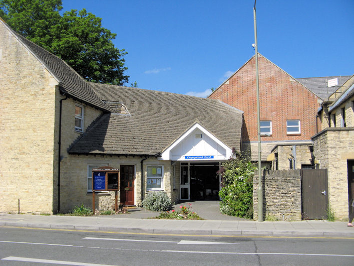