The Churches of Britain and Ireland
| Watford, Hertfordshire
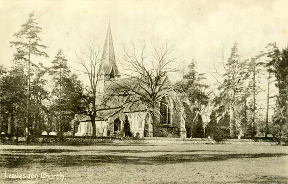
Churches at Garston, Leavesden Green.
The former Chapel of the London Orphan Asylum on Orphanage Road, as seen by Streetview in 2018. Its grade II listing dates it to 1871. TQ 1131 9719. Christ Church (2024 Streetview) on St. Albans Road. TQ 1087 9787. Link. Church of Jesus Christ of Latter-day Saints on Hempstead Road, as seen by Streetview in 2025. TQ 0866 9931. Link. A Congregational Church used to stand at the junction of St. John's Road and Clarendon Road at TQ 1093 9701. A newspaper history article here includes photos, and dates it to 1904 to the late 1970's. 2024 Streetview of the site. Cornerstone Church (2022 Streetview) is on Vicarage Road and Banbury Street, at TQ 1055 9582. This source (many photos) says it used to be known as West Watford Christian Fellowship), and that it was built as a Wesleyan Mission Church in 1893. The 25" O.S. map of 1898 labels it as Wesleyan Mission Room. Facebook. Derby Road Baptist Church (2024 Streetview) stands on Derby Road and Grosvenor Road at TQ 1129 9647. Link, which says that the church has been on this site for 133 years. Its grade II listing, which calls it The Baptist Tabernacle, dates it to 1887. The Elim Pentecostal Church (2024 Streetview) on St. Albans Road is a former Primitive Methodist Chapel, dated here to 1897-8. It was successor to a tin tabernacle to the rear of the present site, and before that a chapel on Carey Place (so far un-located). Facebook. Harebreaks Gospel Church on Leggatts Way, as seen by Streetview in 2024. TQ 0995 9935. Link. Holy Rood (R.C.) stands at the junction of Market Street and Percy Road - 2024 Streetview. TQ 1087 9633. Link. Grade I listed, wherein it's dated to 1889-1900. Leavesden Road Baptist Church, on Leavesden Road and Garfield Street, as see by Streetview in 2024. An un-dated (at least as regards the year) news article says that it had been closed since 2021, and that planning permission to turn it into a mosque had been refused. Nevertheless, in 2026, Google maps was labelling it as Watford Islamic Centre. Its grade II listing dates it to 1895-1909. TQ 1068 9808. The cemetery on Vicarage Road used to have two Mortuary Chapels. The Nonconformist stood at TQ 1059 9612, and the Church of England at TQ 1066 9603. Only the latter survives - 2016 Streetview. Oasis City Church Watford meets in Leonardo's Hotel (2024 Streetview) on Clarendon Street. TQ 1096 9669. Link. The Quaker Meeting House stands on Church Road, and was seen by Streetview in 2011. TQ 1034 9788. Link. St. Andrew on Church Road, as seen by Streetview in 2008. It's dated in its grade II listing to 1853-7, by Teulon. TQ 1069 9761. Link. St. James Road Baptist Church (2024 Streetview) stands on St. James Road and Farraline Road at TQ 1081 9600. Link. The church history page advises that the first church on the site was a tin tabernacle, opening in 1903, with the present church dating to 1965-6. St. John is on Sutton Road, and was seen by Streetview in 2024. TQ 1119 9674. Link. The history page dates it to 1891-3, preceded by a tin tabernacle (there is a photo) from 1873. Grade II listed. St. Luke (2016 Streetview) on Langley Way. TQ 0964 9781. Link. Its predecessor stands adjacent (2008 Streetview), and now serves as the church hall (source). St. Mark, on Leggatts Way. Vegetation effectively obscures the view for Streetview, but the church website has a photo. TQ 0999 9920. St. Mary. TQ 1107 9631. From an old postcard in Steve Bulman's Collection. A 2020 Streetview provides a modern view. A comprehensive church guide can be found here. Link. Grade I listed. See here for related listed features. St. Michael and All Angels stands on a triangular plot between Mildred Avenue and Durban Road West, at TQ 1015 9632. Streetviews from 2024, 2021. Link. The history page dates it to 1913, preceded by a smaller church which still stands adjacent, now serving as the church hall - 2024 Streetview. St. Thomas (U.R.C.), on Langley Road, as seen by Streetview in 2021. A 2026 news article says it "has not been in use as a church since 2021" and that it's awaiting a planning decision about turning it into a mosque. TQ 1046 9745. Stanborough Park Seventh-day Adventist Church (2018 Streetview) is off the A412, at TQ 1120 9964. Link. Watford Christian Spiritualist Church is on Estcourt Road - 2024 Streetview TQ 1109 9701. Link says they have been in the present building since 1989, having previously been on Queens Road since 1920. Can you advise where this was exactly? The Watford Union Workhouse on Vicarage Road had a Chapel, at TQ 1051 9574. Some photos of it (scroll down) can be seen here (where it's called St. Barnabas, demolished circa 1962). Its site now serves as an outdoor seating area for the hospital - 2024 Streetview. Wellspring Church on Wellspring Way and Pump House Lane, as seen by Streetview in 2024. TQ 1137 9599. Link.
West Watford Free
Church (Baptist) (2024 Streetview) stands at the junction of Croxley
View and Tolpits Lane, at TQ 0963 9536.
Link.
Garston
Leavesden
Green
|
||
06 May 2026
© Steve Bulman
Contact Details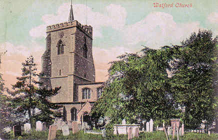