The Churches of Britain and Ireland
|
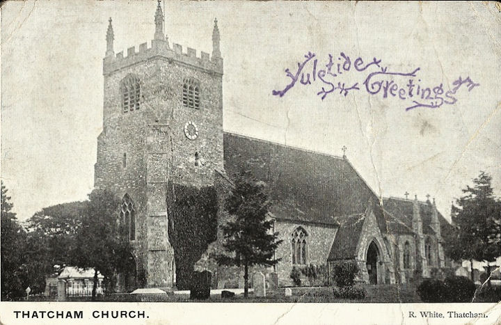
Thatcham, Berkshire The Christadelphian Hall, on Lower Way, as seen by Streetview in 2021. SU 4963 6741. Link. Glendale Church is on Green Lane, and was seen by Streetview in 2021. SU 5138 6740. Link. The Methodist Church is on Chapel Street. Older maps label it as Wesleyan, and Genuki dates it to "before 1848". It was seen by Streetview in 2011. SU 5186 6748. Link. The cemetery on London Road has a Mortuary Chapel. It was seen by Streetview in 2021. SU 5258 6749. Our Lady of The Assumption (R.C.) on Bath Road, as seen by Streetview in 2021. SU 5128 6752. Link. Old maps show a Primitive Methodist Chapel on Rope Walk, at SU 5127 6735. It stood at the end of the cul-de-sac seen here by Streetview in 2021, and is dated here to 1848. Genuki says "founded before 1833", and "closed after 1967", so perhaps there was another chapel. St. Barnabas meets in a school (Streetview 2021) on Park Avenue. SU 5171 6789. Link. St. Mary. SU 5164 6723. © Jill Bennett. Postcards of the exterior (franked 1906) and interior (franked 1921), both from Judy Flynn's Collection. Link. Grade II* listed. Two tombs in the churchyard are listed separately; they can be found here. The former St. Thomas's Chapel (Streetview 2021) on Chapel Street is dated here to circa 1304. SU 5218 6747. Thatcham Community Church (Evangelical) meets in the Parish Hall on Chapel Street. Streetview from 2021. SU 5186 6743. Link. U.R.C. on Church Lane, as seen by Streetview in 2021. It's marked on a map of 1900 as Independent. SU 5162 6734. The same map marks the further adjoining building as School. Its grade II listing dates it to the early 19th century.
|
||
04 March 2023
© Steve Bulman
Contact Details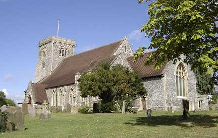