The Churches of Britain and Ireland
|
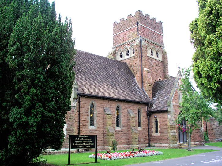
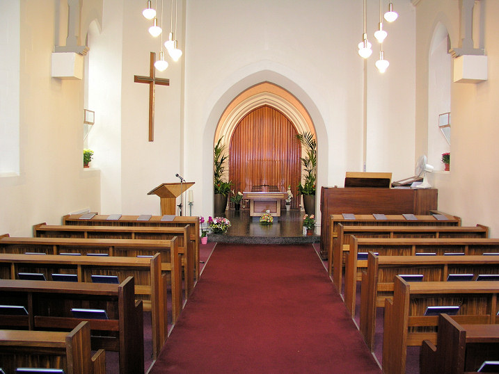
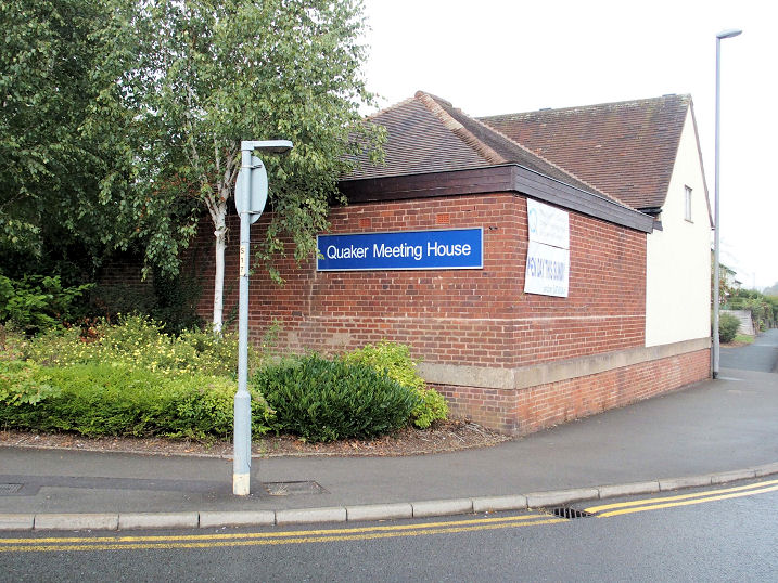
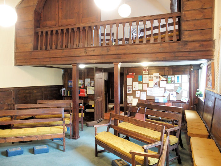
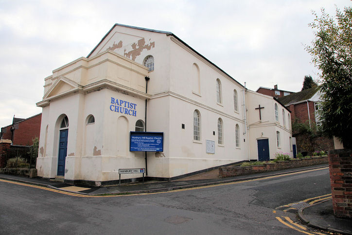
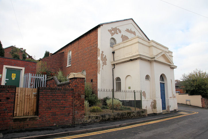
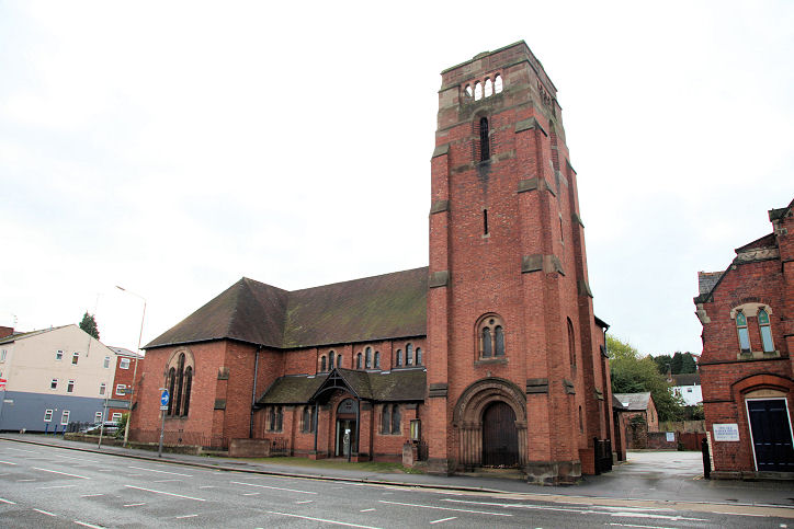
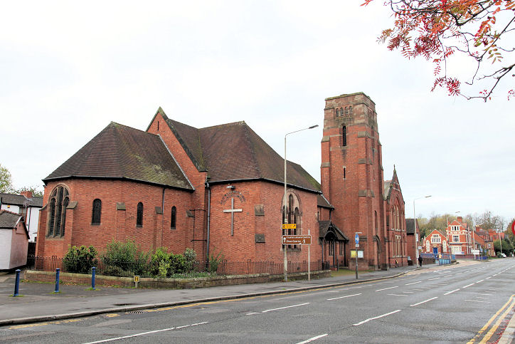
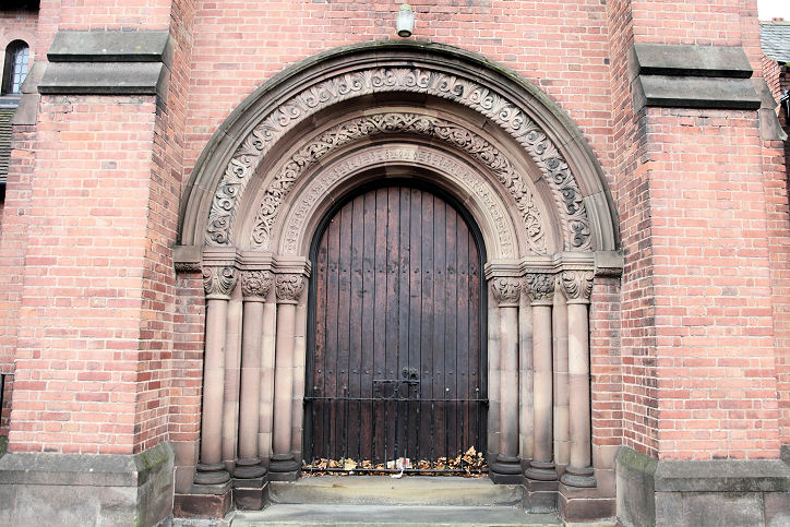
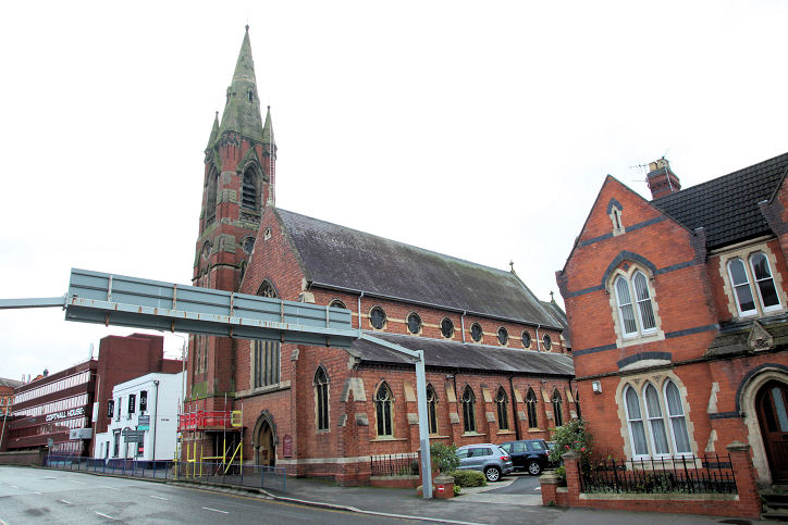
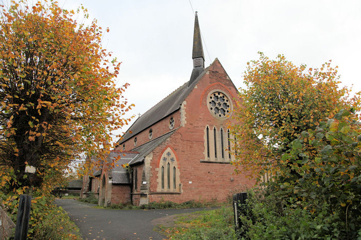
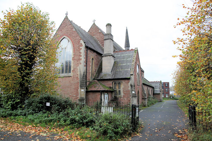
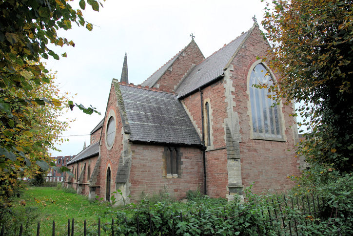
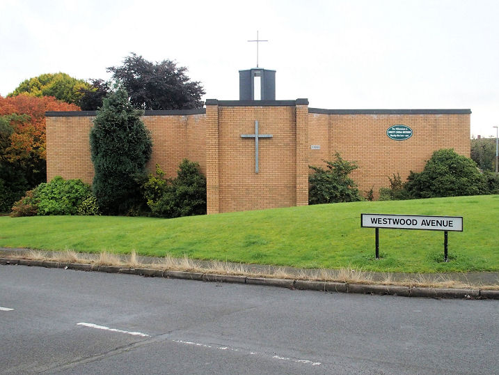
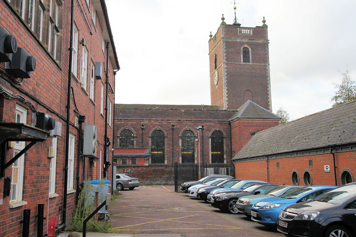
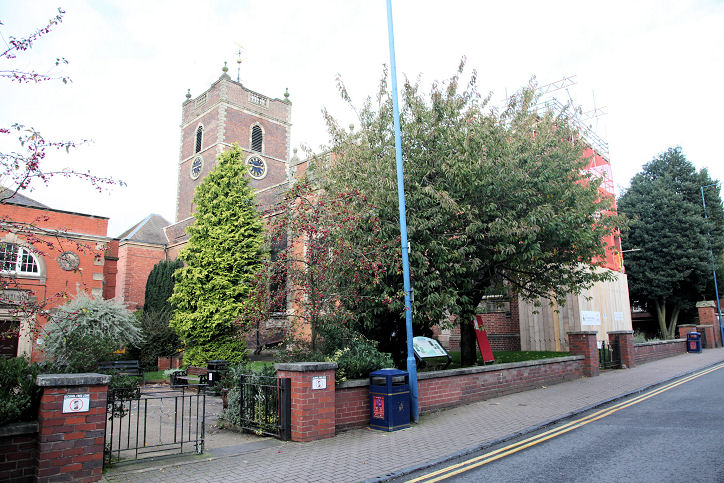
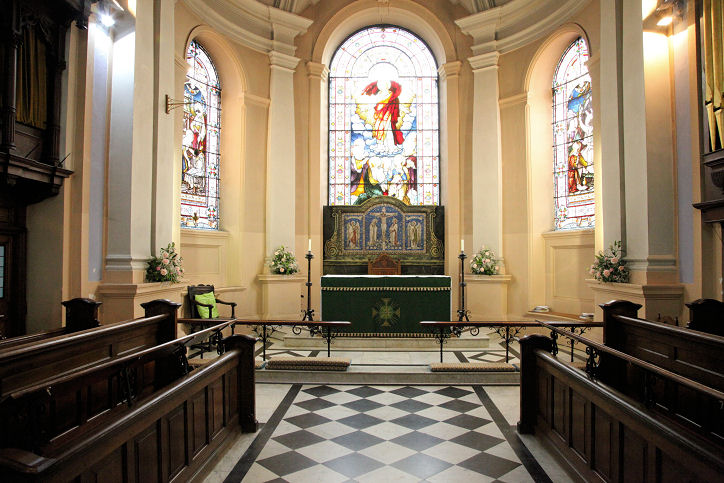
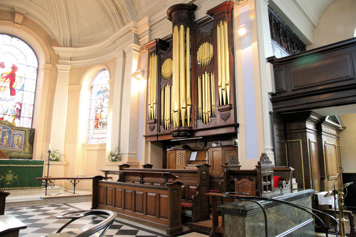
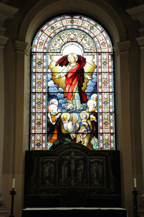
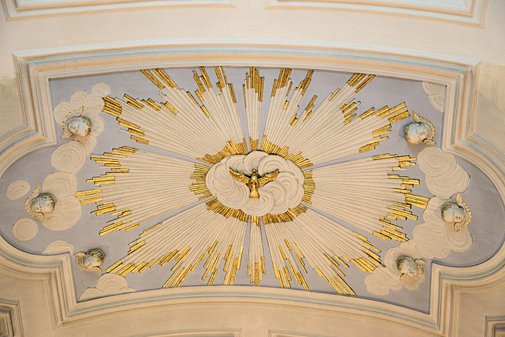
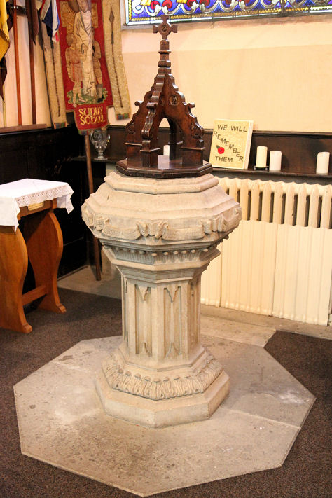
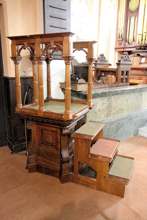
Stourbridge, West Midlands Churches in Pedmore. A Catholic Apostolic Church used to stand on Duke Street, at SO 9013 8453. Although not labelled, a map of 1884 appears to show it, and it shows as still active on a map of 1953. The building on its site was seen by Streetview in 2017. Chapel of Stourbridge Crematorium on South Road. It was originally a double mortuary chapel, aligned roughly north-south, with Nonconformist to the north, and Church of England to the south. Another view, and the interior. SO 8864 8381. All © Dennis Harper (2012). There used to be a Congregational Chapel on Lower High Street at SO 9001 8460, directly across the road from the Unitarian Chapel. Pre-dating a map of 1903, it was still active at least as late as 1959, but was later demolished. The buildings on the site today (flats or perhaps offices) was seen by Streetview in 2022. Friends' Meeting House (1689) on Scotts Road. Another view, and two of the interior - 1, 2. SO 8991 8453. All © Dennis Harper (2018). Link. Gig Mill (or Gigmill) Methodist Church (2022 Streetview) stands on Glebe Lane and Witton Street. SO 8936 8373.The adjacent Church Hall (2022 Streetview) stands on the site of the church's predecessor, labelled as Wesleyan on a map of 1903. SO 8936 8374. Link. Hanbury Hill Baptist Church on Chapel Street, Hanbury Hill. Another view. SO 9010 8395. Both © Dennis Harper (2017). By 2024 it had been renamed as Hope Baptist Church - link. A Methodist Chapel is shown on a map of 1945 at the corner of Enville Street and West Street. Other available maps label it just as Chapel. SO 8975 8446. Genuki identifies it as Primitive Methodist. A news story (with photo) dates it to 1857, closing in 2005, and says it was to be demolished to make way for housing. It site can't be seen on Streetview (blurred out). New Road Methodist Church (1928), on New Road. Another view, and a fine doorway. SO 9015 8407. All © Dennis Harper (2017). Link. The history page says that the church stands on the site of an earlier Methodist church of 1805. It's presumably this one which is shown on a map of 1882, where it's labelled as Wesleyan. Our Lady and All Saints (R.C.) on New Road. Its grade II listing dates it to 1863-4, by E.W. Pugin. Another view. SO 9029 8406. Both © Dennis Harper (2017). Link. The former St. John the Evangelist off Vauxhall Road, was up for sale in 2017. It's dated in its grade II listing to 1860-1, by Street. Two additional views - 1, 2. SO 9040 8416. All © Dennis Harper (2017). St. Mary on Church Road, Old Swinford, as seen by Streetview in 2021. SO 9079 8308. Link. Grade II listed. St. Michael and All Angels on Maynard Avenue and Westwood Avenue. Another view. SO 8874 8323. Both © Dennis Harper (2017). Link. St. Thomas on Market Street. Another view. SO 9002 8420. Both © Dennis Harper (2017). A 2022 Streetview provides another view. Four views of the interior - 1, 2, 3, 4, the East window, a decorated ceiling panel, the font, and what is apparently known as a "skeleton" pulpit, all © Dennis Harper (2018). Link. Grade I listed, wherein it's dated to 1726.
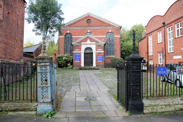
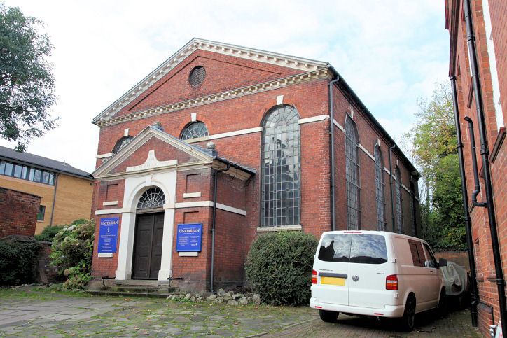
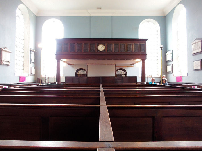
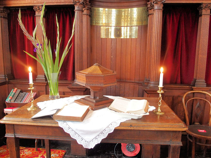
Unitarian Church (1788) on
Lower High Street. Another view.
SO 8996 8460. Both © Dennis Harper (2017).
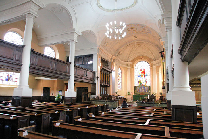
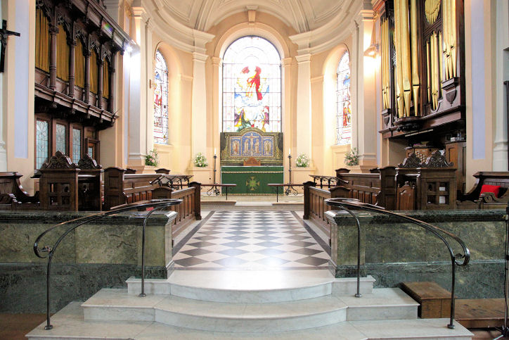
Three interior views - 1,
2,
3, all © Dennis
Harper (2018).
Link, which says it was built as Presbyterian, and that it was preceded on
the same site by a church of 1698. The 25" map of 1903 does indeed label it as
Presbyterian. The very brief
Grade II listing.
Pedmore
|
||
21 July 2025
© Steve Bulman
Contact Details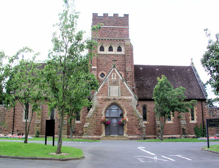