The Churches of Britain and Ireland
| St. Austell, Cornwall
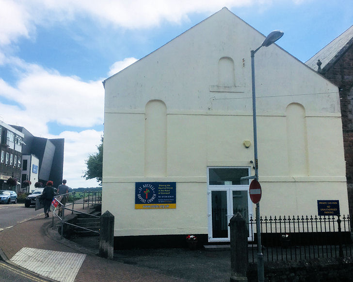
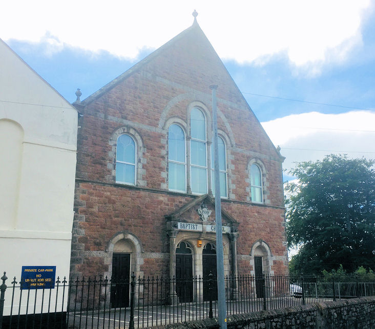
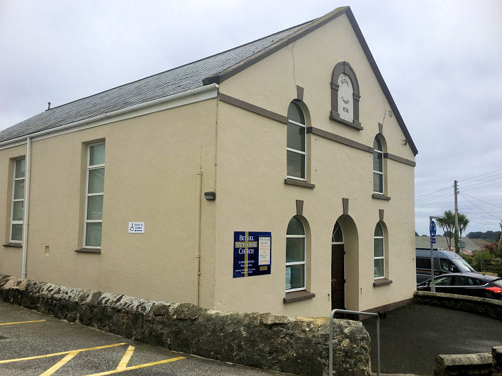
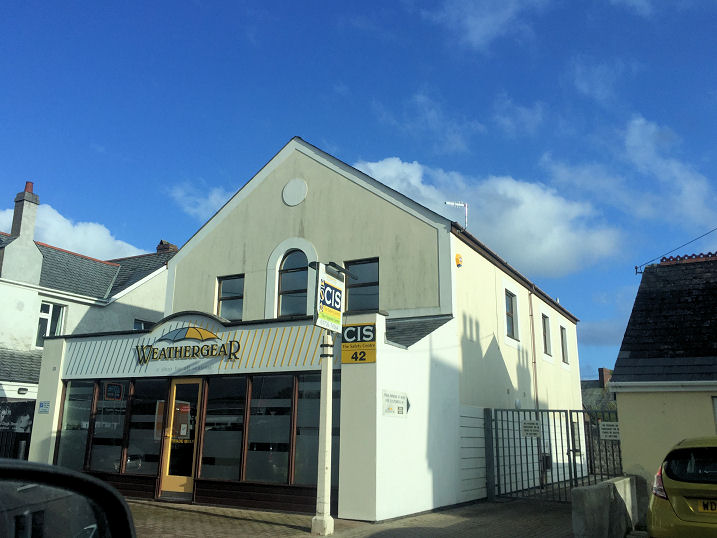
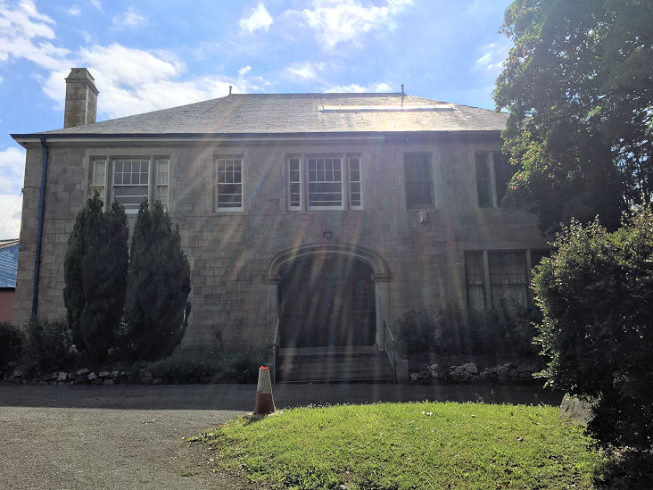
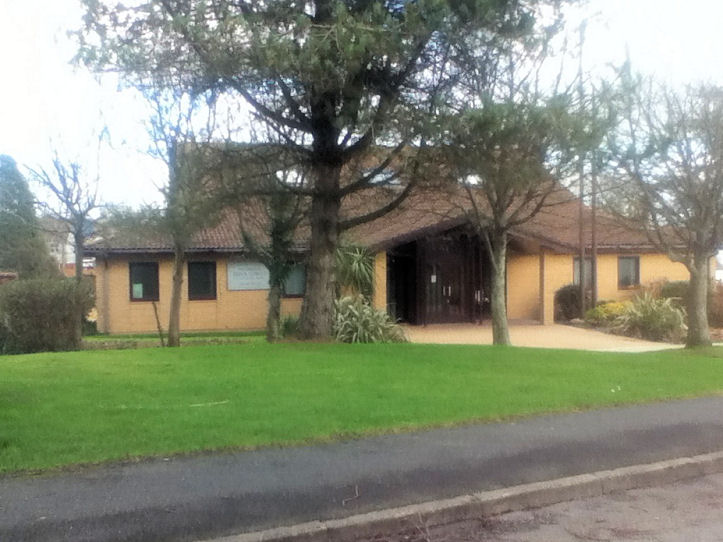
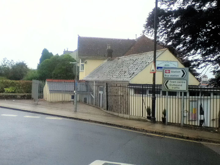
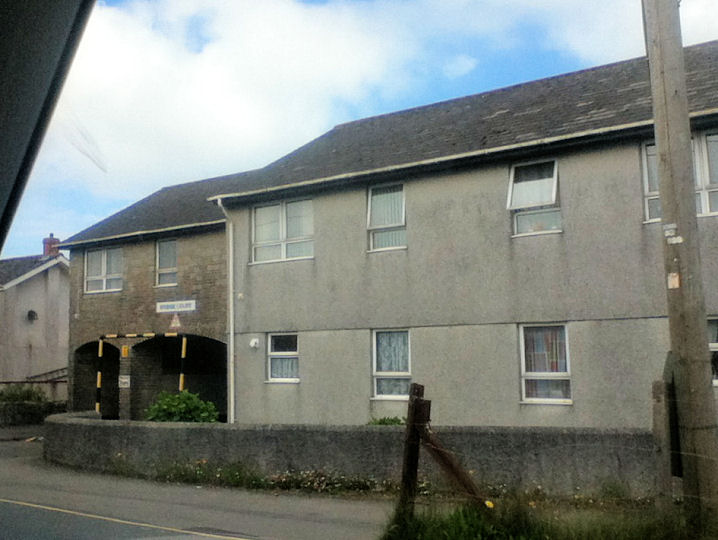
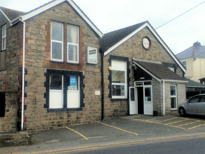
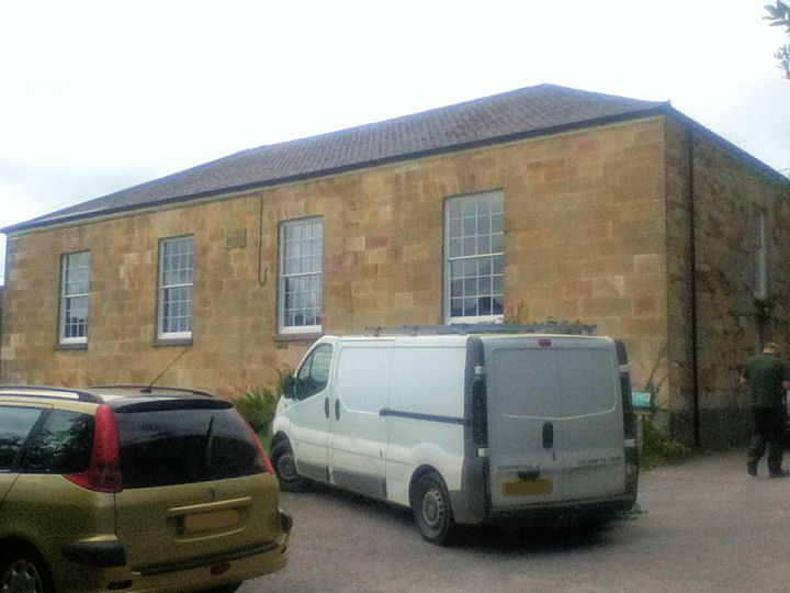
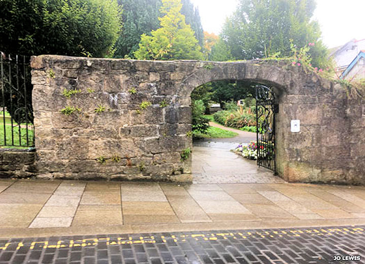
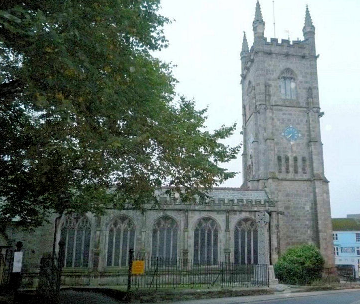
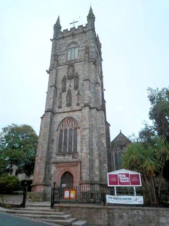
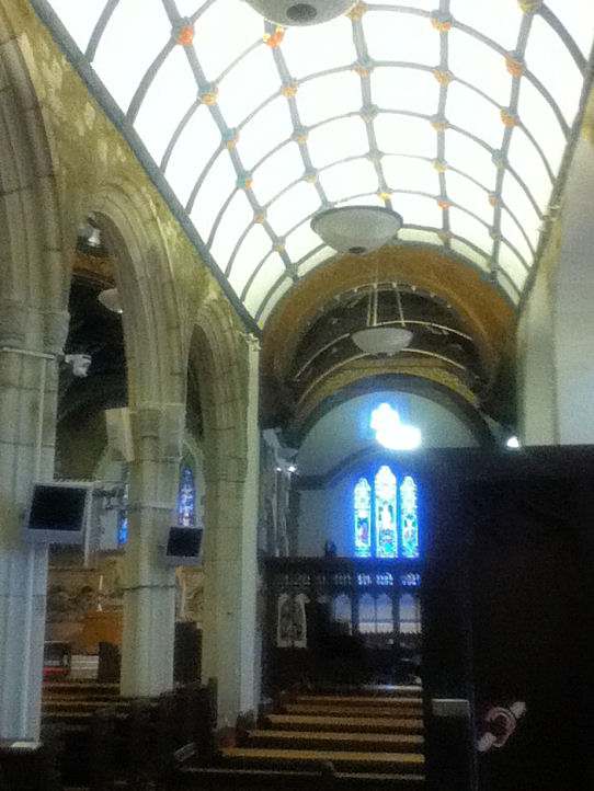
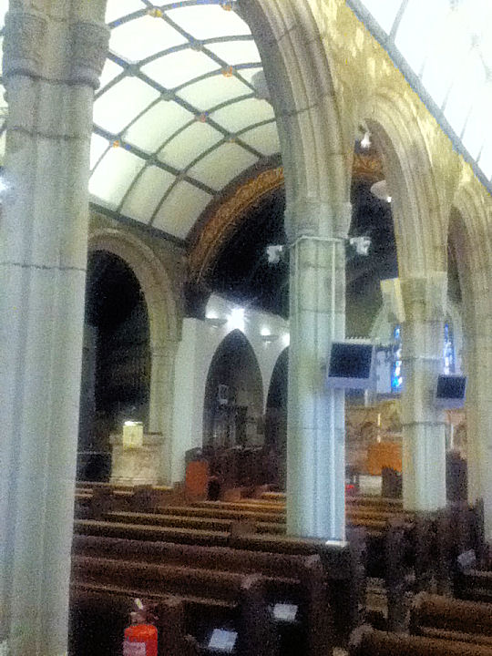
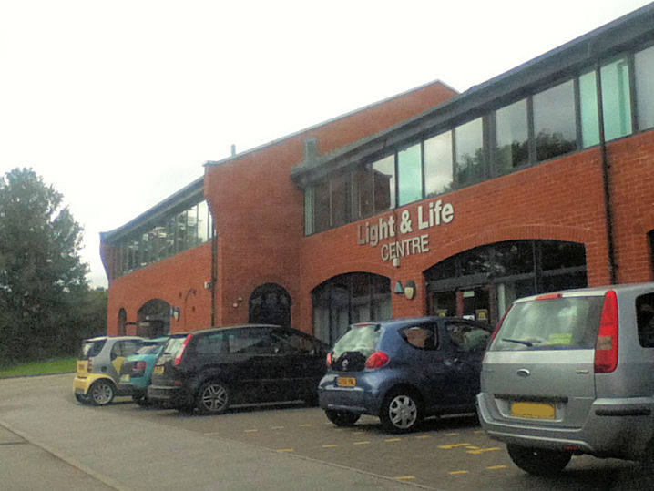
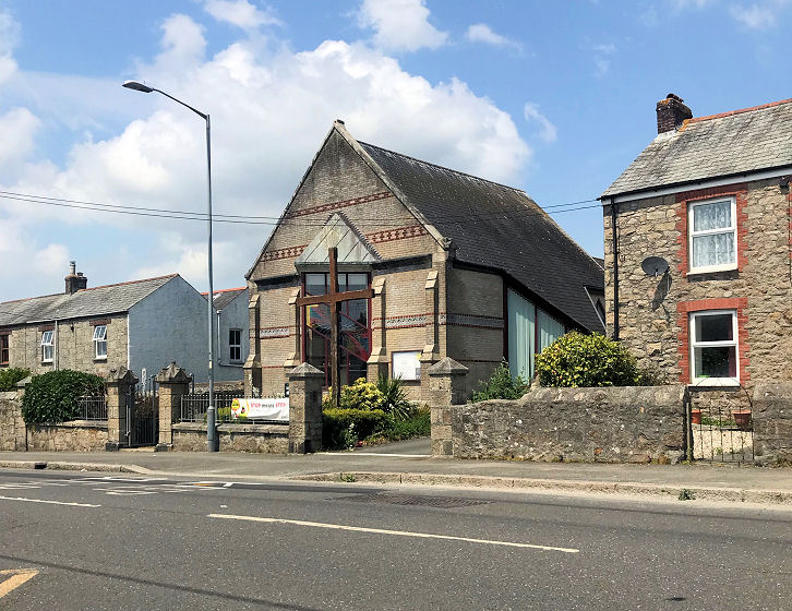
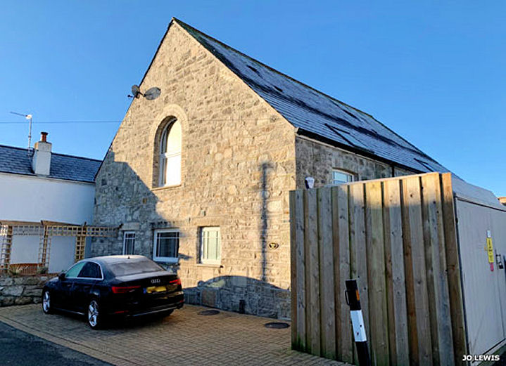
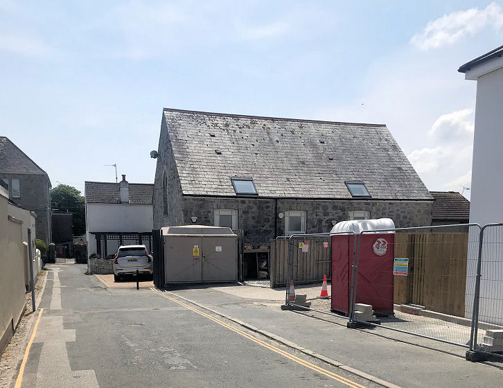
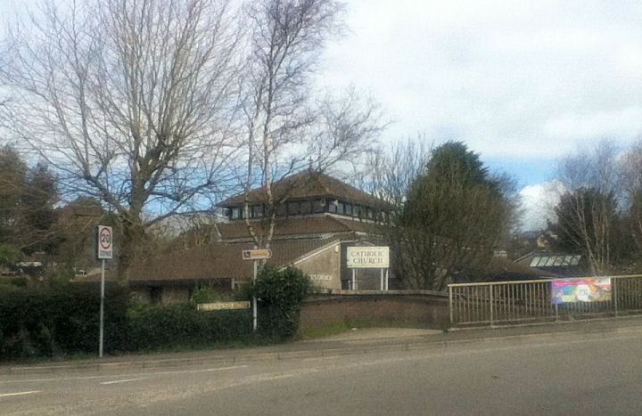
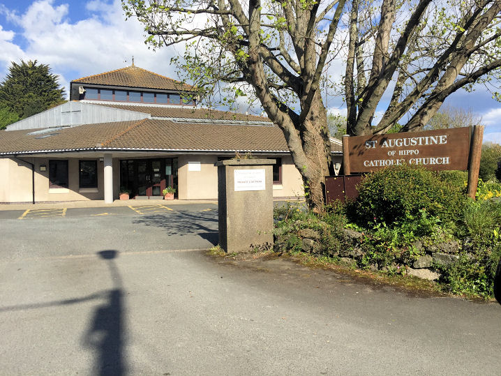
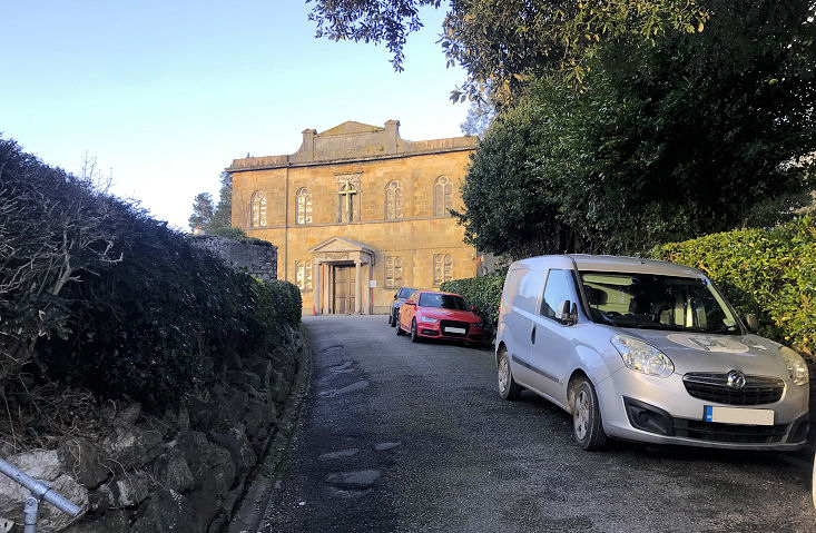
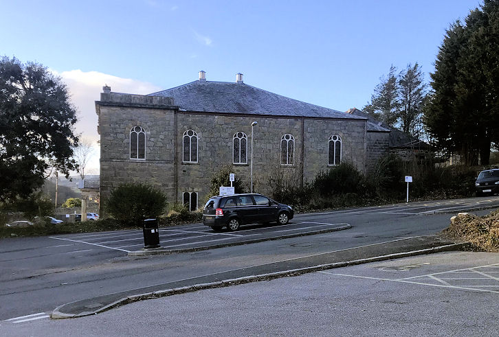
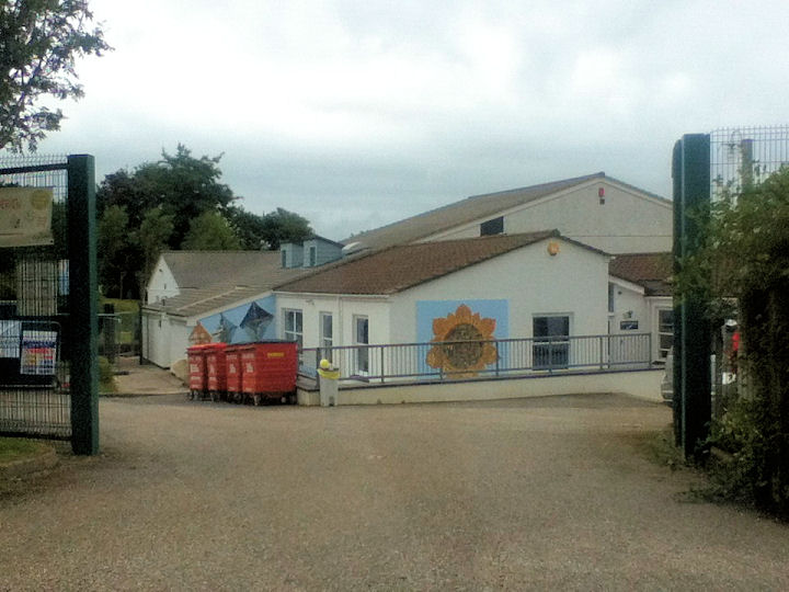
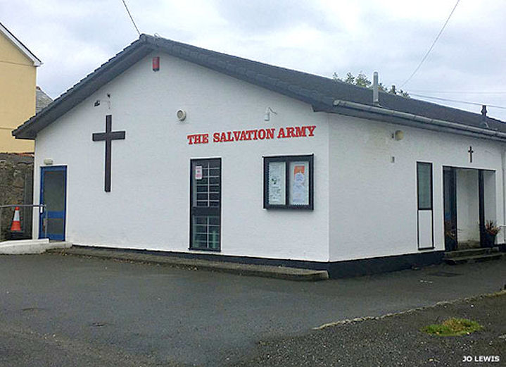
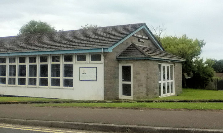
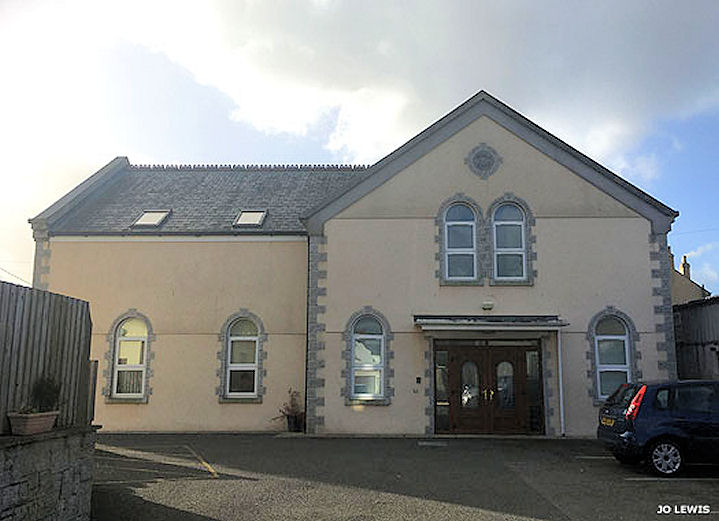
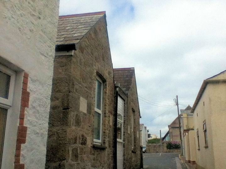
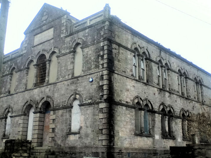
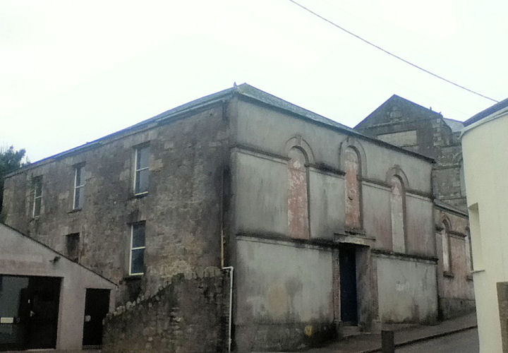
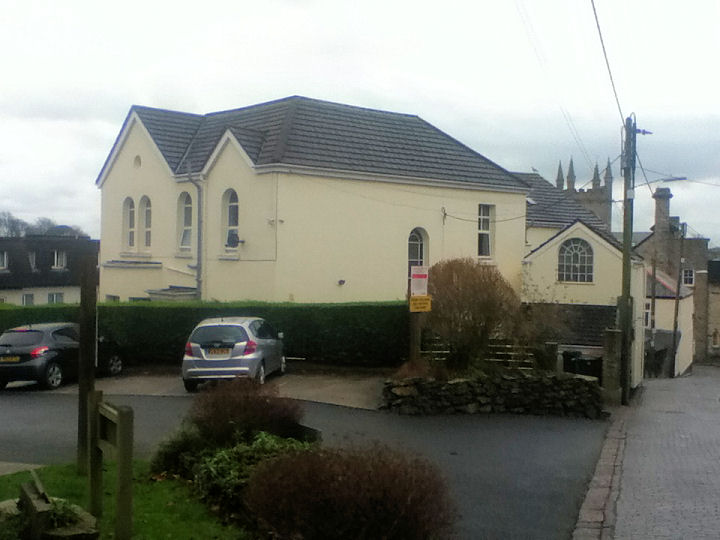
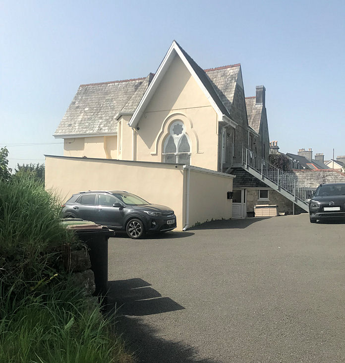
The former Baptist Church (1833). SX 011 524. This was originally a Wesleyan Chapel (Ebenezer), and is now known as Cornerstone Christian Centre. © Paul E. Barnett (2016). Another view, © Jo Lewis (2019). An active Baptist Church stands adjacent. © Jo Lewis (2019). A very good history (pdf) is available here. Bethel Methodist Church was built as Bible Christian in 1836. It was a replacement for an earlier Bethel Chapel which stood across the road (now replaced by housing), built in 1822. © Jo Lewis (2019). The site of the cemetery chapel in the Eastbourne Road Cemetery. SX 0204 5223. © Paul E. Barnett (2017). Jo Lewis advises that this was also known as Watering Hill Cemetery Chapel. It probably dates from the mid-1870's, and was destroyed in a fire in 2011. Polkyth Road has a so far unidentified (possible) former chapel at SX 02575 52771. © Paul E. Barnett (2019). Jo Lewis has been looking at old maps to try and identify this building, without success, though she does advise that a Sunday School stood on the other side of the road. The Christadelphians meet at the Assembly Room (aka St. Austell Arts Centre) on Truro Road. SX 0048 5192. © Paul E. Barnett (2019). Link. Church of Jesus Christ of Latter-day Saints. SX 031 526. © Paul E. Barnett (2017). Church of the Holy Spirit. SX 017 525. © Paul E. Barnett (2016). Jo Lewis advises that old maps show a Plymouth Brethren Meeting House here - whether it is the same building is not at present known. The site of the United Methodist Free Chapel on Clifden Road. This was also known as Bridge Street Chapel, and a photo of it is available here. SX 027 526. © Paul E. Barnett (2017). The former Free United Methodist Chapel on East Hill. Although there is a date-stone for 1911, old maps show a chapel here from at least 1881 up to 1936. Whether 1911 refers to a new build, or a renovation, is not clear at present. It's now used as a band room. SX 015 524. © Paul E. Barnett (2017). Jo Lewis thinks this may have been the Sunday School, the chapel proper being further down the hill on the opposite side of the road. A photo is available here. Friends' Meeting House. SX 015 525. © Paul E. Barnett (2016). Jo Lewis advises that this was the third Friends' Meeting House in the town. High Cross Cemetery (now closed and the headstones cleared) is now an open space called Cemetery Park. Old maps (e.g. the 1881-2 O.S. map) show a Mortuary Chapel. It stood just to the right of this entrance archway. Circa SX 0159 5249. © Jo Lewis. Holy Trinity on Church Street. Another view. SX 0142 5245. Both © Carole Sage (2013). Two interior views - 1, 2, both © Paul E. Barnett (2016). Link. Grade I listed. Light and Life Free Methodist Church. SX 023 525. © Paul E. Barnett (2016). Link. Mount Charles Methodist Church, built as Wesleyan. It was previously known as Victoria Road Chapel. An older photo of it can be seen here, from before the modern glass extensions. SX 0268 5243. © Paul E. Barnett (2023). It was preceded by an earlier chapel, on Wesley Place, which was used as a Sunday School after the newer church opened. It's now in residential use. SX 0267 5236. © Jo Lewis. Another view, © Paul E. Barnett (2023). The former Primitive Methodist Church on Clifden Road. It pre-dates 1881, as it is shown on the O.S. map of that year. SX 0264 5264. © Paul E. Barnett (2016). Jo Lewis advises that it was closed in the 1940's. St. Augustine of Hippo (R.C., 1937). See also the Salvation Army Chapel entry, below. SX 025 522. © Paul E. Barnett (2016). Another view, © Paul E. Barnett (2019). Link. St. John's Methodist Church, off Bodmin Road. Another view. SX 0117 5258. Both © Paul E. Barnett (2023). Link. Grade II* listed, wherein it's dated to 1828. St. Luke meets in a school. SX 037 533. © Paul E. Barnett (2017). Link. The Salvation Army Chapel on Ranelagh Road. Built at an unknown date prior to 1969, it stands on the site of St. Augustine's Roman Catholic Chapel of 1913. SX 0260 5249. © Jo Lewis. Link. Seventh-day Adventist Church on Bucklers Road. SX 035 529. © Paul E. Barnett (2016). Seymour Gospel Hall on Slades Road. Dating from 2009, it succeeded an earlier building on the same site. The earlier building can be seen here. SX 023 533. © Jo Lewis. Link. The former Wesleyan Methodist Chapel on Wesley Place. SX 027 524. © Paul E. Barnett (2016). Zion Chapel. It was built as Bible Christian in 1890, was later United Methodist, and closed in 1994. Two buildings standing opposite can both be mistaken for churches, but old maps show these as the church hall, and vicarage. SX 014 526. All © Paul E. Barnett (2016). A building with lancet windows stands near the railway station, on Menacuddle Hill, at SX 0131 5276. None of the available maps, back to the 1880's show it as a church. © Paul E. Barnett (2023).
|
||
08 September 2023
© Steve Bulman
Contact Details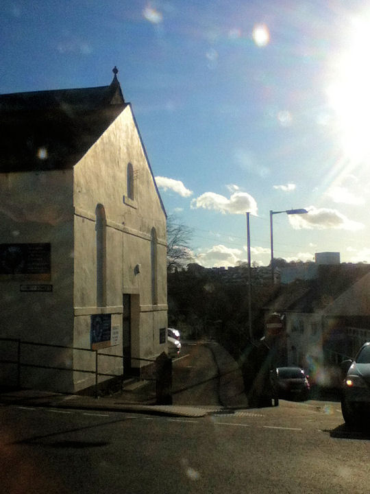