The Churches of Britain and Ireland
|
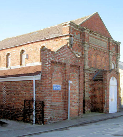
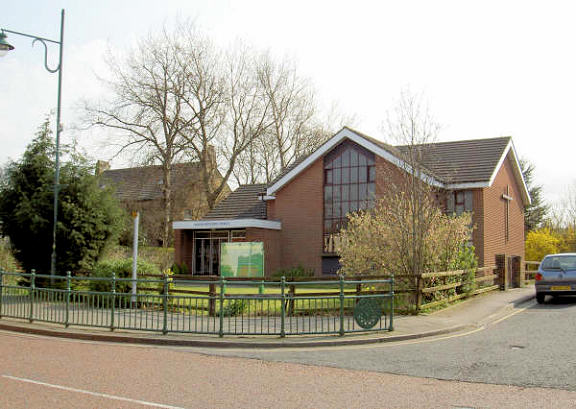
Shildon, County Durham All Saints. Another view. Both © Alan Blacklock. The former Friends' Meeting House of 1907 stand on Byerley Road. Howard Richter advises that it is not marked as a church on the 1939 6" O.S. map, so it may have gone out of use before then. NZ 227 259. It can be seen on a 2009 Streetview here. Independent Methodist Tabernacle. © Alan Blacklock. Methodist Church on Main Street. © Alan Blacklock. For the preceding Methodist Church (which also stood on this site), see the St. John entry below.
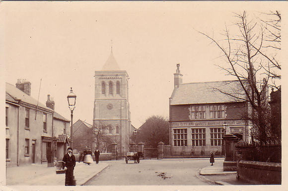
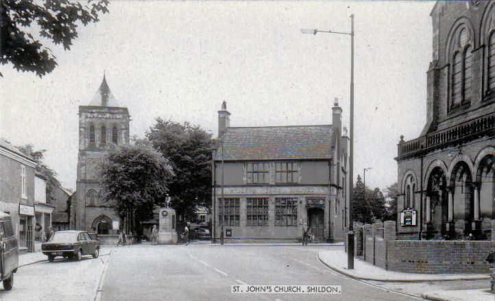
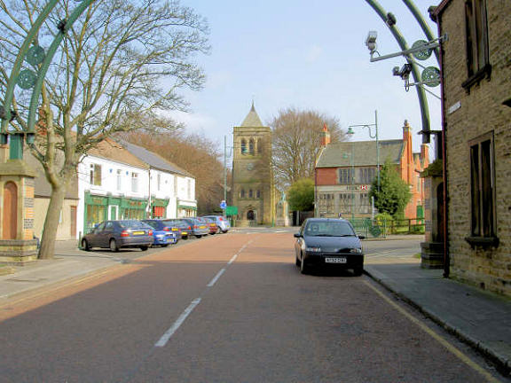
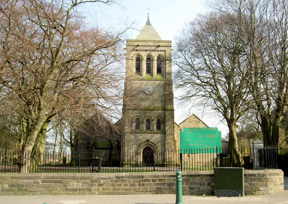
St. John.
Previously in the "Unknown" section, this old postcard (posted in 1908), is from
Andrew McGarrigle's Collection. The building to the right of the church has a
sign reading "York City and County Banking Ltd." There were no other clues to
the identity of this church, but Tony Preston advised that the YCCB ultimately
became the property of the HSBC bank, and he put me in touch with Sara Kinsey,
archivist at the HSBC. She identified it as Shildon, which allowed me to find
the appended link, which named the church as St. John. My thanks to Tony and
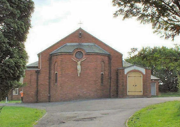
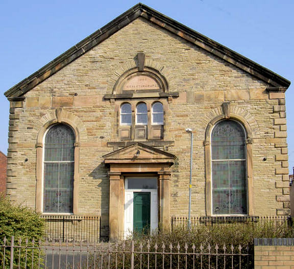
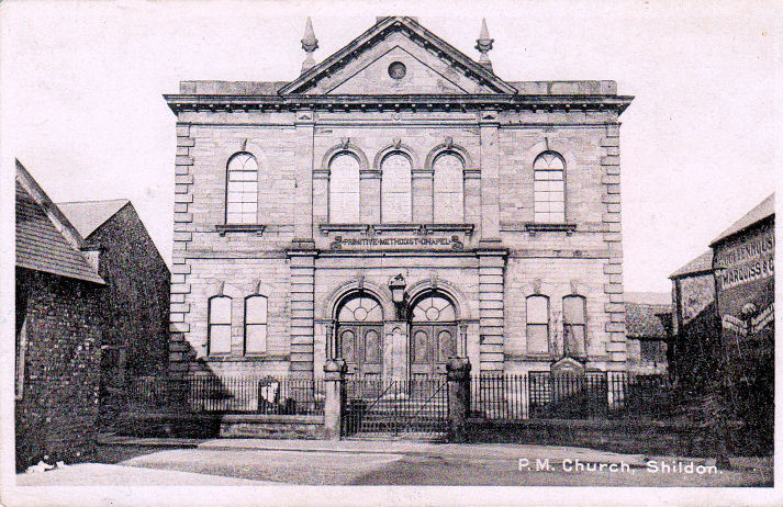
Sara for their help! St. Thomas Apostle (R.C.). © Alan Blacklock. Link1. Link2, from which we learn that the church was opened in 1934. It also says that it was preceded by a tin tabernacle "higher up the road", opened in 1906. Howard Richter advises that this stood on the east side of Auckland Terrace at about NZ 2230 2682, and that an O.S. map of the period marks it as "St. Thomas Aquinas". Salvation Army, © Alan Blacklock. Shildon Wesleyan Chapel (1865) on Cross Street and Soho Street. © Alan Blacklock. John Hardy has advised of a number of Methodist/Wesleyan Chapels in Shildon as follows - additional research by Howard Richter. Main Street Methodist Church (which is the one just caught in the St. John photo above). It has since been replaced on the same site by the present Methodist Church. Redworth Road Methodist Church which stood at NZ 230 256. A 2009 Streetview shows the site. New Shildon Methodist Church (closed 1960). Primitive Methodist Church on St. John's Road. NZ 2308 2592. The My Primitive Methodist Ancestors entry has a photo of it on an old postcard. An old postcard has another view. The 2009 Streetview shows a row of houses on the site. Another Primitive Methodist is shown here, on an old postcard from Alan Blacklock's Collection. This stood at about NZ 2282 2655, and map evidence indicates that it was built before 1897, and demolished in the 1960's. In a 2018 Streetview, the road seen heading into the distance didn't exist when the church was still standing; the church would have been across the roadway, approximately level with the tree behind the advertising hoarding. This church was a replacement for one which stood on Fryer Street at about NZ 2278 2650, the site now lying beneath a car park. It pre-dated a map of 1876, closed at some unknown date, but was still standing marked as "Hall" until at least 1969, but had been demolished by the time of the 1978-9 edition. Shildon Chapel Row Methodist Church had been built by 1876 as Wesleyan, and stood on what was then Chapel Row (now Church Street). The 2018 Streetview shows a much modified older building which may well have been the church. NZ 2297 2662. United Methodist on Garbutt Street stood at NZ 224 265. Demolished at some point, housing has been built on the site, as Streetview shows.
|
||
04 March 2023
© Steve Bulman
Contact Details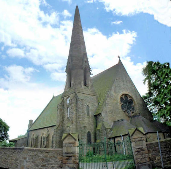