The Churches of Britain and Ireland
| Ramsey, Cambridgeshire
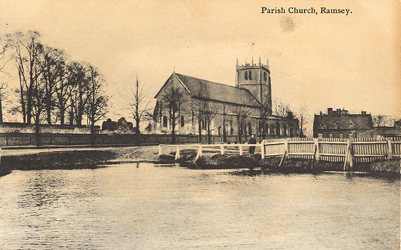
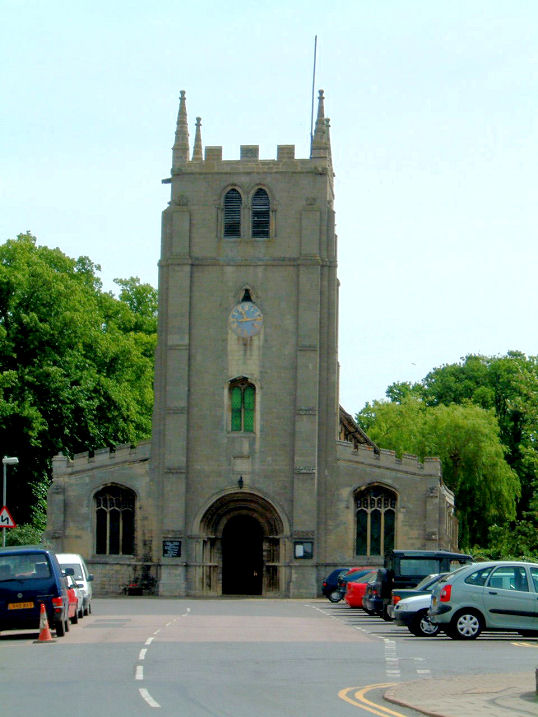
Catholic Church of the Sacred Heart (R.C.) on Newtown Road, as seen by Streetview in 2022. SZ Link. The history page dates it originally to 1863. Methodist Church on High Street. Older maps label it as Wesleyan. TL 2864 8503. © Jim Rushton. Link. It post-dates a map of 1887, which shows another Meth. Chap., set well back from High Street. On a different map this one shows as Meth. Chapel (Wesleyan) (Disused). Aerial views show woodland here now, so it doesn't appear to have survived. Its site hasn't been seen by Streetview, but it stood west of Lion Yard at SZ 2871 8495. The building seems to have survived at least into the mid-20th century, but I haven't been able to find a photo of it. The cemetery on Wood Lane has a double Mortuary Chapel. Its grade II listing dates it to circa 1858. In this Streetview from 2022 the Nonconformist Chapel is on the left, CoE on the right. TL 2925 8554. Some buildings survive of Ramsey Benedictine Abbey which stands to the south-east of the town. St. Thomas (below) was originally part of the abbey. Also surviving is a gatehouse, seen by Streetview in 2022 (gatehouse at right, St. Thomas at left). Link1. Link2. Link3. Various listed features remain - they can be found here. St. Thomas a Becket. TL 2907 8514. From an old postcard (franked 1916), in Geoff Watt's Collection. Another old postcard view, this one from Alan Craxford's collection. Two modern views, 1, 2, both © Jim Rushton. Link. Grade I listed. For other listed features associated with the church, see here. Salem Baptist Church (1857) stands on High Street at TL 2875 8499. It was seen by Streetview in 2022. Grade II listed. Great Whyte Baptist Church (2022 Streetview), on Great Whyte, was formerly a separate Baptist Church, but the congregations united in recent years. Both chapels remain in use. Link.
|
||
18 April 2023
© Steve Bulman
Contact Details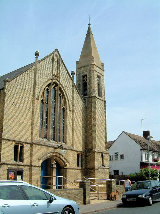