The Churches of Britain and Ireland
|
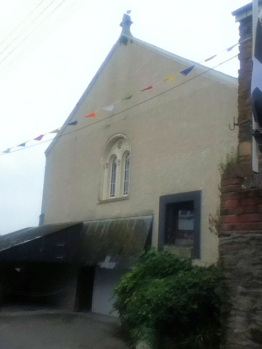
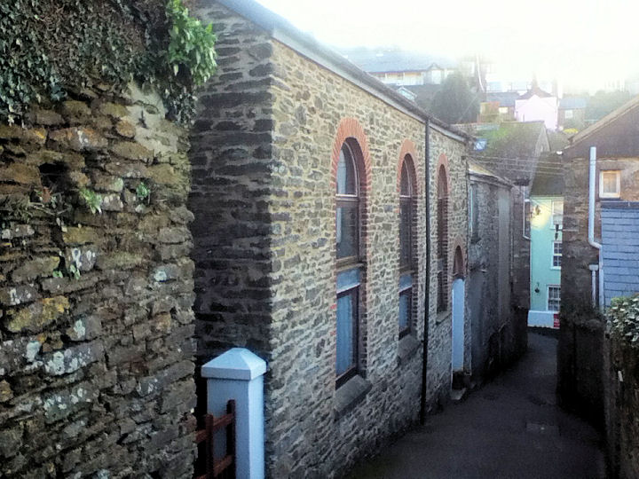
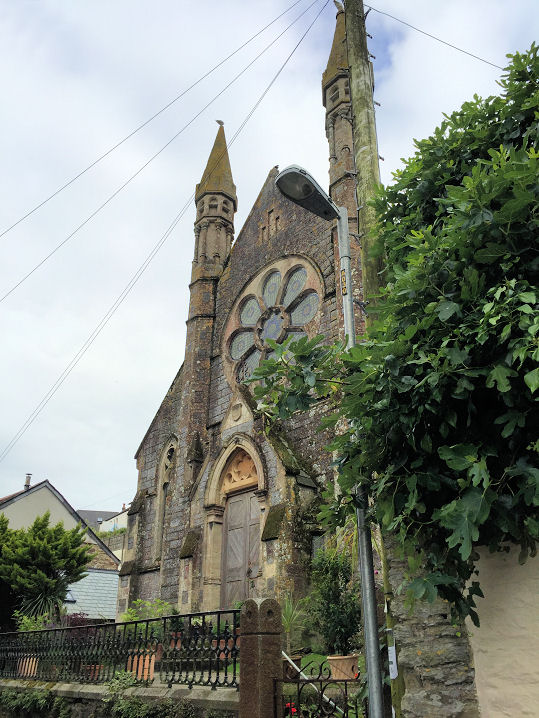
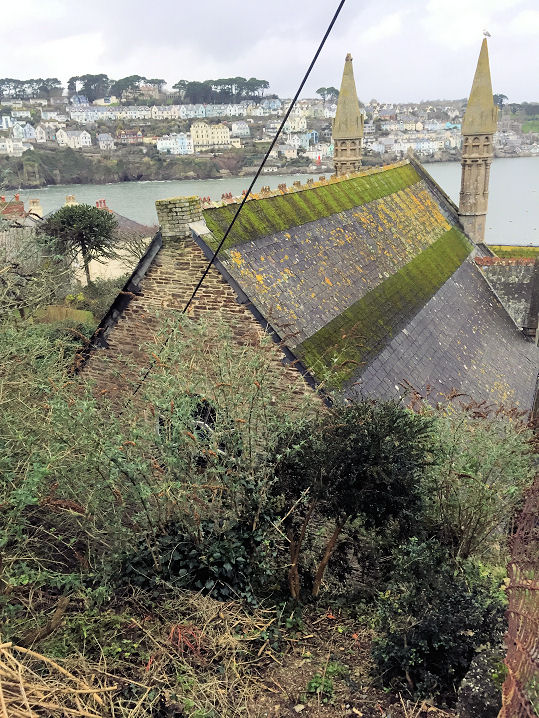
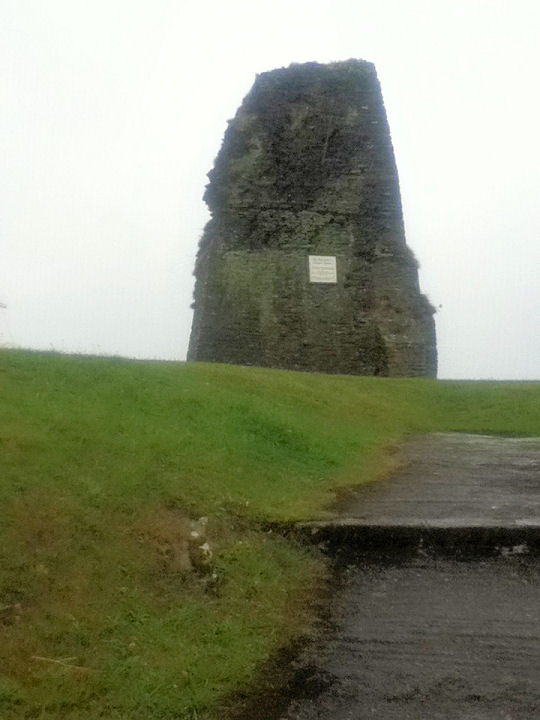
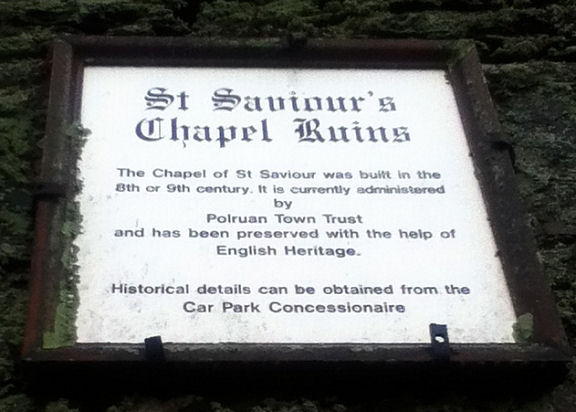
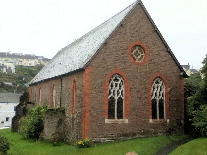
Polruan, Cornwall Chapel House on West Street is very likely a former chapel, but of so far unknown denomination. SX 123 510. © Paul E. Barnett (2017). This source includes a map showing a "former Congregational Chapel" at the corner of West Street and Battery Lane. A map of 1907 labels it as a Sunday School, and one of 1882 also shows it as a Sunday School, and shows a Congregational Chapel a few yards to the north. Perhaps the school was the first Congregational Chapel, re-purposed when its successor was built. Streetview saw the former Sunday School (or the house on its site), and what may be the former chapel (or the house on its site), in 2023. SX 1238 5101 (school), SX 1239 5103 (chapel). A former Methodist Church stands on Fore Street at SX 1265 5090. It pre-dates a map of 1888 (this source dates it to 1879-1958, originally as a United Methodist Free Church). © Paul E. Barnett (2015). Another possible former church stands on Chapel Lane - this may be the predecessor of the previous entry. SX 1265 5093. © Paul E. Barnett (2016). The Methodist Church on West Street, originally Wesleyan, is dated in its grade II listing to 1880. It may have been closed as it doesn't seem to have a web presence. Google Maps labels it as "Stone Church", but searching for this is also fruitless. Another view. SX 1245 5097. Both © Paul E. Barnett (2017 and 2018). The ruins of St. Saviour's Chapel. A plaque has some very brief details. SX 1252 5080. Both © Paul E. Barnett (2016). Link. Grade II listed. The present St. Saviour on Fore Street, which a 2022 news article describes as "redundant". SX 1265 5081. © Paul E. Barnett (2016). Link.
|
||
07 July 2024
© Steve Bulman
Contact Details