The Churches of Britain and Ireland
|
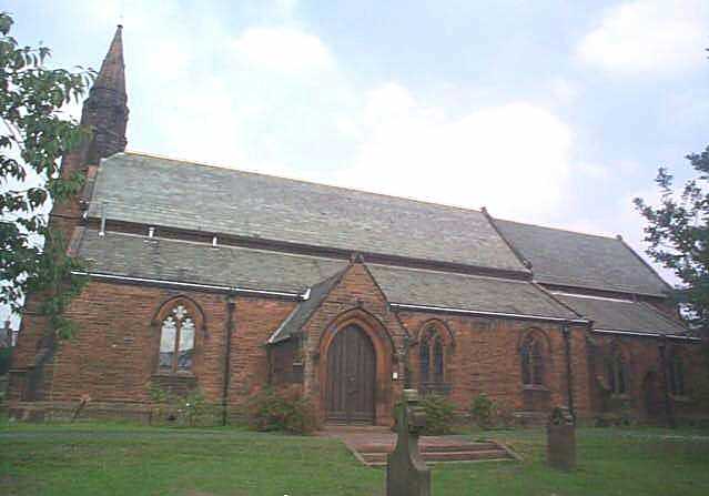
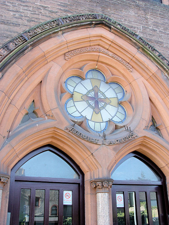
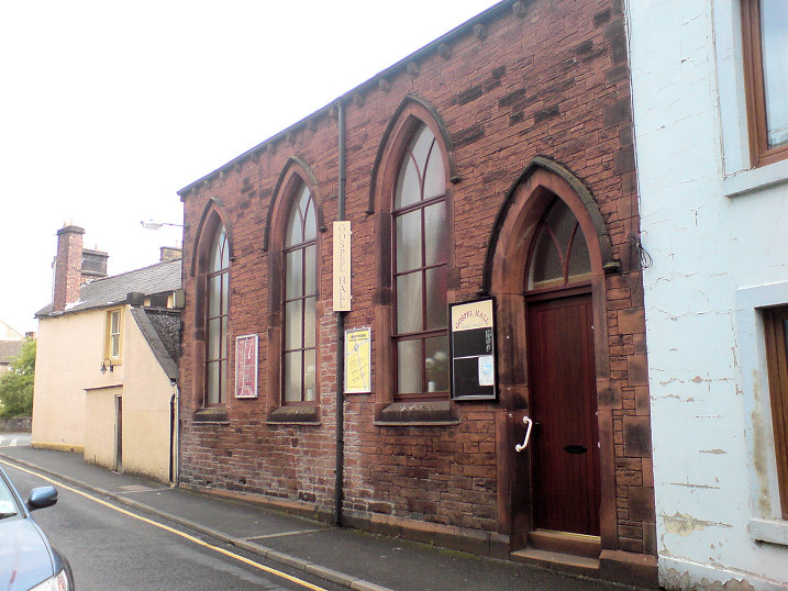
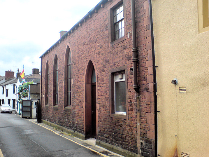
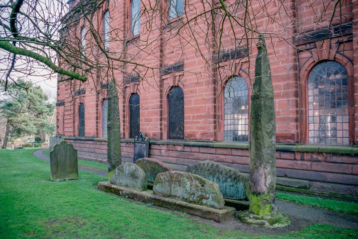
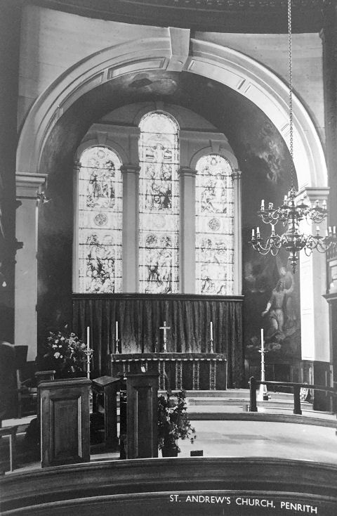
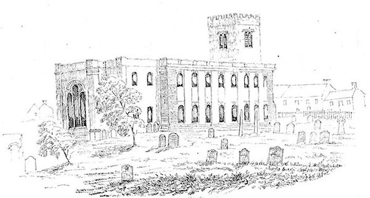
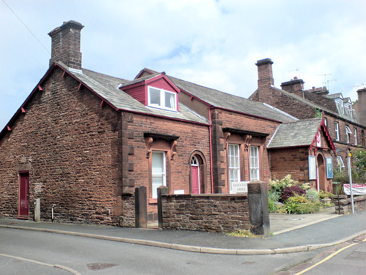
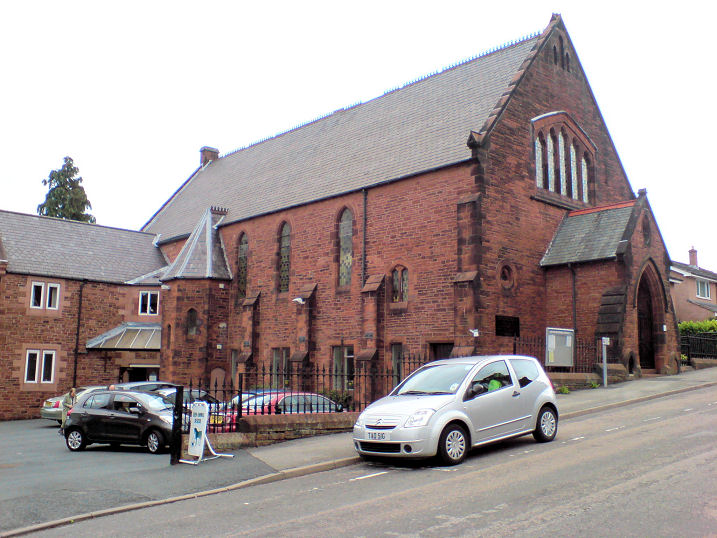
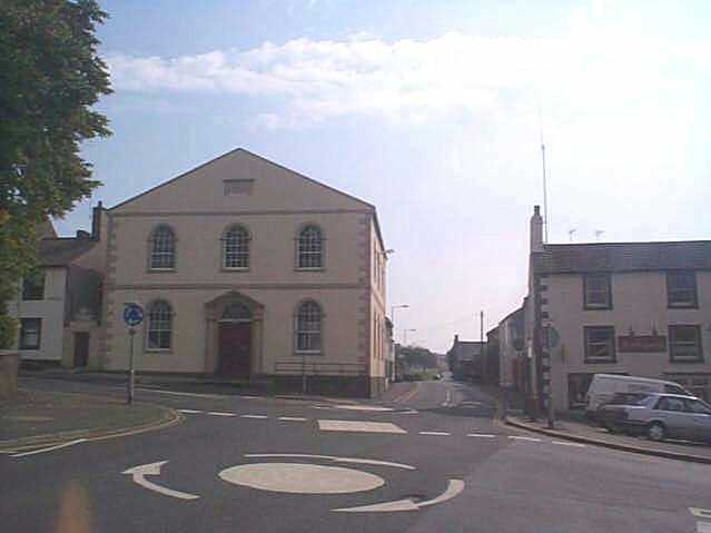
Penrith, Cumbria The former Arthur Street Primitive Methodist Chapel (1857), as seen on a 2010 Streetview. The congregation left when the Zion Sandgate Chapel (see below) was transferred from the Wesleyans to the P.M.'s in 1873, and was subsequently used as a Temperance Hall, but was eventually converted to residential use. NY 5161 3047. Link. The Brougham Street Primitive Methodist Chapel is attested to here, wherein it says that it had become St. Saviour's Mission Room by 1894, a chapel of ease from St. Andrew's. Closed in 1976, it was subsequently demolished, and housing built on the site - it can be seen here on a 2015 Streetview. NY 5102 3010. Cemetery Chapels (non-conformist to the left, CoE at right). NY 5173 3116. © Steve Bulman (2010). 2020 News story about plans to convert into offices. Christ Church (1848-50) on Stricklandgate. NY 5138 3054. © Les Strong. Grade II listed. Church in the Barn currently (2020) advertises itself as meeting at Faith Barn on Newtown Road. Access to the site can be seen here (2017 Streetview) It had previously met at Castletown Community Centre on the Gilwilly Industrial Estate - seen here by the Streetview van in 2018 - and other places before this, though exact details are unknown - see its history here. The former Congregational Church on Duke Street, now in residential use (it was closed circa 1990). The date-stone - "Rebuilt A.D. 1865" implies an earlier building, which Carole Sage advises was Ebenezer Independent Chapel of 1824, on the same site. NY 5135 3041. Both © Steve Bulman (2013). A Franciscan Friary once stood on what is now Friargate, a building called The Friarage now occupying the site, as seen here on a 2018 Streetview. It seems to have been very poor, and remarkably little seems to be known about it. What there is is summarised in a pdf available here - the writer of which favours the house seen here as the site of the Friary Chapel. NY 5180 3013. Gospel Hall (Plymouth Brethren, 1873) on Queen Street (front) and Albert Street (rear). The Gospel Hall website lists this building, though without contact details, but there are web references, apparently to this building, suggesting that it is now used commercially, so its status was uncertain. However, having re-visited in August 2012, I can confirm that the building is still used for worship. NY 515 303. © Steve Bulman (2012). King's Church Eden meets at The Play Station on Huntley Avenue. It can be seen on a 2009 Streetview. Link. The Methodist chapel on Wordsworth Street and Drovers Lane was built as Wesleyan in 1873. NY 5148 3057. © Steve Bulman (2010). Oasis Evangelical Church meets in a room in the Cranstons Foodhall, seen here in a 2018 Streetview. They had previously met in Brackenber Court - Streetview. Link. Penrith Mosque meets at 17 Middlegate, which is an Indian take-away. Seen here in a 2018 Streetview, this source says the mosque is at the back of the shop, though whether access is through the shop or there is access to the back is not at present known. Religious Society of Friends (Quakers) Meeting House on Meeting House Lane. It was originally a farmhouse, bought by the Friends in 1699, and subsequently enlarged several times. Circa. NY 5167 3038. © Steve Bulman (2010). Grade II listed. St. Andrew, the tower, and the "Giant's Grave". NY 5165 3016. All © Steve Bulman. Interior view, from an old postcard in Paul E. Barnett's Collection. An old drawing made by Thomas Bland in the 1850's is available here, reproduced by kind permission of Carlisle Library. It's from the searchable Cumbria Image Bank, which can be accessed here. Link. Grade I listed. St. Catherine (R.C.) on Drovers Lane was built in 1850. It replaced an earlier church of 1833 which stood on Bishops Yard, near St. Andrew. Its exact location isn't known to me yet, and Bishops Yard hasn't been visited by the Streetview van, but here is a 2018 Streetview of the entrance to it. NY 5132 3061. Link. Salvation Army Barracks (1882) on Hunter Lane. ca. NY 515 304. It was preceded by an earlier building somewhere in Castletown, though its precise location in so far unknown to me. © Steve Bulman (2012). Former church on Princes Street, now in commercial use. This has been identified by Janet Gimber as a United Presbyterian church, from an old map of 1861-4. It was built in 1785, and replaced by the present U.R.C. (for which see the next entry). NY 5166 3000. © Steve Bulman (2012). The U.R.C. on Lowther Street dates from 1884. The 1900 25" O.S. map marks it as Congregational. Since I took the photo, it has been closed and converted into flats. NY 5135 3041. © Steve Bulman (2010). Zion Methodist chapel on Sandgate. NY 5175 3032. © Les Strong. Another view, © Steve Bulman (2010). On a visit in 2010, the church looked to have been derelict for some time. Originally built as Wesleyan in 1815, it transferred to the Primitive Methodists in 1873 when the Wesleyans moved into their new chapel on Wordsworth Street. Zion was closed as a Methodist in 1967. Bought by the Pentecostal Church in the mid-1970's, it closed in the mid-1990's, and is now in residential use. Link. An old chapel, with a date-stone for 1862, stands on Scotland Road at circa NY 5115 3064. I've been unable to establish a denomination (though there is a label nearby on an old map saying Mission Room, which, if it applies to this church, is remarkably badly placed). It still stands and can be seen on a 2009 Streetview here.
|
||
04 March 2023
© Steve Bulman
Contact Details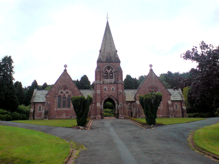