The Churches of Britain and Ireland
| Orford,
Suffolk
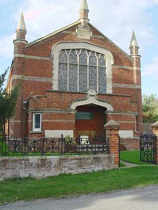
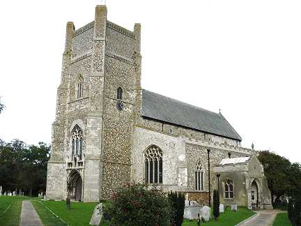
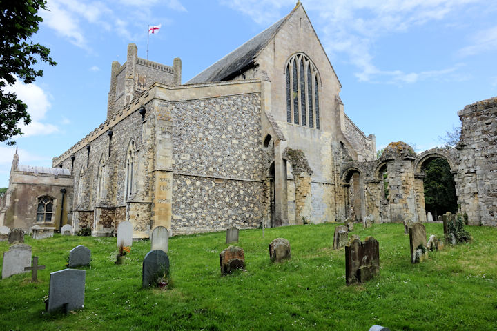
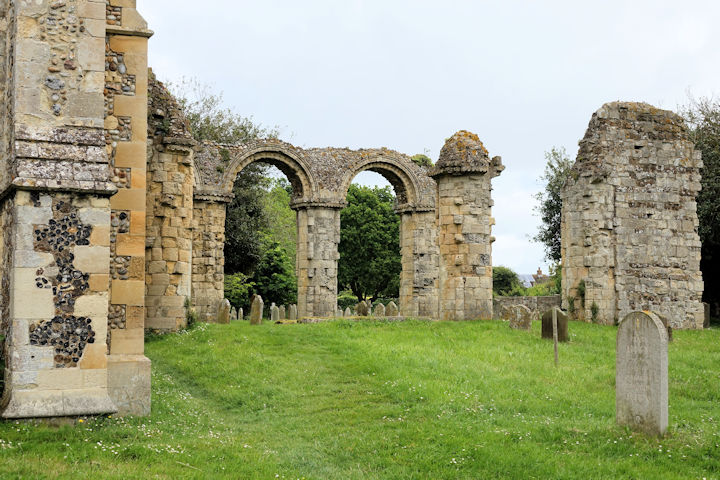
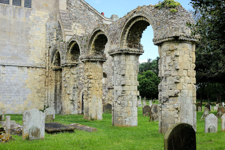
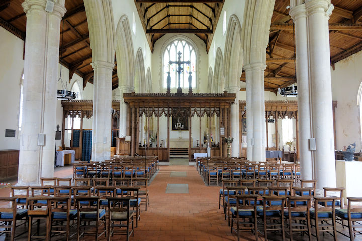
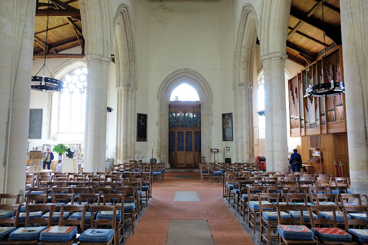
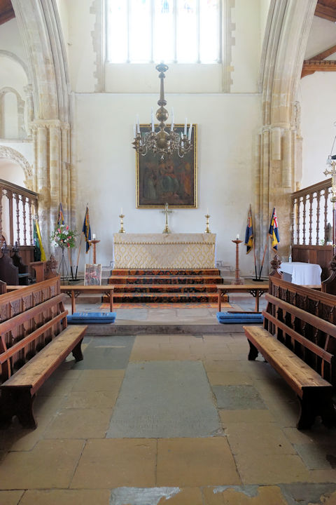
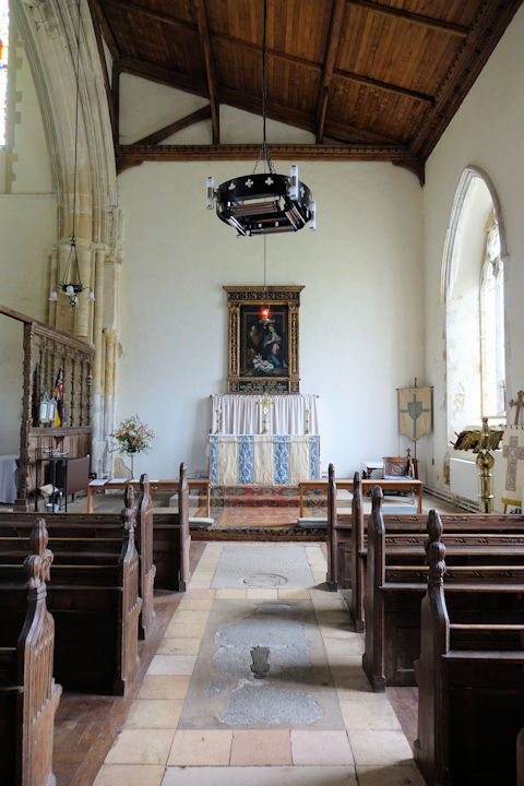
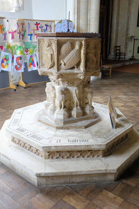
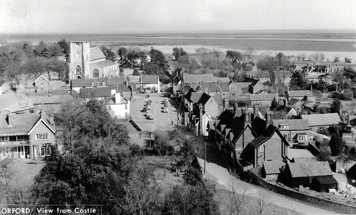
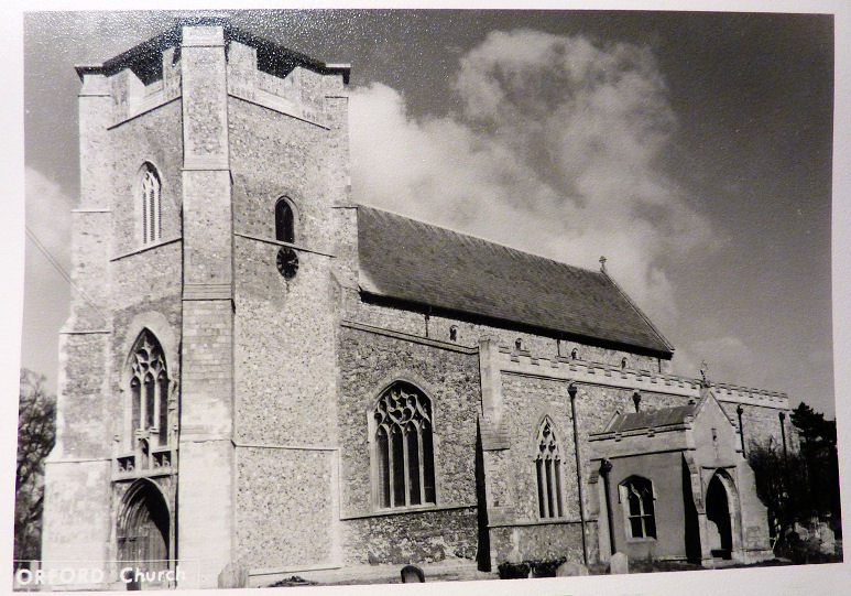
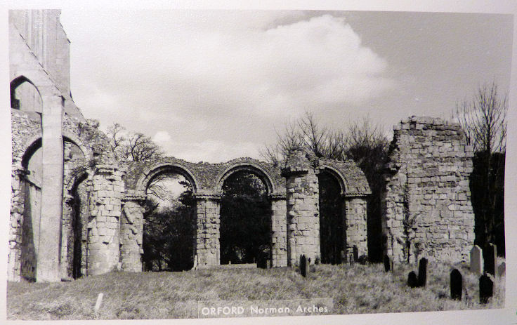
The 25" O.S. map of 1904 shows Friary (Augustinian) (Rems. of) at TM 4226 4978. The grade II listing for The Old Friary says the "west gable contains stone from the Augustinian Friary c1294 which originally occupied the site." The west gable (with the pale yellow stone) can be seen here in a Streetview from 2011. The same map also has a field labelled as St. John's Chapel Field immediately north of the village, centred on TM 4230 5026, and Chantry Farm at the southern end of the village at TM 4211 4971. Can you throw any light on either of these? According to this source, the grade I listed castle has a chapel, on the first floor, above the entrance door. TM 4194 4987. The Methodist Church on Broad Street was originally Primitive Methodist, and is dated here to 1901-2, where it also says that it "adjoined the previous one of 1837". Older maps show that it stood on the present chapel's western side, where a driveway now stands - 2011 Streetview. TM 4209 4975. © Steve Bulman (2005). The 25" O.S. map of 1904 shows a Mission Hall on Broad Street at TM 4220 4980. What appears to be the same building was seen by Streetview in 2011. St. Bartholomew. Three more views - 1, 2, 3, two of the interior - 1, 2, the chancel, side chapel, and the splendid C14 font. TM 4221 4999. All © Steve Bulman (2024). Three old postcards show an aerial view, the exterior, and the remains of the Norman chancel, all from Christopher Skottowe's Collection. Link1. Link2. Grade I listed. The churchyard war memorial is also listed, as grade II.
|
||
10 June 2024
© Steve Bulman
Contact Details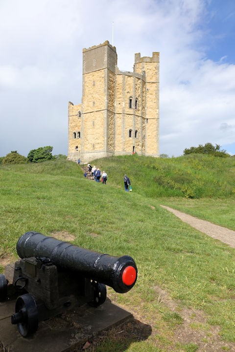