The Churches of Britain and Ireland
| Maryport, Cumbria
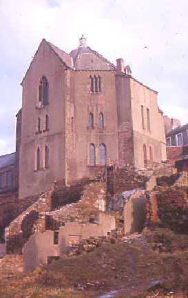
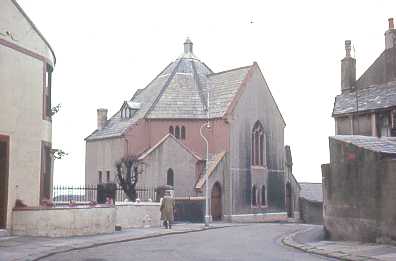
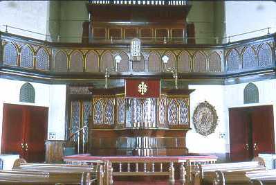
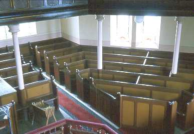
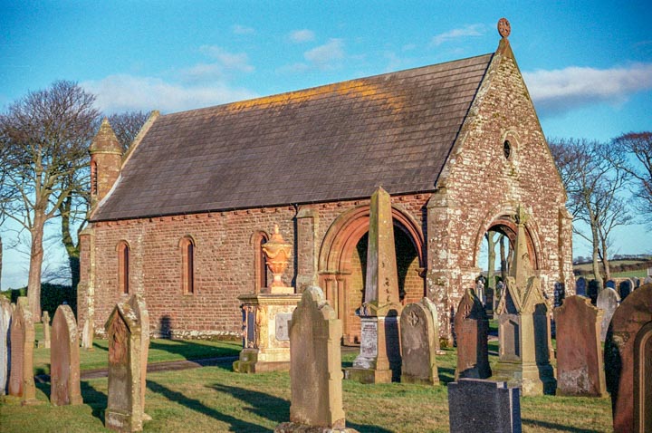
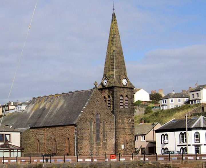
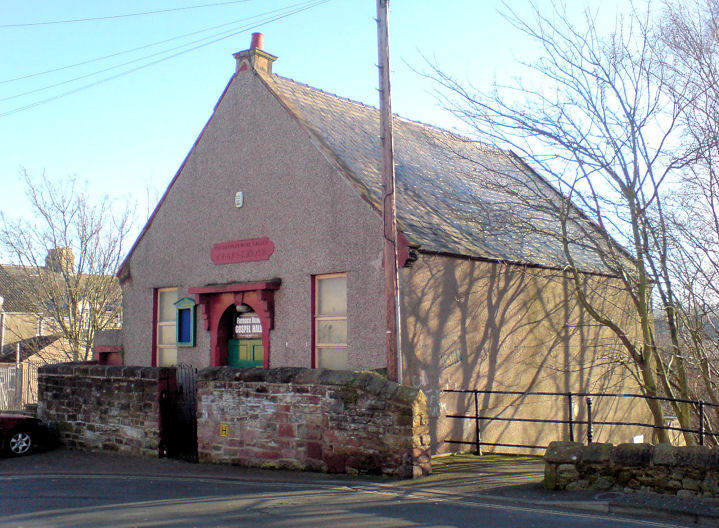
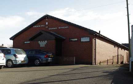
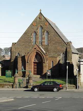
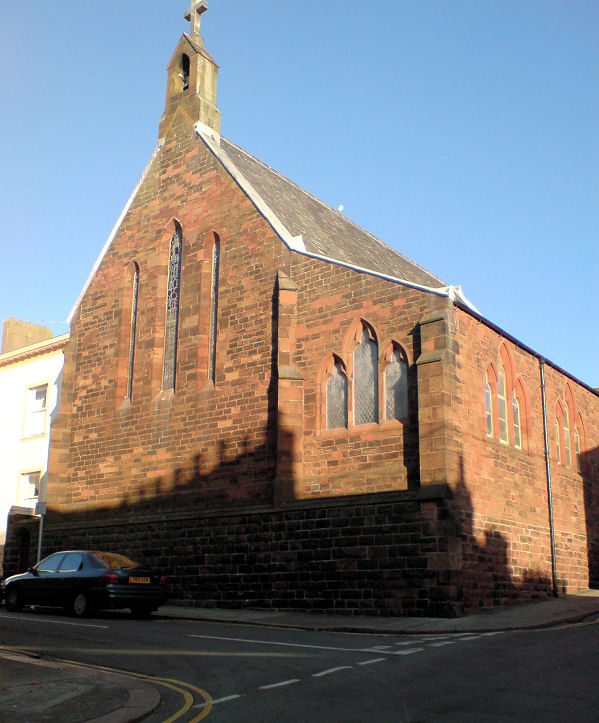
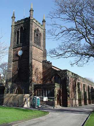
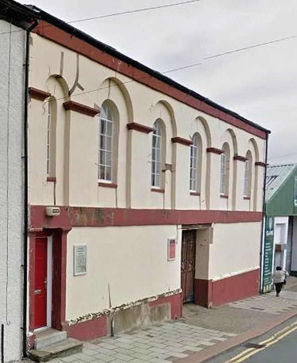
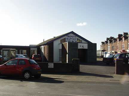
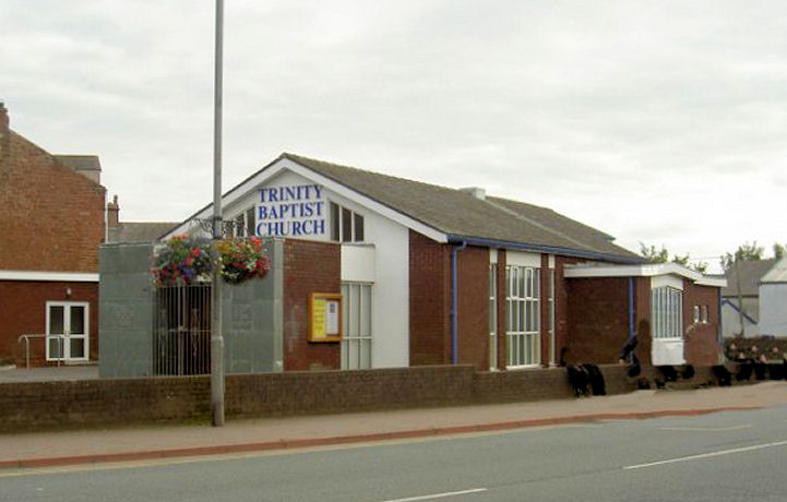
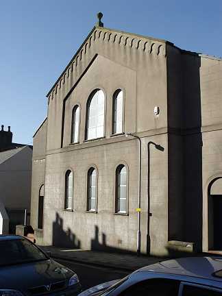
All Souls on Ashby Street and George Terrace, Netherton, originally a chapel of ease to Dearham. NY 0440 3602. © Steve Bulman. Brow Street chapel (now demolished); the view from Brow Street; the pulpit; and the pews. NY 0349 3668. All © Peter Ostle. Mortuary Chapel in Maryport cemetery at NY 0521 3829. It was originally the chapel for Nonconformists; the demolished CoE chapel was a little way to the south at NY 0520 3820. © Steve Bulman. Christ Church (1872) on King Street, by the harbour. NY 0341 3665. © Steve Bulman. Another view, © Alan Blacklock. It was announced in 2013 that the church has had to be closed because of spiralling repair costs - news item here. News item (2019). News item (2020) about its deteriorating condition. Link. There used to be a Friends' Meeting House on King Street, at NY 0351 3695. It pre-dated a map surveyed in 1863, was seemingly still active in 1899, and the building seems to have survived at least up to the early 1960's, but it has since been demolished, and the site (2022 Streetview) grassed over. According to this source it originally dated from 1772, was re-built in 1810, and closed in 1912. Furnace Road Gospel Hall. It's marked on older maps as a Baptist Chapel. NY 0361 3643. © Steve Bulman. Kingdom Hall of Jehovah's Witnesses on Pecklewell Lane. NY 0453 3575. © Steve Bulman. Maryport Community Church (2022 Streetview) on John Street was previously the Sunday School for the Presbyterian Chapel which stood behind it (now demolished). The chapel, which pre-dated a map of 1863, was accessed via the gated passageway to the right. The Salvation Army entry below suggests that the school may have become the Presbyterian Chapel at some point. NY 0355 3656 (school), NY 0356 3657 (original chapel). Methodist Chapel on Church Terrace, Ellenborough. According to this source, it was closed by 2016. NY 0456 3588. © Steve Bulman. Methodist Chapel, Netherton. NY 043 361. © Steve Bulman. The 25" O.S. map from 1900 shows a Mission Room at the junction of Main Road and Grasslot Street, at NY 0340 3582. It was no longer labelled as a place of worship on mid-20th century maps. The building on the site was seen by Streetview in 2009, evidently in residential use. This source identifies it as Baptist, and later Primitive Methodist, though this has to be suspect as it says it was "probably the building which received local authority approval on 20 April 1908" - approval to build? Yet it already existed by that date. Another Mission Room is shown on a map of 1947, which had been revised in 1938. It stood a little way south of the above Mission Room, at about NY 0334 3575. Its site now lies beneath an access road (2022 Streetview). Our Lady and St. Patrick (R.C.) on Crosby Street. NY 036 367. © Steve Bulman. St. Mark's Methodist Church on Kirkby Street, as seen by the Streetview van in 2011. It's dated here to 1973. NY 0372 3662. Link. Its predecessor was Primitive Methodist, and it stood across the street, just a short walk away at NY 0370 3666. Dated in the first source in this entry to 1871-1973, housing has since been built on its site, seen by Streetview in 2011. The same source also mentions an earlier chapel, also on Kirkby Street, of 1839. St. Mary (1847). NY 0380 3661. © Steve Bulman. Link. Grade II listing, which says that the church was originally built in 1760. The present building is substantially of the re-builds of 1847 (of which the tower survives) and 1892. The Salvation Army commenced in Maryport in 1886, and initially used the Temperance Hall, Athenaeum, and Co-operative Hall, before moving into what had previously been a Presbyterian Chapel (see Maryport Community Church, above) on John Street in 1892, and remained there until 1959 at least, as Maryport Temple. © Salvation Army Philatelic and Historical Society (SAPHA). Can you advise if any of the other buildings survive, or where they were? Howard Richter has located the Atheneum (demolished) which stood at the corner of High Street and Catherine Street at NY 0348 3647. It's dated here to 1857-1983 - the S.A. usage of the building probably pre-dates its conversion into the Atheneum Picture Palace in 1910. There's now housing on its site (2022 Streetview). The Co-operative Hall was in all likelihood part of the building seen here in a 2016 Streetview, a former Co-op store on Curzon Street. NY 0371 3638. Trinity Baptist Church. NY 037 363. © Steve Bulman. Another view, © Alan Blacklock. Link. A United Presbyterian Church used to stand on Crosby Street and Kirkby Street at NY 0366 3668. It's dated to 1831 here. Still active into the middle decades of the last century, it's been demolished and replaced by housing (2022 Streetview) - note the catholic church to the left. A photo of the church can be seen here (scroll to the bottom). Possible old church, which I'm advised is now a Masonic Hall. NY 036 368. © Steve Bulman. Janet Gimber has advised that, although not a chapel, the Masonic Hall stands on the site of a Baptist Chapel. It had a Sunday School behind, and to judge from old map evidence, that building may have been incorporated into the present building.
|
||
27 July 2025
© Steve Bulman
Contact Details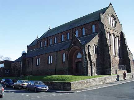