The Churches of Britain and Ireland
| Lincoln, Lincolnshire
A list of vanished medieval churches can
be seen
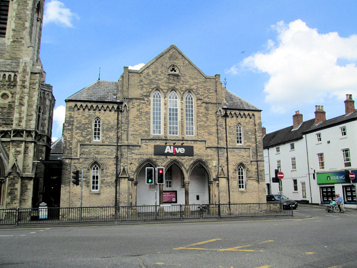
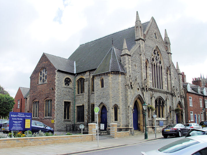
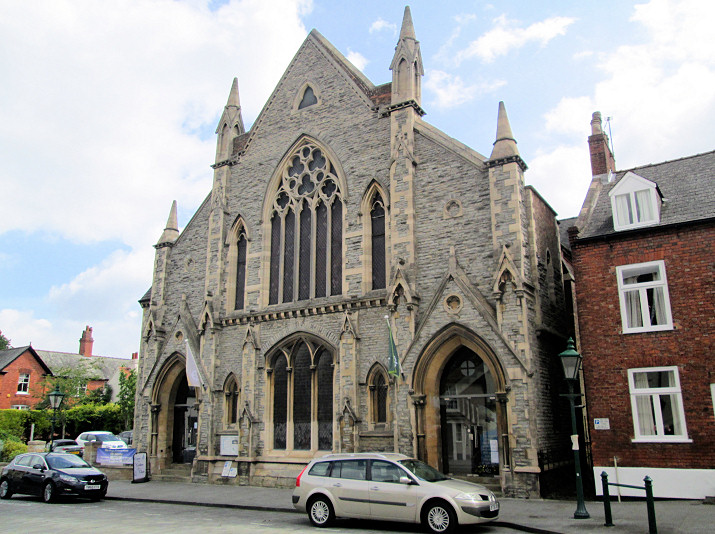
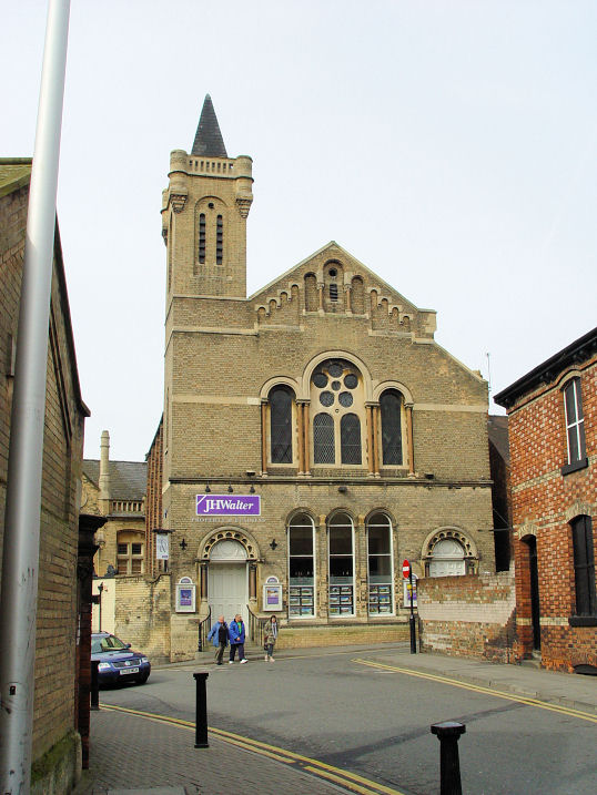
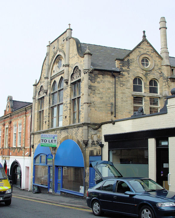
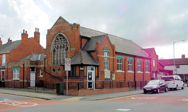
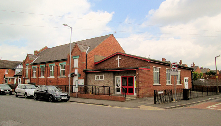
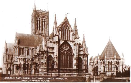
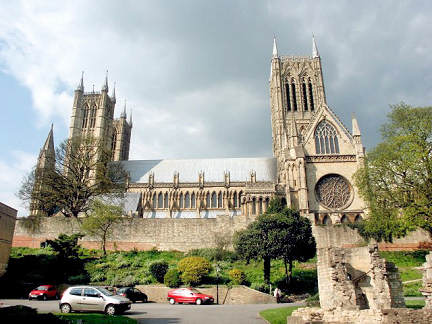
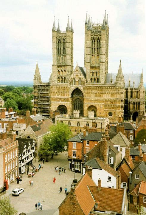
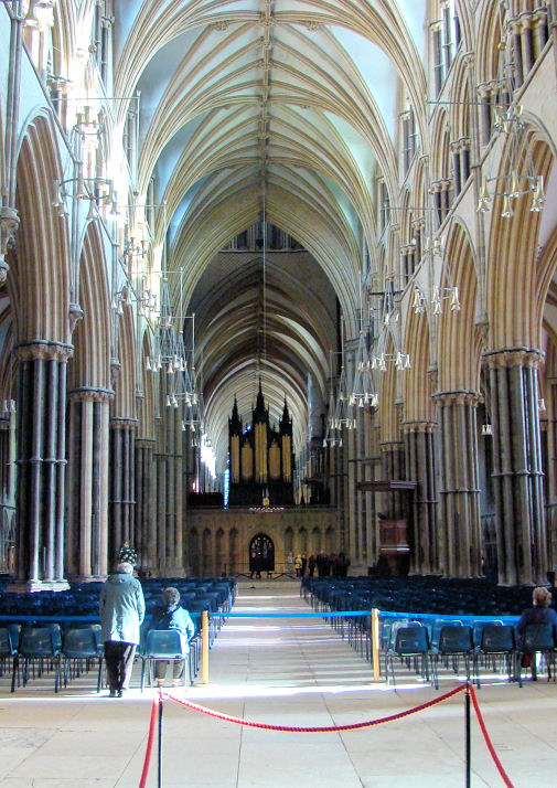
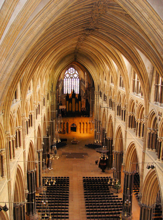
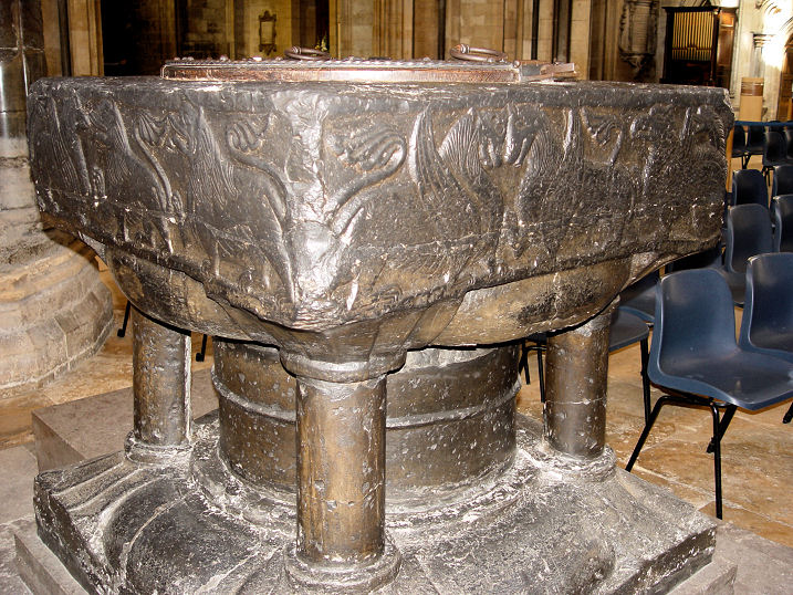
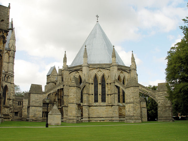
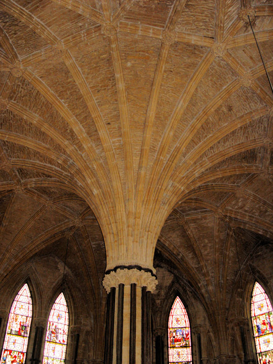
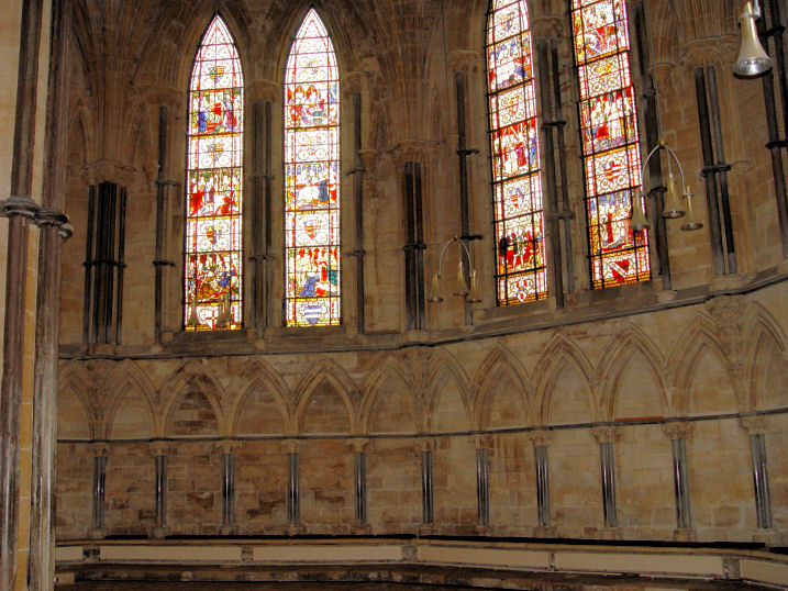
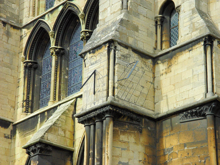
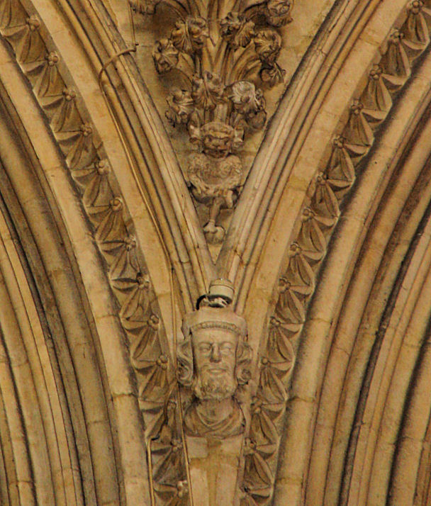
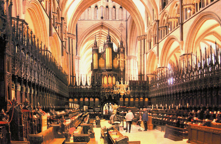
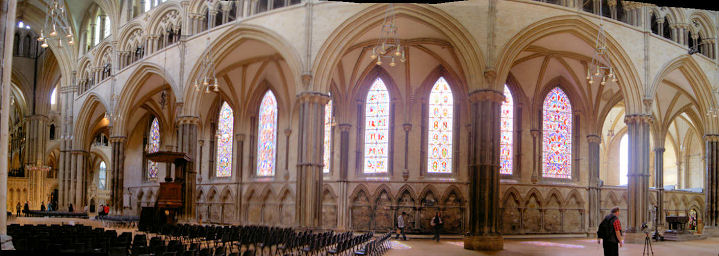
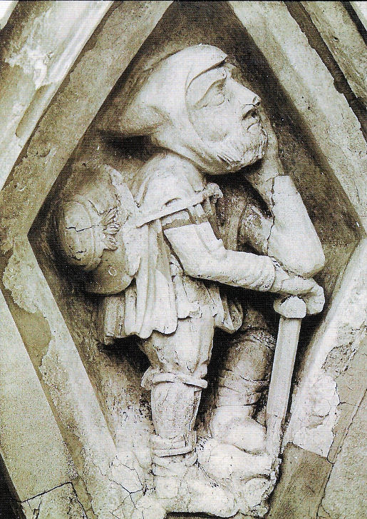
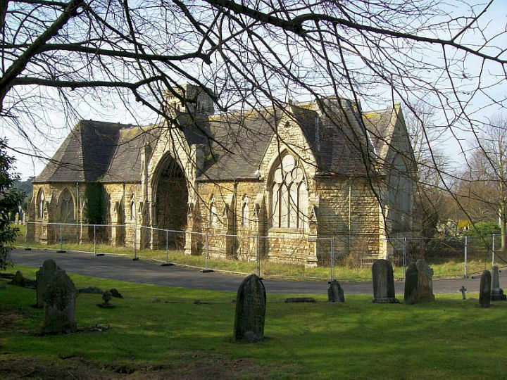
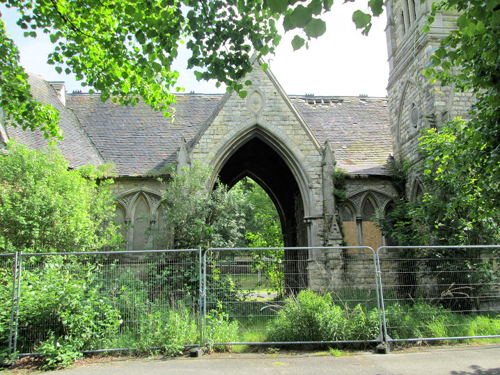
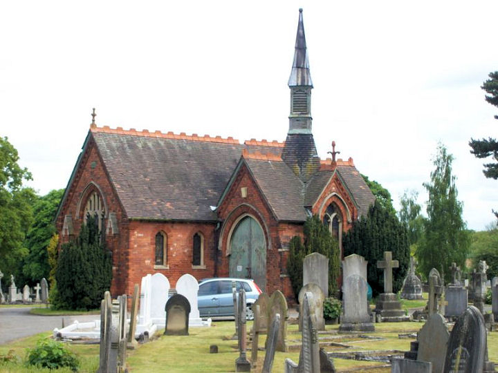
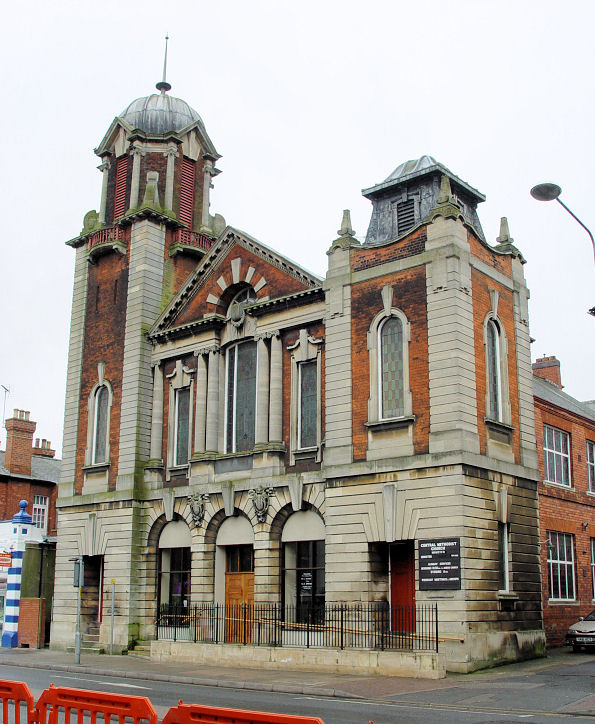
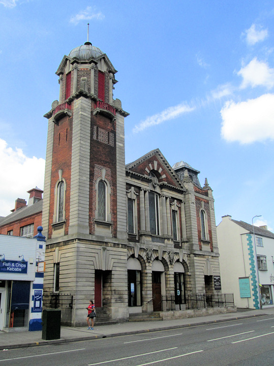
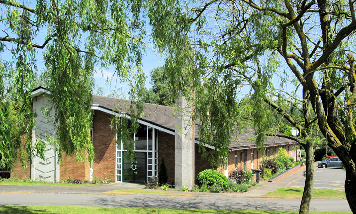
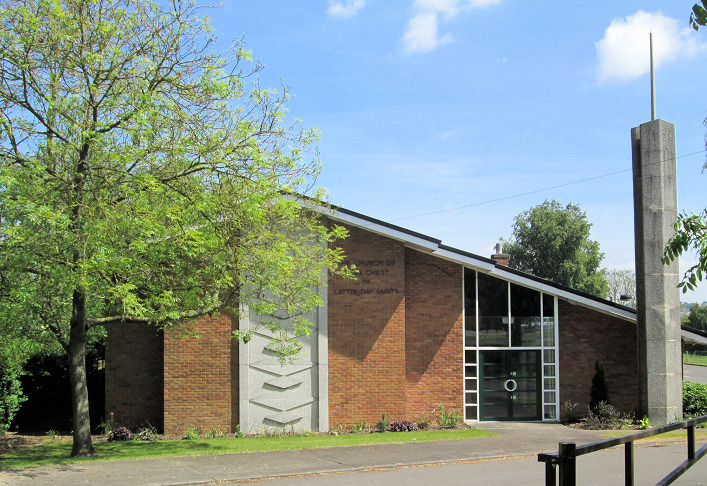
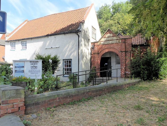
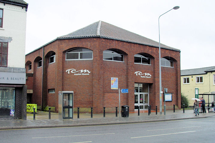
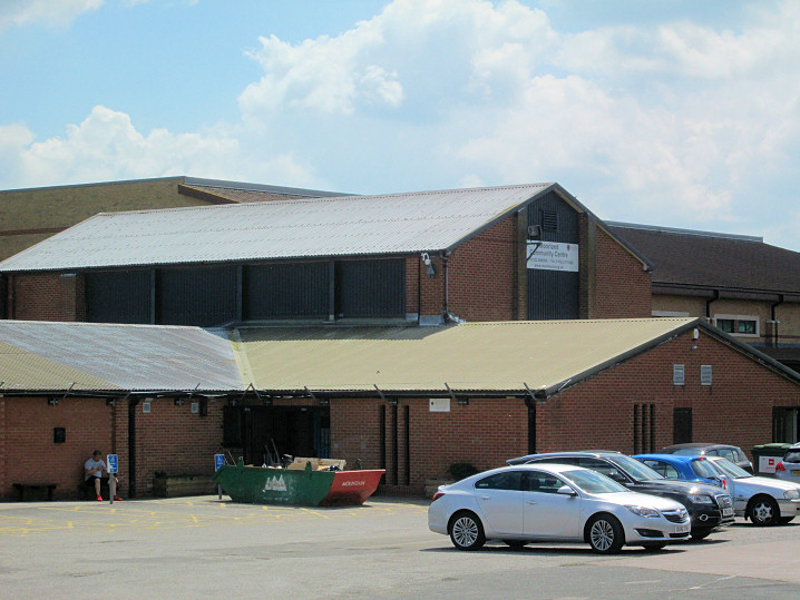
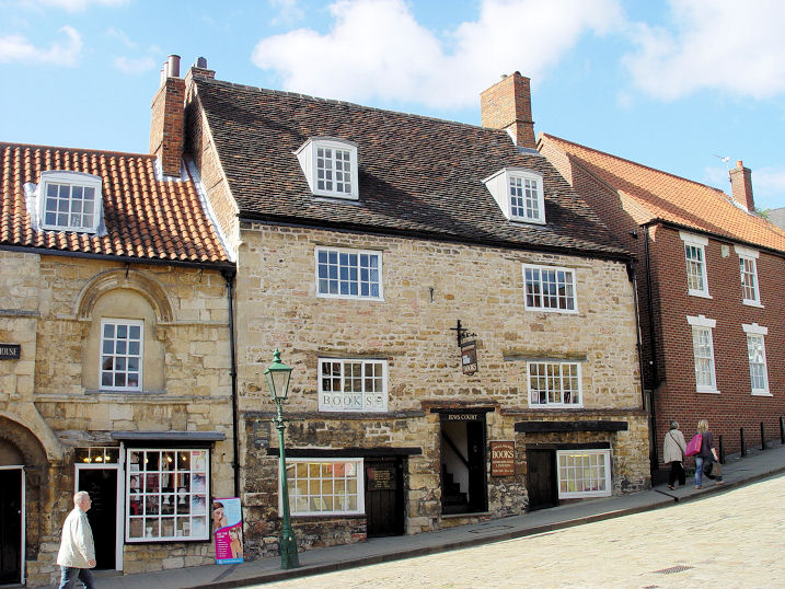
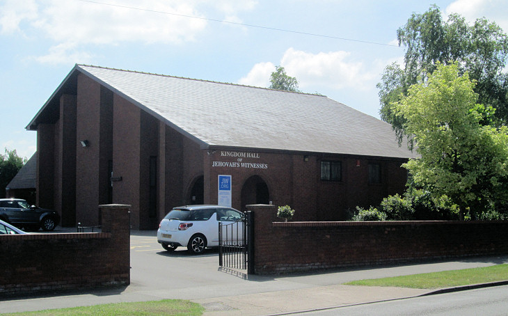
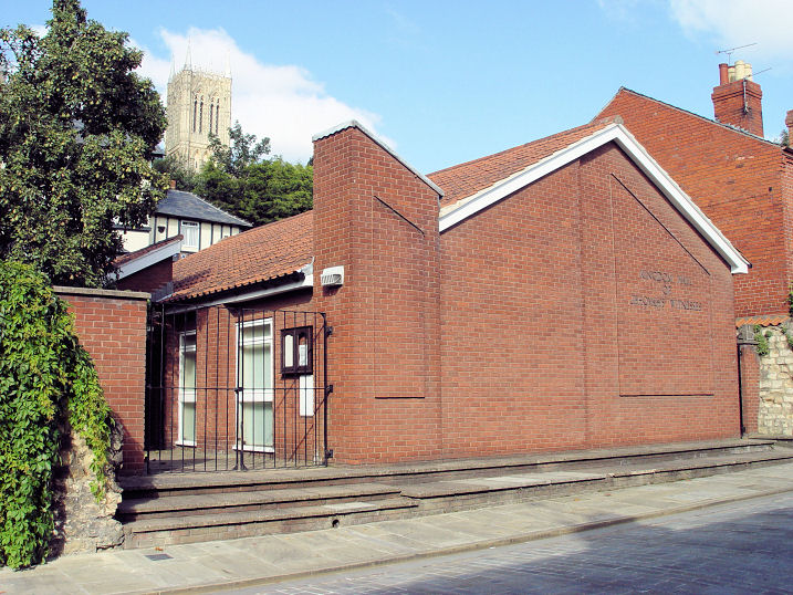
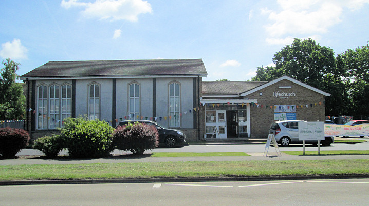
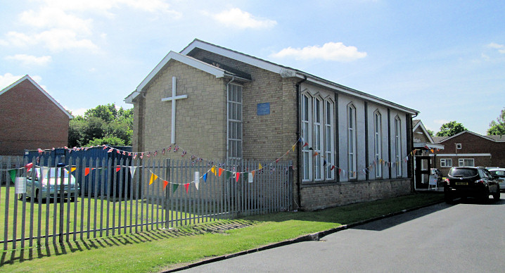
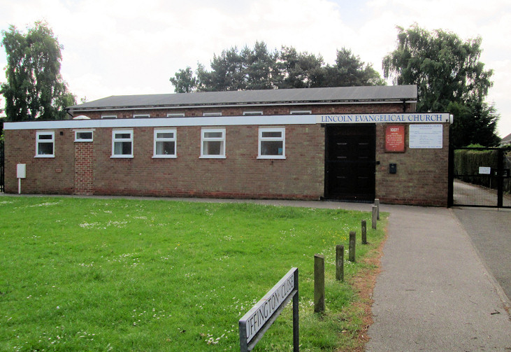
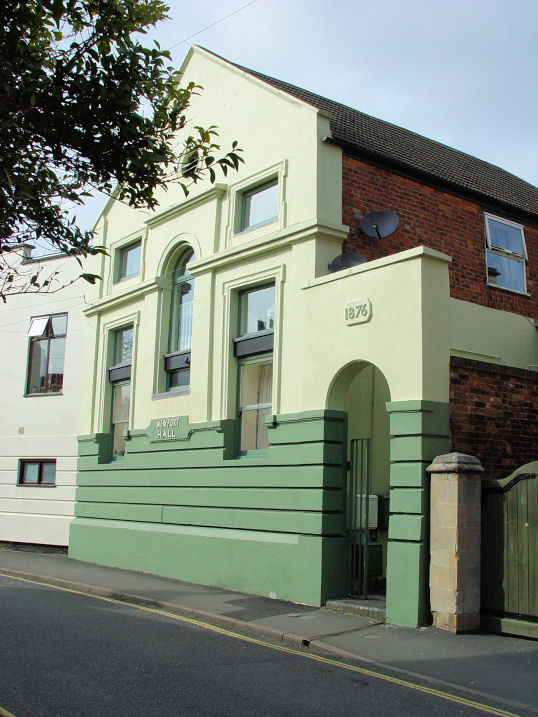
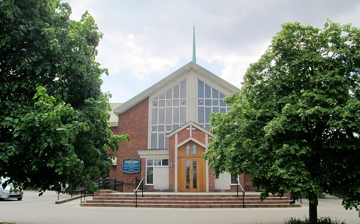
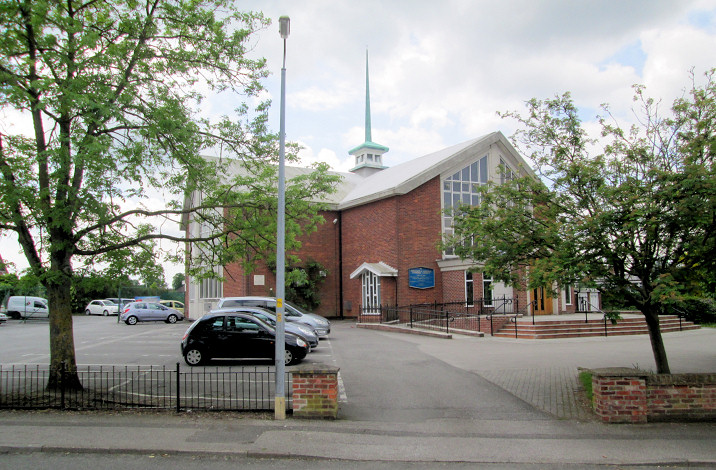
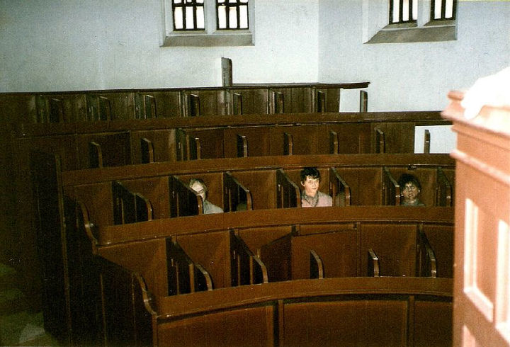
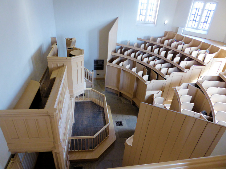
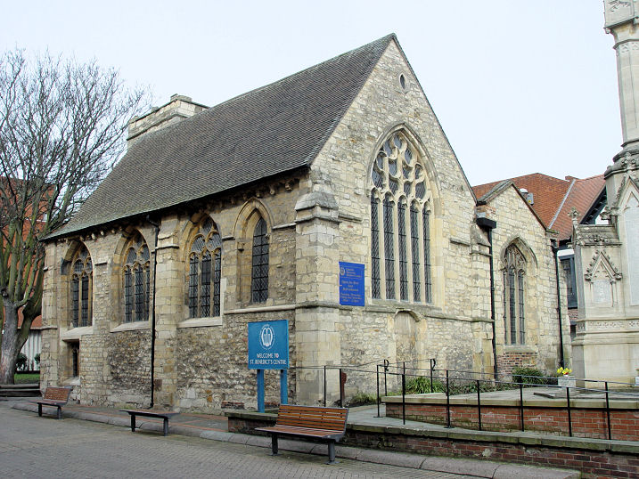
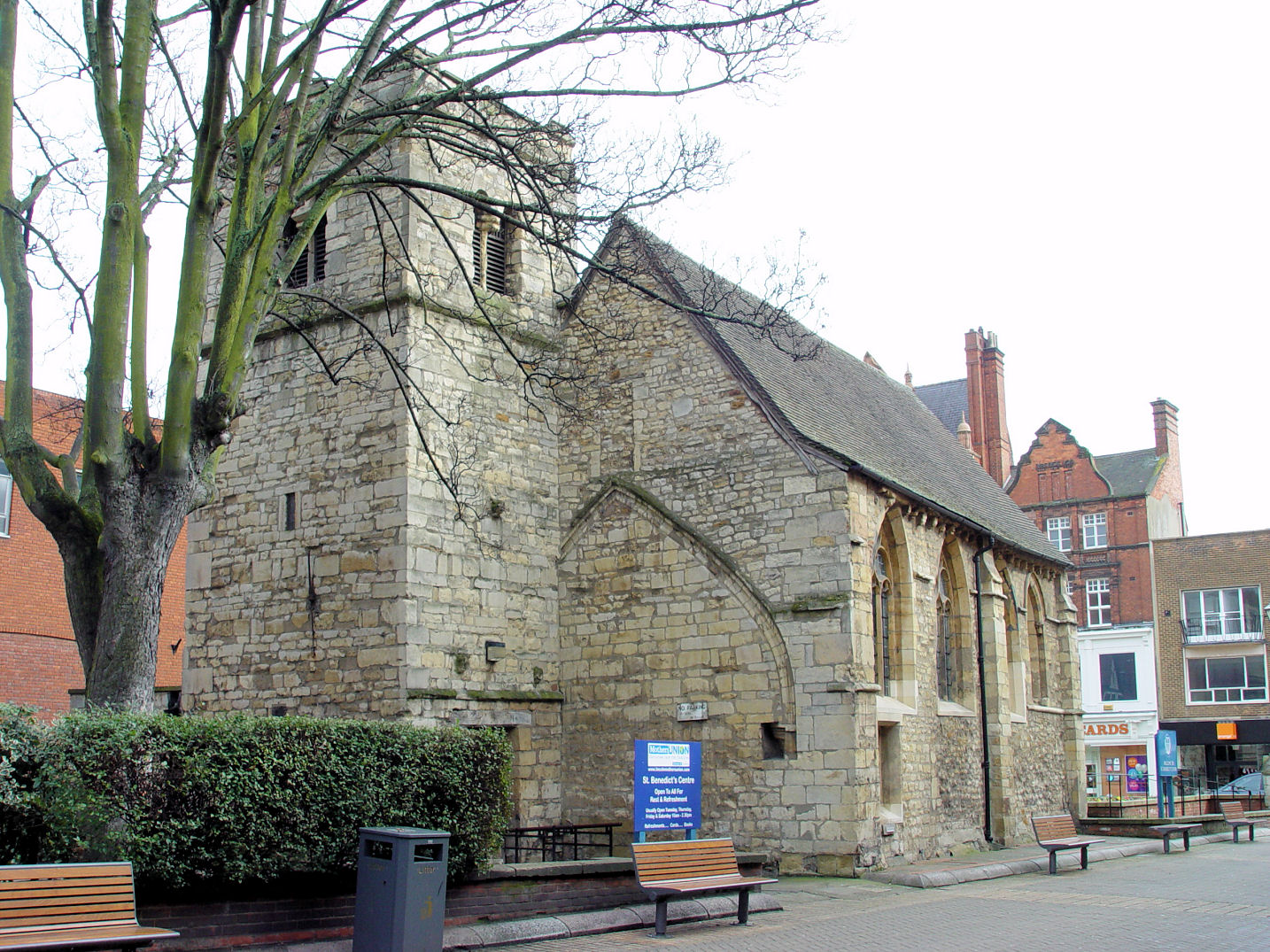
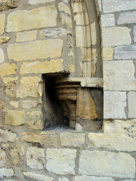
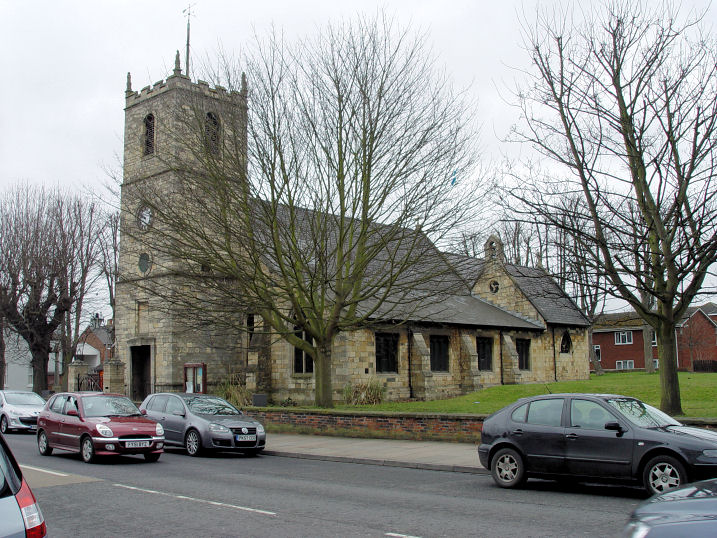
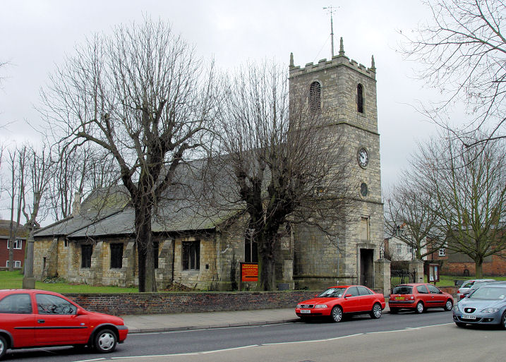
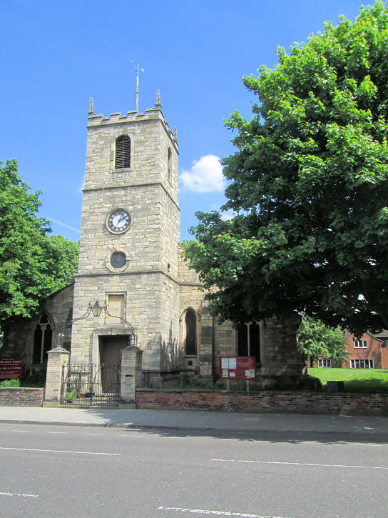
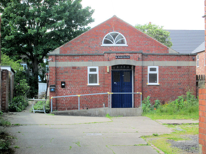
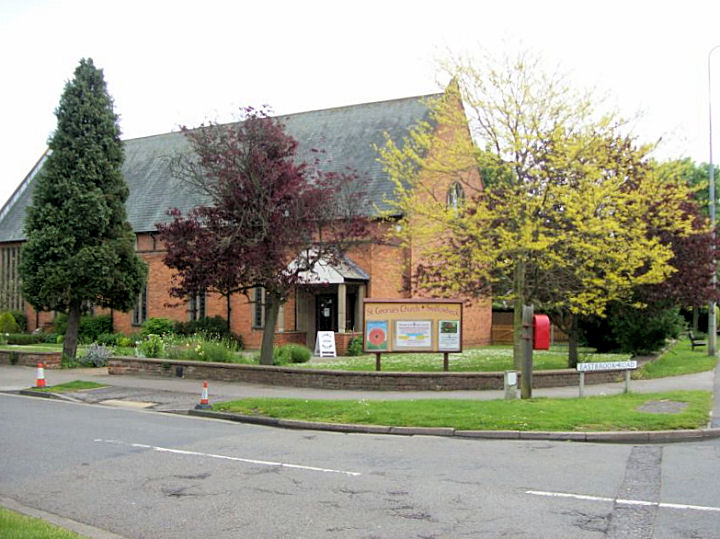
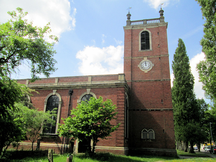
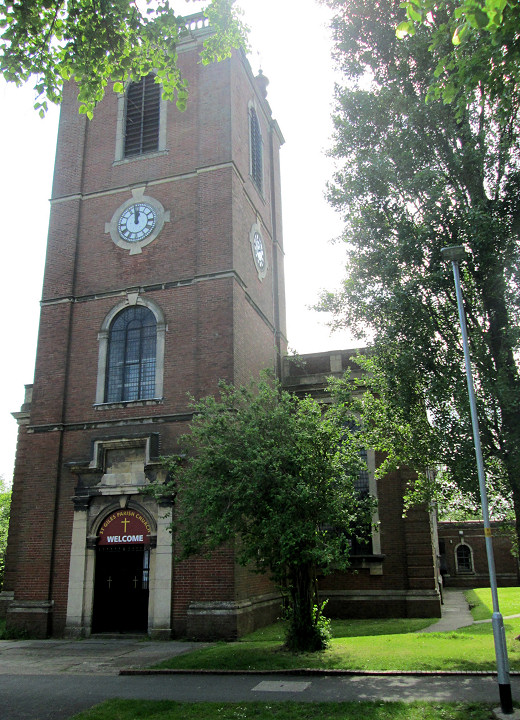
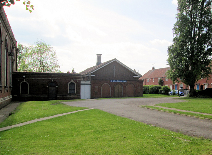
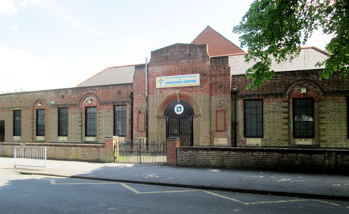
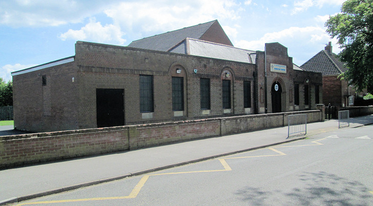
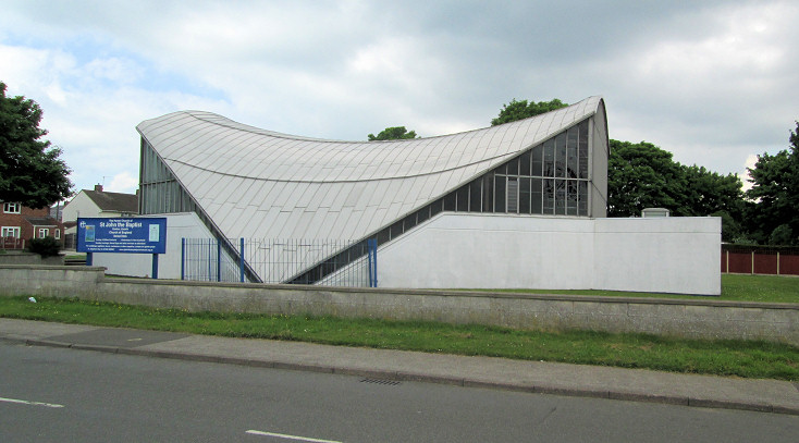
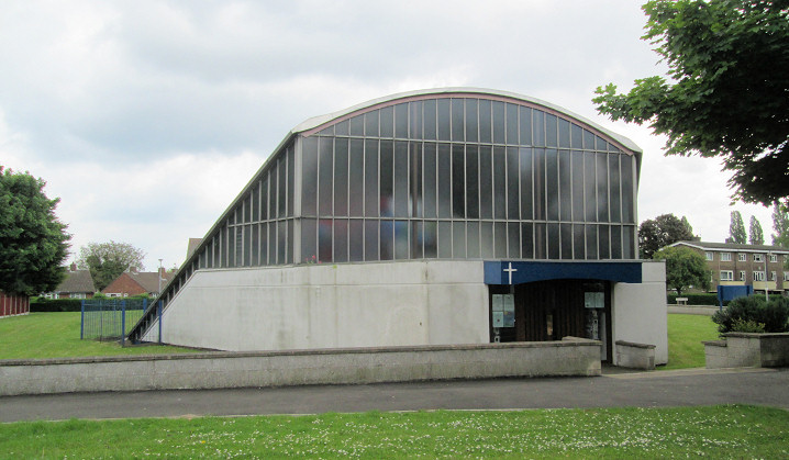
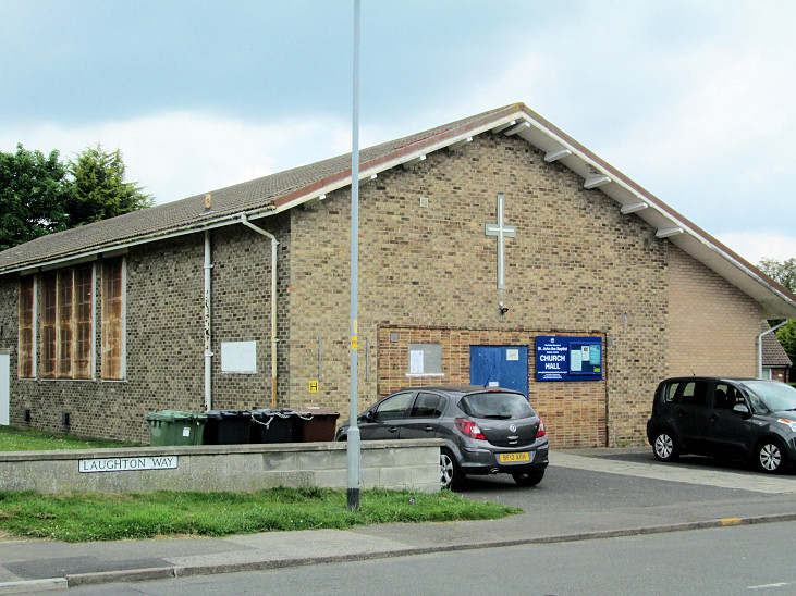
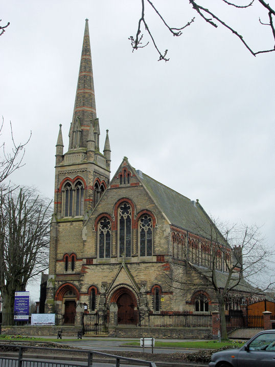
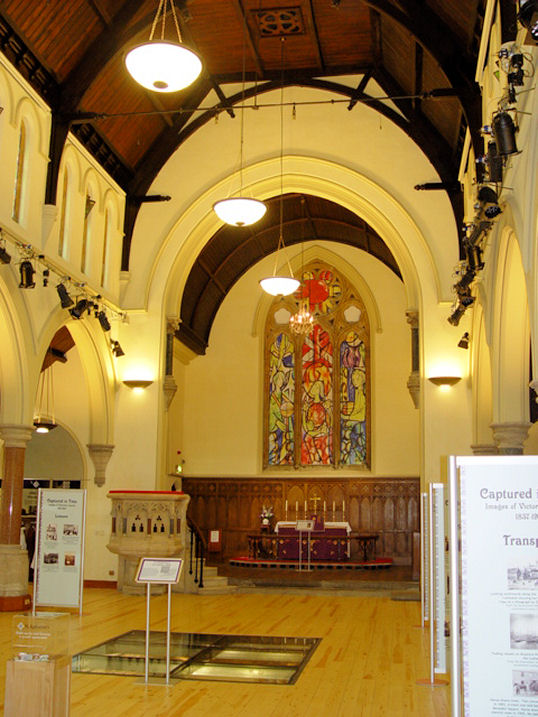
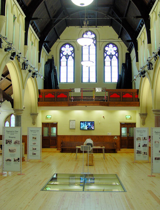
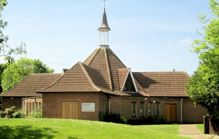
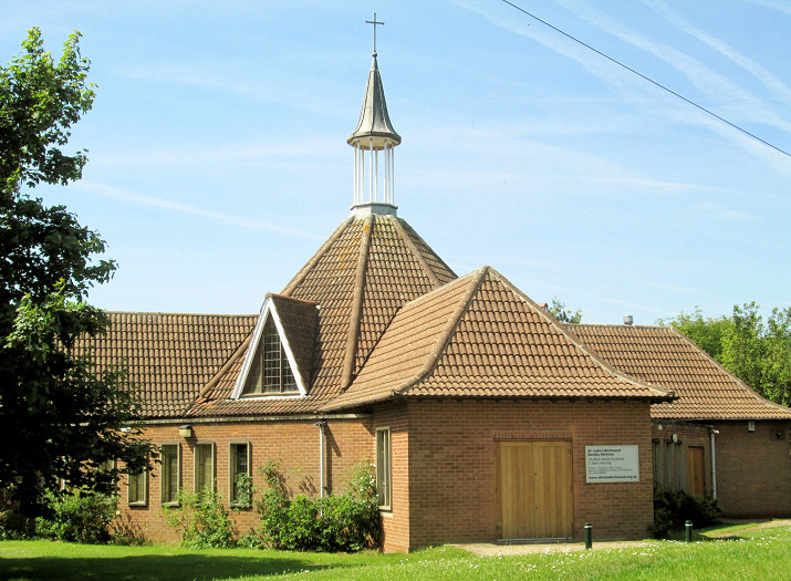
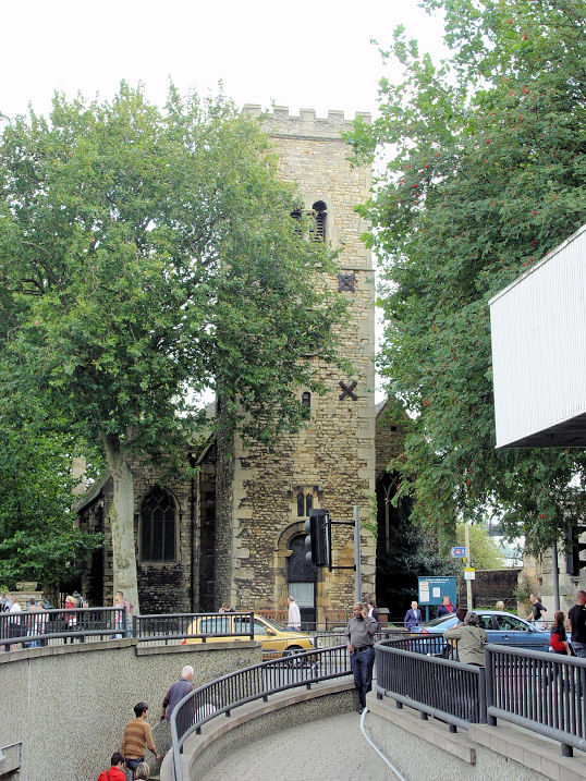
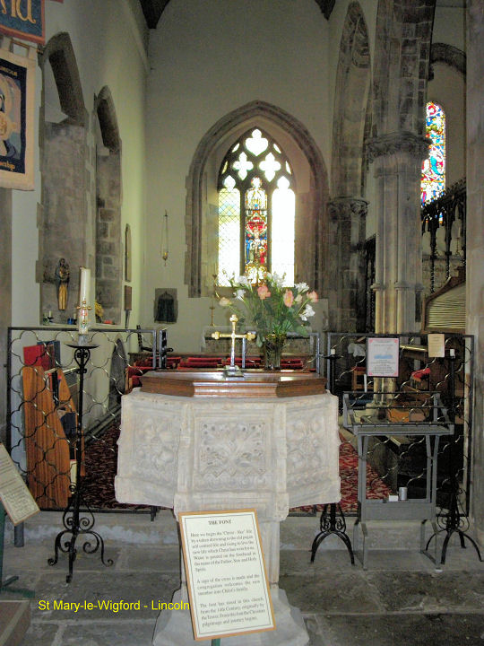
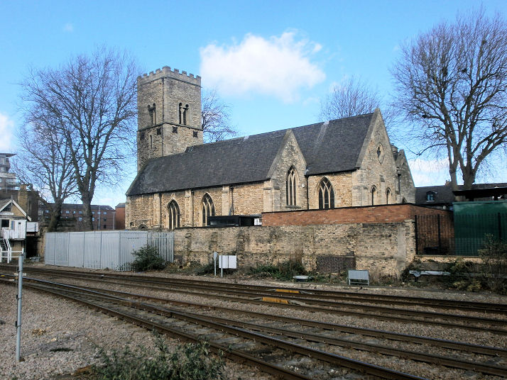
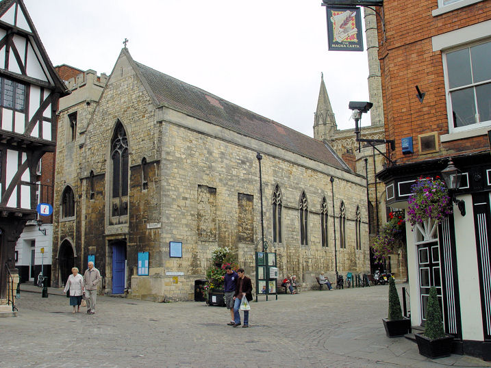
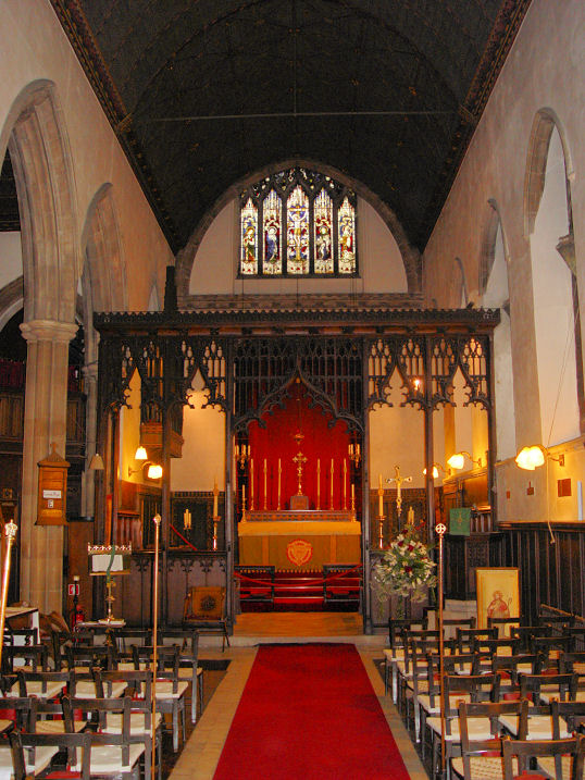
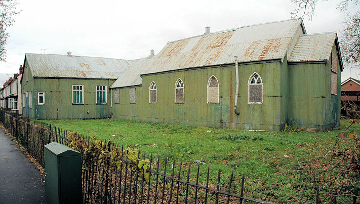
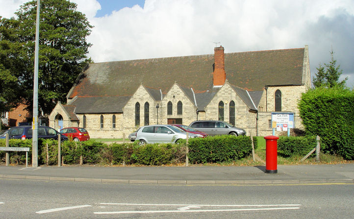
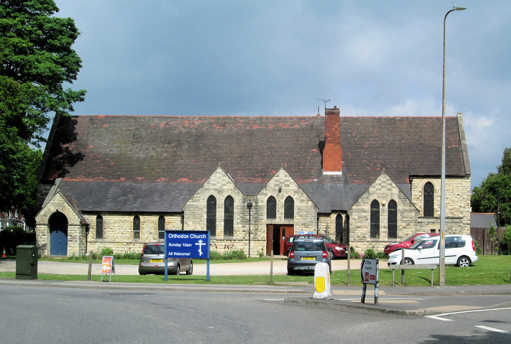
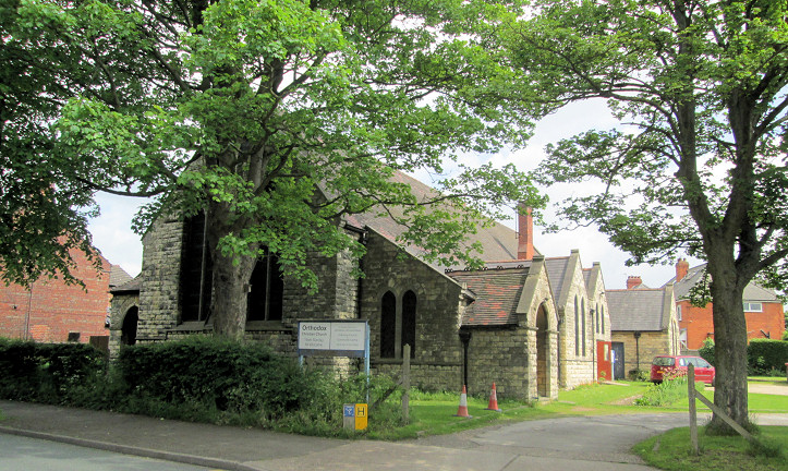
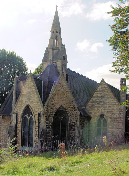
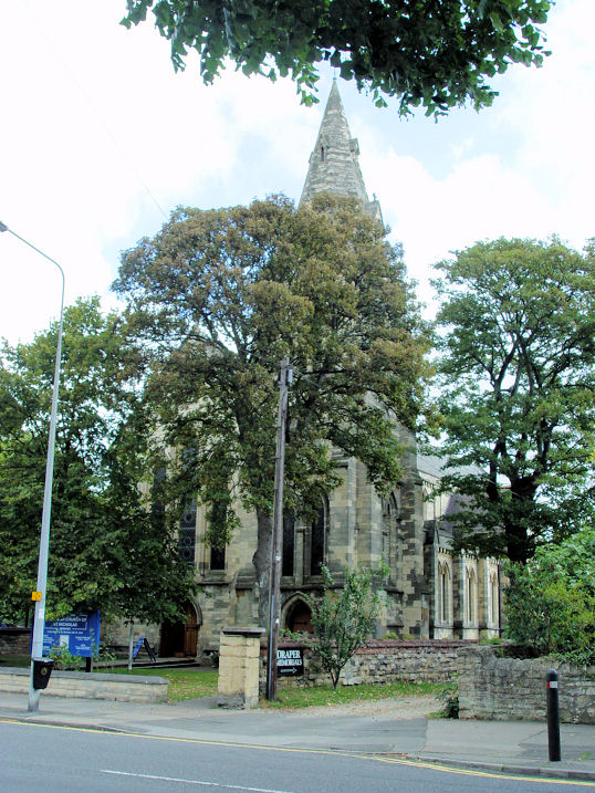
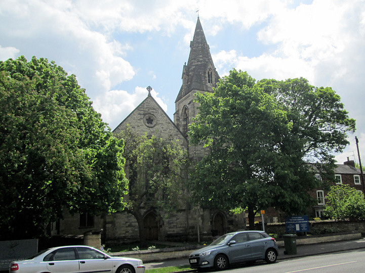
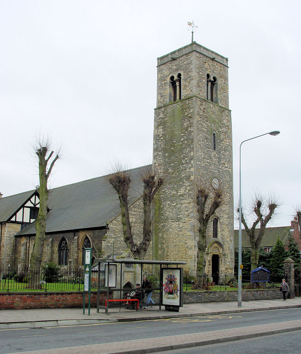
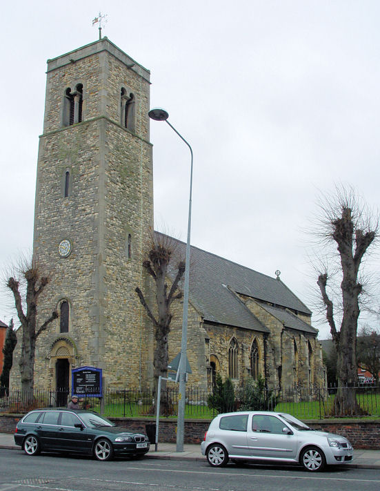
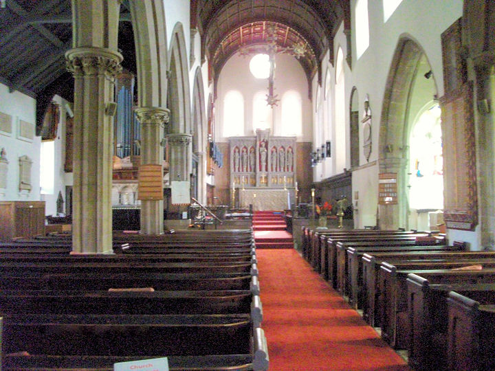
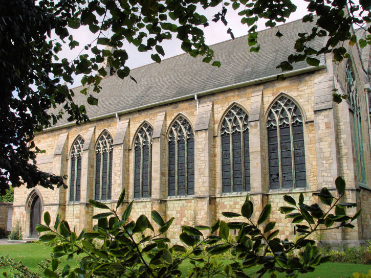
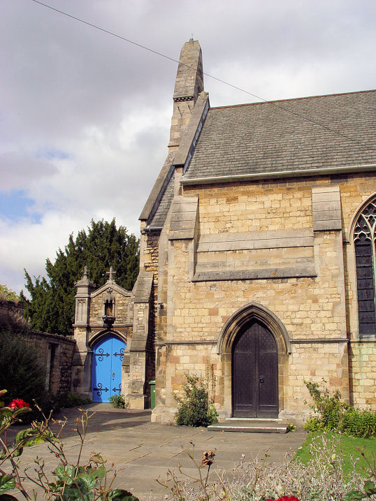
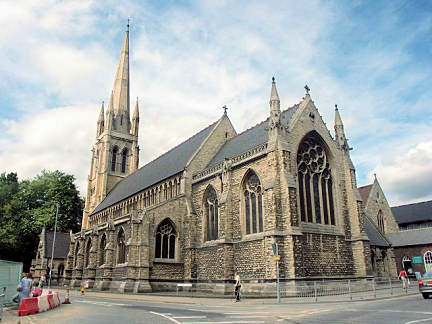
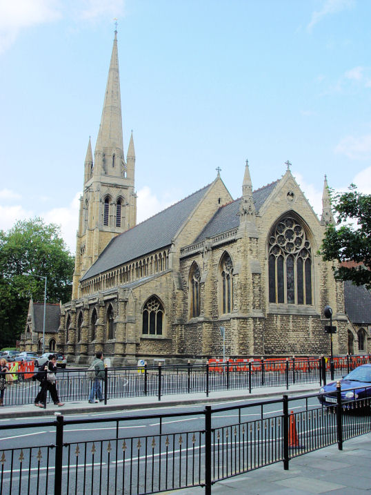
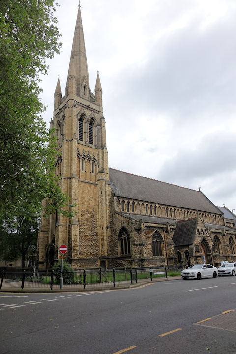
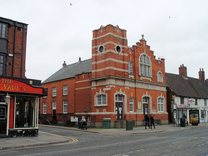
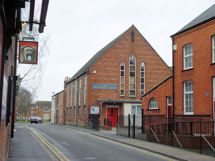
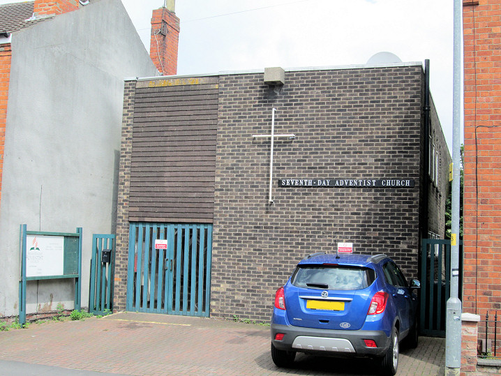
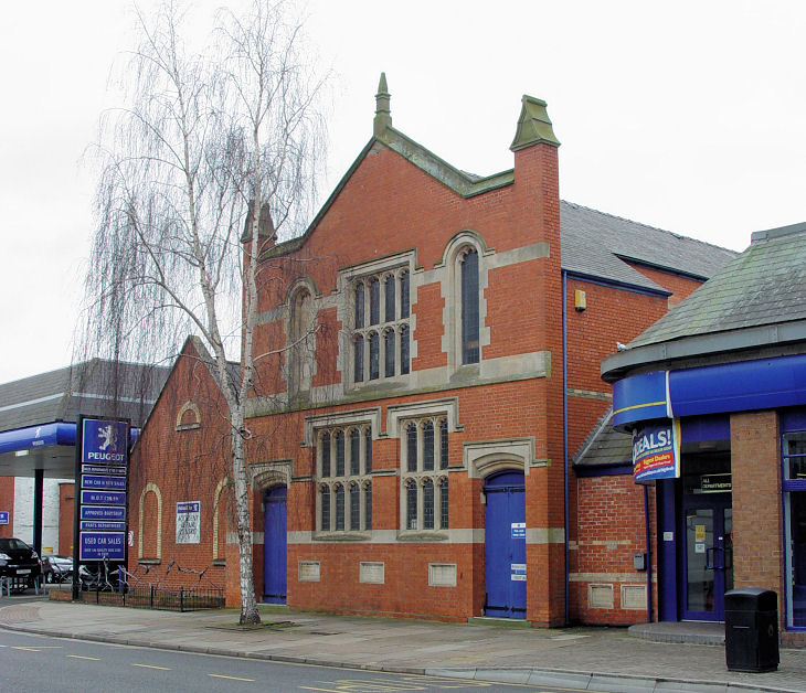
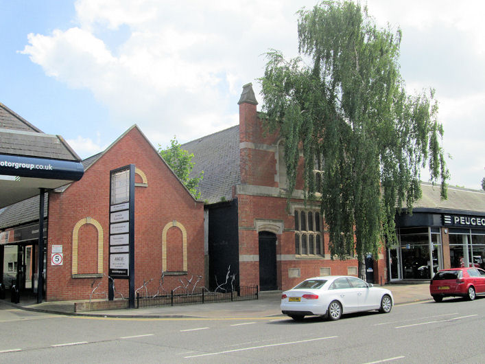
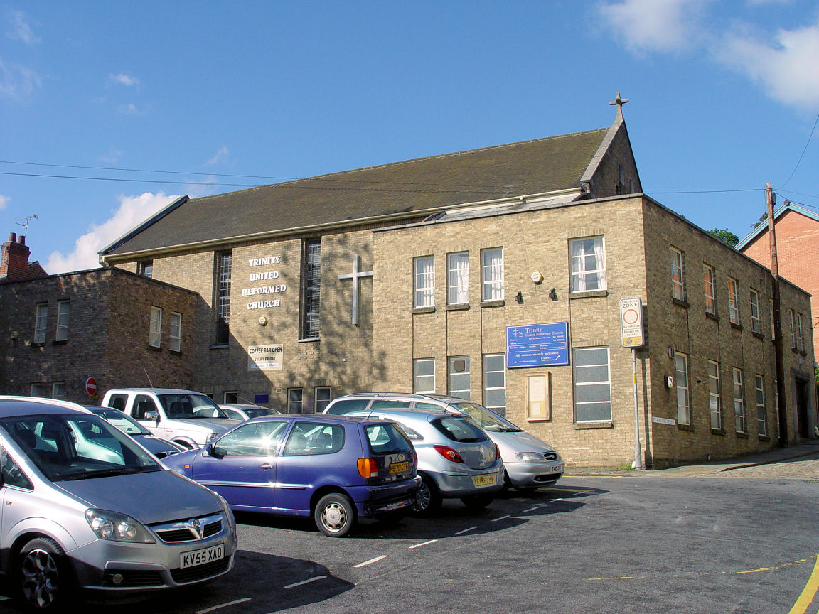
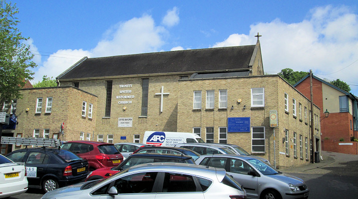
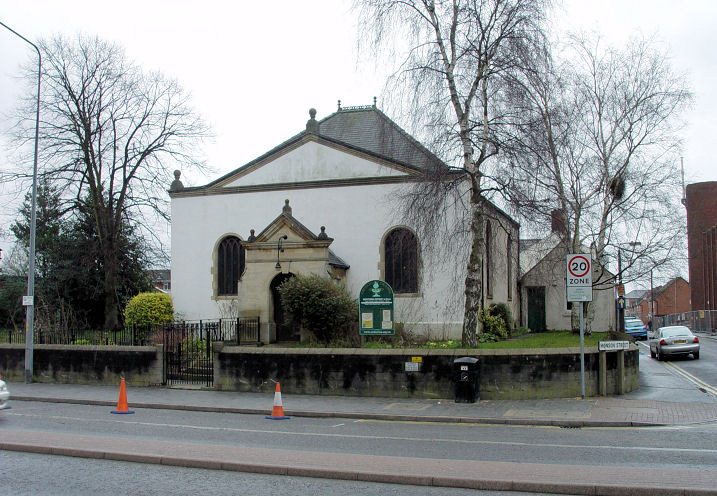
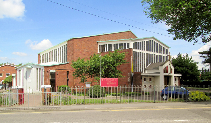
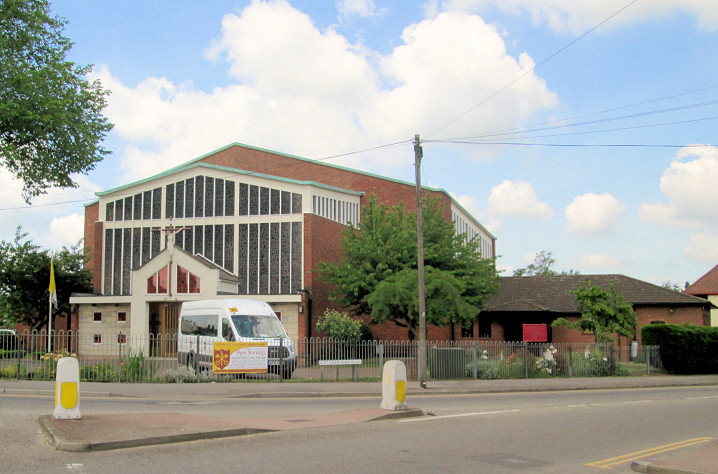
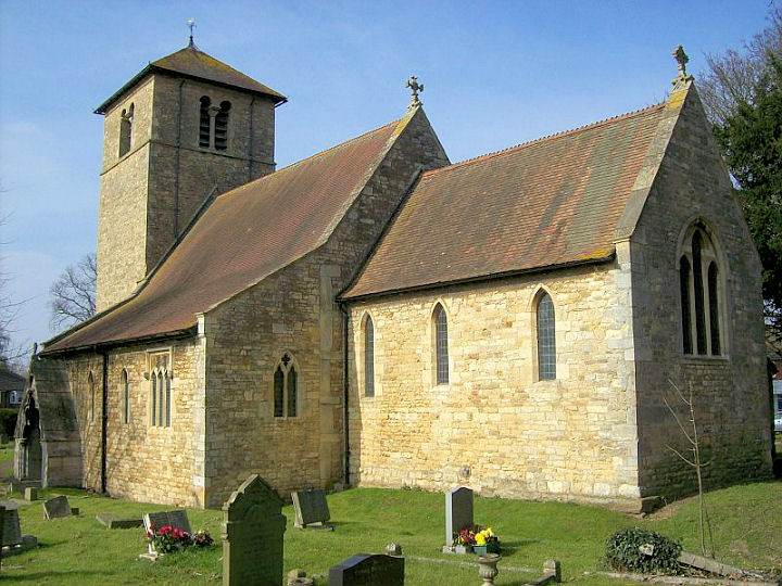
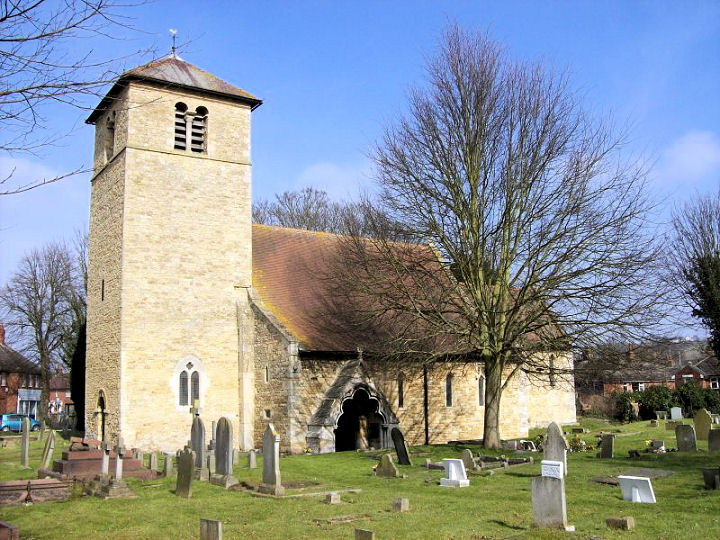
here. Churches in Boultham, Bracebridge. Alfred Street Wesleyan Methodist Chapel survived until fairly recently. It was noted in a directory of 1919 as dating from 1864, and had already been converted into a school. It was latterly a Salvation Army building, as it was when seen by Streetview in 2009. It was demolished between late 2012 and late 2014, and replaced by a new S.A. building, erected by late 2020 (Streetview). SK 9722 7042. Alive Church (formerly New Life Church) on Newland. Older maps label it as a Congregational Chapel, and its grade II* listing dates it to 1876. The adjacent Sunday School was the original chapel, and dates from 1840. SK 9734 7129. Both © Jim Parker (2017). Link. All Saints, on Monks Road, as seen by Streetview in 2024. Another Streetview, from 2017. The church Wikipedia article advises of a highly regarded organ, and an altar slab from Bardney Abbey. SK 9850 7141. Link. Grade II listed - dates it to 1903. The site of the demolished Baggholme Road Wesleyan Methodist Chapel, as seen by Streetview in 2011. It post-dates a map of 1887 where its site is shown as empty, and had been built no later than 1905, when it shows on a map just as Chap. A 1930 map shows it as W. M. Ch. The building seems to have survived at least up to 1965, though it had probably closed by then. SK 9820 7115. Bailgate Methodist Church (1879). An older map labels it as Wesleyan. SK 9768 7208. © Steve Bulman (2009). Another view, © Jim Parker (2017). Link. The former Baptist Church on Mint Street is now an estate agents. A little further down the hill is this building, which may be the Sunday School, described by Pevsner as "Arts & Crafts version of latest Flanders Gothic". Both © Steve Bulman (2010). See also the Lincoln Baptist Church entry below. Bridge Church (Assemblies of God) on Portland Street, as seen by Streetview in 2024. The site of St. Andrew (q.v.) stands immediately to the photographers left. SK 9784 7055. Link. Burton Road Methodist Church on Burton Road is dated 1904. It's labelled on older maps as Wesleyan. SK 9713 7252. © Steve Bulman (2009). Another view, © Jim Parker (2017). Link1. Link2. The Cathedral Church of the Blessed Virgin Mary. SK 9780 7181. From an old postcard in Steve Bulman's Collection. A modern view, © Dave Hitchborne. Another view, © Jim Parker. Interior view showing the nave, chancel screen and organ, from the nave. © Graeme Harvey. View of the nave from the clerestory; the impressive font; the Chapter House and two interior views, 1, 2, a sun-dial, and the famous Lincoln Imp, all © Steve Bulman (2009). The choir stalls, and a panoramic view of the nave, both © Alan Blacklock. A carved figure, from Christopher Skottowe's postcard collection. Link. Grade I listed. The former Cemetery Chapels in Canwick Cemetery. © David Regan (2016). Another view, © Jim Parker (2017). Grade II listed. The adjacent Canwick New Cemetery (or St. Swithin's Cemetery also has a small chapel, © David Regan (2017). Central Methodist Church (1905) on High Street, originally Portland Place Primitive Methodist chapel (source), successor to two earlier chapels, for which see Portland Place Primitive Methodist Chapel below. SK 9730 7040. © Steve Bulman (2010). Another view, © Jim Parker (2017). The Central Mosque and Cultural Centre (2018 Streetview) is a recent build on the south side of Dixon Street. A 2016 Streetview shows it under construction. SK 9678 7006. Link. A Chapel shows on the O.S. map dated 1944-74 on the east side of Orchard Street. It survives, and was seen by Streetview in 2017. It was probably the Particular Baptist noted in a directory of 1905 on Orchard Street. SK 9725 7138. Chapel Lane Wesleyan Methodist Chapel was, according to a directory of 1856, built by 1852, when it was sold to a Wesleyan Reform congregation. By the time of a map of 1885 it was in use as a Sunday School. Housing now stands on its site (2020 Streetview). SK 9756 7208. It was successor to a Wesleyan Chapel somewhere (un-located) on West Bight, at circa SK 9758 7203. Two 2020 Streetviews of West Bight, looking north from Westgate near the site of St. Paul's Church, and south from Chapel Lane. Christadelphian Hall (2024 Streetview) on Princess Street. It seems to have closed - earlier Streetviews show railings and signage, now gone. SK 9719 7031. Church of Jesus Christ of Latter-day Saints on Skellingthorpe Road. Another view. Both © Jim Parker (2017). A building on Wragby Road, at SK 9935 7265, is shown on a map of 1959 as a place of worship, and on a pre-WWII map as a Church Room, but no further details are known at present - can you advise? The building there today - 2022 Streetview - looks to be post-war. Clasketgate Wesleyan Methodist Chapel stood on a site between Clasketgate and Grantham Street. A large chapel with adjacent Sunday School, dates for it are somewhat contradictory. Built 1836 or 1853 (perhaps 1853 was an enlargement or re-build), with closure in 1958 or 1960, the latter of which is also given as its demolition date. The caption of a photo of the chapel here has 1836-1961, demolished 1963. A block of student flats has been built on its site - 2024 Streetview. SK 9773 7140. Link. It was successor to a Wesleyan chapel on St. Swithin's Lane. It's not marked on any available maps, but must have stood somewhere near SK 9767 7120. It's dated here to 1816, "probably closed when the new chapel in Clesketgate opened in 1853". A former Independent/Congregational Chapel (2021 Streetview) can be seen in Blue Anchor Yard (aka Tanner's Lane) off High Street, with a large commercial addition at the front. This source dates it to 1819-20, and says "occasional services were held in the chapel until 1907." A 2020 Streetview shows the back of the building. SK 9729 7062. The former Elim Pentecostal Church (2024 Streetview) on Monks Road. It was a Congregational Chapel in 1900. SK 9863 7143. Ermine U.R.C. on Sudbrooke Drive. SK 9802 7339. © Jim Parker (2017). A 2025 news story dates it to the 1950's and says that the church has closed, and is in imminent risk of demolition. Ermine West Methodist Church on Trelawney Crescent. © Jim Parker (2017). Link. The former Far Newland Congregational Chapel (2021 Streetview) stands at the corner of Newland Street West and Gresham Street. Dated 1867, it seems to have gone out of use in the middle of the last century. A map of 1889 labels it as Congregational Mission Chap. SK 9674 7163. The Friends' Meeting House on Park Street and Beaumont Fee. The archway has a date-stone for 1910, but the meeting house is much older, dated here to 1689. © Janet Gimber (2018). Link. St. Benedict's Square used to be home to a General Baptist Chapel, known latterly as the Thomas Cooper Memorial Chapel. Demolished, it had been the third chapel on the site, built in 1701, 1860 and 1886 (source, which has photos of the second and third buildings). Its site, now part of M&S, was seen by Streetview in 2024. SK 9744 7113. The chapel name was retained when the old chapel was demolished and the congregation moved to a new site, on High Street and Chaplin Street - Thomas Cooper Memorial Baptist (1972). SK 9735 7062. © Steve Bulman (2010). This modern church was built on the site of Hannah Memorial Wesleyan Chapel, which is dated here to 1874, still active in 1940, and closed by 1970. There must be photos of it out there, but I haven't been able to find one. Ignite Elim Church meets in Moorland Community Centre on Moorland Road. SK 9561 6857. © Jim Parker (2017). Link. Howard Richter has advised that, as of 2024, they no longer meet here, instead using two libraries - Birchwood Library (2016 Streetview) on Jasmin Road and Larchwood Crescent (SK 9326 6972) and Boultham Library (2019 Streetview) on Boultham Park Road (SK 9618 6921). Link. Immanuel Evangelical Church meets at the Grandstand Community Centre on Saxilby Road. Google Streetview indicates the nearer red-roofed building seen in this Streetview from 2024. The large building at the left is the former grandstand for the defunct Lincoln racecourse. SK 9592 7185. Link. Jew's House on Steep Hill, originally dating from the C12. According to the plaque, this was used as a synagogue, though Pevsner thinks this attribution is "on scanty evidence". © Steve Bulman (2009). Kingdom Hall of Jehovah's Witnesses on Birchwood Avenue. © Jim Parker (2017). Kingdom Hall of Jehovah's Witnesses on Danes Terrace. © Steve Bulman (2009). Kingdom Hall of Jehovah's Witnesses (2020 Streetview) on Riverside Drive. SK 9709 7056. There used to be a Kingdom Hall (of Jehovah's Witnesses, presumably) on Baggholme Road. It shows on a map revised in 1963-4. Its site is now a car park, seen by Streetview in 2024. Its frontage was about level with the black car, and it extended to just beyond the nearest wall of the flats. SK 9823 7114. Life Church on Birchwood Avenue. Another view. Both © Jim Parker (2017). Link. Lincoln Crematorium Chapel on Washingborough Road. © Jim Parker (2017). Link. Lincoln Baptist Church (2024 Streetview) is on St. Rumbold Street, at SK 9805 7124. Another view, from Streetview in 2024, Link. History here dates it to 1978, and advises that it was built to replace the Mint Street Baptist (which needed a lot of money spending on it), and Monks Road Baptist (compulsorily purchased to allow for expansion of a college). For the Mint Street Baptist see the Baptist Church entry near the top of this page. Monks Road Baptist stood at SK 9793 7143, and is dated in the history already referenced to 1884. Its site (roughly the nearer half of the building on the left with the three projecting windows) was seen by Streetview in 2017. See also Newport Hall, below. Lincoln Evangelical Church on Uffington Close. © Jim Parker (2017). Link. The houses (2014 Streetview) built on the site of a Mission Church on Vernon Street. Genuki dates it to 1893, but the link to a photo of it wouldn't work for me. SK 9716 7027. Monks Road Methodist Church, on Monks Road and Walmer Street, as seen by Streetview in 2022. From the church history page, the modern building dates from 1962, and the earlier Wesleyan, fully on Walmer Street, dates from 1913-14 - 2022 Streetview. SK 9904 7139. Link. Newport Hall (1876) on Chapel Lane, was, according to the Lincolnshire County Council Archive, Lincoln Free Church (New Life Christian Fellowship) in the early 1980's. Now a private residence, can you supply its earlier history? SK 975 721. © Steve Bulman (2010). The history source referenced in the Lincoln Baptist Church entry above mentions a period when a splinter from Mint Street (which became the Monks Road congregation) met in Newport Hall for a time from 1881. Orthodox Christian Church of All Saints - see St. Matthias, below. Our Lady of Lincoln Catholic Church on Laughton Way. Another view. Both © Jim Parker (2017). Link. This source (which includes interior photos) says it was preceded by a wooden church on Oval Approach - St. Giles - dating from 1933. It shows on O.S. maps at SK 9892 7311. Its site was seen by Streetview in 2015. A multi-storey car park (2020 Streetview) stands on the site of a Plymouth Brethren Chapel at the south end of Lucy Tower Street at its junction with Brayford Wharf North. It pre-dates a map of 1888, and seems to have gone out of use in the first half of the last century. SK 9726 7120. The site (left of the garages; 2009 Streetview) of a vanished Primitive Methodist Chapel on Charlesworth Street. It's dated here to 1882-1959. SK 9667 7147. The former Primitive Methodist Chapel on Croft Street, as seen by Streetview in 2024. This source dates it to 1904-1940. It stands on the site of an earlier, smaller, Congregational Chapel, which shows on a map of the mid-1880's. SK 9809 7126. A 1940 list of Methodist Chapels includes a Primitive Methodist Chapel on Great Northern Street (now Great Northern Terrace), with seating for 200 people, and including a school hall. It's dated here to 1909-1955. Curiously though, none of the available O.S. maps shows a chapel on or near to Great Northern Street. Large scale maps suggest two possible candidates - one technically on Moss Street, looking down along Great Northern Street (SK 9797 7068), the other at the western end of Great Northern Street at its junction with Canwick Road (SK 9788 7065). The road layout is completely different to what it used to be. The site of the building on Moss Street is now beneath the right side of the commercial building seen in a 2018 Streetview. The site of the other is beneath the nearer part of a block of shops, seen in a 2024 Streetview. Can you advise if either of these location is the correct one? New Boultham Primitive Methodist Chapel stood on Waterloo Street. This source dates it to 1901-1963. Its site now lies beneath Tritton Road, and was seen by Streetview in 2012. The chapel frontage will have been roughly where the closer double yellow lines are marked, and heading back across the road. SK 9664 7057. Not shown on available O.S. maps, but mentioned in a directory of 1856, is Portland Place Primitive Methodist Chapel. This source says it was built in 1839, and enlarged in 1854. Portland Place shows on a map of 1889, as a terrace of housing on the north side and eastern end of St. Mary's Street (grid ref SK 9761 7095 for the terrace). The source also mentions its successor, dating from 1874. This chapel is shown on O.S. maps, on the south side of Norman Place (the south-eastward continuation of St. Mary's Street), at SK 9765 7092. Demolished at some point, its site was seen by Streetview in 2024 - the frontage running along the wall in the background, with its nearest (N.W.) corner about where the tree is. Rasen Lane Primitive Methodist Chapel is dated here to 1863, replacing a predecessor of 1850, and closing in 1957. Demolition was "circa 1960's". An old photo of it can be seen on this page, and the YMCA on its site was seen by Streetview in 2021. The chapel occupied roughly the left half of the YMCA site. SK 9746 7223. The Prison Chapel in Lincoln Castle. © David Regan. Another view, © Janet Gimber (2018). Redeemed Christian Church of God - Victory Centre, on the west side of Dixon Way was seen by Streetview in 2018. The building existed when the Streetview van passed by the year before, but was then in secular use. SK 9686 7003. Link. An 1880's large-scale O.S. map shows R.C. Chapel on Park Street and Beaumont Fee at SK 9741 7137. A 1919 directory calls it St. John. St. Martin's Church Hall of 1923 now stands on the site. 2017 Streetview, another from 2018 when it was undergoing major works, and in 2024, job done. St. Andrew used to stand at the junction of Canwick Road and Portland Street, at SK 9785 7056. Its Wikipedia entry supplies dates of 1877 to 1968, when it was demolished. Its site was seen by Streetview in 2024, and the church can be seen in a video here - the building that starts and ends the video can be seen in the Streetview behind the black car. The former St. Benedict on St. Benedict's Square is now used as a day centre. Another view, showing a fossil chancel arch, showing that the church was once larger, and the tower must date to after the rest of the church was demolished. At the base of the chancel arch is an old column capital. © Steve Bulman (2010). St. Botolph on High Street. Another view. SK 972 698. Both © Steve Bulman (2010). Another view, and the church hall, both © Jim Parker (2017). Link. St. Faith on Charles Street West as seen by Streetview in 2020. Two views from Geograph - 1, 2. SK 9683 7162. Link - says it was preceded by "a small mission hut" over 100 years ago (O.S. maps show that the mission was present by the mid-1880's, and had been replaced by the present building no later than 1904). St. George on Doddington Road, Swallowbeck. © David Regan (2017). Link. St. Giles on Shelley Drive. Another view, and the church hall. All © Jim Parker (2017). Link. The church hall was, by 2025, home to a congregation of Malayalam speaking worshippers. Another view is provided by Streetview in 2022. St. Giles Baptist Church, on Outer Circle (now MS Therapy Centre) as seen by Streetview in 2022. O.S. maps suggest that it's a post-war building - absent from a map surveyed in 1950-5, and shown on one published in 1963. SK 9934 7309. St. Giles Methodist Church and Christian Centre on Addison Drive. Another view. Both © Jim Parker (2017). Link. St. Hugh (R.C.) on Broadgate. SK 9784 7139. © Alan Blacklock (2010). Link. Grade II listed, wherein it's dated to 1893. St. John the Baptist on Sudbrooke Drive. Another view, and the church hall. SK 9807 7328. All © Jim Parker (2017). Link. Grade II* listed - wherein it's dated to 1962-3. St. Katherine (originally Wesleyan Methodist, now Anglican) on High Street. Built on the site of St. Katherine's Priory Without Lincoln, the Methodist Church was opened in 1888, and closed in 1977. It served as various commercial premises, but as the present century dawned, it was disused, and in a very poor state of repair. It was refurbished as a Community and Cultural Centre, and the Lady Chapel returned to use for Anglican services. Interior view, which shows a painted design for a new stained glass window. The gallery. SK 971 695. All © Steve Bulman (2010). Link. St. Luke and St. Martin on Jasmin Road, Birchwood. Another view. Both © Jim Parker (2017). Link. St. Mark used to stand on High Street and St. Mark's Square at SK 9735 7081. Originally a pre-Norman church, its final 1871 version was demolished as recently as 1972. It stood on a roughly square site, now occupied by the St. Mark's building seen in a Streetview from 2022 - the church standing left of the rotunda, and the churchyard fronting onto what is now St. Mark's Street. A history can be seen here, and some photos of the church here. The site of St. Martin, which used to stand on St. Martin's Lane. A good history here where it says it was a Saxon foundation, destroyed in the civil war, re-built in 1739-40 (there is an illustration of this building), and demolished in Victorian times, except for the tower (photo here) which survived until 1930. SK 9755 7151. © Steve Bulman (2024). A replacement St. Martin was put up on West Parade and Orchard Street in 1873 and demolished in 1970, at SK 9725 7150. A photo of it can be seen here, and the office block on its site was seen by Streetview in 2024. St. Mary-le-Wigford on St. Mary's Street is said to be Lincoln's oldest church. SK 974 709. © Steve Bulman (2009). Another view, © Alan Blacklock (2010). Interior view, © Stuart Mackrell. Another view, from the railway station, © Howard Richter (2017). Link. Grade I listed. St. Mary Magdalene on Bailgate, close to the cathedral. Interior view. Originally C13, it is almost entirely now of the Victorian re-build. Both © Steve Bulman (2009). The now demolished St. Matthew, a tin tabernacle. Genuki dates it to 1912-2000. They provide a grid reference of SK 96701 70254, which puts it at the corner of Boultham Park Road and Church Drive, but curiously the 1" O.S. map of the mid 20th century doesn't mark it with the usual cross. It does however show on 1930's maps as a Mission HallAssuming this is the correct location (and Church Drive suggests it is), the building on the site today, (which is handily called St. Matthew's House) can be seen on a Streetview from 2020. The first Streetview, from 2009 shows that the church had been demolished by then. © Karel Kuča (2007). A BBC news story mentions that the church had been listed. St. Matthias (1891) on Yarborough Crescent and Burton Road. © Steve Bulman (2009). Before 2017, this had become Orthodox Christian Church of All Saints. Another view. Both © Jim Parker (2017). Link. The former St. Michael on the Mount, on Christ's Hospital Terrace, off Steep Hill, now used for educational purposes. I couldn't find access to the site, so couldn't photograph from another angle. Genuki has one here. © Steve Bulman (2009). St. Nicholas on Newport. © Steve Bulman (2009). Another view, © Jim Parker (2017). Link. The site (2020 Streetview) of St. Paul-in-the-Bail at the eastern end of Westgate. A history of this ancient church (possibly early 7th century Saxon originally) can be seen here. The last church is dated to 1876-1972 (demolished). A view of the church in 1890 can be seen here. SK 9759 7196. St. Peter and St. Andrew, originally St. Peter at Gowts, on High Street. Another view. SK 973 704. Both © Steve Bulman (2010). Interior view, © Stuart Mackrell. The site (in the foreground) of St. Peter at Arches on the east side of High Street, as seen by Streetview in 2024. It was built in 1724 and demolished in the 1930's. Some of the fabric was used in the construction of St. Giles. An old photo of it can be seen here, and another showing its demolition here, where it says that the stone to build St. Peter came from the ruins of Roche Abbey at Maltby. SK 9755 7129. St. Peter in Eastgate. Another view. Re-built in both the 18th and 19th centuries. Both © Steve Bulman (2009). St. Swithin on Free School Lane and St. Swithin's Square. SK 9775 7123. © Dave Hitchborne. Two more views - 1, 2, both © Steve Bulman (2009 & 2024). Link. Grade II* listed. Salvation Army on High Street and Alfred Street presumably had a previous ownership. Can the "tower" really have been designed like that? A separate building to the rear may also have been a chapel - can you confirm? Both © Steve Bulman (2010). Link. My speculations as to the building's history have been demolished by Rob Brettle, who has advised that the building was custom-built for the S.A. A Salvation Army Citadel used to stand on Gray Street at SK 9729 7231. Showing on a map revised in 1969, it has since been demolished, and replaced with the two houses seen in the centre of a Streetview from 2015 - though the citadel was detached. What may have been its predecessor shows as a Salvation Army Hall on maps of 1930 and 1938 about 90 yards from the citadel, between Kingsley Street and Wilson Street at SK 9724 7239. In a 2009 Streetview, the hall would have stood to the left of the silver car in front of the skip. Seventh-day Adventist Church on Rasen Lane. © Jim Parker (2017). Link. The former South Bar Congregational Mission Room (1905) on High Street, later South Bar Congregational Church, and identified by Janet Gimber. Circa SK 972 697. © Steve Bulman (2010). Another view, © Jim Parker (2017). Link, which advises that the church became redundant "after 1991" and that it is now in use as warehousing for a garage. Trinity U.R.C. on Garmston Street. In its early days this had been St. Andrew (Presbyterian). © Steve Bulman (2009). Another view, © Jim Parker (2017). Link. Unitarian Chapel on High Street and Monson Street. Jim Parker advises that Lincoln Spiritualist Church also holds services here. SK 973 704. © Steve Bulman (2010). Two United Methodist Free Chapels stood on a site on the south side of Portland Street, at SK 9775 7055. The second chapel survives, in commercial use, and was seen by Streetview in 2024. It's dated 1904. Its predecessor stood further back from the street, and pre-dates a map of 1887. A United Free Methodist Chapel used to stand on Saxon Street, at SK 9747 7229, only a very short walk away from the Portland Street chapel (see previous entry). It pre-dated a map of 1887, and was closed between 1940 and 1965. Chapel and adjacent Sunday School occupied the whole of the site seen by Streetview in 2016, chapel at left, school to the right. Another United Free Methodist Chapel used to stand on Silver Street. An 1856 directory advises that the earlier chapel on this site was a Lady Huntingdon's Connexion Chapel, of 1802, bought by a Wesleyan Reform congregation in 1855, who built a replacement chapel in 1864, an illustration of which can be seen here, where it also advises that it was "closed by 1970". In a 2019 Streetview, the chapel frontage was about where the hoardings are. The spire in the distance is St. Hugh (q.v.). SK 9775 7136. Well Lane Wesleyan Methodist Mission is included on a list of Methodist Chapels from 1940, but none of the available maps show exactly where it was located. There is a building on Well Lane which looks to be a plausible candidate - seen by Streetview in 2009 and 2020. It's located at SK 9768 7161. Can you confirm if this is the former chapel, or if not, say for certain where it was? Another chapel noted on the 1940 list is West Parade (Hampton Street) Wesleyan, which still partly survives on West Parade and Hampton Street at SK 9684 7176. It post-dates a map of 1907 where its plot of land is shown as vacant, and it was still active in 2000 when marriages were registered there. The church frontage survives, but seemingly not much else, as shown in Streetviews from before (2009) with church hall and church behind, 2012 (derelict), and 2014, after flats had been built. The frontage of the church in 2021.
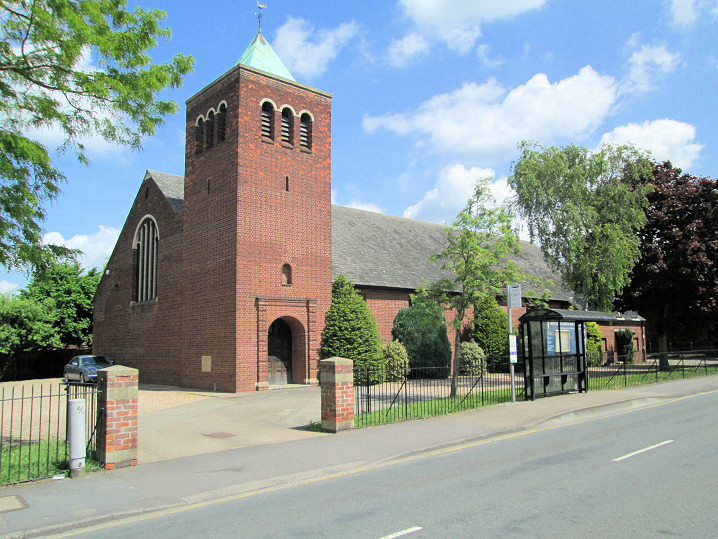
Bracebridge
|
||
21 July 2025
© Steve Bulman
Contact Details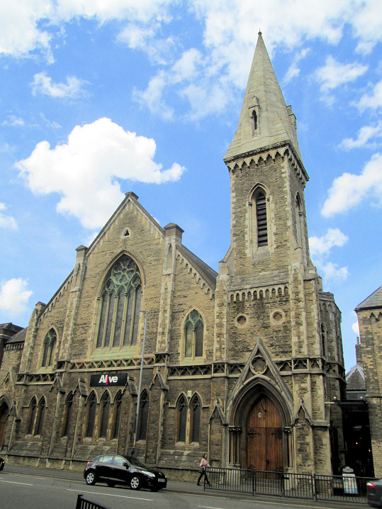