The Churches of Britain and Ireland
| Launceston,
Cornwall
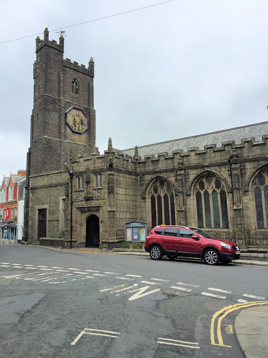
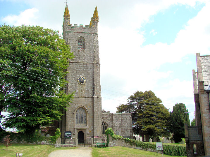
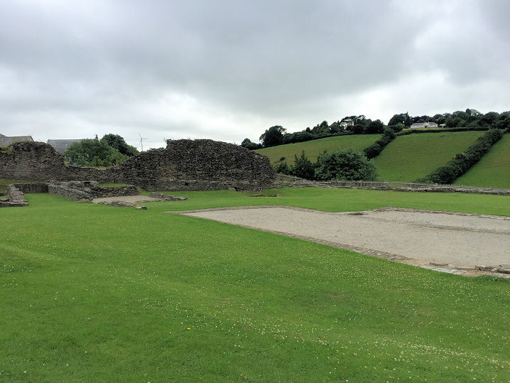
An otherwise unidentified Chap. is shown on a map of 1906 on Tower Street at SX 3309 8485. It's identified here as Tower Street Bible Christian Chapel of 1897. Immediately to its right was its predecessor of 1851, and there is a photo showing both chapels. The earlier one has since been demolished, and flats built on the site (2023 Streetview). The later chapel survives. Long out of active use, it has been converted (2023 Streetview). The Central Methodist Church, on Castle Street, as seen by Streetview in 2023. Older maps label it as Wesleyan. SX 3315 8470. Link. There was another Wesleyan Chapel on St. Stephen's Hill at SX 3271 8535. An estate agents sale notice dates it to 1884. 2016 Streetview. A Free United Methodist Chapel is shown on old maps set back from St. Thomas Road at SX 3290 8485. If it survives, it's the building seen behind the van here on a Streetview from 2023. St. Cuthbert Mayne (R.C., 1911) on St. Stephen's Hill. It was seen by Streetview in 2023. SX 3258 8544. Link. Grade II* listed. Its predecessor of 1887 is marked on early map a little way west of the present church at SX 3255 8541. It seems to be the hut seen at left in a 2009 Streetview. A later Streetview shows it to have been demolished. St. Mary Magdalene. SX 3321 8467. From an old postcard in Steve Bulman's Collection. A modern view, © Paul E. Barnett (2017). Link. Grade I listed. For related listed features, see here. St. Stephen the Martyr. SX 3247 8570. © Graeme Harvey (2011). Link. Grade I listed. For related listed features, see here. Launceston Castle once had a chapel in the courtyard, which is mentioned in a survey of 1337. Circa SX 330 845. © Paul E. Barnett (2017).
|
||
16 May 2024
© Steve Bulman
Contact Details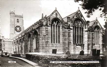