The Churches of Britain and Ireland
| Knowle, Knowle West, Inns
Court, and Upper and Lower Knowle, Bristol
Knowle on
Wikipedia.
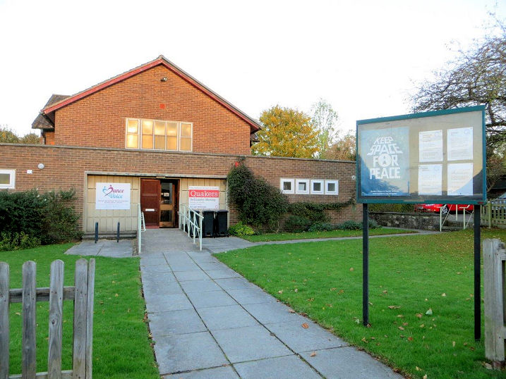
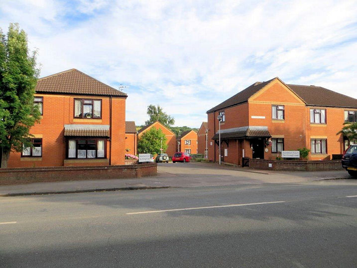
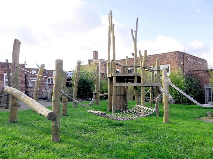
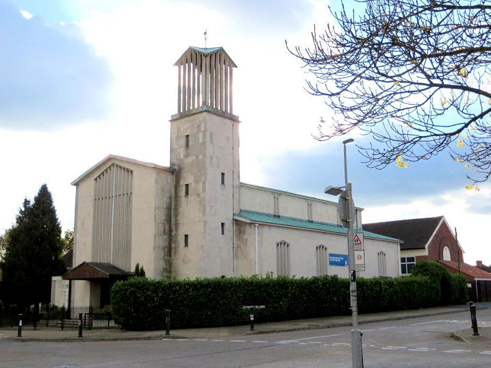
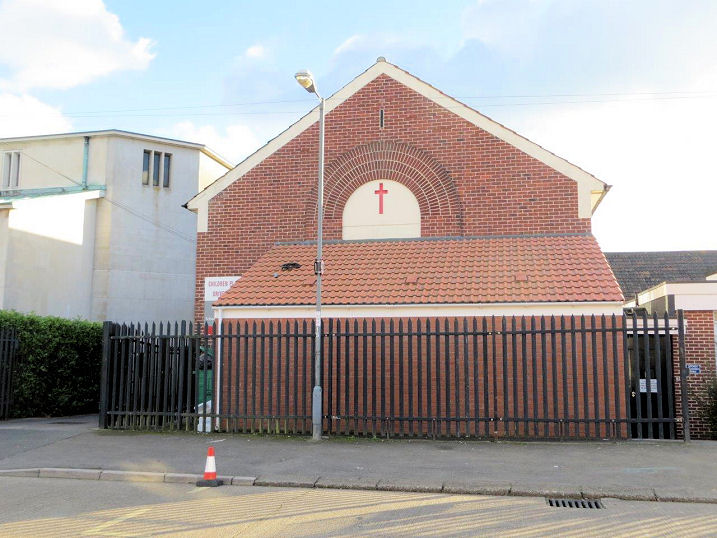
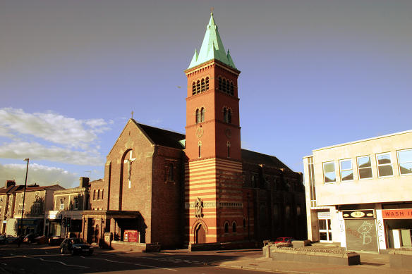
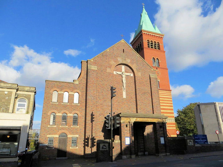
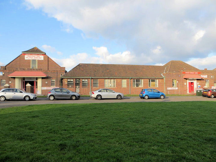
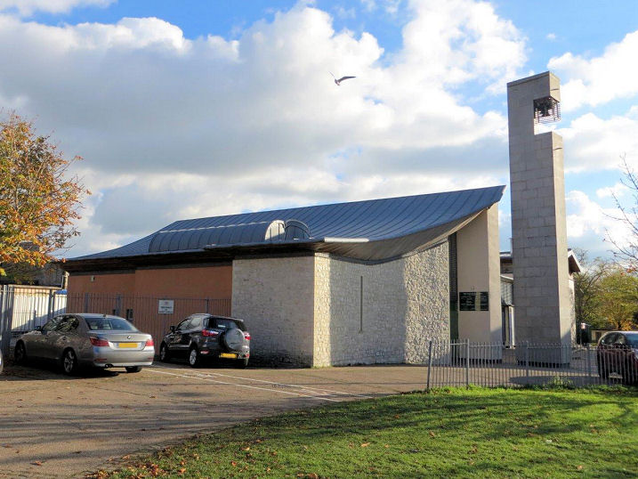
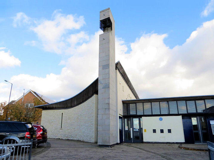
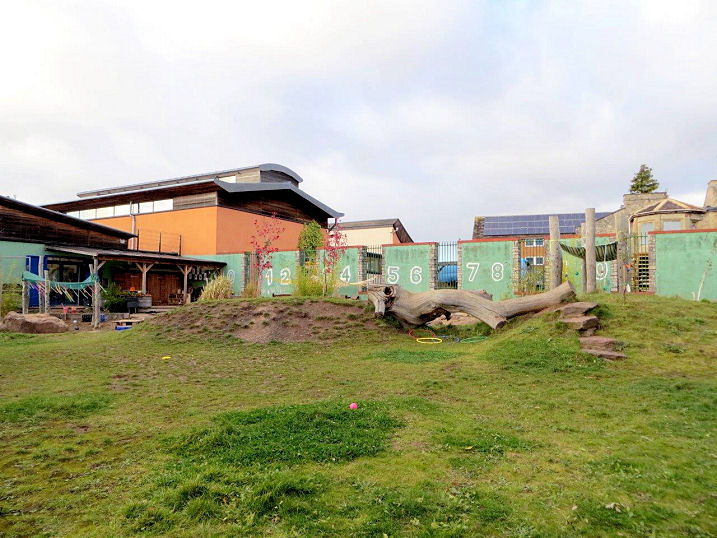
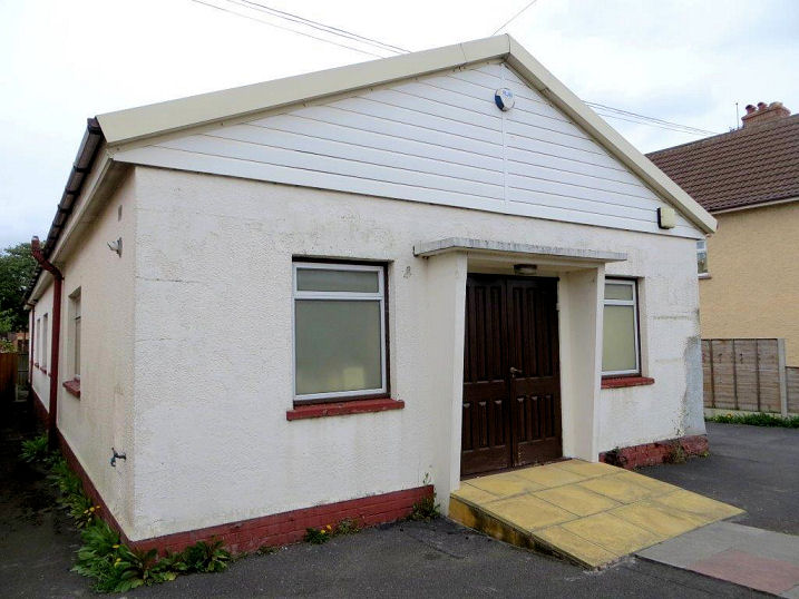
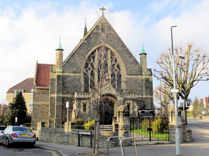
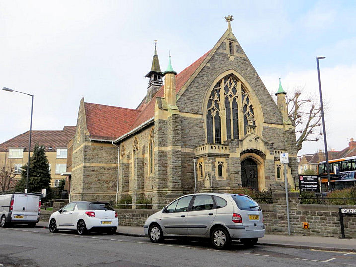
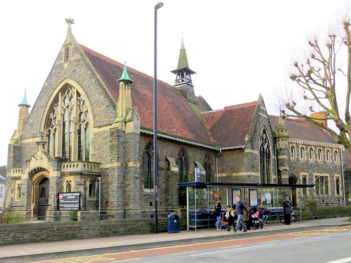
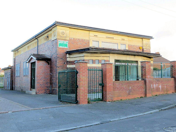
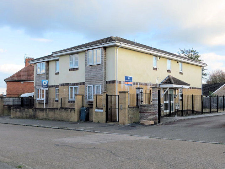
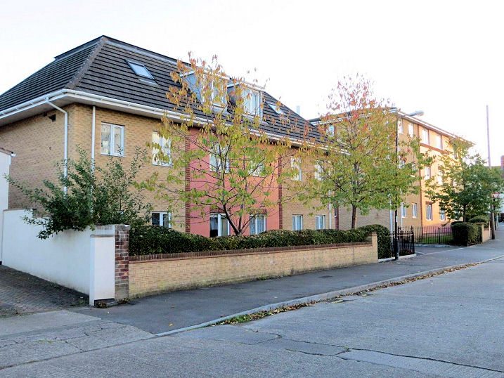
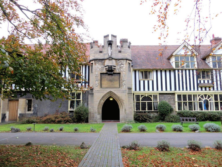
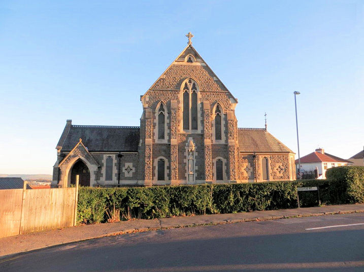
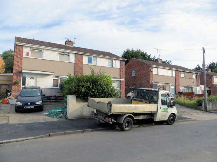
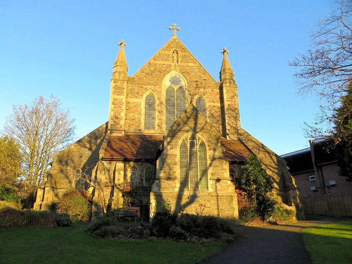
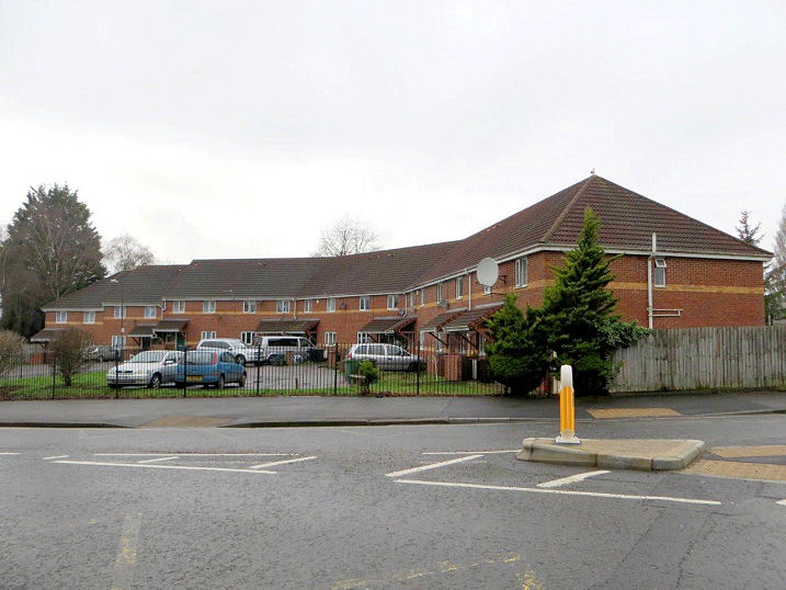
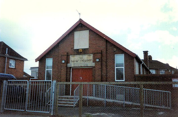
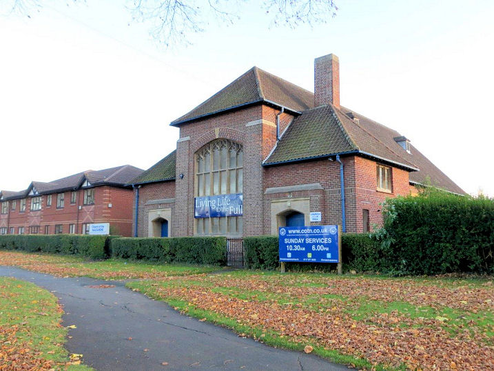
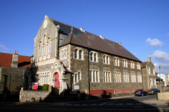
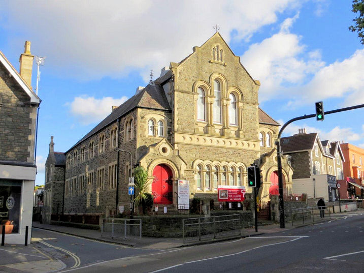
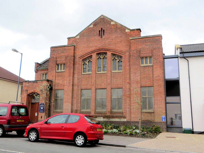
The site of a Bible Christian (later United Methodist) Chapel, which used to stand on Harrowdene Road and Greenmore Road. Opening in 1904, maps show that it was United Methodist by 1915, and it was closed in 1969. Now redeveloped as housing, an old photo is available here (scroll down to Knowle), and comparison shows that the church stood where the rear gardens are today - note that the building at the right is the same in both photos. Another view shows the front of the houses, and this is where the church hall used to stand. ST 60817 70966. Both © Carole Sage (2016). A Loxton drawing shows the church, with its hall to the left. The site of the vanished Bristol City Mission Hall, on Bedminster Road. Founded in 1936, the site is now occupied by housing (Avondown Court). ST 58263 70751. © Carole Sage (2016). Broad Plain House on Broadbury Road was designated as a place of worship in 1949, but Carole has been unable to establish any other details. Not in use as a church any more, part of the building is used as a community centre. ST 58976 69761. © Carole Sage (2016). A Chapel of the House of Charity on Crowndale Road was open from 1921 to 1991. Now a private house, it is the building at the centre of the photo. Carole has been unable to find any information about it, other than that it was associated with the Church of the Holy Nativity (for which see below). ST 60216 71256. © Carole Sage (2016). Church of Christ the King (R.C.) on Filwood Broadway and Hartcliffe Road dates from 1950. Another view. ST 59356 69610. Adjacent to the church stands a school hall - this was used as a Mass Centre before the present church was built. All © Carole Sage (2016). Link. Church of the Holy Nativity (1950), on Wells Road. ST 60211 71442. © Andrew Ross. Another view, © Carole Sage (2016). The previous Holy Nativity was a victim of WWII bomb damage, and a photo showing the result can be seen here. A Loxton drawing shows it before the war. Link. Grade II listed. Elim Church met for some time at the Filwood Community Centre on Barnstaple Road. This was an off-shoot from their church on Jamaica Street in Stokes Croft, for which see the Bristol (City) page. ST 59365 69787. © Carole Sage (2016). Holy Cross Church was built in 2000 on Inns Court Avenue. Now known as Inns Court Church Centre, the church is shared by three congregations - Church of England and Baptists have shared services, and the Church of God of Prophecy has separate services. Another view. ST 58741 69228. Link. It was successor to the first Holy Cross Church, built in 1959. This in turn was the successor of St. Giles Mission Church, which had been converted from farm buildings in 1949-1950. Both were on the same site, which is now a play area behind the Mede Community Centre, close to the present church. ST 58772 69185. All © Carole Sage (2016). The former Kingdom Hall of Jehovah's Witnesses on Marksbury Road was closed in 2014, and Carole advises that that it appears to be unused at present. Another view. ST 58249 70677. Both © Carole Sage (2016). Knowle Methodist Church (1904) stands at the junction of Redcatch Road and Wells Road. Two further views - 1, 2. ST 60615 70853. All © Carole Sage (2017). Link. Loxton has two drawings - 1, 2. Knowle Pentecostal Church stands on Leinster Avenue, and dates from 1960. It has recently been re-named as Destiny: Knowle's Pentecostal Church. ST 58938 69786. © Carole Sage (2016). Link. Knowle West Baptist Church (1935) on Newry Road. The church has of recent years formed formed a partnership with St. Barnabas (see below) and Holy Cross (see above), with the result that the Baptists now mostly worship at Holy Cross, though some services, such as immersion baptisms, still take place here. ST 59470 70105. © Carole Sage (2016). The site of Knowle West Gospel Hall (Christian Brethren) on Hartcliffe Road. Built in the 1940's, it was also known as Hartcliffe Hall. Closed circa 2002, a block of flats (Gospel Gardens) was built on the site. ST 59715 69741. © Carole Sage (2016). The site of Redcliffe Crescent Memorial Methodist Church on Wingfield Road. Built in 1951 as a replacement for Redcliffe Crescent Methodist Church on York Road, Bedminster (originally Bible Christian, and destroyed by WWII bombing), it was closed in 2004, and the site redeveloped for housing. The church stood on the site of the left hand building, plus the parking area to its rear. The church hall stood on the site of the right hand building. ST 59325 70675. © Carole Sage (2016). The St. Agnes House of Charity (ST 59918 70829) on St. Agnes Avenue was a convent, and an orphanage and school for girls. It's now called St. Saviour's House, and is a priory and retreat for the Society of St. Pius X. Masses, which are open to the public, are held in the chapel (ST 59918 70829) on Redcatch Road. Another view. St. Agnes House © Carole Sage (2016), chapel © Carole Sage (2017). Link, which has an interior view of the chapel. The Loxton Collection has a drawing. St. Barnabas on Daventry Road was founded in 1933, and the first temporary building was replaced by the present church in 1938. Adjacent to it were the St. Barnabas Institute, with the church hall to the rear. Judged to be too large for the requirements of the 1970's, the nave was demolished and replaced by housing, and the transepts now serve as the church hall. The church is now known as St. Barnabas Church Centre. ST 59559 70350. © Carole Sage (2016). Link1. Link2 has old photos of the interior. St. Gerard Majella (R.C., 1909) on Talbot Road and Leighton Road. Another view. ST 61054 70737. Both © Carole Sage (2016). Link, which has some interior photos, and some history. Loxton has two drawings, - 1, 2, the latter of which shows it as it was intended to be (design by Pugin and Pugin) but the tower was never built. The site of St. Hugh's Mission Church on Lynton Road has been re-developed for housing. Founded as a mission from St. John the Baptist in Bedminster in 1931, it closed in 1962. ST 58817 70607. © Carole Sage (2016). St. Martin (1901-8) on St. Martin's Road and Wells Road. ST 60866 70500. © Carole Sage (2016). The Loxton Collection has two drawings - 1, 2, and an old photo is available here. The site of St. Philip's Methodist Church on Novers Lane. Built in 1950, it was closed in the mid-1990's, and subsequently redeveloped for housing, as Soper Gardens. ST 58535 69346. © Carole Sage (2017). Salvation Army Hall (and Knowle West Community Church) on Padstow Road. Dating back to at least 1971 (when it was registered for the solemnising of marriages), it may be the same building as shown on older maps as Mission Hall. If it's a replacement, then it has the same footprint. ST 59489 69855. © Carole Sage (2016). Another (older) view, © Rob Kinnon-Brettle. The Church of the Nazarene on Broad Walk was formerly Knowle Park Congregational Church, which dates from the 1930's. It was closed in the 1980's, and subsequently taken over by the present evangelical church. ST 60383 70547. © Carole Sage (2016). Link. Totterdown Baptist Church (1881), on Wells Road. ST 60301 71302. © Andrew Ross. Another view, © Carole Sage (2016). Link. Grade II listed. Victoria Park Baptist Church on Sylvia Avenue. Another view, showing the 2014 extension. ST 59534 71102. Both © Carole Sage (2016).
|
||
04 March 2023
© Steve Bulman