The Churches of Britain and Ireland
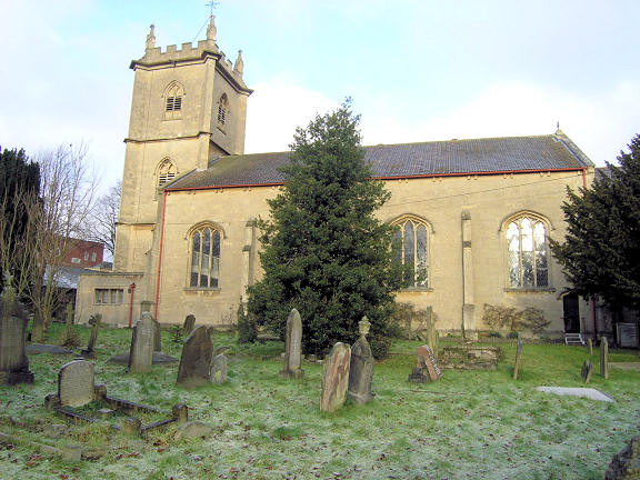
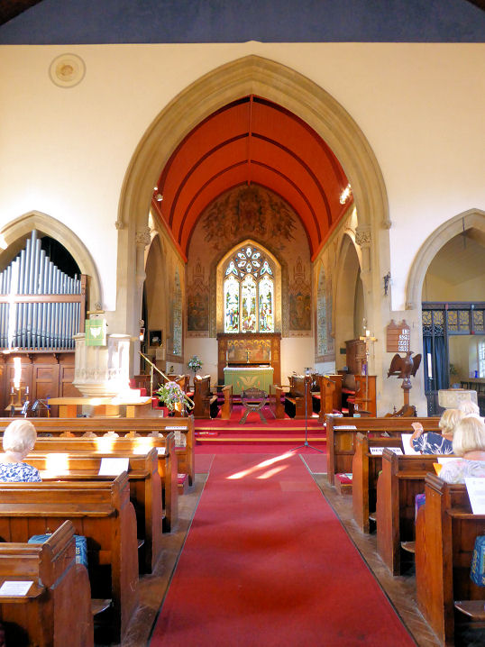
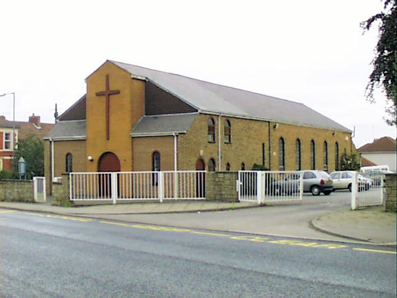
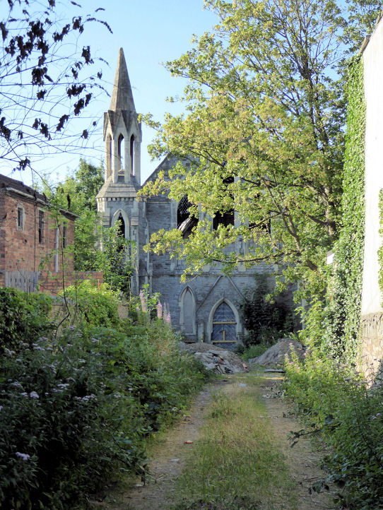
Kingswood (near Bristol), GloucestershireBourne Christian Centre (2020 Streetview) on Two Mile Hill Road and Waters Road. A map of 1882 labels it as Bourne Chapel (Primitive Methodist). It's dated here to 1873, replacing an earlier chapel of 1841 (perhaps called Ebenezer) on the same site. ST 6428 7391. Link. Freedom Church meets in Acorn House (2019 Streetview) on The Kingswood Estate, Britannia Road. ST 6430 7347. Link. Holy Trinity. ST 6509 7380. © Phil Draper. Interior view, © Janet Gimber (2018). Link. Grade II* listed. The war memorial is also listed, as grade II. House of Healing Ministries meets (according to its website, in 2025) in Kingswood Community Centre on Kingswood High Street - 2021 Streetview. Horeb Church (AG Pentecostal) also meets here. ST 6505 7379. Link. Kingswood Congregational Church (2025 Streetview) on Hanham Road. It pre-dates a map of 1887. ST 6500 7376. Link. Kingswood Masjid is on Moravian Road, and seen by Streetview in 2024. This is a former Moravian Chapel, dated here to 1868 (though Pevsner says 1856), and was latterly United Church (2017 Streetview). ST 6484 7378. Kingswood Methodist Church (2025 Streetview) on Two Mile Hill Road and Grantham Road. It's labelled on a map of 1882 as Zion Chapel (Free Methodist), and is dated here to 1854. ST 6444 7396. Link. Our Lady of Lourdes and St. Bernadette (R.C.) on Court Road. ST 6499 7349. © Phil Draper. Link. The derelict former Whitfield's (or Whitefield's) Tabernacle (U.R.C.). Another view. ST 6488 7391. Both © Janet Gimber (2018). There's a useful Wikipedia entry for this church. Grade I listed, wherein it's dated to 1741, enlarged 1802. Potters Wood Methodist Church on Pow's Road, as seen by Streetview in 2025. ST 6486 7329. Link dates it to 1957, on the present site. St. Michael the Archangel on Two Mile Hill Road and Kingsway, as seen by Streetview in 2023. ST 6389 7379. Link. Salvation Army Church on Two Mile Hill Road and Kennard Road, as seen by Streetview in 2021. It has a date-stone for 1879, and is labelled on a map of 1882 as a Gospel Hall, with adjacent Sunday School. ST 6411 7387. Link. A former Wesleyan Methodist Chapel (2021 Streetview) stands on Blackhorse Road at ST 6448 7379. This source dates it to 1843-1978.
|
||
01 November 2025
© Steve Bulman