The Churches of Britain and Ireland
|
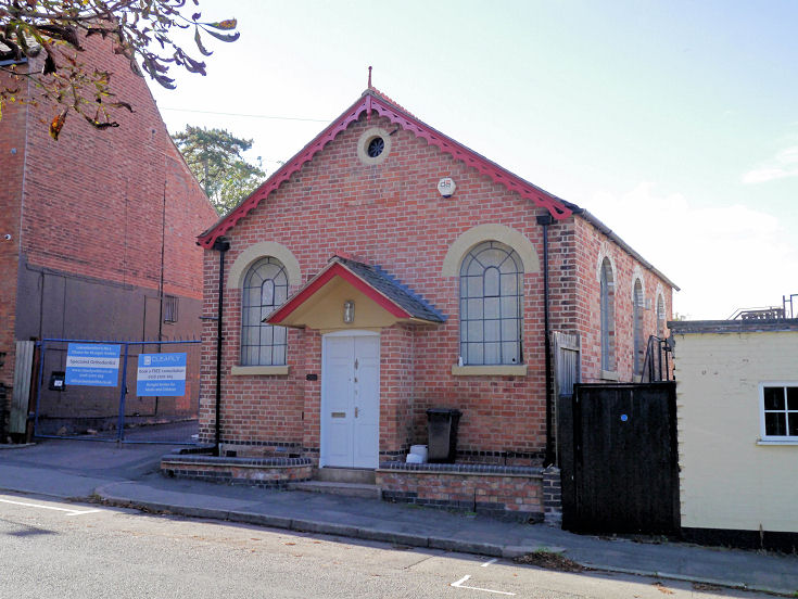
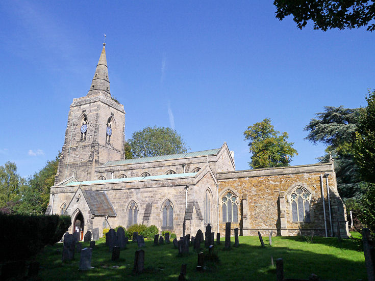
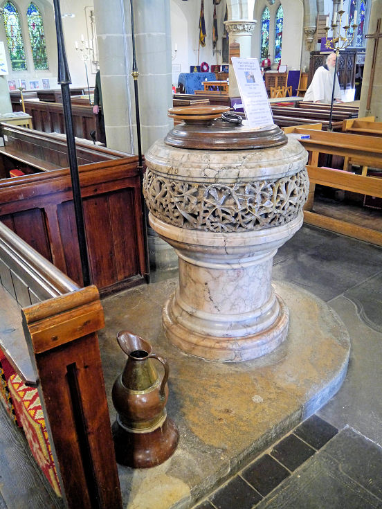
Humberstone, Leicester, Leicestershire Abbots Road U.R.C. as seen by Streetview in 2022. It stands on Abbots Road South and Cardinals Walk at SK 6306 0558. Link. According to the history page it was opened in 1968, replacing an earlier church of 1929, (Humberstone Congregational Church) which now serves as the church hall. I assume this is the adjacent building on Abbots Road South, seen here by Streetview. Al Ma'rifah Academy (2022 Streetview) on Armadale Drive. SK 6366 0603. Link (wasn't working when I tried it). A former Baptist Chapel (2008 Streetview) stands on Overton Road at SK 6085 0539. Following closure it was a YMCA but is now a boxing club. It's dated here to 1881. Baptist Church, on Uppingham Road, New Humberstone. SK 6102 0537. © George Weston. Earlier O.S. maps mark Chapel (Remains of) on Gipsy Lane, at SK 6238 0601. On later maps it was changed to (Site of). Its site lies amongst the trees seen in a 2015 Streetview. I haven't been able to discover any further information about it, but speculate that it might have been Swan's chapel or Keble's chapel, mentioned here. The former Congregational Chapel on Main Street. It's identified as such on the 25" O.S. map of 1904, and a directory of 1895 has "Here is a small Congregational chapel, built in 1851". SK 6242 0593. © Peter Smith (2022). Laburnum Road Community Church on Laburnum Road had previously been U.R.C (from 1981), but was built in 1910 as Christian Meeting House (Church of Christ) - source. It was seen by Streetview in 2012. Link. A former Mission Hall (2023 Streetview) stands at the junction of Overton Road and Prestwold Road. It has been a parish room but is now in commercial use, and map evidence dates it to between 1902 and 1913. SK 6092 0545. St. Mary on Lidster Close, and its font. SK 6263 0598. Both © Peter Smith (2022). Link. Grade II listed. An A-Z streetmap of Leicester from 2000 shows an otherwise unidentified place of worship on Austin Rise at SK 6350 0598. It had been demolished by the time of the first Streetview visit in 2008, and the site remained undeveloped in 2015 (Streetview). Can you advise what it was, or provide any other information about it? A Wesleyan Methodist Chapel used to stand on Victoria Road. Even the road has gone, and the site of the chapel is now occupied (roughly) by the two houses to the right of the lamppost in this 2022 Streetview, and from the other side, the houses left of the brown windows (2022 Streetview). This source dates it to 1882. SK 6108 0556. West Humberstone Gospel Mission on Brighton Road, as seen by Streetview in 2015. The church website dates the building to 1896-7. SK 6113 0574.
|
||
27 May 2023
© Steve Bulman
Contact Details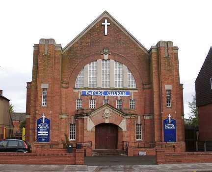