The Churches of Britain and Ireland
| Hexham, Northumberland
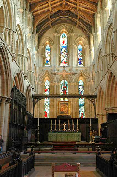
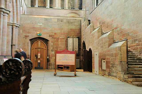
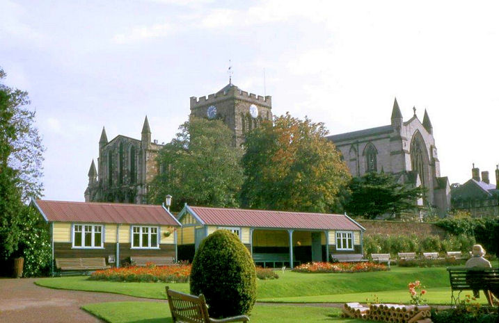
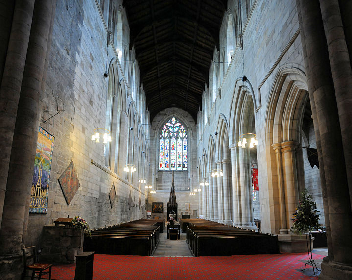
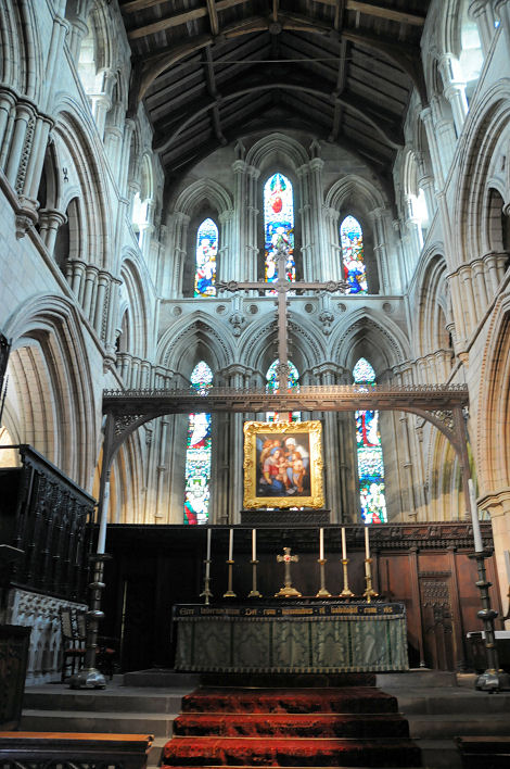
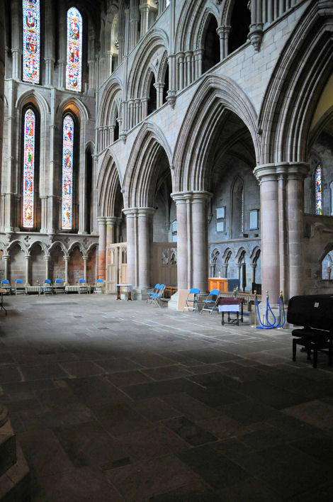
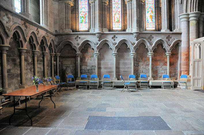
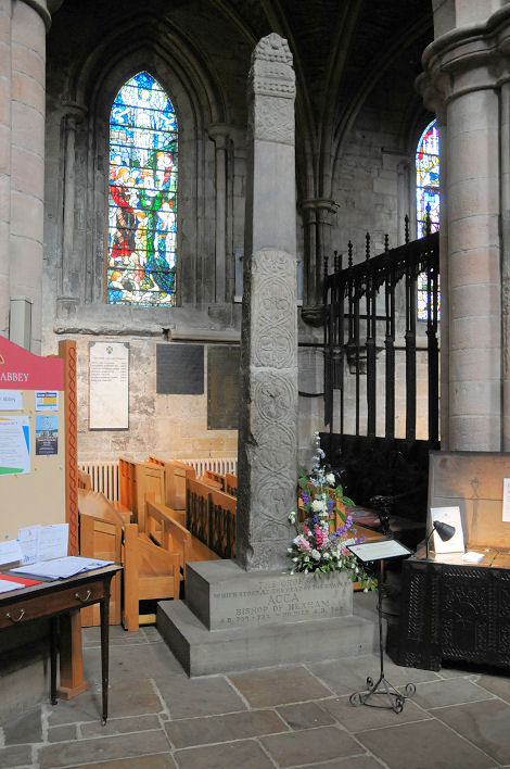
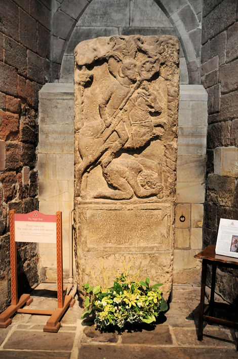
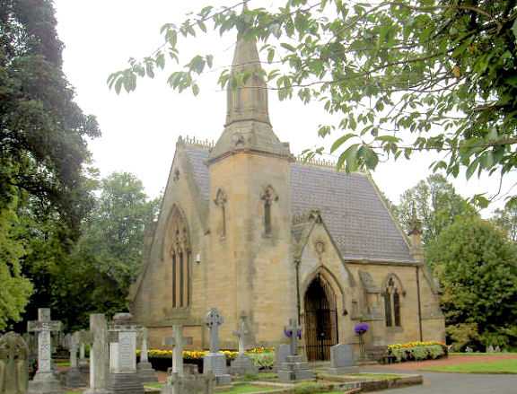
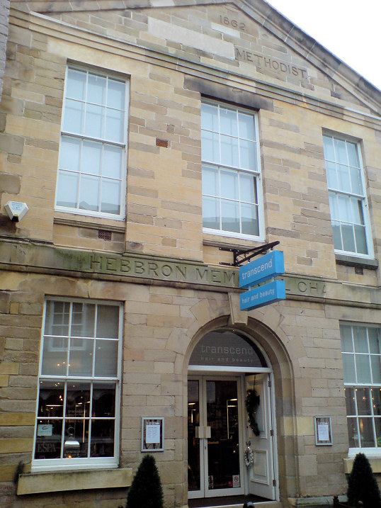
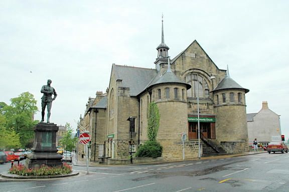
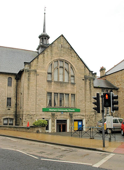
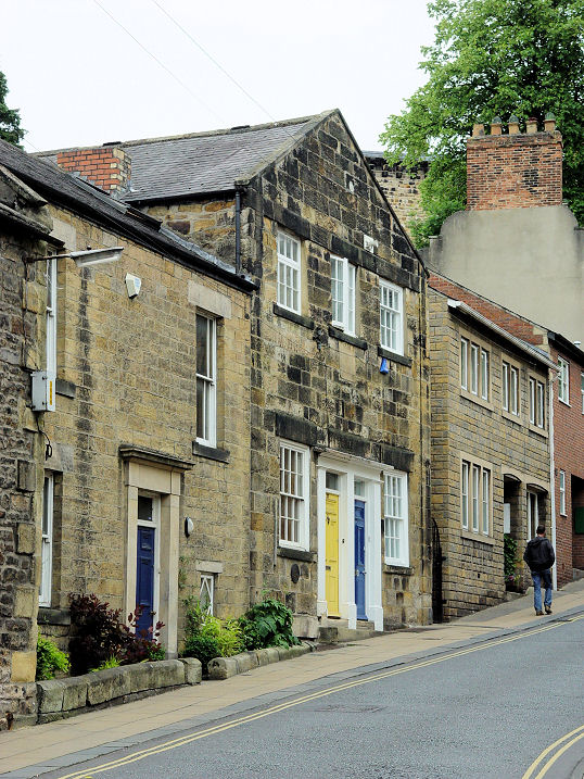
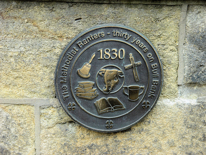
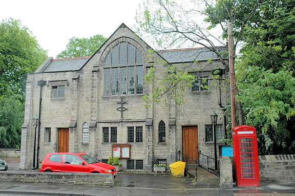
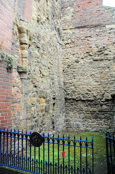
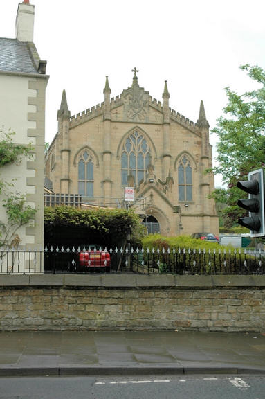
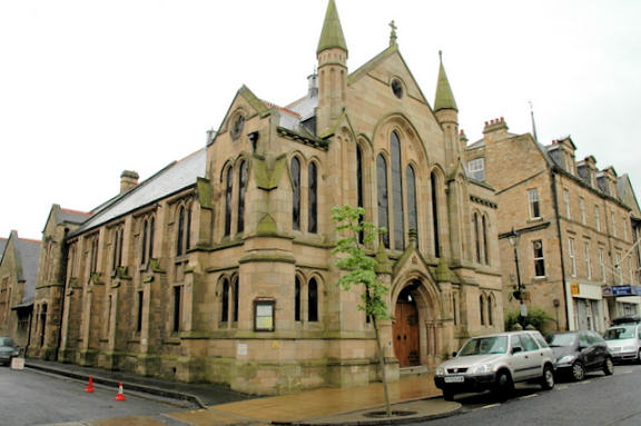
The Abbey, properly the Priory and Parish Church of St. Andrew. NY 9356 6411. From an old postcard in Steve Bulman's Collection. A modern view, interior view, and the Night Stairs, all © Alan Craxford. Link. This page explains about the Night Stairs. Another view, © Carole Sage (1969). More interior views - 1, 2, 3, 4, the cross, which formerly marked the grave of Bishop Acca, and a Roman gravestone (more detail here), all © Karel Kuča (2019). Much remains of the Priory Gate on Gilesgate, © Steve Bulman (2010). Link. Grade I listed. Cemetery Chapel (St. Andrew's) on West Road. © Alan Blacklock. Grade II listed. There are two cemetery chapels here, one at NY 9191 6496 (CoE) and the other at NY 9195 6495 (nonconformist). A Congregational Chapel once stood on Hencotes at NY 9323 6389. Maps show it as surviving to 1963 at least. Housing and gardens now occupy the site, visible here on a 2018 Streetview. NY 9323 6389. The former Hebbron Memorial Chapel (1862) on St. Mary's Chare, now in commercial use. It was built as Primitive Methodist; evidently "Primitive" was later erased. Circa NY 935 640. © Steve Bulman (2012). Hexham Community Church stands at the junction of Beaumont Street and Battle Hill. Another view. NY 9348 6393. Both © Alan Craxford. Link. The history page says that the building is a former community centre, but it's evidently also a former church - but what was it? A former Independent Chapel stands at NY 9371 6386 on Broadgate. Currently in commercial use, a 2015 Streetview can be seen here. The 1862 O.S. map shows a Presbyterian Chapel set back from Gilesgate (map) at NY 9343 6430. The former Primitive Methodist Chapel on Hallstile Bank (once known as Bull Bank). What appears to have been a date-stone sits below the central upper window, but it is completely defaced. A plaque records "1830 .... 30 years on Bull Bank"; whether this means 30 years from 1830, or that 1830 was the end of their presence here, is unclear. The building seems to have long been converted into two houses. Circa NY 937 641. Both © Steve Bulman (2013). St. Aidan (U.R.C.). © Alan Craxford. The fragmentary remains of the ancient church of St. Mary. Originally built in the 8th century, it was a ruin by the 16th. © Alan Craxford. Link. St. Mary (R.C.) on Hencotes. © Alan Craxford. Grade II* listed. Salvation Army on Market Street is an unusually handsome S. A. building, dating from 1883. There is a stone above the right-hand window which reads "blood and fire", a S.A. motto, so perhaps this building was built by the movement. © Steve Bulman (2010). Link. Trinity Methodist Church on Beaumont Street. Older maps label it as Wesleyan. It's dated here to 1887. NY 9351 6396. © Alan Craxford. Link. Grade II listed. A former United Methodist Chapel stands at the south end of Giles Place, at NY 9336 6432. It can be seen on a 2015 Streeview here and in 2017 here. It may have been replaced by 1896, when a "Meth. Chap" is shown on a map of that vintage, standing just a few yards away at NY 9331 6434. Housing now stands on the site, seen here on a 2009 Streetview. Another United Methodist Chapel was present by 1922, at the corner of Leazes Terrace and Shaftoe Leazes. Now called West End Methodist Church, it can be seen on Streetview here. NY 9290 6408. Link. Its appearance would never hint at it as being a former chapel, but the building known as "The Old Post Office" on Market Street was a Wesleyan Chapel in the mid 19th century, and shows as such on an O.S. map of 1862-3. According to a comment appended to the grade II listing (scroll down), it was a C18 house converted to a chapel in 1839, and became the main Post Office for the town in 1887. It can be seen on a 2017 Streetview here. NY 9351 6422.
|
||
04 March 2023
© Steve Bulman
Contact Details