The Churches of Britain and Ireland
|
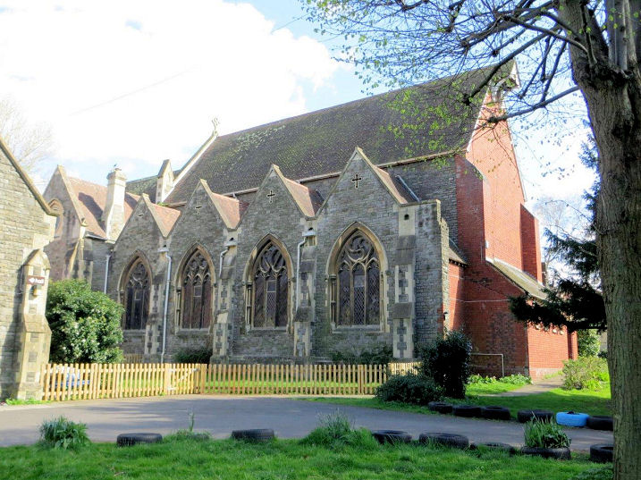
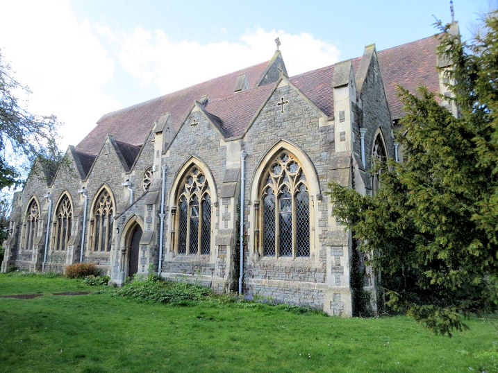
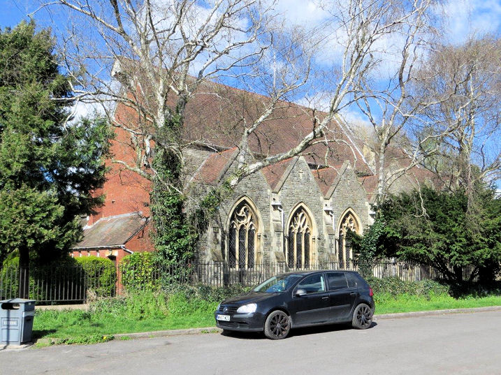
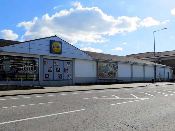
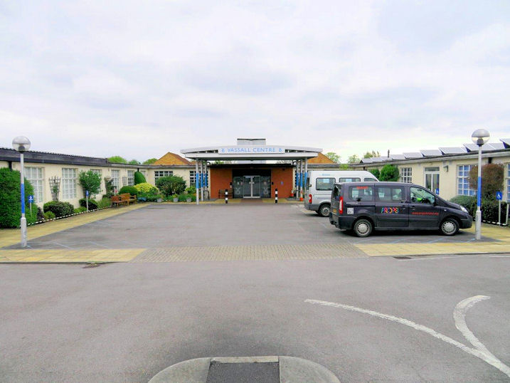
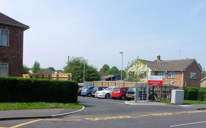
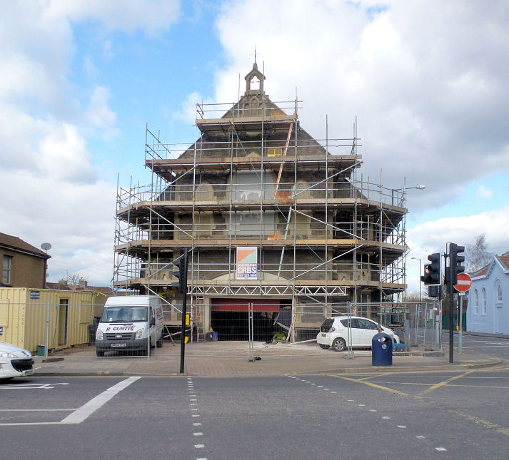
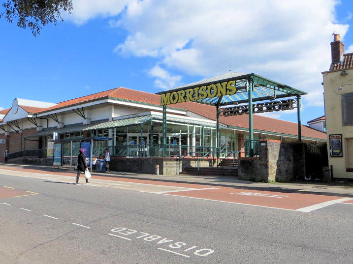
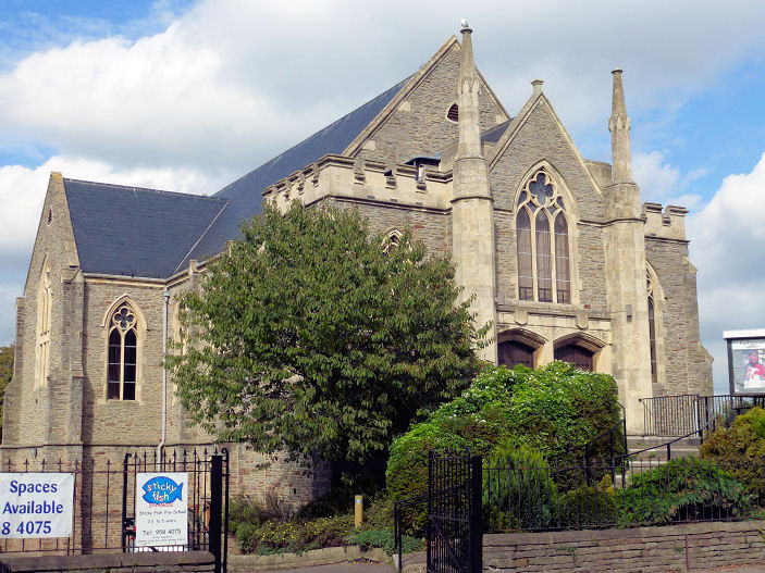
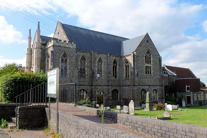
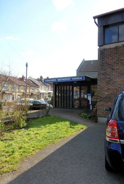
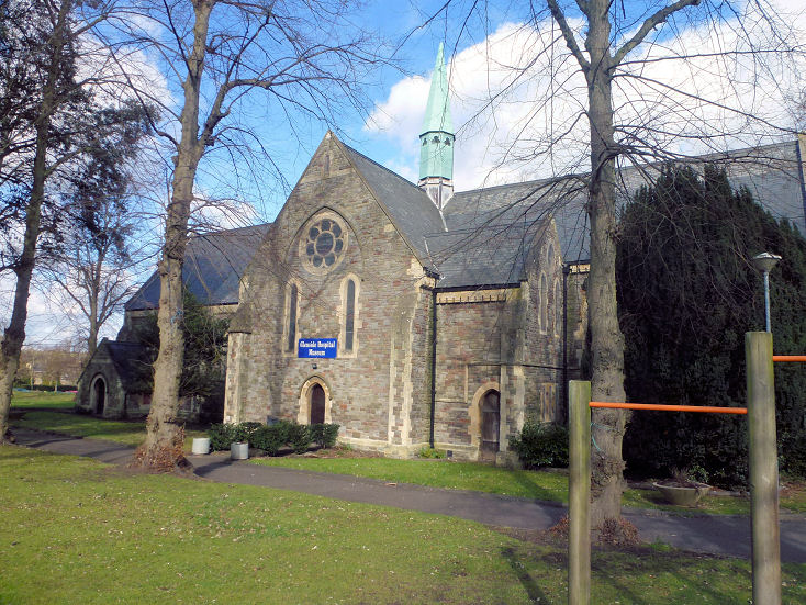
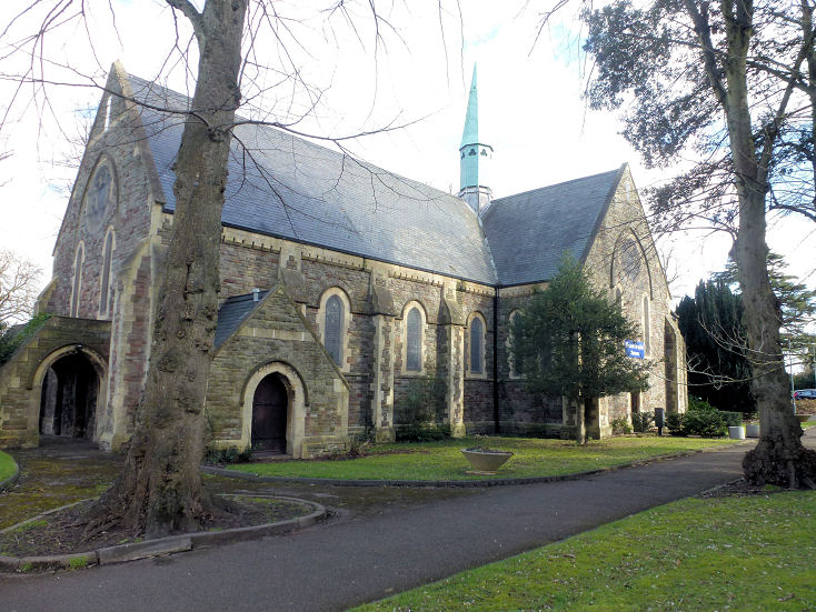
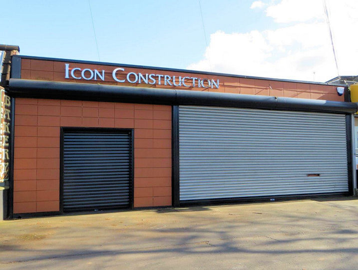
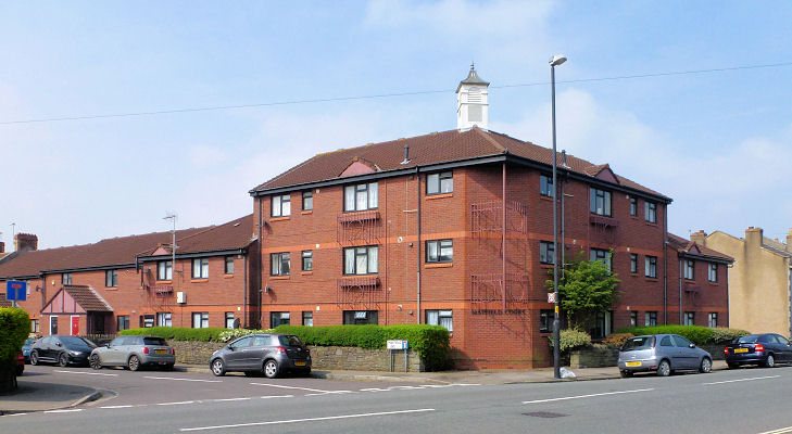
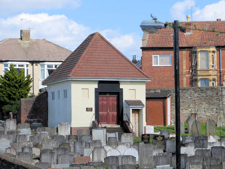
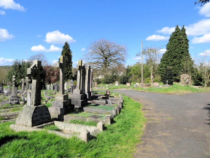
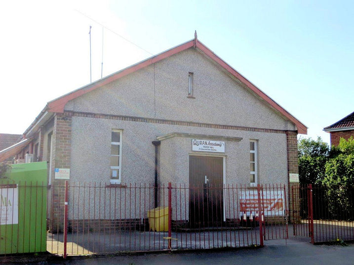
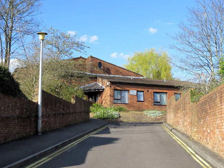
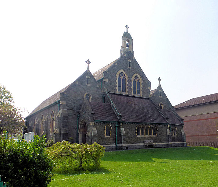
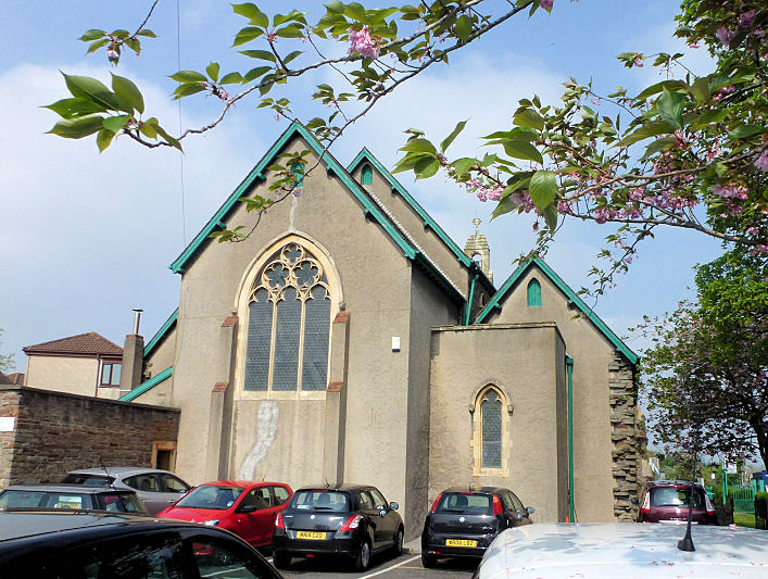
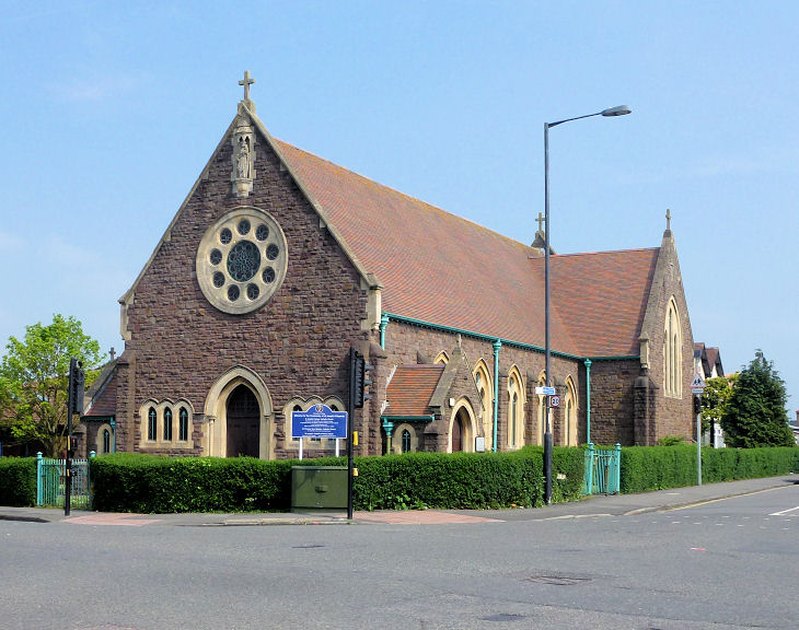
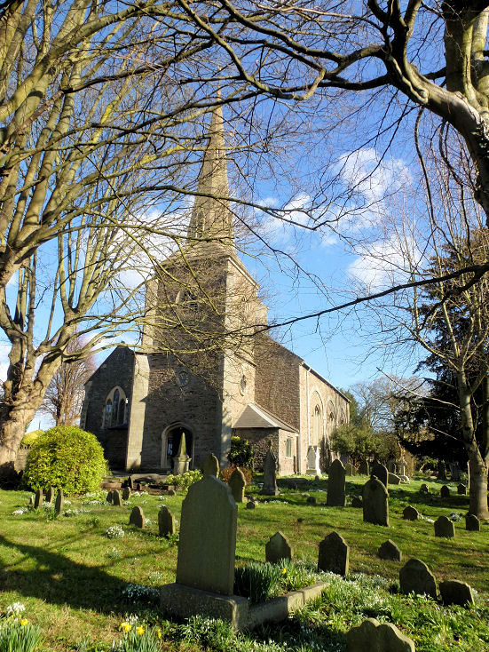
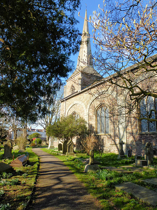
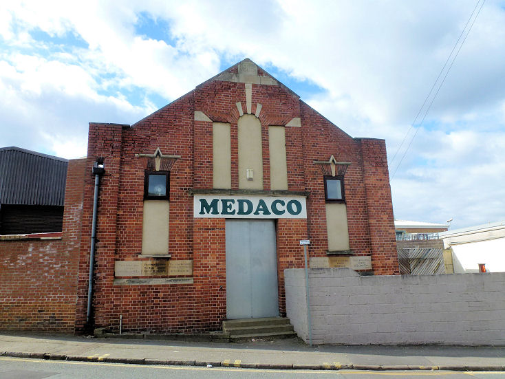
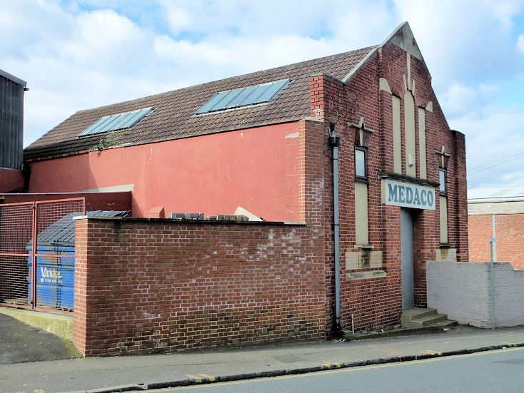
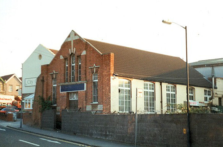
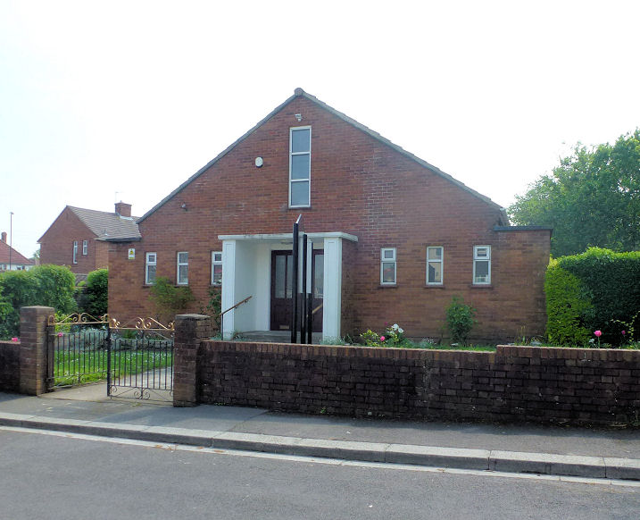
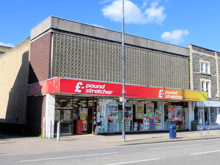
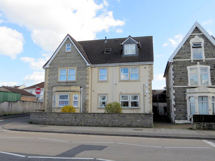
Fishponds and Hillfields, including Clay Hill and Oldbury Court, Bristol All Saints on Grove Road opened in 1909. Two additional views - 1, 2. ST 62663 75676. © Carole Sage (2017). Link. A Loxton drawing. Argyle Morley U.R.C. on Duncombe Lane and Whitefield Road. Dating from 1898, it is marked on old maps as Argyle Hall, but seems to have been the home of Argyle Congregational Church. In 1970 the congregation joined with that of Morley Memorial Congregational Chapel, and the church assumed its present name. See also Morley Memorial Congregational Chapel, below. © Janet Gimber (2016). The site of Bethel Tabernacle (Pentecostal) on Chapel Lane. Founded in 1929, it was later known as Bethel Gospel Hall. It seems to have still been in active use in 1970, but it was demolished in 2003, and a supermarket now stands there. Bethel stood at the far end of the supermarket in Carole's photo. ST 63190 75703. © Carole Sage (2017). A photo of it being demolished is available here. Bread of Life Ministries meet at the Vassall Centre on Gill Avenue in Oldbury Court. In the early 2010's, Oldbury Court Church also met here. ST 63661 76431. © Carole Sage (2017). Link. The site of a demolished Brethren Hall on Briar Way. It had previously been a Mission Hall (from where?) and is shown as such on old maps. © Janet Gimber (2016). Clay Bottom Chapel (Primitive Methodist) at Clay Hill was founded in 1808, and was closed circa 1948. Subsequently used as a glove factory, it was eventually demolished to make way for housing. In Carole's photo of the site, the chapel would have stood where the right hand end of the flats is now. ST 61947 74688. © Carole Sage (2017). The former Ebenezer Methodist Chapel (United Free) on Fishponds Road. Undergoing conversion into flats when Janet took her photo. It was commonly known as The Clock Chapel. Dates are 1850-1964, when the chapel closed due to rising maintenance costs, and the congregation joined with the nearby Trinity (Wesleyan) Methodist Chapel (see below), though that went the same two years later, and it was replaced by Fishponds Methodist Church (see below). ST 63045 75691. © Janet Gimber (2016). Loxton's drawing has it as Fishponds Methodist Free Church. Exterior and interior photos here (about halfway down), when it was in use as a garage, and more here. Another Ebenezer Methodist Church, this time Wesleyan, also stood behind buildings on on Fishponds Road, quite close to the United Free Church (above). Dates not apparent, but it shows on the 1880's O.S. map, and had closed by 1900 by when it had become part of a biscuit factory. The site is now covered by a supermarket. ST 63123 75645. © Carole Sage (2017). Faizan e Madina Mosque on Fishponds Road. Previously a shop, the congregation have only recently moved in. ST 62715 75460. © Carole Sage (2017). Fishponds Baptist Church opened in 1967. Another view. ST 63239 75900. Both © Janet Gimber (2014). Link1. Link2. Fishponds Methodist Church on Guinea Lane. Another view. ST 63239 75900. Both © Janet Gimber (2016). The former Glenside Hospital Chapel. Another view. Originally the chapel for a large mental hospital, it now serves as a museum to mental health and its treatment as part of the educational campus on Blackberry Hill. Both © Janet Gimber (2016). Hillfields Park Baptist Church. © Janet Gimber (2014). A short-lived (circa 1944-6) Kingdom Hall of Jehovah's Witnesses occupied one of a row of four shops on Downend Road. The site now has a small industrial unit on it. ST 64207 76273. © Carole Sage (2017). The Mata Sahib Kaur Sikh Temple is a worship room in a private house on Fishponds Road. ST 62154 75223. © Carole Sage (2017). The site of the demolished Morley Memorial Congregational Chapel on Lodge Causeway, now occupied by flats. Built in 1889, by 1970 structural problems prompted its closure and subsequent demolition, and the congregation joined with Argyle Congregational Church (see Argyle Morley U.R.C., above). © Janet Gimber (2016). Mortuary Chapel (1898) at Ridgeway Jewish Cemetery, on Oakdene Avenue and Elmhurst Avenue. ST 61970 75254. © Carole Sage (2017). The site of the non-denominational mortuary chapel at Ridgeway Park Cemetery - it stood just to the left of the telephone pole. Built in 1888, it was demolished only recently. ST 61966 75343. © Carole Sage (2017). Quran Academy Prayer Hall and Education Centre on Abingdon Road occupies a former Brethren Gospel Hall (dates for this are 1937-1996). ST 63229 75060. © Carole Sage (2017). The site of St. Bede's Church (opened 1927, closed 1962) on Cherry Tree Close off Cherry Tree Crescent. It was originally a mission from St. John's in Fishponds. Sheltered accommodation has been built on the site - the church stood at the right hand side of the development. ST 64169 74982. © Carole Sage (2017). St. John on Lodge Causeway. Another view. Both © Janet Gimber (2016). A Loxton drawing. It was preceded by a "tin church" on a site close-by (at the junction of Mayfield Park Road and Lodge Causeway), which was erected in 1894, having been brought from Peasedown St. John in Somerset, it having served as a church there since 1874. After the present St. John was built it was used as the church hall until 1930. It subsequently had a number of uses, being eventually demolished circa 1970. Loxton made a drawing, and there are photos of both churches, and a good history here. St. Joseph (R.C.) on Lodge Causeway and Forest Road. © Janet Gimber (2016). St. Mary the Virgin on Manor Road. This was previously Trinity Chapel, a chapel of ease to Holy Trinity, Stapleton (for which see here). Another view. Both © Janet Gimber (2016). Built before WWI on
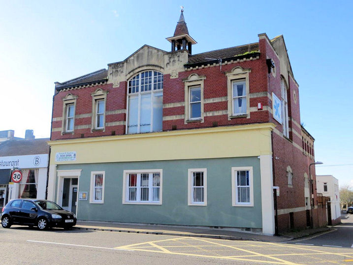
Guinea Lane, the former St.
Mary's Parish Hall seems to have been a place of worship in its own right.
An inscription on the building reads
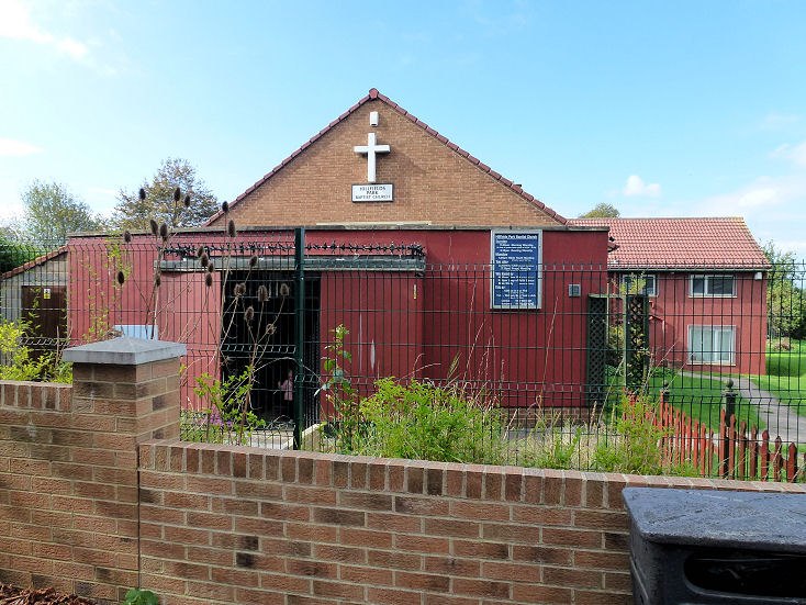
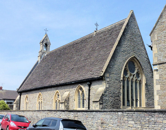
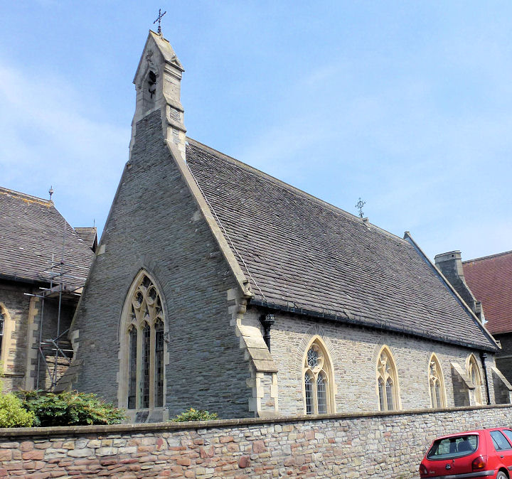
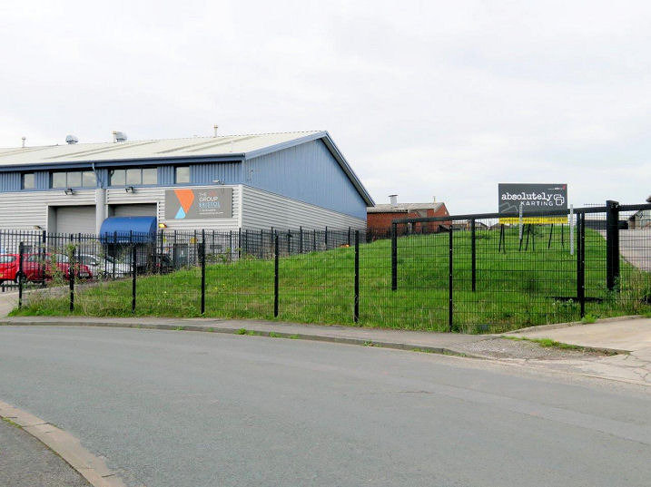
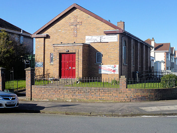
St. Matthias Campus Chapel on College Road and Elfin Road. Another view. Both © Janet Gimber (2016). Link. Salem Chapel once stood on Chapel Lane, Clay Hill. United Free Methodist, it was built in 1813, and re-built in 1867. It was still in use as Salem Methodist Church, showing on a map of 1970, but was demolished before the end of the 1970's, to make way for a trading estate. The site is now a grassy area. ST 62341 74667. © Carole Sage (2018). A photo is available here (scroll down to Clay Hill Chapel). The former Salvation Army building on Channons Hill is now in secular use. Built in 1915, it was closed in 1973. Another view. Both © Janet Gimber (2016). Another view, © Rob Kinnon-Brettle (circa 1997). Seventh-day Adventist Church on Worcester Close. © Janet Gimber (2016). The site of Trinity Methodist Church, on Fishponds Road, now occupied by retail premises. It opened in 1894, perhaps as successor to the nearby Ebenezer Wesleyan Methodist Church, which was closed in the latter years of the 19th century. This church closed in 1966, having structural problems. It was succeeded by the Fishponds Methodist Church on Guinea Lane (see above). ST 63227 75777. © Carole Sage (2017). Link (with photo). A Loxton drawing, which describes it as Fishponds Wesleyan Chapel. Vintage Church on Forest Road. This was previously Emmanuel Church. © Janet Gimber (2016). Carole Sage has advised (2018) that this is now used by (or has become) Life Church - link. The site of the demolished Zion Primitive Methodist Church on Fishponds Road. Founded in 1875, it was demolished about 1990, by which time it had been in secular use for many years. ST 62945 75566. © Carole Sage (2017). Link, which says a car park stands on the site, but housing has subsequently been built here.
|
||
13 October 2023
© Steve Bulman