The Churches of Britain and Ireland
| Exeter, Devon Lots of useful information relating to the churches of Exeter. My
appreciation to Peter Kessler for his permission to use many of his
photographs here, and for his researches into the history of Exeter
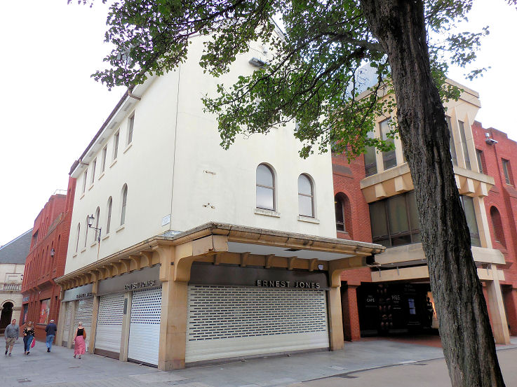
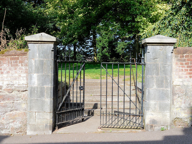
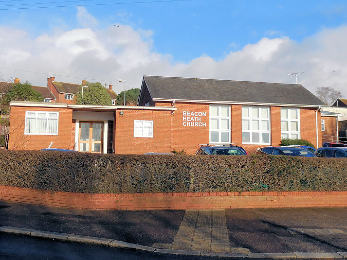
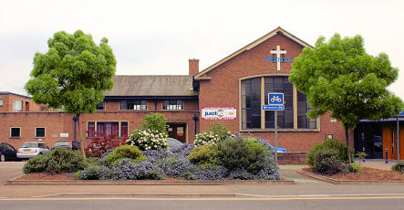
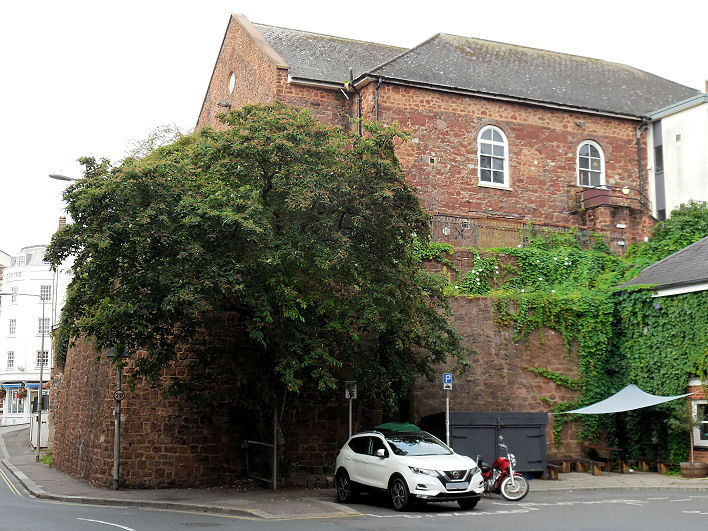
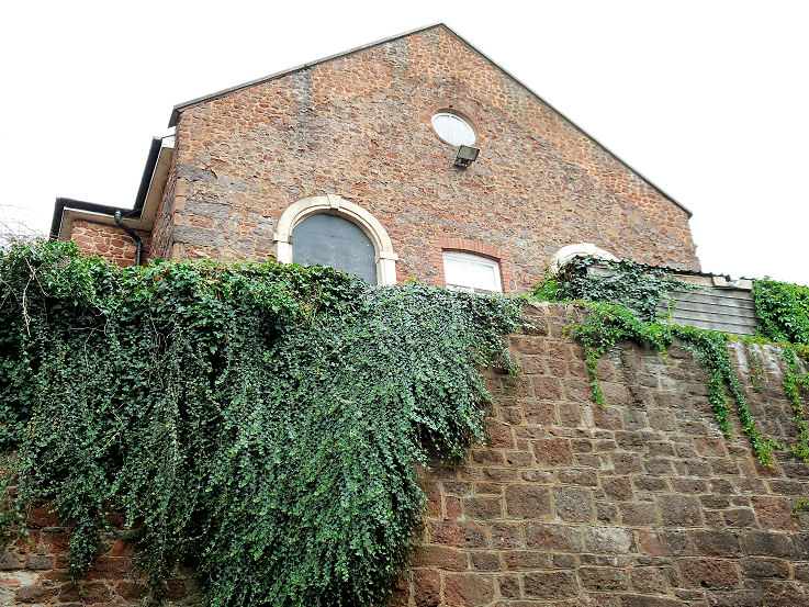
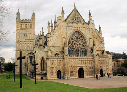
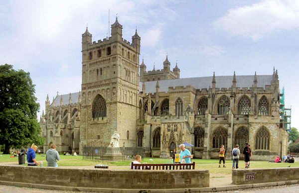
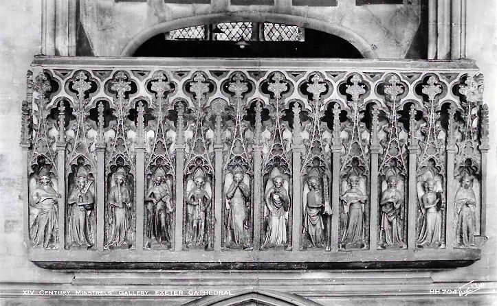
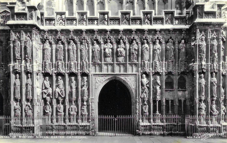
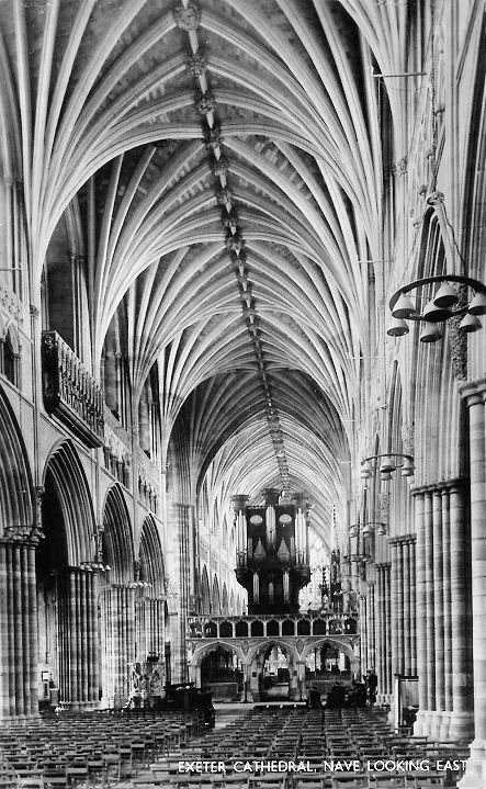
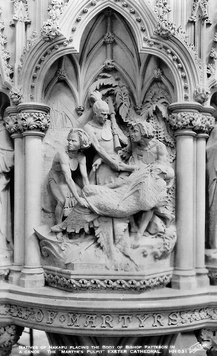
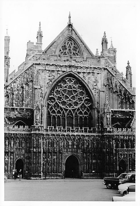
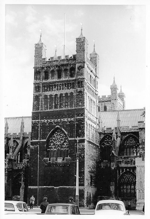
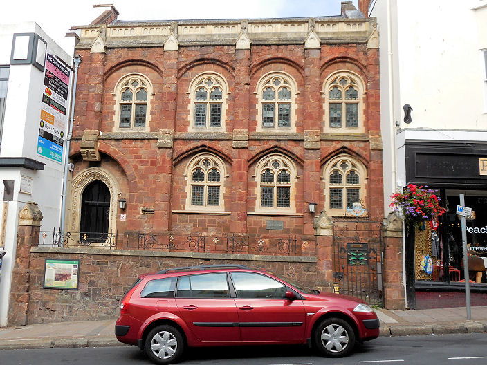
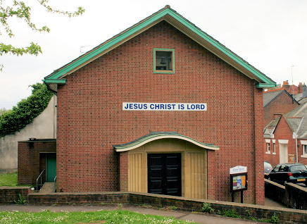
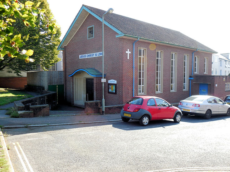
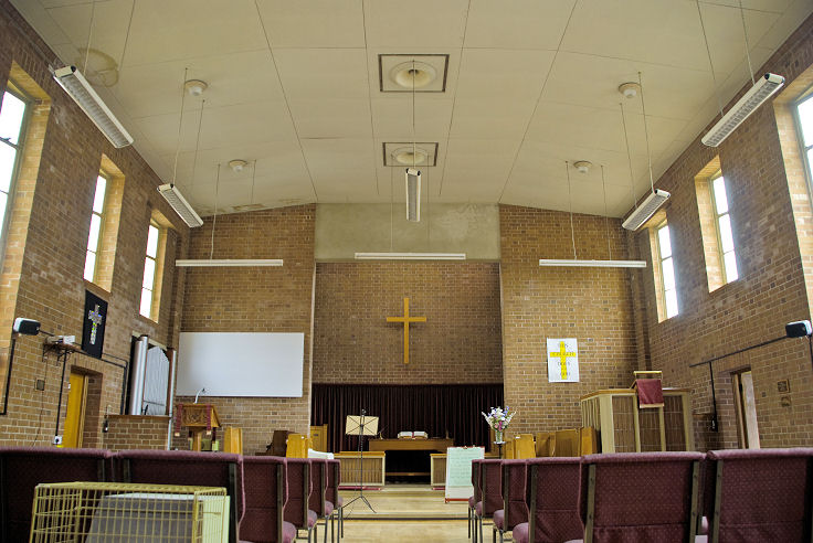
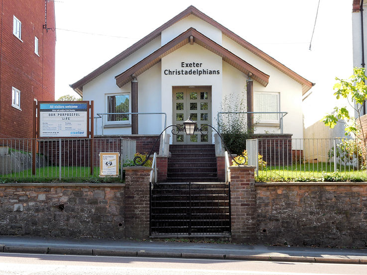
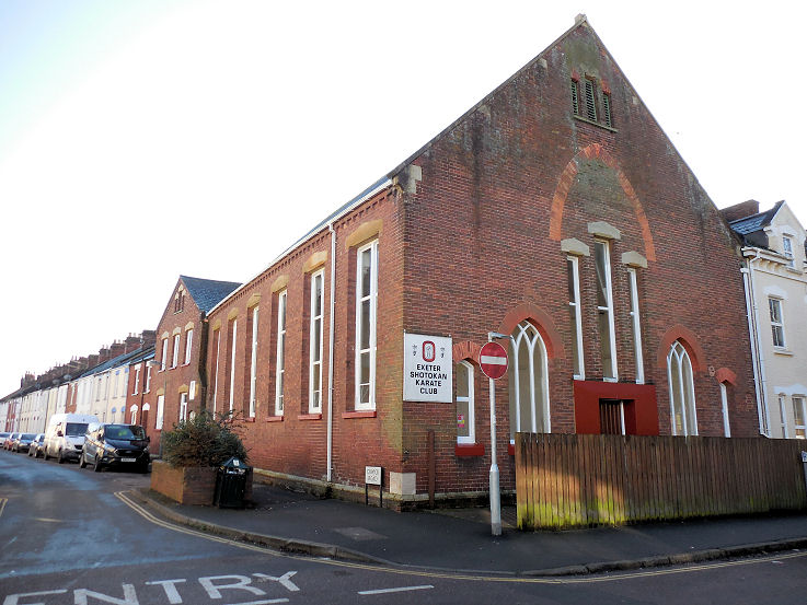
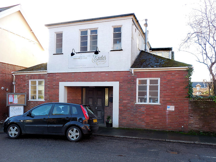
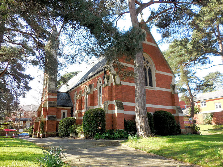
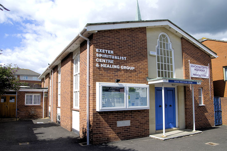
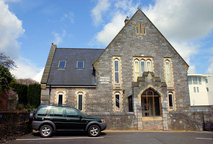
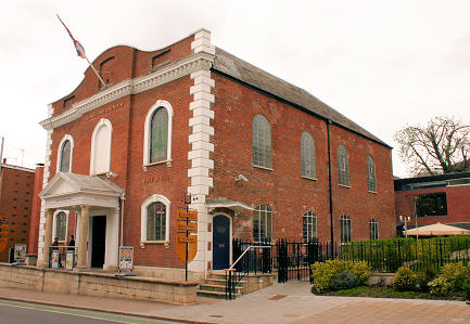
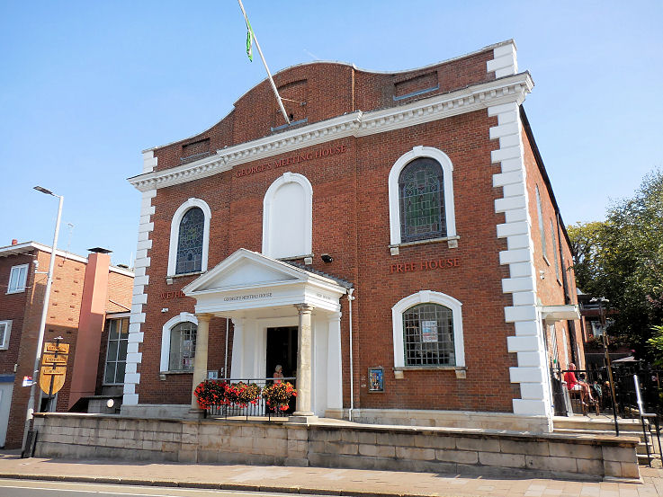
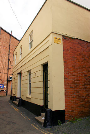
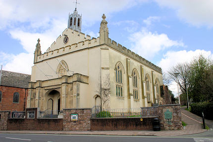
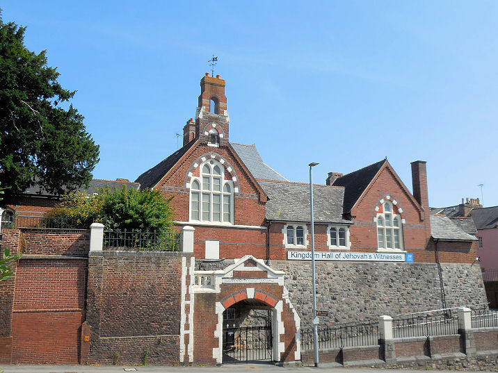
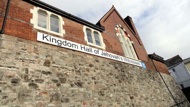
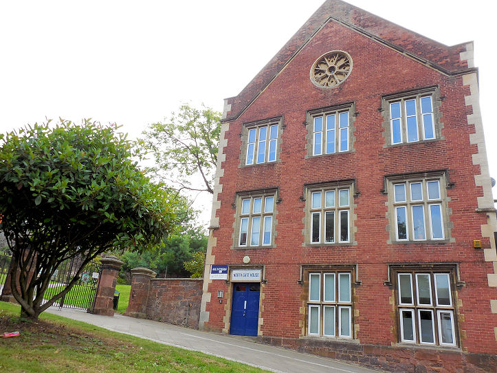
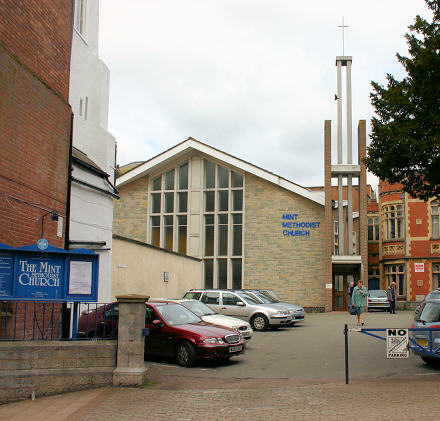
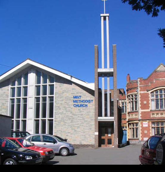
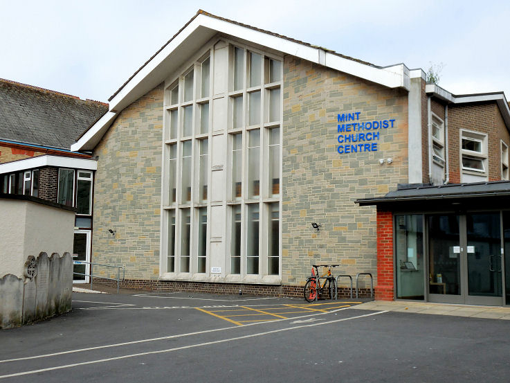
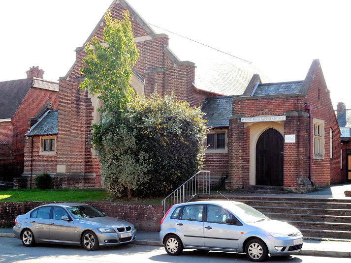
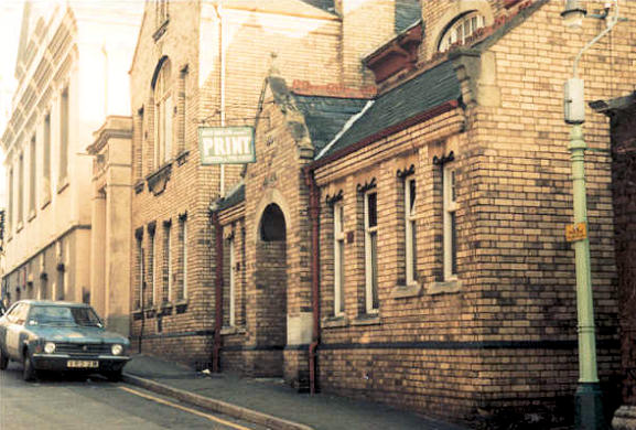
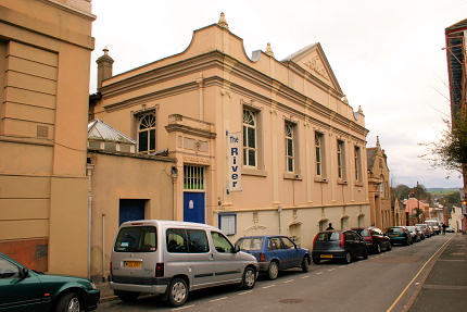
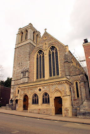
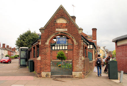
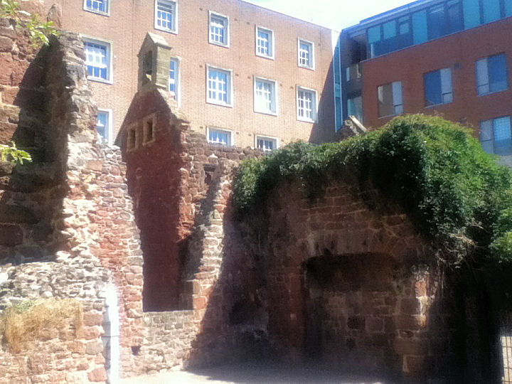
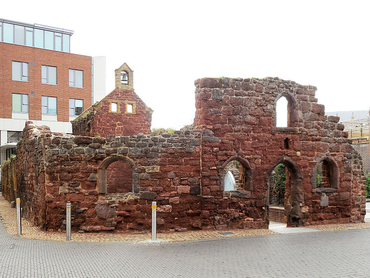
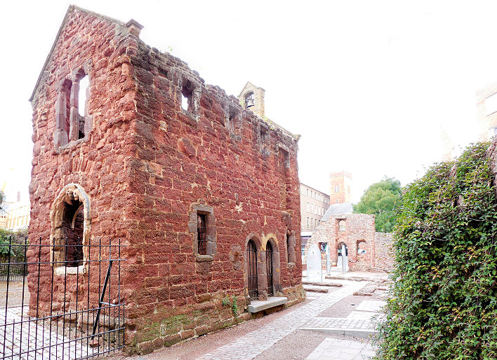
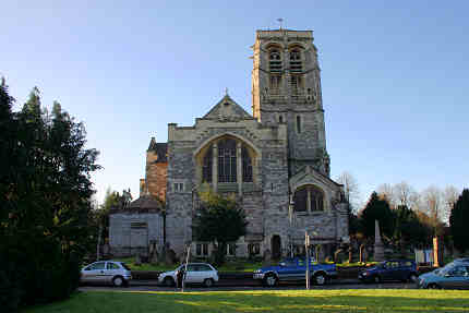
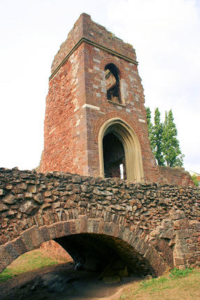
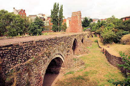
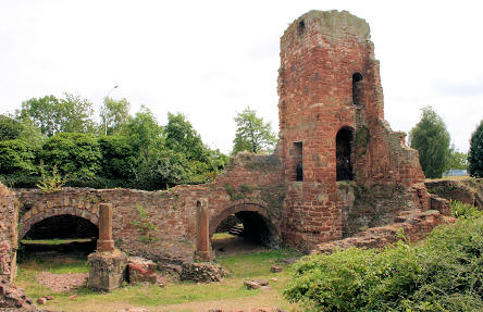
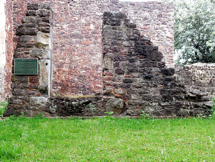
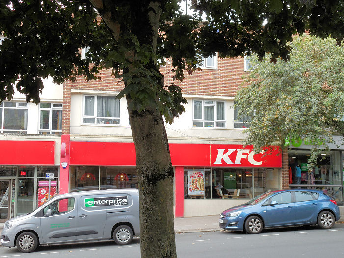
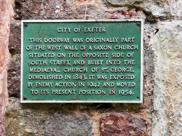
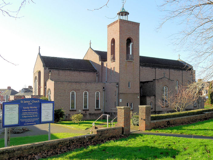
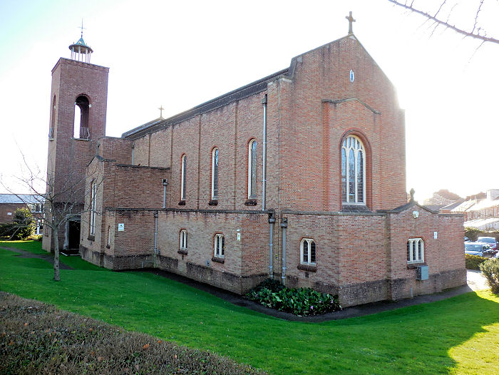
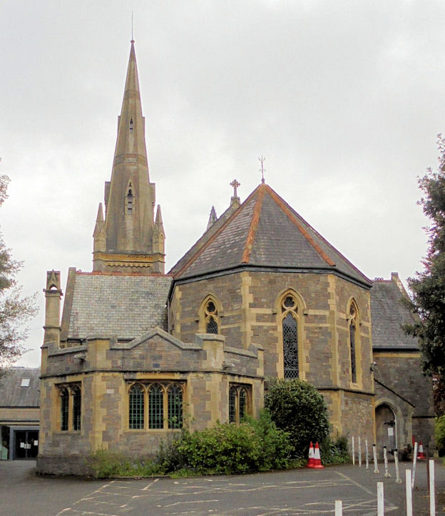
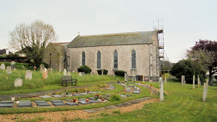
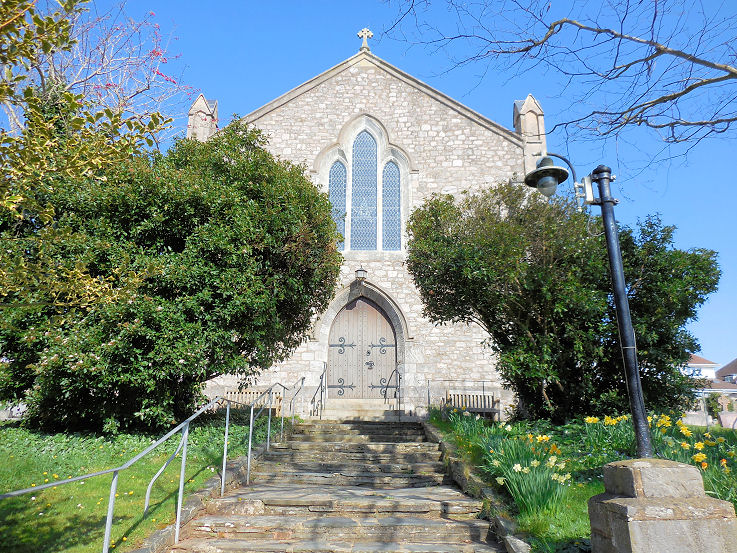
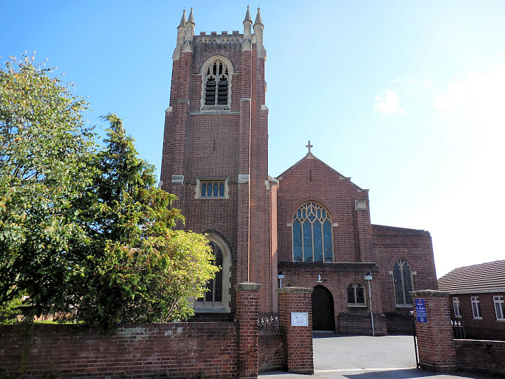
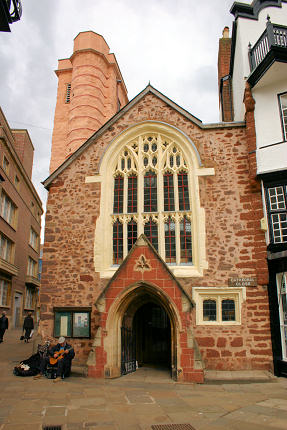
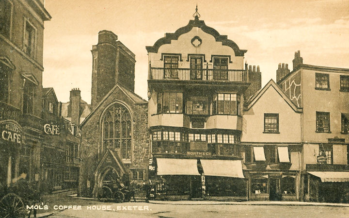
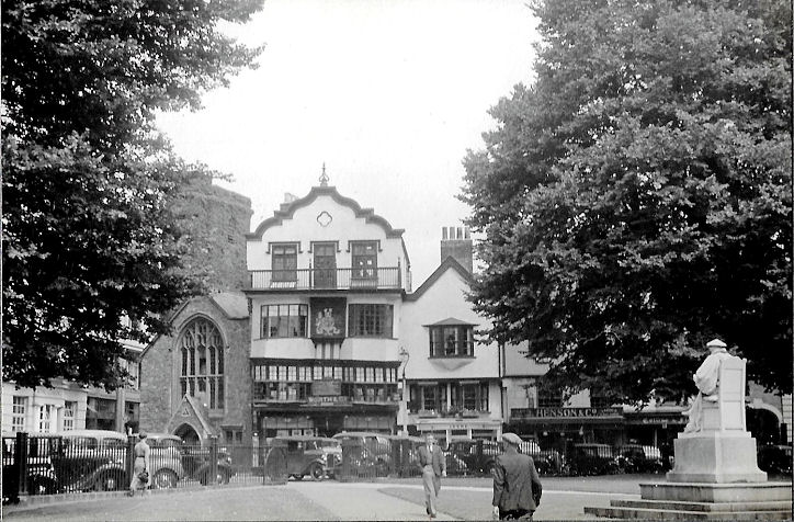
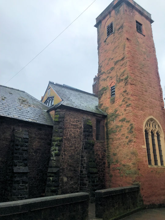
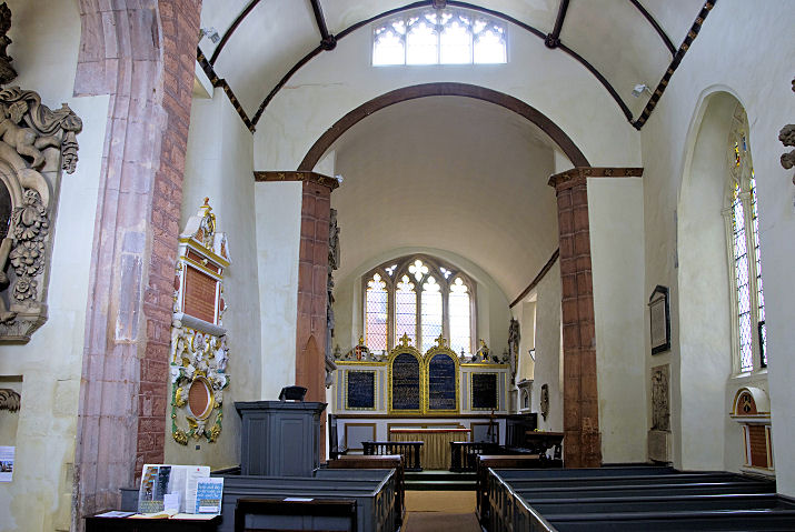
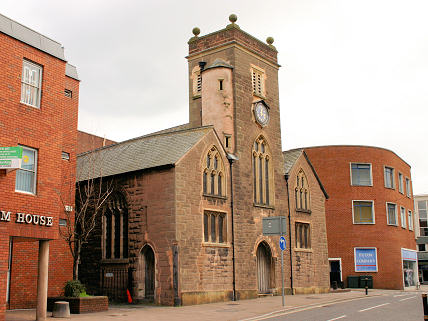
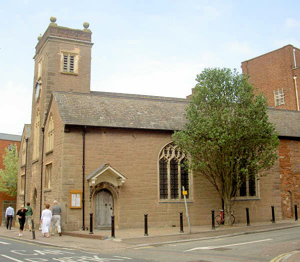
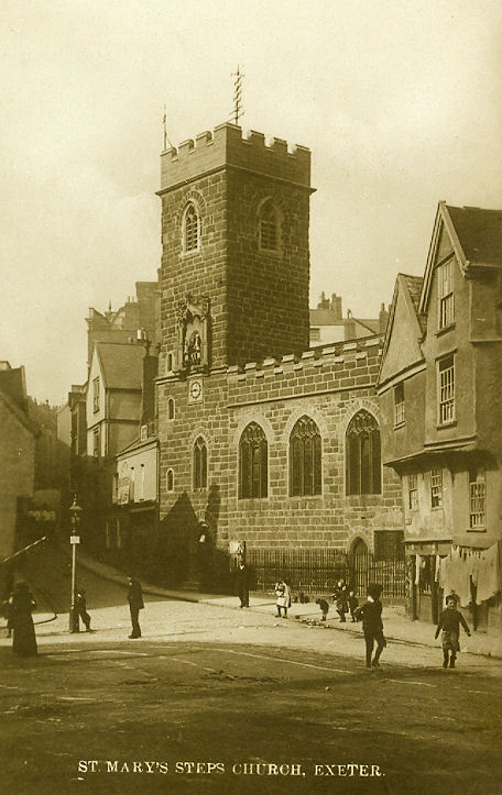
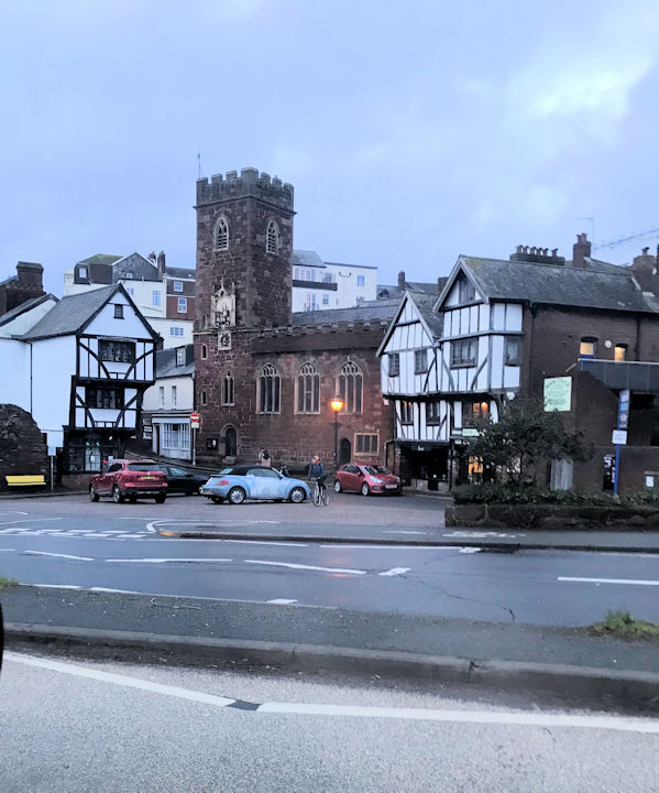
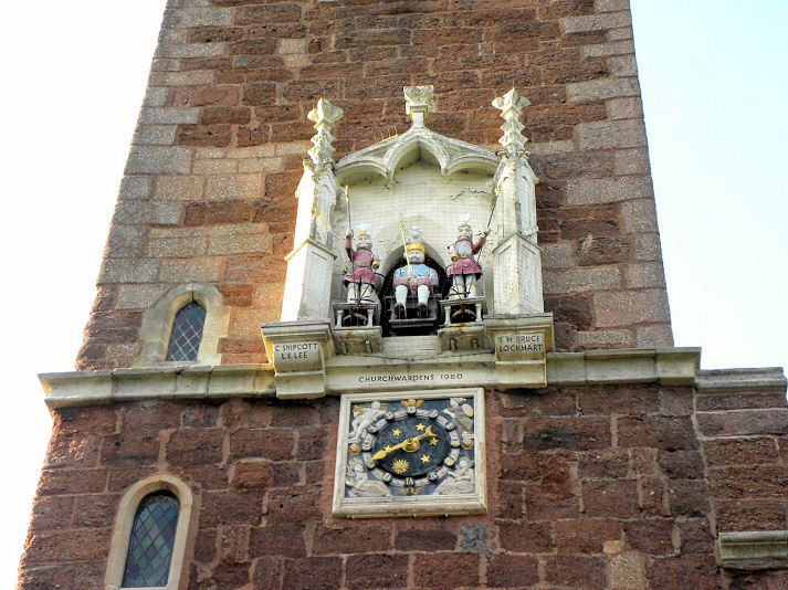
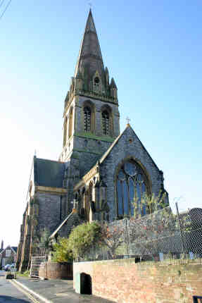
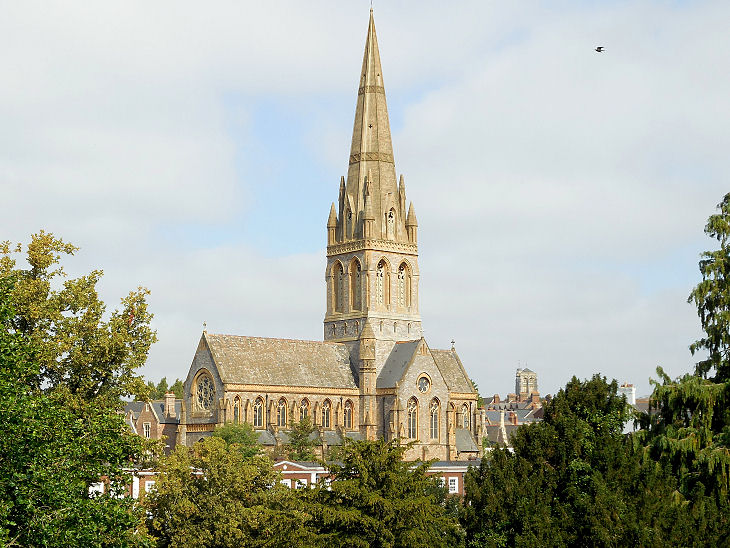
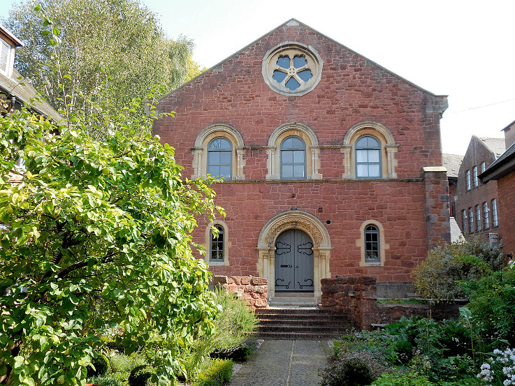
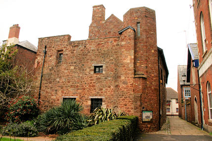
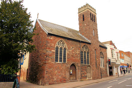
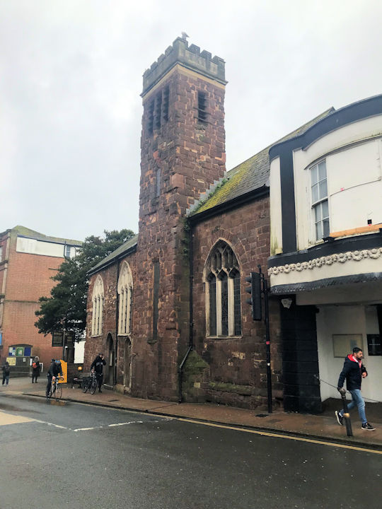
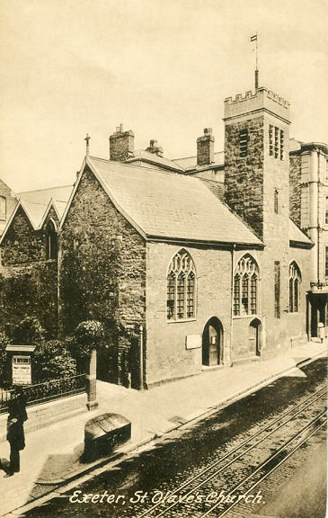
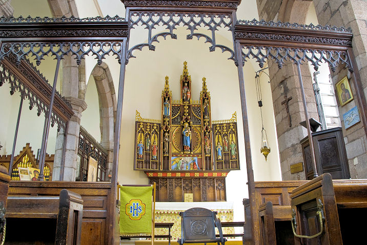
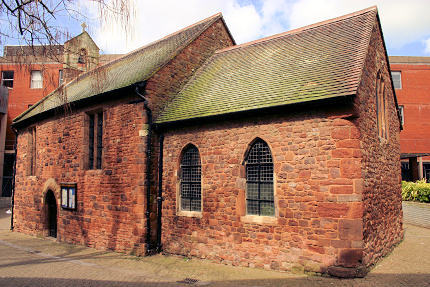
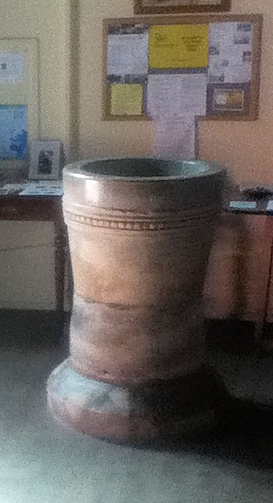
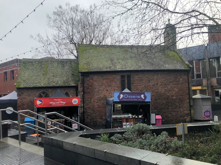
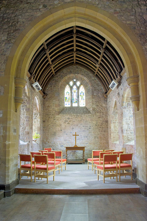
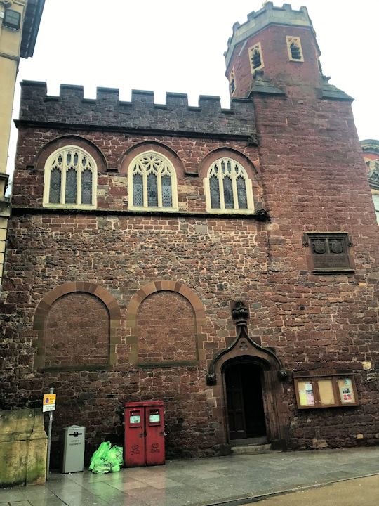
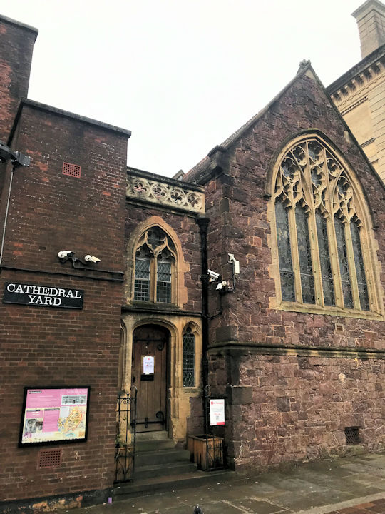
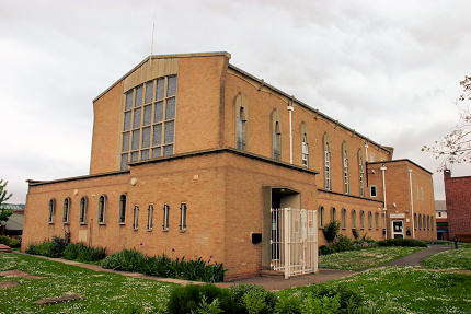
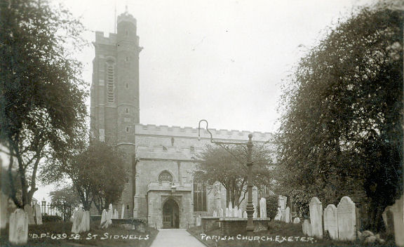
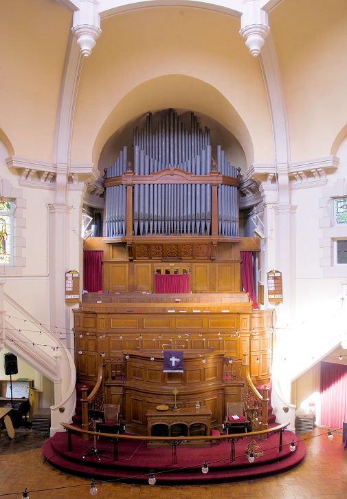
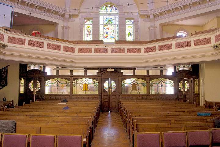
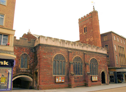
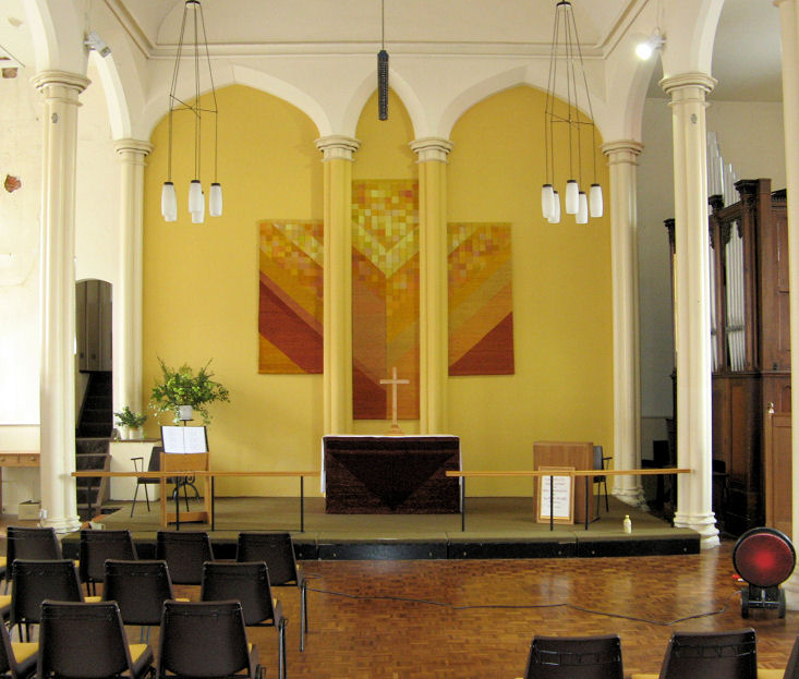
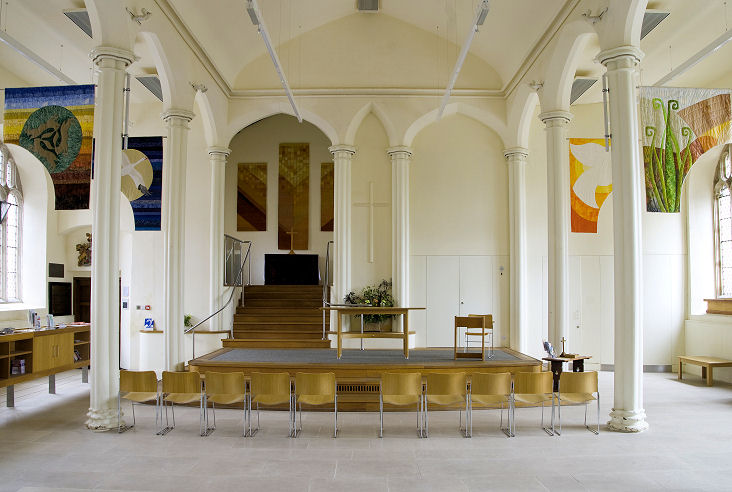
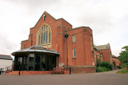
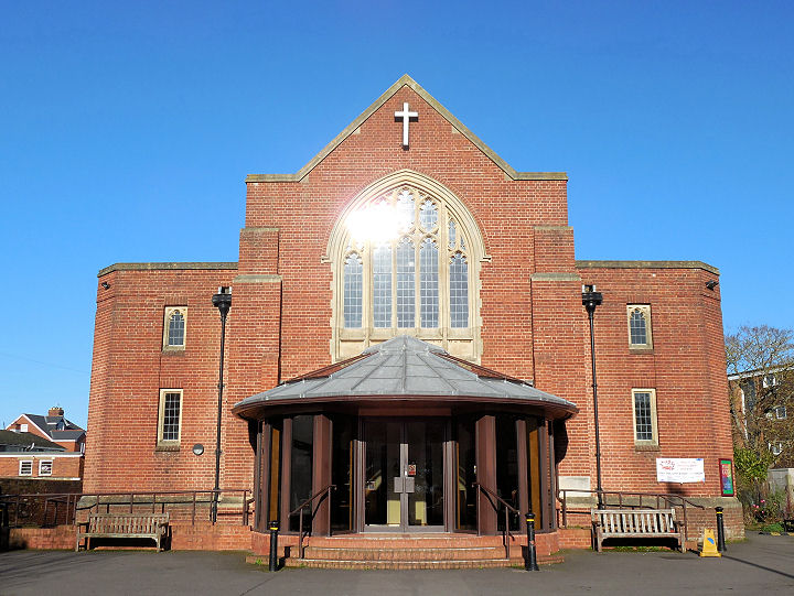
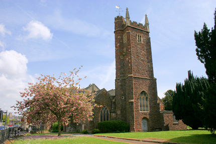
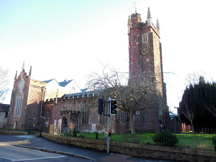
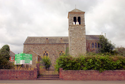
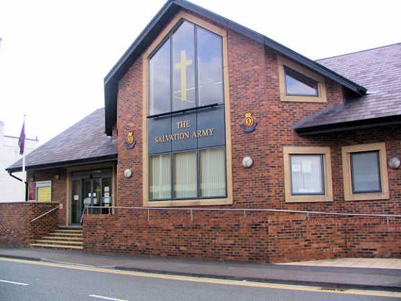
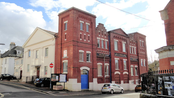
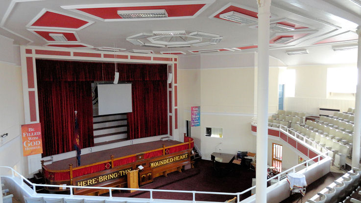
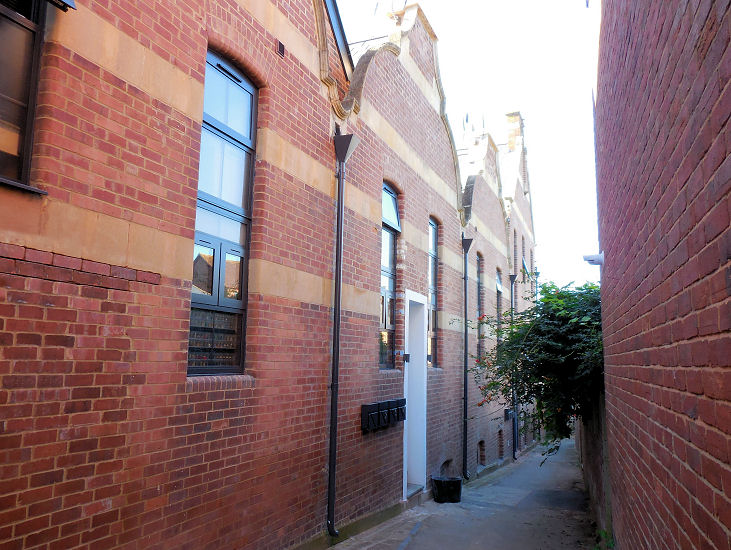
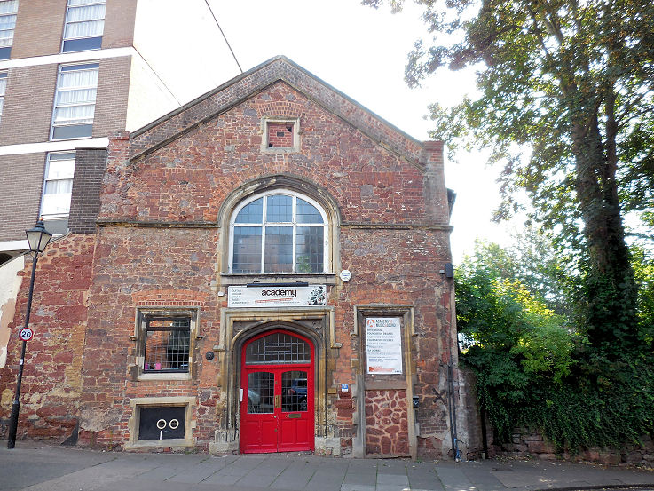
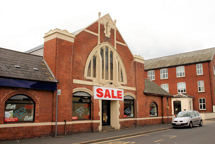
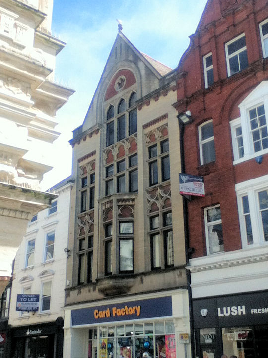
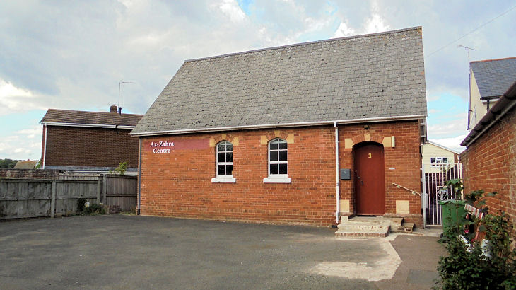
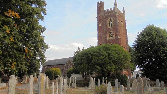
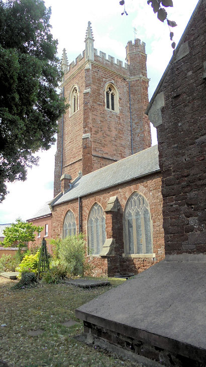
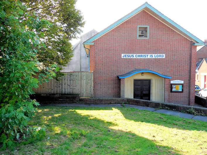
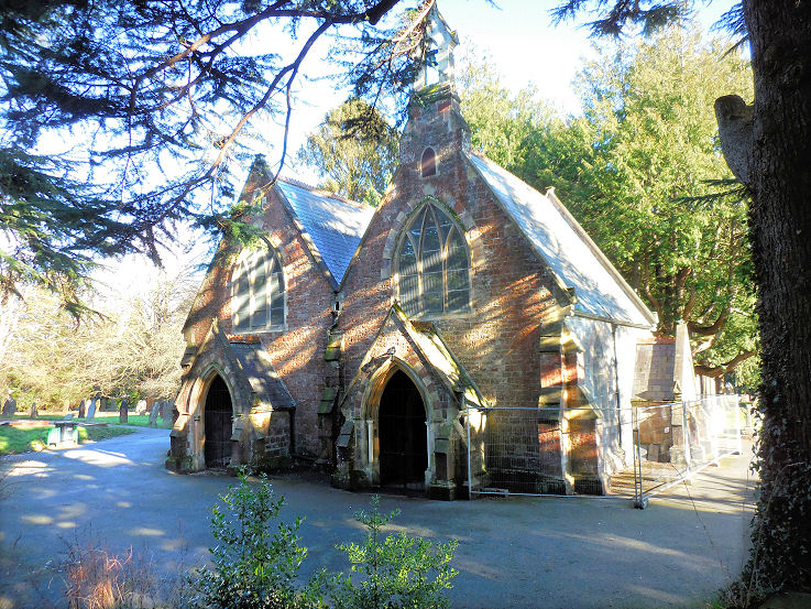
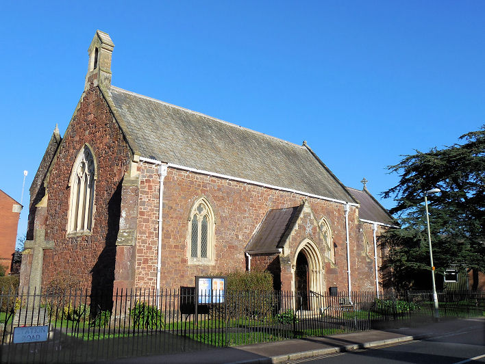
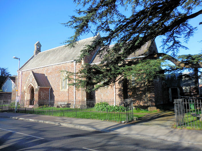
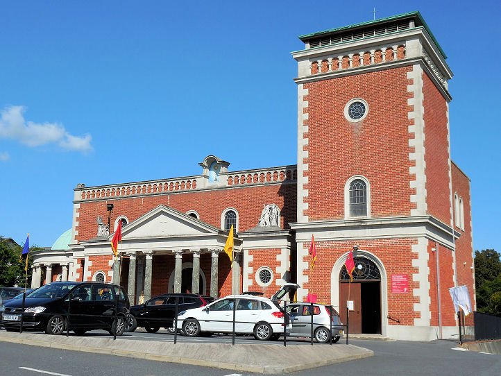
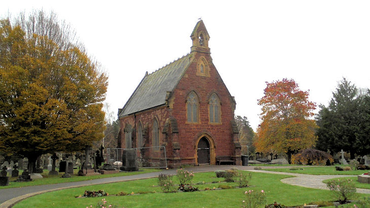
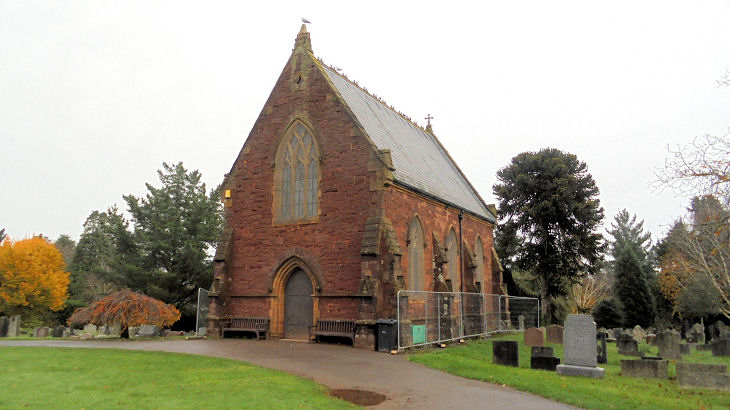
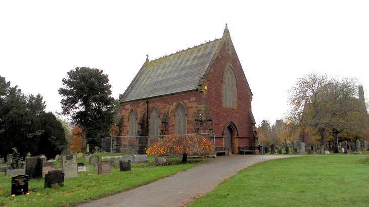
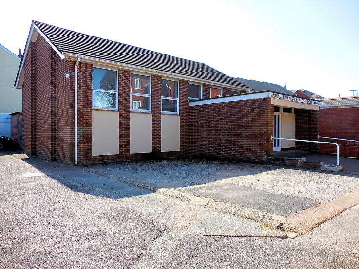
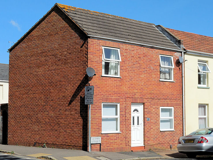
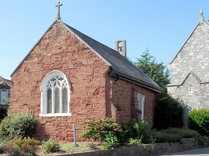
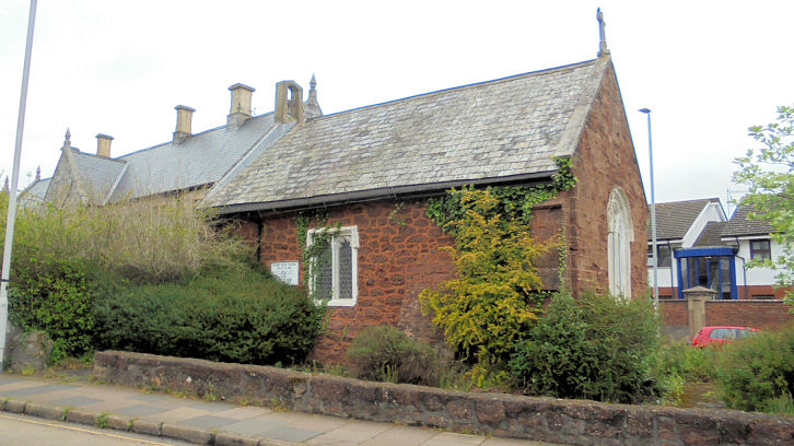
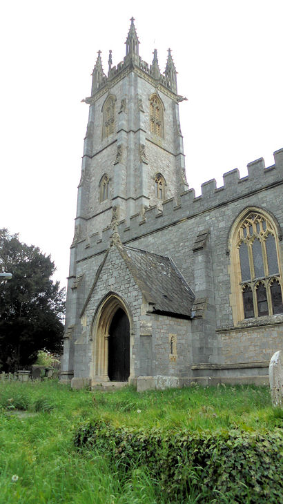
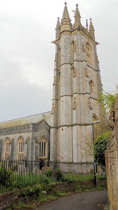
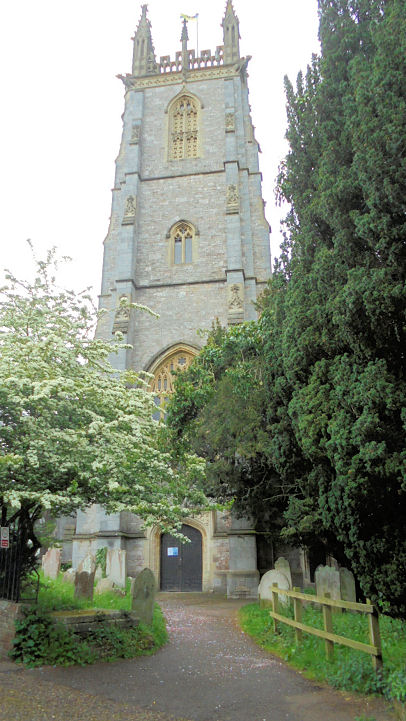
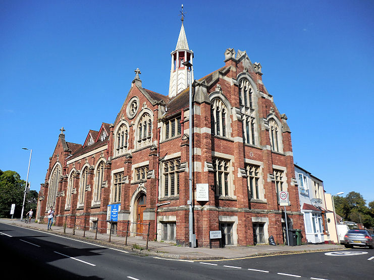
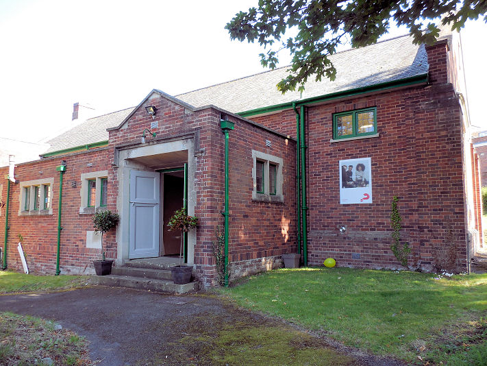
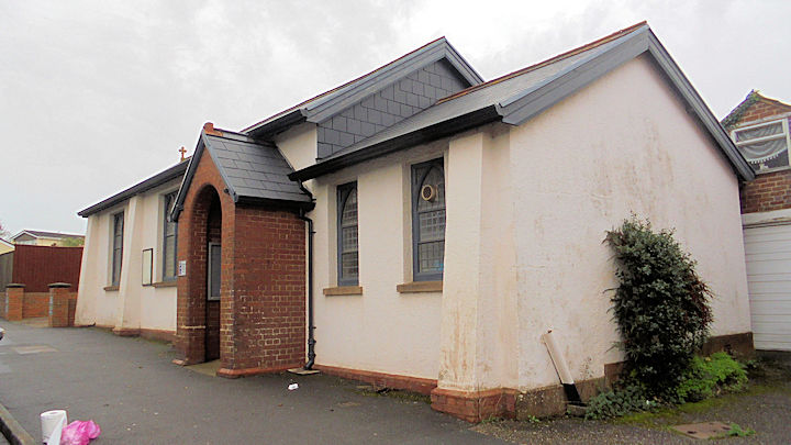
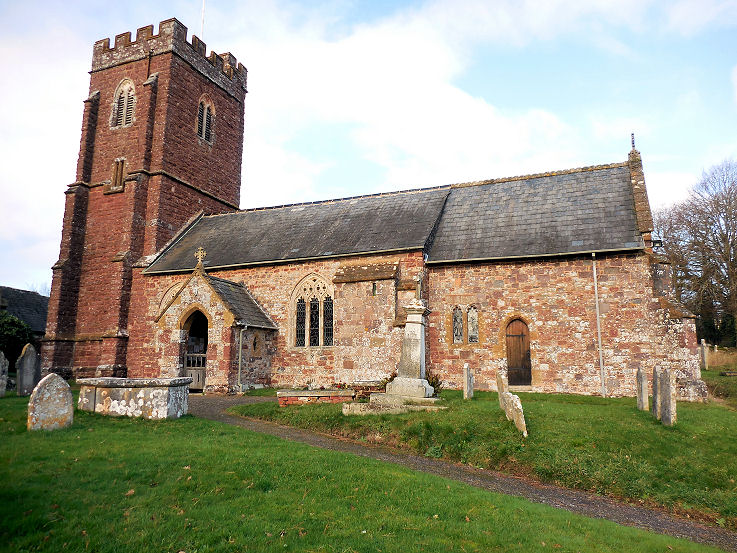
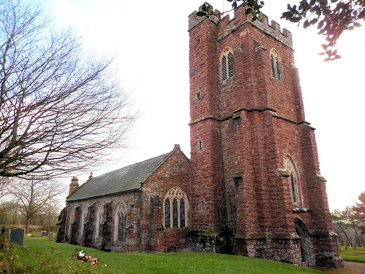
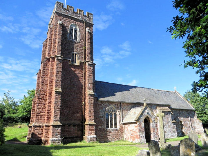
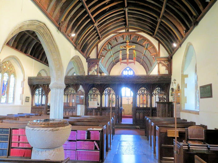
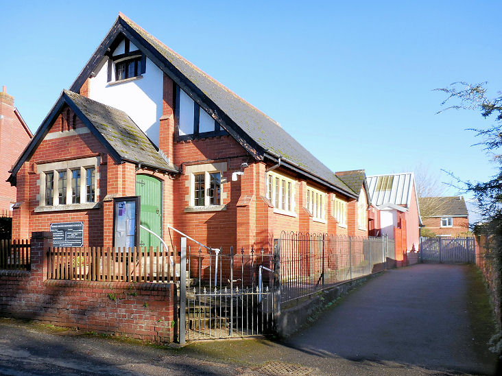
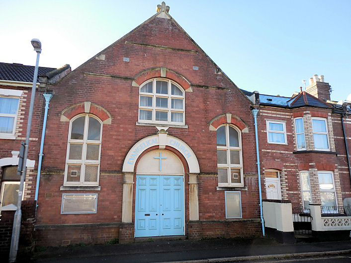
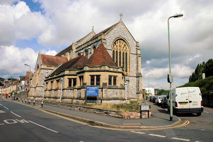
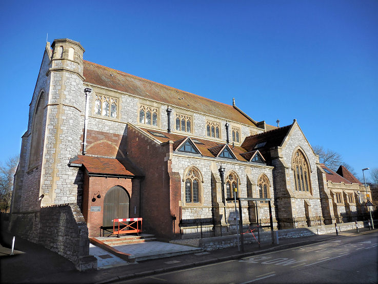
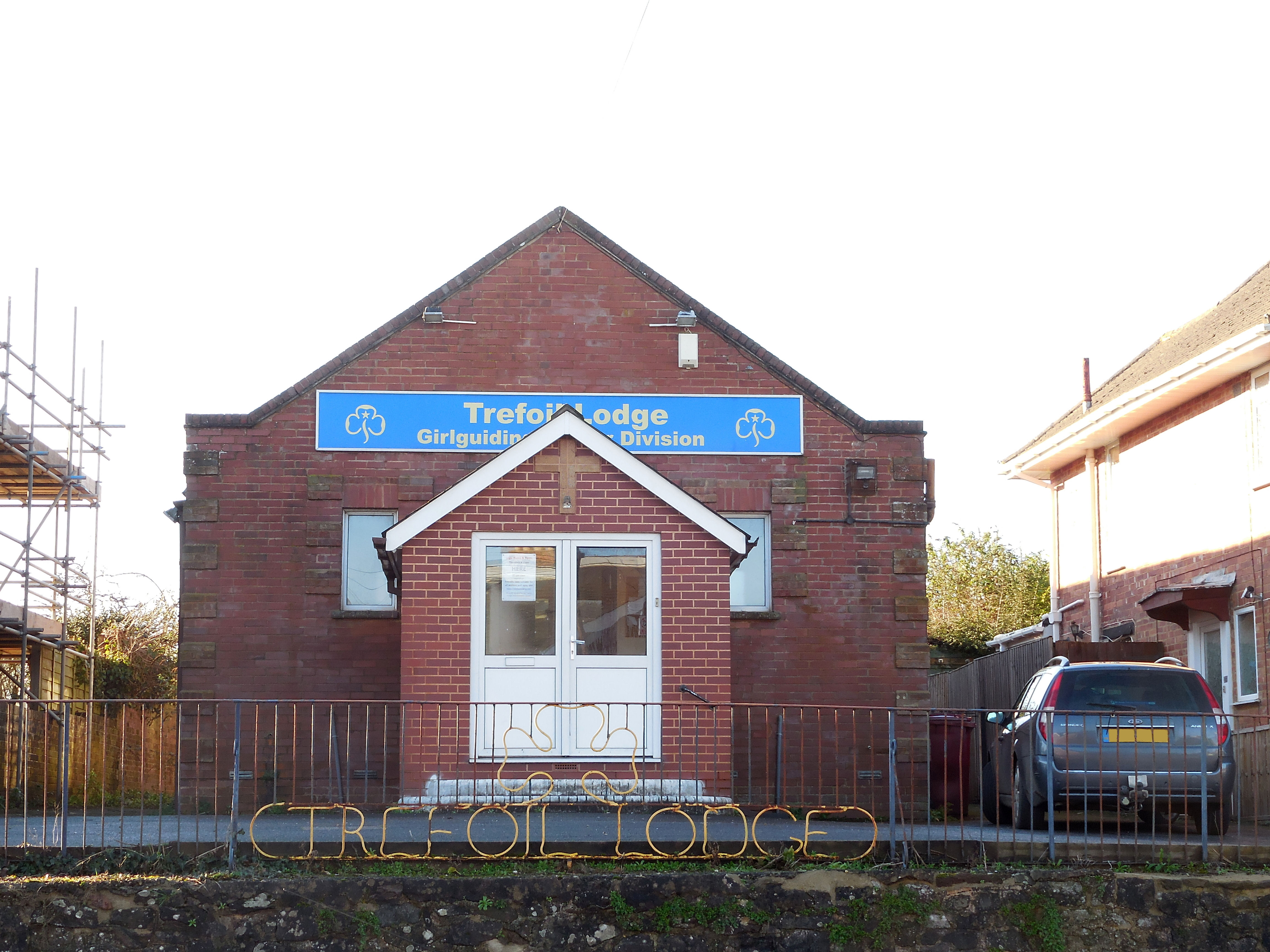
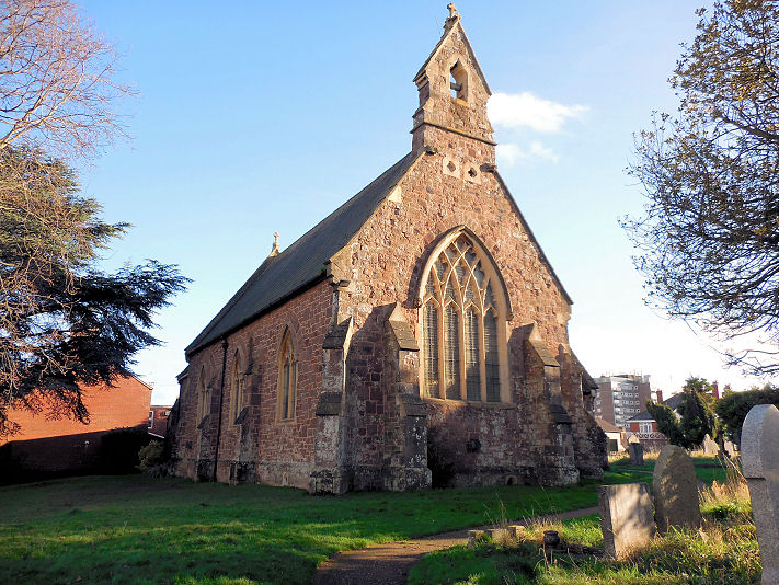
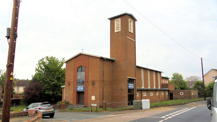
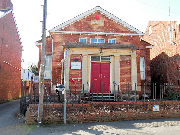
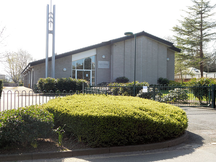
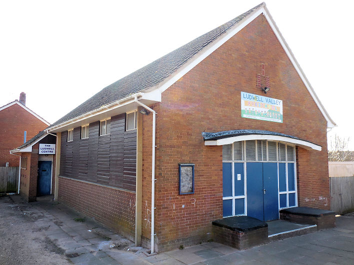
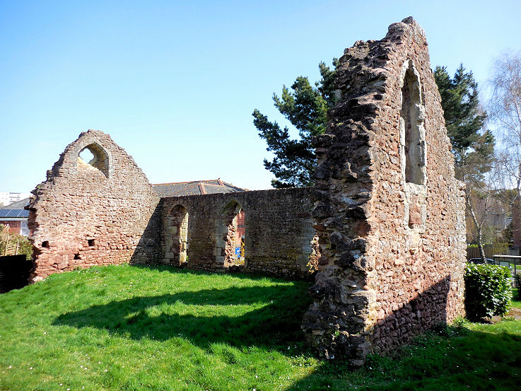
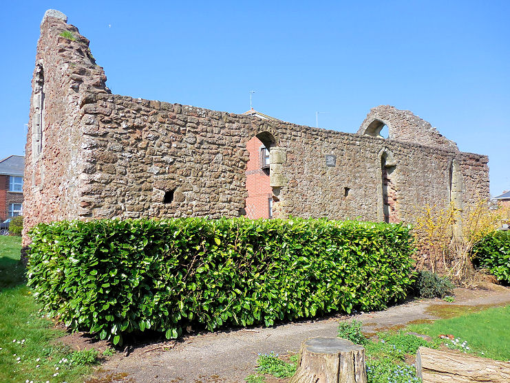
churches. Churches in Alphington, Belmont, Exwick, Heavitree, Newtown, Pinhoe, St. Thomas, Whipton, Wonford. The site of the long-demolished Allhallows on Goldsmith Street. © P. L. Kessler / The History Files, wherein it says that the church was demolished in 1906. The site of Allhallows-on-the-Walls (1843-5), which was built in Friernhay Burial Ground. Declared redundant in 1938 it was demolished in 1950. The churchyard walls and gateways survive. © P. L. Kessler / The History Files. Beacon Heath Church on King Arthur's Road and Galahad Close. © P. L. Kessler / The History Files. Link. The site of the demolished Bedford Chapel, on what is now Bedford Square. Built in 1832, it suffered serious damage during WWII, and was finally demolished on 1946. © P. L. Kessler / The History Files. Belmont Chapel on Western Way. SX 927 929. © Andrew Ross. Link. The former Castle Street Chapel (Congregational, 1797-1870), which stands on Bailey Street, is currently in use as a nightclub. Another view. SX 9221 9290. Both © P. L. Kessler (2020) / The History Files. The Cathedral Church of St. Peter in Exeter. SX 9210 9255. © Andrew Ross. Another view, © Alan Blacklock. Interior view, © Graeme Harvey. The following are all from Christopher Skottowe's postcard collection - the C14 Minstrels' Gallery, a close-up of the western screen, the interior, and a detail from the "Martyr's Pulpit", and these photos - 1, 2, show its very dirty state before cleaning - both © Christopher Skottowe (1967). Link. Grade I listed. For other listed features and buildings associated with the cathedral, see here. Hereabouts perhaps once stood the Chapel of St. Roche (or St. Roch). The chapel seems to have been built in the 14th century, with almshouses replacing or attached to it the early years of the following century. All were demolished in the 18th century. Coombe Street, which the photo shows, was once known as Rock Lane, and the chapel may have stood in what are now gardens at its southern end. © P. L. Kessler / The History Files. The former Chapel of the Assumption of Our Lady. This has been in secular use since at least 1602, and is now known as Tuckers Hall. © P. L. Kessler / The History Files. Christ Church Free Church (1957) on Salem Place. SX 9286 9324. © Andrew Ross. Another view (© P. L. Kessler / The History Files) and the interior (© Heath Nickels [2016]). A useful history. Christadelphian Hall on Heavitree Road, where they have been meeting since 1987. © P. L. Kessler / The History Files. Link. Cowick Road Hall, at the junction of Cowick Road and Church Road, is a former Wesleyan Methodist Chapel, showing as such on a map of 1890. Maps from the 1950's to 1970's shows it as a Salvation Army Hall. On a later map dated 1989-92, it's labelled as "PW", a place of worship. As can be seen from the photo, it's now in secular use. SX 9128 9178. © P. L. Kessler / The History Files. Hereabouts on Paris Street once stood an Elim Pentecostal Church. Opening in 1928, it was demolished to make way for the bus station in the 1960's. © P. L. Kessler (2019) / The History Files. The former Exe Island Mission Hall stands east of Tudor Street at SX 9163 9227. © P. L. Kessler (2019) / The History Files. Now used as offices, Peter dates it to 1876. Exeter Calvary Church meets in The Old Gospel Hall on Edgerton Park Road. It had previously, and for many years, been home to Pennsylvania Christian Fellowship (Plymouth Brethren). SX 9248 9360. © P. L. Kessler (2020) / The History Files. Link. The former Chapel to the former Exeter Lunatic Asylum, off Digby Drive at Clyst Heath. It pre-dates a map of 1873-88, and Peter advises that it was closed in 1987 and that it now serves as a nursery. SX 9571 9127. © P. L. Kessler (2020) / The History Files. Exeter Spiritualist Centre and Healing Group on York Road. SX 9254 9316. © Heath Nickels (2016). First Church of Christ, Scientist on Longbrook Street. SX 9237 9315. © Heath Nickels (2016). Link. Friends Meeting House (Quakers, 1691) on Wynards Lane. SX 9238 9235. © Andrew Ross. Another view, © P. L. Kessler / The History Files, whose entry (click on "8") for this building describes it's history. Link. George's Meeting House, on South Street, formerly a Non-Conformist Chapel, now a pub. SX 9210 9234. © Andrew Ross. Another view, © P. L. Kessler / The History Files. His entry (see #2) says it was originally Unitarian, of 1760. Hebrew Congregation Synagogue on Synagogue Place. SX 9181 9256. © Andrew Ross. Link. Grade II* listed wherein it's dated to 1764. Holy Trinity Church. Previously of uncertain status, thanks to David Cornforth for identifying this as a church, and for advising of his website. On South Street, this church is now the White Ensign Club. SX 921 923. © Andrew Ross. Kingdom Hall of Jehovah's Witnesses on Holloway Street. Only in the building since sometime in the last quarter of the last century, the building was originally a school, dating from 1876. © P. L. Kessler (2019) / The History Files. Another view, © Heath Nickels (2016). A large scale O.S. map of 1890 shows a M. Chap (U.F.) or Methodist Chapel (United Free) attached to the outside of the city walls on Northernhay Gate, at SX 9192 9289. The only Streetview to see the present building on the site (in 2009) shows that it was in commercial use at that time. Here's a photo, © P. L. Kessler (2019) / The History Files. The Mint Methodist Church (1970) on Fore Street. The tower is no longer there, having been taken down in 2010 (source). Old maps show that there was an earlier Wesleyan chapel on the same site, and a photo of it can be seen in the source already given, where it's dated to 1867, and not the first on the site. SX 9178 9247. © Andrew Ross. Another view, © Graeme Harvey, and another, © P. L. Kessler (2019) / The History Files. Interior view, © Heath Nickels (2016). Link.The site of Mount Pleasant Methodist Church, which stood at the junction of Mount Pleasant Road and Pinhoe Road, at SX 9326 9340. A photo of the church is available here. It's dated here (choose #10) to 1910, with demolition in 1971. © P. L. Kessler (2019) / The History Files. From 1833 this private residence - now Mowbray Cottage - on Butts Road, was used as a meeting by an Independent congregation, and later by the Wesleyans. Following the Wesleyans vacating in 1860 it was converted to residential use. © P. L. Kessler (2019) / The History Files. Pinhoe Road Baptist Church at Polsloe Bridge. SX 939 934. © Paul E. Barnett (2016). Another view, © P. L. Kessler (2019) / The History Files. Link. The site (the car park) of Polsloe Park Chapel (Bible Christian), which stood at the junction of Thurslow Road and Pinhoe Road, next to Mount Pleasant Methodist Chapel, at SX 9327 9340. A photo if it can be seen here (where it's called Polsloe Park Christian Chapel), and it's dated here to 1901. © P. L. Kessler (2019) / The History Files. Part of Providence Chapel on Northernhay Street (an extension of 1894). The chapel which was opened by the Plymouth Brethren in 1839, became Bible Christian by 1851. This photo was taken in 1983, when the building was being used as a print works. © Ray Harrington-Vail. The chapel extended further back along the road than the first photo shows and this next photo shows more of the chapel, looking back towards the part shown in the first photo. © P. L. Kessler (2019) / The History Files. For some history, see here and select #3 and #4. The River Dream Centre, on Northernhay Street (1894). SX 918 928 © Andrew Ross. Link. My appreciation to Janet Gimber, whose researches have revealed the following - 1894 is the date of an extension to the Chapel. This extension is visible in the photo, as a smaller building beyond the 5-bayed chapel. The main chapel itself was built in 1839 as a Plymouth Brethren Chapel, and a comment in Pevsner shows that it was Elim Providence Chapel at some point as well.Sacred Heart Catholic Church (1883-4) on South Street and Bear Street. SX 9202 9244. © Andrew Ross. Link. St. Anne's Orthodox Church (on Old Tiverton Road and Black Boy Road). SX 928 932. Andrew thinks this used to be a chapel, and that it looks older than the date given above the gate (1927). © Andrew Ross. It is indeed older than the date, which may be the date for the gate itself. Janet Gimber has found its interesting history here. The site of the ancient church of St. Bartholomew stands beneath a branch of Boots on High Street. Circa SX 922 928. © P. L. Kessler (2019) / The History Files. The remains of St. Catherine's Chapel on Catherine Street. SX 9214 9269. © Paul E. Barnett (2016). Two more views - 1, 2, both © P. L. Kessler (2019) / The History Files. The brief grade II listing. St. David. SX 915 931. © Andrew Ross. Link. St. Edmund - a ruined bridge chapel. Another view, and another. SX 916 921. A plaque inside the tower reads "It became a Parish Church, was rebuilt 1833-4, damaged by fire in 1969, and made safe by partial demolition in 1975.” All © Andrew Ross. Link1. Link2. The re-sited remains of a mid-Saxon church, which had been built into the now-demolished St. George the Martyr, stand on South Street. St. George the Martyr was originally on St. George's Street and South Street, and a "KFC" now stands partly on the site. A plaque provides some dates. All © P. L. Kessler (2019) / The History Files. An old engraving of St. George is available here. St. James on Prince Charles Road and Mount Pleasant Road, Stoke Hill. The church website dates it to the mid-1950's (dedicated 1956, here). Another view. SX 9314 9383. Both © P. L. Kessler (2019) / The History Files. St. Leonard on Topsham Road. Its grade II listing dates it to 1873 (chancel) with later additions. Another view. SX 9243 9191. Both © Chris Kippin (2022). Link. St. Luke on Countess Wear Road, Countess Wear. SX 9405 9032. © Chris Kippin (2022). Two more views - 1, 2, both © P. L. Kessler (2019) / The History Files. Link. St. Mark on Pinhoe Road. SX 9359 9340. © Paul E. Barnett (2016). Another view, © P. L. Kessler (2019) / The History Files. Link. St. Martin, at the north end of Cathedral Close. The first church on the site was consecrated July 6th, 1065. SX 9210 9266. © Andrew Ross. An old postcard view, from Reg Dosell's Collection, and another from 1938, from Christopher Skottowe's Collection. Another view from Catherine Street, © Paul E. Barnett (2025). Interior view, © Heath Nickels. Link. Grade I listed. St. Mary Arches on Mary Arches Street. SX 9183 9253. © Andrew Ross. Another view, © Alan Blacklock, and another, © Paul E. Barnett (2025). Link. Grade I listed. Nothing remains of St. Mary Major, which stood on South Street, on the site of older church buildings, including a Saxon minster, and a Roman bathhouse. Unlike so much of Exeter destroyed by German WWII bombing, the church was demolished in 1971. See here for a good history, and old photos. SX 920 924. © Paul E. Barnett (2016). St. Mary Steps on West Street. SX 9176 9227. From an old postcard in Reg Dosell's Collection. A modern view, © Alan Blacklock, and another, © Paul E. Barnett (2025). A close-up of the clock, showing the date of its refurbishment (1980). © John Balaam (2013). Link. Grade I listed. St. Michael and All Angels on Mount Dinham. SX 9157 9271. © Andrew Ross. Another view, © P. L. Kessler (2019) / The History Files. Link. Grade I listed, wherein it's dated to 1865-8. The former St. Nicholas (R.C), which stands off Bartholomew Street East, near The Priory. Peter advises (here, choose #10) that it dates from 1790-2, and was converted into flats in the early 1900's. © P. L. Kessler (2019) / The History Files. St. Nicholas Priory. SX 9175 9247. © Andrew Ross. Link. Grade I listed. St. Olave on Fore Street. SX 9182 9247. © Andrew Ross. Another view, © Paul E. Barnett (2025), and an old postcard view from Reg Dosell's Collection. Interior view, © Heath Nickels (2016). Link. Grade II* listed. St. Pancras. SX 9192 9270. © Andrew Ross. Interior view, © Jim Parker, and the font, © Paul E. Barnett (2016). Another view, © Paul E. Barnett (2025). Another interior view, © Heath Nickels. Link. Grade II* listed. St. Petrock, on High Street. SX 9200 9254. © Andrew Ross. Another view, © Alan Blacklock, and two more views 1, 2, both © Paul E. Barnett (2025). Grade II* listed. The site of St. Philip (a tin tabernacle) is now occupied by housing on Buddle Lane. Erected in the 1920's, it was demolished before the end of the century. SX 9078 9180. © P. L. Kessler / The History Files. An interior view is available here. I've been unable to find an exterior photo, but there must be one out there somewhere, surely. St. Sidwell. SX 9245 9307. Not a pretty building. Andrew thinks it might have been re-built after WWII bombing, as the graveyard looks older. © Andrew Ross. As this old postcard proves, Andrew's suspicions are spot-on. From Reg Dosell's Collection. Two interior views - 1, 2, both © Heath Nickels (2019). St. Stephen on High Street. SX 9211 9272. © Andrew Ross. Another view, © Paul E. Barnett (2016). Interior view, © Graeme Harvey, and another © Heath Nickels. Grade II* listed. St. Thomas (Methodist) on Cowick Street. SX 9099 9176. © Andrew Ross. Another view, © P. L. Kessler / The History Files, where it's dated to 1934. Link. St. Thomas the Apostle on Cowick Street. SX 9122 9182. © Andrew Ross. Another view, © P. L. Kessler / The History Files. Link. Grade I listed. St. Thomas of Canterbury (R.C.). This church closed in the mid-2000's and was subsequently converted into two houses. SX 907 916. © Andrew Ross. Salvation Army Hall. SX 921 921. © Graeme Harvey. Salvation Army Temple on Friars' Gate. Interior view. SX 9214 9216. Both © Heath Nickels (2016). Link. The entry on Peter Kessler's website provides a little history of this former Quaker building. Seventh-day Adventist Chapel on King William Street. SX 9246 9315. © Heath Nickels (2016). Link. Sidwell Street Methodist Church. SX 926 931. © Andrew Ross. Link. South Street Baptist Church. SX 9204 9242. © Andrew Ross. Link. Southernhay U.R.C. SX 924 927. © Andrew Ross. The Chapel of the Holy Trinity and Maison Dieu on Magdalen Street, belonging to Wynards Almshouses. SX 923 923. © Andrew Ross.Toronto Road Mission Church pre-dates the 25" O.S. map of 1904-5, and Peter Kessler's entry for this church dates it to the 1890's, and suggests that it ceased to be used as a church "by the 1940's". SX 9289 9335. © P. L. Kessler (2019) / The History Files. The former Victoria Chapel on Coombe Street (Rock Lane as was), was Primitive Methodist. It's now in use as an Academy of Music. On-line information about this chapel is remarkably sparse, but according to the entry on Peter Kessler's site, it went out of use "before 1887". © P. L. Kessler / The History Files. A 2018 Streetview. Vineyard Church, on Prospect Park. © P. L. Kessler (2020) / The History Files. Link. Westgate Christian Fellowship occupies the former Bartholomew Street Baptist Church. A handsome building from 1817 (this source, which includes a photo of the church from the 1970's, says the foundation stone was laid 30th September 1817), the Baptists left in the 1960's, whereupon the current Fellowship took over. SX 9161 9239. © P. L. Kessler (2019) / The History Files. Link. The Grade II listing mentions a date in the pediment of 1827, contradicting other sources. Enlarging the original photo from this entry only shows a blank where the date may be expected, so perhaps it has been plastered over. Possible old chapel, now a bed shop. SX 912 919. © Andrew Ross. A possible former chapel at SX 919 925. © Paul E. Barnett (2016).
Belmont Exwick
Heavitree
Newtown
Pinhoe St. Thomas
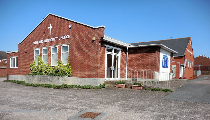
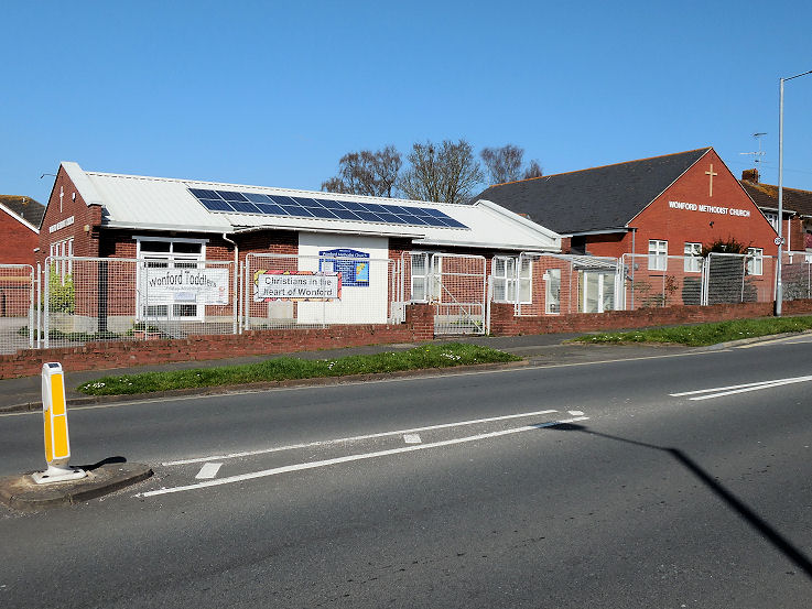
Whipton Wonford
|
||
20 July 2025
© Steve Bulman