The Churches of Britain and Ireland
| East Grinstead,
West Sussex
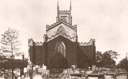
Church of Jesus Christ of Latter-day Saints (2024 Streetview) on Ship Street and West View Gardens. TQ 3938 3788. The former First Church of Christ, Scientist (2015 Streetview) on Cantelupe Road, now an office. Genuki supplies dates of 1930 (founded) - 1985 (closed). TQ 3952 3817. The former Friends' Meeting House (the yellow-painted building in the background) on Station Approach, as seen by Streetview in 2024. Its Wikipedia entry says "Opened in the early 1950s, extended in 1957 and closed in the 1980s". It's now in use as a nursery. TQ 3912 3824. This source mentions a Jewish congregation meeting here from the late 1970's, at least up to the 1990's. Jubilee Community Church (2024 Streetview) on Charleswood Road. TQ 3902 3902. Link. Kingdom Hall of Jehovah's Witnesses is on London Road at TQ 3909 3841, and was seen by Streetview in 2024. They had previously met in a nearby Salvation Army Hall (now demolished), also on London Road, at TQ 3910 3840. In a Streetview from 2024 the site of the old S.A. Hall can be seen directly in front of the camera, with the new Kingdom Hall on the corner to the right. A former Mission Hall stands on De La Warr Road at TQ 3968 3818. Seen by Streetview in 2021 (here and here), it's evidently now in secular use. The lintel over the door seems to have some defaced lettering, but I can't make it out. Some history here. Moat Church (U.R.C.) on London Road is labelled as Congregational on a map of 1878. An old directory says it was built in 1871. Streetviews in 2024, 2021, 2019. TQ 3906 3846. Link. The cemetery off Queen's Road shows a double Mortuary Chapel on older O.S. maps, aligned roughly N.W.- S.E. The more northerly is labelled as CoE, the other as Nonconformist. Not seen by Streetview, an old photo can be seen here. They have been converted into flats, collectively known as The Belfry. A sale notice (scroll down for a video tour) for one of the flats says it was "converted circa 1986". TQ 3911 3802. Our Lady and St. Peter (R.C.) on London Road at TQ 3901 3847, as seen by Streetview in 2024 and 2023. Its grade II listing dates it to 1897-8. Link. A set of C17 almshouses, called Sackville College, includes a Chapel, a photo of which can be seen here on Geograph. The college occupies a large site bounded on the south by High Street, and on the east by College Lane. Two interior views are also available, here and here. TQ 3978 3804. Grade I listed. The former St. Barnabas is on Dunning's Road, Sunnyside, at TQ 3927 3695, and now serves as a Community Hall. Despite it's closure as a church, its website is still available (for the moment anyway), here. Two 2024 Streetviews - 1, 2. Link supplies some history - an iron mission church from 1910, it was replaced by the present building in 1975 and sold to the council in 2023. An old directory of 1911 mentions Sunnyside Mission Room .... on Dunnings Road, as being "from the Countess' Connexion", i.e. Methodist. Was this the same church? Kelly's 1911 directory mentions St. Edward and St. Louis (R.C.) of 1879 at Imberhorne Manor. Genuki agrees with the date, and adds a closure and demolition date of 1955. However, it's not shown on any available maps, so the grid ref. is tentative - TQ 3780 3830, as is the view of its site (2024 Streetview). Can you supply an accurate location, or provide a photo or a link to one? The former St. Margaret's Convent is a substantial complex of buildings set well back from Moat Road. TQ 3923 3895. The chapel can partly be seen in a 2022 Streetview, though there's a better photo of it in the convent's grade I listing - wherein it's dated to 1865, by G.E. Street. The chapel is of 1879-85. St. Mary the Virgin (2024 Streetview), on Windmill Lane. It post-dates a map of 1878 (Pevsner dates it to 1891-1912). An old directory says it was consecrated in 1905. TQ 3865 3893. Link1 - a church video tour can be followed from a link towards the bottom of the page. Link2. St. Swithun. From an old postcard (where it's spelled Swithin) franked in 1919, in Steve Bulman's Collection. A good modern photo here on Geograph, and more can be found here. The interior (on an external website). TQ 3965 3799. Link1. Link2. Grade II* listed, wherein it says that the church was re-built from 1789, with the tower of 1812. It stands on the site of its medieval predecessor, some details of which are included in the listing. Also listed (at grade II) is the churchyard gateway. Spiritual Community meets in the Old Court House, on East Court, which was seen by Streetview in 2014. TQ 3979 3864. Link. A Muslim prayer group (Musalla) also meets here. The Hope Church (R.C.C.G.) meets in the Kings Centre (2019 Streetview) on Moat Road. TQ 3931 3841. Link. Trinity Methodist Church (2024 Streetview) is on Lingfield Road and London Road. On available maps, it first shows in the middle of the last century. TQ 3873 3876. Link. According to this source, it was built in 1938, replacing a Wesleyan Chapel of 1884. This stood on London Road at TQ 3947 3805. Streetview saw its site (a shop) in 2024. West Street Baptist Church (on West Street) is dated 1810, as Zion Chapel, and was seen by Streetview in 2024. Its listed at grade II. TQ 3943 3799. Link1. The history page has several old photos and illustrations. Link2. An earlier Baptist Chapel (Providence) shows on London Road on a map of 1899, at TQ 3887 3861. Closed before the 1960's, it has since been demolished, its site marked roughly by the alleyway alongside the garage seen by Streetview in 2024.
|
||
26 December 2025
© Steve Bulman
Contact Details