The Churches of Britain and Ireland
| Darlington, County Durham
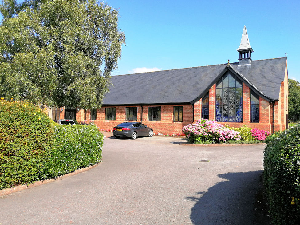
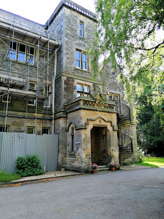
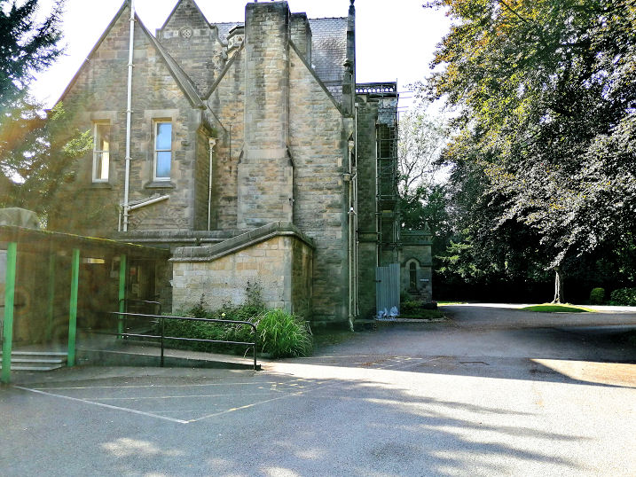
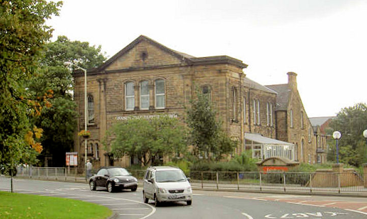
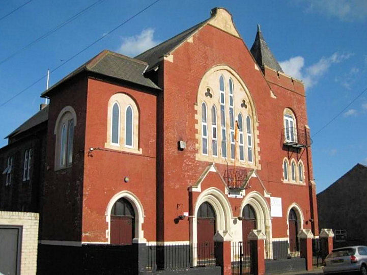
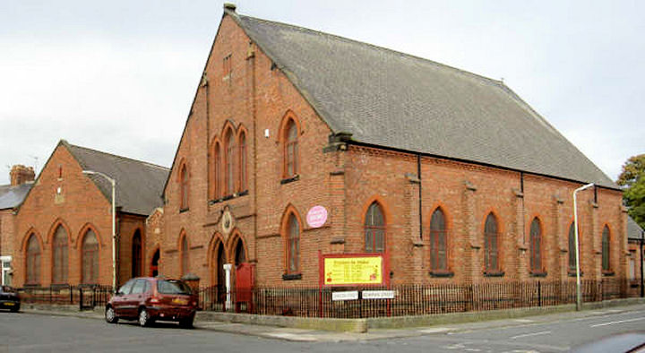
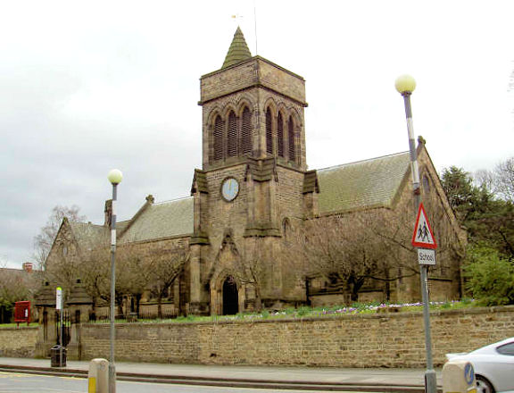
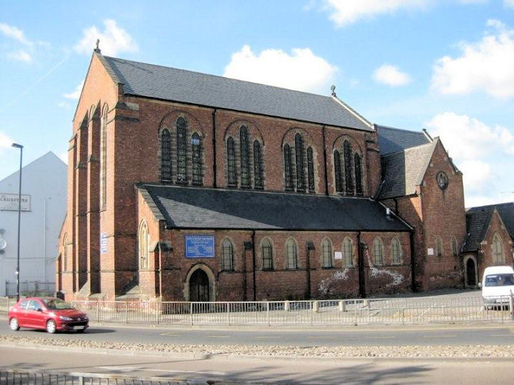
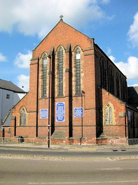
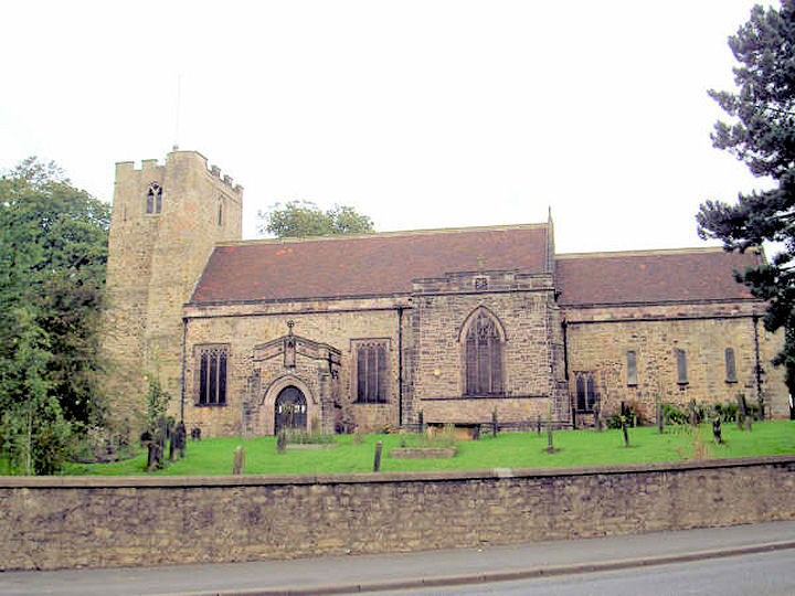
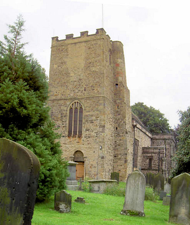
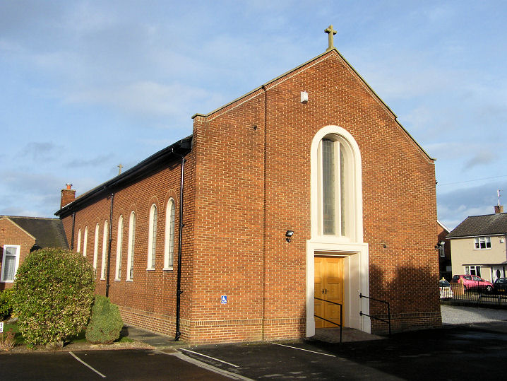
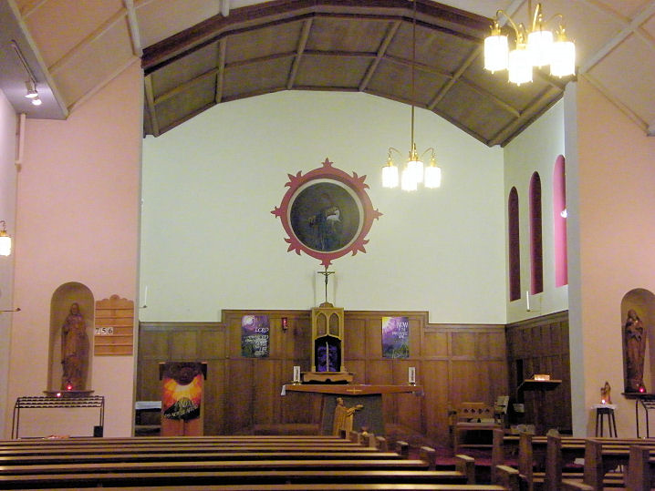
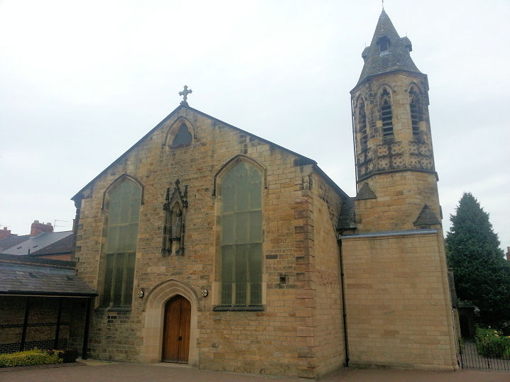
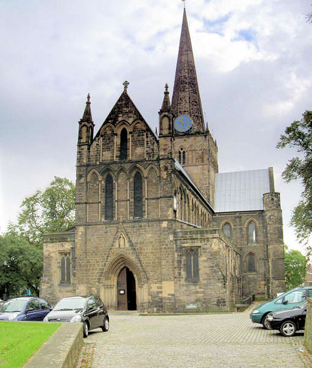
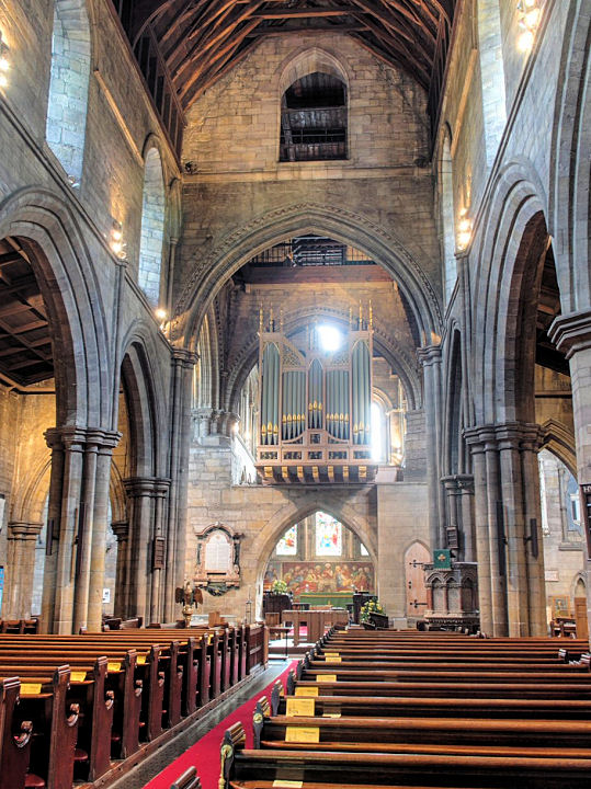
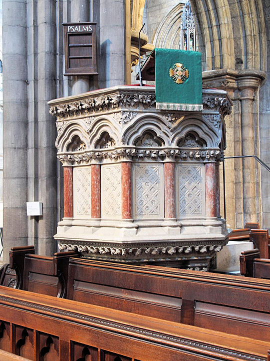
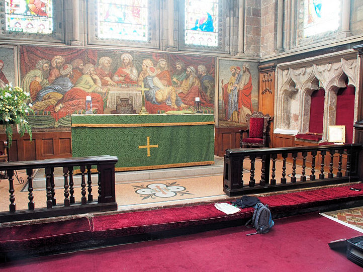
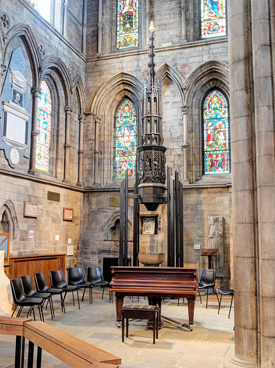
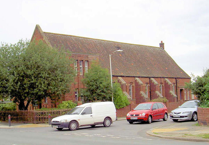
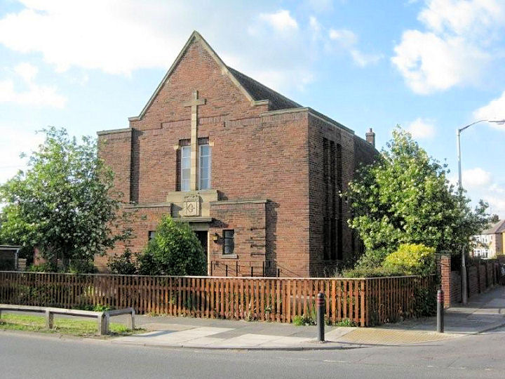
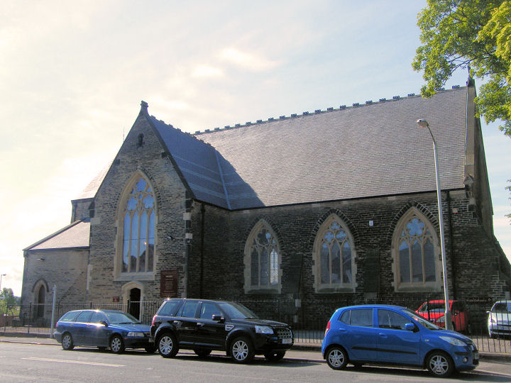
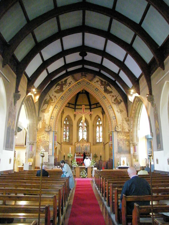
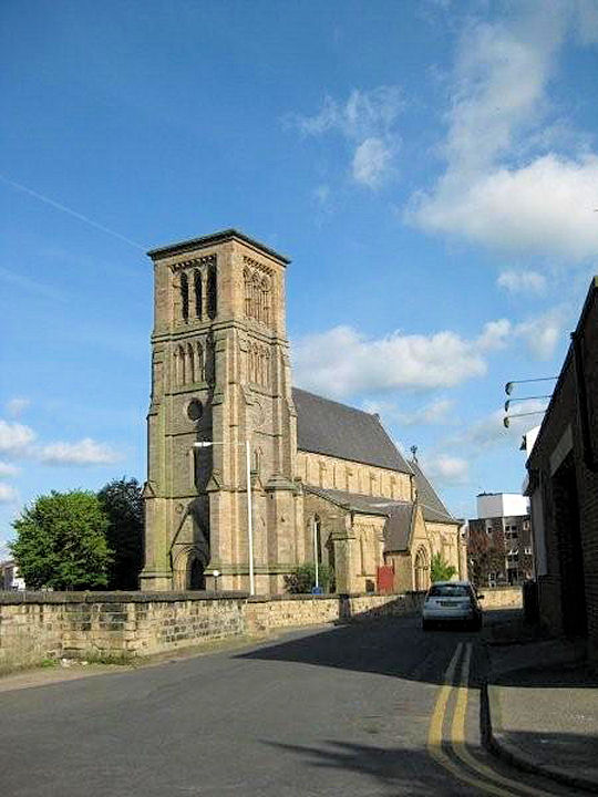
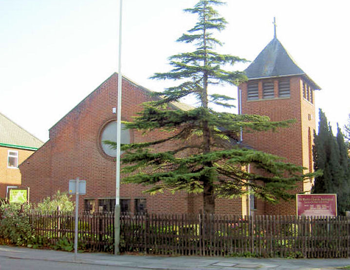
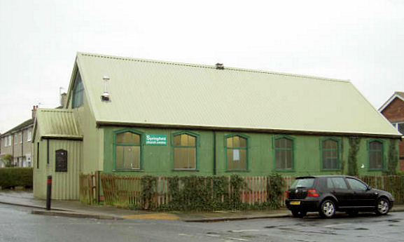
Churches in Cockerton. Albert Road Methodist Mission stood (unsurprisingly) on Albert Road, at NZ 2919 1571. It had earlier been Methodist New Connexion and United Methodist. Pre-dating a map of 1889 (when it's labelled as M.N.C.), it survived at least until 1981 when this photo was taken. Its site was seen by Streetview in 2009. All Saints & Salutation Church and Millennium Centre on Ravensdale Road. NZ 2773 1339. © Bill Henderson (2019). Link. Freemasons Hall on Upper Archer Street is a former Baptist Church. As early as the 1898 25" O.S. map it only shows as Hall. It was seen by Streetview in 2018. NZ 2876 1479. Baptist Tabernacle stands at the corner of Corporation Road and Easson Road, as seen by Streetview in 2015. Old maps imply it was built somewhere from the last few years of the 19th century, and before 1913. A photo from 1981 is available here. NZ 2870 1525. Link. Bethesda Gospel Hall on Florence Street was originally Primitive Methodist. It has a date-stone for 1897, visible here in a Streetview from 2014. Two more Streetviews, from 2009 and 2012. A photo from 1991 is available here. NZ 2978 1423. Bondgate Methodist Church stands on Salt Yard and Winston Street. Originally Wesleyan, its grade II* listing dates it to 1812. Its up-coming closure was mentioned in a local newspaper article in 2020, and it was being offered for sale in 2021. It was seen by Streetview in 2020, and in 2009. NZ 2867 1460. Carmel Convent Chapel stands on Nunnery Lane at NZ 2717 1477. The site is walled around, but the chapel may be visible here, on a Streetview from 2021. Grade II listed. Other listed buildings on the same site can be found here. Link. A directory of 1914 lists a Catholic Apostolic Church on Post House Wynd. Not shown on O.S. maps of 1898 or 1961, it doesn't seem to be mentioned anywhere on-line, nor is it obvious which building was used, but here is a possible candidate, seen by Streetview in 2017. This grid reference is for the centre of the Wynd - NZ 2880 1450. The site of the demolished Christian Science Hall, as seen by Streetview in 2021. It stood at the junction of Greenmount Road and Coniscliffe Road. Pre-dating the 1" O.S. map of 1961 (though the latest revision for this map was in 1950), it was demolished in 1990. A very dark photo of it is available here. NZ 2816 1396. The Church of Jesus Christ of Latter-day Saints stands on Blackwell, and was seen by Streetview in 2021. NZ 2744 1308. Church of the Salutation (1937) on Salutation Road, in a Streetview from 2012. A photo from 1981 can be seen here. Originally larger, the rest of the church stood up to the frontage of the present residential buildings. At some point it became an outstation of the more recent All Saints, for which see above. Congregational Bicentenary Memorial Church stood on Union Street at NZ 2893 1476. It was built in 1862 on the site of a predecessor of 1812, active until 1972, and in commercial use until a fire in 2012. It survived until 2020. (Dates from these newspaper stories - 1 2, which provide a good history). Stood as it was on a narrow street, it was difficult to get good views of it, but here are some Streetviews - in 2014, 2015, 2017, and 2009, and undergoing demolition in 2020. Old photos of it can be seen here and here. Darlington Christian Fellowship (House of Prayer Apostolic Ministries, UK) on Yarm Road, as seen by Streetview in 2015. The building was originally the Sunday School for Louisa Street Wesleyan (for which see Gurdwara Sahib below), later Eastbourne Methodist Church, which closed in 2013 (source). NZ 2991 1431. Link. Darlington Hebrew Congregation (the single storey builing at right) on Bloomfield Road, as seen by Streetview in 2012. They had previously met in the larger building (at left) from 1967 - 2007. NZ 2794 1528. Link1. Link2. Darlington Memorial Hospital has a Chapel, shown on this plan (pdf). The hospital's main entrance was seen by Streetview in 2020. NZ 2831 1516. Darlington Spiritualist Church (meets in a former Sunday School on Denmark Street. It was seen by Streetview in 2012. NZ 2907 1608. They had previously met in premises on the west side of Northgate at NZ 2902 1513. A photo of it in 1981 can be seen here, another one dated 2013 here, and in 2016 (after they had left) here, on a Streetview. Link. East Cemetery on Geneva Road has a Mortuary Chapel. Not visible on Streetview (cemetery entrance here in 2009), there is a photo on Geograph here. NZ 3037 1323. Elim Church on Bowman Street meets in what shows on a map of 1897 as a Mission Room. Later St. Mark, it was re-built on the same site in 1958 (source) and is labelled as Elim on a map of 1966-80. It was seen by Streetview in 2012. Link. Elm Ridge Methodist Church on Carmel Road South. It's dated here to 1932. Another view. NZ 2733 1358. Both © Bill Henderson (2019). Link. The former Firth Moor Pentecostal Church (now a shop) on Barden Moor Road was seen by Streetview in 2009. A 1981 photo can be seen here. An active Friends' Meeting House stands on Skinnergate at NZ 2872 1439. Its grade II* listing dates it to 1846, retaining a slightly earlier frontage of 1839. The listing also includes quite an expansive section on Quaker history and buildings. It was seen by Streetview in 2018. The walls of the adjacent burial ground are listed as grade II. Geneva Road Evangelical Baptist Church, as seen by Streetview in 2020. The church website history page dates it to the 1930's, with later additions. NZ 3068 1382. Grange Road Baptist Church. A directory from 1914 dates the church to 1871. NZ 2866 1417. © Alan Blacklock. Link. Greenbank Primitive Methodist Chapel once stood at the junction of Greenbank Road and Bondgate. A block of flats now stands on the site, as seen by Streetview in 2009. This source dates it to 1879, and here can be found an interior photo. A distand view of it can be seen in a newspaper article here, where it also says that it closed in 1965 and demolished two years later. A good view of it can be seen here, where the Sunday School at the back of the site is also visible. It was an impressive building! Another view here. NZ 2858 1480. Gurdwara Sahib on Louisa Street, was previously Eastbourne Methodist Church and before that, Louisa Street Methodist Church. It originally dates from 1901, and closed (as Methodist) in 1980. Eastbourne Methodist then moved to what had been Louisa Street Sunday School (for which see Darlington Christian Fellowship, above). Another view. NZ 2988 1428. Both © Martin Richter (2011). Harrowgate Hill Christian Fellowship (The Apostolic Church) stands on the south side of Crosby Street at NZ 2911 1694. It was seen by Streetview in 2021. Link. Harrowgate Hill Methodist Church stands at the junction of Bowman Street and Lowson Street. NZ 2926 1708. © Alan Blacklock. It dates from 1902-3 (its rather good date-stone for 1902 can be seen here), and was preceded by an earlier (1871) Wesleyan Chapel diagonally across the junction, at NZ 2928 1706. Later the Hope-Wilson Institute, it has since been demolished and housing built on the site, seen in a Streetview from 2018. Link. Haughton Methodist Church on Haughton Green was originally Wesleyan. Its grade II listing dates it to 1825. It was seen by Streetview in 2009. NZ 3100 1595. Link. Haughton Road Methodist Church was originally Primitive Methodist, and stands at the junction of Haughton Road and Alexander Street. It pre-dates a map of 1898. It appears to have been converted to residential use, and was seen by Streetview in 2009 and 2016. NZ 3017 1545. Holy Trinity on Woodland Road and Elms Road was originally a mission from St. Cuthbert. NZ 2830 1483. © Alan Blacklock. Grade II* listed, wherein it's dated to 1836-8, with later additions. Associated listed features can be found here. Jamia mosque and Islamic Society stands on the west side of North Lodge Terrace, and was seen by Streetview in 2020. A photo from 1981, available here, shows that it was an Assembly of God Pentecostal Church at that time. Link (Facebook). Earlier still it had been a Christian Science Church. Kingdom Hall of Jehovah's Witnesses is on the west side of Salters Lane at NZ 306 163. It was seen by Streetview in 2021. Life and Light Missions Church, formerly St. Hilda (CoE, 1887-8). Another view. NZ 293 145. Both © Martin Richter (2011). Link1. Link2. Link3. A Methodist Church used to stand on North Road in Harrogate Hill, at NZ 2934 1680. Now demolished, a 2020 Streetview shows that the site remained undeveloped at that time. Although no available maps show which variety of Methodism it was, standing just round the corner from Thompson Street as it does suggests that it might have been Thompson Street Primitive Methodist Chapel. If this is correct then its congregation merged with the Lowson Street Chapel in 1961 to form Harrowgate Hill Methodist Church - 1961 thus being the earliest date for its closure and demolition. A former Methodist New Connexion Chapel stands on Victoria Road at NZ 2928 1411. It was seen by Streetview in 2017 and 2018. It originally had a slightly taller spire - seen here on an old postcard. An old photo. There used to be a Mission Church on Whessoe Road, Drinkfield, at NZ 2848 1758. Of so far unknown affiliations, it was replaced during or soon after WWII by a secular building with more or less the same footprint. This building (or a further successor) was in the process of demolition when the Streetview camera passed by for the first time in 2009. The site was still vacant in 2021. A demolished Mission Church once stood on Pierremont Road, at the eastern end of Bloomfield Road. A house was later built on the site, seen here by Streetview in 2021. There's an on-line reference to a chapel of ease which "was built on the Pierremont in 1913" - was this this Mission Church? NZ 2783 1531. A Mission Hall is shown on a map of 1913 west of Alliance Street at NZ 2887 1583. Housing has been built on the site - the block of flats at the centre of this Streetview of 2016. A Mission Room once stood on Whessoe Road, a short way north of the Presbyterian Mission mentioned below. Showing as School on maps from 1897 and 1915, by 1939 it was Elmtree Mission Room. Its site is under grass, as seen by Streetview in 2012. NZ 2860 1656. Housing now stands on the site of another demolished Mission Room, on the corner of Bedford Street and George Street. NZ 2910 1401. A double Mortuary Chapel stands in the cemetery on Thompson Street West at NZ 2914 1679. Almost totally obscured by vegetation on Streetview, the grade II listing has three photos here, and dates it to 1874. The demolished Nestfield Methodist Chapel stood on Nestfield Road at NZ 3003 1559. Maps show it as Free United Methodist in 1898 and United Methodist in 1915. It later became part of a Catholic School. It can be seen here at the extreme left, and here. Replaced by housing, its site can be seen here, at the far end of the fence, in a Streetview from 2012. Northgate U.R.C. on Northgate (the A167) and Chesnut Street, was originally the Presbyterian St. George of 1869. Streetviews from 2012 and 2015. NZ 2905 1505. An old (un-dated) photo is available here. Grade II listed. The railings and gate piers are separately listed as grade II. News story about temporary closure for roof repairs. Link. Pierremont Primitive Methodist Chapel stood at the corner of Vine Street and Vancouver Street. The site can be seen on a Streetview from 2018. NZ 2815 1542. Directories of 1890 and 1914 mention a Plymouth Brethren Meeting on Park Place. Unfortunately it isn't shown on any available maps, so its precise location isn't known, but here are Streetviews from the south end in 2009, and north end in 2015. This grid reference is for the centre of the road - NZ 2928 1429. A demolished Presbyterian Mission Church stood on Whessoe Road at NZ 2865 1647. Housing has been built on the site, and it was seen by Streetview in 2012. The site of Queen Street Primitive Methodist Chapel is now covered by St. Augustines Way, seen here on a Streetview of 2020. An old directory dates it to 1822. It was later Free Methodist, and at the time of the 25" O.S. map of 1898 it's labelled as Lay Church. NZ 2886 1483. Rise Carr Methodist Chapel stood on Jane Street (now Westmoreland Street) at NZ 2870 1633. Originally Primitive Methodist, they built a small chapel in 1867 (old photo of date-stone), a larger chapel was built adjacent in 1889, and the earlier chapel became the Sunday School. The buildings were put up for sale in 1962 (source, with photo). A view of both chapels here and here. Demolished in 1999, the housing built on the site in 2000 can be seen in a Streetview from 2016. St. Andrew at Haughton-le-Skerne. Another view, and the interior. NZ 3082 1588. All © Alan Blacklock. Link. Grade I listed, wherein it's dated to about 1100, on the site of a Saxon predecessor. Other listed features associated with the church can be found here. St. Anne (R.C.) at Haughton-le-Skerne. Interior view. NZ 312 162. Both © Mike Forbester. Link. Streetview (2009) provides another view. St. Augustine (R.C.). Interior view. NZ 2858 1438. Both © Mike Forbester. Link. Its grade II listing dates it to 1825-7, with subsequent enlargements. The former St. Clare's Abbey (R.C.) stands on Carmel Road. Its Chapel is grade II* listed, and is dated in it to 1856-7. Only its roof can be seen in a 2019 Streetview - directly above the St. Clare's Court street sign. The Abbey itself is listed as grade II. NZ 2729 1450. A news article from 2017 details conversion plans for the Abbey - the chapel will be retained unaltered. St. Columba (CoE) stands at the junction of Clifton Road and Clifton Avenue. Seen by Streetview in 2012, it is obviously a different building to that seen here in circa 1971 - and the earlier one can't have been built before 1939, as a map revised in that year shows a vacant plot. The photo of the list of incumbents seen here (at the bottom of the page) implies that the church was opened in 1948. NZ 2922 1333. Link. St. Cuthbert on Market Place. NZ 2910 1445. © Alan Blacklock. An interior view, the carved stone pulpit, the altar, a misericord, and the font and cover, all © Chris Stafford (2015). Link. Grade I listed. St. Herbert, the parish church of East Darlington. NZ 311 142. © Alan Blacklock. Two further views - 1, 2, both © Martin Richter (2011). The parish was created in 1939, and the church must date from about then. Link. St. James the Great. Interior view. Streetview provides additional views, in 2020 and 2021. NZ 2993 1538. Both © Mike Forbester. Link. Grade II listed. St. John the Evangelist on Neasham Road. Built 1847-9, the vestries were added in 1900. NZ 296 143. © Martin Richter (2011). Link1 (see page 188). Grade II listed. St. Luke - see Word of Life Christian Centre below. St. Mark on North Road and The Leas. NZ 2943 1713. © Alan Blacklock. Link. St. Matthew on Brinkburn Road. Dating from 1936, it was preceded by a tin tabernacle of 1911 on the same site, which was destroyed by a fire in 1921 (source). The congregation merged with that of St. Luke (for which, see Word of Life Christian Centre, below) in 1979. NZ 2813 1578. Three Streetviews, from 2020, 2021 and 2009. The demolished St. Paul stood on North Road, at NZ 2919 1618. Genuki mentions its registers, which commenced in 1872. It fell victim to a fire in 1973 and was demolished two years later. Photos of it are available here and here. Its site was seen by Streetview in 2012. NZ 2857 1525. St. Teresa (R.C.) on Harris Street. NZ 3083 1390. © Martin Richter (2011). Link1. Link2. Another Catholic Church is shown on an old map (no longer available on-line) on Bright Street at NZ 3011 1425. About half a mile from St. Teresa, it may have been a predecessor, though the present church is clearly post-war, and the older church had closed (or at least had ceased to be labelled on maps) by 1896. Its site can be seen in a Streetview from 2009. Nearby (further south on Bright Street) stands what may possibly have been the Presbytery, as it has a cross above the front door - it can be seen by zooming-in to the Streetview of 2009. Can you provide any further information about this church? St. Thomas Aquinas (R.C.) stands on North Road. It's dated here to 1926, where there is also an interior photo. NZ 2925 1655. © Alan Blacklock. Link. St. William and St. Francis de Sales (R.C.) on Barton Street and Nestfield Street in Albert Hill, as seen by Streetview in 2021. NZ 3000 1557. Link. Its grade II listing dates it to 1870-1. A 2007 newspaper article says that the first Salvation Army base in Darlington was on North Road (where a BP garage now stands). It was seen by Streetview in 2016. NZ 2903 1537. Next came a Citadel on Northgate - the newspaper article provides dates for this of 1887-2006. It was still standing in 2021 - Streetview. NZ 2905 1500. For their current building, see the Springfield Church entry, below. The Seventh-day Adventist Church on Hird Street, as seen by Streetview in 2020. It was a Gospel Hall when noted on a map of the mid-1980's. NZ 2937 1429. Link. Sir E.D. Walker's Homes for the Aged has what may be a Chapel. The homes opened in 1928, paid for by the philanthropist Sir E.D. Walker. The Homes website calls the building in question a "Communal Hall", but is labelled on an old O.S. map as Chapel. A photo of it can be seen here. Another view from Streetview in 2012, and it can be glimpsed through the archway in another from 2021. NZ 2760 1356. A former Spiritualist Church stands on Northgate at NZ 2902 1513. Seen by Streetview in 2016, a photo taken when it was still active can be seen here. Springfield Church (U.R.C.) on Thompson Street East and Hercules Street was originally Presbyterian (shown as such on a map of 1915). NZ 3020 1685. © Alan Blacklock. Since Alan took his photo, the church has been demolished and replaced by a Salvation Army Citadel, seen here in a Streetview from 2021. It had been built before 2009, when the earliest Streetview was taken. Link. The King's Church was seen by Streetview in 2017. NZ 2863 1628. Link. The Well (Methodist) is the former Northland Methodist Church on North Road. Originally Wesleyan, a photo of it can be seen here. Re-built in 1981, the present building can be seen in a Streetview from 2021. NZ 2915 1610. Link. The former Union Row Wesleyan Methodist Chapel stands on what was originally Union Row - now King Street. At the time of a Streetview visit in 2020, it was a former bar, up for sale. A (very dark) photo from 1986 here shows it when it was in use as an auction room. NZ 2880 1471. The site of a United Methodist Chapel on Coniscliffe Road, as seen by Streetview in 2019. Originally Wesleyan Association, an old directory dates it to 1840. It was still active in 1940, and was being offered for sale in 1973. NZ 2865 1432. An old photo is available here. Unity Church (Unitarian) stood on Lead Yard, just south of St. Cuthbert, at NZ 2907 1437. Pre-dating a map of 1898, this source provides dates of 1873-1922. Its site was seen by Streetview in 2020. A Wesleyan Methodist Chapel used to stand on Corporation Road at NZ 2868 1527. Dated in an old directory to 1904, photos of it can be seen here and here. Its site was seen by Streetview in 2020. West Cemetery on Carmel Road has a double linked Mortuary Chapel. A photo here shows the Nonconformist Chapel closest to the camera, with the Anglican Chapel in the background. NZ 2734 1409. Word of Life Christian Centre on Corporation Road and Marshall Street is the former St. Luke. It acquired its Word of Life signage between June 2015 (Streetview) and April 2017 - here and here. St. Luke is dated here to 1917, and was successor to an earlier St. Luke on Leadenhall Street, at NZ 2910 1523. Dating from 1884, it was demolished after 1912 - a photo of the church football team dated to that year is available here. The site was seen by Streetview in 2012. St. Luke merged with St. Matthew in 1979.
|
||
19 July 2025
© Steve Bulman