The Churches of Britain and Ireland
| Coldstream,
Borders
See here for a good Coldstream Churches history,
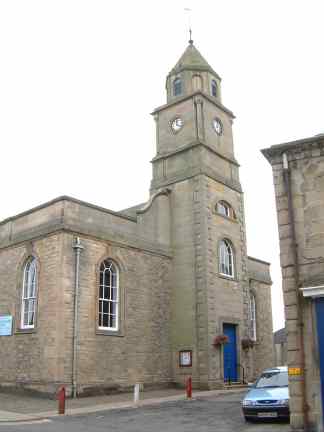
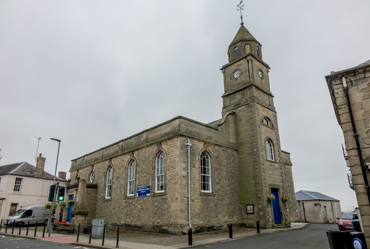
The site of the Catholic Apostolic Church, on Leet Street (earlier New Road) as seen by Streetview in 2021. The source given above dates it to 1862, probably closing in the years before WWI. The Parish church (CoS) on High Street. This source says that the tower remains from the original 1718 church, the rest being a re-build of 1905. NT 8425 3978. © Bill McKenzie. Another view, © Steve Bulman (2017). Link. Category B listed The local Roman Catholic congregation currently uses the Episcopal church, for which see the next entry. The source given at the top of the page says that they first met in moder times at the chapel of Lees House (demolished). Lees House stood at NT 8404 3918. Its site hasn't been seen by Streetview, but some photos of the house are available here. Other places they have met in are - the Drill Hall, which I take to be the building labelled as such on O.S. maps, behind the parish church, at NT 8427 3976. It (or the building built on its site) was seen by Streetview in 2011. Also Coldstream Homing Society clubrooms at the corner of Home Place and Duns Road, which I assume to be this building (2021 Streetview), and 3 Luke's Brae, the entrance to which can be seen here (2009 Streetview). St. Mary and All Souls (Episcopal, 1897). NT 8460 4019. © Bill Henderson. Link. The source given at the top of the page mentions a Salvation Army chapel - probably in the Free Church Mission Hall on Duke Street. It survives as a garage and was seen by Streetview in 2021. The former United Presbyterian West Church on High Street, also known as St. Cuthbert's West Church. It's now used as a community centre. NT 8411 3975. © Bill Henderson. Category B listed. Two other churches are shown close together on older maps - a Free Church on Victoria Street (now Victoria Place) at NT 8429 3988, and U.P. East Church behind it at NT 8431 3991. The Free Church, later known as Rodger Memorial Church, dates from 1846, and was closed by 1953. It was seen by Streetview in 2021. The East U.P. Church dates from 1826, closing in 1905, and it survives as part of, and behind, the garage buildings seen here in a Streetview from 2022.
|
||
19 July 2025
© Steve Bulman