The Churches of Britain and Ireland
| Bury St. Edmunds, Suffolk
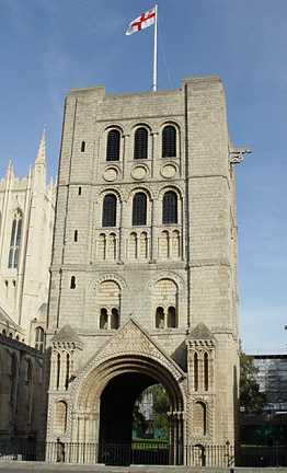
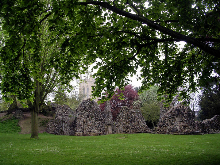
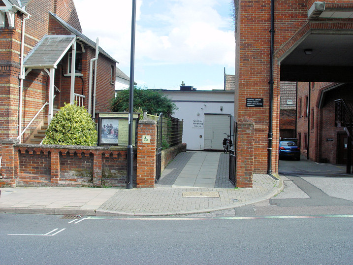
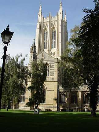
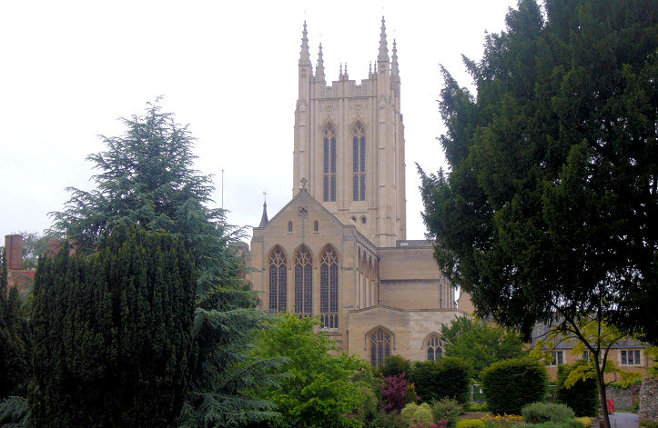
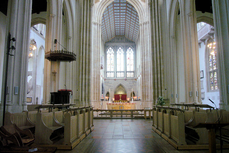
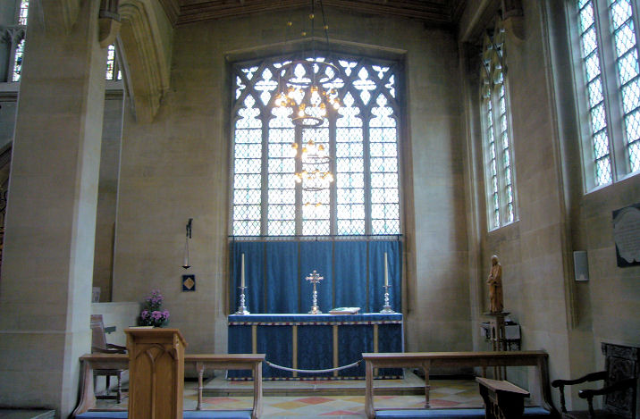
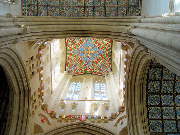
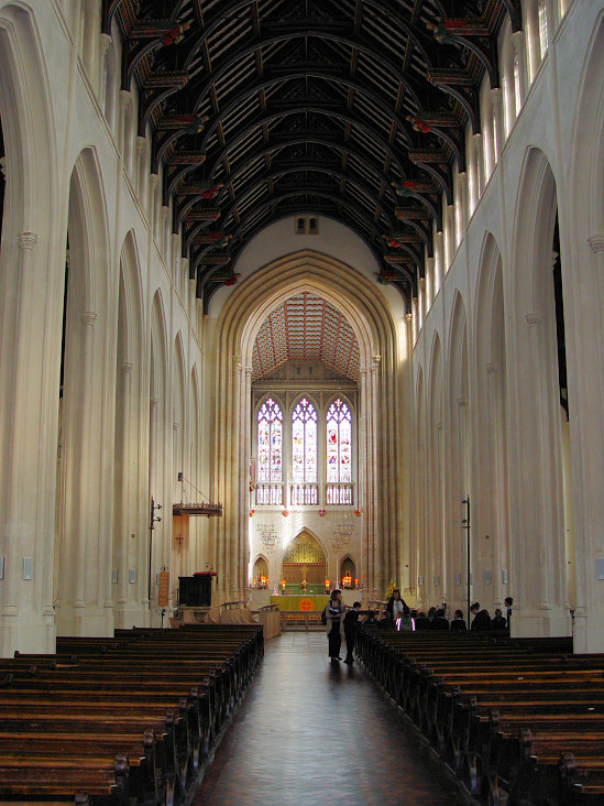
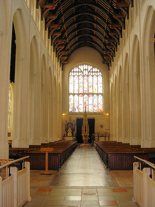
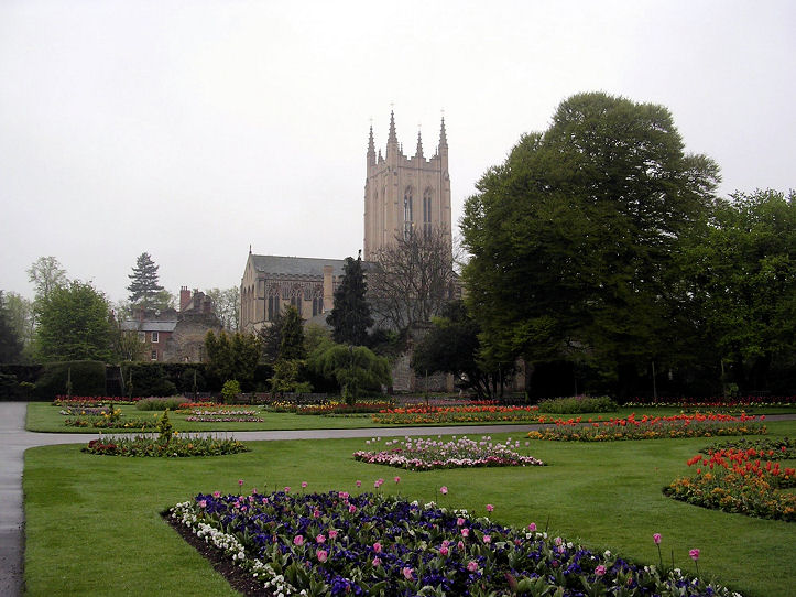
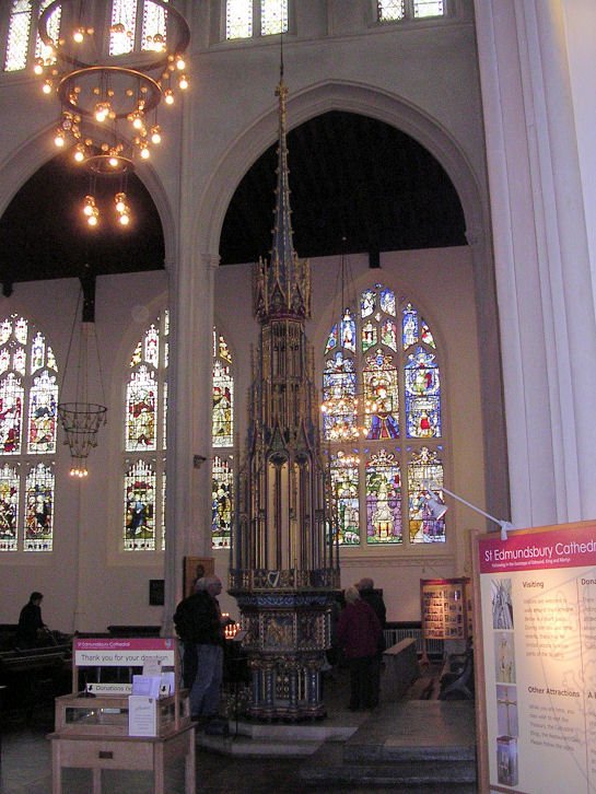
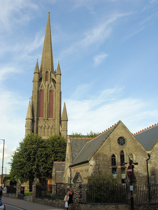
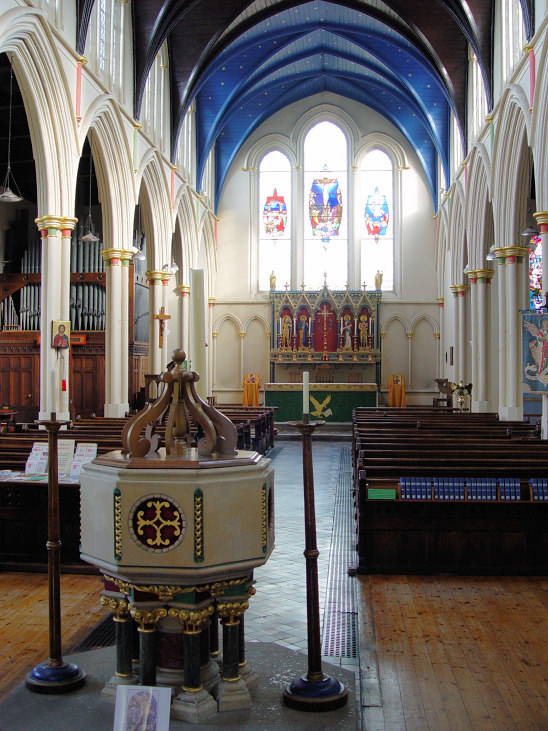
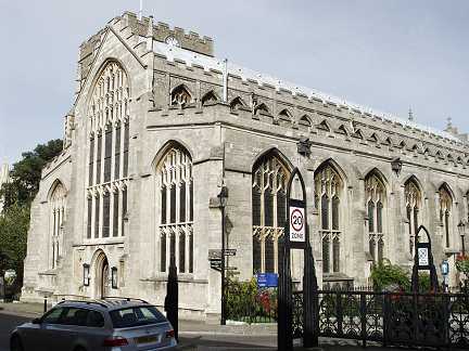
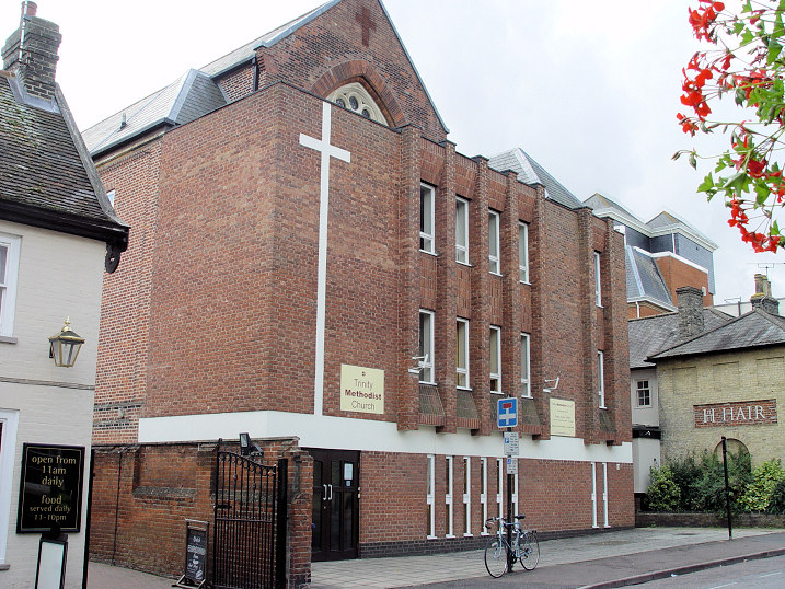
Bury St. Edmunds on Wikipedia. The Abbey Gateway (TL 8554 6422). Another gateway serves as the belltower for the cathedral (TL 8557 6408). Both © Steve Bulman (2005). There are some scant remains of the abbey in the cathedral grounds. © Iris Maeers. Link. Garland Street Baptist Church, of 1834, as seen by Streetview in 2018. TL 8543 6445. Link. Quaker Meeting House on St. John's Street. Another view, from St. Andrew's Street North. TL 8521 6461. Both © Steve Bulman (2012). Link. Grade II listed. According to the My Primitive Methodists entry for the town, there have been three Primitive Methodist Chapels. The earliest (or at least, the earliest mentioned) is of 1830, then a chapel of 1851, and the third, of 1902, all on Garland Street. Photos of each are provided. However, the 25" O.S. map of 1904 shows a P.M. Chapel on Northgate, at TL 8556 6436, seen here by Streetview in 2021. This is undoubtedly the 1902 chapel. What is identified as the 1830 chapel is on Garland Street, seen here by Streetview in 2018, as is the 1851 chapel seen here by Streetview, also in 2018. St. Edmundsbury Cathedral Church of St. James. Formerly one of the Abbey Churches, this was elevated to cathedral status in 1914. Building works have since added many new features, including the tower, only recently completed. TL 8559 6411. © Steve Bulman (2005). The Cathedral, and an interior view, the High Altar, and the Lady Chapel, all © James Murray. Looking up from the crossing, another two interior views - 1, 2, and the organ, all © Steve Bulman (2012). Another view, and the font and cover, both © Iris Maeers. Link1. Link2. Grade I listed. St. John the Evangelist on St. John's Street. Interior view. TL 8528 6468. Both © Steve Bulman (2012). Link. Grade II listed. St. Mary, a huge and impressive church. TL 8562 6395. © Steve Bulman (2005). Link. St. Peter on Hospital Road. It was seen by Streetview in 2009. TL 8511 6379. Link. Grade II listed, wherein it's dated to 1858. Salvation Army Church on St. John's Street, as seen by Streetview in 2021. What appears to be the same building is marked on 1903 as S.A. Bks.TL 8528 6481. Link. Trinity Methodist Church on Brentgovel Street. The top of the original chapel can just be seen behind the more recent extension. It's labelled on older maps as Wesleyan, and an illustration of it can be seen here, where it's dated to circa 1878. TL 853 643. © Steve Bulman (2012). Link. Westgate Chapel (Evangelical) on Hospital Road. TL 8516 6378. Link, which dates the church to 1976, in a pre-existing building. They had previously met in Westley Estate Community Centre - if this is Westbury Community Centre, it's on Oliver Road, and seen here by Streetview in 2009.
|
||
04 March 2023
© Steve Bulman