The Churches of Britain and Ireland
| Broseley, Shropshire
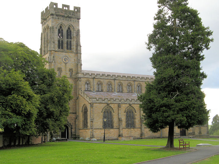
All Saints on Church Street. SJ 6789 0154. © Graeme Harvey (2010). Link. Grade II* listed. The Baptist Church (2025 Streetview) stands on Chapel Lane, at SJ 6710 0188. Facebook - dates it to 1742. News story. Pre-dating a map of 1883 is a Baptist Chapel (Particular) on Birchmeadow Road. It's now in use as Birchmeadow Centre (altered beyond all recognition, 2025 Streetview). It's history section here (scroll down) dates it to 1803, closing in 1927 - though O.S. maps show it as still active at least to the mid-century. SJ 6746 0204. The 25" map of 1902 has a label - Gospel Rooms - for a building around where High Street, Dark Lane and Smithy Bank intersect. This grid. ref. - SJ 6747 0175 - specifies the centre of the label, rather than the particular building, as it's unclear which is intended. Suffice it to say that if the building survives, it will probably be visible on this 2025 Streetview. There used to be an Independent Chapel on Duke Street, also pre-dating the 1883 map. Its site today is a car park - 2022 Streetview (note small surviving cemetery). SJ 6719 0224. A photo can be seen here, where its dates are given as 1840-1, on a site which had earlier included a Quaker meeting place, with closure in 1965 and demolition in the 1970's. The cemetery to the east of the town has a Mortuary Chapel (2011 Streetview). SJ 6808 0174. The Primitive Methodists had a chapel on Sycamore Road. It hasn't been seen by the Streetview van, but some photos can be seen here. It has a date-stone, unfortunately erased. SJ 6715 0277. A Roman Catholic Chapel used to stand on Barber's Row (now Barber Street) at SJ 6743 0190. It's dated here to 1888 - a tin tabernacle called St. Winefride's, closing in 1913. A hiatus followed until 1962 when a wooden church was built on the same site, and this was succeeded in 1979 by the present church, also St Winefride - 2011 Streetview. It may have subsequently closed, as by June 2022 (Streetview) the signage had disappeared, and it seems to have no web presence in 2026. St. Bartholomew (2022 Streetview) stands to the N.W. of the town at SJ 6578 0256, beside Benthall Hall. Its grade II* listing has it as "former", and dates it to 1667-8. There was a Wesleyan Methodist Chapel on Duke Street at SJ 6732 0209. Its site is now a car park - the current Methodist Church sits beside it. 2022 Streetview. It's dated here to 1971, the old chapel having been demolished in 1964. This source tentatively dates the old chapel to 1796-7. Link.
|
||
17 July 2026
© Steve Bulman
Contact Details