The Churches of Britain and Ireland
|
Birkenhead, Merseyside Churches in Bidston,
Claughton,
Oxton, Prenton,
Rock Ferry,
Tranmere,
Upton, Woodchurch. Some
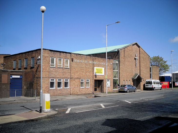
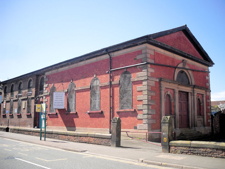
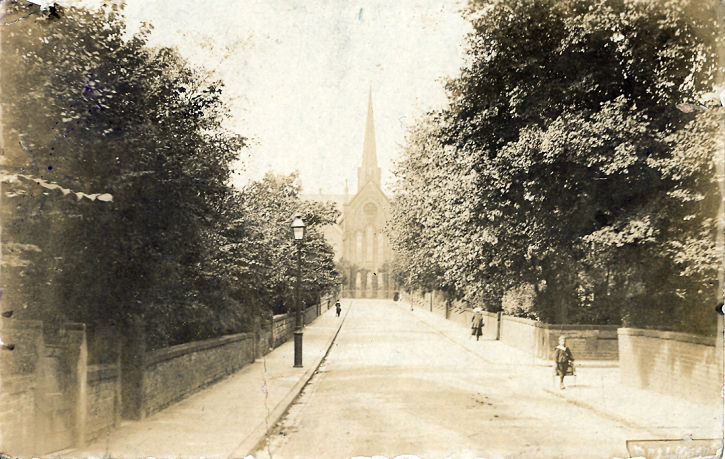
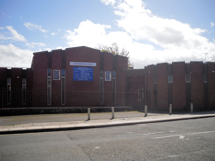
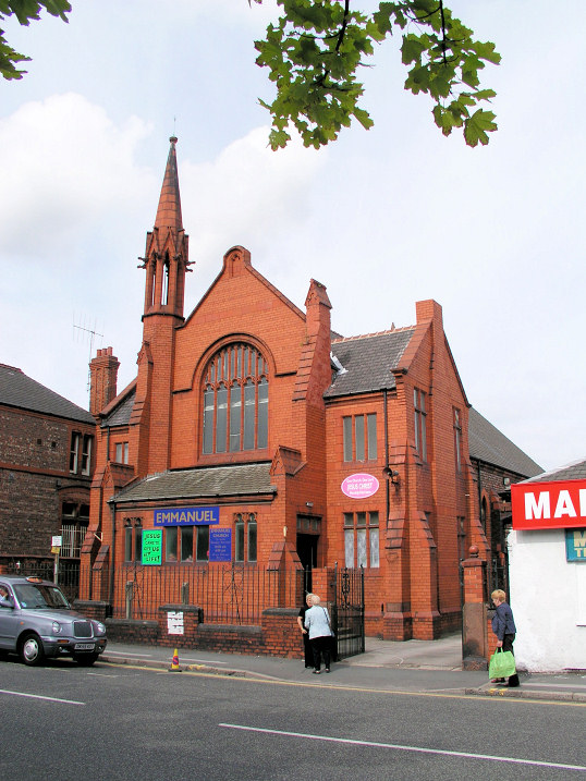
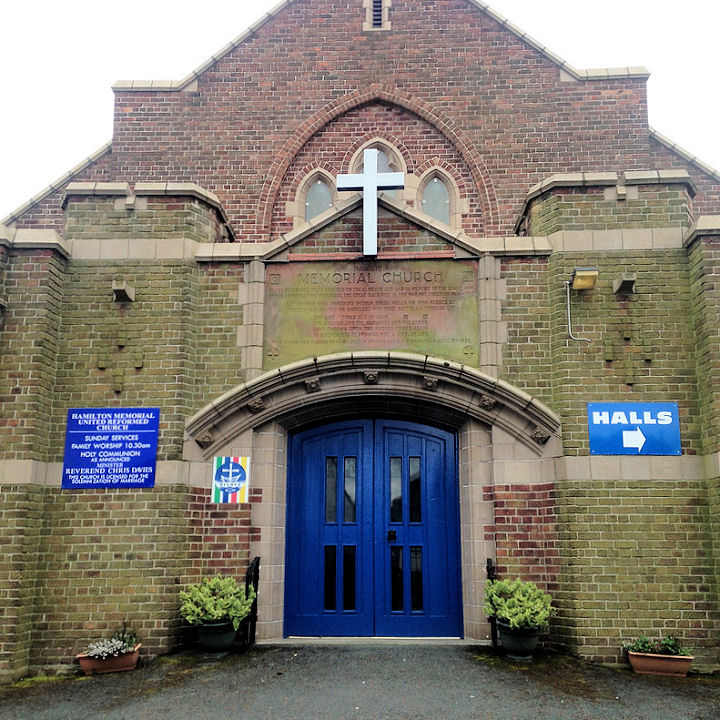
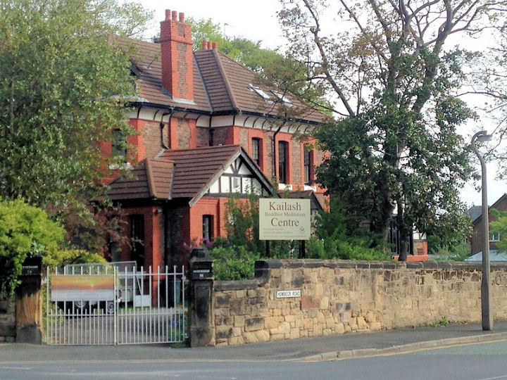
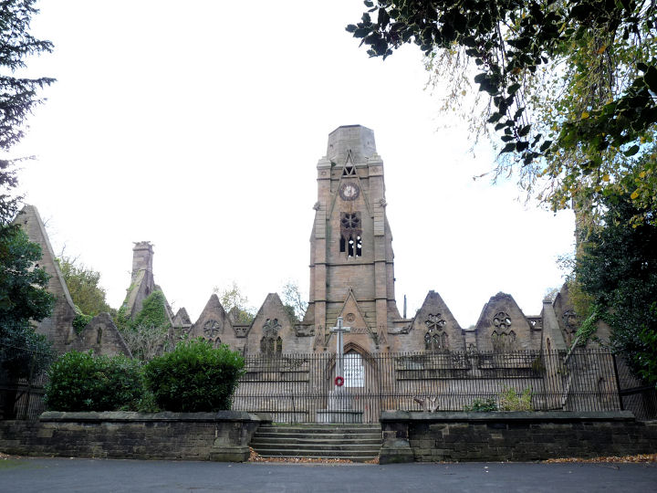
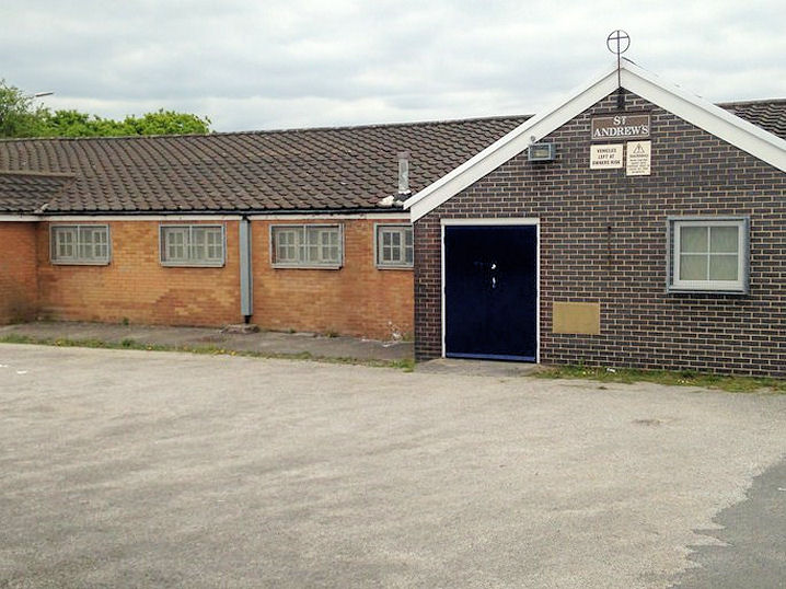
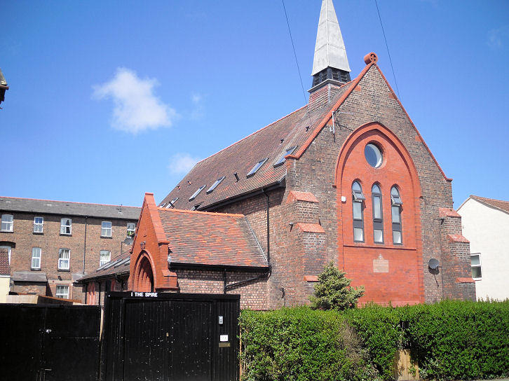
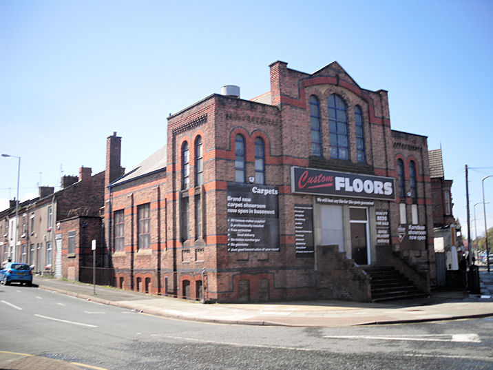
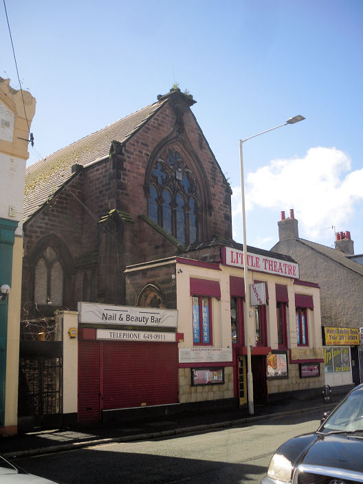
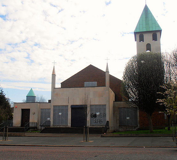
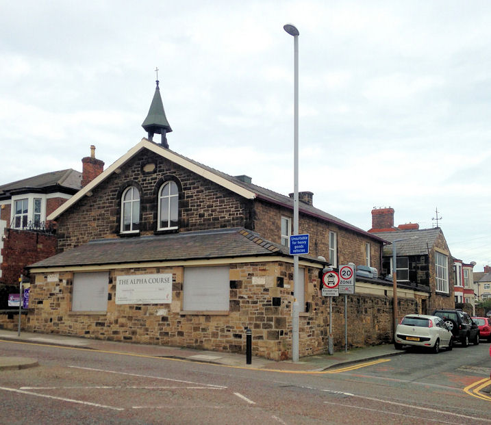
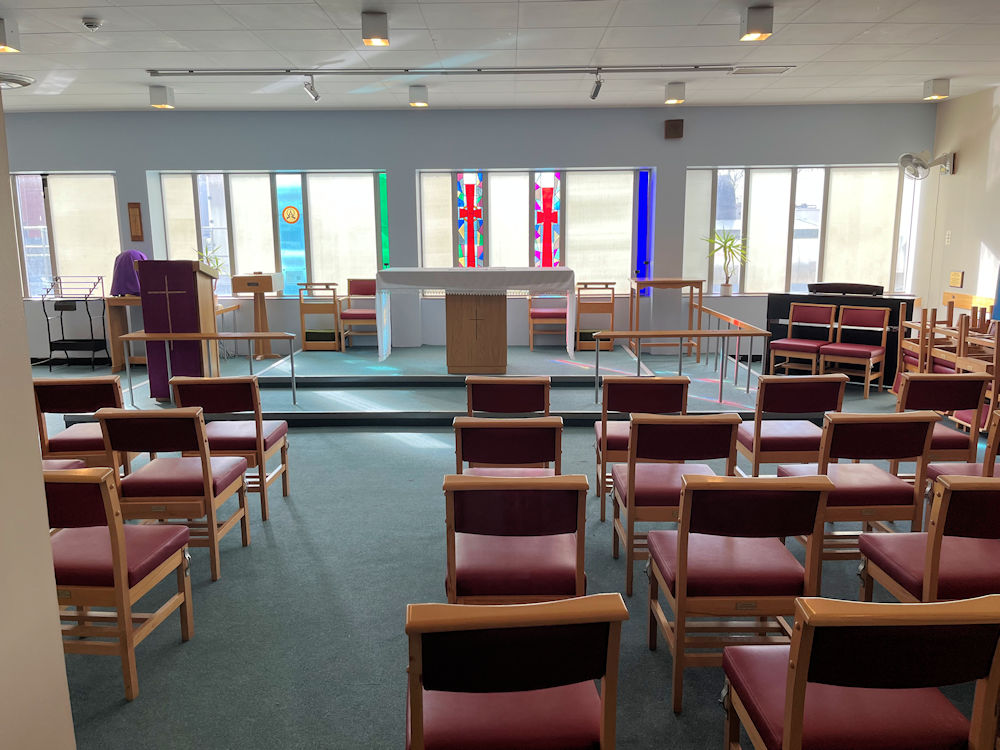
links will open a new page. Bethany Chapel (Evangelical) on Holmlands Drive, Prenton. SJ 2949 8667. © Magnus Park (2015). Link. Charing Cross Methodist Church on Claughton Road. SJ 3154 8865. © Gerard Charmley. As of 2025, the church seems to no longer be active, having merged with a Tranmere Church - link. Charles Thompson Mission Church on Hemingford Street. SJ 3192 8881. © Gerard Charmley. Link. Christ Church. This is an old postcard from Steve Bulman's Collection, and had been in the "Unknown" section for a long time. It caused much discussion, and was finally solved by Phil Draper. It was posted to an address on Anglesey, stamped (though not franked) in the reign of Edward VII (1901-1910). Simon Davies had suggested St. Paul, on Vicarage Gate, Kensington, London, which was damaged during the war, and demolished, but I'd been unable to find any corroborative photos. Brian Curtis had been looking at Old Maps, and deduced that the only way to get a view similar to the postcard would be by looking SSE along Palace Gardens Terrace. Using Google Earth to get a modern view along that road showed that the houses (which look Victorian), didn't have gardens - which the view in the postcard shows. In addition, Brian had found an old illustration here - Plate "19c"- it seemed more ornate than the church in the postcard - examine the spire, and note also the small turret to the left, not apparent in the postcard view. Janet Gimber had also been digging, and found a view of the church looking along Palace Gardens Terrace - proof positive that the postcard is not of St. Paul. Select image 55475 from this page. Phil offered up as proof the following links - link1, link2, link3. SJ 3093 8787. Its grade II listing dates it to 1844. Streetview offers modern views in 2012, 2016, and 2014. Christ the King on Beckwith Street, formerly St. Anne - the name change was in 1991 (source). Two further views- 1, 2. SJ 3114 8952. All © Dennis Harper (2012). A 2009 Streetview provides another view. Grade II listed. Church of God meets in Atherton Hall. SJ 3135 8850. © Gerard Charmley. Since Gerard took his photo the church has been demolished. It was still standing in 2020 (Streetview), replaced by flats by 2024 (Streetview). Emmanuel Holiness Church on Claughton Road. This source dates it to 1875, and the Ordnance Survey labelled it as Free Ch. (Welsh) on a map of 1908-9. SJ 3178 8871. © Dennis Harper (2012). Another view, © Gerard Charmley. Link. Hamilton Memorial U.R.C. on Upton Road. SJ 2985 8918. © Magnus Park (2015). Another victim of recent re-development - Streetviews in 2018 (surviving), 2020 (replaced by flats). The site (2025 Streetview) of the demolished Holy Trinity (1840) on Price Street. Several old photos can be seen here. SJ 3208 8917. Kailash Buddhist Meditation Centre on Bidston Road and Howbeck Road. SJ 2965 8847. © Magnus Park (2015). A 2022 Streetview. Link. The former Mortuary Chapels (CoE and Non-conformist, 1864) in Flaybrick Cemetery on Tollemache Road, Bidston. The cemetery was re-named as Flaybrick Memorial Gardens in 1995. SJ 2925 8941. © Mike Berrell (2014). Link. There was also a Catholic Chapel, at SJ 2917 8975, demolished in 1971. Our Lady of the Immaculate Conception (R.C.) on Price Street and Cavendish Street, as seen by Streetview in 2018. It's sometimes referred to as St. Mary. SJ 3082 8974. Link dates it to 1860-2. Providence Strict and Particular Baptist Church on Storeton Road has been home to the congregation from Shaw Street Chapel in Liverpool since 2000. SE 3068 8704. © Gerard Charmley. This source provides another view, and an interior view - the signage on the church describes it just as Providence Particular Baptist Chapel. There used to be an Anglican college (St. Aidan's College) on a site bounded by Howbeck Road, Forest Road and Shrewsbury Road. Its Chapel (dated here to 1882) stood on that part of the site on Howbeck Road and Shrewsbury Road. The college was closed in 1969 and subsequently demolished. A 2025 Streetview shows the site of the chapel. There are many old photos and illustrations of the college building on the web, but none, as far as I can tell, show the chapel. SJ 3003 8858. St. Andrew (Presbyterian) used to stand on Conway Street at SJ 2306 8880. An old directory dates it to 1840, and it seems to have still been active at least up to the 1950's. Streetview saw its site in 2022. St. Andrew on Raymond Way, Noctorum. SJ 2868 8770. © Magnus Park (2015). A 2009 Streetview provides another view. Link. St. James (2022 Streetview) stands on Laird Street and St. James Road. SJ 2967 8997. Link. Grade II listed, wherein it's dated to 1845-58. St. John used to stand on Huskisson Street at SJ 3188 8854. An old directory dates it to 1845, and was still marked on O.S. maps at least up to the 1950's. Demolished at some point, its site now lies beneath a shopping centre. An old illustration of the church can be seen at the bottom of this page, and it's site was seen by Streetview in 2019 and 2024. The site (2024 Streetview) of St. Lawrence (or St. Laurence, R.C.), which used to stand on Beckwith Street, at SJ 3187 8907. An old directory dated it to 1889, a re-build on an existing site. Genuki says founded 1864, "Present church dates from 1890", closure in 1995. I haven't been able to find a photo of the church on-line. The demolished St. Mark stood on Slatey Road and Devonshire Road, at SJ 3083 8835. Genuki dates it to 1891-1991. Its site was seen by Streetview in 2022. Only the tower and a length of wall remains of St. Mary, which stands close to the Mersey on Church Street. Only a glimpse of it can be seen on Streetview, but its grade II listing, which dates it to 1821 (and "partly demolished in 1975"), has a good photo. SJ 3284 8855. Another vanished church is St. Matthew, which stood on Park Road East, and is dated by Genuki to 1889 (originally as a chapel of ease to Holy Trinity) to 1974. Housing now stands on its site, seen by Streetview in 2022. SJ 3130 8877. The long-demolished St. Paul stood on Argyle Street and Market Street. SJ 3241 8889. An old directory dates it to 1863, and was still there in the late 1930's, according to a map of the time. Genuki dates it to 1862-1948. Its site was seen by Streetview in 2012, and an old illustration of it can be seen here. St. Peter on Cathcart Street was built in 1867, according to its Genuki entry, closing in 1991. Subsequently demolished, housing was built on its site - 2024 Streetview. A couple of photos of it can be seen here (scroll down). SJ 3167 8913. St. Werburgh (R.C., now St. Werburgh and St. Laurence) on Grange Road, as seen by Streetview 2024. Its grade II listing dates it to 1835-7. Another Streetview, from 2018. SJ 3216 8856. Link1. Link2. The adjacent presbytery is also listed at grade II. The former St. Winifred on Westbourne Road, converted to residential use. SJ 3121 8840. © Gerard Charmley. A comment here says that the foundation stone was laid in 1890. The former United Methodist Chapel on Claughton Road and Eastbourne Road is now in commercial use. © Gerard Charmley. The former United Presbyterian Church on Grange Road West. It's dated here to 1881. SJ 3148 8851. © Gerard Charmley. A 2024 Streetview shows an updated colour scheme.
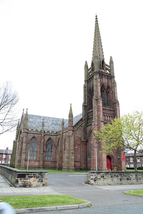
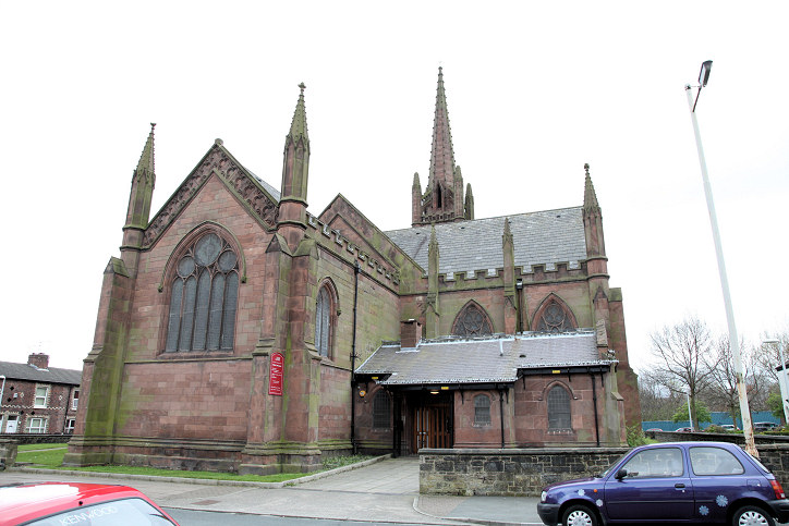
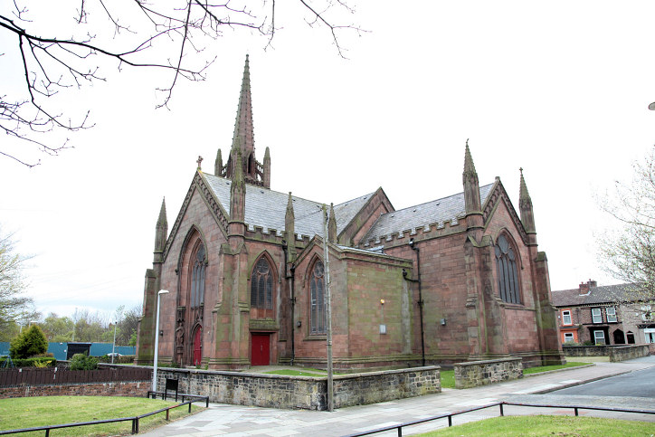
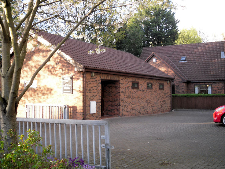
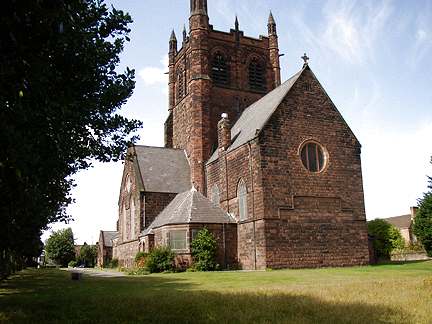
Claughton The site of the demolished All Saints on Shrewsbury Road, as seen by Streetview in 2015. Built in 1879, an O.S. map of 1961 shows it to have still been in active use at that time. Some old photos and postcards can be seen here. SJ 3000 8841. Holy Name of Jesus (R.C.) on Beresford Road was seen by Streetview in 2016 and 2018. SJ 2989 8904. Link advises of a building date of 1899. Maitland Evangelical Church on Storeton Road. SJ 3060 8731. © Magnus Park (2015). Link. St. Saviour on Talbot Road and Gerald Road. SJ 3013 8778. © Frank Joinson. A 2025 Streetview provides another view. Link1. Link2. Grade II* listed - dates it to 1889-92.
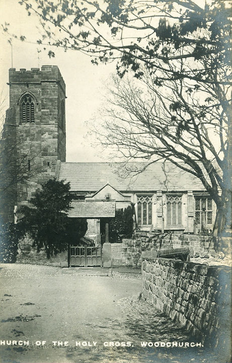
Prenton Upton Woodchurch
|
||
17 March 2026
© Steve Bulman
Contact Details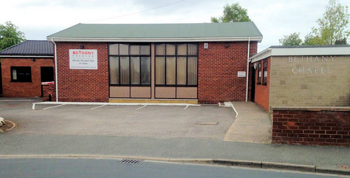