The Churches of Britain and Ireland
| Batley, West Yorkshire
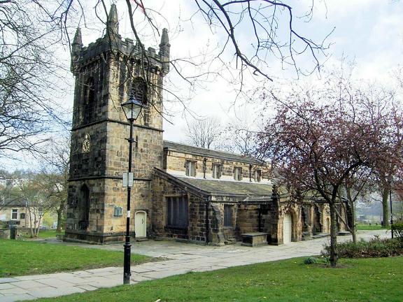
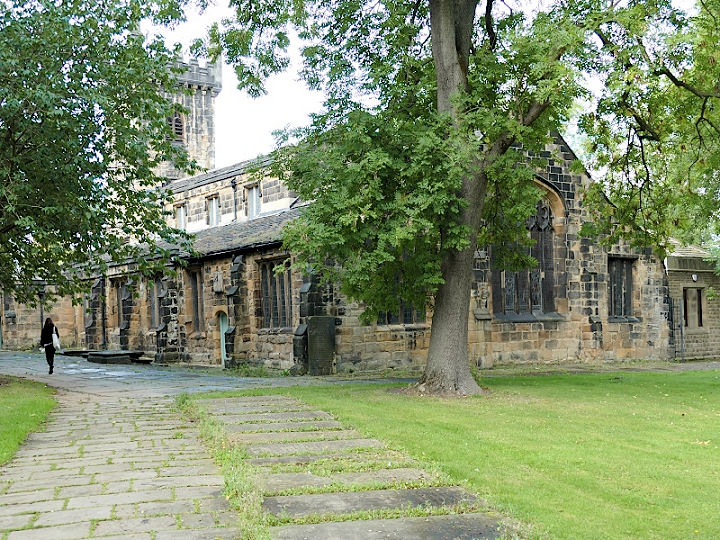
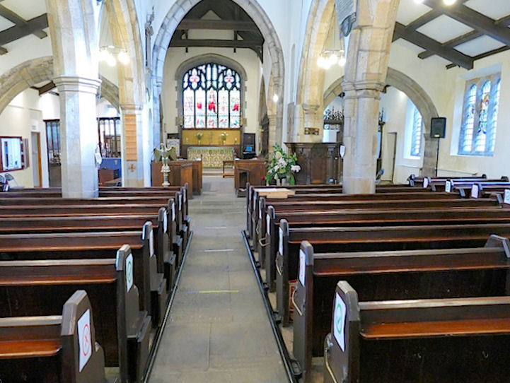
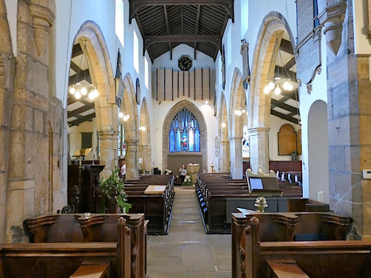
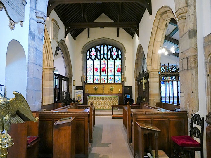
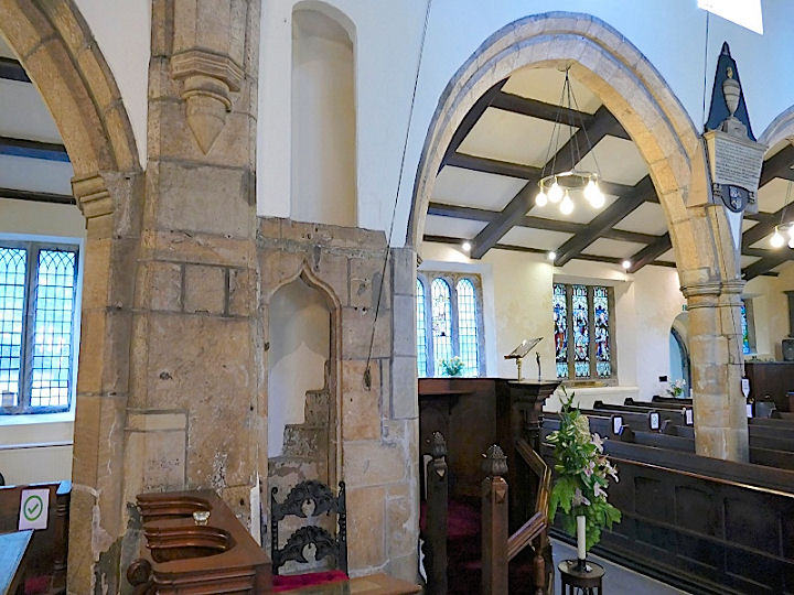
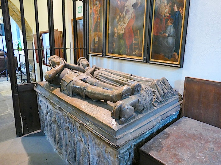
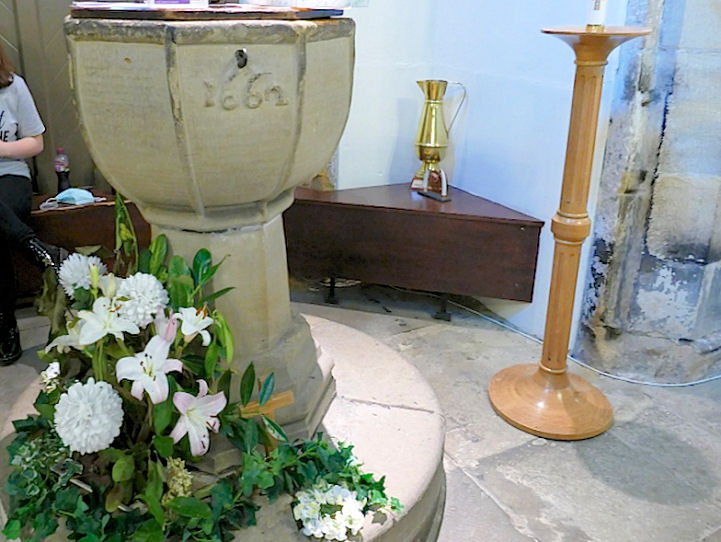
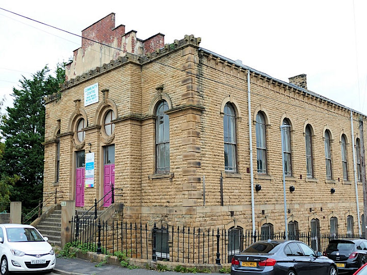
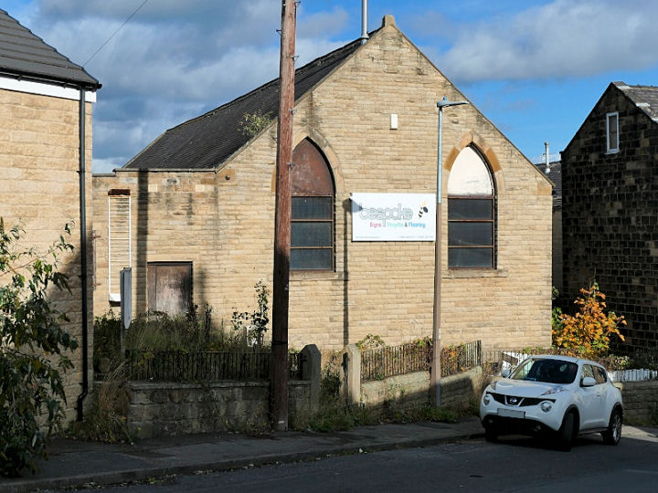
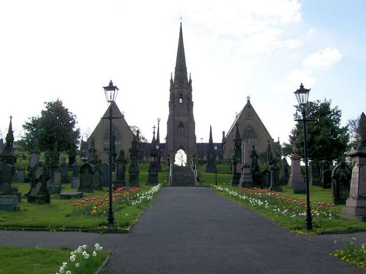
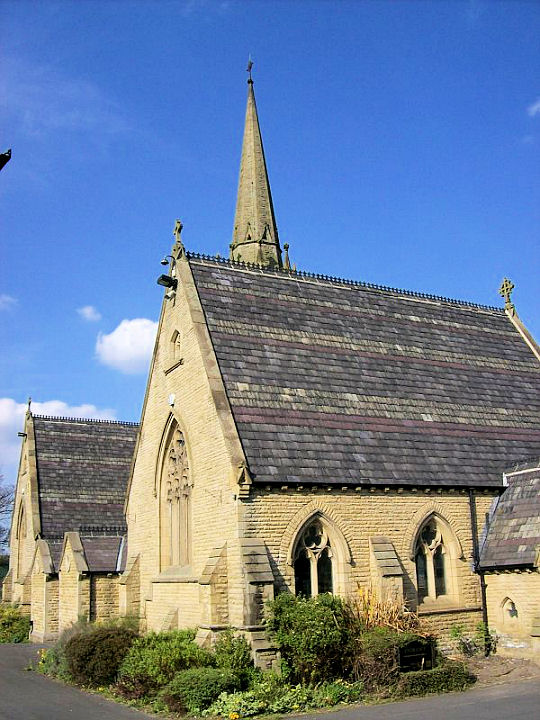
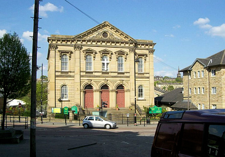
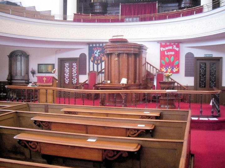
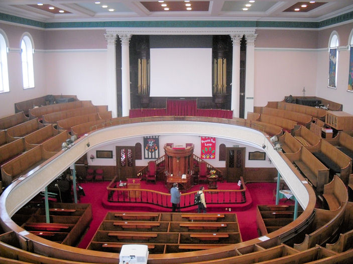
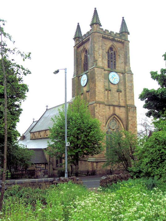
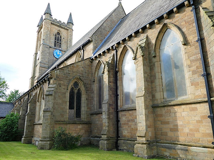
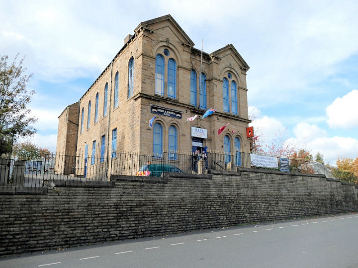
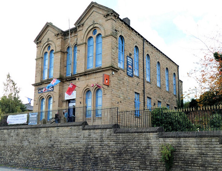
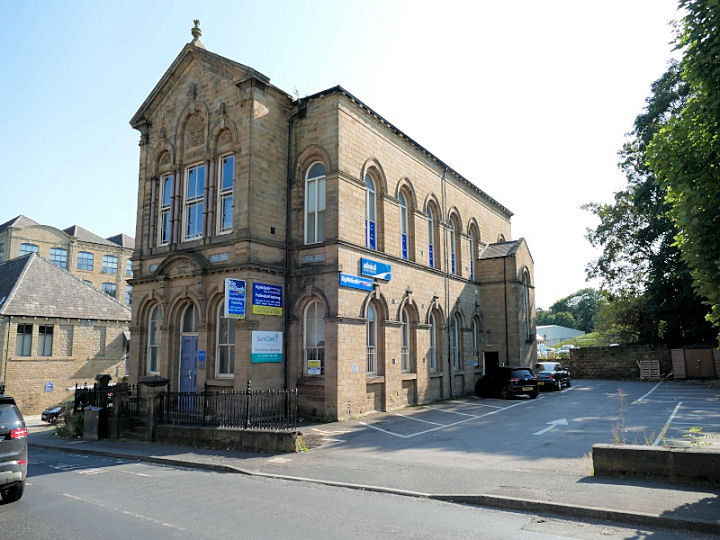
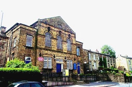
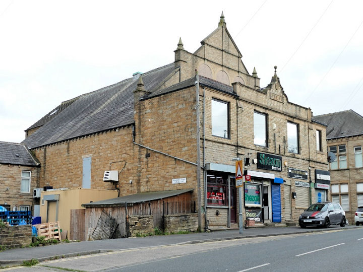
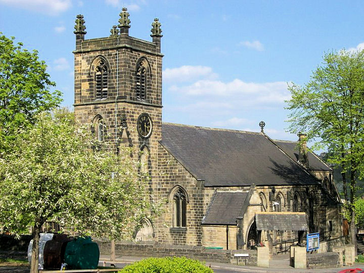
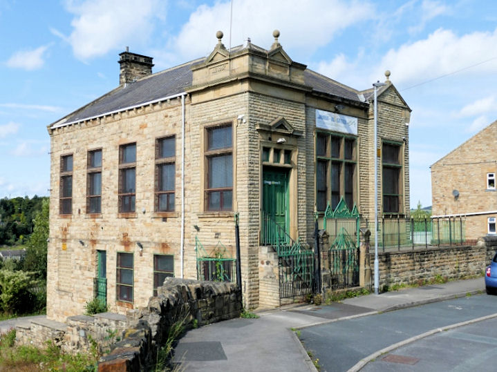
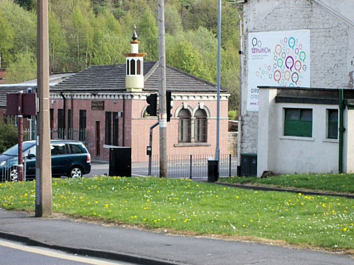
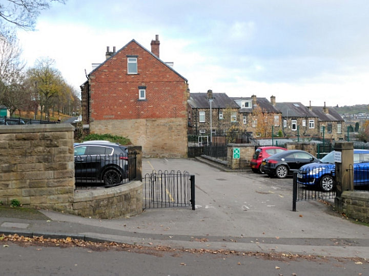
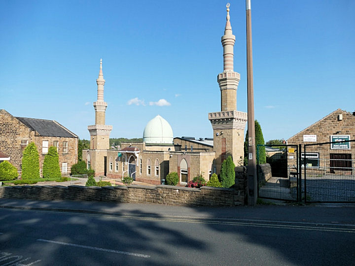
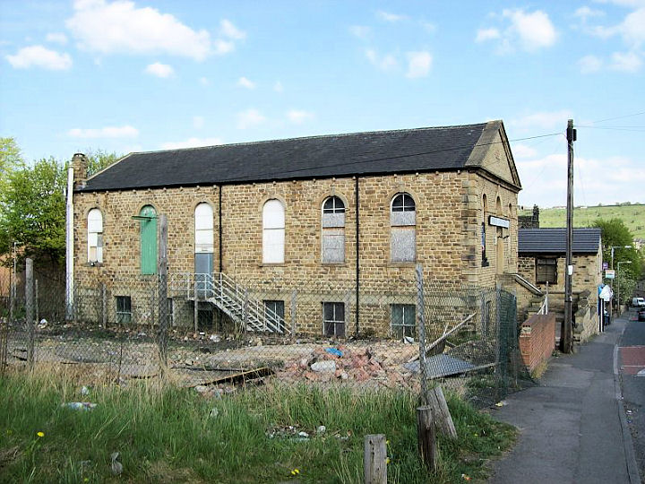
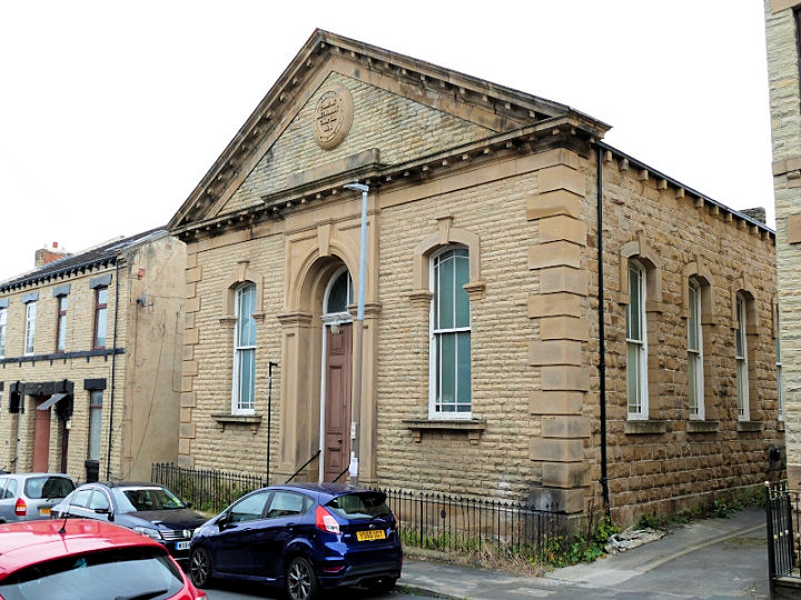
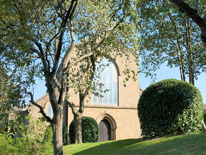
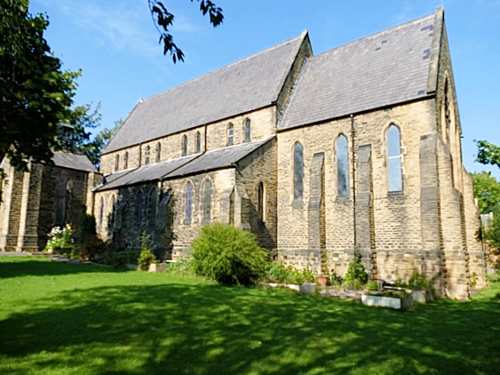
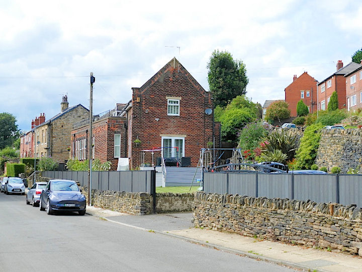
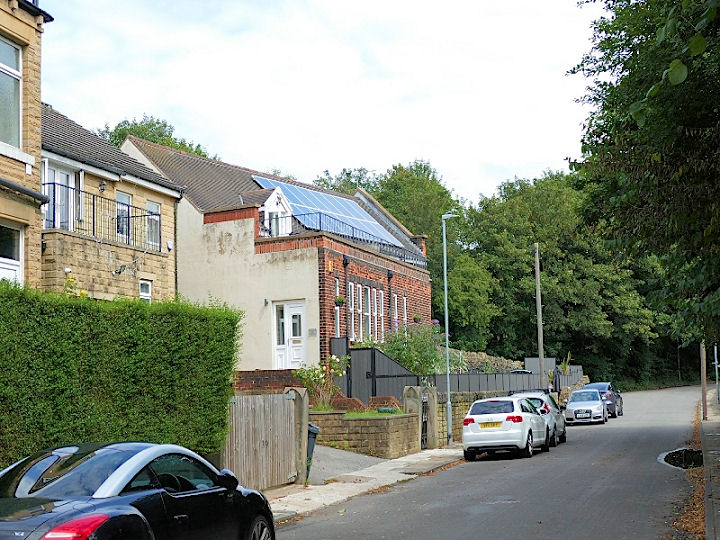
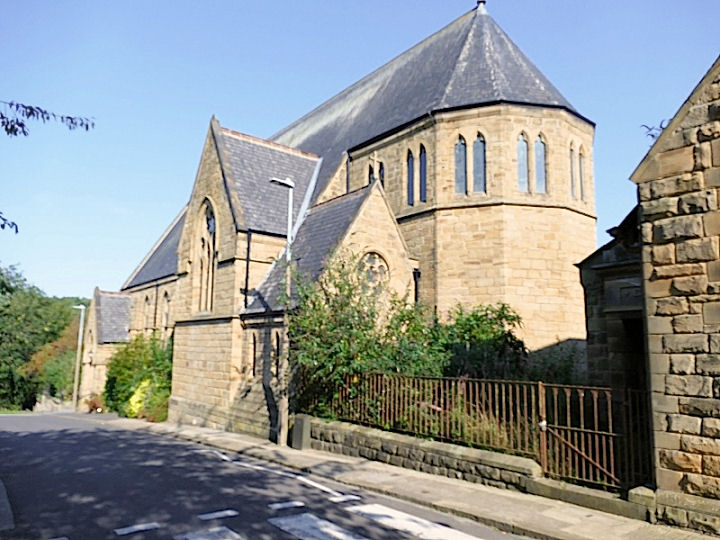
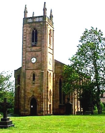
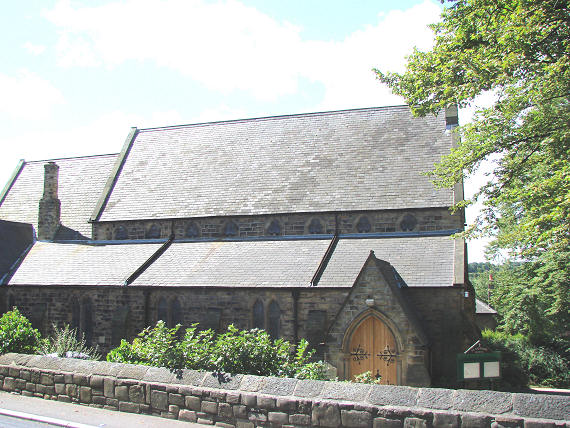
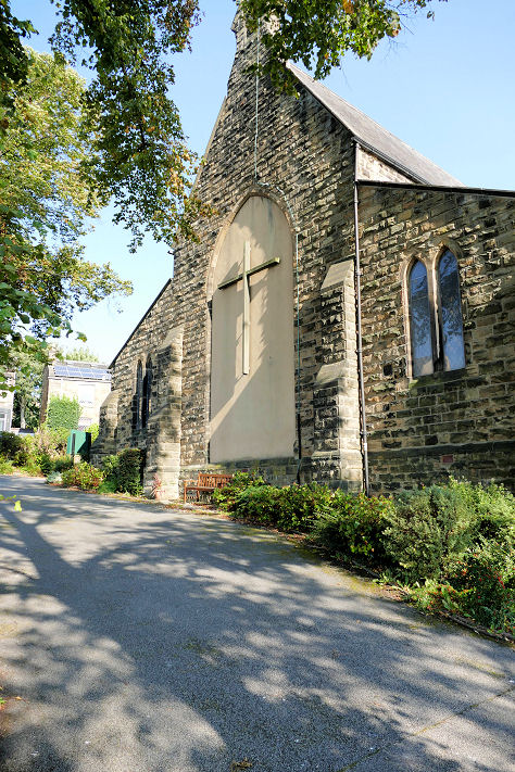
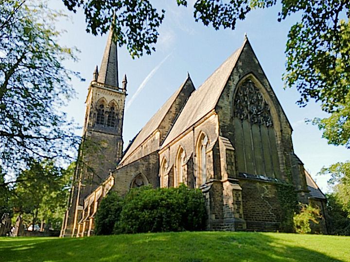
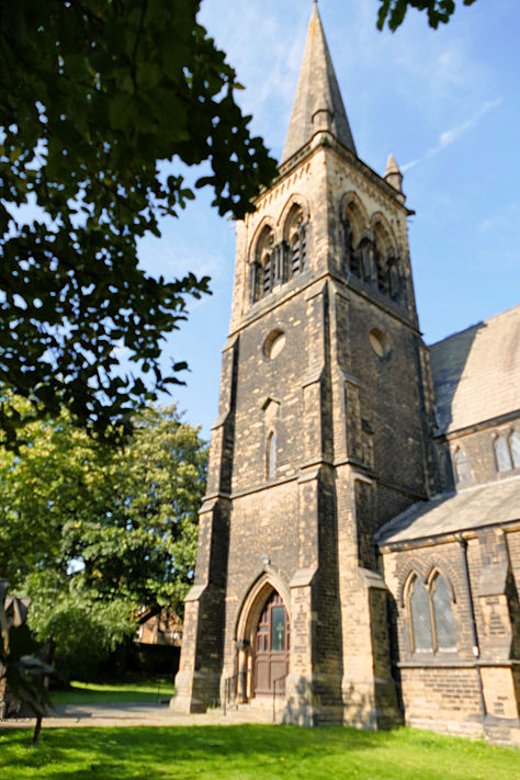
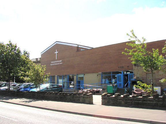
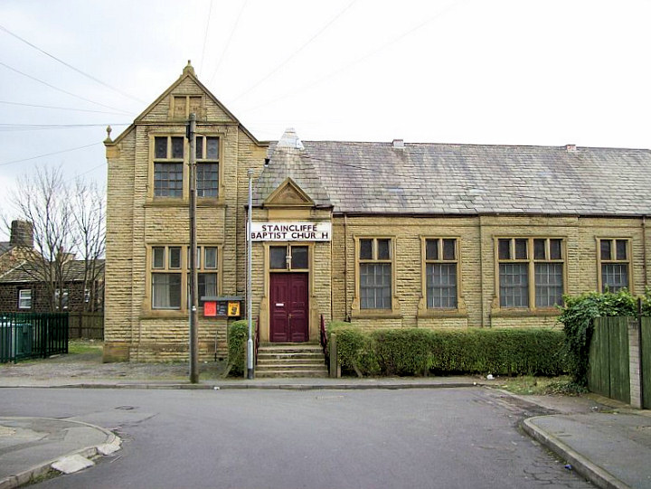
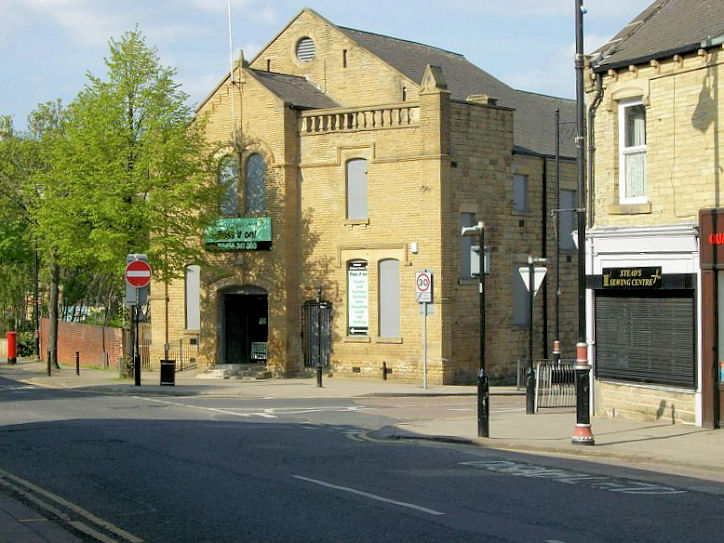
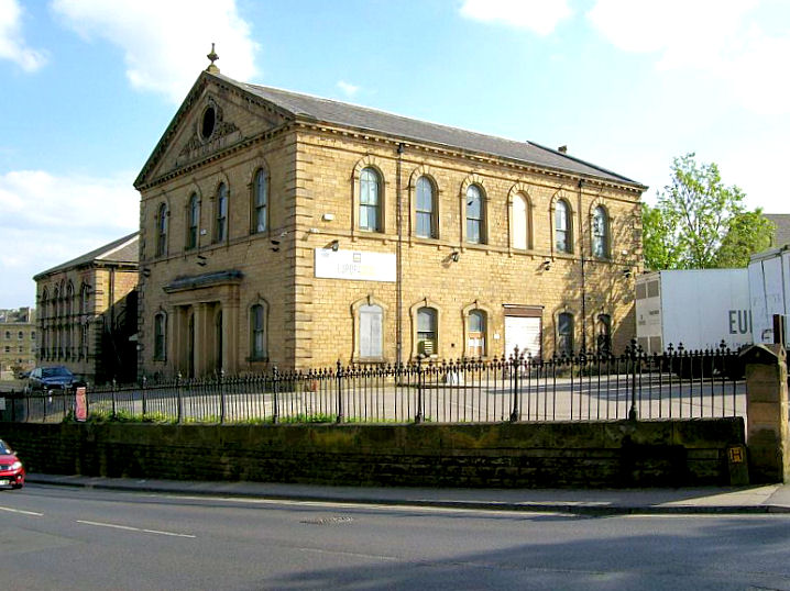
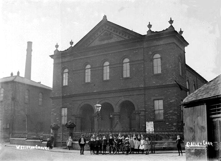
All Saints on Stocks Lane. SE 2413 2445. © Stan Walker. Another view, two of the interior - 1, 2, the chancel, the rood loft stair, a fine tomb, and the dated font, all © David Regan (2021). Link. Grade I listed. Batley Christian Fellowship - Assemblies of God (seen on a 2018 Streetview) stands on Wellington Street, at SE 2410 2407. It's almost on the site of a Primitive Methodist Chapel, whose My Primitive Methodists entry (which includes a photo) dates to 1855. The P.M. Chapel actually stood on the grassed area to the right of the present meeting hall. The former Broomhill Chapel (Methodist New Connection) on Taylor Street now serves as a Community Centre. SE 2451 2370. © David Regan (2020). Link has an old photo. Old maps between 1905 and 1938 mark a Catholic Apostolic Church on Howard Street, Batley Carr, at SE 2441 2312. There seems to be nothing on-line regarding this church. © David Regan (2020). Cemetery Chapels in Batley Cemetery. One is still in use, the other now serves as a community centre. Another view. SE 2363 2438. Both © David Regan (2011). Link. Central Methodist Church on Hick Lane was formerly Zion Chapel, and was colloquially known as The Shoddy Temple. See here for an explanation about shoddy; mill owners would strike deals on the steps of the church on Sundays. SE 2462 2404. © David Regan (2011). Two interior views - 1, 2, both © Gerard Charmley (2023). Link. Christ Church at Staincliffe. SE 2306 2361. © Bill Henderson. Another view, © David Regan (2023). Link. Grade II listed, wherein it's dated to 1867. The former Christian Brethren Chapel on Cambridge Street. The first map I have access to which shows it is from 1890. Subsequent maps just mark it as "Chap." until the 1922 edition, which labels it as "Meth. Chap.". By 1956 it was "Independent Methodist Church". The 1977 marks it as "Club", which it remains today. This source mentions it as Providence Street Chapel (built 1843, closed 1971), but the main entrance is definitely on Cambridge Street. Was the building radically re-modelled at some point, moving the original entrance to the other side of the building? Another view. SE 2421 2414. Both © David Regan (2020). A Congregational Church once stood on Hanover Street at SE 2431 2416. A photo is available on Wikipedia here, where it's dated to 1856. The site is now occupied by housing and car parking - seen here on a Streetview of 2012. Another Congregational Church stood on Grace Leather Lane, Lower Soothill at SE 2534 2413. An offshoot from the Hanover Street Church (see previous entry), it's dated here to 1874-5, with closure (as U.R.C.) in 1990. It has since been demolished - the housing built on its site was seen by Streetview in 2023. The site of Cross Bank Chapel (Wesleyan), at the junction of Blakeridge Lane and Cemetery Road. The building in the photo is the former Sunday School, the chapel stood where the parking area is now. A war memorial from the chapel survives (now located in the Central Methodist Church, for which see above) and a photo and details can be seen here. SE 2380 2450. © David Regan (2020). The surviving gate piers and gates are grade II listed. Ebenezer Methodist Church, on High Street, Hanging Heaton. SE 2551 2318. © Bill Henderson. Streetview saw it in 2020. The former Gospel Hall at the junction of Purlwell Lane and Banks Street, now in commercial use. Circa 240 236. © David Regan (2020). Holy Trinity, © David Regan (2011). Jamia-Al-Saeed on Bromley Street, Commonside, Hanging Heaton. This is a former Wesleyan Methodist Chapel. SE 2483 2308. © David Regan (2020). Jumma Masjid on Bradford Road, aka Batley Carr Mosque. © David Regan (2011). Link. Madressa-e-Zinatul Islam (as seen on a 2019 Streetview) which stands at the junction of Taylor Street and Talbot Street is a former Free United Methodist Chapel, so labelled on a map of 1890. SE 2444 2371. Link. The demolished Park Road Baptist Church was previously Christian Brethren. Baptist from 1885 (source), other details relating to its closure, and building date, are so far unknown to me. The site is now a car park. SE 2458 2442. © David Regan (2020). Mount Pleasant Islamic Trust on Purlwell Lane. A chapel previously stood on part of the site, for which see St. Andrew, below. SE 2410 2372. © David Regan (2020). Link. Former Primitive Methodist Chapel. © David Regan (2011). The former Primitive Methodist Chapel on Talbot Street. SE 2452 2386. © David Regan (2020). St. Andrew (1909-10) on Denison Street at SE 2416 2366. The church website history page says it was preceded by a Mission Room (1880), and a tin tabernacle (1901, previously in Morley), but doesn't give their location. However, the 1907 25" O.S. map marks a Chapel close to the site of the later church, on Purlwell Lane (SE 2408 2373), so perhaps this was it. The site now stands within the grounds of the Mosque of Mount Pleasant Islamic Trust, for which see above. The chapel stood roughly in line with the low wall, going back over the grassed area, and including the front part of the present mosque. The rear part of the mosque site is where a Sunday School once stood. © David Regan (2020). Link. St. John the Evangelist at Carlinghow. A 2019 Streetview shows the hefty porch - was a tower intended? SE 2338 2497. © David Regan (2020). Link. Grade II listed. The former St. Luke's Mission Church, which stands on Oaks Road at SE 2546 2397. Its National Archives entry references documents for 1909-2001, although it was certainly built before this as it's shown on a map of 1905. It's not present on a map of 1894. Another view. Both © David Regan (2023) . St. Mary of the Angels (R.C.) on Upton Street, Carlinghow. Its grade II listing dates it to 1870. SE 2372 2458. © David Regan (2020). Link. St. Paul, at Hanging Heaton. © Bill Henderson. History (well worth a look for some entertaining tales). Two photos of 1916 showing the shell of the church following a fire - link1, link2. St. Saviour (1870-1) at Brown Hills. SE 2276 2585. © Bill Henderson. Another view, showing the blocked arch, intended to connect to a tower, which was never built. © David Regan (2020).Link. Grade II listed. St. Thomas the Apostle (1867-8) at Upper Batley. Another view. SE 2474 2460. Both © David Regan (2020). Link. Grade II listed. Salvation Army Church and Community Centre. © Bill Henderson. Staincliffe Baptist Church. © David Reagan (2012). Link. Former Salvation Army Citadel. © David Reagan (2011). Former Wesleyan Methodist Chapel on Hick Lane, now in industrial use. © David Reagan (2011). Wesleyan Methodist Chapel at Batley Carr. David suspects that this is the demolished Mackenzie Memorial Methodist Church - can you confirm? From an old postcard in David Regan's Collection. Howard Richter has confirmed that this is the Mackenzie Memorial Methodist Church, which stood on Town Street, and has provided the following dates - built 1872, vacated in 1943, and demolished in 1951. A Streetview of 2009 vintage shows a low wall (left hand side of the road, to the right of the "humps" road sign) which may be the wall in the old postcard. By 2018, Streetview shows that housing and grass had covered the site of the church, and the old wall has evidently been built up or completely re-built. This link provides a useful summary of the various buildings used by the church on this site.
|
||
22 August 2023
© Steve Bulman