The Churches of Britain and Ireland
|
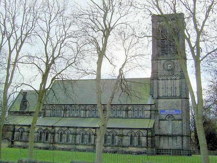
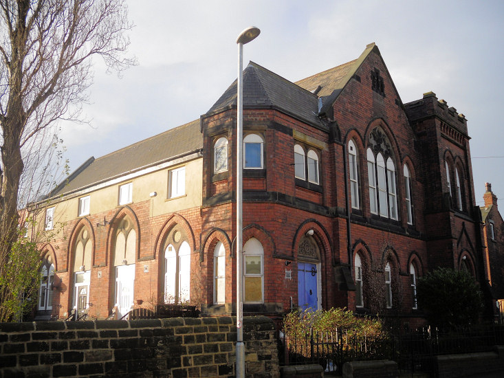
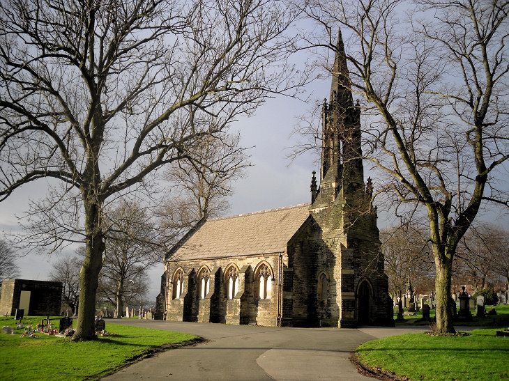
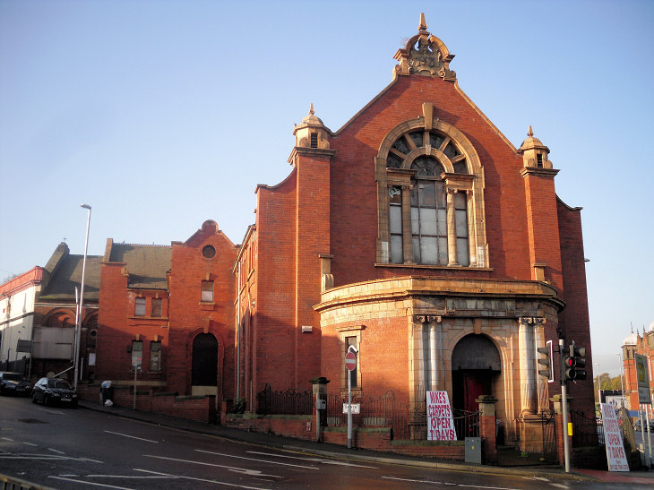
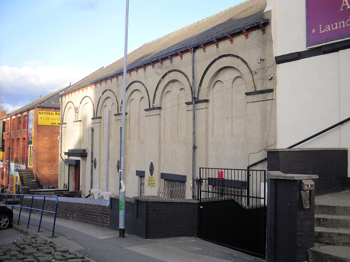
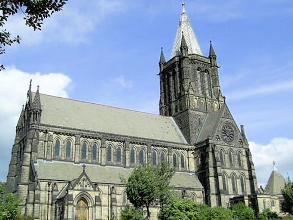
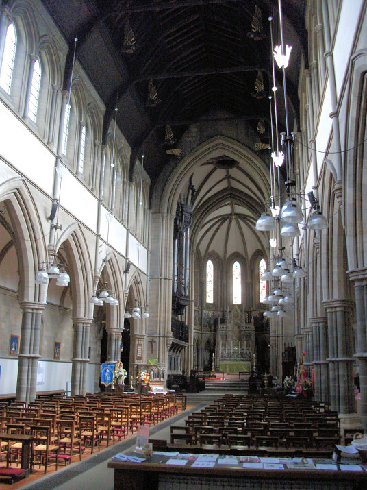
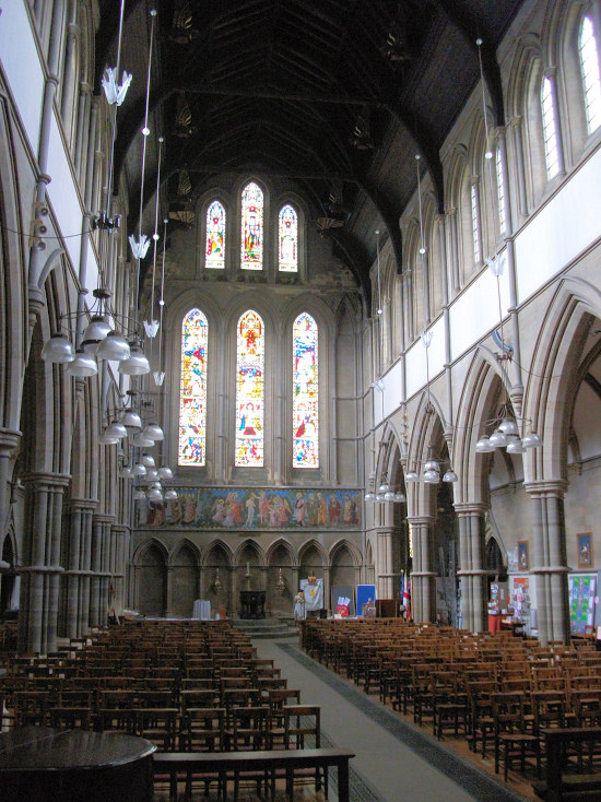
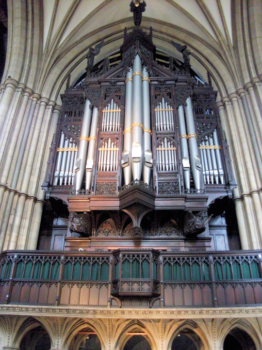
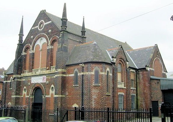
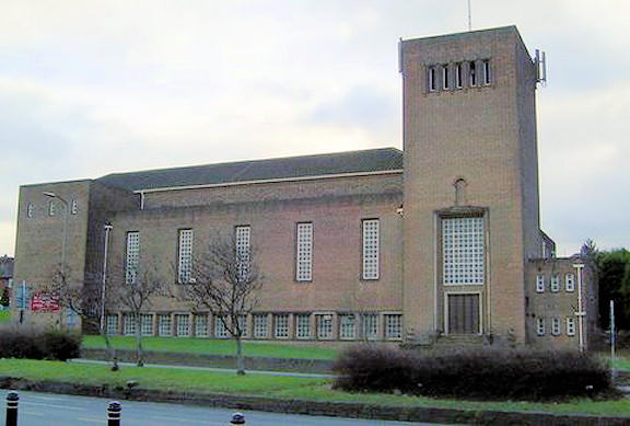
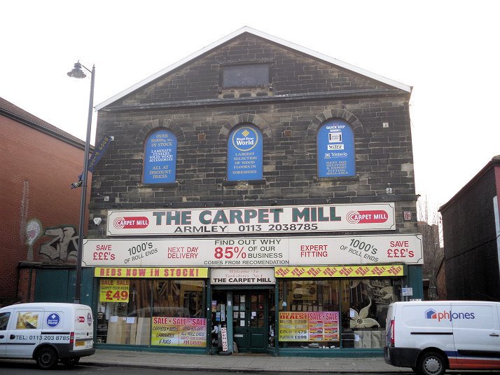
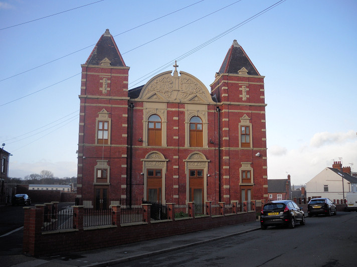
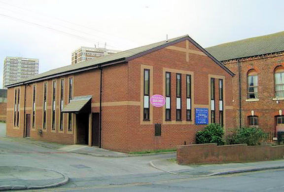
Armley, Leeds, West Yorkshire Bethel Free Church on Fourteenth Avenue, as seen by Streetview in 2022. SE 2798 3297. Link. Christ Church on Armley Ridge Road. Another view. SE 2657 3373. Both © Michael Bourne. Link. Grade II listed, wherein it's dated to 1869-72. The churchyard walls, railings, etc., have their own grade II listing. The former Congregational Church (later U.R.C.) on Hall Lane and Mitford Road, converted to residential use. It was still in use as a church at least as late as 1957. Older maps label it as Methodist New Connexion. SE 2782 3332. © Gerard Charmley (2011). The site of the vanished Congregational Church on Oak Road, as seen by Streetview in 2022. An old photo can be seen here where it shows bomb damage from a raid in 1941. The damage may have been enough to result in its demolition, as the church isn't shown on a map of 1953. SE 2823 3331. Holy Family (R.C.) on Green Lane as seen by Streetview in 2022. SE 2810 3290. Link. Holy Trinity used to stand on Canal Street, between the side roads of Ingleby Street and Stapleton Street (both now gone), at SE 2832 3341. Map evidence shows that it was a late Victorian church, and survived at least until the late 1950's. In this 2022 Streetview, it would have stood to the right of the path. Jamia Masjid Ghousia on Brooklyn Terrace and Brentwood Terrace, as seen by Streetview in 2022. SE 2737 3335. Link. The Mortuary Chapel in the cemetery on Green Hill Road. SE 2553 3403. © Gerard Charmley (2011). New Wortley Cemetery on Hall Lane used to have two Mortuary Chapels, Church of England at SE 2784 3321, and Nonconformist at SE 2790 3319. Neither have survived. The sites of both are just beyond the paved area, looking west to the CoE chapel site (2019 Streetview), and east to the Nonconformist site (2019 Streetview). New Whingate Methodist Church (2022 Streetview) on Whingate. SE 2646 3325. Link, which dates it to 1988. The former Primitive Methodist Chapel (1905) on Branch Road and the A647, now in commercial use as a carpet shop. SE 2727 3361. © Gerard Charmley (2011). Another former Primitive Methodist Chapel stands adjacent, on Branch Road and Beech Drive. A 2022 Streetview shows that its condition is deteriorating. SE 2725 3360. © Gerard Charmley (2013). St. Bartholomew on Wesley Road and Church Road. Its grade II* listing dates it to 1872-7. SE 2730 3321. © Michael Bourne. Two interior views - 1, 2, and the famous organ (link), all © Tim Hollinghurst (2012). Link1. Link2. The boundary wall and lych-gate also share a grade II listing. Its predecessor, also St. Bartholomew (1630), stood in the same churchyard, and was still standing in 1906, but had been demolished before 1950. There's a photo of it here, where it says it was demolished in 1909. SE 2730 3327. The former St. Hugh's Mission Church on Armley Lodge Road. SE 2727 3395. © Gerard Charmley (2011). St. Mary used to stand on a plot of land bounded by Lodge Road, Hugh Street and Tong Road. It pre-dates a map of 1894, and was still active in the 1950's. St. Mary's Close covers the site (2022 Streetview). SE 2793 3284. The former Southfield Primitive Methodist Chapel on Wesley Road. SE 2724 3312. © Michael Bourne. Link, which dates it to 1875. Sri Guru Nanak Sikh Temple on Tong Road, as seen by Streetview in 2022. It has a date-stone announcing United Methodist Free Church 1877. SE 2785 3295. Facebook. The Venerable Bede on Stanningley Road and Cockshott Lane, Wyther. SE 2553 3423. © Michael Bourne. A 2021 news item discusses its proposed closure. The former United Methodist Free Church (now in commercial use) on Town Street. SE 2695 3342. © Gerard Charmley (2011). Its replacement, which stands on Colton Street and Hall Road, was built in 1900. SE 2707 3333. © Gerard Charmley (2011). Wesley Road Chapel (Baptist, Methodist and U.R.C.). SE 2719 3347. © Michael Bourne. West Leeds Christadelphian Hall on Town Street, as seen by Streetview in 2022. SE 2662 3352. Link.
|
||
28 September 2024
© Steve Bulman
Contact Details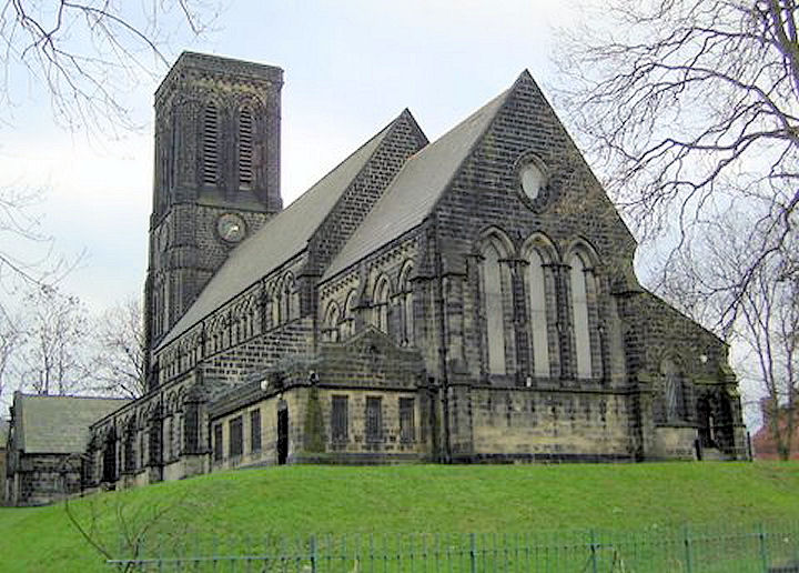