The Churches of Britain and Ireland
| Arbroath,
Angus
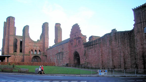
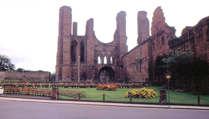
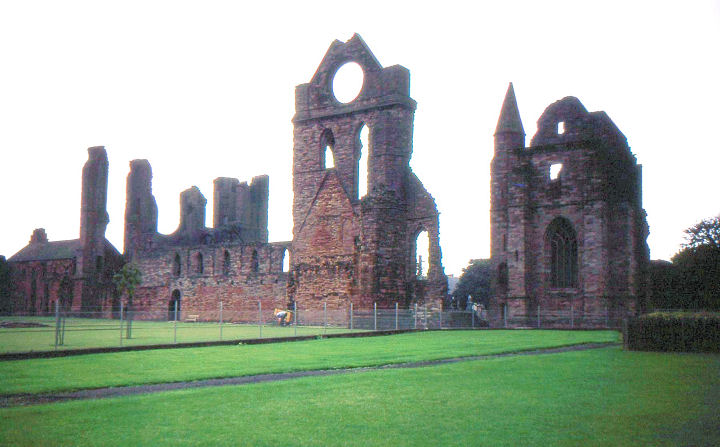
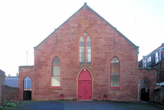
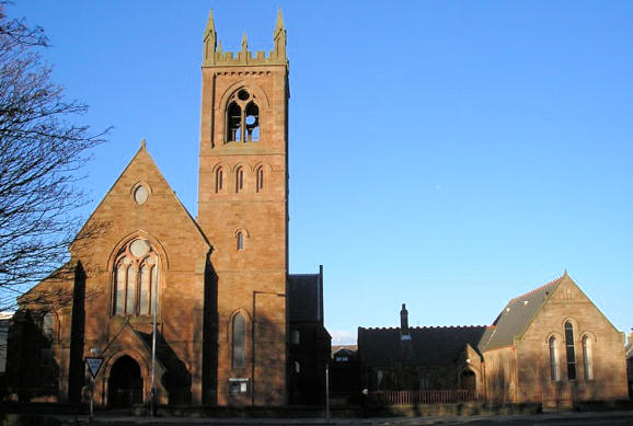
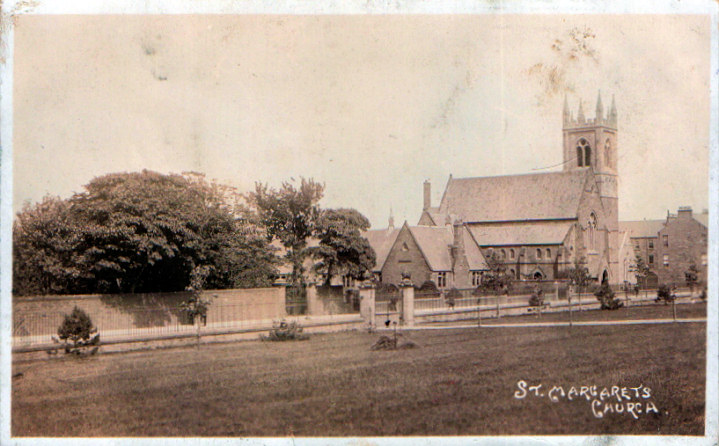
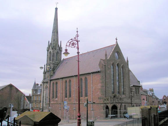
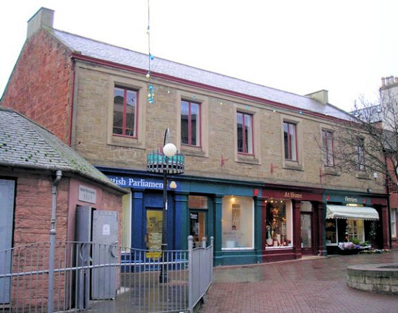
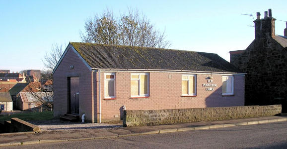
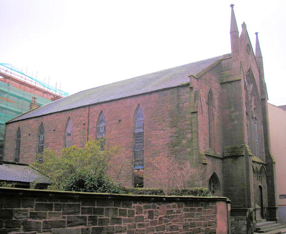
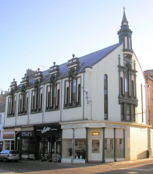
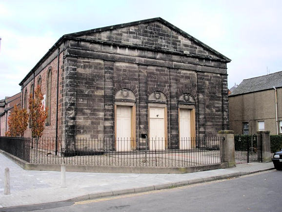
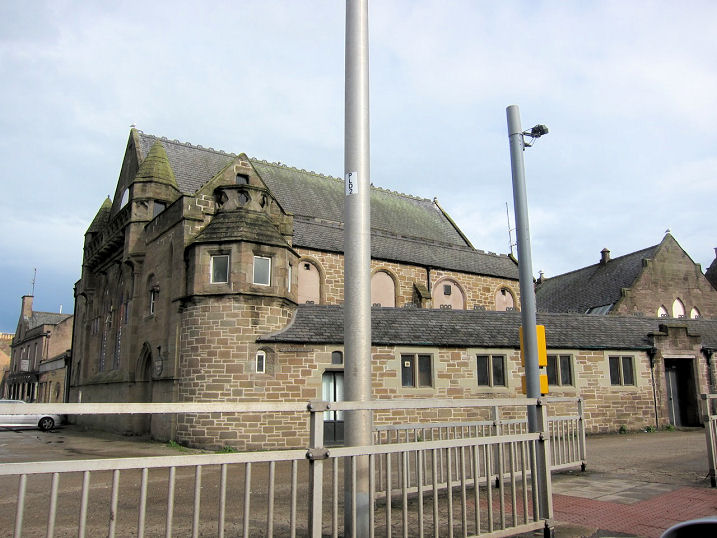
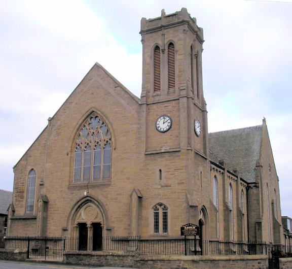
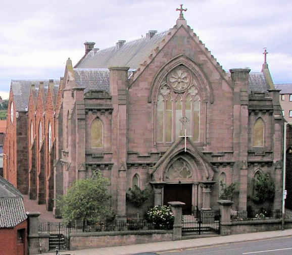
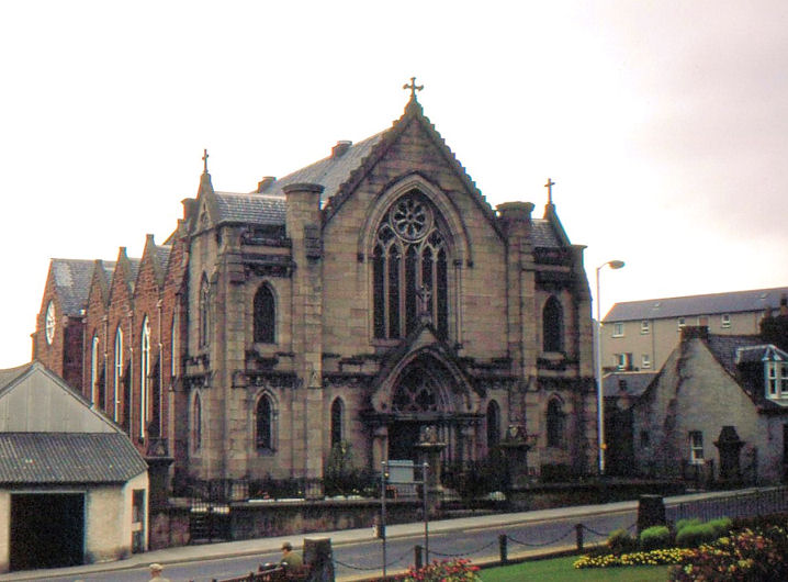
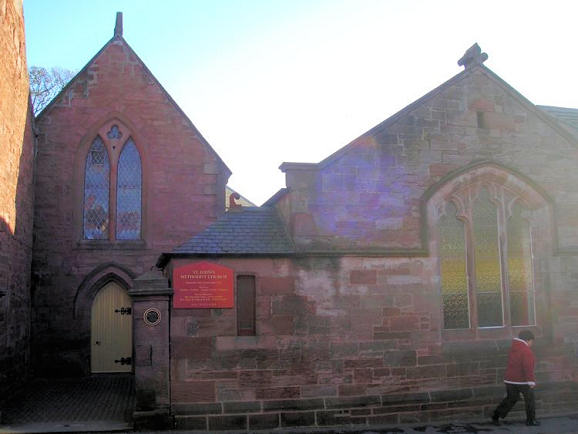
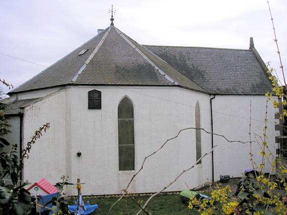
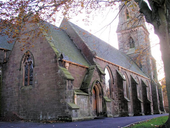
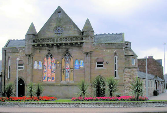
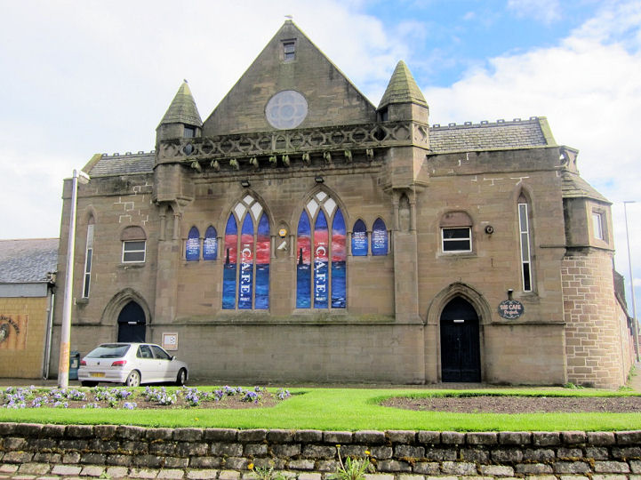
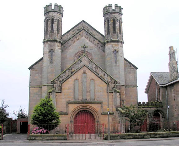
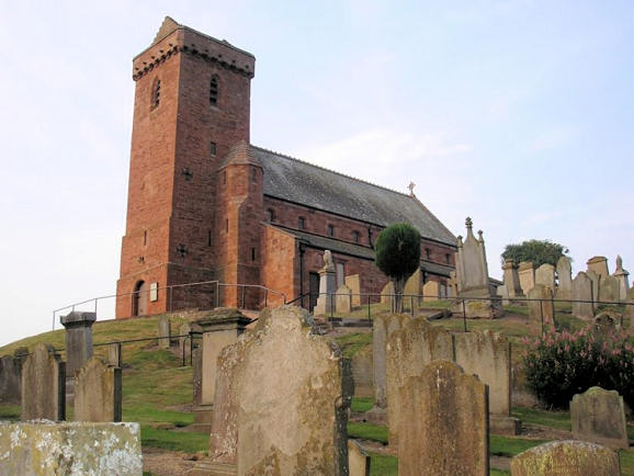
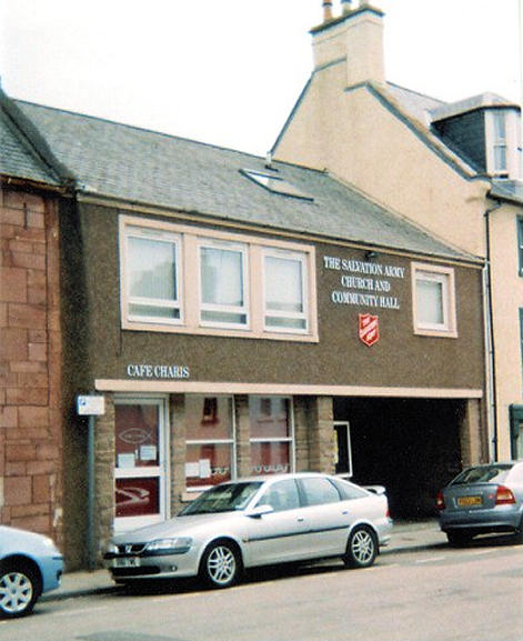
Arbroath Spiritualist Centre (2023 Streetview), on Commerce Street. NO 6428 4084. Link. Arbroath Town Mission Centre on Guthrie Port, as seen by Streetview in 2023. NO 6403 4142. Facebook. Arbroath United Free Church, off High Street. This source says that the first church on this site was St. Mary's Episcopal Church of circa 1806, sold to a Free Church congregation in the 1850's, and demolished at some point. High Street Free Church (the present building) was built on the site around 1900, and became St. Ninian's United Free Church in 1924. NO 6446 4076. © Derek Robertson. Arbroath West Kirk. NO 6359 4103. © Derek Robertson. This next view was previously in the Unknown section. Although Brian Curtis's postcard is labelled as St. Margaret, the location was unknown, until solved by Greg Mishevski and Janet Gimber. On Keptie Street, it opened in 1879 as St. Margaret's Chapel of Ease. In 1990 it merged with Ladyloan St. Columba and took its current name of Arbroath West Kirk. This photo can be usefully compared with the postcard. Both Greg and Janet have supplied a number of links as follows - link. Category B listed. The former Arbroath Parish Church (CoS) on Kirk Square. Canmore says that its predecessor of 1580-90 burnt down in 1892. NO 6440 4103. © Derek Robertson. The former Baptist Church (first floor) on Market Place. NO 6430 4092. © Derek Robertson. An otherwise unidentified Chap. shows on the 25" map of 1903 on John Street at NO 6448 4075. No longer indicated as a place of worship on a map of 1961, it was possibly the Salvation Army hall mentioned here. The building on the site today appears old enough to have survived from the time of the maps - 2023 Streetview. A Congregational Church is shown on a map of 1903, at the junction of Queen Street and Duke Street. Its closure and demolition are given here as 1959 and 1986 respectively. The housing built on the site was seen by Streetview in 2018. NO 6369 4076. Elim Pentecostal Church on Ogilvie Place. It's dated here to circa 1945, and says it's no longer in use as a church. I'm not sure about this, as the church has a current Facebook page. NO 6385 4155. © Derek Robertson. The former Erskine Church on Commerce Street. This source dates it to 1851, and it ceased being used as a church in the 1950's. NO 6433 4084. © Derek Robertson. Category C listed. The former Evangelical Union Church on Keptie Street and Dishlandtown Street. NO 6390 4087. © Derek Robertson. Category B listed. Older maps show a place of worship on Lady Loan at NO 6402 4055. Unidentified on available maps, its given here as First Ladyloan Parish Church, and dated to 1838-1965 when it was demolished for a road programme. I haven't been able to find a photo of it, but its site (under the grass and adjacent road) was seen by Streetview in 2023. Inverbrothock Church (CoS) on James Street and Burnside Drive. NO 6411 4124. © Derek Robertson. By 2015 (Streetview) the church had become Life Church. Link. Canmore. Category B listed, wherein it's dated to 1828. Kingdom Hall of Jehovah's Witnesses. Part of the former St. Ninian (the long low building nearest to the camera) has been taken over by the Witnesses. NO 6420 4081. © Martin Richter (2013). Knox's Church (CoS) on Cairnie Street and Howard Street is dated here to 1866. NO 6376 4139. © Derek Robertson. Category B listed. The Western Cemetery on Cairnie Road has a Mortuary Chapel at NO 6249 4177. It wasn't well seen by Streetview in 2018, but a good photo can be seen here, where there is more on this fine building. Old and Abbey Church. NO 6435 4122. © Derek Robertson. Link. According to its category B listing, it's of 1876-8, incorporating much of its 1797 predecessor. Redeemed Christian Church of God meets in a karate club (2021 Streetview) off Burneside Drive. NO 6420 4076. Link. St. Andrew (CoS) on Hamilton Green. NO 6419 4135. © Derek Robertson. Another view, © Alex Parker. Link. Another church building is called Community Spirit, on the A92. NO 6432 4153. 2016 Streetview. Link. St. John (Methodist, originally Wesleyan) on Ponderlaw Street. Its category B listing says it was opened by John Wesley in 1772. Another view, showing the unusual hexagonal shape. NO 6452 4107. © Derek Robertson. Link. St. Mary (Episcopal) on Springfield Terrace. NO 6470 4120. © Derek Robertson. Link. Category B listed - dates it to 1852-4. The former St. Ninian (1875-1959) on Burnside Drive was built to serve the congregations of two United Free Churches. NO 6420 4082. © Derek Robertson. After the church became redundant it was in commercial use as a nightclub, and has subsequently been used as a community youth venue, called Cafe Project, as can be seen here. © Martin Richter (2013). Link. See also Kingdom Hall, above. St. Thomas of Canterbury (R.C.) on Dishlandtown Street. This source dates it to 1847. NO 6380 4063. © Derek Robertson. Link. St. Vigean (CoS) Its category A listing dates it to a restoration in 1871 of a medieval church. Numerous "Pictish" carved stones from the site are now kept in a museum. NO 6384 4290. © Derek Robertson. Link1. Link2. Link3. The churchyard walls are also listed as category B. Salvation Army Hall on Marketgate. NO 6426 4078. © Rob Brettle. Link. Springfield Gospel Hall (2023 Streetview) is on Ponderlaw Street and Ponderlaw Lane. NO 6465 4115. Link. A United Free Church is shown on a map of 1903 on Mount Zion Brae, at NO 6383 4068. It survived in active use into the mid-20th century at least. The house on the site was seen by Streetview in 2008. Iy has the same footprint as the church, so does anything of the church survive? Another United Free Church shows on the 1903 map at the junction of Queen Street and Princess Street, at NO 6367 4071. Housing was built on the site (2023 Streetview). Yet another U.F. Church shows on the same map at the junction of Park Street and Gravesend, at NO 6418 4102. The whole area has been redeveloped, and the site of the church now lies under this building (2021 Streetview). Another church shown on the 1903 map is a United Original Secession Church at the junction of Maule and Hume Streets. It still shows as active on a map of 1957, but was demolished at some point. Its site now lies beneath Burneside Drive (2018 Streetview). NO 6409 4121.
|
||
07 January 2024
© Steve Bulman