The Churches of Britain and Ireland
| Andover, Hampshire
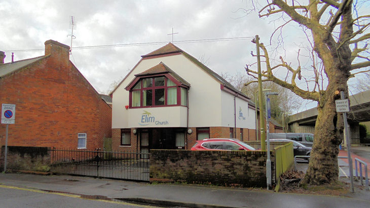
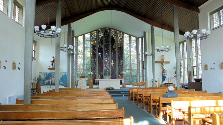
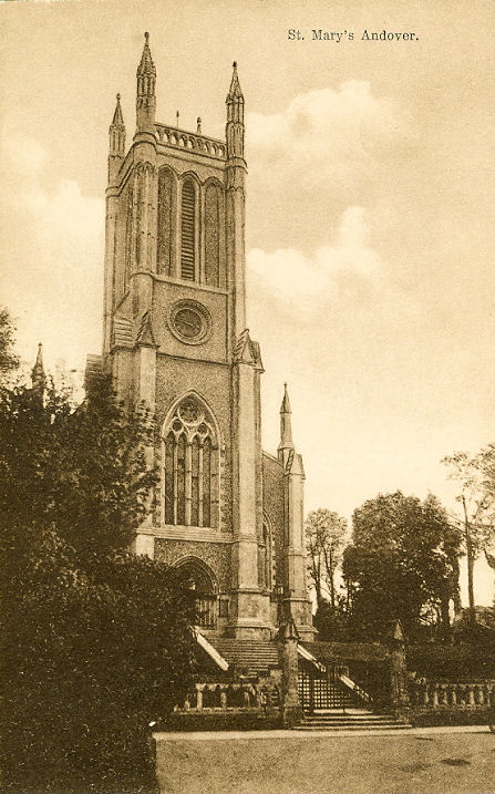
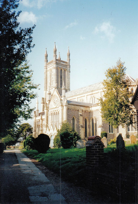
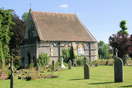
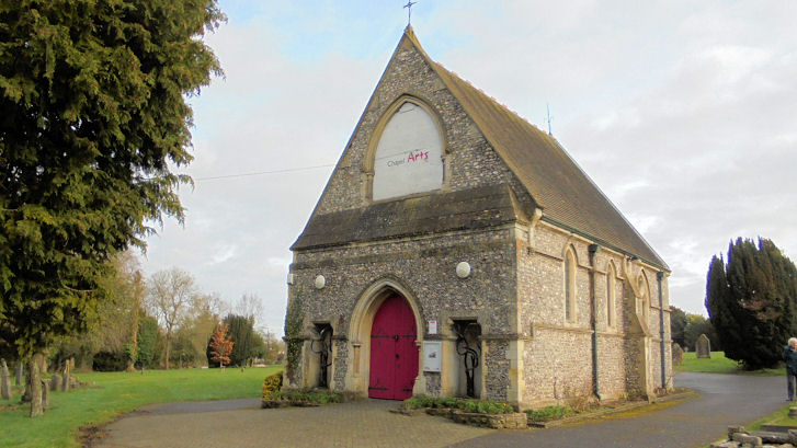
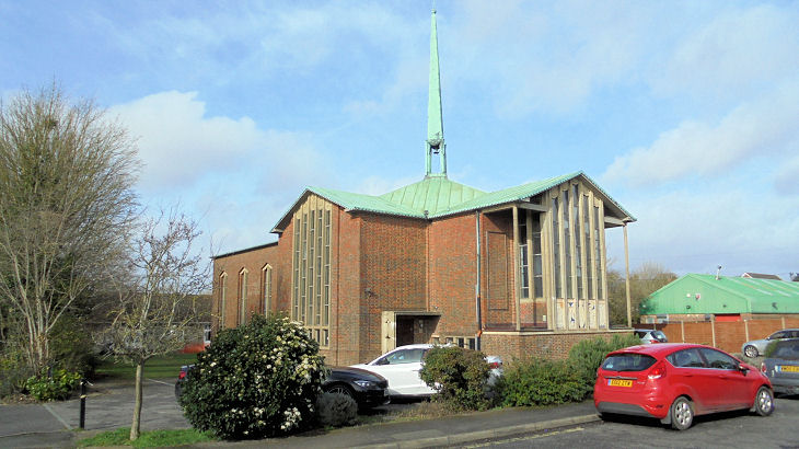
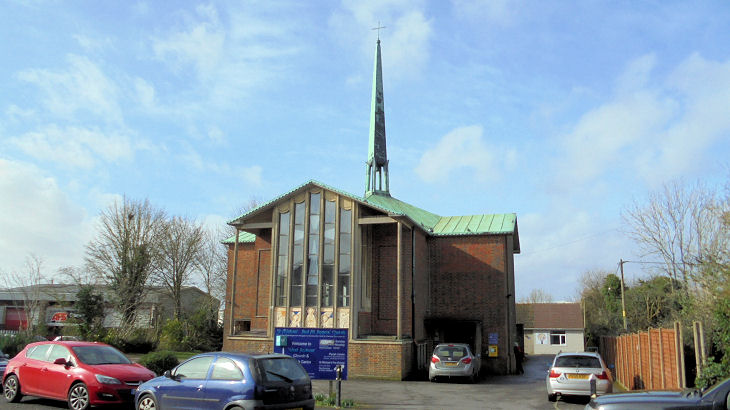
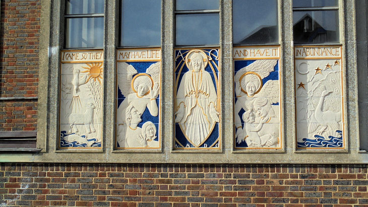
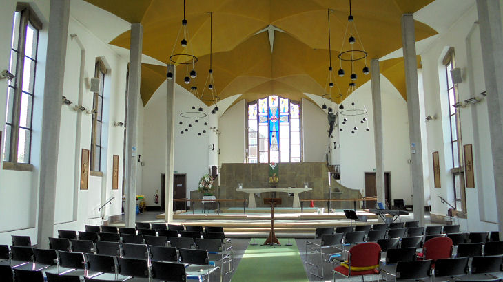
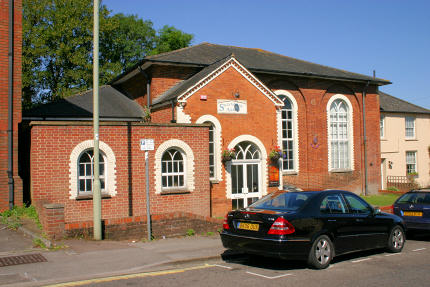
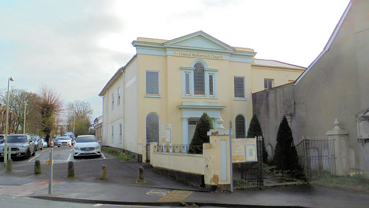
Andover Community Church (2009 Streetview, when it was called Baptist) on Charlton Road and Heather Drive. SU 3596 4604. Link. Andover PIWC (Church of Pentecost) meets in Picket Piece Social Club (2021 Streetview) on Walworth Road. Link. Andover Spiritualist Fellowship (SNU) meets in the The Wellington Centre (2021 Streetview) on Winchester Road. Link. Elim Church on South Street. SU 3642 4518. © Chris Kippin (2020). Link. Father's Heart Church meets somewhere on Byng Walk, but it hasn't been seen by Streetview. Link. Koinonia Evangelical Church meets in Endeavour Primary School (2018 Streetview) on Dairy Road. SU 377 472. Link. Methodist Church on Bridge Street. It pre-dates a map of 1910, where it's labelled as Wesleyan. SU 3637 4539. © Andrew Ross. Link. A place of worship shows only on a 1" map of 1956 on the east side of High Street, just above the old Town Hall, at SU 3650 4556. It will have been in or behind one of the buildings seen in a Streetview from 2018. Another unidentified place of worship also shows only on the same map at the 90 degree bend of Eastfield Road. All of the housing looks to be of the same age, so perhaps the church met in one of them. They can be seen in a Streetview from 2009. SU 3661 4555. Can you advise what these were? St. Andrew (Methodist) on Weyhill Road. SU 3464 4560. © Chris Kippin (2020). Link. St. John the Baptist (R.C.) on Alexandra Road. Interior view. SU 3584 4563. Both © Chris Kippin (2020). Link. St. Mary, of ancient foundation, the Parish Church. SU 3653 4579. © Andrew Ross. An old postcard view, from Reg Dosell's Collection. Another view, © Chris Kippin. Link. Grade II listed. For other associated listed features, see here. This may be a chapel in the grounds. Janet Gimber has advised that it shows on an 1874 map as a Dissenters' Chapel, and on later maps as "Mortuary Chapel (Nonconformist)", and has also supplied this link, which mentions that it had been disused for at least 50 years. The articles mention it as having been "St. Mary's Chapel", though given its history, this may be fanciful. Judy Flynn advises that Pevsner's Hampshire, of the 1967 vintage, says that it was the Industrial School for Girls, founded in 1849, and that at the date of publication it was the Church Institute. SU 3651 4593. © Andrew Ross. Another view, © Chris Kippin (2020), who advises that that at the time of his visit, it was in use as Andover Arts Centre. St Michael & All Angels on Colebrook Way, West Andover. Another view, a lovely frieze, and an interior view. SU 3489 4545. All © Chris Kippin (2020). Link. According to the "Welcome" page of the church website (not working when tested in 2023), the church was dedicated in 1964, and was built around a pre-existing mission hall. St. Paul's Church Centre (2018 Streetview) on Smannell Road. SU 3678 4711. Link. St. Thomas on Hatherden Road and Enham Lane, Charlton, as seen by Streetview in 2021. SU 3508 4703. Link, where it's described as Edwardian. Salvation Army on Winchester Street. SU 3650 4527. © Andrew Ross. The older building at the right (better seen here in a 2009 Streetview) is a former Wesleyan Methodist Chapel, shown on a map of 1871. Silver Birch Gospel Chapel (2009 Stretview) on Ferndale Road. SU 3517 4616. Link. The Lord's Pentecostal Church meets in The Phoenix Centre (2009 Streetview) on Pilgrims way. SU 3719 4664. Link. U.R.C. on East Street. SU 3666 4565. © Chris Kippin (2020). Grade II listed, as are the associated piers and railings.
|
||
16 July 2025
© Steve Bulman