The Churches of Britain and Ireland
| Aldershot, Hampshire
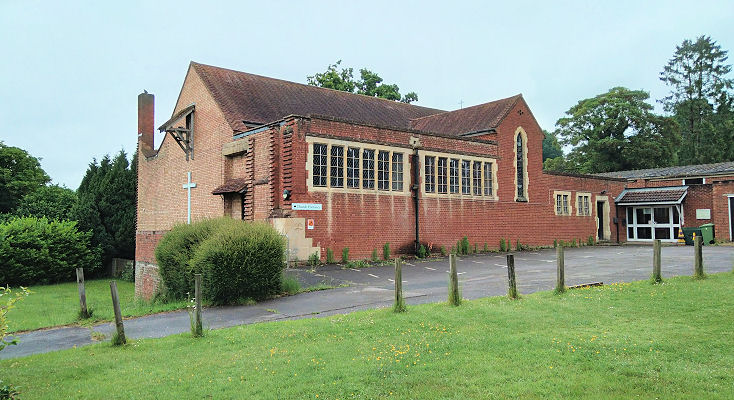
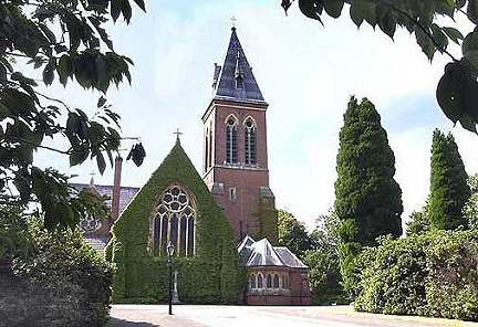
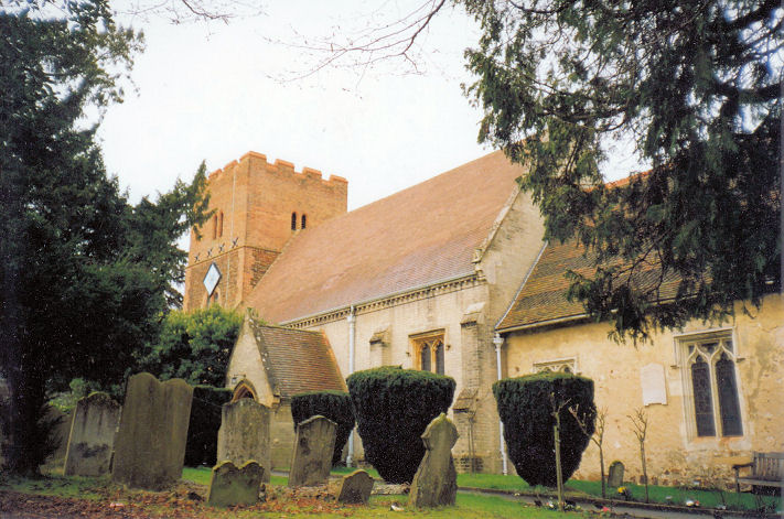
Aldershot Community Church (New Testament Church of God) on Victoria Road was seen by Streetview in 2023. A map of 1897 labels it as Presb. Church. SU 8657 5060. Link. The Baptist Church on Upper Elms Road and Vine Street, as seen by Streetview in 2022. I suspect that this may not always have been Baptist. A building with the same footprint existed by 1897, however it is unlabelled. It is labelled as a place of worship on a map of 1958, but not in 1959. There are also inscribed foundation stones facing Vine Street, typical of Methodist Chapels. SU 8614 5042. Link. Cathedral Church of St. Michael and St. George (R.C.) on Queen's Avenue. It was seen by Streetview in 2023. SU 8664 5193. A church is marked on the 1" O.S. map of 1958, on Victoria Road at SU 8646 5065. Not so marked on any available earlier or later maps, I haven't been able to discover what it was, but perhaps it's the Baptist Church mentioned on Genuki here. It survives (re-fronted), and was seen by Streetview in 2023. Another mystery church, also show only on the 1958 map is one on Victoria Road and Albert Road at SU 8685 5057. Demolished, its site was seen by Streetview in 2023. Church of Jesus Christ of Latter-day Saints (2023 Streetview) on St. George's Road. SU 8646 5010. Link. Church of The Ascension on Ayling Hill. SU 8580 5007. © Chris Kippin (2022). Link. Park Church (2023 Streetview) on Church Lane East. SU 8712 4982. Their previous church (2023 Streetview), now used as a church hall, is on Lower Farnham Road at SU 8701 4928. Link. O.S. maps show Garrison Church on Evelyn Woods Road at SU 8754 5289. It pre-dates a map of 1898. The area is seemingly off limits to Streetview, but aerial views suggest it has been demolished. Nearby in the same area (west of Alanbrooke Road) at SU 8768 5297 is an unidentified place of worship, shown on a map of 1958. It also seems to have been demolished, replaced by a larger building. A Hall is shown on the 25" map of 1897 at the corner of Alexandra Street and a short un-named street (neither of which still exist) at SU 8786 5095. It, or the building which replaced it, is shown as a place of worship on the 1958 1" map. It stood behind the block of flats seen here in a Streetview from 2022. Holy Trinity Church (2022 Streetview) stands on Albert Road and Alice Road. Nepali Christian Church (link) also meets here. SU 8669 5055. Link. Grade II listed, wherein it's dated to 1875-8. Hope Church Aldershot meets in Wellington Community Primary School on Alexandra Road. Link. A former Methodist Church (2023 Streetview) stands on Grosvenor Road and Queen's Road at SU 8612 5067. Older maps label it as Wesleyan. The adjacent building on Queen's Road, marked as Hall on old large-scale maps, presumably belonged to the church. Both buildings are now in secular use. Grade II* listed. The 25" 1897 O.S. map shows a Mission Room on Sandford Road and Alexandra Road at SU 8551 5048. The house on the site today was seen by Streetview in 2023. Possibly an error by the Ordnance Survey, the 1958 1" map shows a place of worship just a few yards to the south, at SU 8552 5044. If not an error, then it has been demolished, and a house built on its site too - seen by Streetview in 2023. The cemetery on Redan Road has a double Mortuary Chapel (Church of England and Nonconformist) at SU 8756 5084. A photo of it can be seen here. The 1958 O.S. map also marks another place of worship in the cemetery a short distance further north at SU 8756 5087. Aerial views suggest it hasn't survived. Another cemetery with a Mortuary Chapel is the Military Cemetery which stands between Gallwey Road and Ordnance Road. The chapel stands at SU 8737 5144 - a photo of it can be seen here. Pre-dating a map of 1958 is a place of worship on Redvers Buller Road at SU 8746 5329. It may have been a chapel for the adjacent surviving school. The building on the site today (2023 Streetview) appears to be more recent than mid-20th century, but there are no indications if it is still a chapel. The Royal Garrison Church of All Saints, commonly known as the Cathedral Church of the British Army. SU 8533 5104. © Frank Riddle at http://hampshirecam.co.uk. Link. Grade II listed, wherein it's dated to 1863. St. Andrew's Garrison Church (CoS, 2023 Streetview) on Queen's Avenue. Its grade II listing dates it to 1927. SU 8670 5201. Link - includes several photos. St. Augustine stands at the junction of North Lane and Holly Road. Seen by Streetview in 2022, the church website dates it to 1907. St. Joseph (R.C., 2022 Streetview) on Queen's Road and Edward Street. This source dates it to 1912-13. SU 8603 5064. Grade II listed. St. Mary (R.C.) on Belle Vue Road at SU 8763 5054, as seen by Streetview in 2023. St. Michael the Archangel on Church Lane. SU 8694 4990. © Chris Kippin. Link. Grade II listed.
|
||
21 December 2023
© Steve Bulman