The Churches of Britain and Ireland
| Accrington, Lancashire Churches at Church.
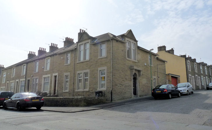
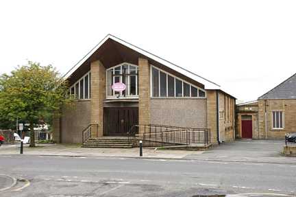
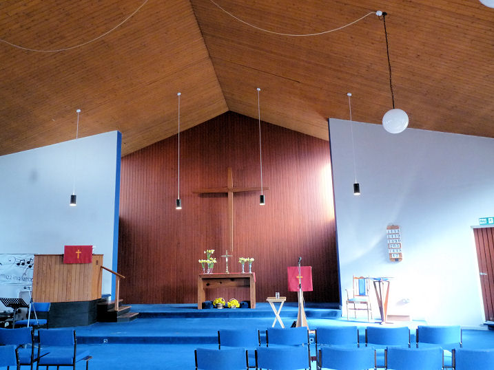
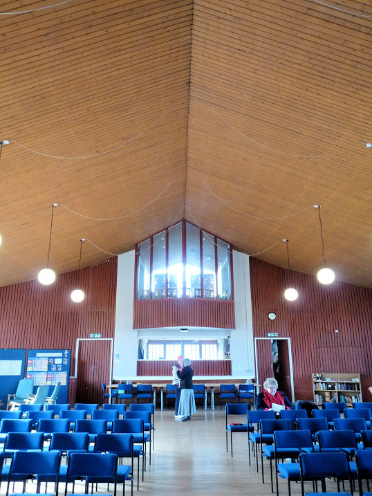
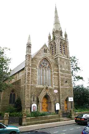
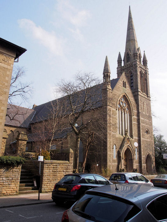
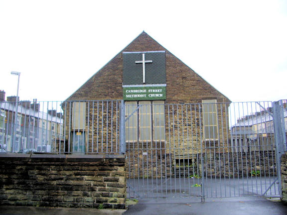
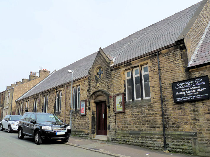
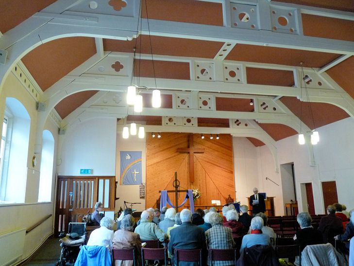
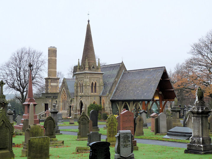
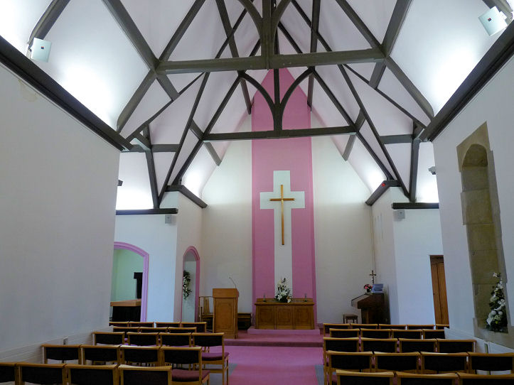
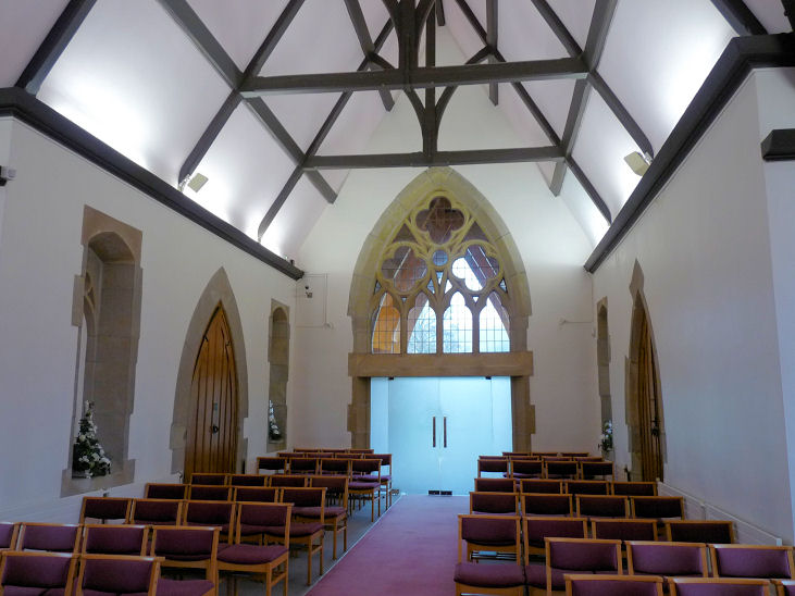
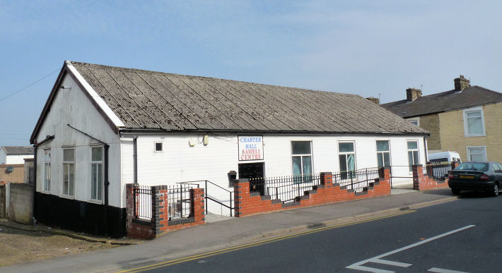
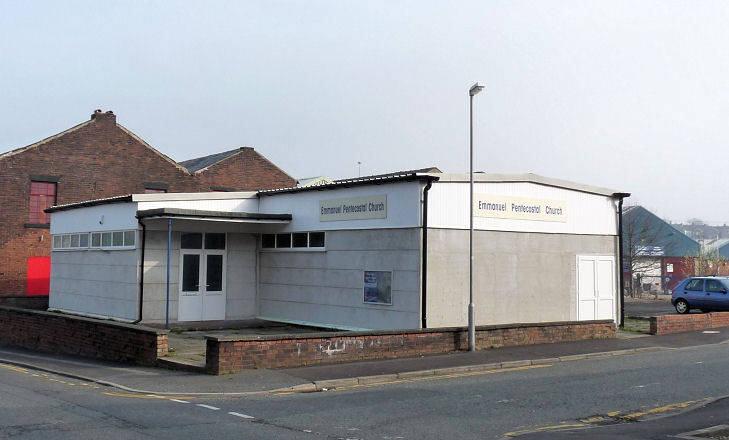
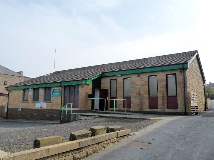
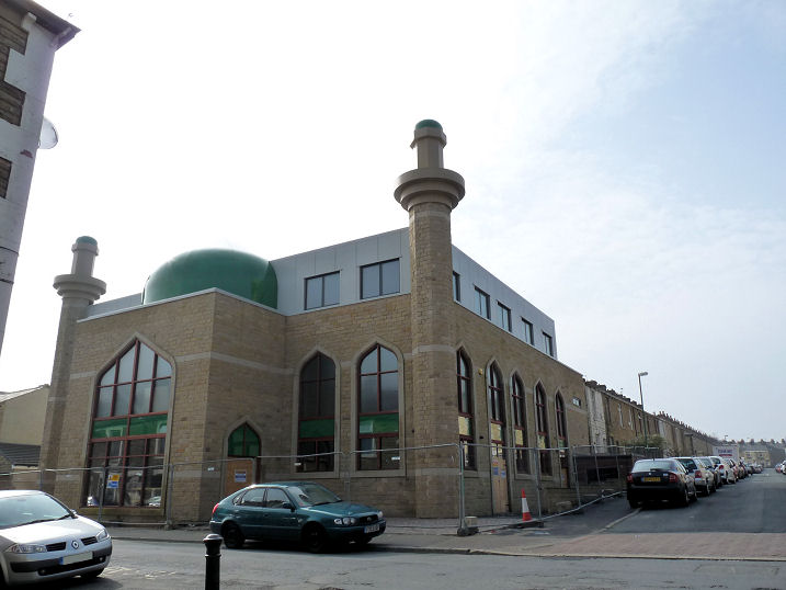
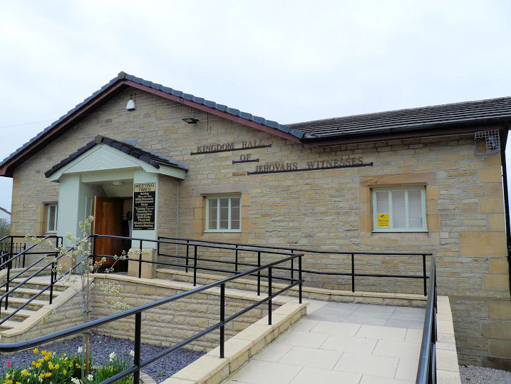
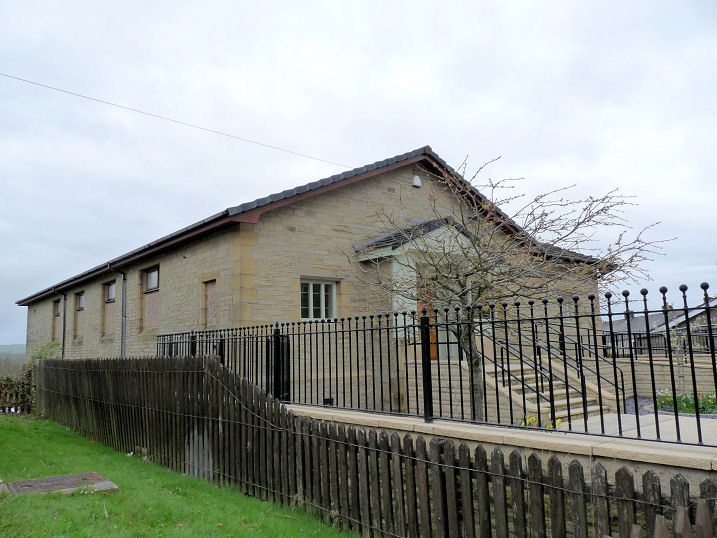
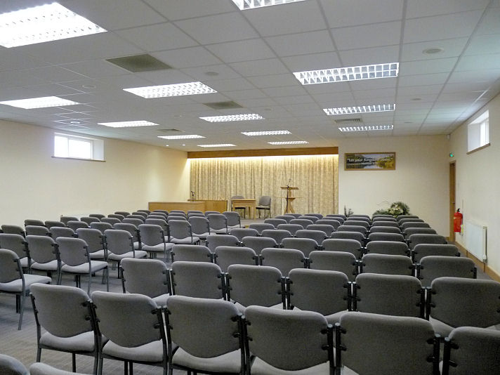
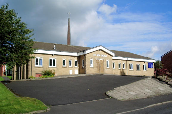
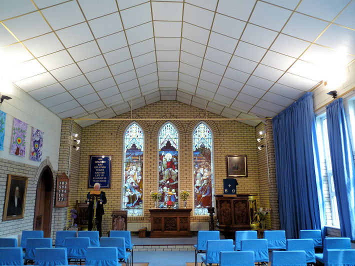
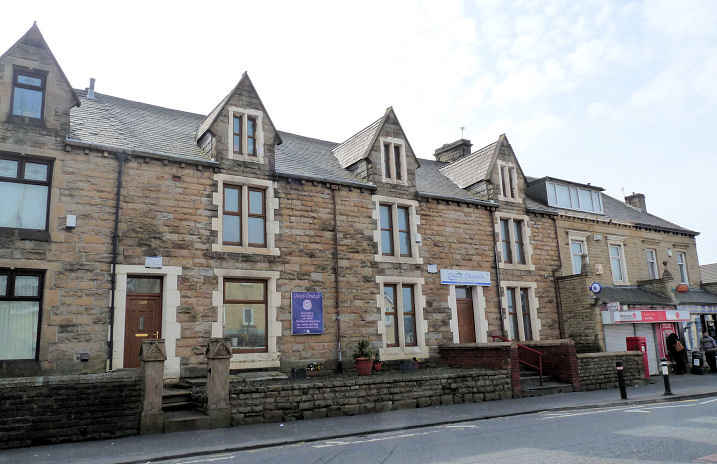
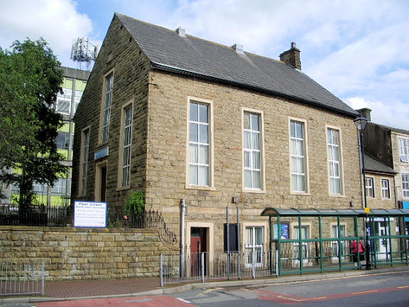
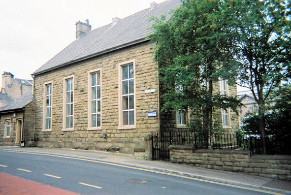
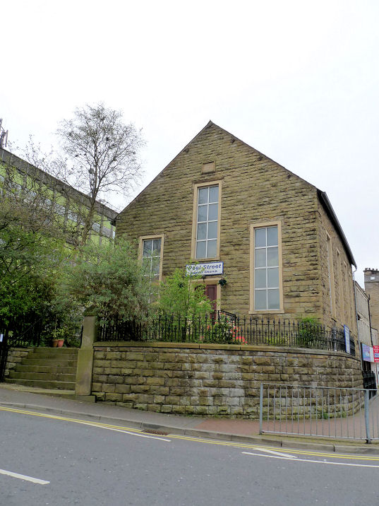
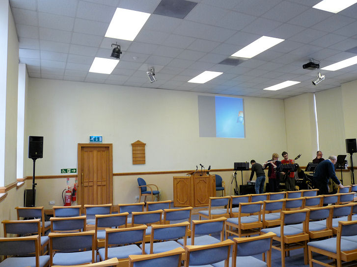
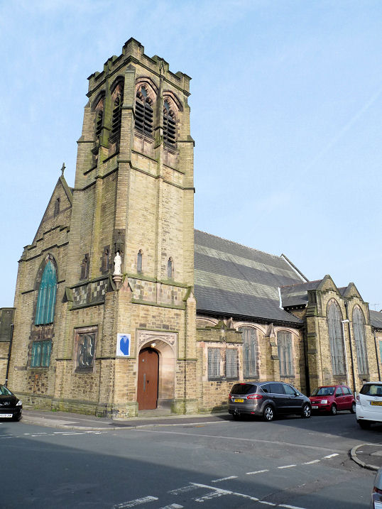
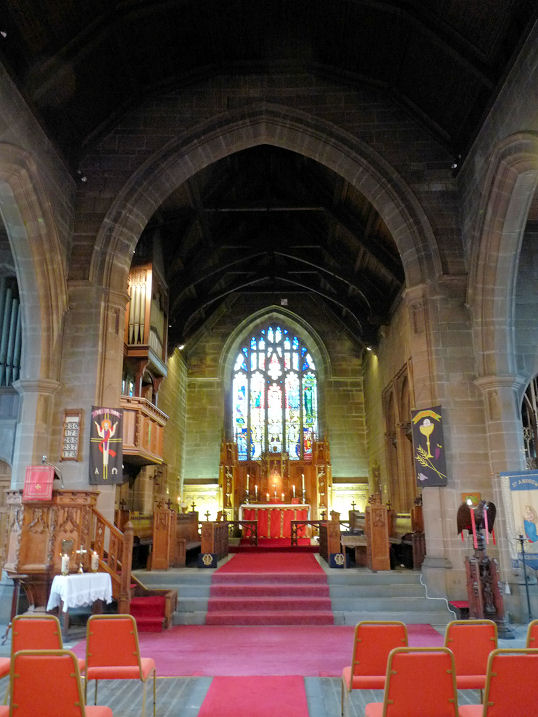
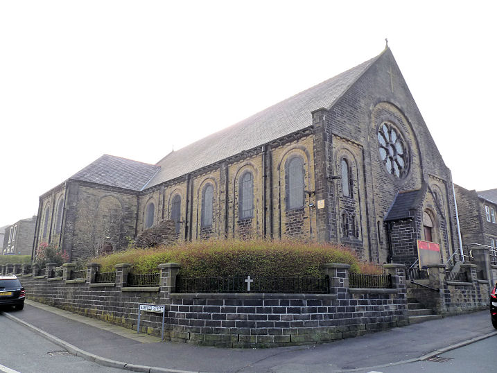
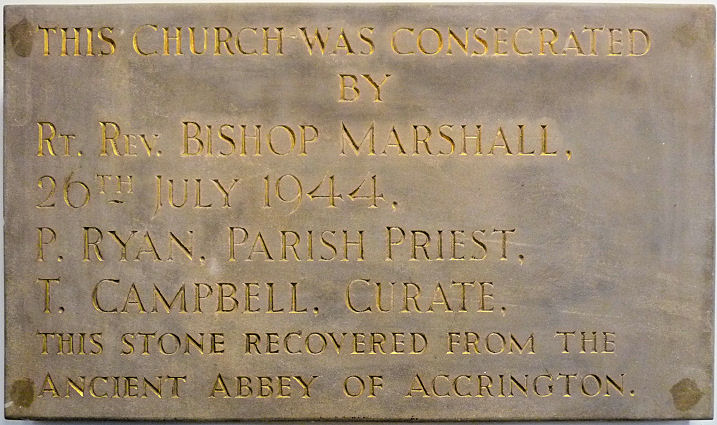
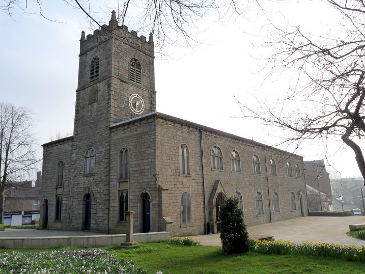
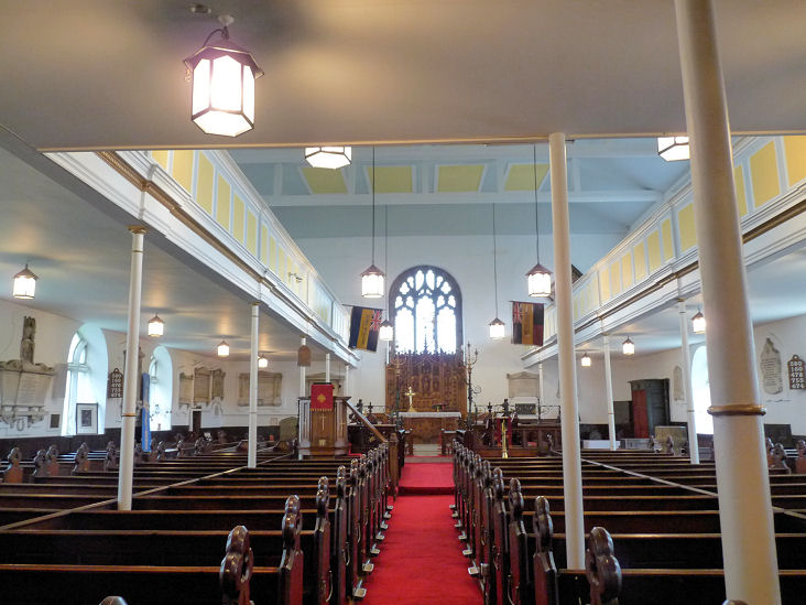
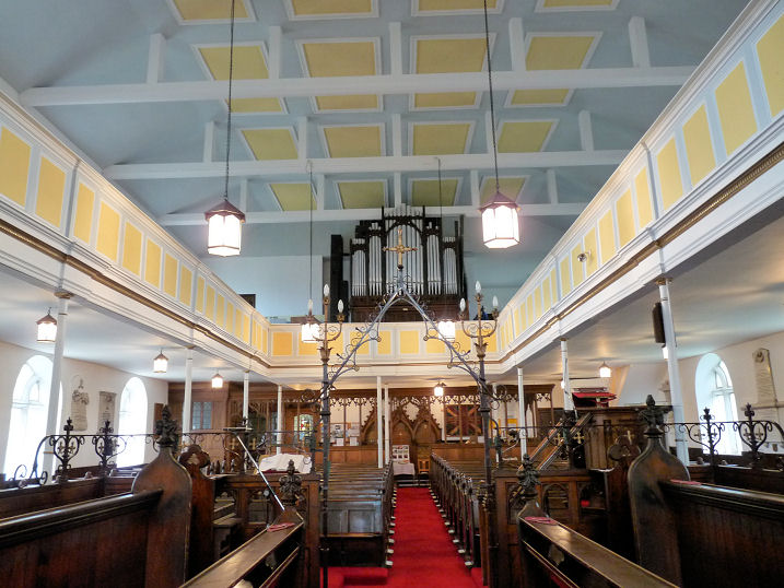
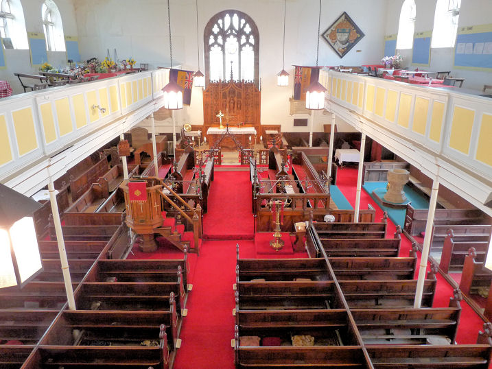
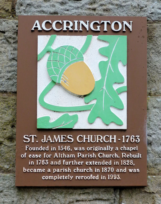
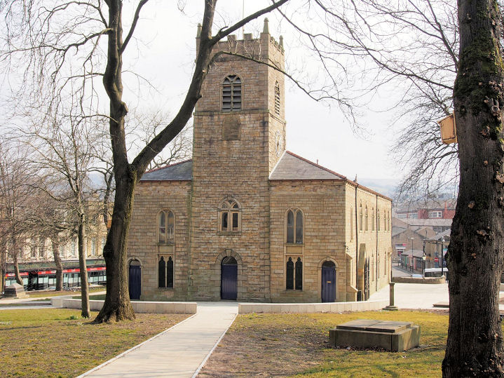
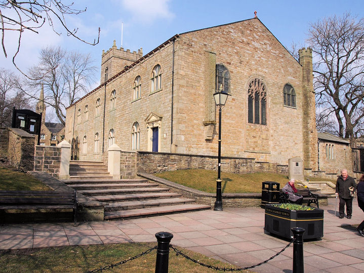
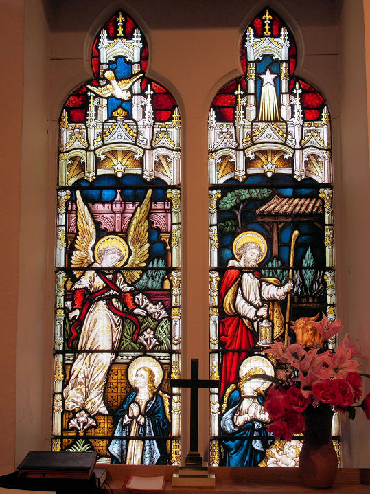
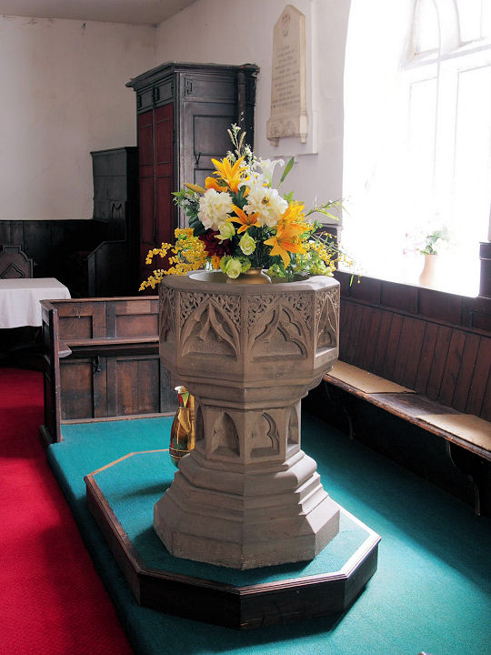
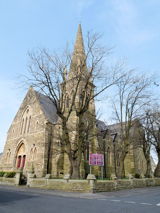
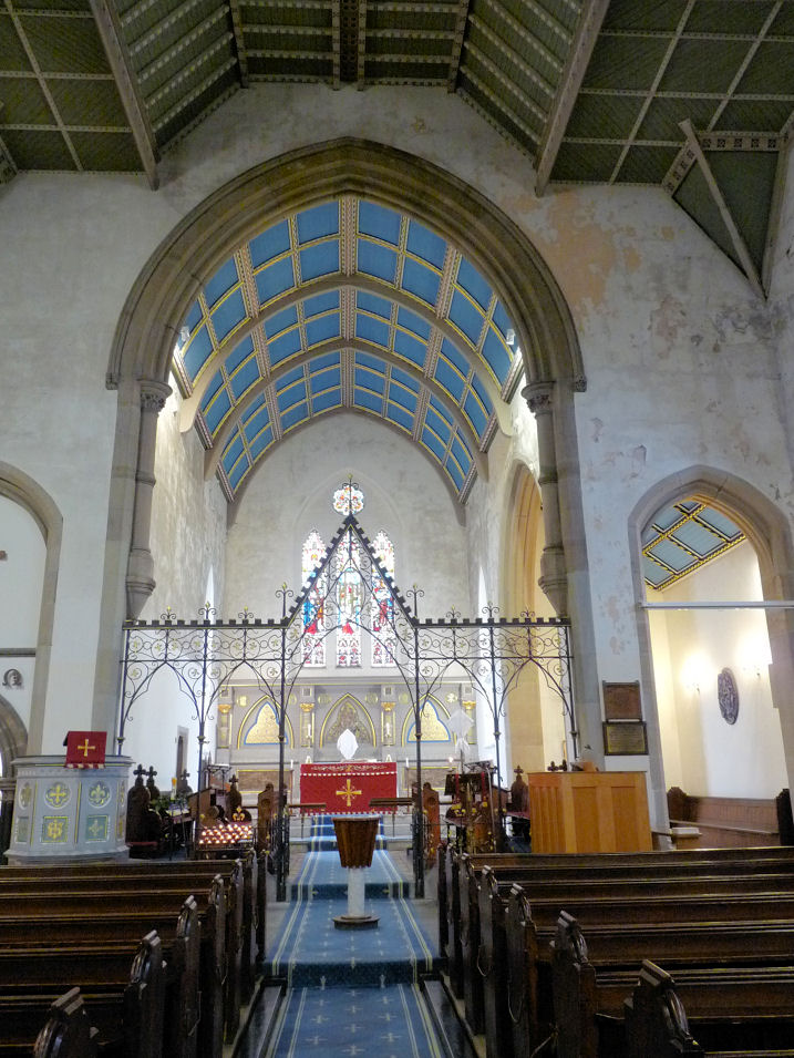
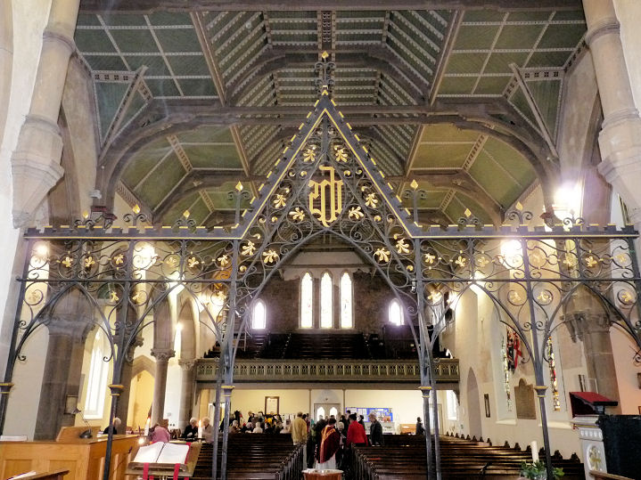
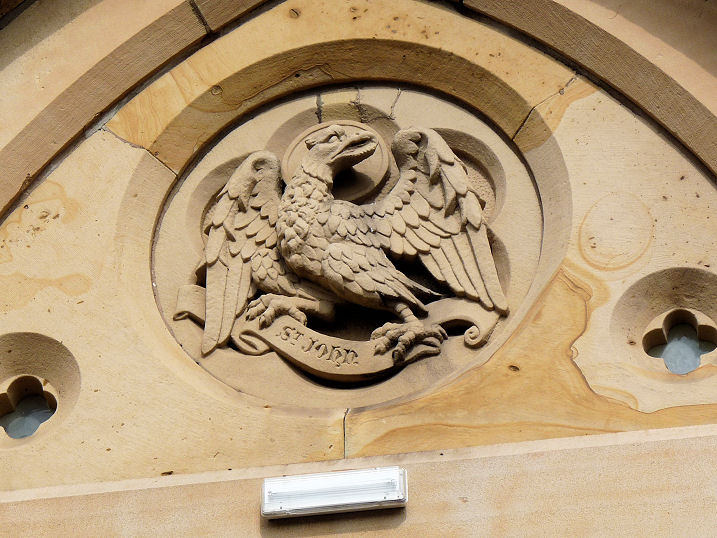
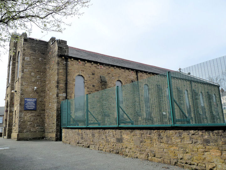
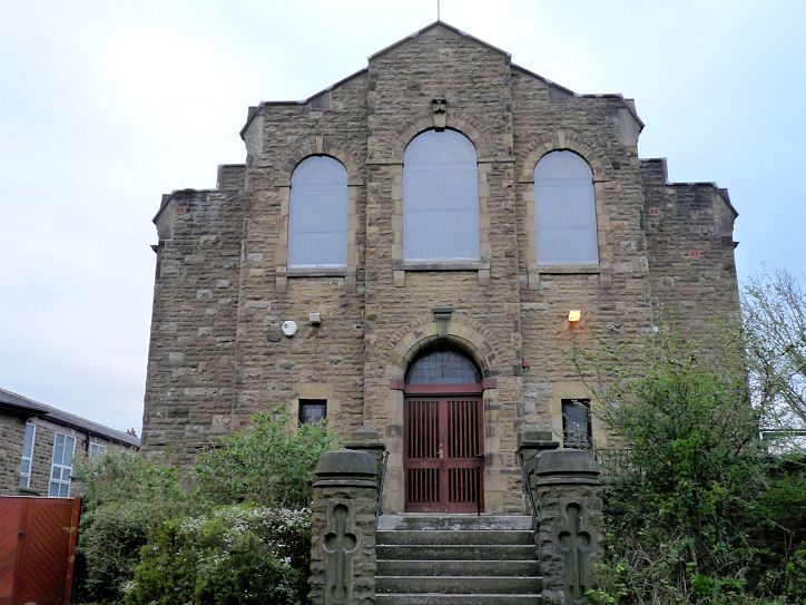
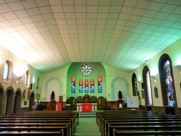
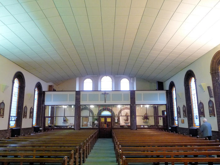
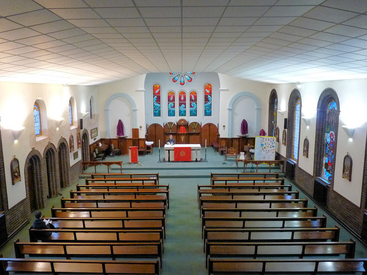
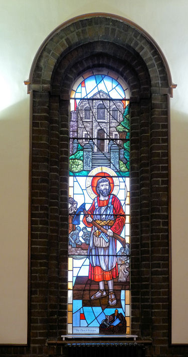
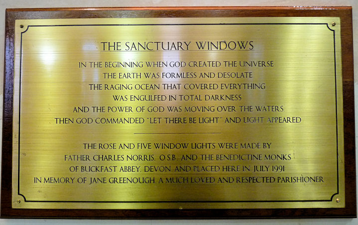
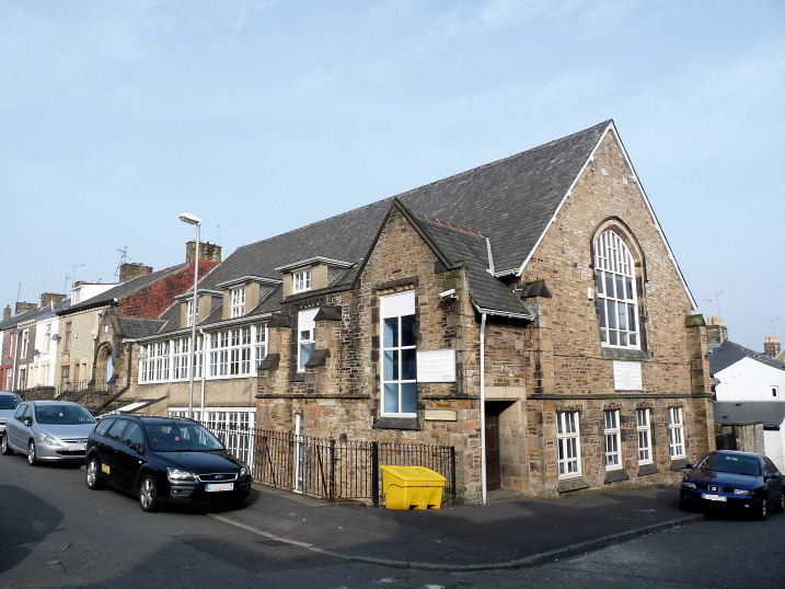
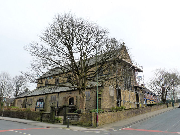
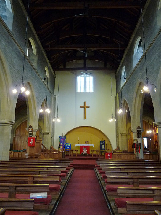
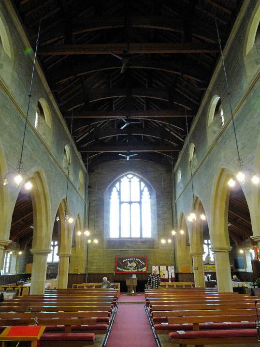
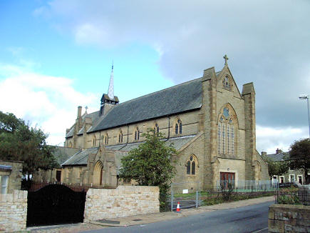
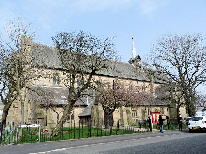
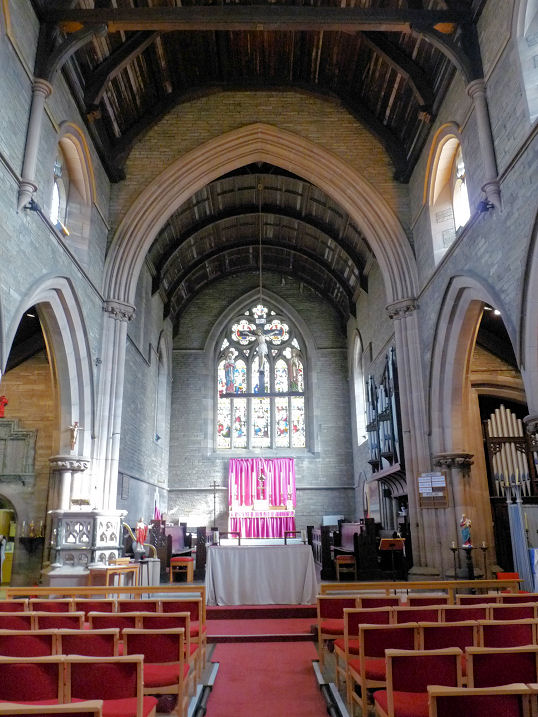
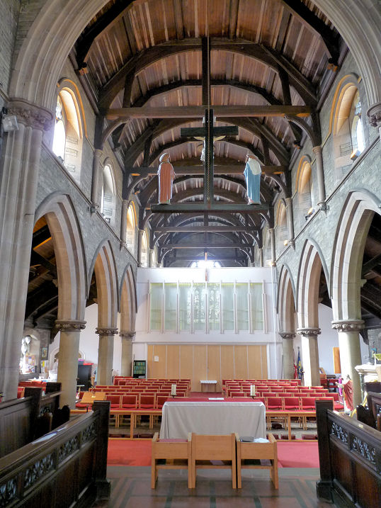
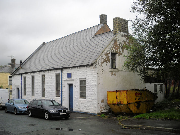
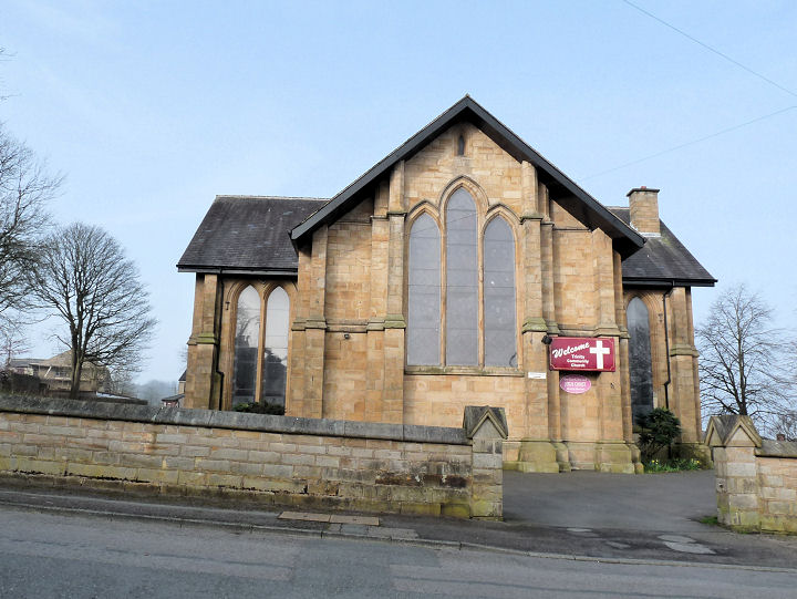
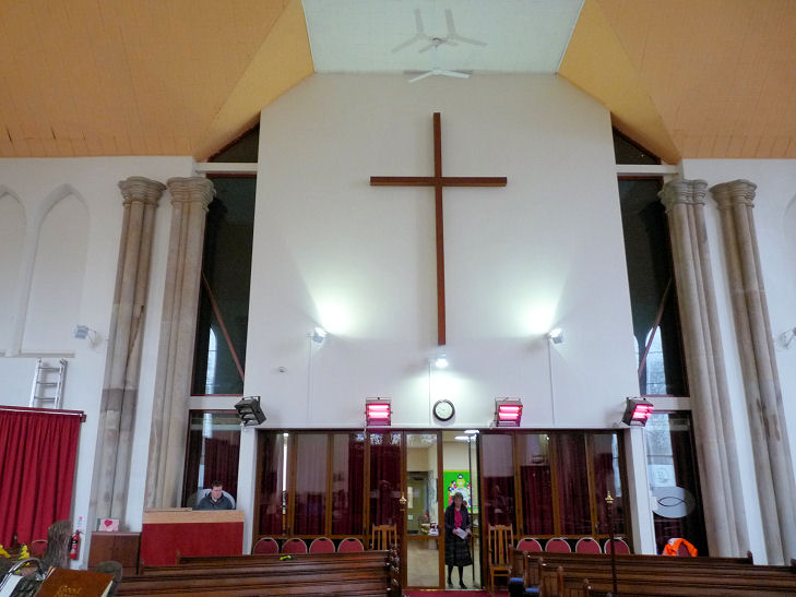
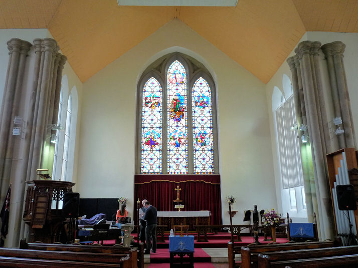
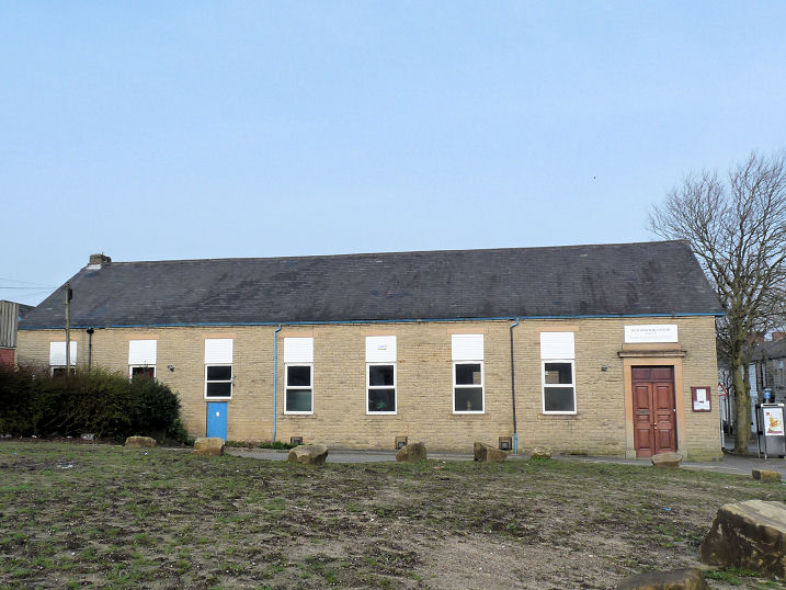
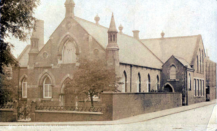
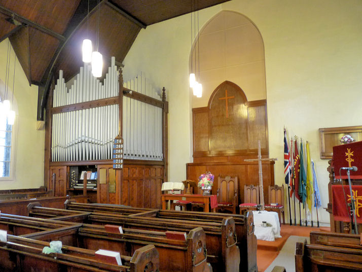
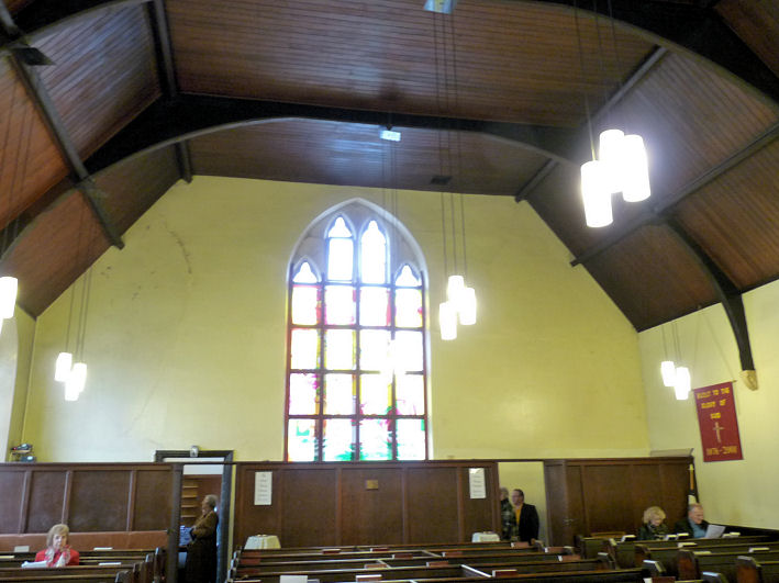
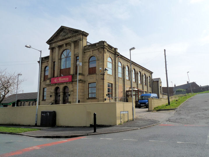
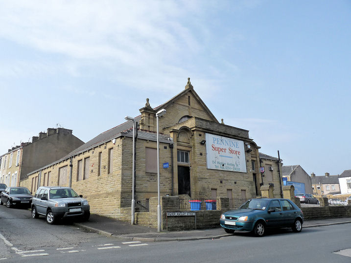
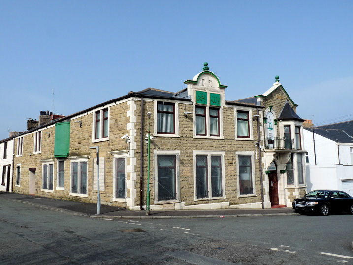
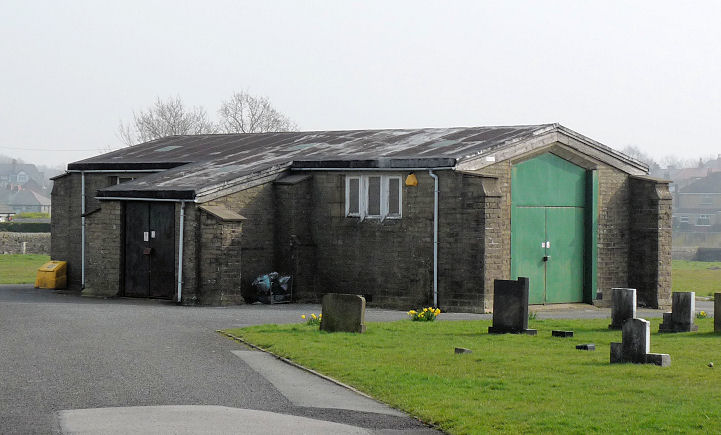
Antley Methodist Church on Blackburn Road and Wesley Street. SD 7458 2857. © Philip Kapp. Two interior views - 1, 2, both © Mike Berrell (2014). Link, which says it was completed in 1961. Old maps show that it stands on the site of an earlier Wesleyan Methodist Chapel, which pre-dates a map of 1911. The Baptist Church (1873) on Cannon Street closed in 2006, and is now in residential use. The congregation now meet at Trinity Community Church (formerly known as Christ Church) on Rough Lee Road. SD 7588 2851. © Philip Kapp. Another view, © Chris Stafford (2013). Grade II listed. News item on closure. A Baptist Church used to stand at the junction of Nuttall Street and Royds Street, at SD 7610 2808. It pre-dates a map of 1912, and was still active in 1954. Housing was built on the site at some point (2009 Streetview) but that has since been demolished, and it's now a car park (2022 Streetview). Cambridge Street Methodist Church on Cambridge Street and Lodge Street. It shows on a map of 1911 as School. SD 7653 2904. © Philip Kapp. Another view, and an interior view, both © Mike Berrell (2014). Link. Chapel at Accrington Cemetery and Crematorium on Burnley Road. The cemetery (and presumably the chapel) dates from 1864; the crematorium from 1956. Two interior views - 1, 2. SD 7685 2984.. All © Mike Berrell (2013). Link. The chapel shown was originally one of three, and is labelled on old maps as Nonconformist. The other two, both demolished, were Church of England at SD 7679 2974, and Roman Catholic at SD 7688 2991. Aerial views show that the latter is now the site of a small car park. Charter Hall Saheli Centre, possibly a former Salvation Army building, on Charter Street and Crossland Street. SD 7532 2834. © Mike Berrell (2014). Christ Church - see Trinity Community Church, below. Emmanuel Pentecostal Church (Assemblies of God) on Oxford Street and Blake Street. See also the Unitarian Church, below. SD 7557 2870. © Mike Berrell (2014). Link. Faizan-e-Madina Masjid Mosque (Sufi - Bareilvi - Qadri Dawat-e-Islami) on Richmond Road. SD 7517 2788. © Mike Berrell (2014). Link. First Church of Christ, Scientist on Burnley Road. SD 7652 2928. © Mike Berrell (2013). Ghousia Razvia Jamia Masjid Mosque (Sufi - Bareilvi) on Higher Antley Street. SD 7550 2801. © Mike Berrell (2014). Link. Kingdom Hall of Jehovah's Witnesses on Fairfield Street. Another view, and an interior view. SD 7474 2781. All © Mike Berrell (2014). New Jerusalem Church (Swedenborgian, 1985) on Hargreaves Street. SD 7637 2835. © Philip Kapp. Interior view, © Mike Berrell (2014). Link. Directly across the road is a car park (2009 Streetview) where, according to old maps, a Church used to stand. It actually faced onto Abbey Street, and must have been the predecessor of the present church, being labelled as New Jerusalem Church (Swedenborgian) (Seats for 828) on a map of 1892. What must be a photo of it can be seen here. Oasis Church and River of Life Christian Fellowship on Blackburn Road. SD 7528 2855. © Mike Berrell (2014). Gerard Charmley advises that, despite appearances, the church meets in what was originally Zion Strict Baptist church, which was later converted into housing. Link. Peel Street Baptist Church. SD 7613 2860. © Philip Kapp. Another view, © Rob Brettle. Another view, and an interior view, both © Mike Berrell (2014). Link. The history page says it dates from 1850, as Ebenezer Strict and Particular Baptist Church. Raza Jamia Masjid Mosque on Blackburn Road. SD 7537 2857. © Mike Berrell (2014). See also Church, at the bottom of this page. St. Andrew (1895) on Empress Street and Swiss Street. Interior view. SD 7488 2862. Both © Mike Berrell (2014). Link. Grade II listed. St. Anne (R.C.) on Cobham Road. The congregation was founded as a Mission in 1897, and the present church built in 1924-5. The building was finally consecrated in 1944 - plaque. Three interiors - 1, 2, 3. SD 7654 2842. All © Mike Berrell (2014). Link. St. James (1763) on Cannon Street. SD 7601 2847. © Philip Kapp. Another view, and three interiors - 1, 2, 3, and an informative plaque, all © Mike Berrell (2014). Two more views - 1, 2, a window, and the font, all © Chris Stafford (2013). Grade II listed. A sun-dial and a monument in the churchyard have separate listings. They can be seen here. St. John the Evangelist (1864) on Addison Street. Two interior views - 1, 2. A carved stone eagle looks unfriendly!. SD 7632 2910. All © Mike Berrell (2014). Link. Grade II listed. St. Joseph (R.C.) on Belgarth Road. SD 7622 2927. Another view, and three interiors - 1, 2, 3, and a window. The sanctuary windows (behind the altar) are explained on this plaque. All © Mike Berrell (2014). Link. St Mary Magdalen (1895) on Devonshire Street and Eccles Street. Two interiors - 1, 2. SD 7577 2918. All © Mike Berrell (2014). Facebook. The former St. Matthew (Free Church of England) on Portland Street is now a community centre. SD 7536 2866. © Mike Berrell (2014). St. Paul (1909) on Barnfield Street and Plantation Street. Two interiors - 1, 2. SD 7667 2852. All © Mike Berrell (2014). Link. St. Peter on Richmond Street. SD 7536 2814. © Philip Kapp. Another view, and two interior views - 1, 2, all © Mike Berrell (2014). Link. Grade II listed. The former Salem Strict Baptist Chapel on Frederick Street, founded in 1884. It had gone out of use by the mid-20th century. SD 7548 2875. © Gerard Charmley (2017). Trinity Community Church, previously Christ Church (1840) on Rough Lee Road. A Local Ecumenical Project (Anglican and Baptist), meeting here and at the Woodnook Centre on Royds Street (see next entry). Two interiors - 1, 2. SD 7634 2802. All © Mike Berrell (2014). Link. Trinity Community Church, Woodnook Centre on Royds Street and Albert Street. A Local Ecumenical Project (Anglican and Baptist), meeting here and at the former Christ Church on Rough Lee Road (see previous entry). Old maps show that it is (or stands on the site of) a former school. SD 761 281. © Mike Berrell (2014). Link. A Unitarian Church (1859) stood on Oxford Street and Blake Street at SD 7558 2871. It was demolished in 1966, and replaced by a pre-fab. Following closure, it was bought by the Elim Church, and now serves as Emmanuel Pentecostal Church (see above). From an old postcard in Mike Berrell's Collection. U.R.C. (formerly Congregational, 1875) on Whalley Road and York Street. Two interiors - 1, 2. SD 7588 2909. All © Mike Berrell (2014). In 2022 I was advised that this church is now closed. The former Wesleyan Methodist Chapel on Richmond Road and Walker Avenue, now a restaurant. SD 7516 2785. © Mike Berrell (2014). Former church on Higher Antley Street and Major Street. The date-stone says 1907. Old maps first show this as a Sunday School, later as a Congregational Chapel, and later yet as Higher Antley Children's Church. SD 7564 2796. © Mike Berrell (2014).
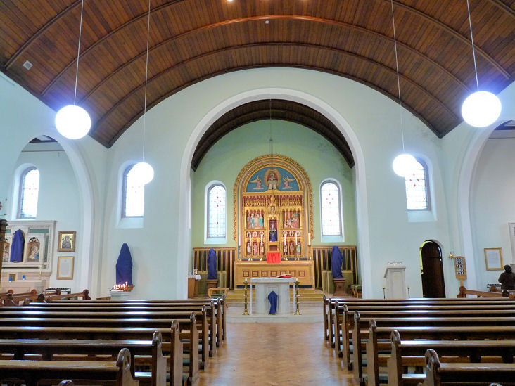
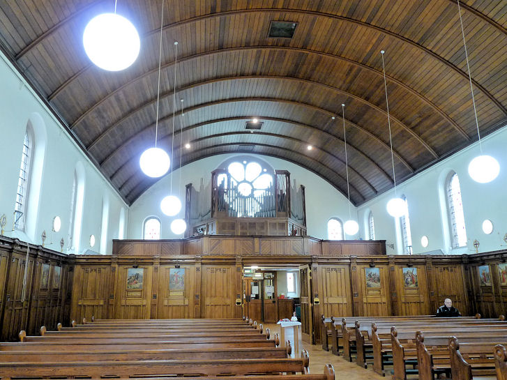
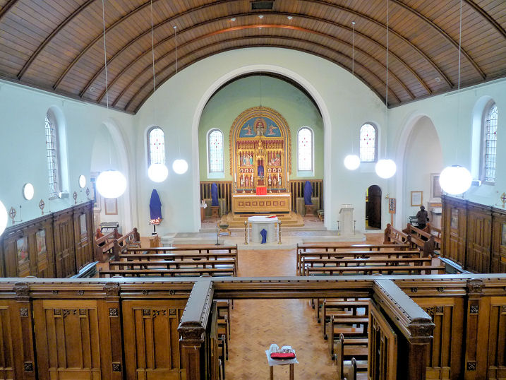
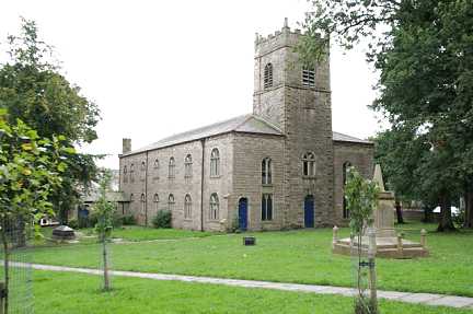
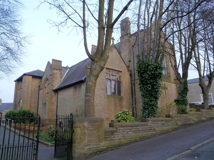
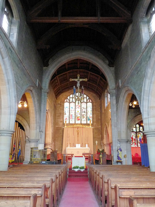
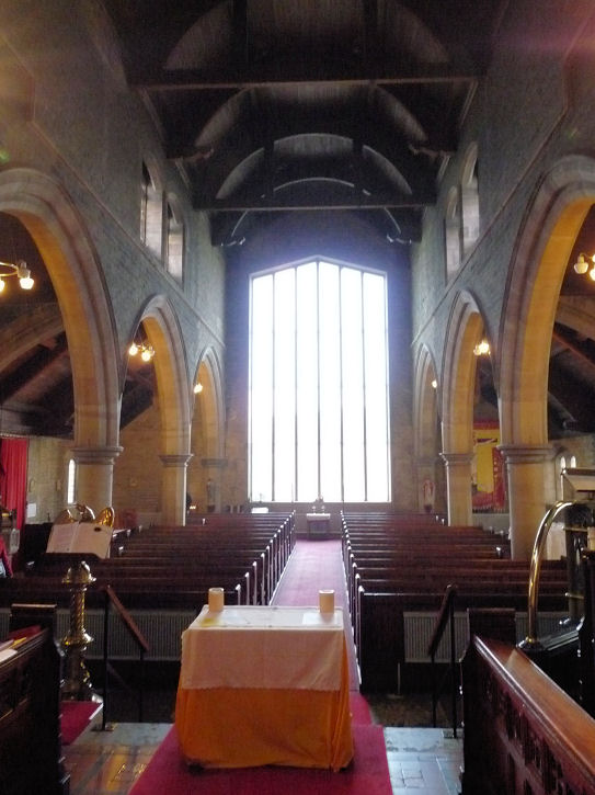
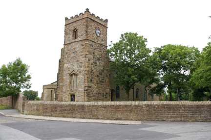
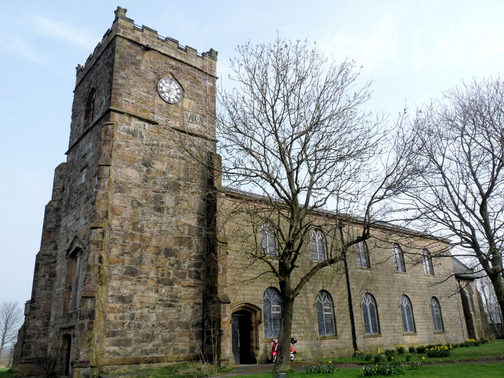
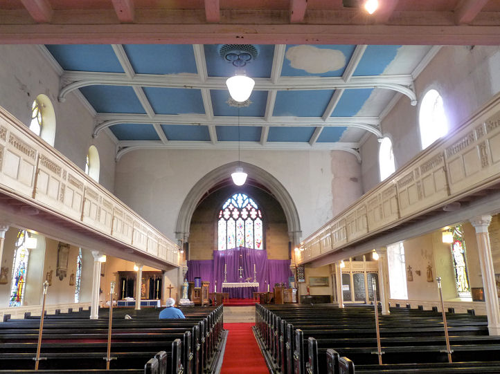
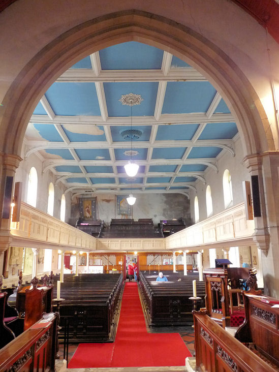
Church
|
||
18 December 2023
© Steve Bulman