The Churches of Britain and Ireland
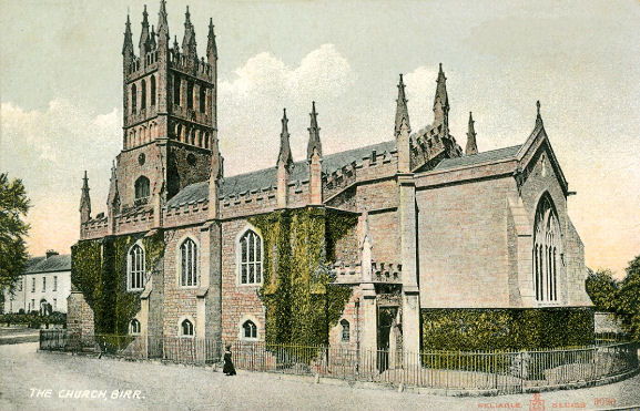
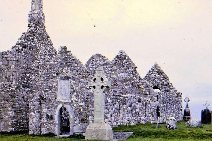
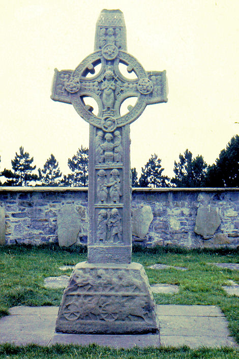
| County Offaly Birr, St. Brendan (CoI) on Cumberland Street and Oxmantown Mall. N 6059 5256. From an old postcard in Reg Dosell's Collection. A 2025 Streetview provides another view. Link. The Methodist Church is on Emmet Street, and seen by Streetview in 2025. It has a date-stone - Wesley Chapel, and (I think) 1820. N 6059 5184. Facebook. New Life Church also meets here - link. The Catholic Church is also dedicated to St. Brendan, on Railway Road and the N52 - 2025 Streetview. N 6182 4735. Link. Early O.S. maps show a Quaker Meeting House somewhere on the north side of St. Brendan Street, though none of the available maps indicate clearly to which building the label should be applied to. A 2025 Streetview gives a general view of the street - the meeting house was on the left (north ) side. Circa N 5960 4712 (my best guess). O.S. maps also show St. Brendan's Church in ruins (2025 Streetview) just a little way east of the castle, on a site on Castle Street and Church Street. Streetview doesn't show it well - this link says it has been closed to public access for twenty years or so (dangerous masonry), but there plans to stabilise it. It perhaps stands on the site of an early monastery. Clonmacnoise, the Monastic Site, a complex of ruined churches and other buildings, as well as a round tower, and High Crosses. The Cross of the Scriptures. Both © Christopher Skottowe (1965). Link.
|
||
29 March 2026
© Steve Bulman