The Churches of Britain and Ireland
|
York, North Yorkshire Recommended reading - Stuart Leadley suggests York’s Other Churches and Chapels, Bryan Seymour (1992). A comprehensive guide with photos and location maps of the places of worship overshadowed (literally, in a couple of cases) by the Minster. An invaluable large scale map of
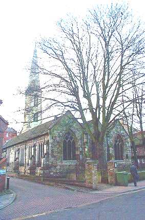
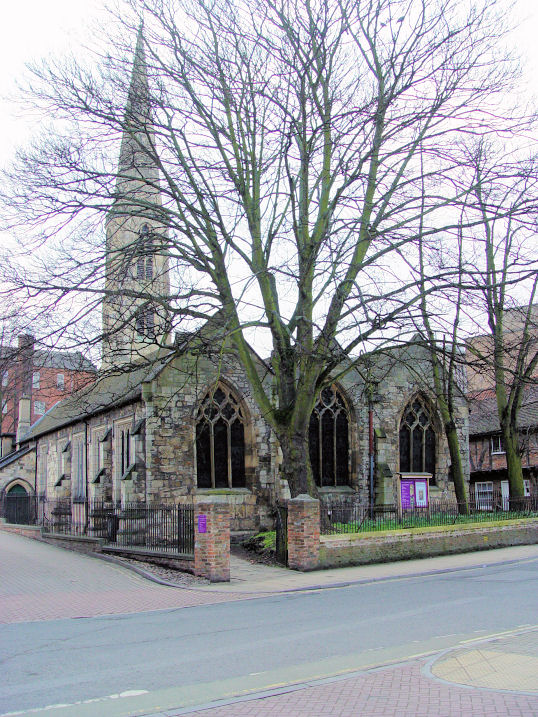
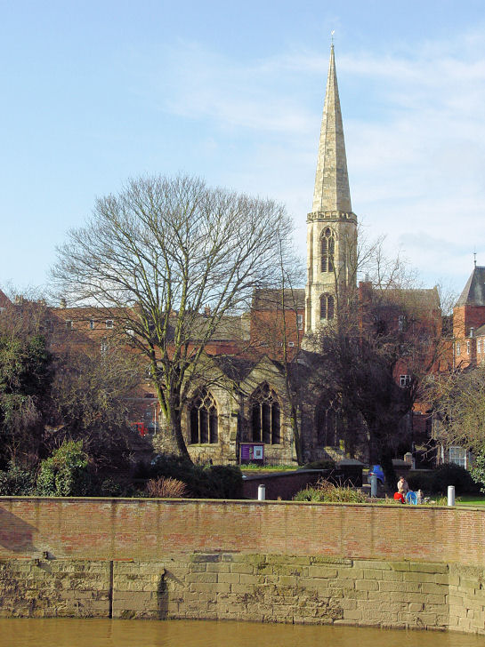
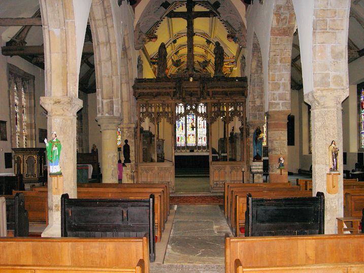
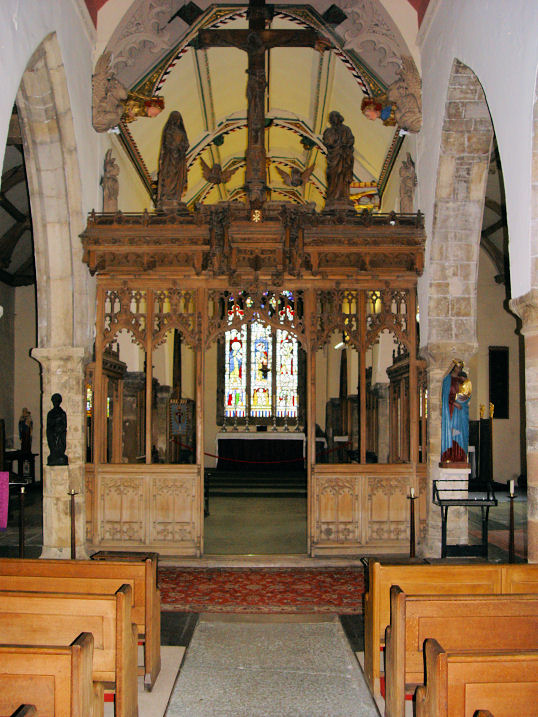
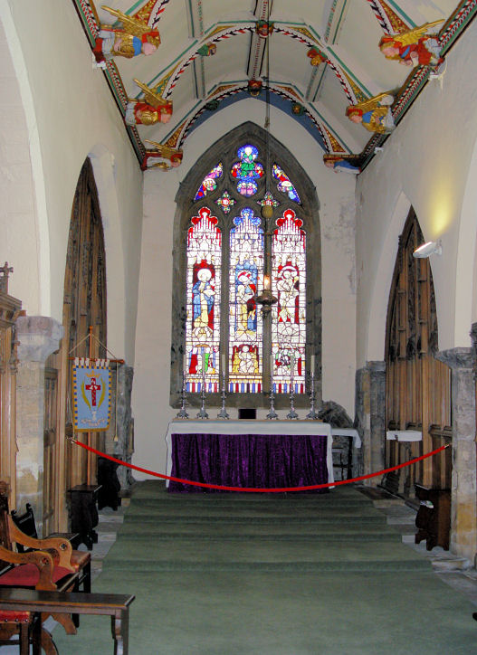
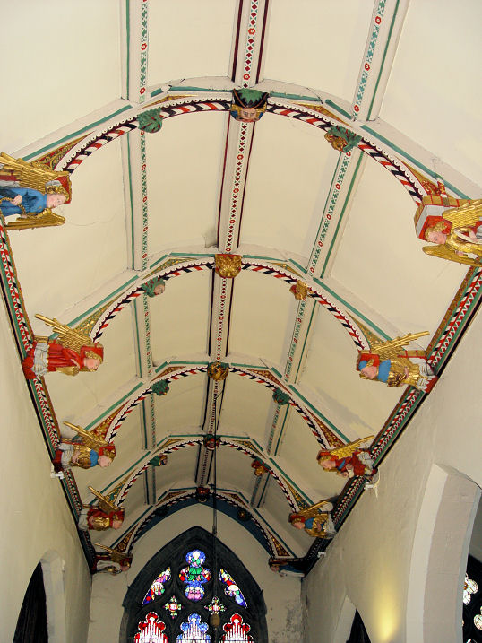
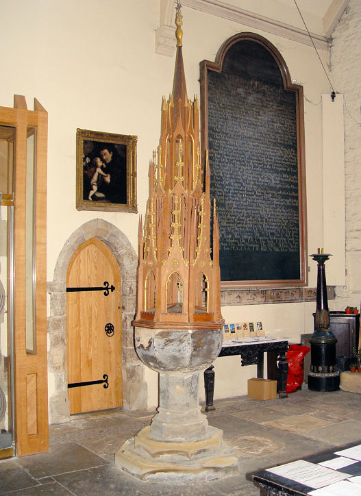
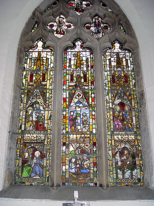
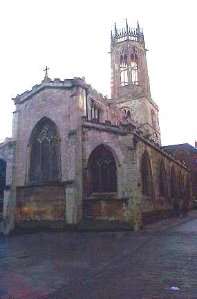
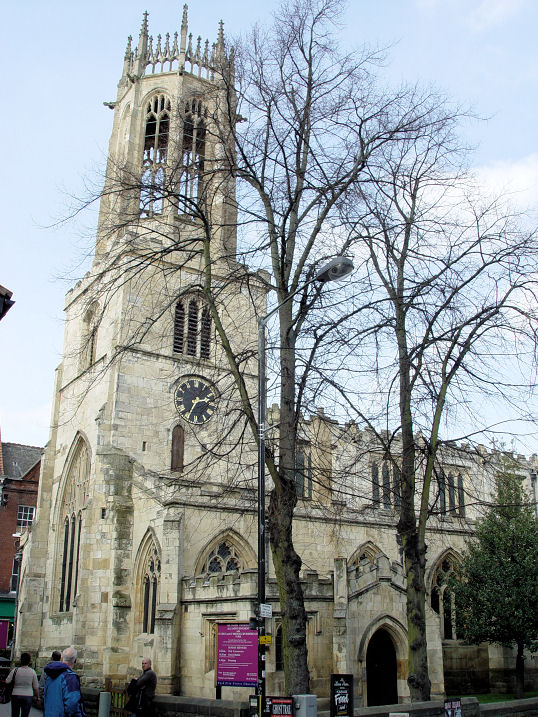
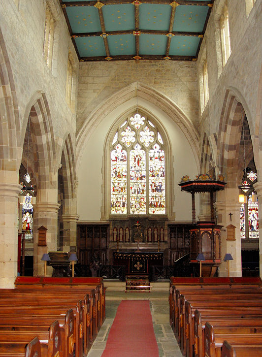
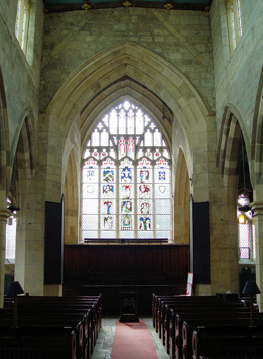
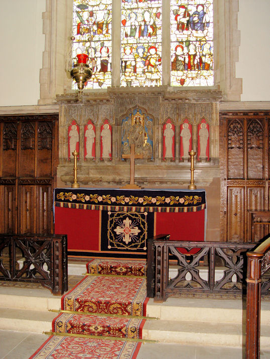
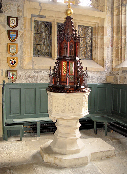
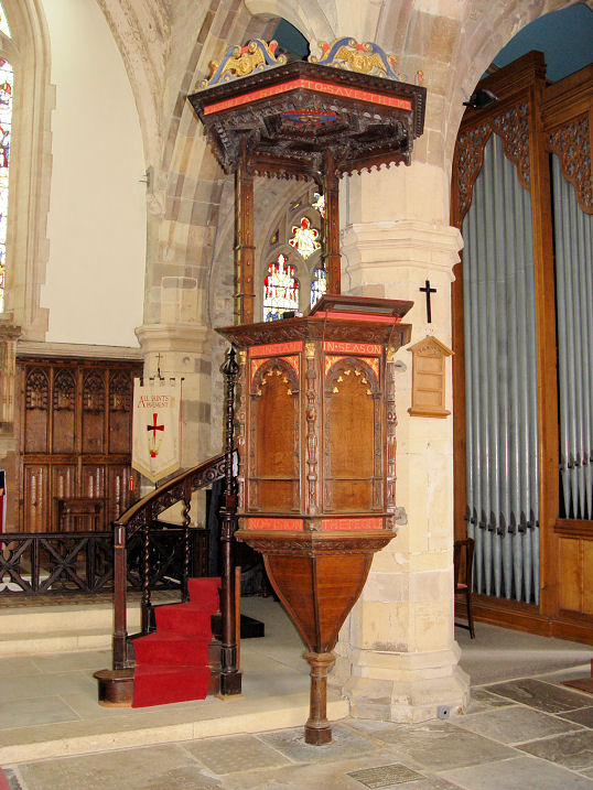
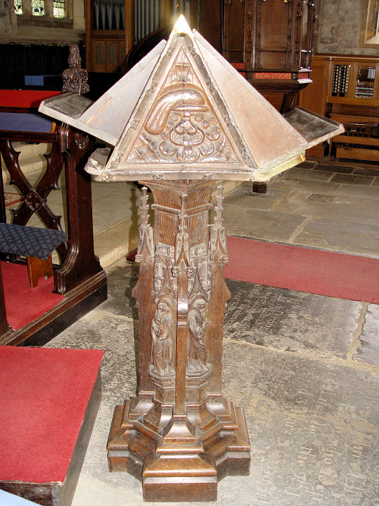
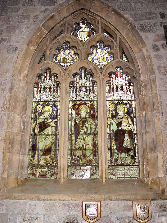
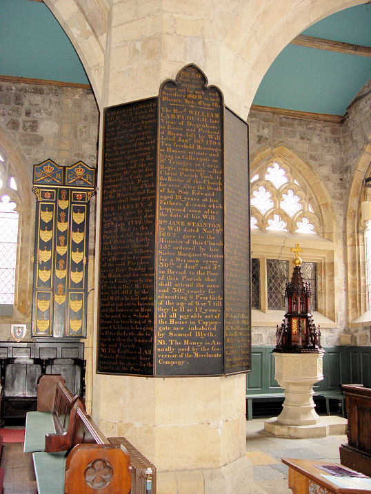
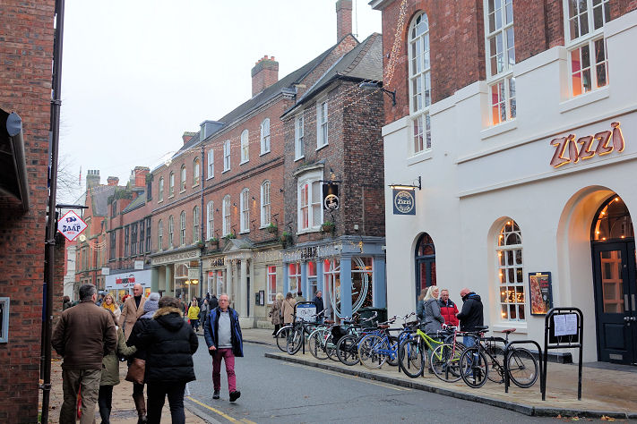
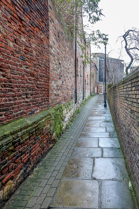
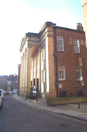
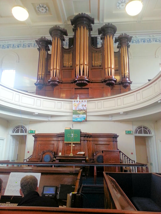
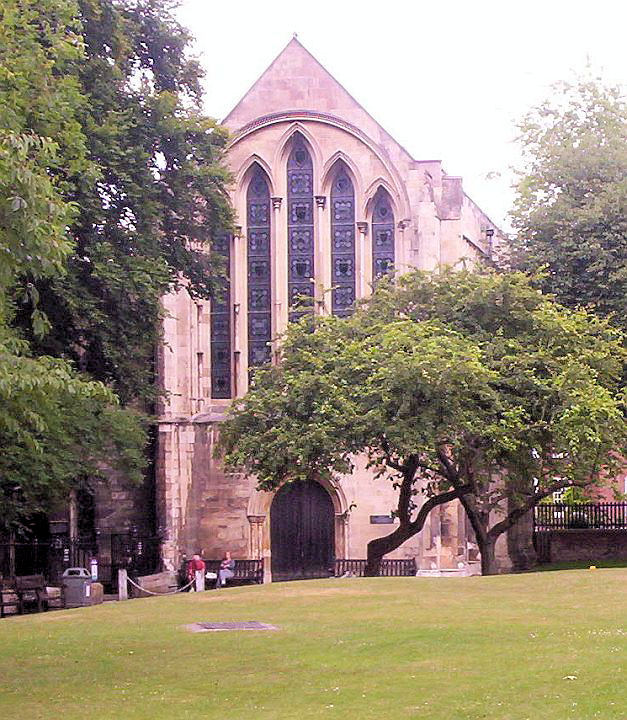
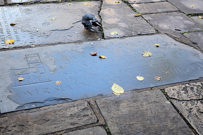
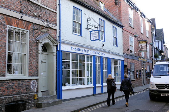
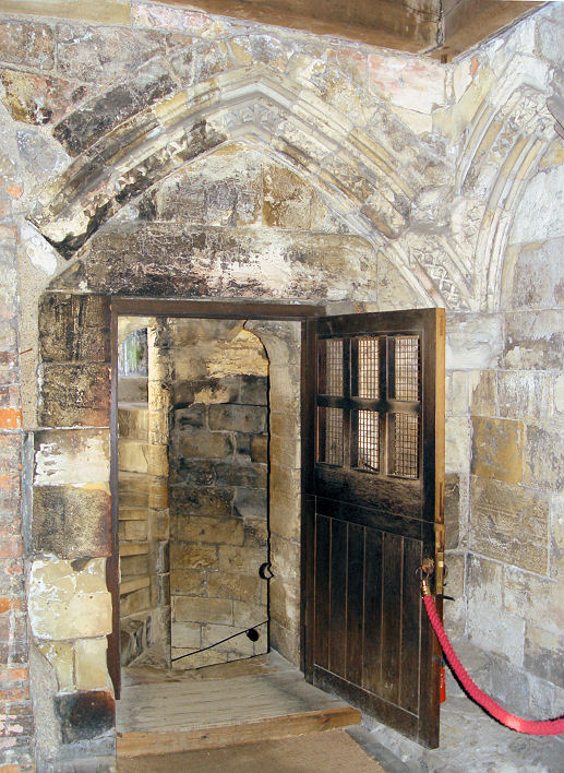
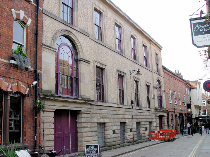
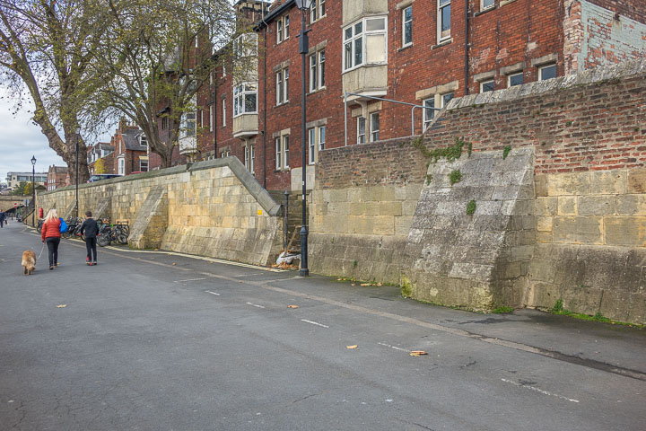
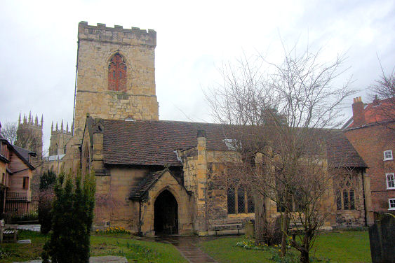
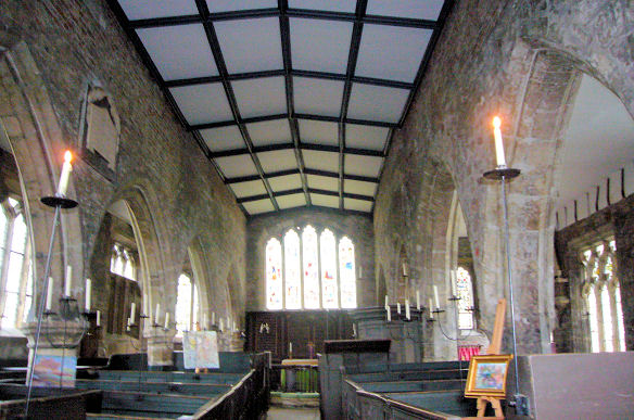
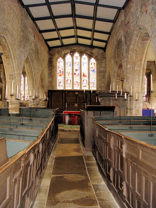
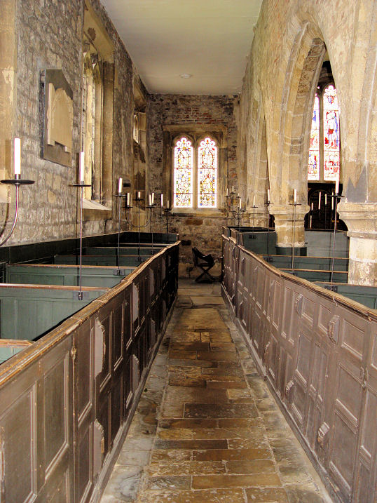
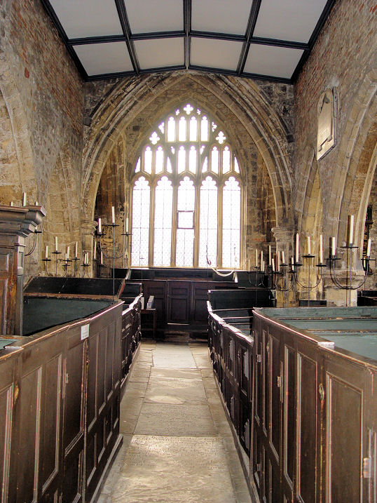
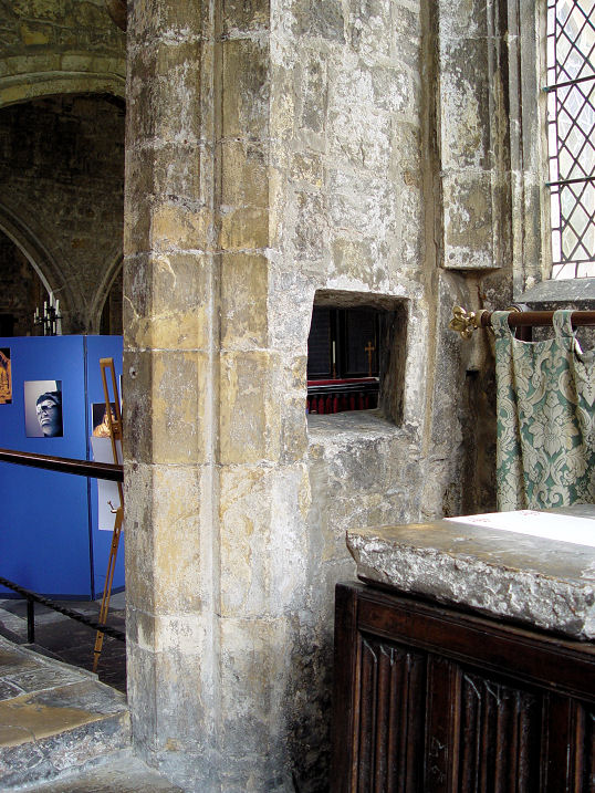
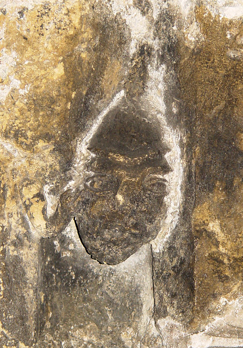
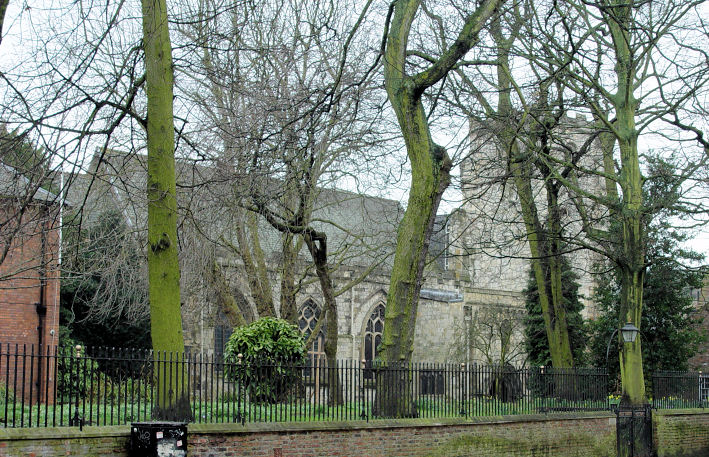
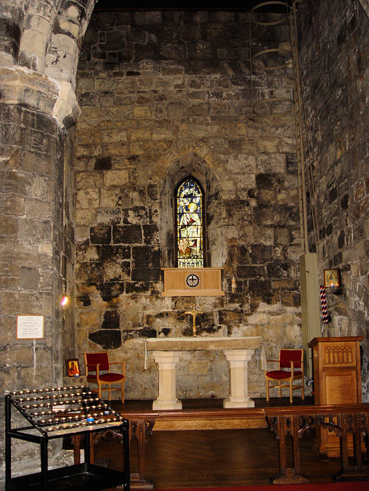
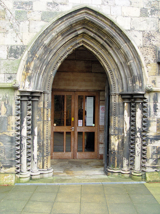
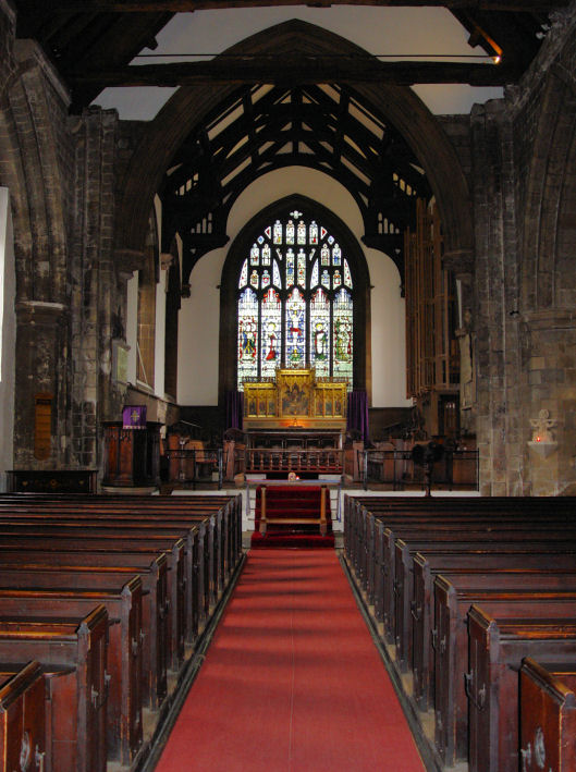
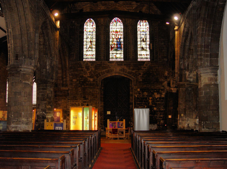
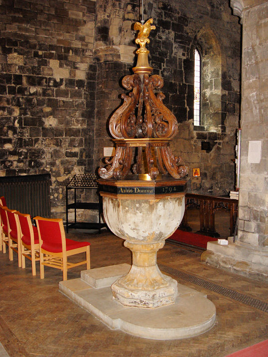
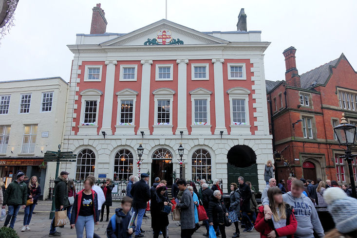
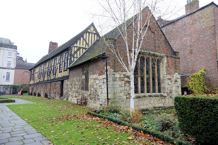
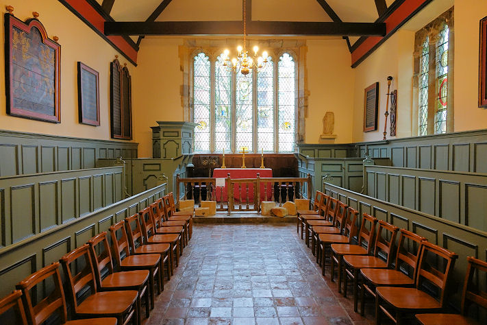
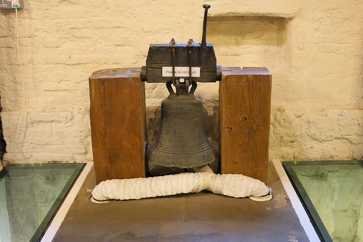
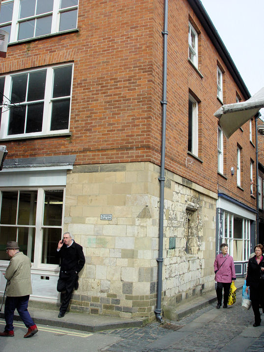
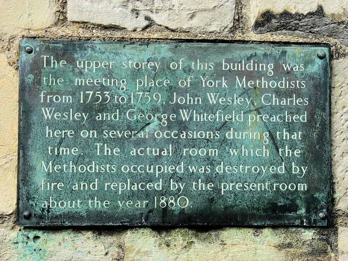
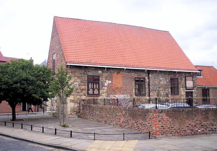
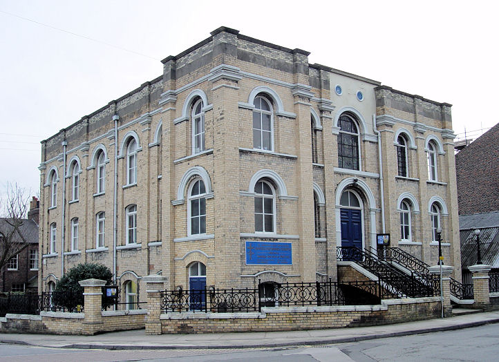
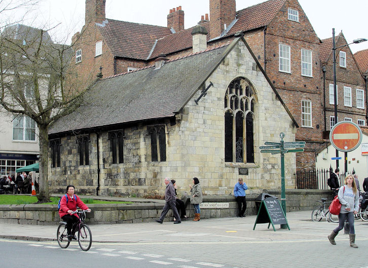
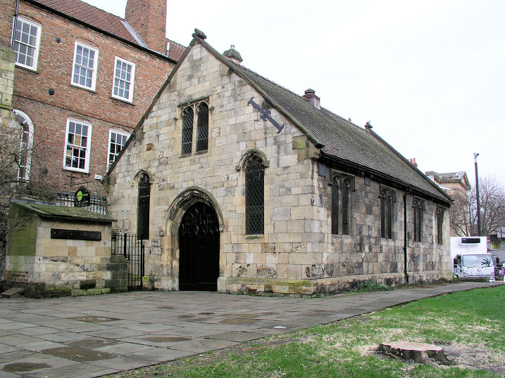
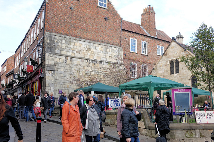
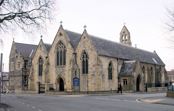
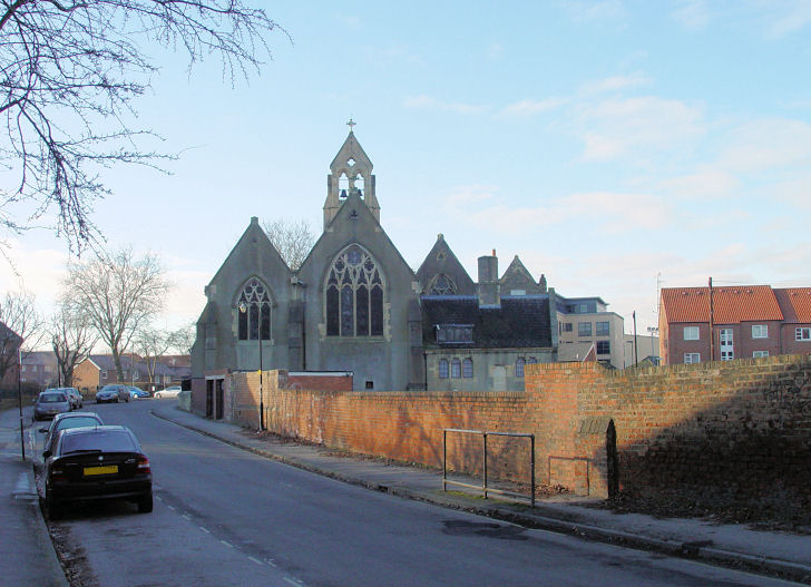
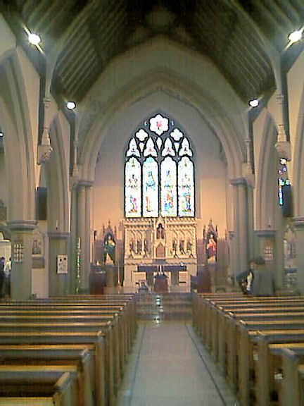
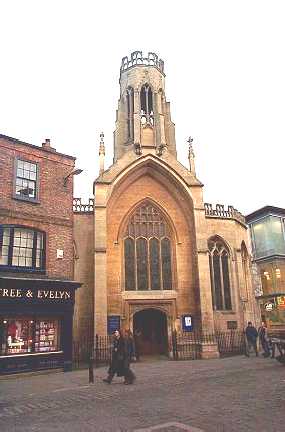
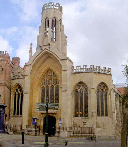
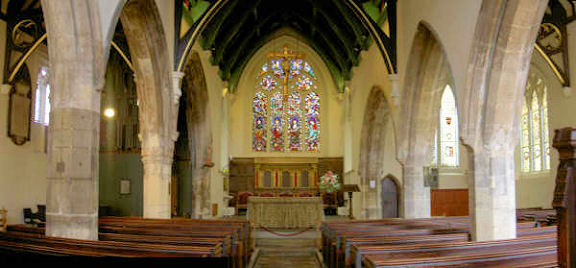
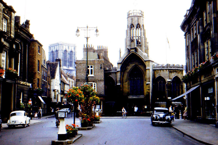
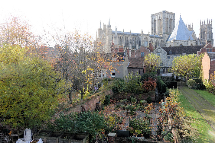
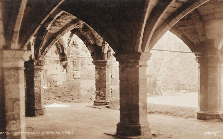
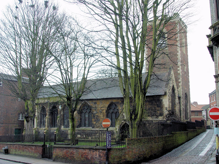
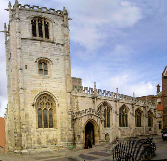
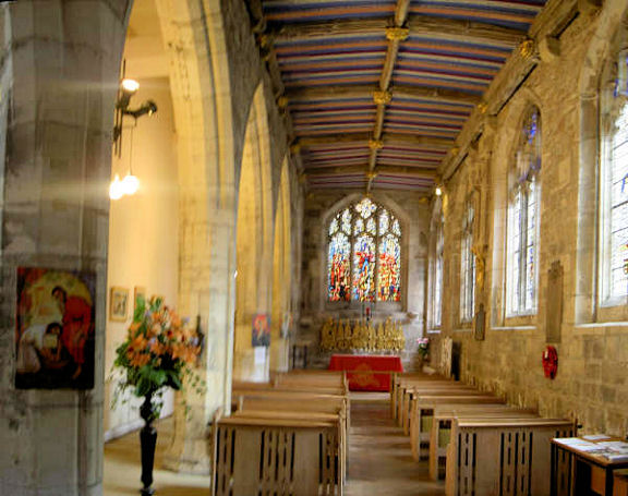
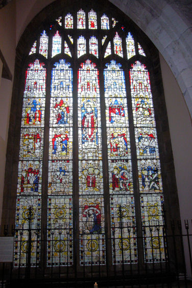
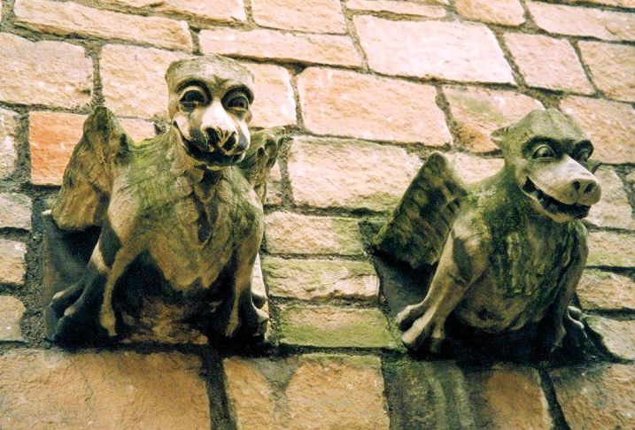
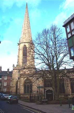
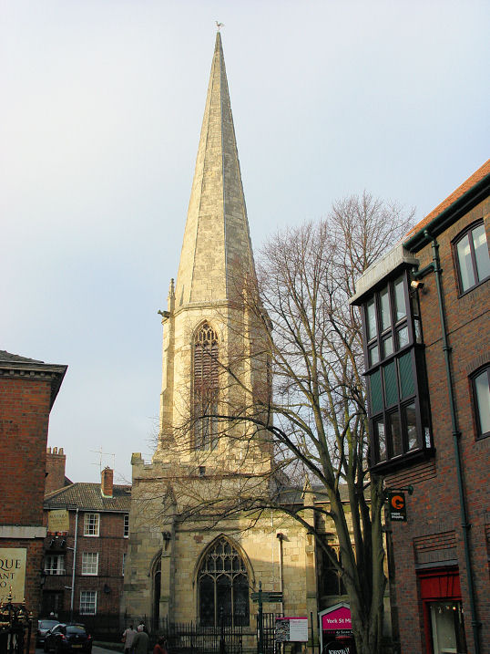
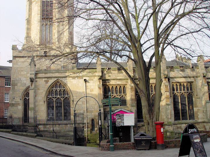
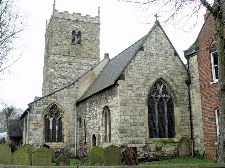
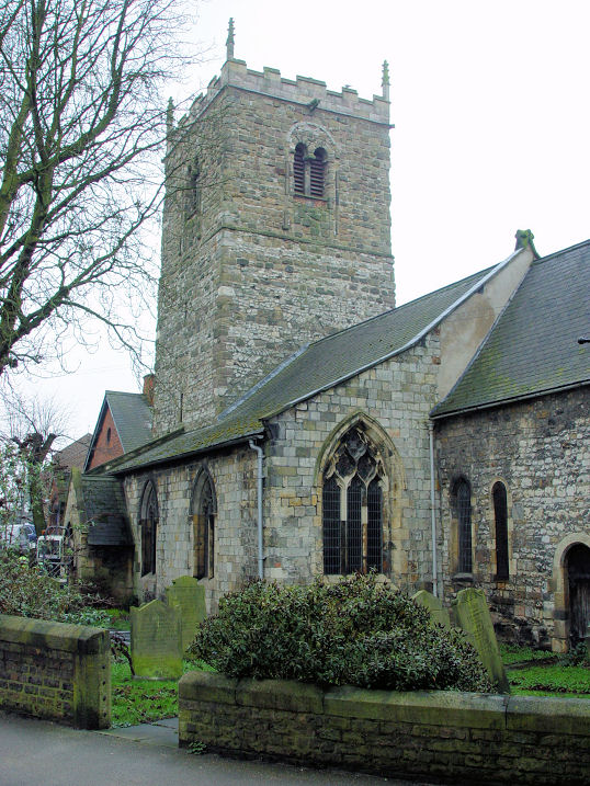
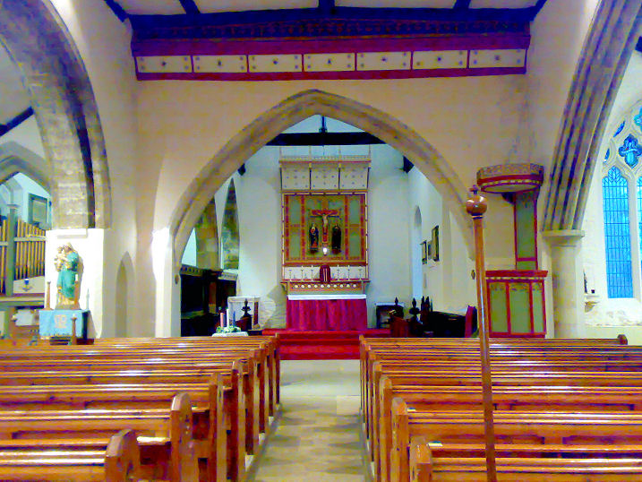
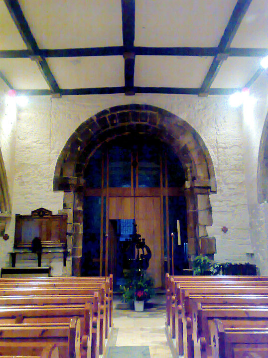
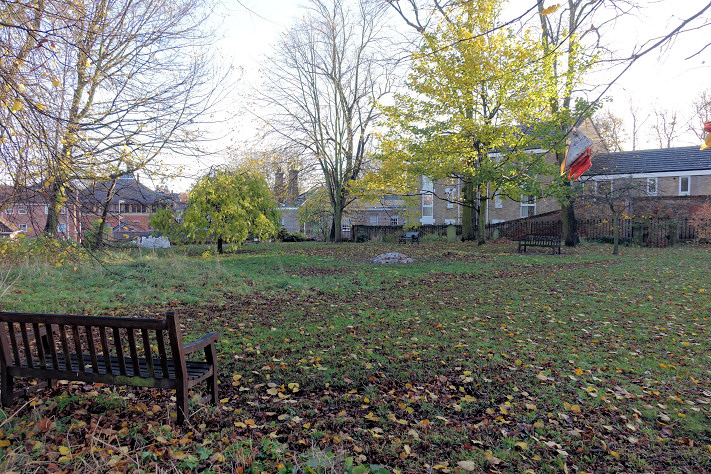
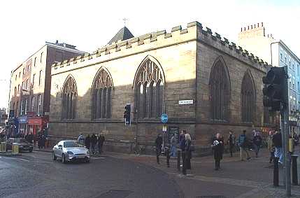
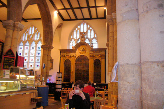
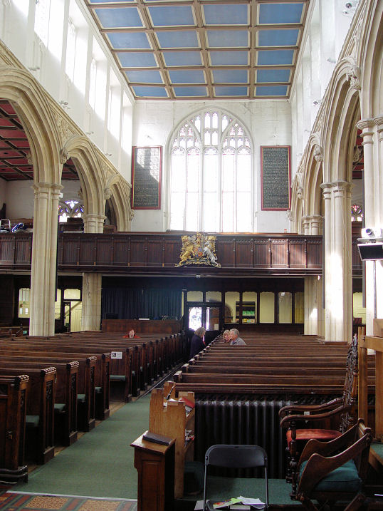
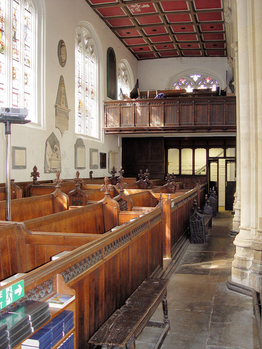
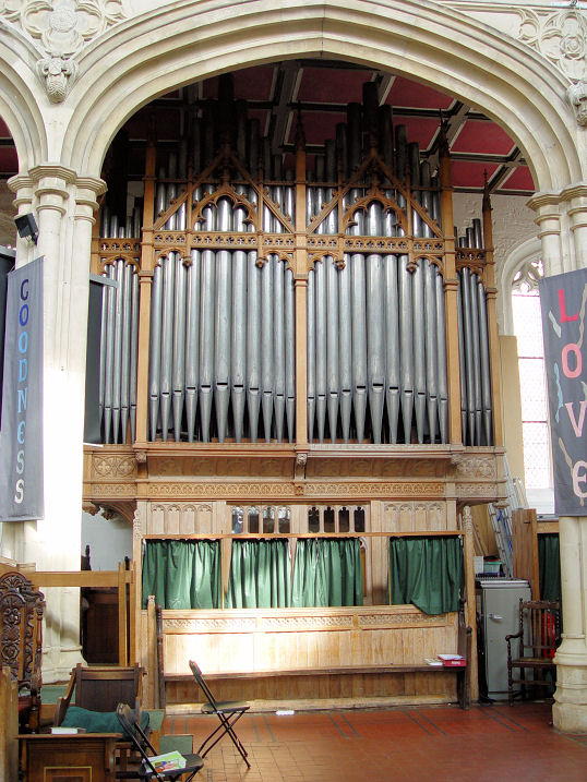
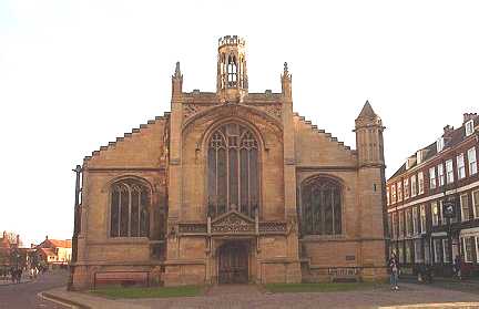
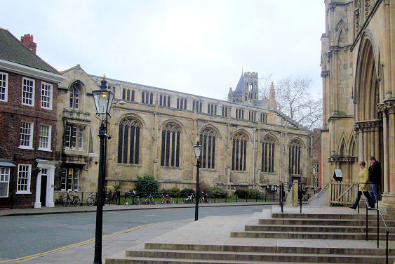
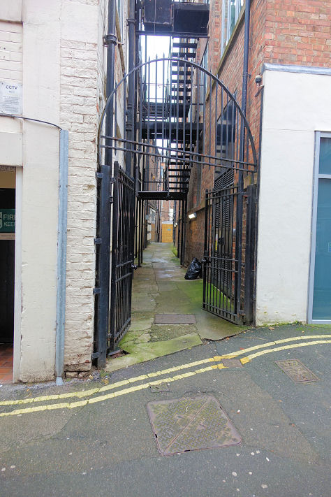
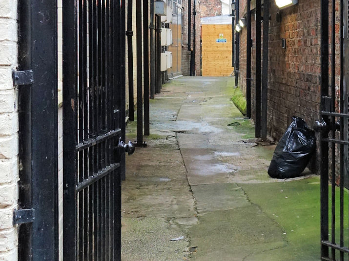
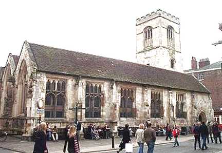
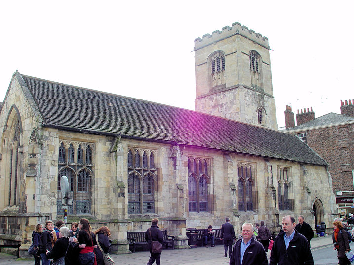
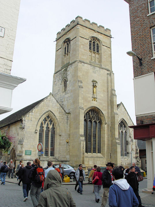
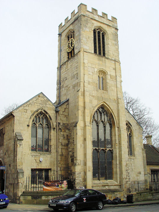
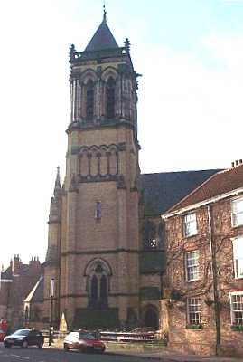
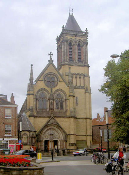
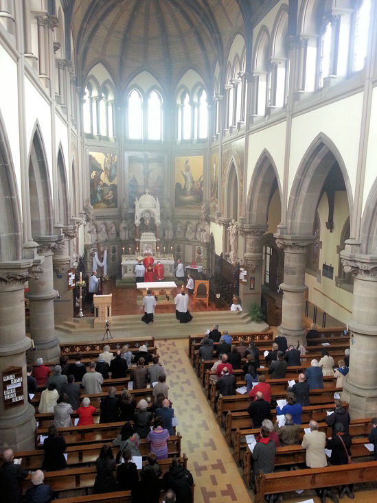
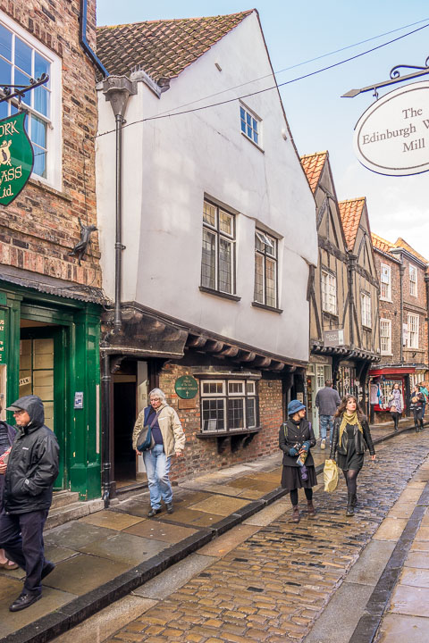
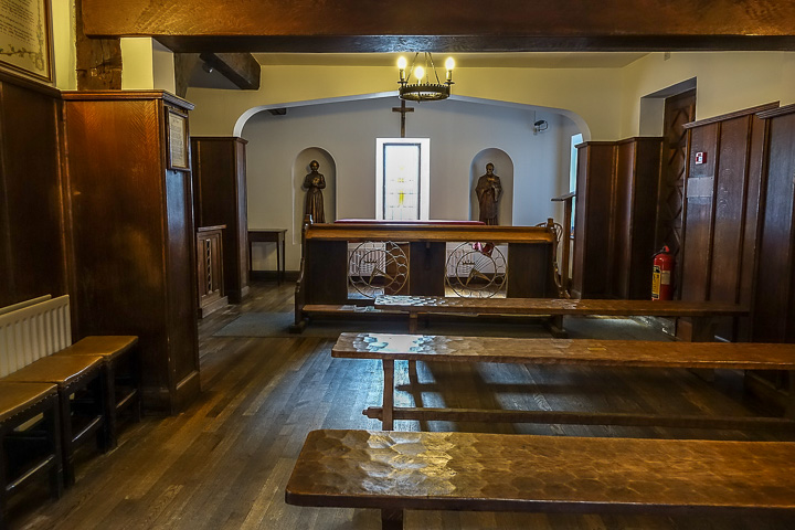
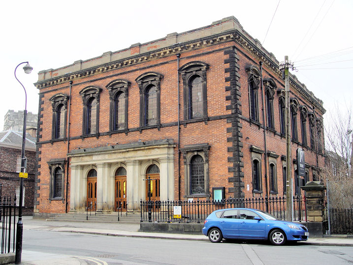
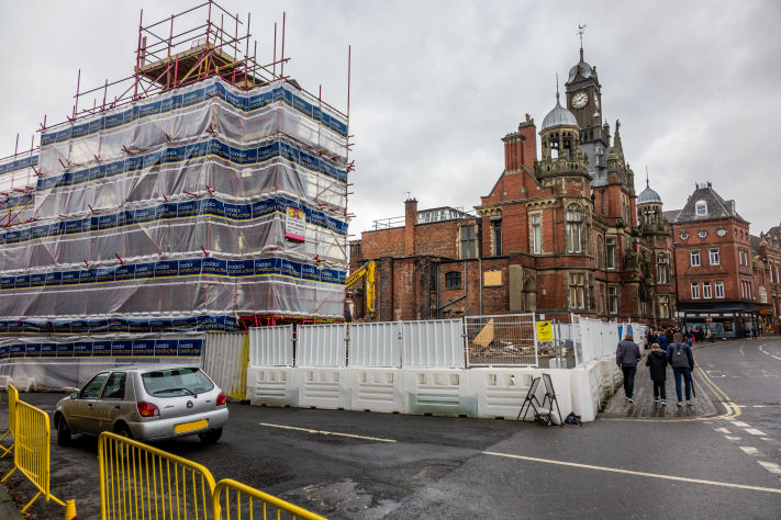
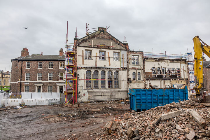
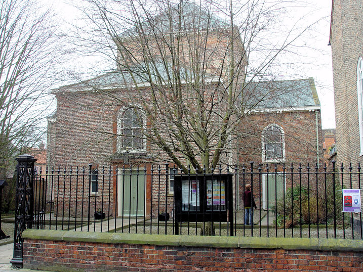
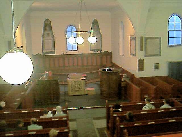
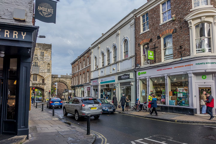
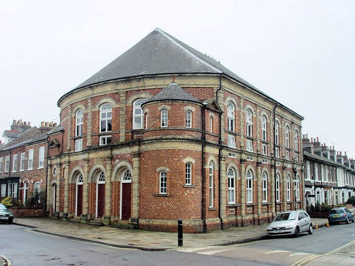
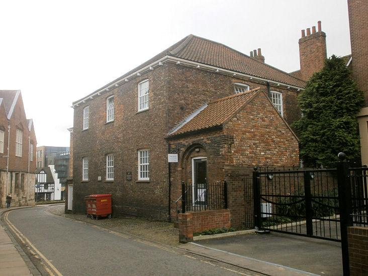
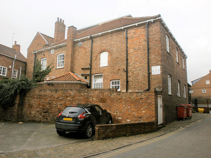
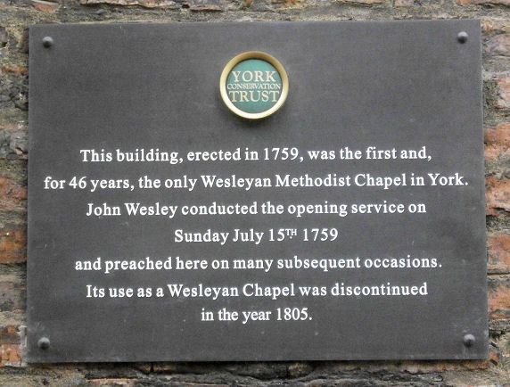
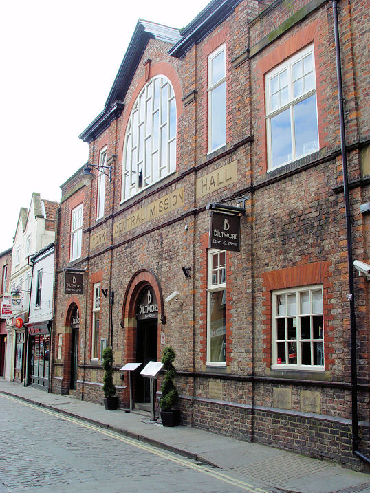
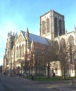
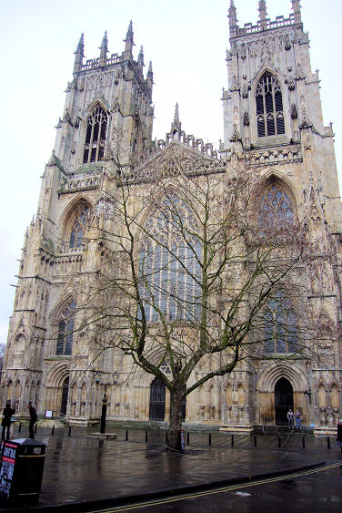
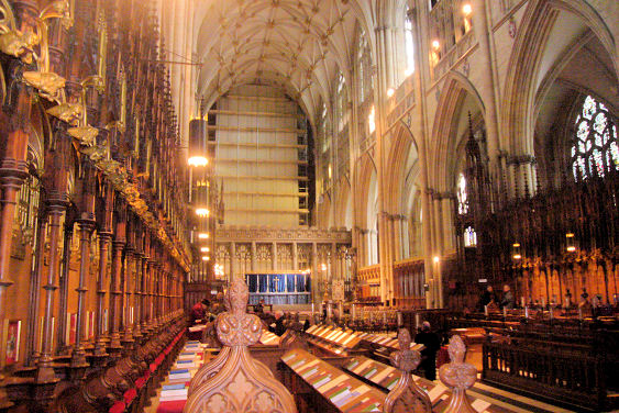
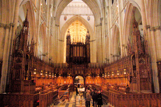
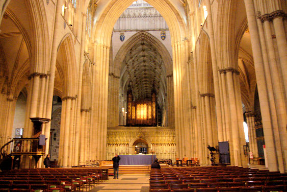
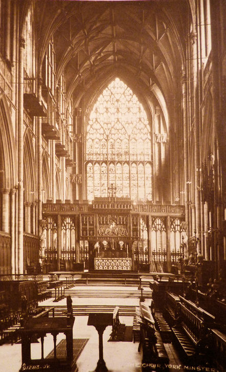
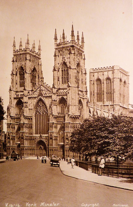
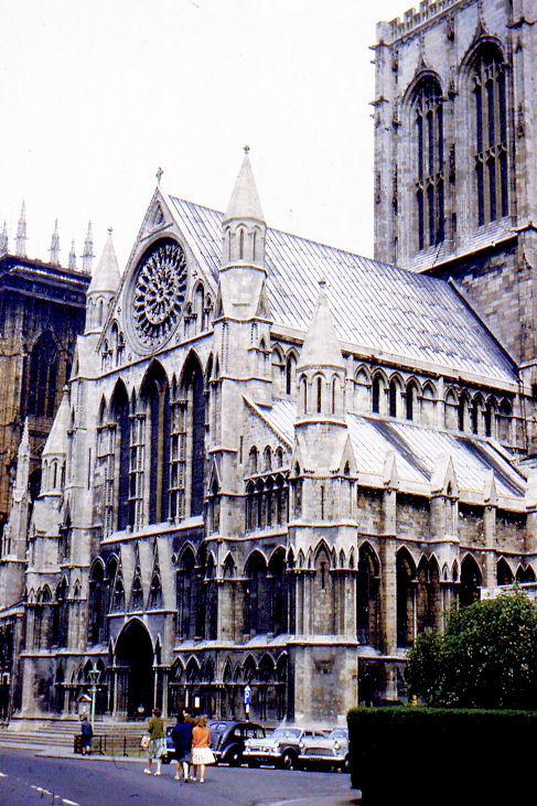
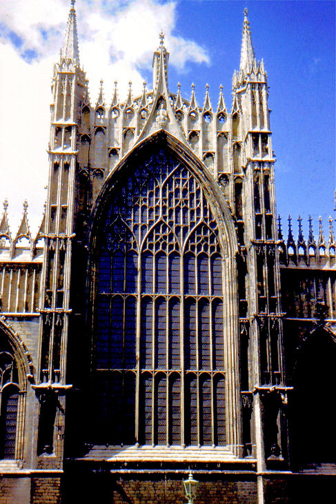
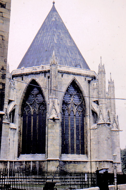
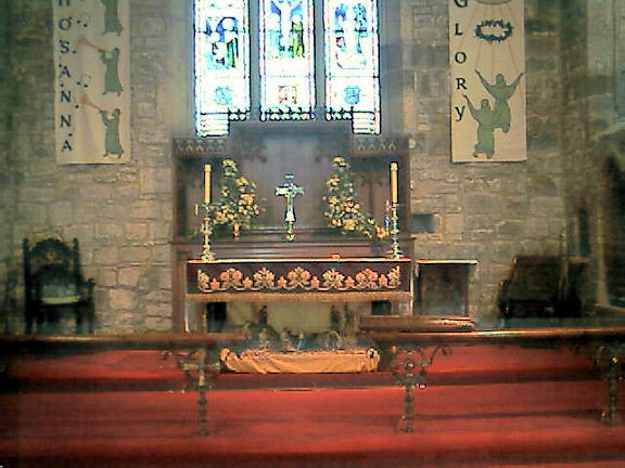
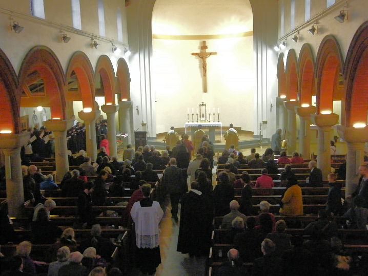
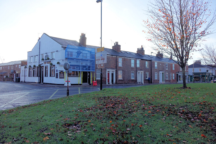
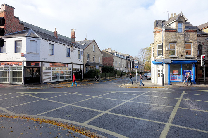
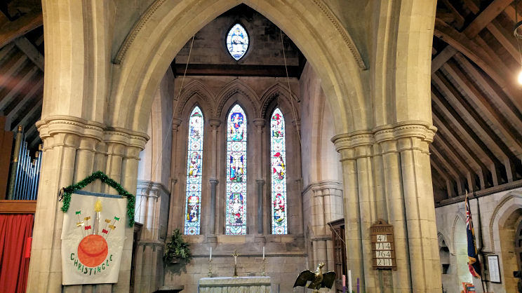
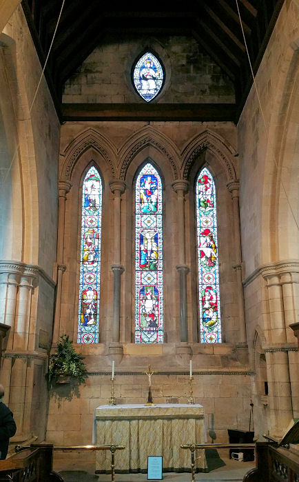
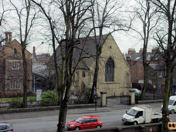
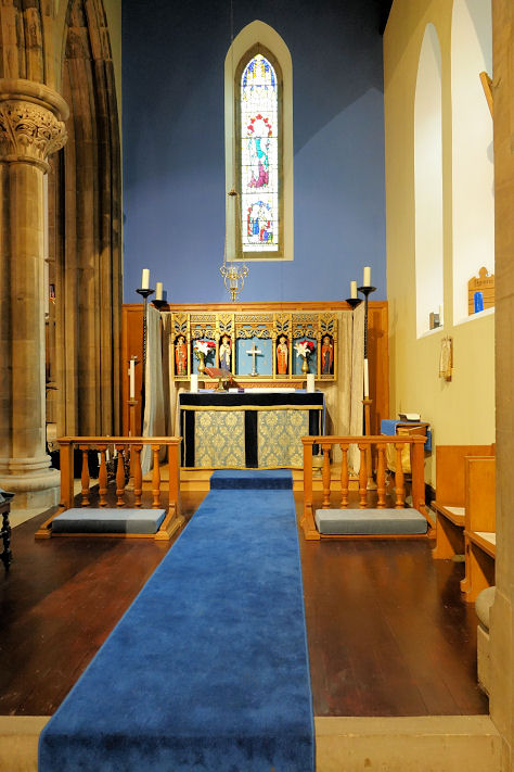
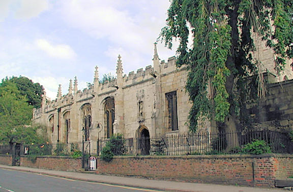
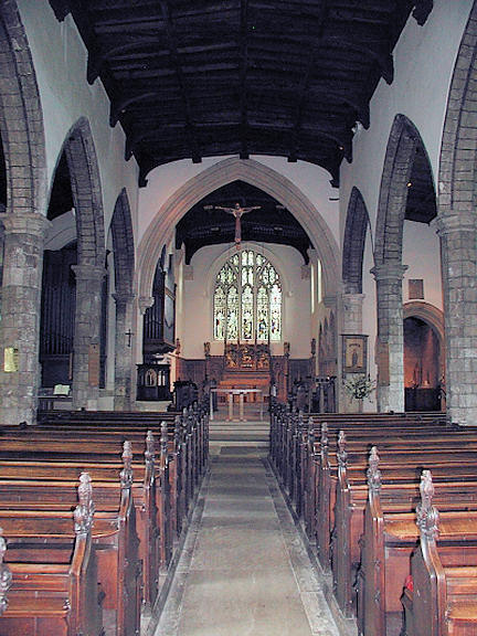
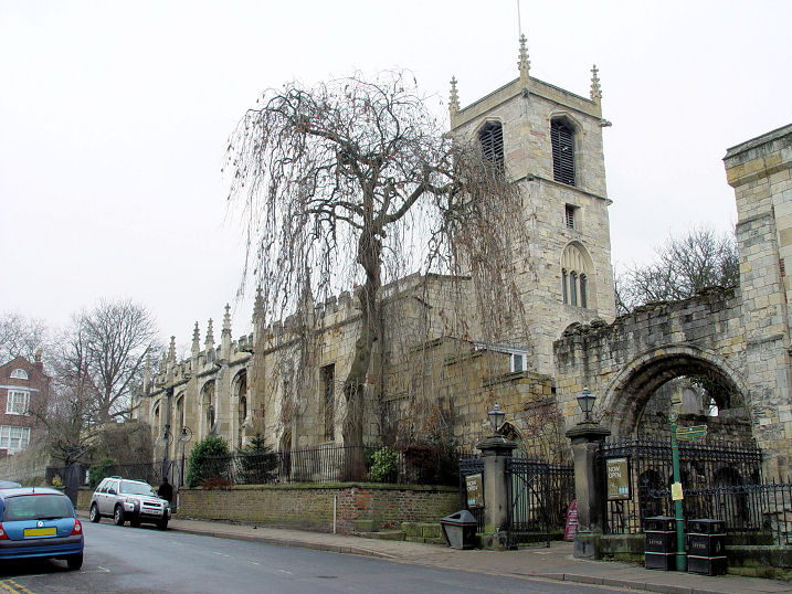
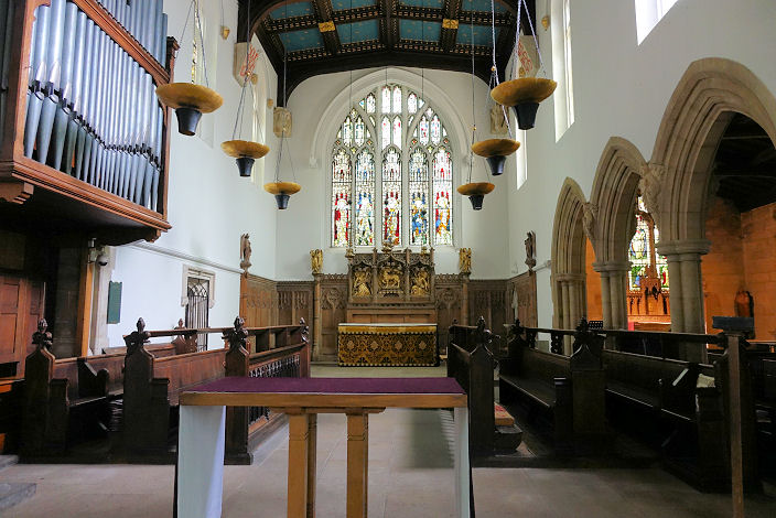
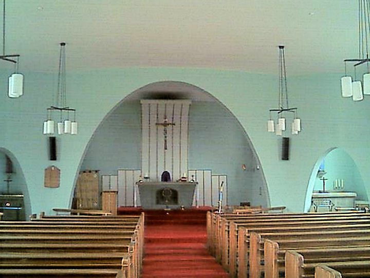
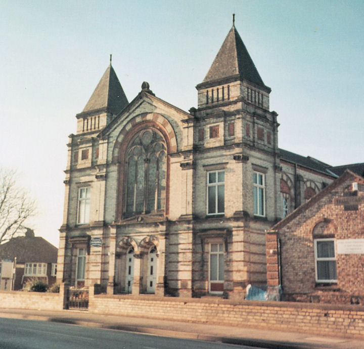
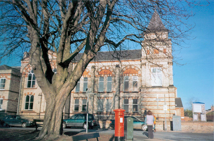
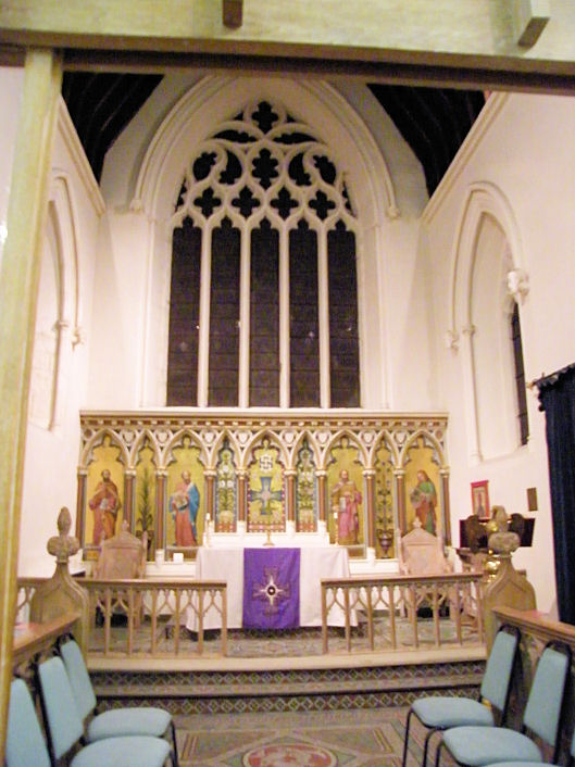
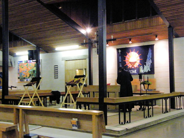
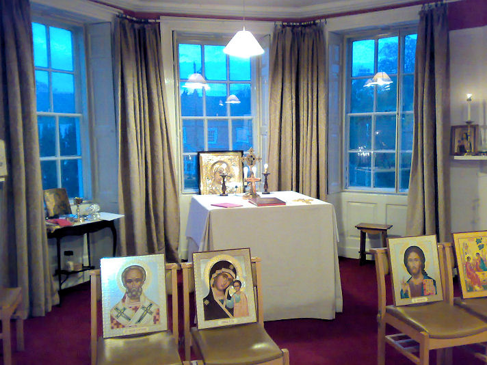
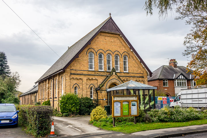
1850 is available here. Churches outside the walls, and at Acomb, Clifton, Fulford, Haxby, Heslington, Holgate, Wigginton. Within the walls The long demolished All Saints in the Marsh stood on Peasholme Green, adjacent to The Black Swan. Mentioned in a York Wikipedia entry here, it doesn't say on which side of the pub the church was, but this link (see the second photo) shows that it stood to the right of the pub. Circa SE 6075 5195. © Steve Bulman (2015). All Saints, North Street. SE 6005 5176. © Bill Henderson. The church has some fine glass and wood. The following are all © Steve Bulman (2010) - another view, and one taken from across the river, giving a better appreciation of the spire; three interior views - 1, 2, 3, hammer beam ceiling, finely carved pews, the font with elaborate cover, and three examples of the stained glass - 1, 2, 3. Link. All Saints, on Pavement. SE 6042 5173. © Bill Henderson. The following are all © Steve Bulman (2010) - another view and two interior views - 1, 2, the altar, font, pulpit and lectern, a window, and boards recording the details of parish charities. A close-up of the tower, © Christopher Skottowe (1961). Link. Grade I listed. The 1850 map mentioned at the top of this page shows the site of the Augustinian Friary on Lendal, on a block of land immediately adjacent to the former Congregational Chapel, and stretching to the river. In terms of frontage on Lendal, it went as far as the shop with the pale green column, visible in this photo in the distance. SE 6009 5197 (for the middle of the frontage on Lendal). © Steve Bulman (2019). The former Bedern Chapel (on Bedern) - this was the Chapel of the Vicars' Choral of York Minster, or St. Peter's Chapel (consecrated in 1349), now home to the York Glaziers Trust. SE 6051 5214. © David Regan. Grade II* listed, which dates it to 1252. All that remains of the Carmelite Priory is a small stretch of yellow stones, at left, at the base of a later brick wall in Black Horse passage, off Stonebow. Mentioned in A Walk around the Snickelways of York (8th edition, page 53), further details would be welcome. SE 6056 5183. © Steve Bulman (2015). Central Methodist Church on St. Saviourgate, was built as Centenary Methodist Church in 1840. SE 6054 5189. © Bill Henderson. Another view, © Steve Bulman (2010), and the interior, © Mike Forbester. Link. The former Chapel of the Archbishop's Palace now houses York Minster Library. SE 6029 5233. © David Regan. Christ Church (aka Holy Trinity) used to stand in what is now known as King's Square. Originally a medieval church, it was re-built in 1861, and demolished in 1937. Some illustrations and photos of the old and re-built church are available here. SE 6046 5193. © Steve Bulman (2014). The actual site of the church is shown by a raised area, partly paved with re-used gravestones. There is also an inscribed slab commemorating the church. Both © Steve Bulman (2018). Christian Science Reading Room on High Petergate (just inside Bootham Bar). SE 6015 5222. © Steve Bulman (2018). Clifford's Tower Chapel. Another view. SE 6047 5147. Both © Steve Bulman (2011). Link. The former Congregational Chapel (1816) on Lendal, now a restaurant. SE 6006 5198. © Steve Bulman (2010). The former Ebenezer Primitive Methodist Chapel (1851) on Little Stonegate. SE 6025 5199. © Steve Bulman (2010). Of the former Franciscan Friary, all that remains is a stretch of boundary wall on King's Staithe, by the river. SE 6029 5155. © Steve Bulman (2017). Link. Holy Trinity, on Goodramgate. Although of 12th century foundation, the present building is 13th century. Now in the care of the Churches Conservation Trust. Interior view. Both © James Murray. Holy Trinity happily escaped the "improvements" of the Victorians, and has a delightful interior, with box pews. The photos don't really convey the uneven nature of the floor. Three interior views - 1, 2, 3, a squint to give views of the altar (a rare survival), and a curious worn carving of a head, with what looks like a hand. SE 6044 5205. All © Steve Bulman (2010). Link. Holy Trinity, Micklegate, has some fabric remaining from Holy Trinity Priory. Another view. Chapel. The main doorway. Two interior views - 1, 2, the font and elaborate cover. SE 5988 5154. All © Steve Bulman (2010). Link. The Mansion House (at the north end of Coney Street) stands on the site of the Chapel of the Guild of St. Christopher - as shown on the 1850 map mentioned at the top of this page. See here for a (very) little information about the chapel - scroll down to the Mansion House paragraph. SE 60151 51925. © Steve Bulman (2019). The Merchant Adventurer's Hall (entrances from Fossgate and Piccadilly) has its own Chapel (the end nearest to the camera). Interior view. On display is a bell, now known as "The Pancake Bell" which was originally in St. Crux. SE 60553 51689. Both © Steve Bulman (2019). Link. The former Methodist Church on Patrick Pool was used by York Methodists in the 1750's. Only the ground floor is original, the upper storey having been destroyed in a fire, as the plaque explains. SE 6042 5191. Both © Steve Bulman (2010). The dark grey building on the site of New Street Wesleyan Methodist Chapel, which was opened in 1805 and closed in 1908 (ref. Borthwick Institute entry), and was the predecessor of what is now the Central Methodist Church (for which see above). An old illustration of the chapel is available here. Circa SE 6022 5187. © Steve Bulman (2023). Quaker Meeting House, on Friargate. SE 6038 5161. © Steve Bulman (2011). Link. Large scale older O.S. maps show a big building labelled as Friends' Meeting House, on Clifford Street. The building (or site) in question is seen here to the right of the lane; the current Meeting House can be seen further up the lane, on the right. SE 6037 5159. St. Andrew, on St. Andrewgate, closed (according to the Wikipedia article) in about 1548. It also lists some of its subsequent usage, including a stint as a brothel! However in 1924 it returned to religious use when it was used as a Gospel Hall for the Plymouth Brethren, and is now known as St. Andrew's Evangelical Church. SE 6057 5204. © David Regan. The site of St. Benet (or Benedict), on Little Stonegate, opposite the entrance to Finkle Street. According to Wikipedia, it was "built before 1154 and demolished around 1300". Circa SE 6032 5199. © Steve Bulman (2018). Archaeological report. St. Columba U.R.C. on Priory Street was originally Presbyterian (1879). SE 5992 5142. © Steve Bulman (2010). Link, which has a photo of the church before the bizarre tower was removed in ca. 1950. St. Crux Parish Room on Pavement includes in its fabric part of the church of St. Crux, demolished in 1887. Inside are preserved some of the monuments from the old church. This link includes an illustration of the church. It now serves as the Parish Hall for All Saints, Pavement. For a bell from the church, see the Merchant Adventurer's Hall entry, above. SE 6050 5183. © Steve Bulman (2010). Another view, © Dennis Harper (2013). A wall (part of the north aisle) from the old church can be seen from the entrance to Whip-Ma-Whop-Ma Gate, and from Pavement. Both © Steve Bulman (2018). The former St. Cuthbert on Peasholme Green, now used as offices. Another view. SE 6077 5204. Both © Steve Bulman (2010). St. Denys on Walmgate. Another view. SE 6071 5158. Both © Steve Bulman (2010). Interior view, © Mike Forbester. Link1. Link2. Link3. St. George (R.C., 1850) on George Street. SE 6079 5141. © Bill Henderson. Another view, © Steve Bulman (2010), and another, © Steve Bulman (2011). Interior view, © Mike Forbester. Of St. George, Fishergate, which stands close to St. George (above), the graveyard alone survives. It is supposedly where Dick Turpin was buried. SE 6074 5137. © Steve Bulman (2011). St. Helen, on St. Helen's Square. SE 6020 5197. © Bill Henderson. Another view, and an interior view, both © Alan Blacklock. Another view, © Christopher Skottowe (1966). Link. Grade II* listed. No above-ground trace remains of St. Helen-on-the-Walls, which stood on Aldwark. A pdf report on the excavation of the cemetery is available here. This link includes a photo of the foundations. The 1891 O.S. map erroneously marks the site of the church at SE 6062 5218. The excavation report has allowed Howard Richter to deduce a corrected grid reference of SE 6066 5212. The site is now occupied by housing :- 9-13 Hunt Court. The medieval St. John del Pyke, long gone, was named after the turnpike of Chapter House Street. This street now makes a 90 degree bend, becoming Ogleforth as it does so, but originally Chapter House Street carried on in a straight line, and the church was on this street. My first photo shows the north end of Oglethorpe - the church will have stood somewhere behind these buildings. Next, a view from the walls, looking West, which shows the area the church must have stood in, perhaps in the garden at left, behind the tree. Circa SE 6048 5228. Both © Steve Bulman (2018). Nothing visible remains of St. John the Baptist (or St. John-in-the-Marsh). A news report (including photos) doesn't locate the church precisely, other than that it was found during a dig on Hungate. Howard Richter advises that the 1891 O.S. map marks the site of the church at SE 6076 5183; the excavation report puts it just a few yards away at SE 6076 5184. It describes the church as "a simple rectangular structure aligned north-east/south-west, measuring approximately 19.25m by 9.25m (c.63 x 30 feet)". It also says that it was decommissioned in 1586. The former St. John the Evangelist on Micklegate is now a bar. SE 6011 5165. © Steve Bulman (2010). Chapel of St. Leonard's Hospital (the chapel was on the first floor) on Museum Street. SE 6005 5205. © David Regan. The crypt, from an old postcard in Christopher Skottowe's Collection. Link. The former St. Margaret on Navigation Road, now the National Centre for Early Music. Another view. SE 6095 5157. Both © David Regan. Link. St. Martin cum Gregory on Micklegate is now a stained glass centre. SE 6001 5161. © Bill Henderson. Another view, © Steve Bulman (2010). Link. St. Martin le Grand on Coney Street. Interior view. Bombed in WWII, it was partially re-constructed in 1960 by George Pace. SE 6017 5186. Both © Alan Blacklock. Saved from destruction by being dismantled before the war, the west window was re-erected as a screen in the north wall. © James Murray. Two handsome gargoyles, © Carole Sage (1998). St. Mary, Castlegate, is no longer used as a church, and is now an exhibition centre. SE 6044 5163. © Bill Henderson. Two further views - 1, 2, both © Steve Bulman (2011). The 1850 map mentioned at the top of this page shows the site of the The Chapel of St Mary and All Angels, commonly called St. Sepulchre's Chapel, butting against the north wall of the nave of the Minster. Nothing remains above ground level. Circa SE 60265 52207. © Steve Bulman (2019). Link. St. Mary Bishophill Junior on Bishophill Junior claims the title of "oldest church in York". Another view. Mike Forbester has advised that the adjacent building (undergoing renovation in 2010) was the church hall. Leased for many years as a dance school, it has been converted to residential use. SE 6000 5147. All © Steve Bulman (2010). Link. The interior in 1930 is shown on an old postcard here, and here are two modern interiors - 1, 2, both © Mike Forbester. Link. Grade I listed. St. Mary Bishophill Senior was demolished in 1963. According to the Wikipedia entry, "Some monuments and fittings were moved to St Clements, Scarcroft Road, and parts of the fabric were re-used in the Church of The Holy Redeemer, Boroughbridge Road". A reproduction of an 1843 painting of the church is available here, and there are exterior and interior photos on the two succeeding pages. The site [© Steve Bulman (2018)] is now a garden, and some of the headstones survive. A video can be seen here. An exterior and interior photo are available here - you'll need to scroll through the film-strip to find them. SE 6016 5142. St. Michael on Spurriergate now serves as a cafe, though still with a religious purpose. SE 6030 5170. © Bill Henderson. Interior view, © James Murray. Two interior views - 1, 2, and the organ, all © Steve Bulman (2010). Link. St. Michael le Belfry sits between High Petergate and Minster Yard. SE 6028 5213. © Bill Henderson. Another view, also showing the main entrance to the Minster, and the spire of the Baptist Church. Guy Fawkes was born nearby, and baptised here. Interior view. Both © James Murray. The site of St. Peter-the-Little stands off today's Peter Lane, which runs between High Ousegate and Market Street. Entering the lane from Market Street, a very narrow gated alley turns to the left (East). The church was demolished centuries ago, but according to The Medieval Parish Churches of York, The Pictorial Evidence, by Barbara Wilson and Frances Mee (York Archaeological Trust, ISBN1 874454 19 1) "Stone from the north-western wall of the church is still visible embedded in the wall of a modern building on the eastern side of a service alley north-west of Peter Lane". A close-up of the earlier photo shows some chamfered stones in the middle distance of the right-hand wall, and I take it that this is the stonework referred to. Circa SE 604 518. © Steve Bulman (2019). The former St. Sampson, bounded by Silver Street, Church Street, and Patrick Pool, now serves as a day centre for senior citizens. SE 6039 5191. © Bill Henderson. Two further views- 1, 2, both © Steve Bulman (2010). Link. St. Saviour on St. Saviourgate and Hungate was made redundant in the 1950's, and now houses the Archaeological Centre. Another view. SE 6059 5189. Both © Steve Bulman (2010). St. Wilfrid (R.C., 1864) on Duncombe Place. SE 6015 5214. © Bill Henderson. Another view, © Alan Blacklock. The grand double-doorway, with tympanum, © Steve Bulman (2010). The interior, © Mike Forbester. Link. Grade II listed. The 1850 map mentioned at the top of this page shows the site of a vanished St. Wilfrid, immediately south of today's Athenaeum, on Blake Street. The website for today's St. Wilfrid says that the old church was pre-Norman, and was disused "by 1585" and subsequently demolished. In this modern view the Athenaeum is the building in the background with the portico. The old church stood where the block with the pink shop now stands. SE 60151 52030 (for the middle of the frontage). © Steve Bulman (2019). The site of the demolished Salem Congregational Chapel on Spen Lane, now occupied by a former office block converted into flats. Another view. This source supplies dates of 1839-1953, demolition following in 1963. SE 6067 5200. Both © Howard Richter (2017). An image of an old postcard of the chapel is available here, and there is another photo here (scroll down). Shrine of St. Margaret Clitherow in The Shambles. Interior view. Circa SE 6045 5187. Both © Steve Bulman (2016). Link. The Rock Church (Assemblies of God) on Priory Street was originally Wesleyan Methodist (1856). SE 5989 5152. © Steve Bulman (2010). Trinity Chapel (1856) stood on Peckitt Street and Clifford Street. Long used as a fire station, it was being demolished on a recent visit, though it looks as though the facade will be retained. Another view. SE 6037 5150. Both © Steve Bulman (2017). The building in 2024, showing the retained wall. © Steve Bulman (2024). Link (with photo, as it was when in use as the fire station). Trinity Church (presbyterian) meets in St. Andrew's Hall (2019 Streetview) on Peasholme Green. SE 6073 5199. Link1. Link2. Unitarian Chapel on St. Saviourgate. SE 6062 5198. © Steve Bulman (2010). Interior view, © Mike Forbester. Link. The former United Methodist Free Church (the white building in the middle distance, with round-headed windows) on Goodramgate, now in commercial use. It became the Monk Bar Central Mission in 1919, and closed as a church in 1934. Howard Richter has advised of this image of an old postcard of 1910, showing the chapel. Note the inscription on the building of 1858, and United Methodist Church Founded 1907, 1907 referring to the date of the merger of the United Methodist Free Churches, the Methodist New Connexion, and the Bible Christian Church. SE 6055 5222. © Steve Bulman (2016). Link (which states a building date of 1859). The former Victoria Bar Primitive Methodist Chapel on Victor Street and Newton Terrace has been converted to residential use. It's dated here to 1880-1939. SE 6007 5130. © Steve Bulman (2010). The former Wesleyan Methodist Church on Aldwark. Successor to the Methodist Church on Patrick Pool (see above), it was opened in 1759 by John Wesley, who preached here often. Another view. A plaque gives a little history. SE 6069 5199. All © Howard Richter (2017). Link, which has much interesting information about the history of non-conformity in York. Grade II listing, which says its use as a chapel ceased in 1805. York Baptist Church on Priory Street. Pevsner says the tower was reduced in height in 1939. SE 5983 5150. © Steve Bulman (2010). The former York Central Mission Hall on Swinegate has also served as the Elim Church, but is now a restaurant. Circa SE 6035 5197. © Steve Bulman (2010). Link. York Minster. SE 603 522. © Bill Henderson. The West End, © James Murray. The Choir and High Altar. The famous East Window would normally be in this view, but is covered up during restoration work (2008). The Choir, facing west, showing the organ. Another view of the organ (and rood screen), from the Nave. All interior views © James Murray. A fine black and white photo of one of the towers. It shows the quality of the stonework very well. © Tony Denham. The following are all from Christopher Skottowe's old postcard collection - the Nave, Choir, across the Nave, and two exterior views - 1, 2, and the following are all © Christopher Skottowe (1961) - the south transept, north transept, east window and the chapter house. Link. Grade I listed.
Outside
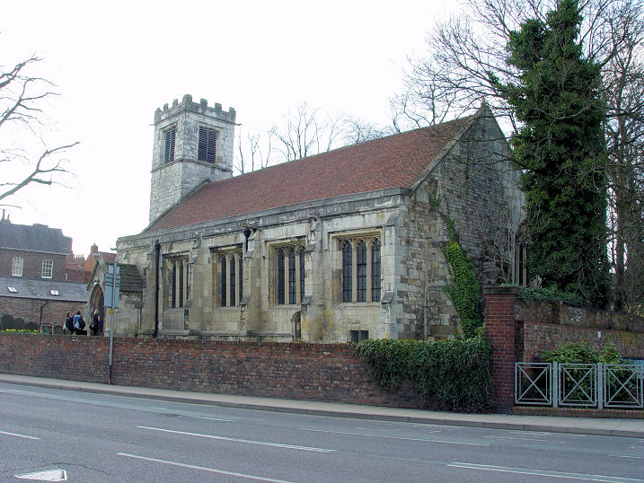
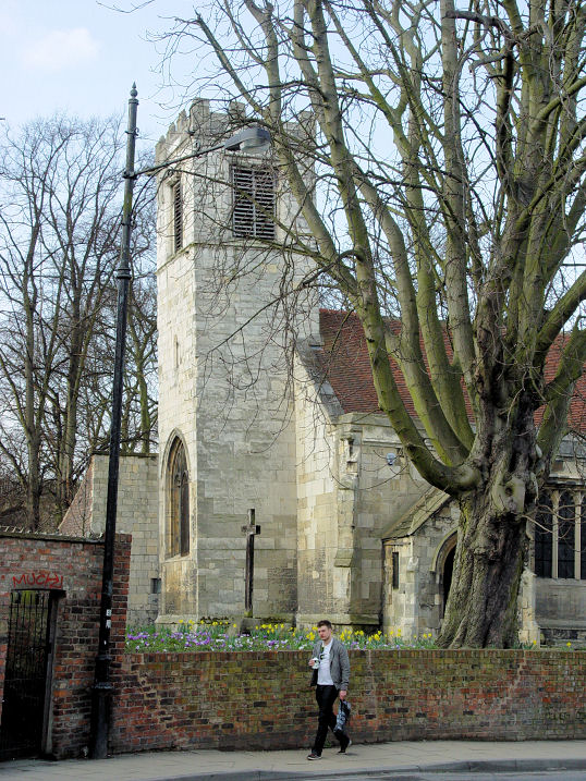
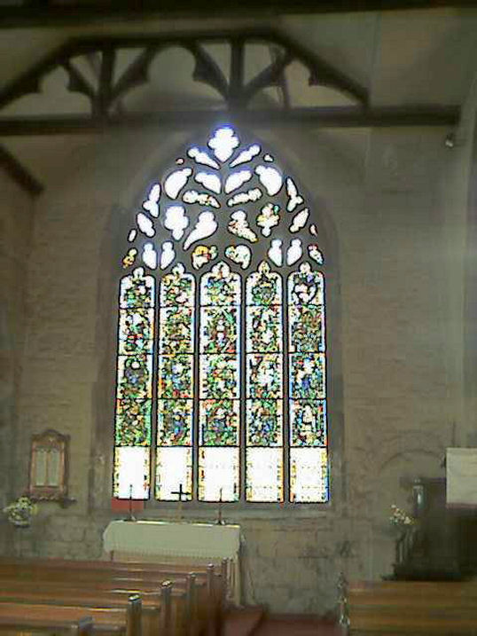
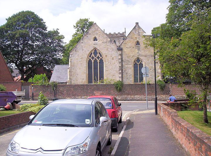
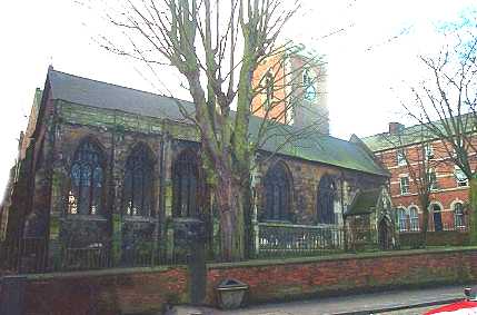
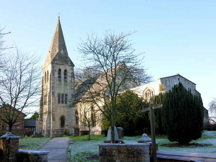
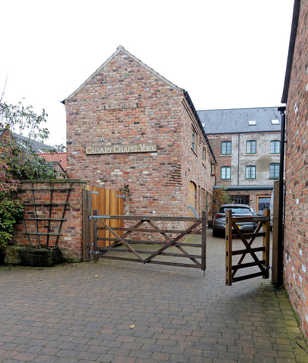
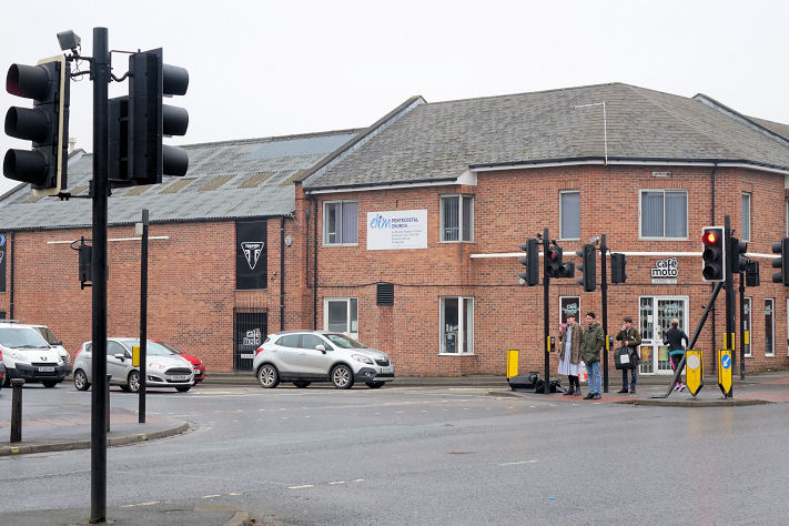
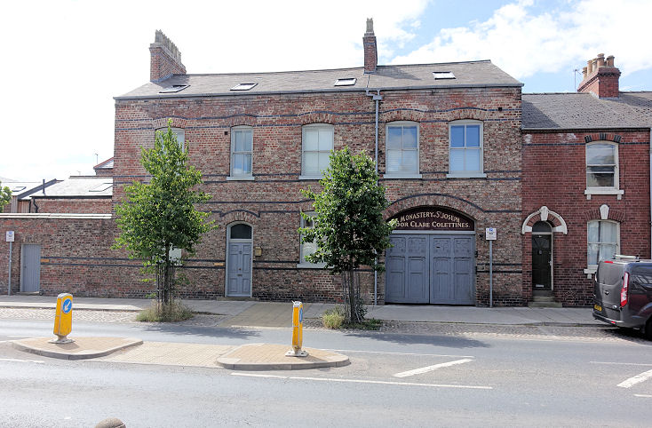
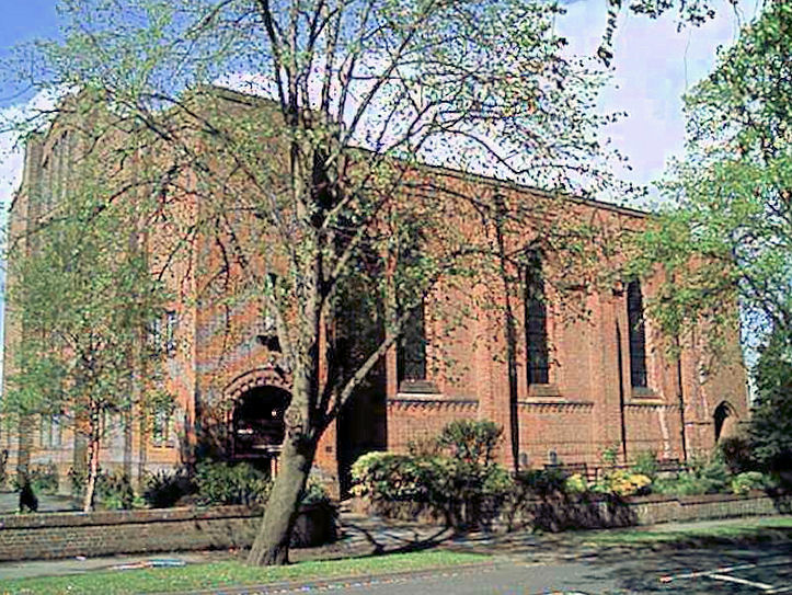
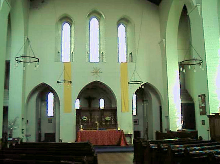
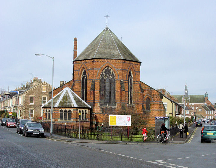
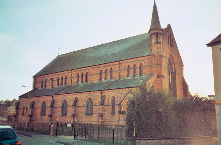
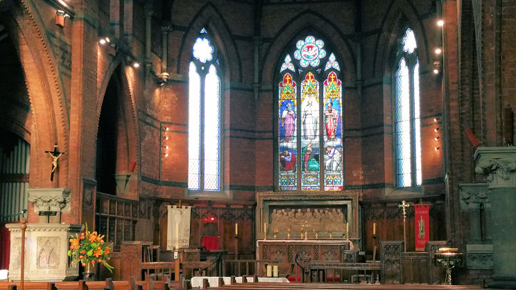
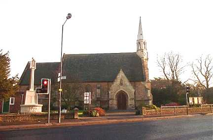
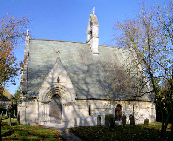
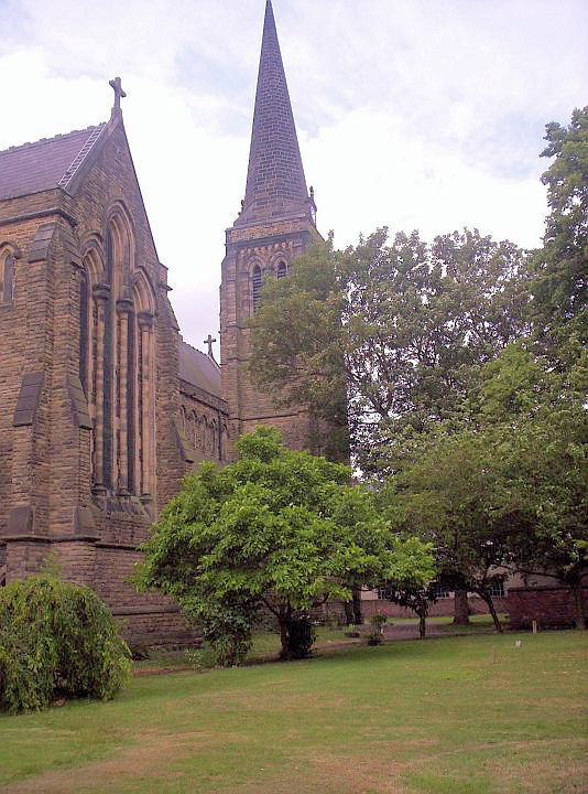
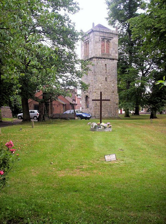
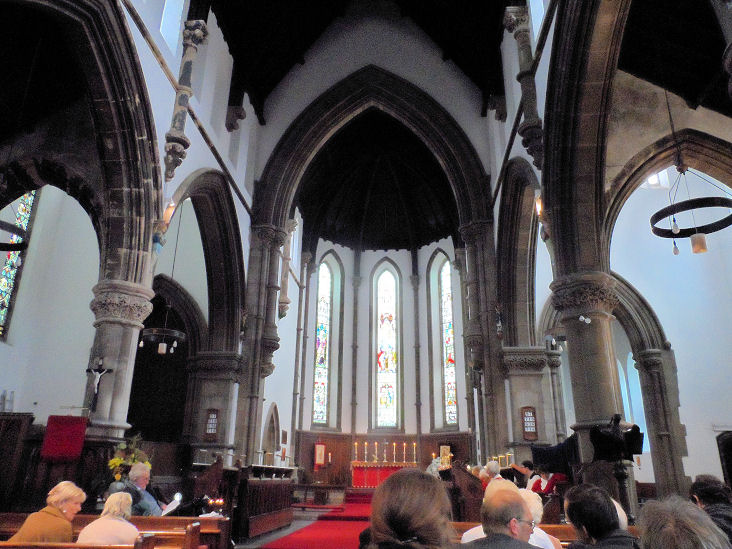
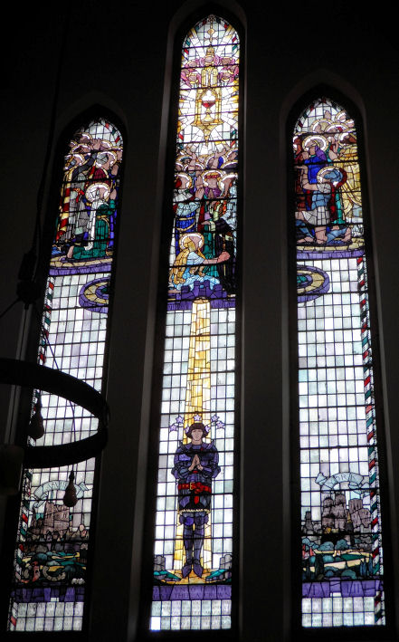
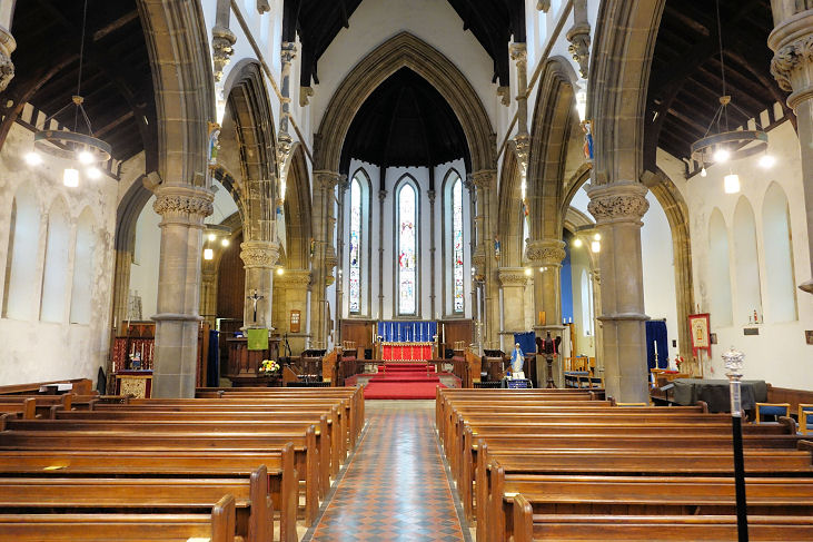
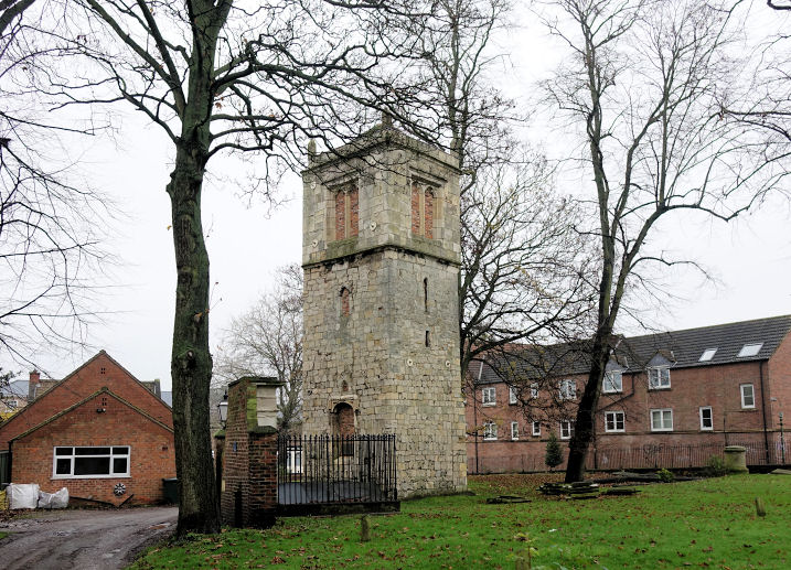
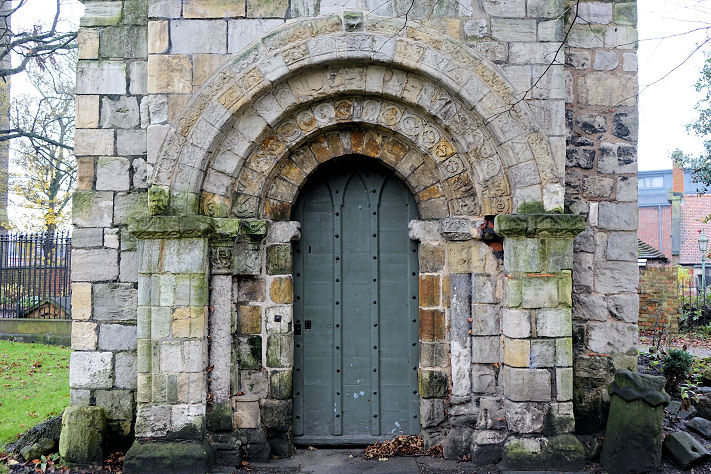
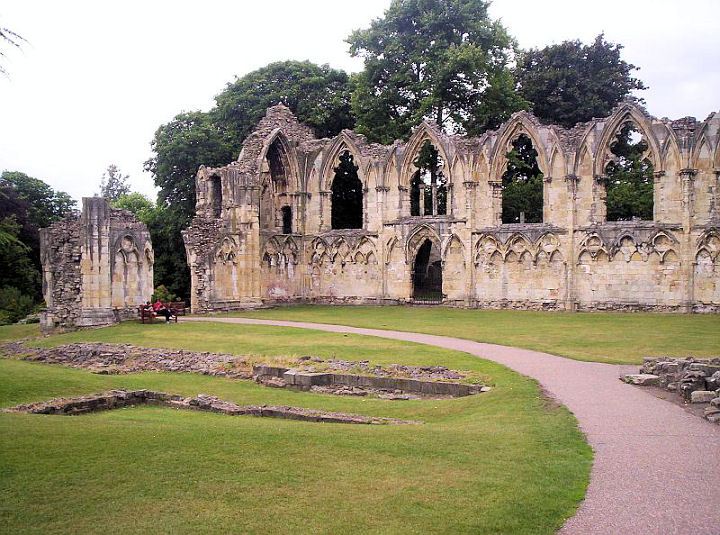
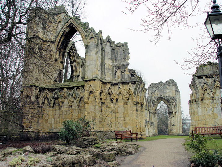
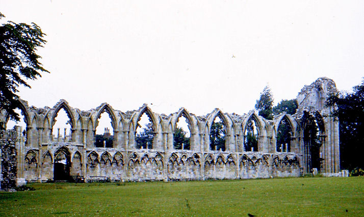
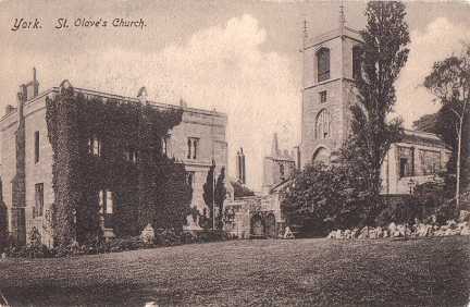
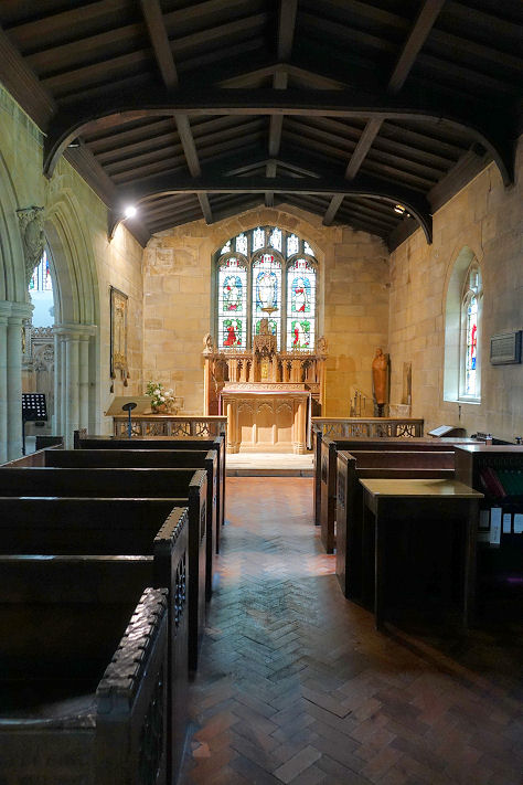
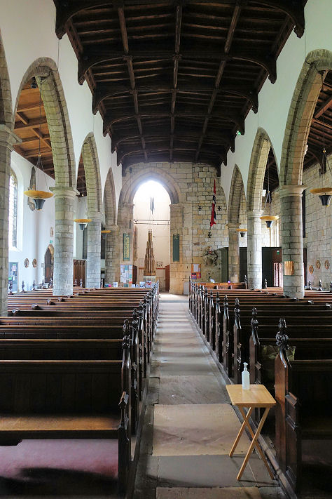
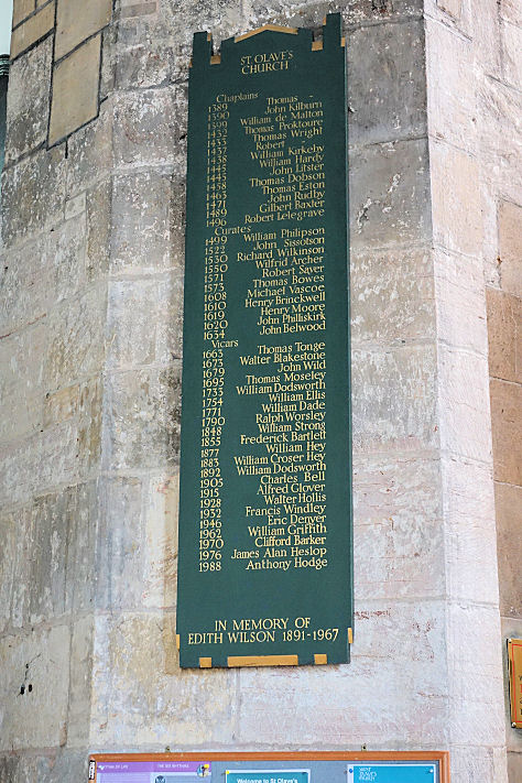
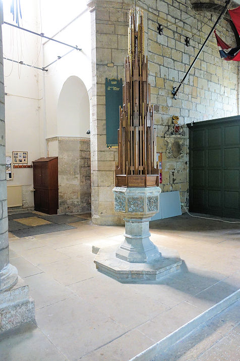
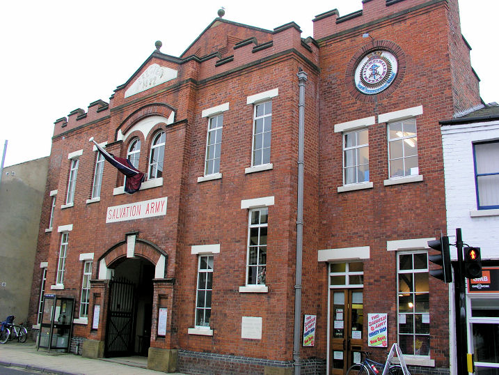
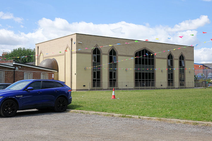
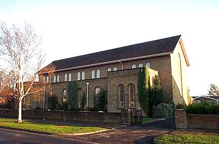
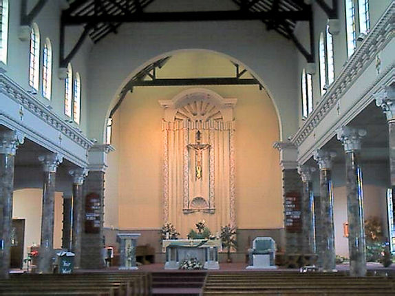
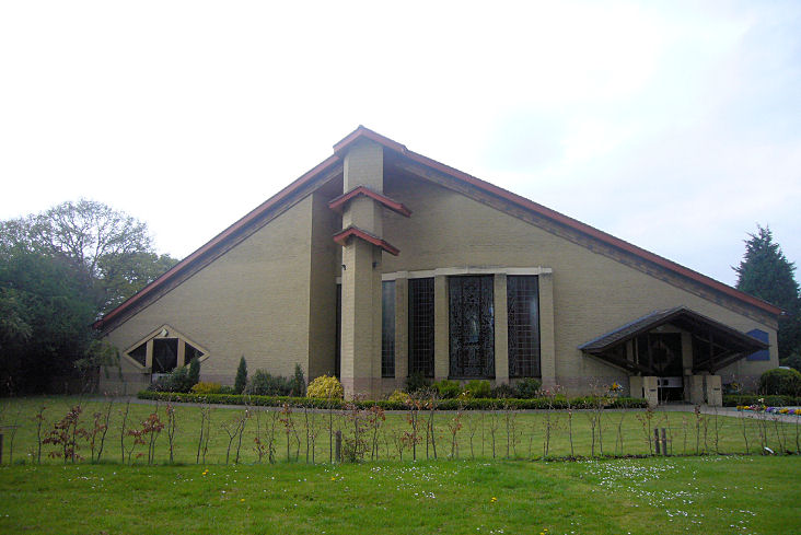
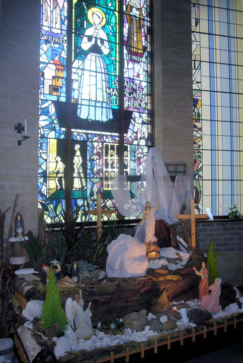
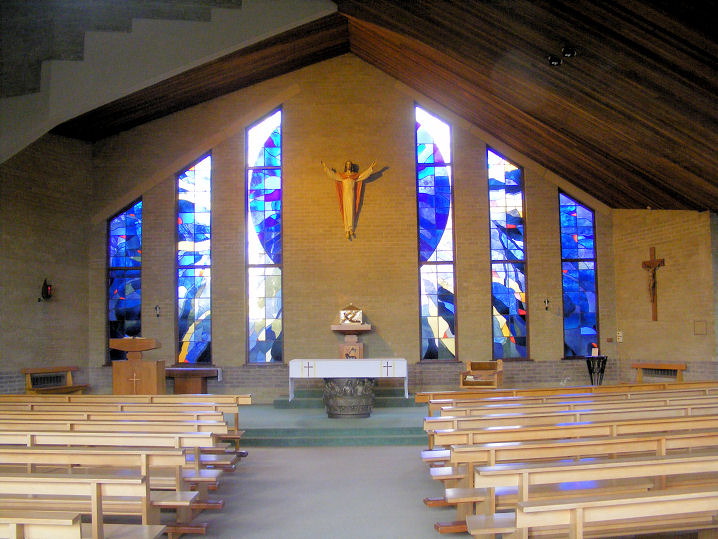
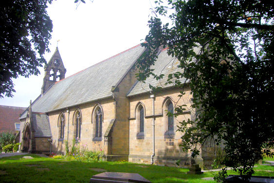
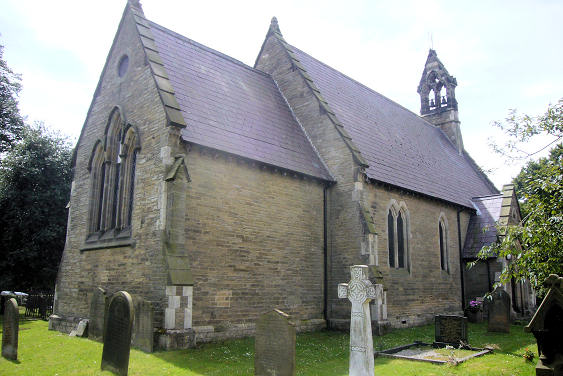
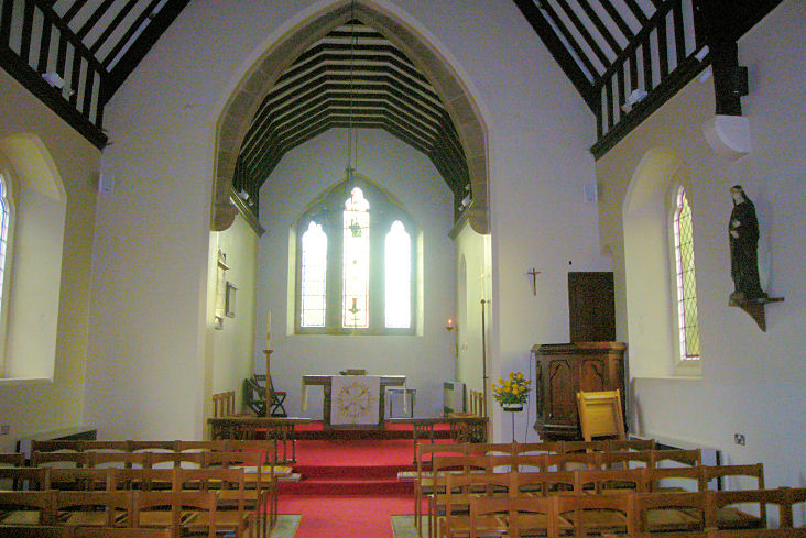
the walls Another All Saints, long-since demolished, stood outside the walls on the South side of Paragon Street. Assuming the 25" O.S. map of 1907 is accurate, the site is now beneath the Barbican. In this view, it would have been a little further back than the junction of the round part of the building, and the glass "betway" part of the building. Circa SE 6087 5122. © Steve Bulman (2019). Bar Convent (R.C.) on Blossom Street is the oldest surviving convent in England, and contains a beautiful chapel. © Steve Bulman (2010). Link. Calvary Chapel on Barbican Road, photographed from the walls. © Steve Bulman (2011). By 2019 the church had evidently moved premises, a little way to the East, but still on Barbican Road, at SE 61106 51346. © Steve Bulman (2019). Link. Church of the Holy Redeemer on Boroughbridge Road. © James Murray. Link. Elim Church on Lawrence Street and James Street. SE 6129 5136. © Steve Bulman (2019). Link. English Martyrs' Catholic Church (1932) on Dalton Terrace. Interior view. SE 5961 5141. Both © Mike Forbester. Link. Grade II listed, wherein it's dated to 1931-2. Its predecessor was on The Crescent, and is marked on O.S. maps from 1891 (where it's labelled as Temporary Church of the English Martyrs & School), and up to 1931 (R.C. Ch.). What is evidently the same building, or at least one with the same footprint, shows on the 1937 map just as "School". The building survived until the 1962 map, but it had gone by the time the 1970-75 map was surveyed. The building itself was of a "T" shape, with the main axis aligned SW to NE, and "transepts" across the northerly end. The site was redeveloped at some point, and where the church stood now lies mostly beneath the car park seen here, behind the railings, with the easternmost transept under the building. I've been unable to find a photo of the church. SE 5961 5141. © Steve Bulman (2019). The former Monastery of St. Joseph and Poor Clare Colettines (so named in the panel above the broad doorway) on Lawrence Street. Labelled on older O.S. maps as Convent of Poor Clares, there is a complex of buildings further back from the road. In a 2019 Streetview, the buildings behind the wall are, I presume, survivors from the convent - the building in my photo are above the hedge in the Streetview. According to their website, the convent left these premises "At the start of the twenty-first century", moving to Askham Bryan. SE 6136 5133. © Steve Bulman (2023). St. Chad on Campleshon Road. Interior view. SE 5977 5009. Both © Mike Forbester. Link. Grade II listed, wherein it's dated to 1925-6. St. Clement (1874) on Scarcroft Road. © Steve Bulman (2010). Another view, and the interior, both © Mike Forbester. Link. The original St. Clement occupied a site outside the city walls, now commemorated by the road Clementhorpe. Different maps show the position of the church differently, so it's hard to give an exact position. One map shows a block of land, now bounded by the afore-mentioned Clementhorpe, Bishopthorpe Road, Darnborough Street, with its Easternmost limit perhaps at the river. I have found maps showing the supposed position of the church within this block, and another showing it straddling Darnborough Street itself, about where the road makes a slight bend to the left. SE 602 511 (this for the north-west corner of the block of land, at the junction of Clementhorpe and Bishopthorpe Road). Both © Steve Bulman (2018). St. Edward the Confessor at Dringhouses. © Bill Henderson. Of the medieval St. Giles, after which Gillygate is named, no trace remains. Some references to it mention it as being in the vicinity of the Salvation Army building on Gillygate (for which see below), while a map in an archaeological report has it a few metres to the East, straddling what is now Claremont Road, near its junction with Gillygate. © Steve Bulman (2018). St. Giles at Skelton, built 1247. © Alan Blacklock. Two interior views - 1, 2, both © Mike Forbester. Link. St. John's College, Old Chapel, on Lord Mayor's Walk - photographed from the city walls. © Steve Bulman (2010). St. Lawrence on Lawrence Street. David advises that this is the largest parish church in York. In the grounds stands the tower of the medieval church. SE 61202 51258. Both © David Regan. Interior view, and two windows - 1, 2, the latter showing York Minster, all © Mike Forbester. Another view, showing the church and the tower of the old church, another interior view, side chapel, another view of the tower, and its fine doorway, all © Steve Bulman (2019). Link. Grade II listed (church), grade I listed (tower of old church). The ruins of St. Mary's Abbey. SE 5994 5217. © David Regan. Another view, © Steve Bulman (2011), another © Stuart Mackrell, and another © Christopher Skottowe (1961). Link. Grade II* listed. Of St. Maurice, on Lord Mayor's Walk, opposite Monk Bar, only the burial ground remains. It was demolished in 1966. This church was preceded by a medieval one, demolished in 1876. © Steve Bulman (2011). Howard Richter has advised of this link, which shows the church - click on the 4th picture in the row of photos below the railway engine. 1910 postcard images show the church and Monk Bar here, and the interior here. St. Olave on Marygate. SE 5986 5219. From an old postcard in Steve Bulman's Collection. A modern view (hampered by trees), and an interior view, both © Paul Marshall. A (treeless) winter view, © Steve Bulman (2011); three more of the interior - 1, 2, 3, the list of incumbents which commences in 1389, and the font and cover, all © Steve Bulman (2023). Link. Grade I listed. For related listed features, see here. St. Paulinus (R.C.) on Monkton Road. The interior. Both © Mike Forbester. Link. Salvation Army on Gillygate. © Dennis Harper (2013). Link. Southlands Methodist Church on Bishopthorpe Road and Southlands Road. Another view. SE 6013 5074. Both © Mike Forbester. Link. York Mosque and Islamic Centre on Bull Lane. The only Streetview (of 2008) shows its predecessor on the same site. SE 6152 5155. © Steve Bulman (2023). Link.
Clifton
Fulford
Haxby
Heslington
Holgate
Wigginton
|
||
27 September 2025
© Steve Bulman
Contact Details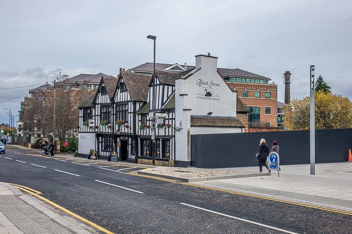